Mount Birch
May 14, 2022
2232m
Yalakom River / Lillooet, BC
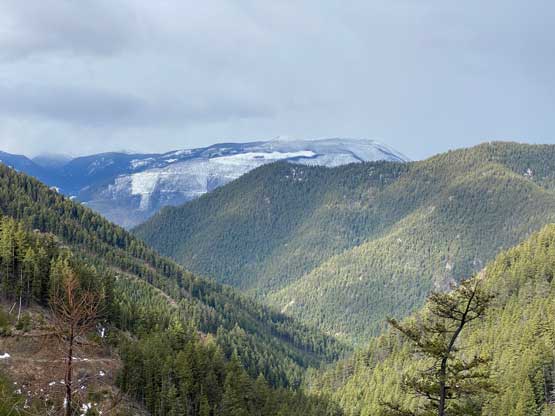
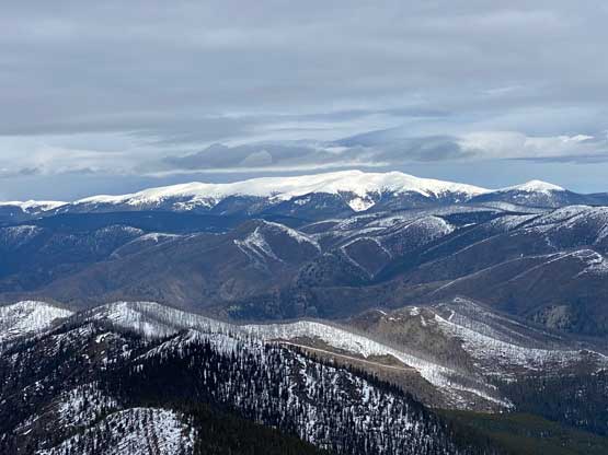
Mt. Birch boasts over 600 m prominence in Camelsfoot Range on the rainshadow side of the Coast Mountains. The area is accessed from Yalakom River FSR that goes a long ass way to the NW from Bridge River Road. There isn’t much “beta” about Mt. Birch, but spur roads in Ore Creek drainage go fairly high and the route itself looked to be rather tame on the topographical maps. The conditions of these spur roads would be largely unknown so the plan was to count on having to walk from the bottom, but I surely hoped that we could have driven at least a few kilometers higher.
I made the last minute decision as this area to the north of Lillloet offered the highest probability of sunshine. Elsewhere in the Coast Range was gloomy and rainy and that had been the theme in the past 5-6 weeks. My original plan was a solo ascent of Mt. Bishop, a smaller summit in the close vicinity of Mt. Birch but then I texted Matt to see if there’s any chance to come over to Lillooet. I literally made the decision at noon and planned to leave town in the same day’s evening and I knew Matt was peak-bagging in the middle of the West Kootenays on that day. To my surprise Matt was actually game for the lengthy detour and the back-to-back peak-bagging mission. Matt even made to Lillooet a few hours earlier than I did, as I couldn’t leave White Rock until 9:30 pm meaning I did not get to Lillooet until 1 am.
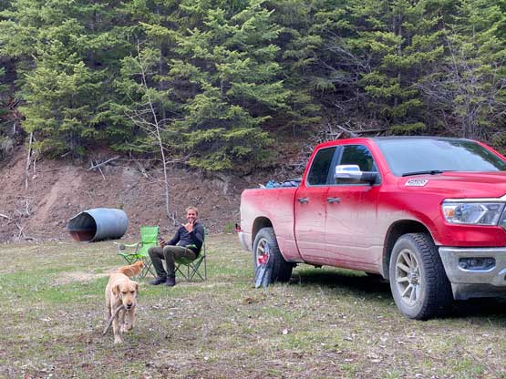
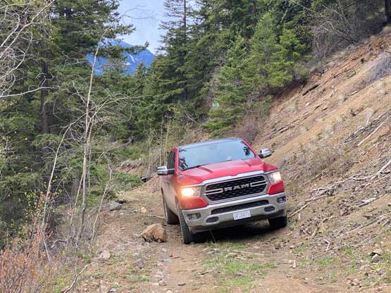
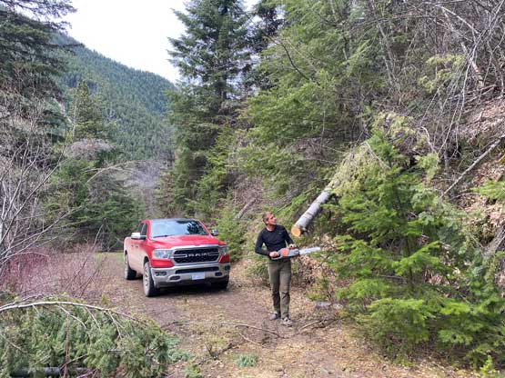
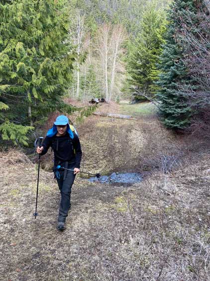
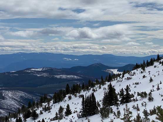
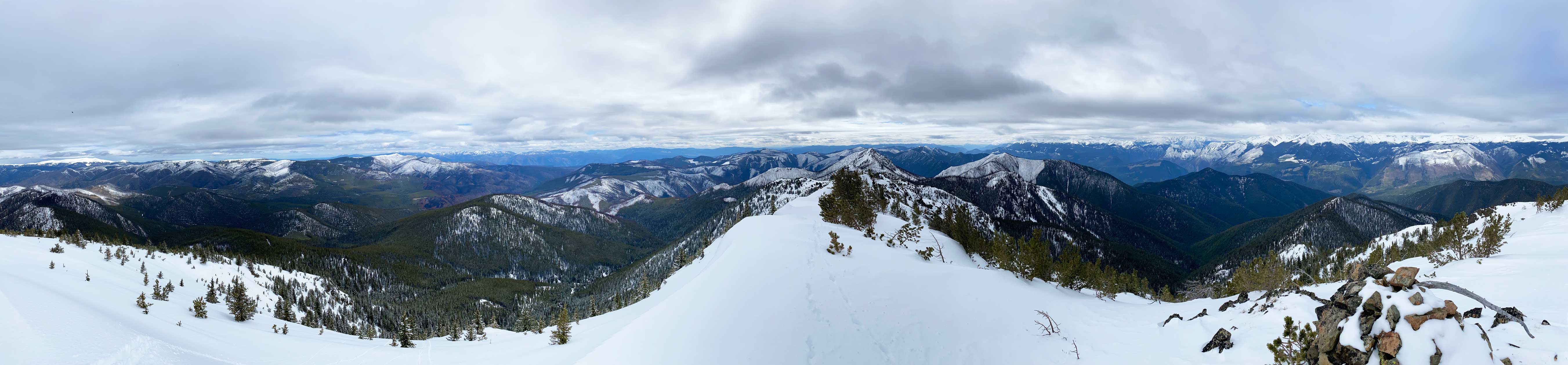
I somehow wasn’t tired and only managed to catch a few hours’ intermittent nap in the car before the alarm went off at 5:45 am. Matt and I then drove into the town of Lillooet in our respective vehicles and went into the A&W for breakfast. We then all piled into Matt’s monstrous Ram and went for the hour-long ride to the Yalakom FSR. The drive to that area was as scenic as I remembered from my other time visit en route to Mission Peak. That old and grumpy woman rumoured to “camp on the FSR blocking off access for the non-locals” was nowhere to be seen on this day. After cruising a short ways up Yalakom FSR we turned onto the narrow and unsigned Ore Creek FSR. There were signs of recent usages so despite the narrow-as-fuck passage we kept pushing further. We had to stop a few times to inspect the road, move away fallen rocks and even sawed one tree but with Matt’s excellent skills we made to the driveable end in the truck. By driving to this point we were already ahead of schedule. We were able to get a few glimpses of Mt. Birch through intermittent clouds and unfortunately it did not look as easy as we hoped for.

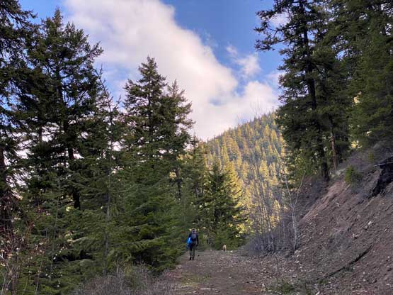
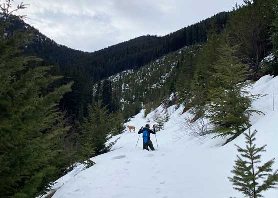
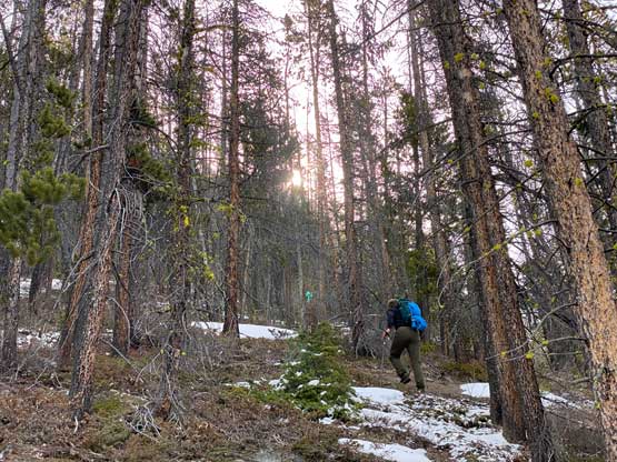
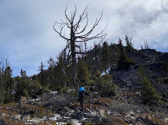
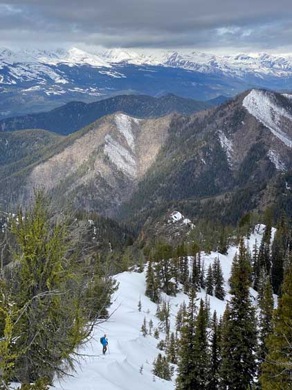
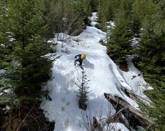
We still had a few kilometers of plodding to the absolute end of the road and not knowing the conditions we decided to carry everything. About 2 km up the road we were able to see more of the upper mountains and ditched the snowshoes. This proved to be a risky decision. The road was very easy for walking with only a few patches of snow but right away we knew the snow wasn’t very supportive. This trip reminded me once again that the climate in Lillooet area is more Rockies than Coast. Nearing the end of the road we faced deep and continuous snow and the post-holing was getting thigh deep. I spent a few minutes swapping footwear from trail runners to mountaineering boots and also to don gaitors. Matt and I then had some discussion about the conditions and the decision was to leave the road here dropping ~50 m down into a creek to cross over to the drier side as quickly as possible. The 50-m descent was unfortunately north-facing and the wallowing was hip deep on average.
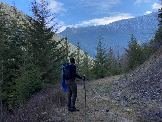
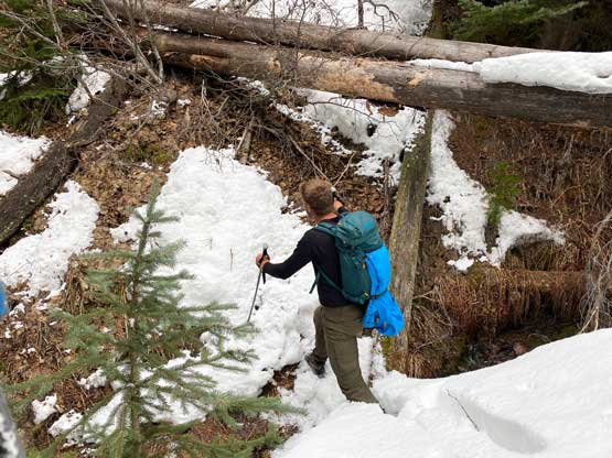
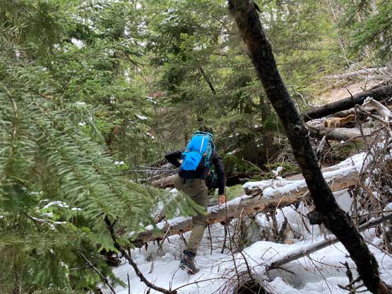
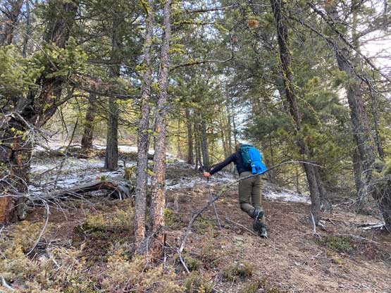
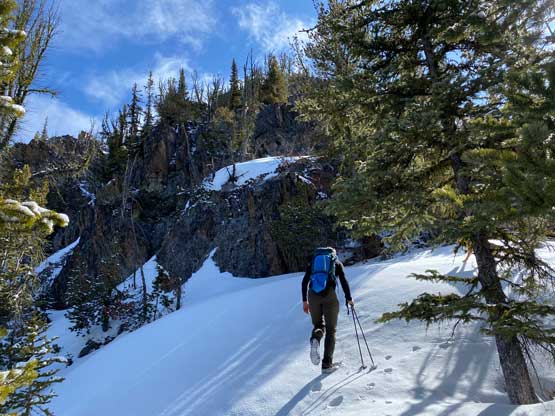
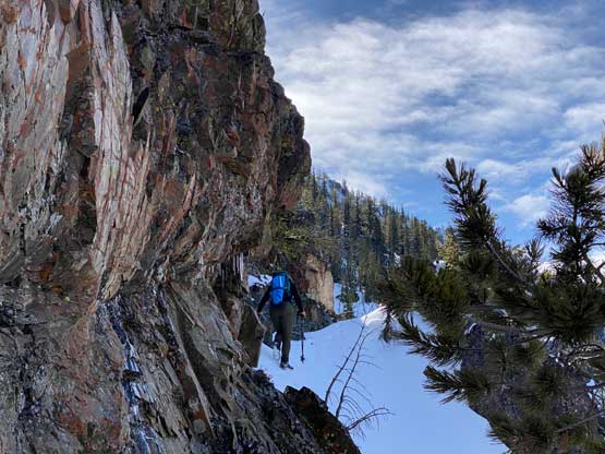
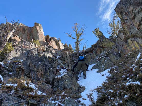
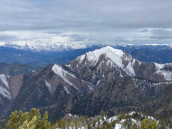
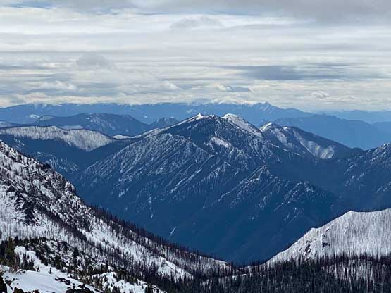
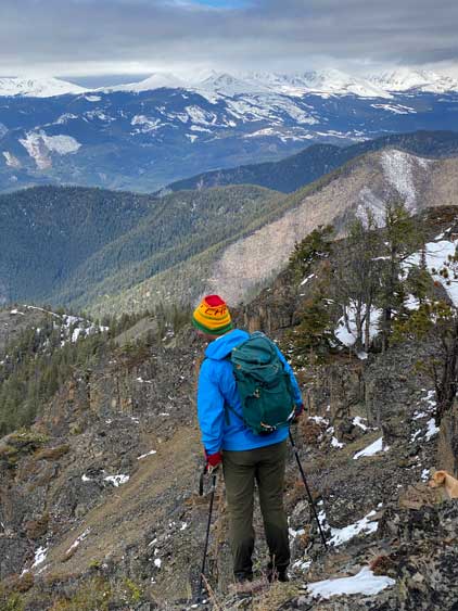
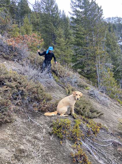
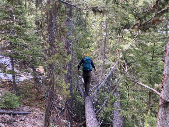
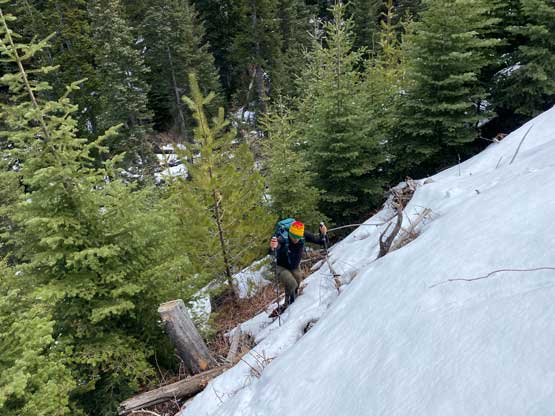
After crossing the creek on logs we were back on dry terrain, but the bottom 100 m of the ascent had a ton of pick-up-sticks to content with. The plan was to traverse leftwards to a smoother south-facing slope, but after a while Matt was tired of the traversing and the dead-falls. I agreed with the change of plan so we started to ascend straight up the slope. This brought us onto a SW-facing rib which eventually would bring us to the NW Ridge but much closer to the summit. About halfway up the rib we encountered snow again and the snow was absolutely bottomless. Thankfully by sticking on the ridge crest or staying on the south side we were able to avoid the worst of the wallowing. Higher up we had to deal with a series of bluffs that required scrambling up to 3rd class. The fresh snow did not make things any easier and the scree was compact, down-sloping and slippery. After one particularly tricky cliff band Matt and I made the decision to descend a different route but for now we had to focus on making the summit first.

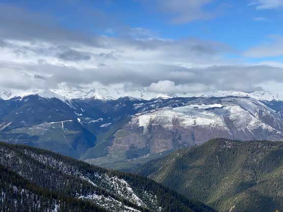
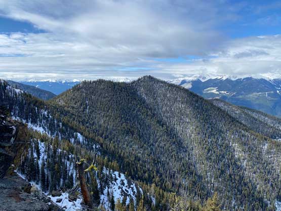

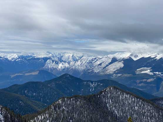
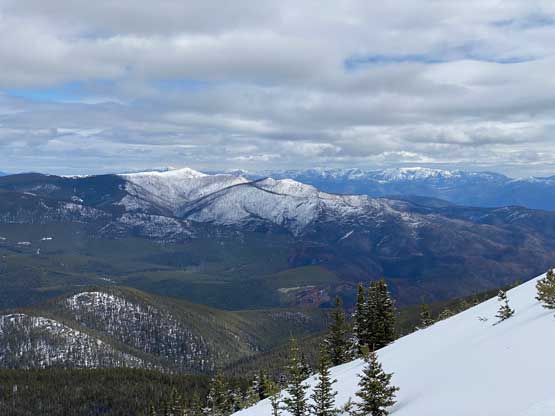
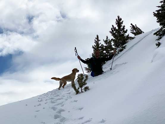
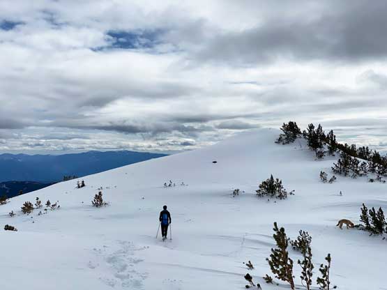
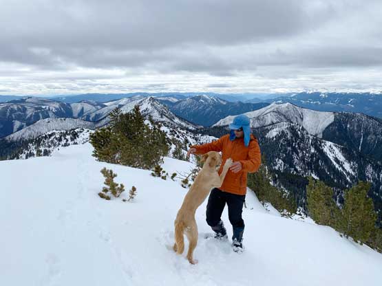
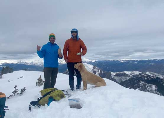
Thankfully the snow condition improved as we ascended higher onto the NW Ridge and the scrambling never became worse. The NW Ridge was not blown bare as I was hoping for, but was actually holding more snow. The snow was more supportive on the ridge and we were not that far from the summit at this point. The plod to the true summit still took a while but overall this was still a “short ascent” as we managed it in under 3 hours from the truck.
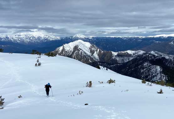
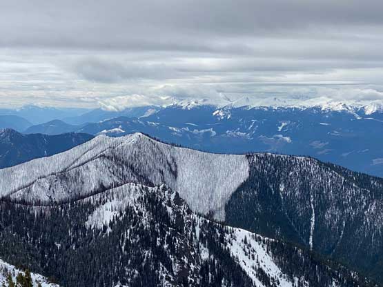
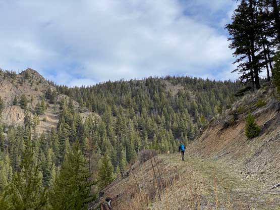
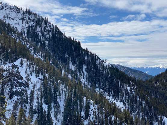
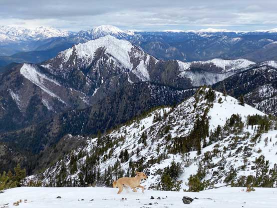
We made the final decision to descend the full length of NW Ridge despite the potential of more post-holing on the ridge and this proved to be a good call. The ridge turned out to be very easy and and post-holing never became worse than calf-deep. Matt then led us down through a series of loose gullies onto some gigantic, south-facing open scree slopes. These slopes weren’t as great as appeared as the scree was more compact and slippery, but still much better than the route we ascended. In no time we were back down to the creek and the dead-fall mess. The worst was to re-ascend the 50-m on the opposite side of the creek. The wallowing was more than waist deep at places so I had to crawl like the double-amputated disabled to use knees and thighs instead of the feet. With a bit of perseverance we climbed out of the misery onto the uppermost logging road spur. The bit of crust that used to support our weight in the morning was completely gone so every step was knee+ deep post-holing back to where I ditched the trail-runners. What amazed me was my socks were still dry at this point..


It wasn’t even noon by the time we got back to the truck. We already decided against in making an additional ascent so we leisurely drove back to Lillooet. The original plan was to have a massive burger dinner in Whistler but Matt changed his mind to drive a single shot back home. Without the burger allure I no longer wanted to drive the Duffey and Sea to Sky anymore. It was only 2 pm so then I made a spontaneous decision to drive to Cache Creek for a late-afternoon ascent of Elephant Hill. I knew this meant I wouldn’t get back home until very late in the evening but whatever.