Tripoli Mountain
May 26, 2012
2620m
Cadomin , AB
This was my first trip with Eric Coulthard. It’s hard to find peak-baggers especially in Edmonton. We also have similar fitness level. I hope to go with him for more trips in the future. Eric wanted to explore some places that he never got to before, namely Cadomin area. It’s east of Jasper National Park boundary and south of Hinton, located in the front ranges. We drove to Cadomin in Friday evening and we were surprised about how much snow in the first range of front country in late May…
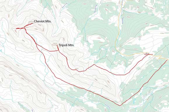
Tripoli Mountain and Cheviot Mountain scramble route
According to the topographic map, there is supposed to be a camping site by “Mountain Park” (a tiny community labelled on the map), about 15 km further from Cadomin. However, we didn’t see any sign of camping area around except for the massive mine site and a grave area. Oh well, we had to camp at trail head then, at Cardinal Divide. This area has elevation of near 2000 m, and with all the snow accumulation we certainly felt like going back into winter… But none of us brought snowshoes… Eric and his friend, Jim, didn’t even bring ice axe and crampons, nor gaiters. Good thing is we start at treeline, and we might can have a good overnight freeze so the post-holing in the morning might not be that bad.

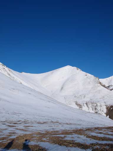
A closer look at Cheviot Mountain
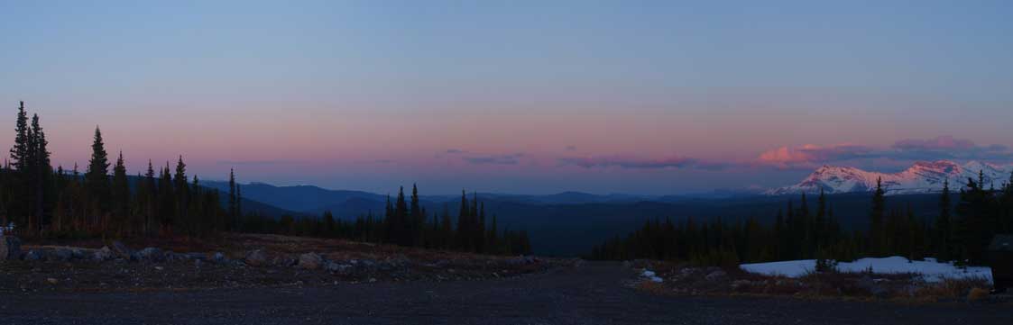
More evening view. Gorgeous!
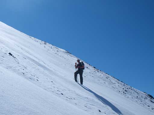
We woke up 5:30AM in the morning and set off at 6AM. Indeed the post-holing wasn’t too bad. Mostly calf deep, but the snow always tried to give us surprise. Occasionally we punched through to our knees or thighs. We didn’t take long to reach the correct ascent gully. Although it was snow covered, the snow wasn’t deep enough to slide.
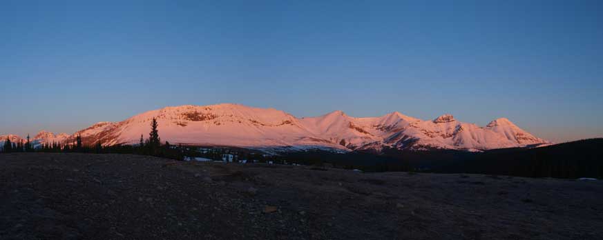
Gorgeous alpenglow in the morning

Not sunrise yet
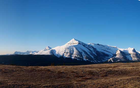
Mount MacKenzie

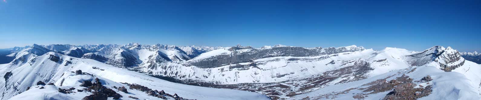
The route is shown, and our objectives are labeled

Looking into Rocky Pass
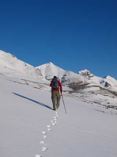
Eric breaking trail towards the ascent gully
This is the ascent gully
The gully looks steep but actually it wasn’t bad at all. There was just right amount of snow. If too deep, then we had to post-hole; if no snow, we had to deal with the tedious talus slope. We soon made to the first summit (Tripoli Mountain has three summits) at 8:30AM. Non of us has been to these mountains before, the view is breathtaking. Soon after topping out on the first summit, the long rockwall of Blackface Mountain came into views. The other side is the foothills and the prairie. From the first summit, it’s very straightforward to traverse to the second one. Again, most of the snow was calf deep, but occasionally knee deep. On the second summit, we got a good view of the third summit (the true summit), and Cheviot Mountain which you can say the 4th summit of the ridge. The true summit of Tripoli definitely looks interesting, several rock bands with mild exposure. And, to traverse to Cheviot would require dropping down to the valley floor and regain all of the elevation because there’s a big cliff band blocking the direct route.

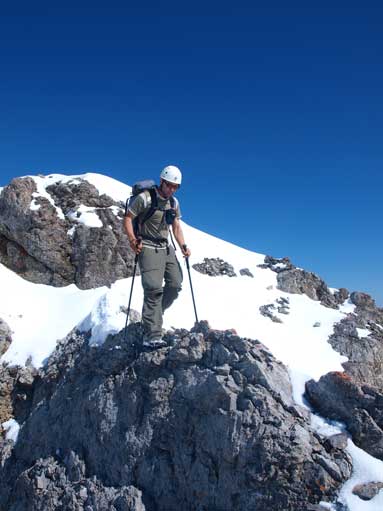
Eric on the first summit

Wow. This is Blackface Mountain
In the distant is Mount Balinhard

Looks like a high line ski touring!

The true summit is in the foreground, with Cheviot Mountain behind.
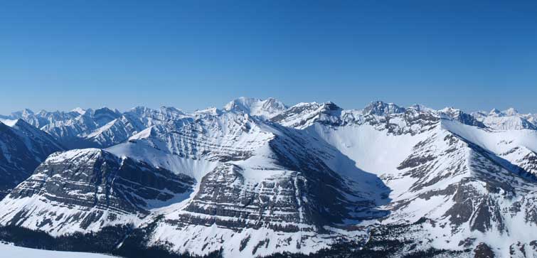
A panorama of the peaks towards Jasper Park. Click to view large size.
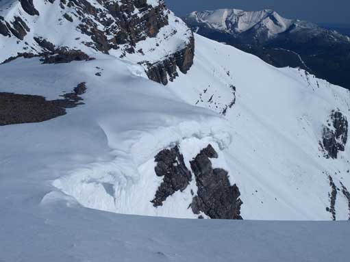
An interesting cornice
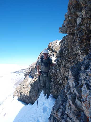
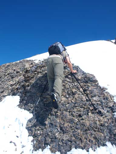
Jim wasn’t confident with exposure so he decided to wait for Eric and me at the col between 2nd and 3rd summit. We gonna attempt the true summit from the most direct ridge line, which involves 2 short difficult scrambling sections even if dry. We got lots of snow there. I had one axe and crampons, but ended up not using them. To get over the first rock band involves a 2m climb with only very small holds, or precisely, friction holds. Soon after that, cross a narrow snow ridge, followed by a rock ridge with half the width of Lady MacDonald’s summit ridge (this is the crux step)… The drop to left was about 5m followed by steep scree so wan’t too bad, but you might gonna injure. To right, it’s steep snow followed by cliff bands, so might be fatal. After this crux, there’s a short 2m downclimb, followed by another rock band, we squeezed under it and traversed on the left. You don’t want to slip here. Definitely a difficult scramble, but manageable. We took scrambling photos on the way down.

Towards East is the foothills and prairie

Zooming-in towards Mount MacKenzie

Looking South.

Me on the summit, with Cheviot Mountain behind.
Eric descending Tripoli Mountain

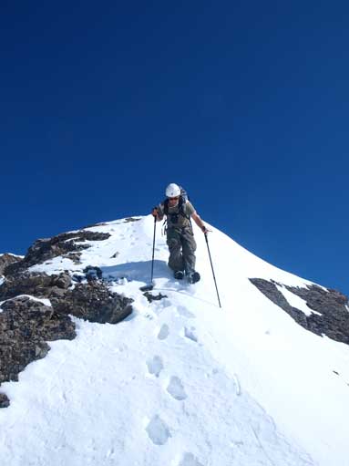
Going up a step

The crux ahead. This is the most exposed part
Eric balancing over the crux
More snow to deal with
Down-climbing a short step
Descending a gully towards Cardinal River side. This also brought us much further away from our car.
We dropped all the way down to valley floor before continuing towards the next objective, Cheviot Mountain.
