Mount Larrabee
July 13, 2023
2396m
Mt. Baker Highway, WA
Mt. Larrabee is a short but somewhat loose objective on Mt. Baker Highway that made into Matt Gunn’s scrambles book. There’s nothing magic and the “beta” on the internet is overwhelming. I simply downloaded a GPX track from peakbagger.com and that’s it. I didn’t even bother to read the book, but I did know what roughly to expect. This peak has the reputation to be “horribly loose” but I take those words with a grain of salt. I don’t think the people that made those comments had done the Goodsirs or even the nearby American Border Peak so I don’t know what exactly they meant by “loose”. In any case I’m probably the only one out there who had done the two infamous Border Peaks, as well as the hike-up Winchester Mtn., but hadn’t done Mt. Larrabee. There had been quite a few posts about this objective on the socials so I asked a few questions and easily made the decision to travel light – approach shoes with no traction. There would involve a few snow crossings but I didn’t think those would require crampons.
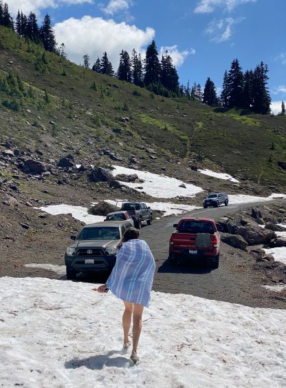
I tossed the idea to a few people at the very last minute and Holly signed up. Holly had an evening commitment at 6:30 pm and I wanted to plan enough contingency such that she would definitely get back in time. The meet-up was 5:30 am in Abbotsford but I slept through my alarms. I had set 3 separate alarms and none went off. I assumed that I likely forgot to toggle the buttons on. I woke up at 7 am and it took me a minute to realize what was going on, so it was a “oh fuck” kind of moment. I was surprised that Holly didn’t call me but she texted a bunch of messages. I quickly did some mental math that despite being almost 3 hours late we could still try it. This trip proved again that it’s important to plan enough contingency no matter how big/important the trip is. I always plan for the worst case scenario and hope for better. In this case it was basically the worst case scenario as I literally woke up naturally, but we still got the peak and she still made back in time for the dinner commitment. I told Holly to buy some junk food for me in Tim Hortons as it would take me an hour to show up thank to the morning traffics. We eventually left Abbotsford at 8:20 am and that was basically 3 hours behind schedule. The road to the trail-head was in a rough shape this year. I had driven it three times and this time was the worst. The farthest parking lot was inaccessible due to snow, but I drove us as far as possible and basically just parked on the road in front of the snow block.
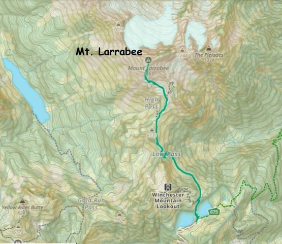
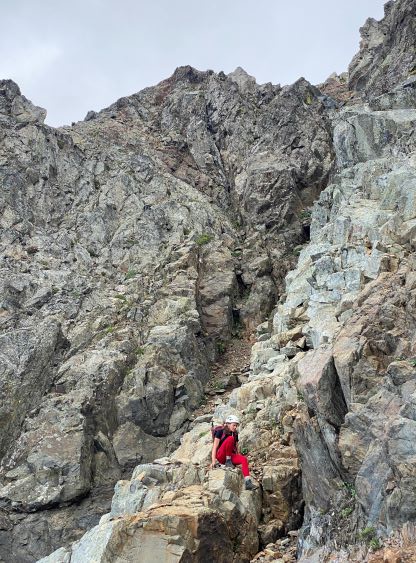
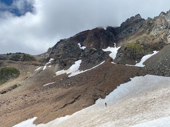
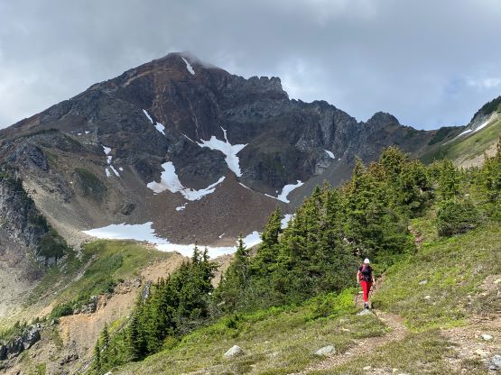
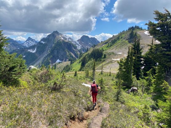
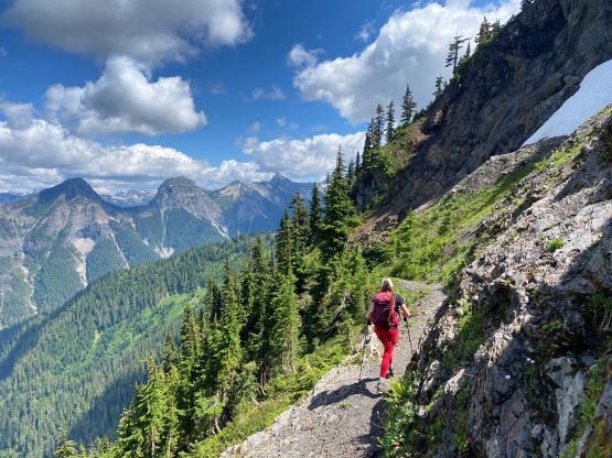
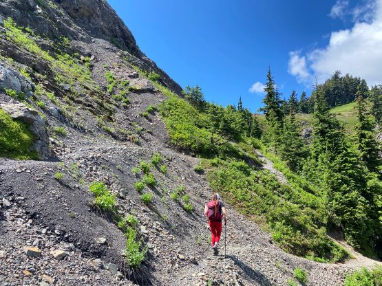
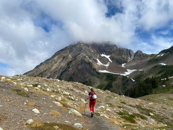
I knew it had taken Nikita and Duffy 2 hours 45 minutes up so I told Holly that we should aim for 2 hours if she’s willing to push herself on the uphills, and she would not be late as long as we could finish the round trip in 6 hours. With that mindset we dashed out onto the High Pass trail, only to realize that Holly had forgotten to grab her poles from the truck. 5 minutes were lost right off the bat. I then made Holly to go ahead to set the trail pace and in about 50 minutes we arrived at High Pass. The trail surprisingly continued beyond the pass and led us onto a large, but low-angled snow slope. We crossed the snow slope and traversed/ascended a long stretch of loose scree, aiming for the first obvious gully feature on climber’s left. The area around this first gully had some compact moraine type of choss as well as some steep grass. Those elements weren’t pleasant, but manageable.


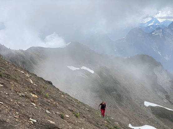
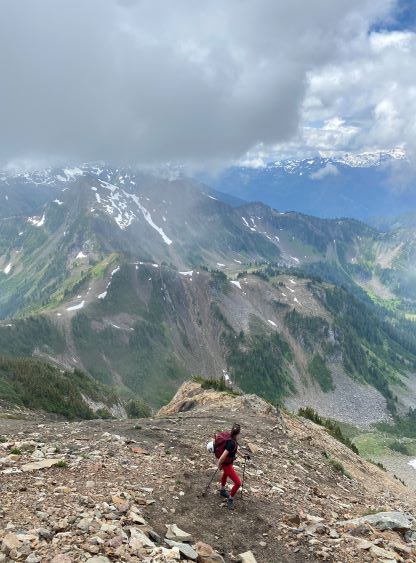
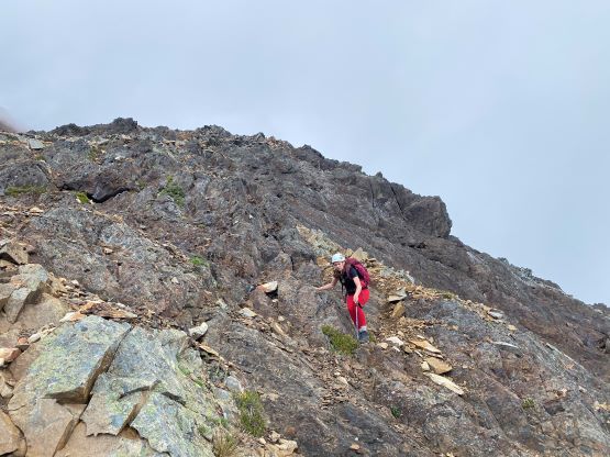
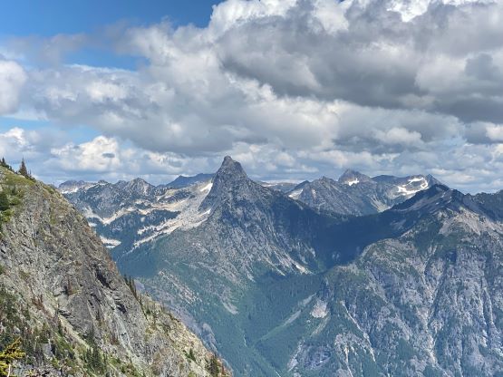
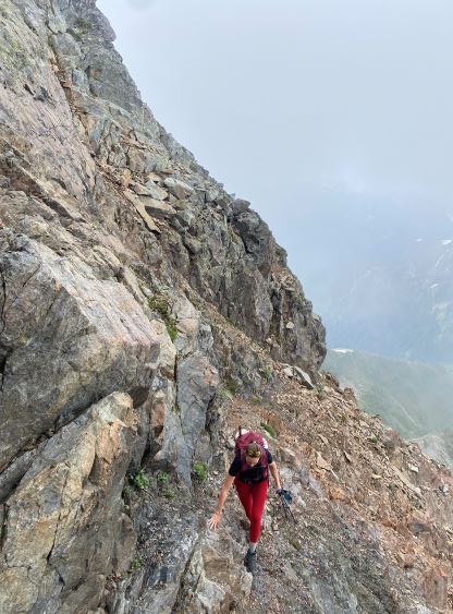
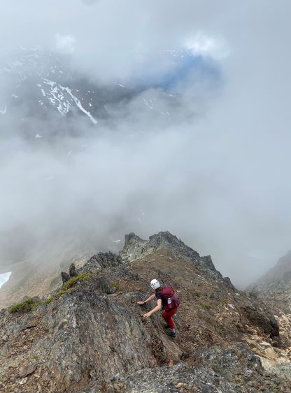
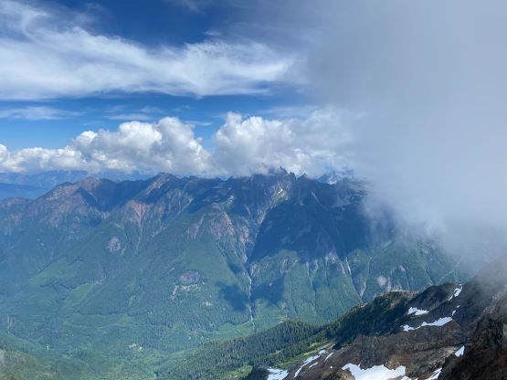
Because I didn’t read any “beta” about this peak I was completely relying on the GPX track as well as my in situ route-finding. The next noteworthy feature was a twin-gully kind of system. The easiest route appeared to be ascending straight up through the right hand gully, but I refused to do so as I wanted to scramble straight up the rib on rocks. I told Holly that she should make her own decision and she opted for the extra challenge. There’s at least one 4th class move with some exposure. The scrambling was harder than I thought so we traversed into and then crossed the gully to rejoin the GPX track. From this point we just had to scramble straight up towards the summit and we apparently didn’t find the easiest path again. Multiple lines all work on this mountain, and it’s pointless to try to find the “correct” path. The weather was unfortunately mostly cloudy but the north side of the mountain was free of clouds. I thought we would have another no-view summit but that was thankfully not the case.
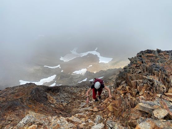


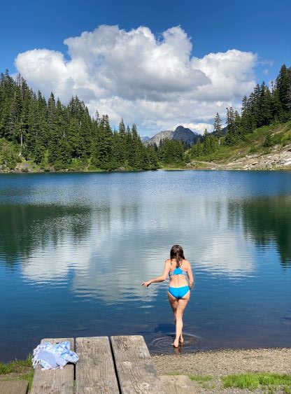
We made the ascent in 2 hours 20 minutes so I told Holly that she had earned half an hour’s stay. I was hoping that the weather could improve, but to no avail. Eventually after forcing in some food we reluctantly started the descent. I paid more attention in route-finding this time and did not encounter anything harder than “class 3”. I have to say that this mountain isn’t particularly solid, especially for those that do not have a Rockies background. We took another break after finishing the scramble, and then easily jogged down the trail. Holly was keen to swim. I wasn’t sure if we had that much of extra time, but then it wasn’t me who had the time constraint, so why not. We then encountered some gong shows on the narrow FSRs, but then the drive back to Abbotsford on the pavement was a cruise sail.