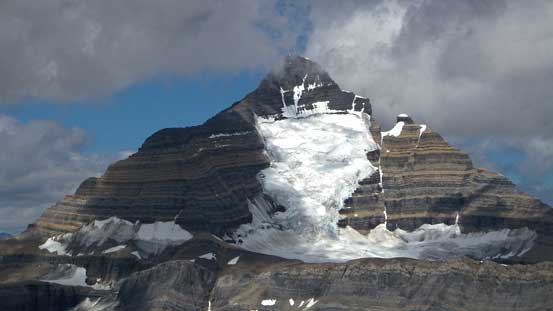
Cinnamon Peak
August 23, 2014
2727m
Mt. Robson Provincial Park, BC
Weather was unsettled throughout most of the Rockies in this past weekend with the exception of Valemount, so that’s exactly where I would go. After throwing out some ideas Eric, Ben and I agreed to give Cinnamon Peak a try, hoping to have some splendid view of Mount Robson. Speaking our objective, it rises 2 vertical kilometers above the Robson information center. Although it’s rather a diminished summit compared to Robson, it’s a huge scramble as a day trip. Despite its proximity to Yellowhead Highway, there’s no information regarding how to attain its summit by just simply searching on Google. The only beta we got was from Cian Brinker, a local guide based in Canmore who was also our trad climbing teacher earlier in this year. The scrambling route essentially follows a gigantic avalanche gully up for near 2000 vertical meters followed by a fun traverse to the true summit with some interesting scrambling.

Cinnamon Peak scramble route. GPX DL
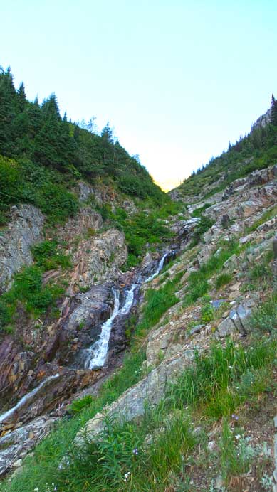
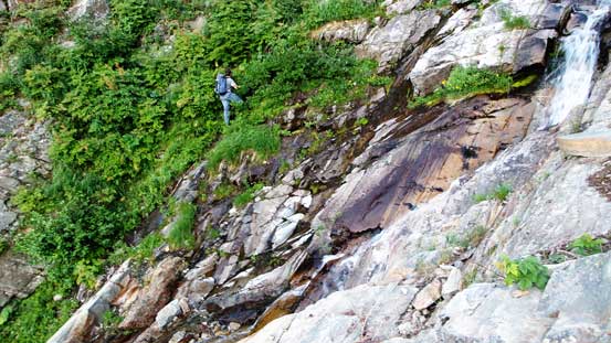
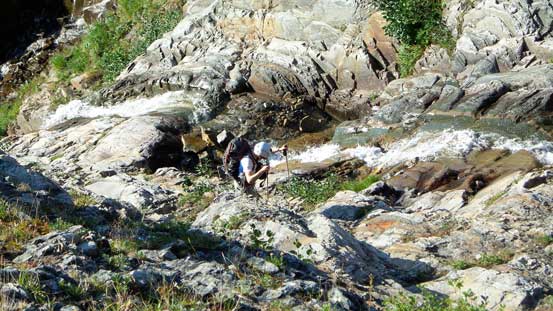
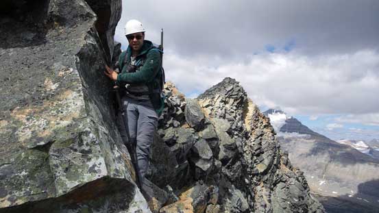
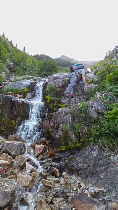
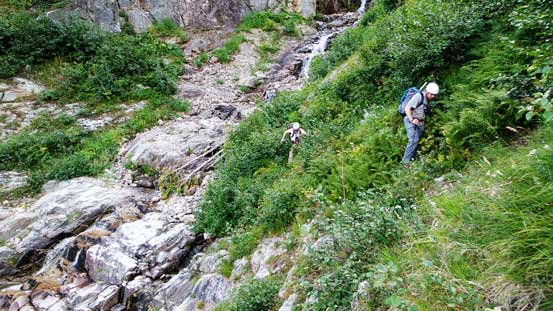
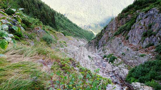
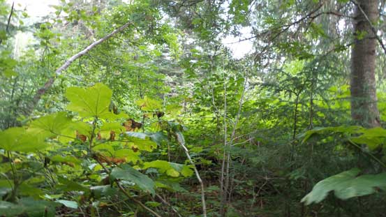
As usual we’d knock off the drive by the previous evening. It started with overcast sky but once crossing the boarder into BC, millions of stars suddenly showed up above us. Our spirits were high. The next morning we started the trip at Berg Lake’s trail-head by about 6 am. After a quite warm-up on this wide and flat trail (for less than 1 km) we arrived at the avalanche slope/gully. It wasn’t very obvious but after checking Ben’s GPS we got confirmed that’s the way to go. The bush looked nasty but we were mentally prepared for that. Lots of alders and brushes to bash through and at sections we were completely buried by the vegetation… Thankfully the bush section didn’t last too long. It was a very welcomed change of pace once we located the dry creek bed. Apparently the water went underground at here and there’s a lot of water running in this gully higher up. Following the creek bed up was fast and fun until the water showed up. The down sloping quartzite rocks were extremely slippery when wet and we had to be extra careful on the footings. This wasn’t a very difficult task on the way up but coming down would be a different game… The middle section of this gully was steep and tight and at a couple spots we had to go up climber’s right to overcome a few obstacles, side-hilling on either down-sloping rocks or steep grass/dense bush.
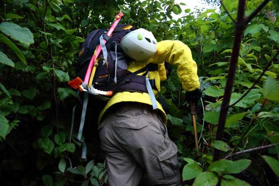
Me bushwhacking… Photo by Ben

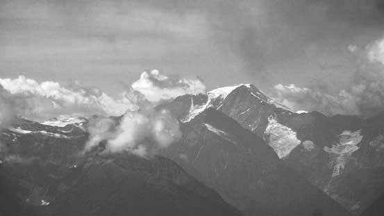
Alpenglow on Klapperhorn Mountain across Highway 16
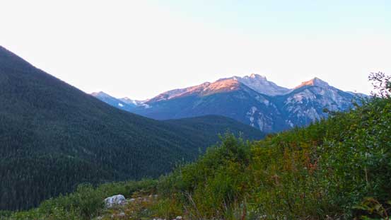
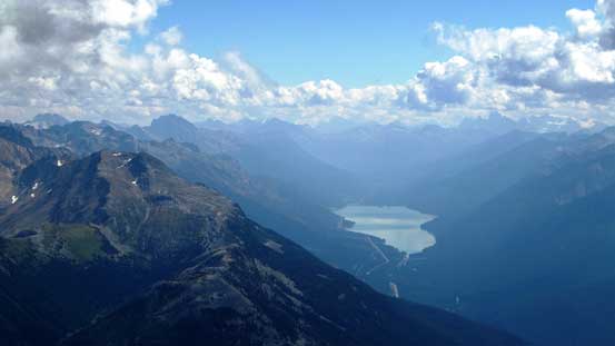
Morning view of Overlander and Klapperhorn
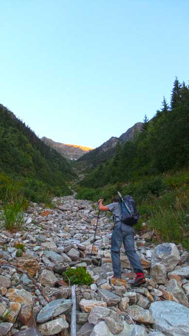
Eric ascending the long and foreshortened drainage
Higher up it gets wet
Eric went up and around a wet section
Another waterfall ahead. This one should be circumvented on climber’s right
Ben coming up the typical terrain
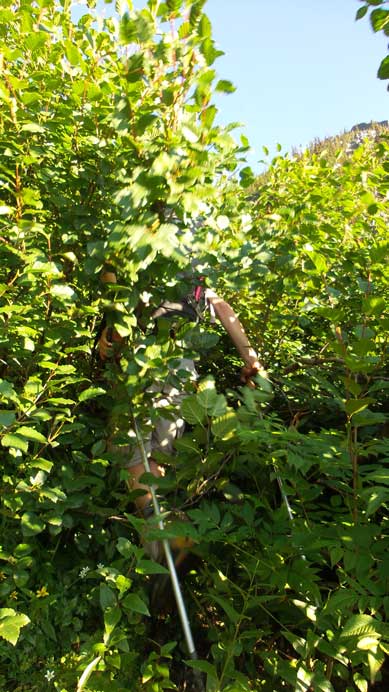
Bashing through alders…
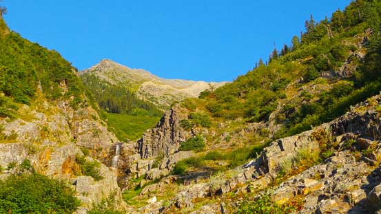
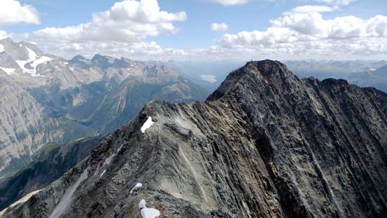
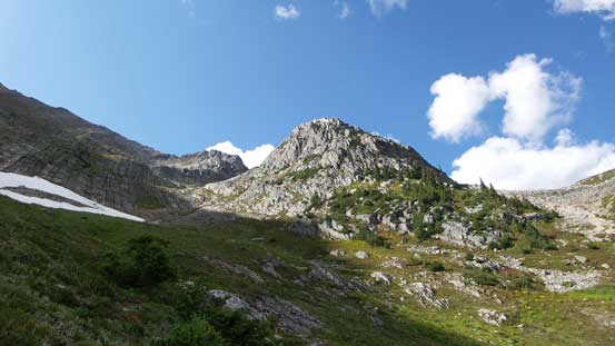
The upper draw of the gigantic avalanche gully was more open and less steep. We were aiming at a distant snow patch which eventually turned out to be quite a snow field. Eric and I went climber’s right of the snow while Ben tackled on the opposite side. Terrain around here was either steep slippery grass or short series of rock steps. Again, it was not difficult going up but would be extremely tedious coming back down. Higher up we had the option to either going straight up or enter another bowl on climber’s right. Either option would work and we decided to go climber’s right – a more scenic option as we could see Robson and Whitehorn much earlier. We eventually followed the right hand side ridge all the way to false summit with one detour around a steeper band. The view from this false summit was already amazing but looking ahead, the traverse looked complicated with lots of elevation loss and regain. So rather than soaking in the views we had to focus on the task ahead.

The upper draw. We’d aim at the distant snow “patch” and then turn climber’s right
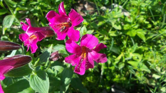
Flowers

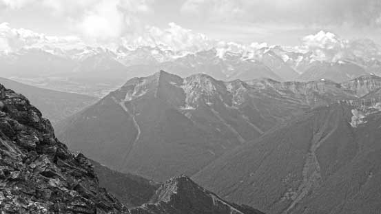
View towards Overlander Mountain

On the southeast ridge now, looking towards Whitehorn Mountain
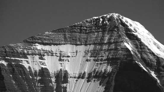
Higher up on Cinnamon Peak

A zoomed-in view of Whitehorn
Ben ascending the ridge with the braided Robson River way down below
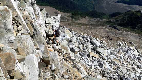
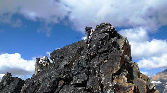
Typical scrambling on the SE ridge leading to false summit

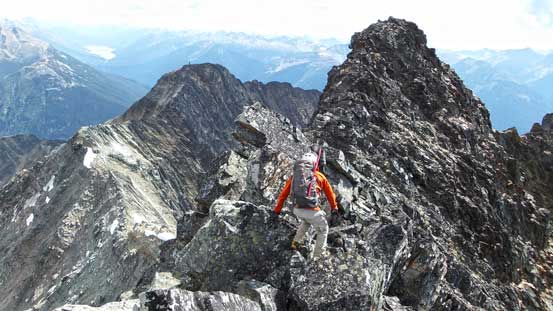
The long traverse to true summit
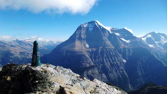
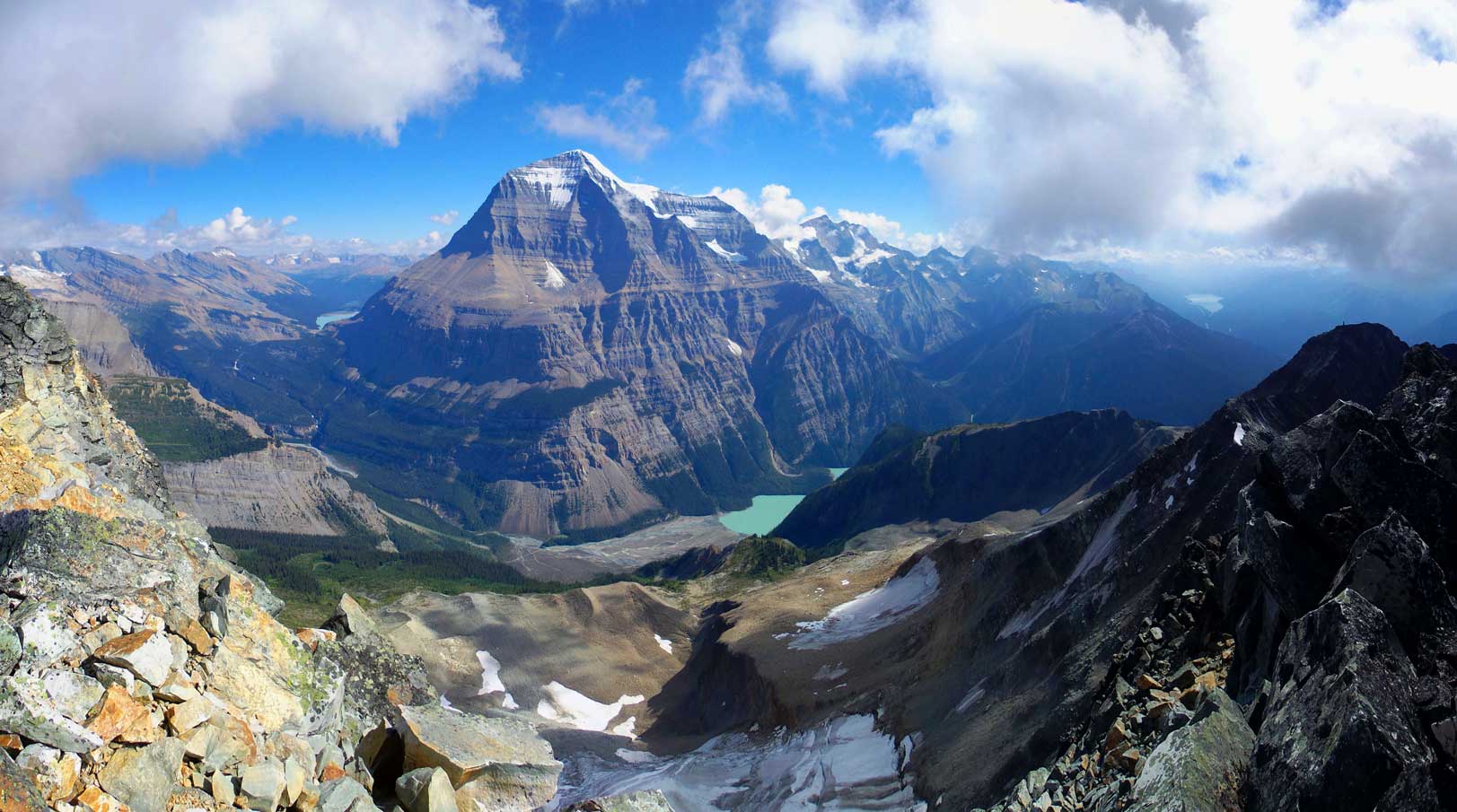
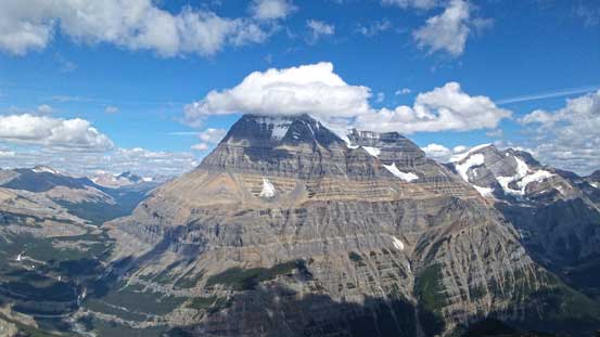
The mythic BC summit green tower and Mt. Robson
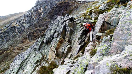
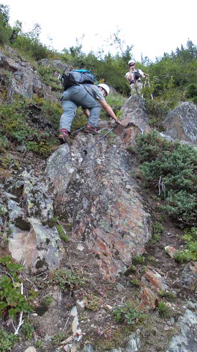
The traverse was mostly class 3 scrambling on quartzite with a few class 4 steps. The rock quality was not nearly as good as the classic quartzite climbs in Rogers Pass and we had to be careful with the holds. I found the crux was right at the start where we must down-climb a near vertical wall with exposure. The rocks were a little bit wet just to make things a little bit more interesting. Nothing too tricky though compared to what we had done earlier in this year. More down-climbing followed after the crux and soon we arrived at the saddle between false and true summits. Up the other side there was a long section of class 3 scrambling on loose terrain with comparable exposure. This part terminated at the final summit ridge. A short but fun traverse brought us to the true high point. The views were needless to say, incredible towards each direction and we were even surprised to find a summit register. We stayed there for 2 hours taking hundreds of photos.
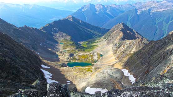
Looking down a hanging valley on the SW side

A beautiful alpine tarn in this valley.

Looking back towards the steep terrain just after false summit
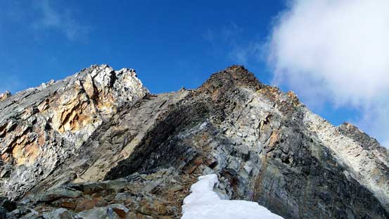
Ahead would be the long loose class 3 section – on the darker rocks
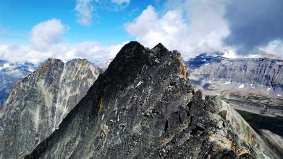
The final traverse to true summit

Looking back from the true summit. False summit is the lower bump on left
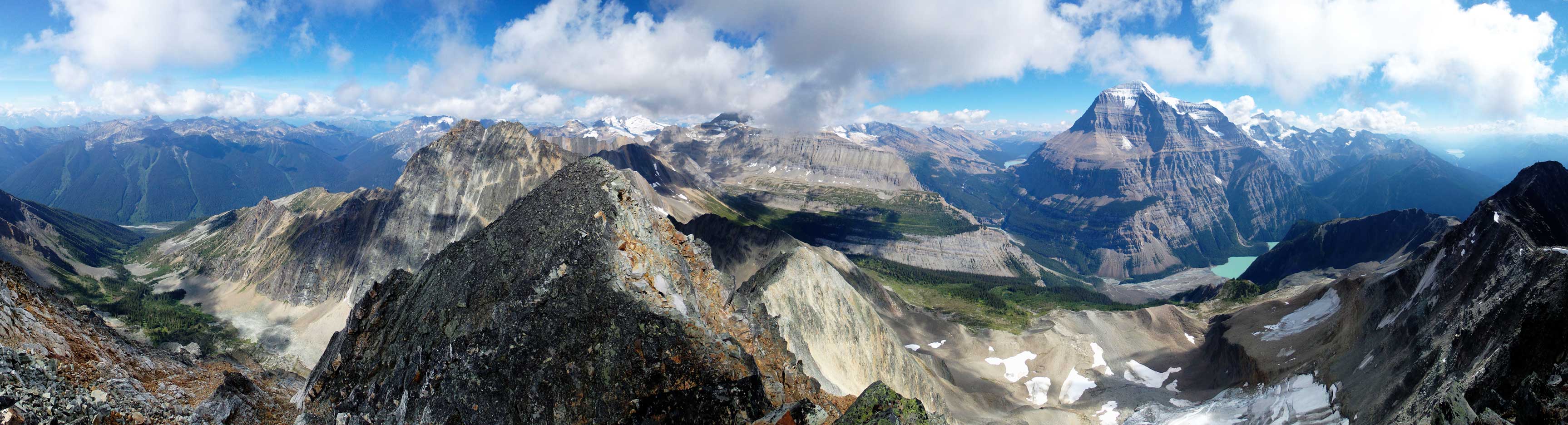
Summit Panorama. Click to view large size.
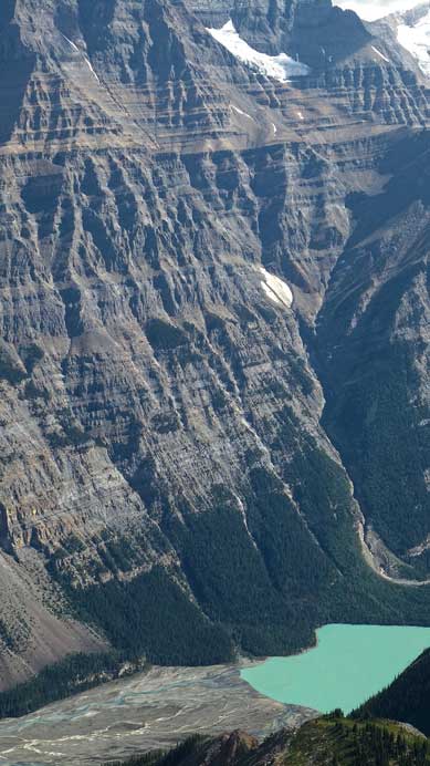
Kinney Lake and the massive face on Robson

The Emperior Face and Wishborn Arete – two of the craziest climbs in the Canadian Rockies
Mt. Longstaff doesn’t look very difficult. Question is how to get there…

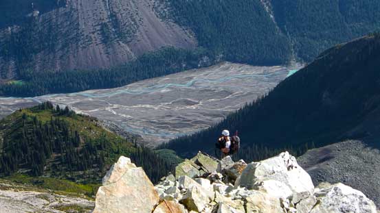
Zooming-in towards Berg Lake.
Mt. Chown in the distance – pretty high on my to-do list.

You can see the crevasses on Resplendent in this zoomed-in photo
Moose Lake way in the distance
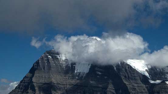
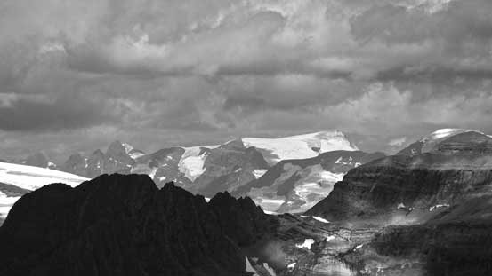
Clouds covering Mt. Robson
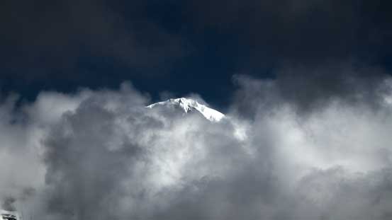
The snowy summit of Robson poking through – makes it looking like a Himalayan giant
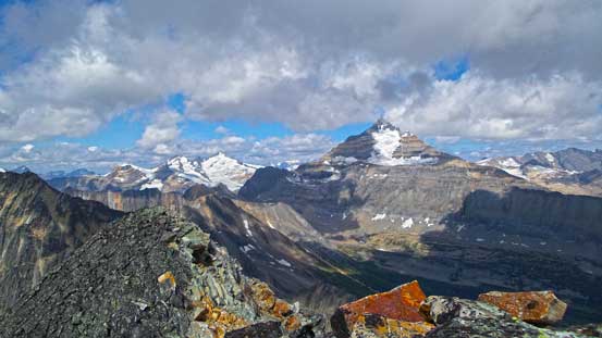
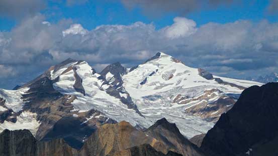
Mt. Longstaff and Whitehorn Mountain
Whitehorn Mountain
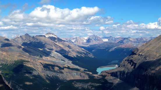
The Berg Lake area – Mumm Peak left of center

Calumet Peak looking north
Emperior Ridge & Face
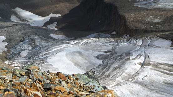
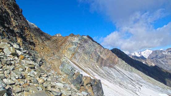
Glacier on the north face of Cinnamon Peak
Mt. Sir Wilfred Laurier – highest in the Cariboo Mountains
Mt. Chamberlin in foreground.

A piece of cloud hanging above Mt. Goslin
Another panorama of Robson. Click to view large size.
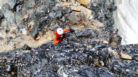
Not came the descent. The traverse back to false summit went slow due to the looseness. I got hit by a boulder at the long loose class 3 section and after that we stuck very close to each other. This was kinda a tedious process but at least it offered various hands-on stuffs with constant view of Robson. Back at the false summit, what was left was a 2000 vertical meters of descent down the avalanche gully. Neither of us was looking forward to this but we had to face it… The upper draw was mostly boulders so wasn’t too bad but the middle section was very tedious. We had to focus on each step. No matter what terrain we were on – steep grass, down-sloping rock, bush or the creek bed, it was extremely slippery and some parts were quite tricky. I was really glad to have worn the stiff mountaineering boots on this trip. The lower section was miserable. We decided to keep following the creek bed down hoping to shorten the bushwhacking distance but apparently not by much. We soon entered an alder field and soon enough, devil’s clubs started to show up. This was my first time bushwhacking in the spiky devil’s club and I found the key was to step on them rather than bashing through. With a bit of perseverance we managed to get out of the bush, exhausted and relieved. The last part was a short and easy hike and then we were back at the parking lot.
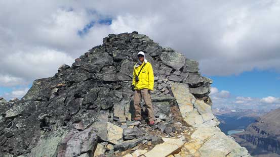
Me with the true summit behind.
Eric
Ben traversing back the summit ridge
Eric down-climbing a steeper section
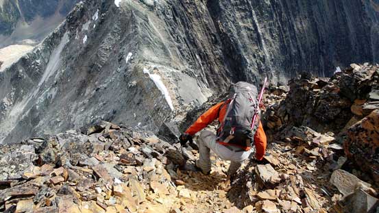
Ben starting the loose 3rd class part

Eric halfway down the loose section
False summit ahead. Lots of elevation regain

Climbing back up the false summit
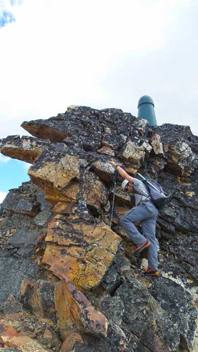
Eric tackling the crux
At the meantime, I took a photo of Robson, can’t stop taking photo of the king…

Me ascending back the crux. Photo by Ben
Ben ascending the crux
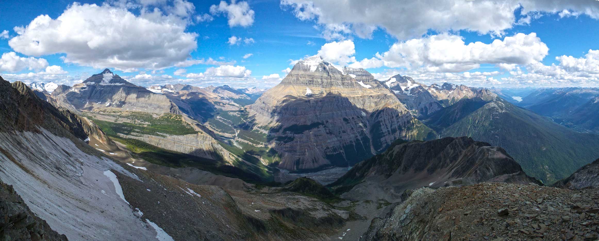
One last panorama of Robson and Whitehorn. Click to view large size.
Ben descending typical terrain
Looking back the upper draw

Still a long long way to go
Eric down-climbing slippery terrain beside a mini waterfall

Ben picking a line down the wet bush
Side-hill traversing
More slippery terrain to descend. Typical, typical…
Many down-climbs like this beside the stream/waterfall

Eventually we entered the bush again…
Ah the devil’s clubs…
Not a pleasant way to end a day…
Cinnamon Peak is a big scramble and I’m very happy to have it bagged, but never ever again. I could totally see why the summit register only got signed twice. It’s a incredibly scenic mountain but nearly all of the ascent was on awkward terrain requiring a high degree of perseverance – a classic example of “quality suffering”. The descent was hard on the knees for pretty much the entire way and a good portion of it required consistent mental concentration. If it rains then this route will be very difficult to descend if not impossible..
In the evening we drove to the Cariboo Grill in Valemount for some well-deserved food. And at the meantime, we talked to Patricia Thoni (Reiner’s mom). We got some detailed route beta for Mt. McKirdy, our objective for the next day.

Good job on the summit! and those are some sweet pics! Any idea if i could pull this off this weekend? or would you say that the snow is too deep?
hey, I’d say for sure skis or snowshoes are still needed and you go up a huge avalanche chute in spring time.. Only if you are experienced in this winter mountaineering and the timing game associated with it and have the right equipment. It’ll be an alpine climb right now.