Mount Dickens
September 11, 2021
1288m
North Shore Mountains, BC
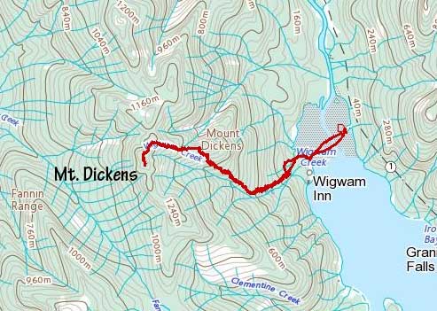
Mt. Dickens is a small and entirely-forested summit directly above Wigwam Inn at the north end of Indian Arm. This was one of the several peaks in the middle of Fannin Range (the others being Mt. Eldee and Bivouac Mountain) that even the most obsessed peak-baggers weren’t desperate enough to attempt. The status of Mt. Dickens had changed significantly in the last several years because of the inclusion in the “Bagger Challenge” list. A “trail” had been built and subsequently improved from near Wigwam Inn all the way to the top such that the degree of bushwhacking had been significantly reduced. The “trail” is very steep and there’s still bushwhacking required but by the Coast Mountains’ standard this is pretty tame. That being said this is still an obscured and rarely-visited summit because of the logistic complication of Indian Arm crossing and the fact the summit is densely forested.
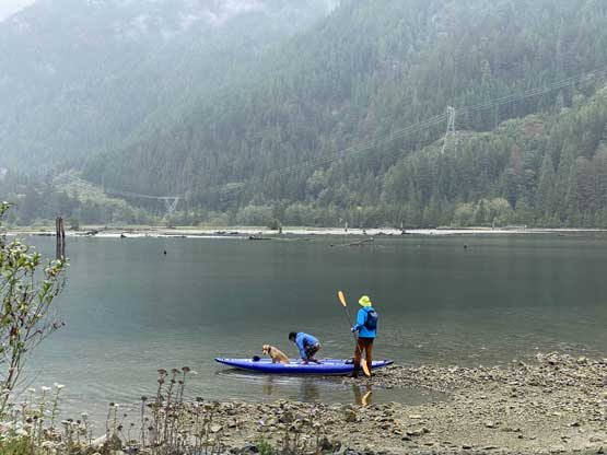
Local peak-bagger Simon C. had approached Mt. Dickens by ascending up and over Mt. Bishop, and back up and over Mt. Bishop to “descend”. Simon’s trip report was published on ClubTread when I was still living in Edmonton, Alberta. This peak was completely irrelevant to me at the time, but I remembered that trip report to this date mostly because of the shear volume of effort needed to grab such an insignificant summit. The way Simon went lacked bushwhacking but for obvious reasons I would pick the Wigwam Inn route. Nowadays most baggers chose to take a water taxi across Indian Arm but I thought it’s cool to paddle across the northern end of the Arm from the end of Stawamu-Indian FSR. The baggers in that “challenge” don’t think about this way because this involves driving to Squamish followed by a total of 70+ km on rough forestry roads. This sounds quite a bit beyond their scope. I mentioned Mt. Dickens to Matt Juhasz a few months ago and we had an instant click on this paddling approach. Matt has a inflatable kayak that can fit two people while I own a packraft. Eventually in early September we finally pulled the trigger. The forecast was looking miserably with rain and low clouds but honestly that’s the only reason why we were here. Had the weather been better I probably would end up on some taller (and farther away) peaks, just like in the last couple months. At the last minute Ni Jin, another fellow bagger from that group joined us despite the weather, the logistics and the bushwhack.
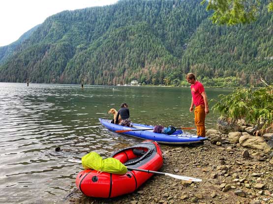
The three of us met in Matt’s house in North Vancouver at 6 am and in an hour we were driving down the rough Stawamus-Indian FSR. I had driven this road down to near Indian Arm about 5 years ago en route to Mt. Bonnycastle and the conditions hadn’t changed much. There wasn’t any particular bad spot such that any vehicle with a “decent clearance and 4WD” could make it, but the entire road (35 km or so) was rough with millions of pot-holes and a few wash-outs. Matt was able to fly down this road in his Yukon but had I been the driver I probably could only go at 20-30 km/h on average. There were a few deeper water bars passed the Hixon Creek turn-off and one did scrape the bottom of Matt’s truck a little bit. We were not able to park right at the beach because someone was there camping. This resulted in a bit of hassle loading our boats.
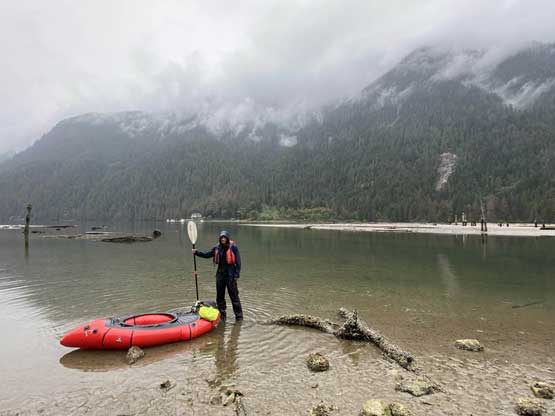
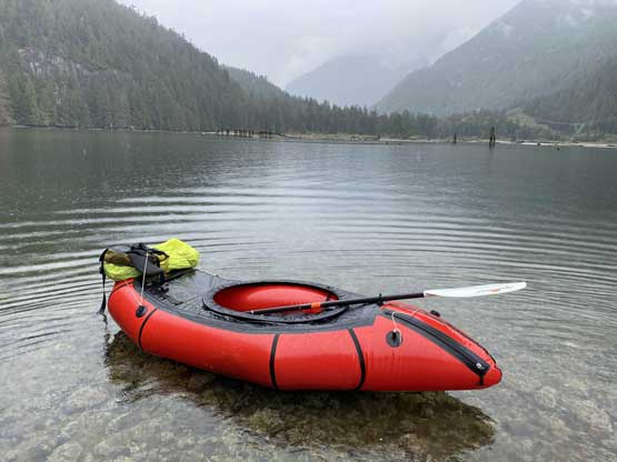
The packraft wasn’t the fastest boat to set up so I was glad that Matt also needed to inflate his kayak so I wasn’t too far behind. I opted to not wear the cumbersome dry suit as the water looked very calm and the crossing was very short (500 m each way). The paddling was also very easy and the water was quite shallow. We parked at the small beach just to the north of Wigwam Creek away from the Inn and their associated “private property”. I hadn’t done much research about this objective but apparently the start of the “trail” involved some trespassing issues. There was one man from the Inn staring at us from afar but he did not come over to fuss with us.


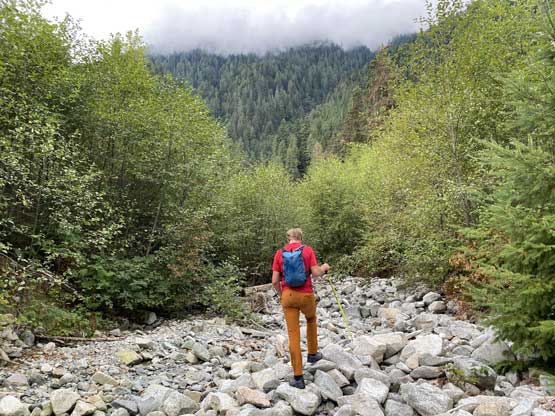
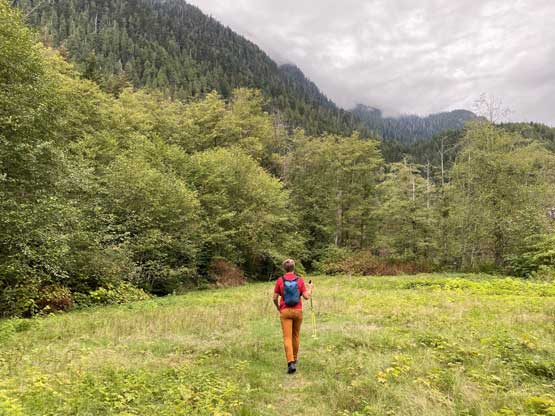
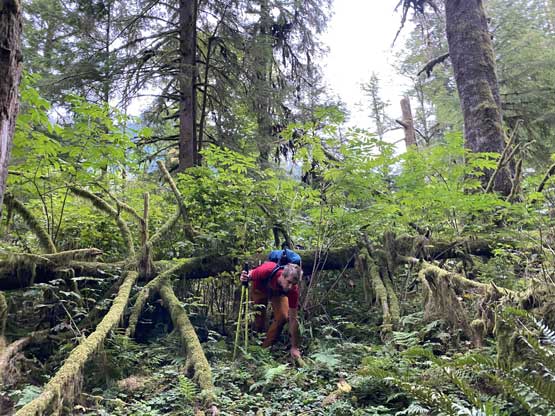
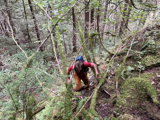
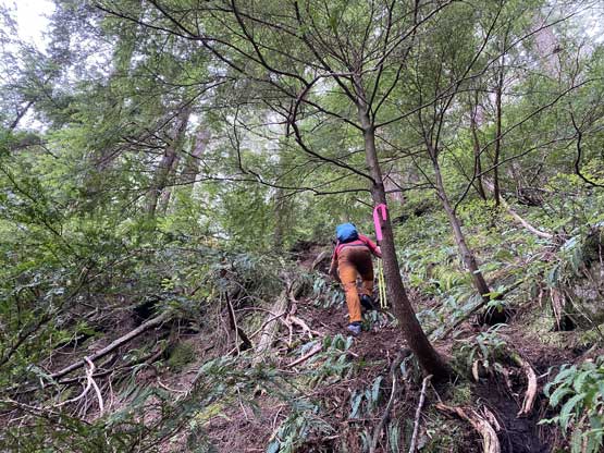
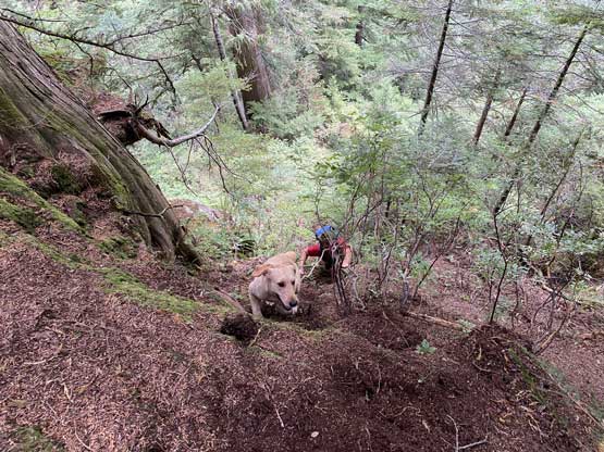
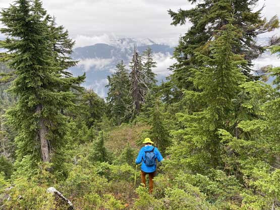
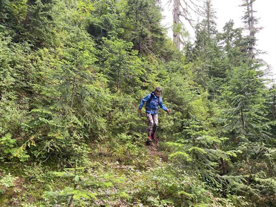
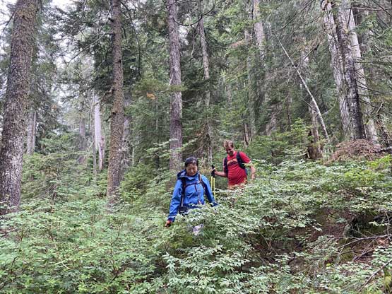
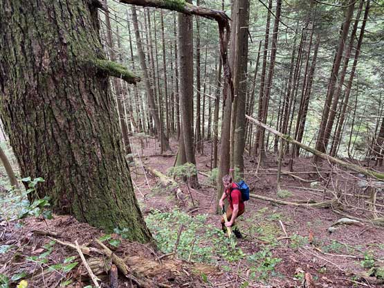
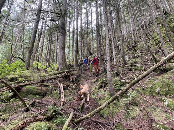
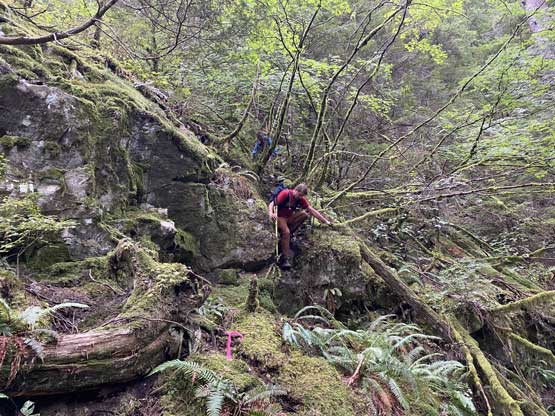
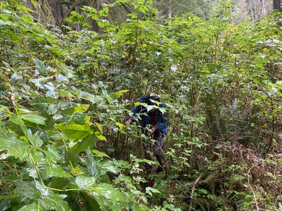
The start of this ascent was the most confusing section because the “trail” was not marked. Previous groups had undergone some serious bushwhacking in brambles but we had the most recent beta (and GPS track) to avoid the nasty stuffs. I think we reasonably nailed the route-finding on our ascent track so if anyone’s looking for beta I suggest to just follow our ascent track. We did a total of maybe 5 minutes of bushwhacking with maybe one tenth of that in brambles in the first 20 minutes and then we traversed leftwards and found the proper, flagged trail. From here onward it was an relentlessly steep grunt for 1200 vertical meters onto the summit ridge roughly following Wigwam Creek. The ascent onto the summit ridge could be broken into three stages. The first stage has some steep zones and ends at around 420 m with an optional detour into Wigwam Creek for some water and/or photos. After that spot the trail made a turn due NW and the start of the second stage was the easiest of the entire ascent with only some “moderate grade”, but towards the top of this stage we had to scramble up some “3rd class roots” on very steep terrain. The second stage ends at a long stretch of flattish terrain around 1000 m elevation. The third stage from here to the summit ridge had the worst bushwhacking of the trip. The “trail” was still decently well-marked but we had to constantly fight the underbrush especially around that flat sections. There were also some steep spots higher up. Overall if considered as a “trail” then it’s one of the steepest I’ve done, but if treated as a random “route” in the North Shore Mountains then it’s not bad at all.


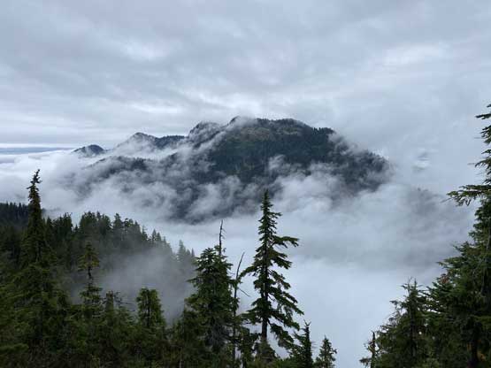
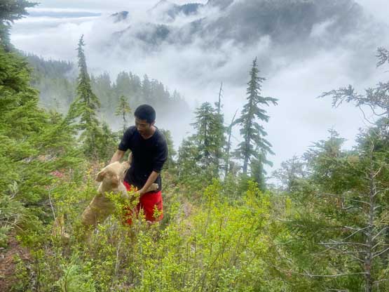
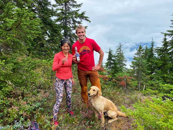
The top-out on the summit ridge was not as close to the actual summit as we thought. We had to scramble up and over two false summits to reach the true one. Honestly I could not tell by visual which of the three highpoints is the highest but we traversed all three so we could safely claim this peak. Matt and I descended the south side of the true summit to a small viewpoint towards Mt. Bishop while Ni was determined to find the whiskey (and she did find it). We lingered on the summit for over half an hour but then the rain finally came and it’s time to retreat.


Up to this point the trip had been much more pleasant than expected and we all actually enjoyed it. I thought the rain was going to ruin the second half of this trip but it did not. The rain never came heavily and after diving into the forest we could barely feel the rain again. Descending those steep and slippery spots definitely required caution but did not impose much of a problem to us. We did take our time and Matt even used the entire descent to do some trail-work. At least 100 if not more (small) logs were cleared. The rain became heavier just when we got down to Indian Arm. I unfortunately had to inflate the packraft again because of the dry bags and the cargo fly. The paddling was again, very easy and the water was actually calmer than in the morning with no wave whatsoever. The final transition at the truck was very dirty though as there’s no way to keep those boats clean with the mud and the rain.


Matt again, did an excellent job to drive us out of the FSR as always and another hour later we were back in the city. I unfortunately had an extra hour of driving but the traffic through the city on a Saturday PM wasn’t too bad. I eventually got back to White Rock at dinner time.
