Volcán Pasochoa
December 24, 2022
4199m
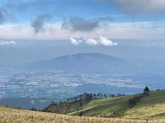
Quito, Ecuador
Pasochoa is an old and extinct volcano south of Quito and is often done as an acclimatization hike. This peak isn’t in a national park so a guide isn’t legally required, but the access has been problematic at least in the recent years. It seems like there are more than a few ways to access this peak but the “beta” isn’t very clear. The “standard” north route now has some private property issues. Adam and I initially ruled out this objective because of that but Abraham assured that we could still do the hike if we were willing to pay some cash to the local farmers.
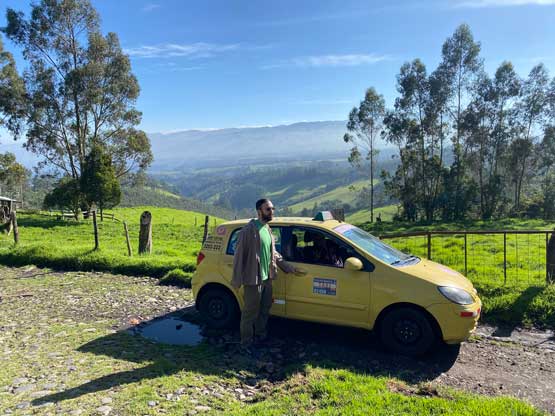
The only reason we did end up doing this peak was the failure of Antisana due to my medical emergency. Technically we didn’t even attempt that peak but turned around a mere hour into the drive, as I was experiencing problems that resembled a heart attack or something. It took me a while to be convinced to abandon that climb to go to hospital and en route I experienced another round of attack and this time it was much more serious. At the time I thought I was going to die. I spent the rest of the day and the following morning in the hospital and they did a bunch of checks, but the conclusion was unclear. There wasn’t any obvious problem so I started to speculate it might actually be panic attacks that came in waves, though I had absolutely no previous anxiety issue. In any case I was feeling fine on the following day so paid the bill (over 1000 dollars that hopefully will get paid by the insurance company eventually), went out and took a taxi back to the Air B&B. I didn’t know if I should even proceed through the rest of this trip but a simple way to test things out was to do a smaller hike on the following day. Adam suggested Pasochoa and I quickly agreed. We should have hired a private 4×4 driver but we decided to hire Jorge and took a chance on his taxi with bald tires again.
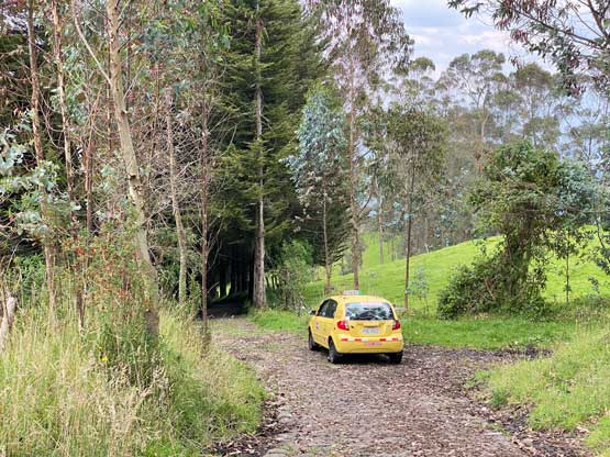
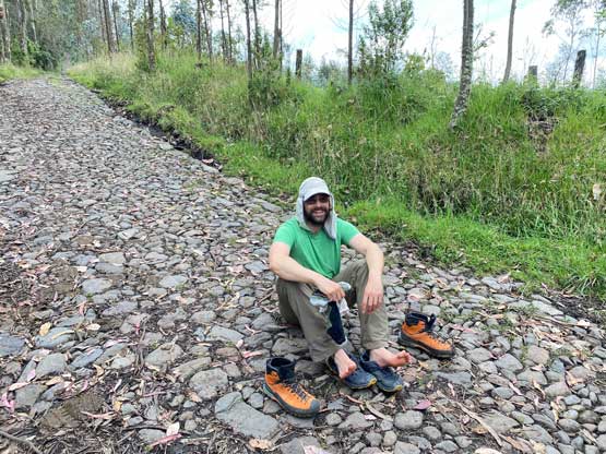
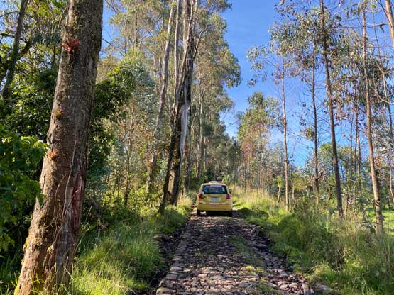
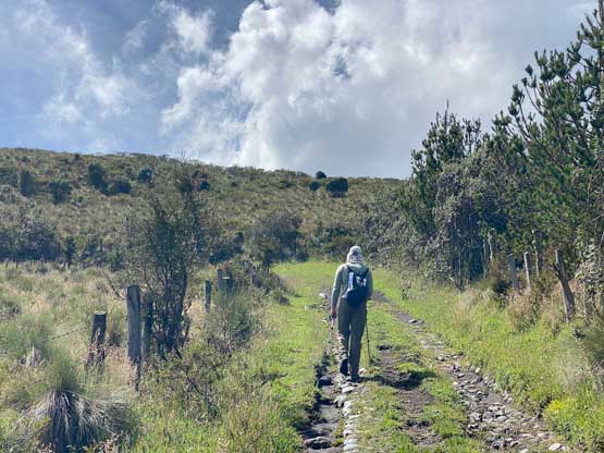
Adam did the research about how to get there from the north but my Gaia app was the one that actually had the roads on the maps. A few junctions after passing the city of Sangolqui the Google Map started to become useless but not all roads were correctly shown on the Gaia map neither. In any case the Google Map directed us to the village of El Taxo and from there we took the rough roads heading southwards. There turned out to have more than a few roads heading south and we took a wrong turn at one point, onto a road that’s not even shown on the Gaia map. I realized the mistake but I honestly had no idea about the condition of the other roads. Jorge was still crawling up the increasingly steep and rough roads so we might as well give it a try. At one point we passed an open gate with sign indicating “private property” but as always, we ignored the sign and went ahead. We did not make as far as we wanted as a few steep stretches with wet leaves on the cobblestone pavement stopped Jorge’s 2WD vehicle, but by this point we were within a walkable range from the actual trail-head. None of us was keen to walk extra distances (about 4 km each way) but the best solution at this point was to not fuss around more, and to park the taxi and walk. Jorge obviously had to wait for us so the clock was ticking again. The faster we could hike and cheaper this trip would be.
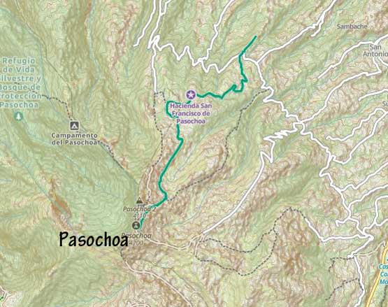
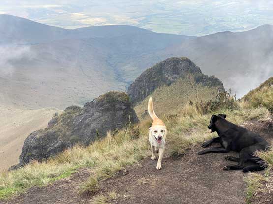
After walking up the remaining of this private road we came to a gate and a man with a machete was waiting for us on the opposite side. If this man wanted to attack and rob us then we would have no way to escape so we might as well go ahead to approach him. I explained in very broken Spanish that we would only want to hike up to the mountain and he seemed to understand. This guy directed us through another private gate to a lady and a house. The lady asked us to pay some cash so we paid her 10 dollars and she allowed us to proceed. This was still a few kilometers from the “trail-head” that we read in some other outdated beta. After thanking that lady we proceeded and soon met a group of 4 local hikers descending. I thought they had already finished the hike after watching an amazing sunrise but apparently they were still on their way up and had become confused. We insured them that the correct way was to go upwards and not downwards and they were convinced, so now a total of 6 of us and an aggressive dog that kept barking at Adam and I were going up. They kept assuring us that the dog would be “fine” but we couldn’t trust that. On our first hike in Ecuador Adam immediately got bitten by a lady’s dog and that time she said the dog was “fine” as well. Thankfully none of us got bitten this time but we remained very alert. The group of four hiked fast, but liked to take breaks so eventually Adam and I still went ahead. Passing the official trail-head we had a few more kilometers of boring slog on an deactivated road which eventually led us to the NE flanks of this peak at 3850 m elevation. This trip was quickly shaping up to become the longest hike that we did in this entire trip, distance wise, though mostly at lower altitude.


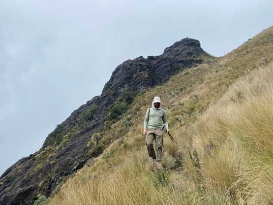
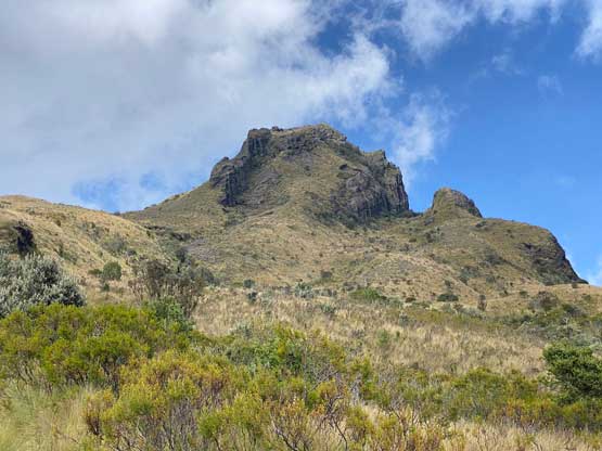
The trail was still easy to follow and we finally started to gain elevation rather rapidly. There’s some controversy about which of the summits (north or south) is the higher one. We originally planned to ascend both but the clouds quickly engulfed in. We then decided to only do the supposedly-higher south summit that most parties opt for. The other team-of-four apparently chose to ascend the north summit as we didn’t see them again. I more or less decided to follow Craig Barlow’s GPS track to reach the south summit that seemed to be contrived near the top. Adam decided to follow the tracks he downloaded elsewhere. The conclusion was to definitely take my route as Adam’s route involved some exposed 3rd class scrambling. The true summit is on a separate boulder that requires an interesting step-across move. I simply jumped across while holding the backpack on my hand, whereas Adam opted found a way to scramble onto the highest rock without doing any dynamic balancing.


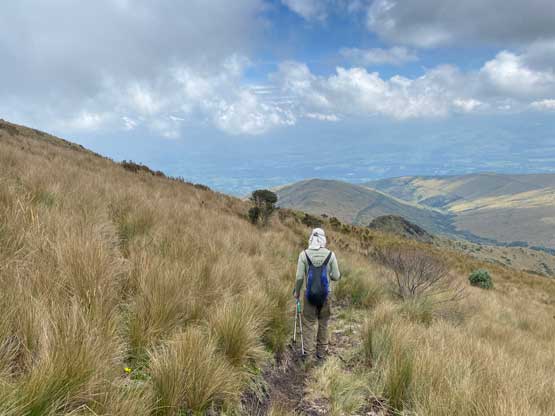
Without being able to see anything we weren’t in a mood to linger on the summit. Instead, we quickly went down the route I took but descending steep grass still needed care. We could see a large English-speaking party approaching the summit from farther to the south but we didn’t manage to talk to them as we descended a few minutes before they showed up. Their appearance from another direction indicated this peak definitely has more than one or two access points. Not to mention that the previous group-of-four, though also taking the north side approach, had definitely parked their vehicle or taken a taxi to a different starting point as well. In any case we definitely picked the worst possible starting point given all of those private land issues we just encountered. There’s not much worth documenting about our descent as it’s just a boring ass slog. The initial gate was surprisingly open by the time we descended back into the private land and then our taxi driver, Jorge informed that he had to pay an extra 20 dollar bill as someone pointed a gun at his head saying we were in his “private property”. Well, since Jorge’s still there waiting for us we just jumped into the car and drove the hell out of this place. Thankfully we did not get a flat tire nor any car problem as the roads were definitely not suitable for a taxi car.. Adam and I paid Jorge that extra 20 dollars making a total of about 90 dollars for this outing. That was still much cheaper than hiring a guide for the day so we wouldn’t complain. At the end of the day I made the decision to proceed Chimborazo’s climb that would start on the following day.