Mount Elphinstone
December 24, 2020
1266m
Gibsons / Sunshine Coast, BC
Mt. Elphinstone is a forested but fairly prominent summit overlooking the city of Gibsons on the lower Sunshine Coast. This peak has gained some popularities in recent years thank to a maintained trail leading to the summit. There are several routes to reach the summit including a backdoor access that requires more driving and less walking. I picked the longest but most popular trail starting in Sprockids Park. This trail-head is only three kilometers away from Langdale ferry terminal so one can even board the ferry on foot to save money. I decided to drive because it’s easier to pay 35 dollars than to walk 6 km extra distance (I don’t have a bike). This was also the 3rd day in a roll of peak-bagging in the Christmas break so I was already tired.

Mt. Elphinstone hiking route. GPX DL
I dragged my tired ass out of the comfortable bed at 5 am and made my way to Horseshoe Bay ferry terminal across the entire stretch of Greater Vancouver. To my surprise the ferry was quite busy that I barely managed to get onto the 7:30 am ride to Sunshine Coast. There were decent views from the ride so I took some photos. I also tried to catch some sleep but failed. The drive to the trail-head took several minutes. It seemed like most vehicles parked at the bottom of a dirt hill but with a Tacoma I easily drove to the actual trail-head.
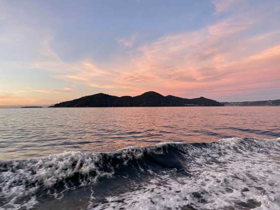
Keats Island on the ferry ride Horseshoe Bay to Langdale

Mt. Collins on Bowen Island
The lower section of this hike was negotiating a maze of biking trails. I was amused by a abundance of trails criss-crossing that without a GPS map I sure would get lost. I just picked whatever trail that seemed to offer the most direct route to access the “upper trails”. It turned out that I accidently picked up a downhill biking trail for a few hundred vertical meters of gain. I made some mental notes to avoid that stretch on the return. At about 500 m elevation the snow had become continuous and the trees started to drop a shit ton of bombs. I regretted for not bringing a helmet on this day but thankfully I didn’t get hit by anything big. The tree bombing didn’t stop until 750 m elevation where I came to the “Elphinstone summit trail” sign. I was also surprised that the boot tracks continued up despite the increasing snow depth. I followed the boot tracks all the way to 900 m elevation where I finally decided to take a break donning snowshoes. The previous parties had kept going on foot but snowshoeing would be more efficient.
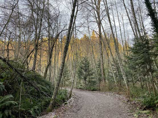
The start of the hike in Sprockids Park
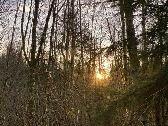
The morning sun beams

The lower trail was nice and flat
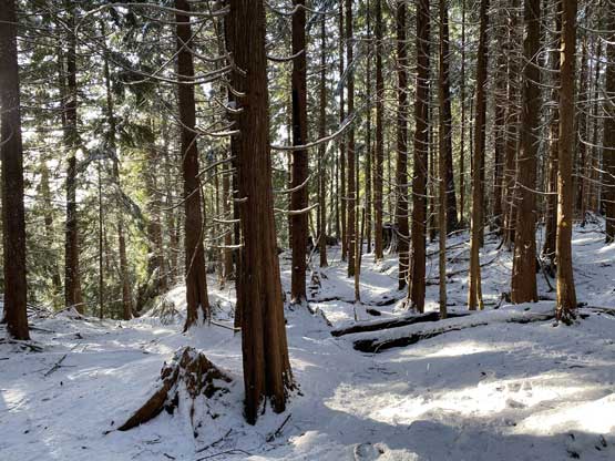
This stretch had a lot of tree bombing the whole day

Almost deep enough for snowshoeing
It took me a good while to regain some strength. The back-to-back hikes had certainly taken its toll on me. At around 950 m elevation the trail started traversing horizontally out climber’s right. There were at least a few tricky creek crossings that required a bit of “technical snowshoeing”. After that I popped out onto what seemed like a very old and overgrown logging road. The boot tracks still continued on so I just followed. At the end of this logging road stretch I came across a fire pit so apparently someone just camped here on the previous night. The trail then did some steep elevation gaining including a few stretches of 35-40 degree slopes. The summit block even had a couple short but 40+ degree steps that put my snowshoeing skills in test. I was surprised that the boot tracks still continued. All the sudden I popped out onto an open area with incredible views so stopped for a second break doing some Instagram thing.

One of the few tricky creek crossings

Coming to this stretch of logging road

Some view looking back at Vancouver and Mt. Baker

The summit block had a few very steep rolls
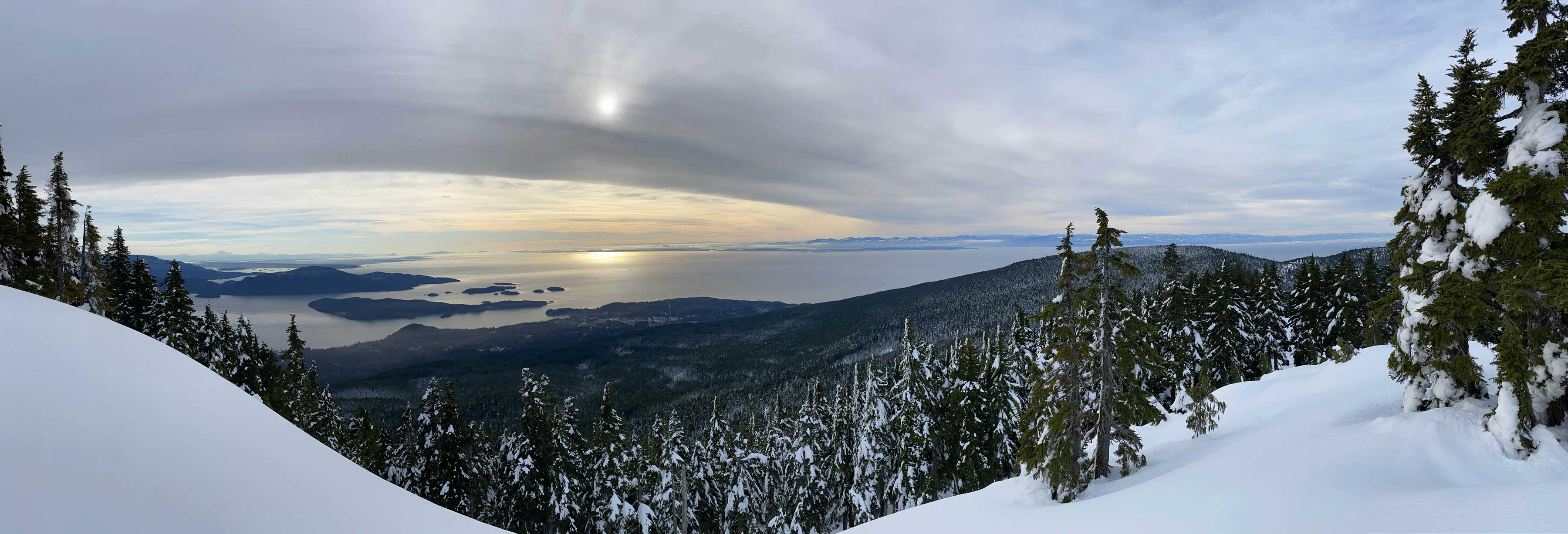
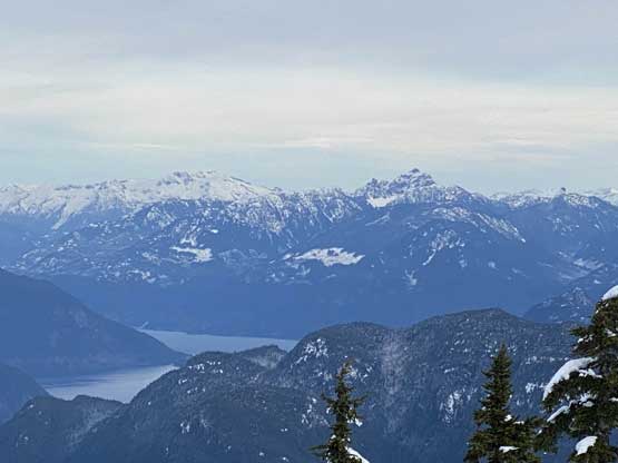
Panorama view from the viewpoint under the summit. Click to view large size.
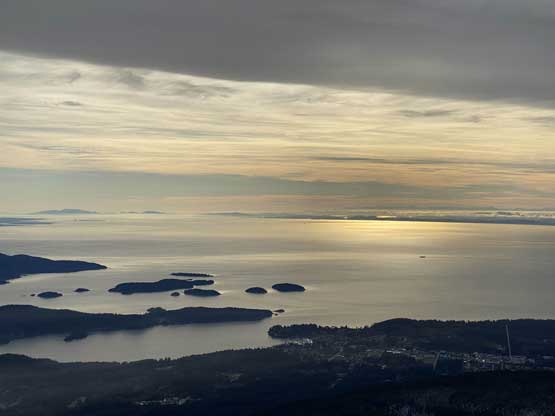
The Straight of Georgia in full snow
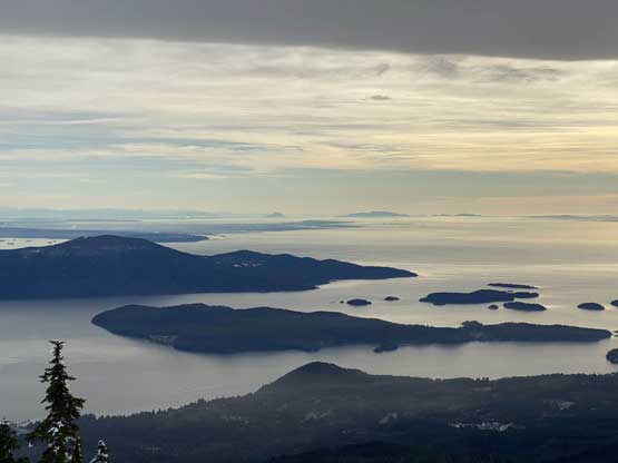
Keats Island and Bowen Island and the Straight of Georgia

Me posing on this viewpoint for the ‘gram
The tracks finally stopped here but this was not the true summit of Mt. Elphinstone, so I had to resume. I plowed through the deep powder for about 10 more minutes due north to the summit where a communication tower was located. There were some views to the north from the summit, so totally worth to check out even if you aren’t a peak-bagger.

Panther Peak is one of the more iconic peaks on Sunshine Coast
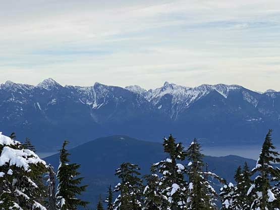
West Lion, Mt. Harvey etc. on the North Shore Mountains
Sky Pilot Mountain and Mamquam Mountain towards Squamish

This is looking at the typical gentle hills on the lower Sunshine Coast

Mt. Garibaldi/Atwell Peak looms behind Mt. Wrottesley

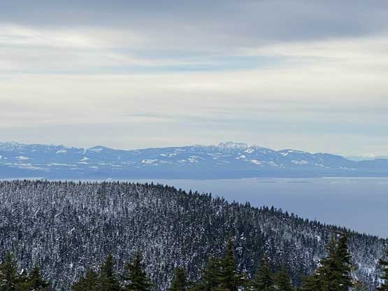
Howe Sound from the summit
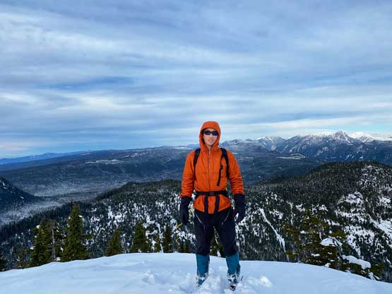
Me on the summit of Mt. Elphinstone
Once taking enough photos I leisured plodded down the soft powder back to that aforementioned viewpoint. I snapped a few more photos and plodded down the upper trails. I used fresh snow for as much as possible to save my knees which worked out pretty well. For the few steep spots I had to down-climb (with snowshoes on) facing into the slopes. Eventually the snow ran out and I had to remove the snowshoes. I paid more attention to the GPS on the descent and managed to pick a gentler trail.
Mt. Arrowsmith on the horizon over on Vancouver Island

Back to that logging road section

The typical descent in the forest
I drove into the city of Gibsons (my first time) to grab some Tim Hortons before driving to the ferry terminal. I didn’t anticipate to catch the 3:15 pm ride so I really took my time eating the late lunch. I made to the terminal at 3:08 pm and was very surprised to actually get onto the early ride. That was cool… I guess most people stayed home on Christmas Eve and I was the only one out there bagging peaks…
