Mount Daly
August 9, 2013
3152m
Yoho / Waputik Icefield, AB/BC
Mt. Daly is a major scramble in “Kane’s list”. It’s also a big peak that one can see while driving north from Lake Louise. To get it done in one day one must be fit enough to cover more than 30km distance and around 1500m total elevation gain, as well as exposed terrain. This past weekend seemed to be a perfect time to get it done. Due to the questionable weather forecast and the availability of my partners, no 11,000er got tossed around so it was the time to tick off a couple scrambles. Mt. Daly was the first candidate. I hooked up with a fellow scrambler from ClubTread, Rod (Semi Awesome). We’d been talking to each other for quite a while and it’s finally the time to do a scramble together.
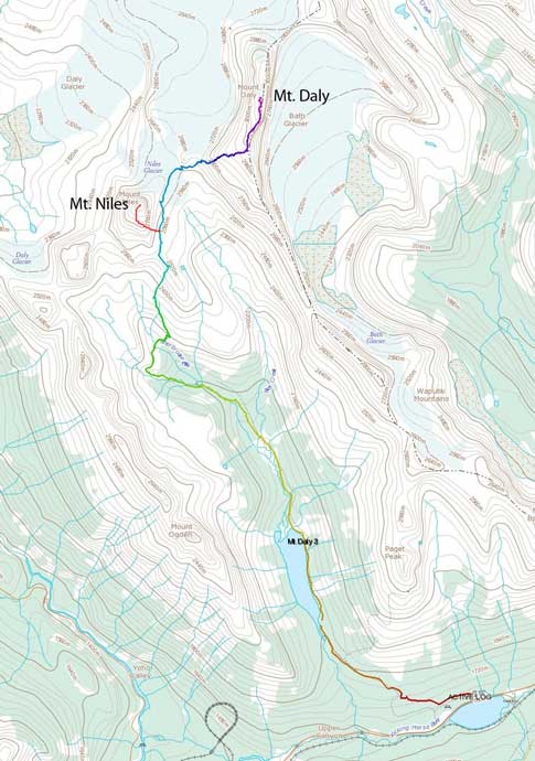
Mt. Daly and Mt. Niles scramble route
Due to the concern with afternoon thunderstorms we decided to start our day at an “alpine hour”. Rod was on vacation in Canmore and he kindly offered me a room overnight so I didn’t need to sleep in my car as usual. We woke up at about 3am and quickly drove to the trail-head which was still quite a bit of distance away. We both had done the nearby Paget Peak and we quickly located the trail. With head-lamps on we marched up towards Sherbrook Lake. It was still partly dark when we got to this calm lake. I really enjoyed the reflection scenery, but without fancy camera gears I couldn’t get a photo of it without blurry, so we kept marching on. The trail leading to Niles Meadows was (surprisingly) in a very good shape. There were bridges crossing most of the streams if not all. I wasn’t expecting this though because this trail isn’t marked on the map.
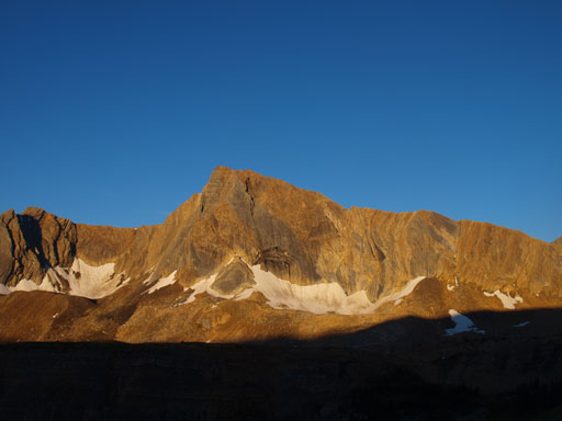
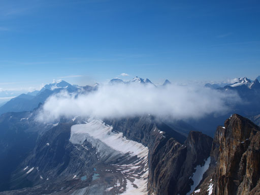
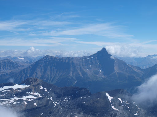
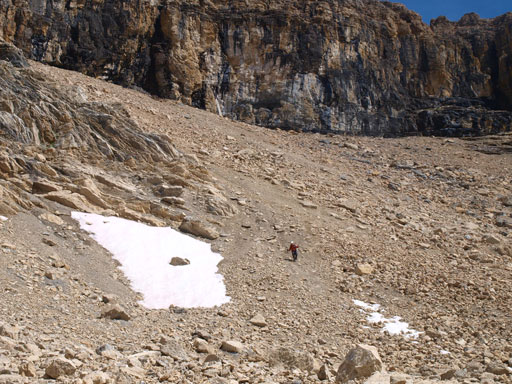
The views started to open up as we approaching Niles Meadows, with alpenglow on Ogden and the ridge between Ogden and Niles being the most attractive. The route up Mount Daly goes climber’s right up the obvious vegetated slope towards the distant bottom-right-corner of Niles. The trail gets faint after dropping down to the Meadows. Kane’s book has a good description but we failed to locate the trail on the other side so we essentially found our own way up. It’s as simple as it looks. Any line would work and we picked one of the few avalanche gullies which offered very little resistance. Once above the vegetation it was mostly a hike, though occasionally on muddy ground, to get to the base of Niles.
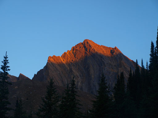
Alpenglow on an unnamed peak between Ogden and Niles
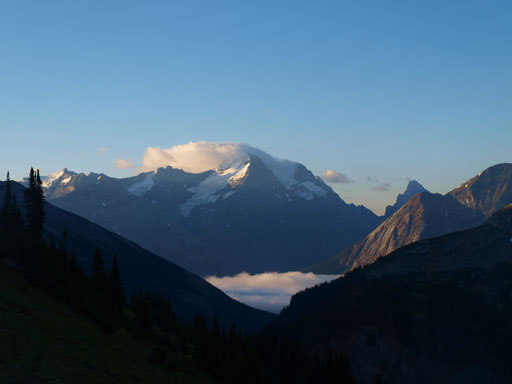
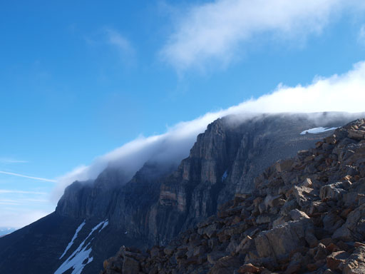
There was inversion clouds in Kicking Horse Valley
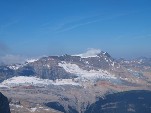
Mount Ogden
Unnamed
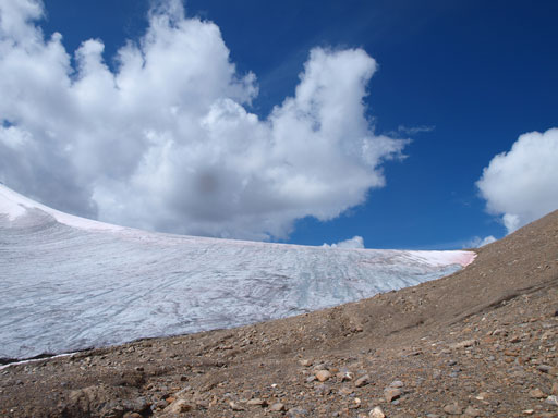
The next thing to do was dropping down to the other side. Elevation loss was frustrating so we started contouring around resisting losing too much. It’s essentially the same as we picked the line with least amount of resistance. The glacier was dry so it was safe to cross it and shave off some elevation loss, but we decided to avoid it. It didn’t look like we could save much elevation loss anyway and we didn’t want to waste time putting crampons on and off neither. So we dropped down the moraine to skier’s right and contoured around the glacier.
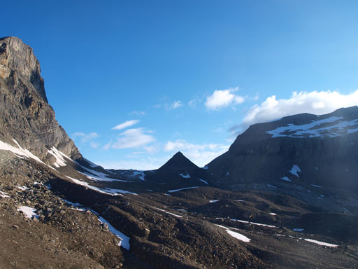
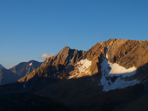
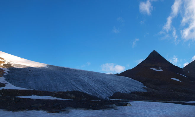
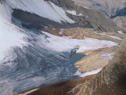
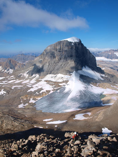
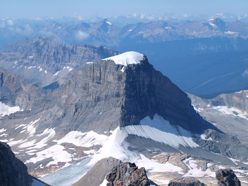
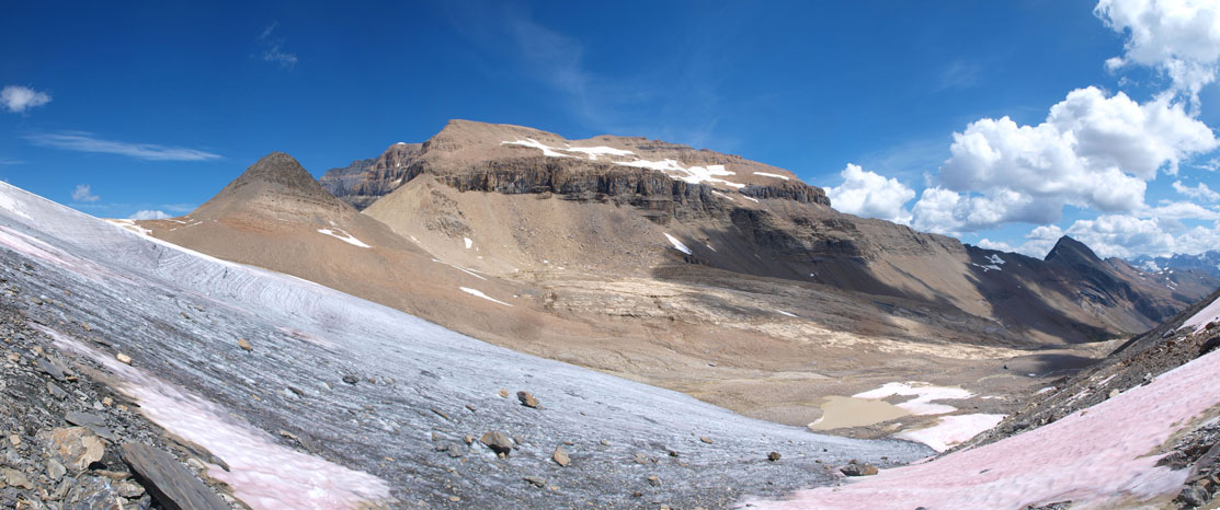
Once at the base of Niles, we could finally see Daly (far right)
Mount Niles. We would bag it on our way back.
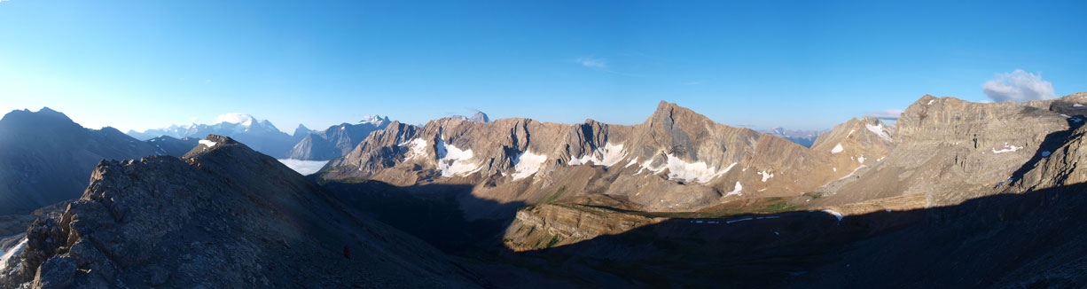
Panorama from the base of Niles
Dropped down to the other side, while contouring around Niles Glacier
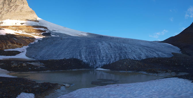
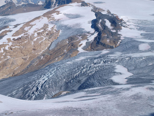
Another photo of Niles Glacier
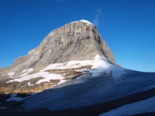
Looking back at the impressive Mount Niles
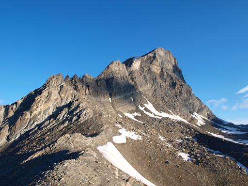
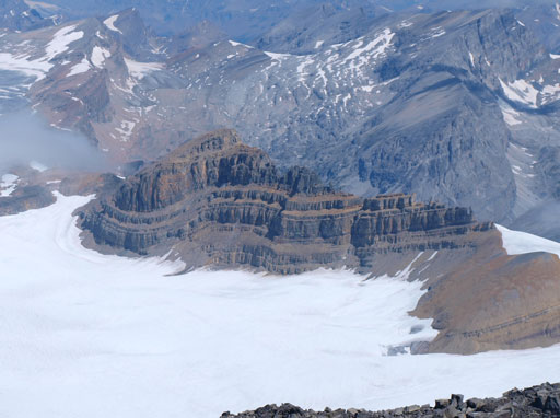
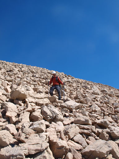
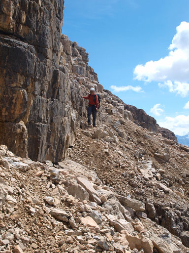
Up the other side, it was a pure slog to get up to the obvious rock band. The little peak between Niles and Daly is called “Pyramid” in Kane’s book so I’ll use this name here. Getting up to Daly/Pyramid col wasn’t that bad, but from there on it was miserable. The terrain was more moraine than scree, and very steep. The rock band, which is marked as the crux in Kane’s book, wasn’t actually a big deal if you do pay attention to route-finding. If you do wonder around looking for the easiest line then it should be no more than moderate scrambling. We picked a direct line which involved a few awkward moves, but discovered the easier line on the way down.

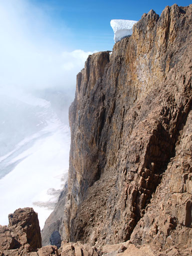
Looking up at the rock band that’s marked as the crux

Panorama view from near this “crux”

Mount Stephen and Mount Vaux
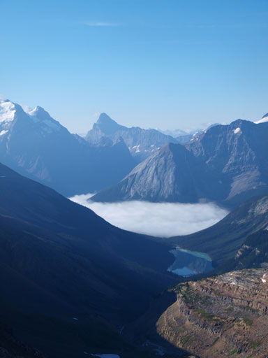
The inversion and also, Sherbrook Lake

Another photo of Mount Niles
Zooming-in down towards Niles Glacier
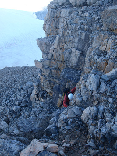
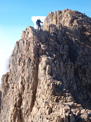
Rod coming up the crux. We discovered our own crux. There’s a easier line on climber’s right side.
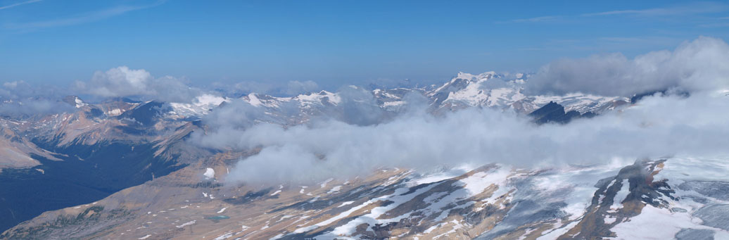
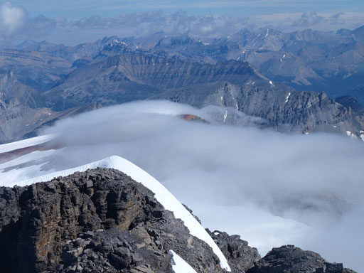
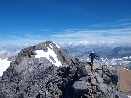
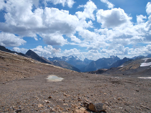
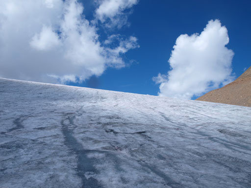
After this band there’s a steep boulder field to ascend. We ascended it straight up, and once the terrain eased off a bit we merged to a snow field and followed it upwards for quite a while. It was foreshortened and we still had a lot of elevation gain to do. With the view keeping improving we eventually reached the summit ridge and followed it easily to false summit. The traverse to true summit wasn’t that difficult actually. There were at least 2 short down-climbs that’re difficult scrambling and the rest is moderate at most, though it was quite exposed at a couple sections. The drop down the east side was huge!! There were clouds rolling in and out creating dramatic views and we enjoyed a long summit stay. Being on the edge of Waputik Icefield this summit for-sure offers great views!
Rod coming up a boulder field, with Mount Niles behind
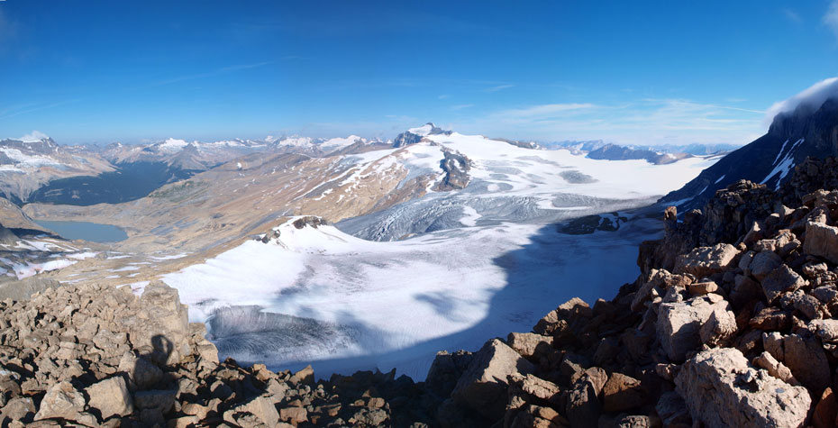
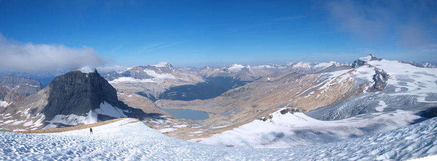
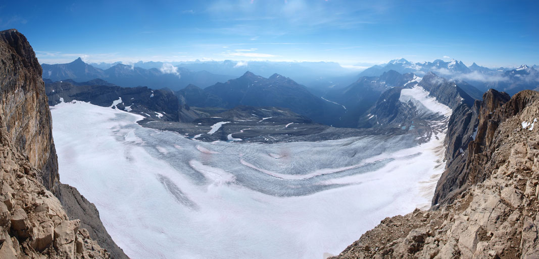
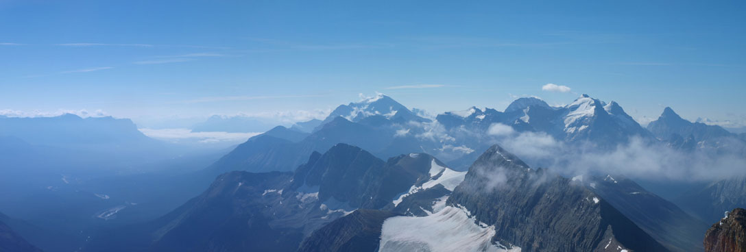
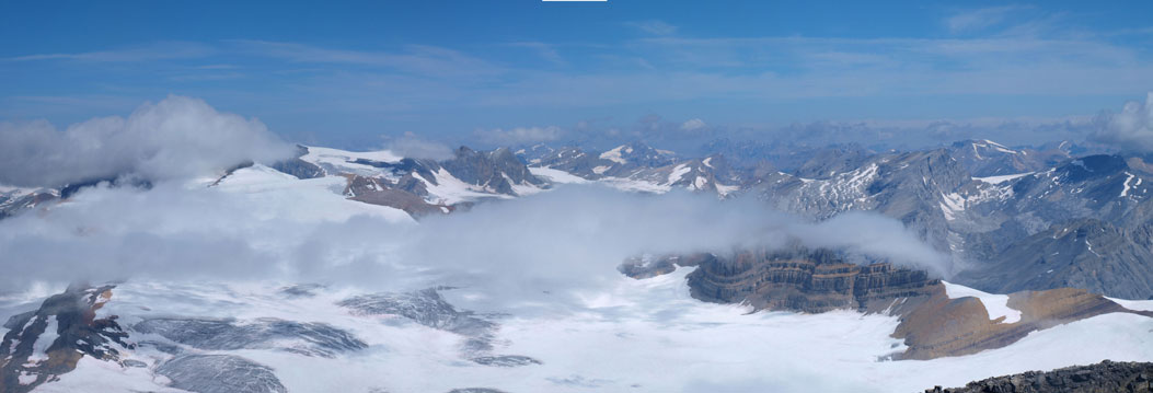
Panorama of Waputik Icefield
Interesting clouds rolling in and out obscuring the summit of Mount Daly
Zooming-in towards a crevassed area on Waputik Icefield
Panorama from a snow field. You can see Rod coming up
Mount Balfour
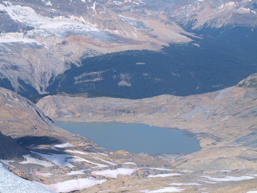
This lake is unnamed. It drains the more famous Takakkaw Falls
The Presidents
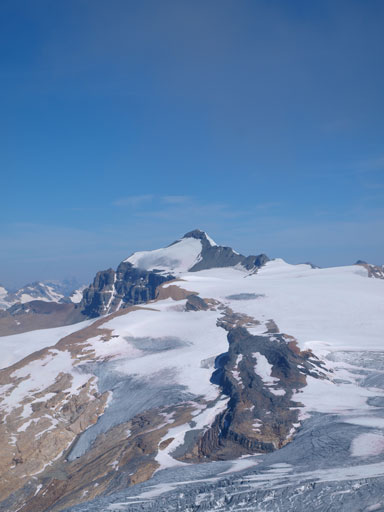
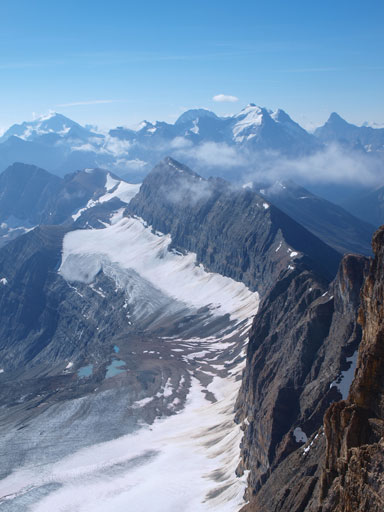
Panorama view of Beth Glacier on the other side

Rod coming up the broad summit ridge
Looking south and east down the steep face.
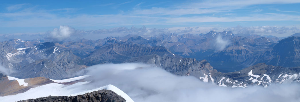
The familiar giants around Lake Louise
Yoho’s giants
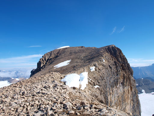
This slope is foreshortened. False summit behind
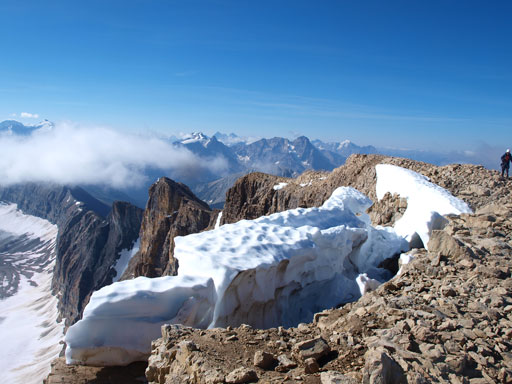
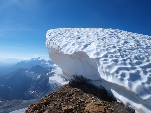
Interesting cornices. I wanted to kick them down
Some clouds were rollin’ in quickly
A big cornice on the false summit. We went around it on climber’s left side
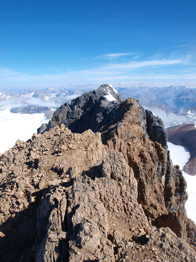
Looking ahead to the true summit
The shear drop down south and east side
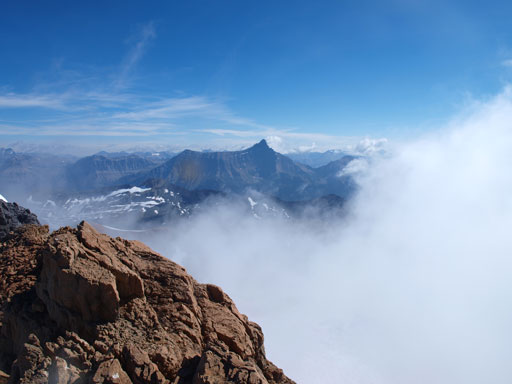
Nice to be above the clouds
Rod coming down from false summit
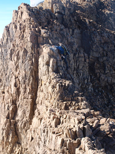
Rod negotiating the crux move on this ridge
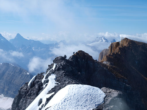
Can you spot Rod coming towards the true summit
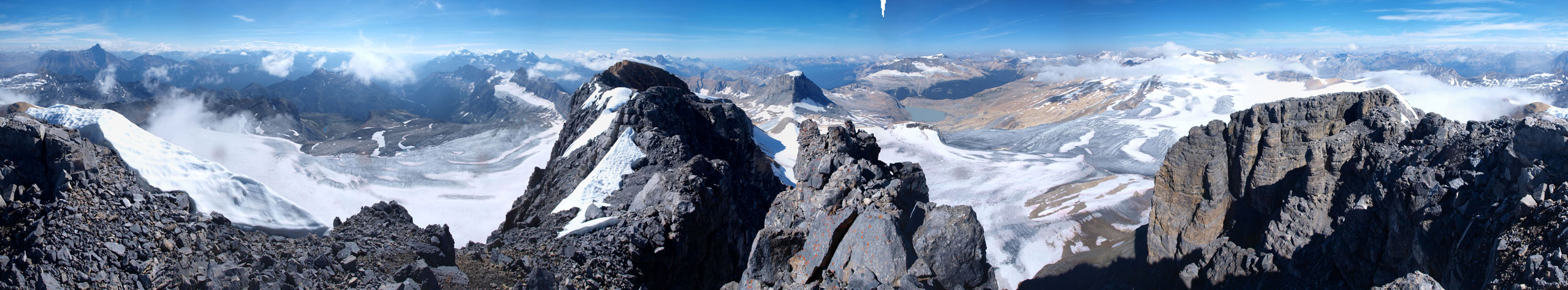
Summit Panorama. Click to view large size.

Carnarvon and Vice President
Peaks behind Yoho Valley and Little Yoho Valley.
Waputik Icefield
Willingdon and other front range peaks
Hector
Niles
Lilliput
Interesting clouds on the Icefield
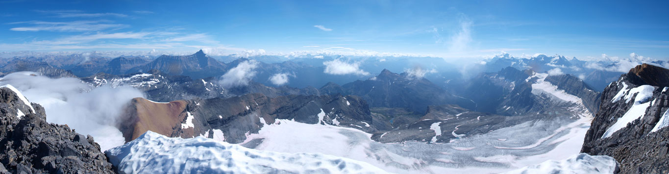
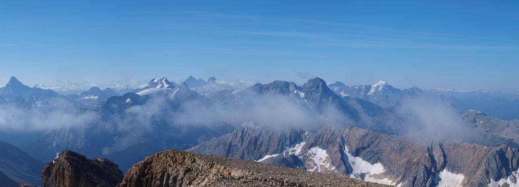
The southeastern panorama view.
On the way back we decided to use an alternate line after exiting the rock band. Bad call, as a long section of very miserable scree/boulder/moraine punished us. Retracing our uptracks wouldn’t be fun neither but at least the miserable section would be (slightly) shorter. In any case after spending a long time not knocking down a ton of rocks to each other we both made through this big slope safely. I decided to take the scenic route crossing the glacier while Rod went around it.
Going back to the false summit
Descending boulder field
We found an easier line down the “crux”
Rod descending hard scree that’s more like steep moraine.. Painful.
Almost back to Niles Glacier
Gorgeous view
On the glacier
Looking back towards Mount Daly
Since weather held well, we decided to check-off Mount Niles since it’s right there. We’d been using a different route than the one described in Kane’s book since our route could shave off extra elevation loss and regain.

Hi Steven,
How many km was the trip/ How many hours?
Thanks
Alex
Don’t remember km but should be 30km ish. Took 15 hours for both Daly and Niles however partner was slower.