Twin Goat Mountain
March 30, 2019
2128m
Pemberton / Lillooet Lake Road, BC
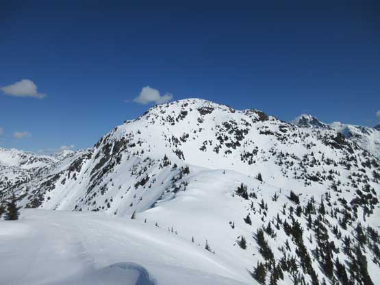
Twin Goat Mountain is by no measure a major summit in the Joffre Group – mountaineering central of Pemberton area, but is far from an “easy” summit to bag. This peak is guarded by insanely steep forest on most sides facing the Lillooet Lake Road and boasts a steep NE Face that potentially offers quality alpinism, although likely too remote to trigger significant interest among the climbing community. The NW Ridge can be, and has been accessed via a contrived, multi-day trek from Joffre Lake over Tszil Mtn. and Duffey Peak in summer without much technical challenge but such ordeal is far from “efficient”. Apart from one ClubTread report by Simon C. there aren’t much useful information online.
It’s not a secret anymore that I’m currently working on a project to ascend all named summits in Joffre Group in winter and that has to include Twin Goat Mountain even though it’s merely a “small summit” on the edge. I kept debating about the route to use. I thought about thrashing up the insanely steep, but wooded SW or SE Ridge knowing it’d be a hell of sufferfest on snowshoes, but it’s hard to resist the temptation to just climb the E/SE Gully like how Simon and Vlad did in May a few years back. The problem is that this gully has a narrow profile (textbook classic of terrain trap), consistent 30-40 degrees with sections steeper, an aspect of E/SE facing and often a hidden and hazardous creek running underneath. To put it down in this way requires the most strict timing window and such window does not form for more than a couple times per season. March the 30th isn’t in the calendar winter anymore but “close enough” in my book so at the last minute I pulled the trigger. The avalanche rating had dropped to “Low” across all zones in all forecast regions of SW BC and Washington. Another problem was the uncertainty in the access road – Twin One FSR. As of last couple years a gate was locked right at the start adding ~6 km distance of walking each way along with over 500 m elevation gain. I brought trail-runners and was fully prepared to walk the full distance adding to the “fun” game…
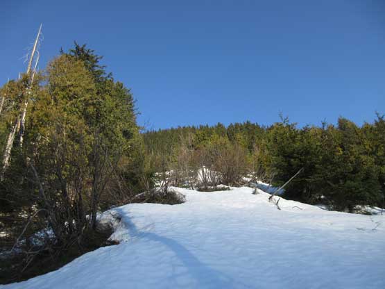
As far as mountaineering in spring goes one should start in dark and finish early but the decision was made too late for that. The driving time would be over 4 hours from White Rock to Twin One FSR plus I worked until 9 pm on the previous evening. It was well after 10 pm when I finished packing and needless to say I was too tired to do anything. I was no longer 20 years old and really needed some sleep, so the alarm was set at 3 am. The drive out of Metro Vancouver and through Sea to Sky Corridor was fluent and without event. I made one stop in Pemberton for gas and food and another half an hour, 10 km of bumpy ride down Lillooet Lake Road (in-SHUCK-ch FSR) later I arrived at the start of Twin One FSR. I noticed two huge water bars that looked like man-made barriers but no gate and my curiosity told me to go explore. The first water bar scraped the bottom of my stock Tacoma but the second one was easier. Soon after that I came to the gate and sure enough it wasn’t locked. That was a surprise so I continued driving up having no idea how far I could get to. The road beyond the gate had a ton of small, but easy water bars and some fresh evidence of maintenance. I had no issue driving over 4 km up the road and parked as soon as hitting snow.
Twin Goat Mountain via E/SE Gully. GPX DL
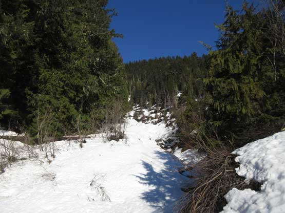
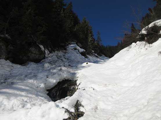
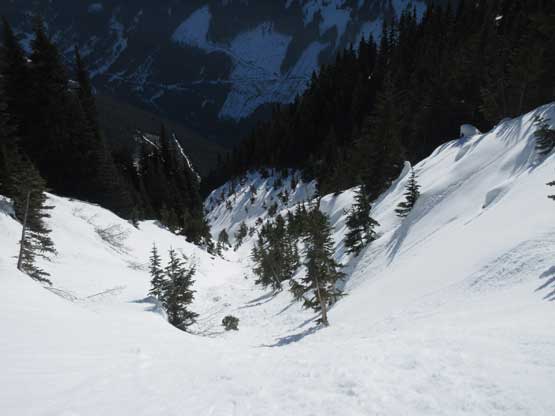
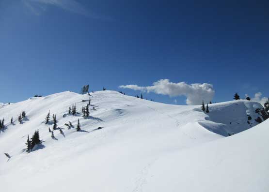
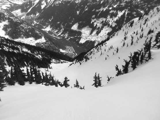
There was less than 2 km of walking on mostly level road to reach the start of SE Gully. I carried snowshoes on hand because I wasn’t sure whether or not they were needed on the road plod. It turned out that I didn’t need the snowshoes for this stretch so it’s a good arm exercise. A major avalanche path had to be crossed along the way. The start of SE Gully wasn’t super obvious and definitely looked like a tangled mess: steep waterfalls, patchy snow and tight secondary growth timbers. I wasn’t sure how and where exactly to enter the gully but it seemed like the first 200 m elevation gain was better done by bushwhacking in the forest. There simply weren’t enough snow at this elevation (~850 m) to ascend the fall line. I took a line too close to the creek and the bushwhacking was horrible but at least the patchy snow was supportive in the morning. After a while of swearing I merged back to the creek, strapped snowshoes on and ascended the opposite (west) side, but soon I crossed back to the east side. At this point there finally had enough snow to allow proper snowshoe travel and meanwhile the bushwhack finally stopped. The sun came out as I ascended into the constraint of the gully at ~1100 m elevation and it’s here that the long ass grunt officially started.
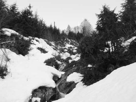
As you can see there weren’t enough snow to ascend the drainage at lower zone
I ascended on the climber’s right side. After a while the sun came out.
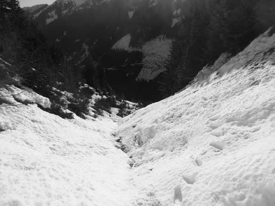
The initial 100 or so vertical meters in the gully proper had some soft snow that made me glad to have the 30′ snowshoes but condition improved higher up as I ascended onto a long zone of avalanche debris. Asides from snow condition I also had to pay close attention to the water running underneath. There were a few spots that I had no choice but to hop across, or ascend directly up the middle of the gully and I could even hear the sound of water. The embankments of the gully was very steep from 1100 all the way to 1500 m elevation making it a huge funnel of shooting gallery. Almost the entire stretch of this zone was chocked with avalanche debris that’s difficult to ascend even on Lightning Ascents snowshoes. The grade was consistent 30-35 degrees and steepened up as I ascended higher. A couple chocks near the top of this section required me to cut a few tight switchbacks and/or hauling vegetation. The terrain didn’t change much until ~1600 m elevation where I exited the constraint of the gully into the “upper funnel”. The direct finish of the SE Gully seemed definitely require boot-packing so I started looking for some other options, too lazy to transition. I ascended almost all the way to the base of the final headwall and decided to ascend the left (south/west) side out of the bowl. It turned out to be much steeper and longer than appeared and certainly put the ability of Lightning Ascents in test. The bonus of going this way was to explore the southern sub-summit.
Entering the gully proper. Trust me. It’s a long and big ass one…

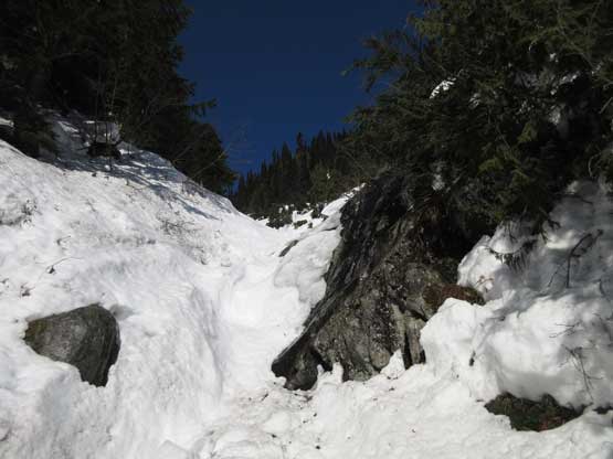
It’s clearly why I’m not going up the ridges. The forest on this peak is very steep…
The lower zone of this SE Gully proper was pretty shitty.
Looking back from right at the start. The snow was soft even in the AM.

Thankfully whatever that could slide had slid… The debris provided some fast travel.

Partway up this long ass debris zone. Looking down…
This shot shows both the debris and an inversion layer
One of the few constraints. I could hear water running underneath and that was freaky

After a while the gully opened up slightly.

What a shooting zone… Upward and onward, snowshoeing straight up…
The terrain around here was 35-40 degrees. It was a hard fight on the Lightning Ascents

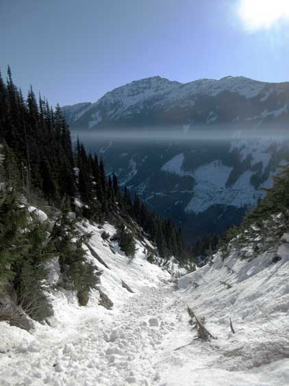
Finally I exited the narrow part of the gully into the “upper funnel” zone…

As you can see the terrain is huge and steep as fuck..

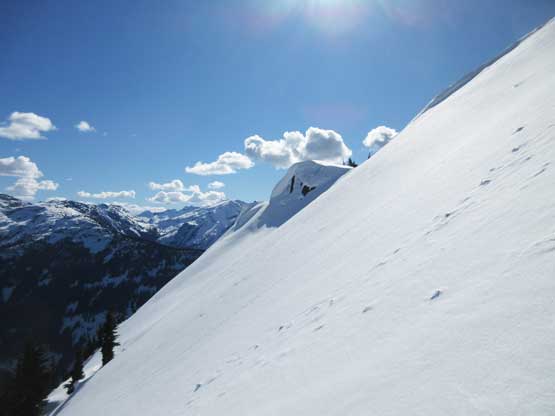
A sideways looking north. It’s here that I needed to decide on my route

Looking at the 45-degree headwall that I down-climbed later in the day
The route I picked on ascent was long, exposed and steep. Not returning this way..
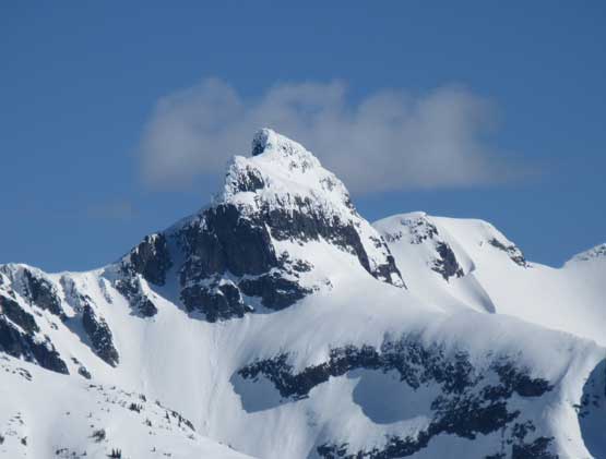
A zoomed-in shot of Mt. Howard – bagged in Dec. 2017 solo
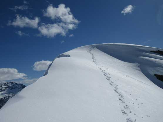
The final 35-40 degree slope to hit the southern sub-summit.
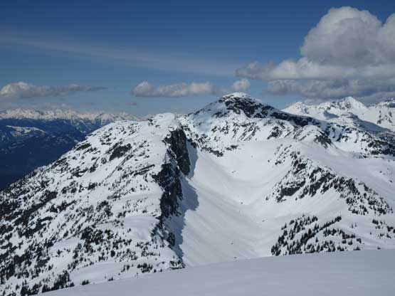
Looking towards the south summit from the southern sub-summit
Finally could see the Pemberton Valley and Duffey Peak

I’m not sure what this structure is. Looks like a solar panel but probably not..

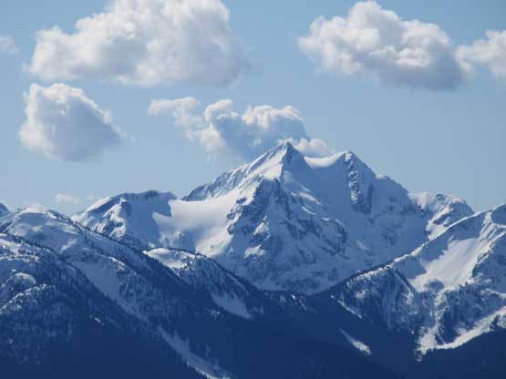
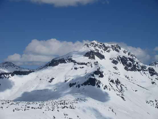
Mt. Weart is massive – bagged in Oct. 2015, solo.

Wedge Mountain in the distance – solo’d its NE Arete in Feb. 2016
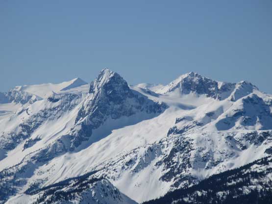
The iconic Gunsight Peak (in-SHUCK-ch Mountain) with Mt. Sir Richard behind on left

The beautiful Nivalis Mountain that I bagged in July 2017 solo from camp
Cloudraker Mountain that I ascended in Dec. 2015 on skis…
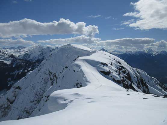
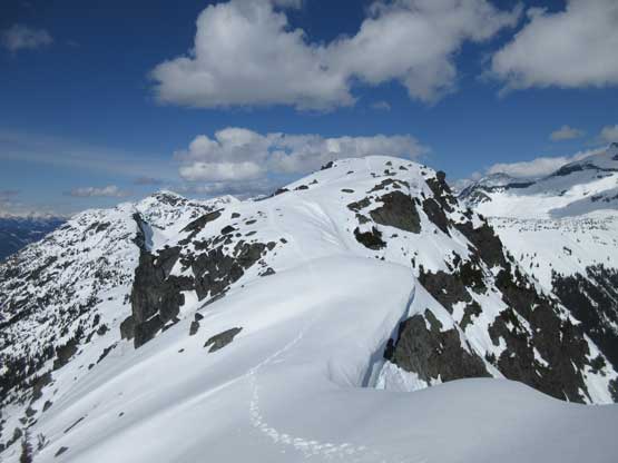
I took the first (and only) long break on the southern sub-summit before resuming towards the dual summits of Twin Goat Mountain. The plod on the upper south ridge was easy peasy compared to what I’d just covered lower down, and in short time I arrived at the south summit. The north summit was reported to be 2 m higher so I immediately turned my focus on getting the true peak. The traverse looked tame but was actually not. There’s one knife-edge along with one steep drop and almost the entire ridge had some huge cornices dangling over the NE Face. It was a little tricky to cover the whole stretch on snowshoes but such didn’t impose too much issue for me.
Leaving the southern sub-summit. There’s about 30 m elevation drop

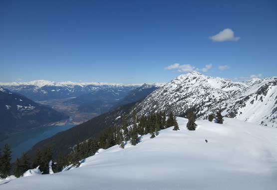
A full show of Lillooet Lake. Twin Goat Mountain is a great viewpoint of it

Looking back from the uppermost south ridge. Lillooet Lake below

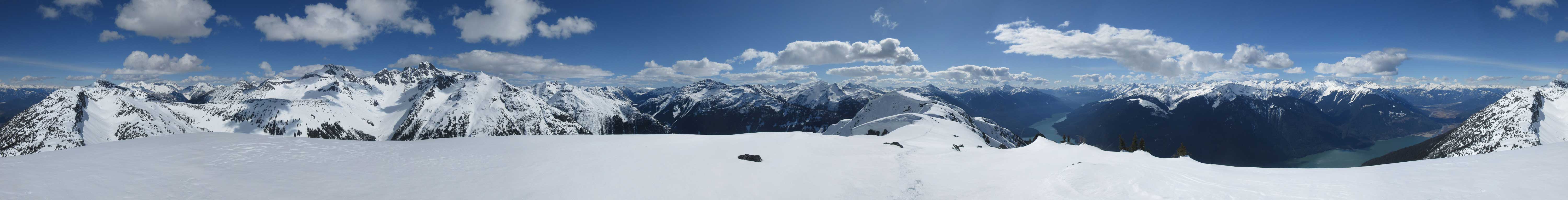
Panorama from Twin Goat Mountain’s south summit. Click to view large size.
Slalok Mountain – climbed and ski’d its north face in Jan. 2016

Snowspider Mountain that I ascended in Jan. 2017 solo via Vantage col

Asherah Peak
Twin Two Peak in the foreground
Meadow Dome and Priory Peaks
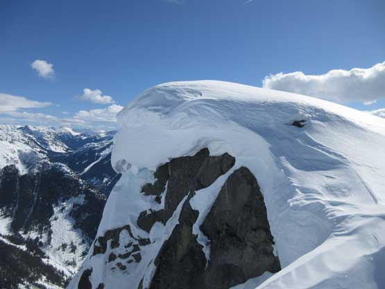
Huge cornices dangling over the uber steep NE Face
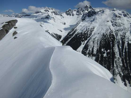
Ahead is that narrow spot on the summit ridge traverse

Looking back at my lone snowshoe tracks on the summit ridge
Summit Panorama from Twin Goat Mountain. Click to view large size.

Mt. Matier (Jan. 2016 on skis) and Mt. Spetch / Mt. Hartzell (Feb. 2017, solo).
Looking north towards Duffey Peak that I bagged in Mar. 2019, solo.
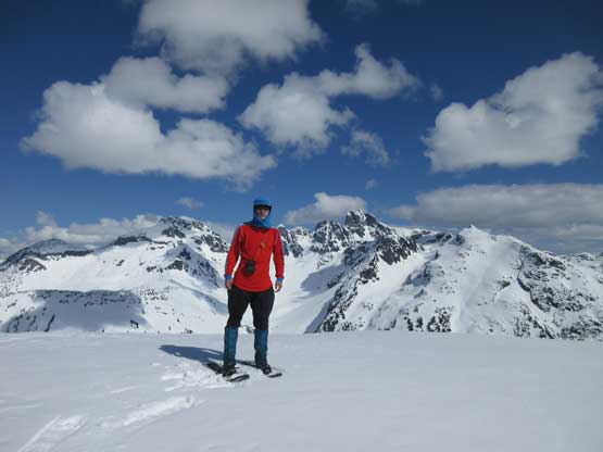
Me on the summit of Twin Goat Mountain

Another photo of me on the summit of Twin Goat Mountain
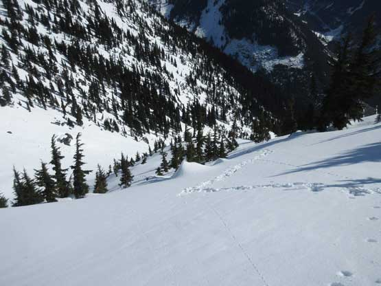
I didn’t linger much longer than absolutely necessary so after snapping enough photos, two timer-aided selfies and making an Instagram live update I turned my attention to the descent. Reversing my snowshoe tracks across the summit ridge was easier because I didn’t need to use much brain power anymore. Then off the upper south ridge I decided to head straight down the steep headwall instead of going up and over that subsidiary summit with a solar panel on it. I took the snowshoes off and swapped for crampons and ice axe and down I went. The headwall had some 45 degrees pitches but nothing major. On hindsight I shouldn’t have donned crampons because the condition was more post-holing than front-point. I plunged past my knees several times even when down-climbing facing into the slope. I continued boot-packing down the upper funnel of SE Gully and despite the arduous post-holing I didn’t want to bother with an unnecessary gear transition. I thought the snowshoes wouldn’t have helped much because the slope angle was too steep for comfortable snowshoeing. The post-holing was knee to thigh deep on average. I made some large and heavy plunges and simply just sucked it up. A few steep spots were very awkward but once entering the gully’s constraint the condition improved dramatically because I could then use the avalanche debris. No more significant post-holing for a long while although wearing crampons on the avi debris was far from enjoyable.
Time to head home. This is looking south from the summit
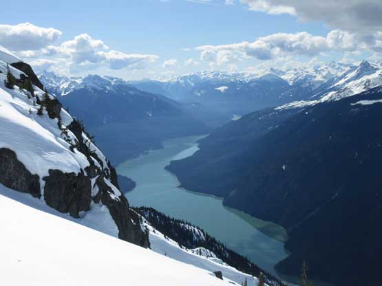
Another photo of the southern end of Lillooet Lake
My snowshoe tracks.
Looking back from partway back across the summit ridge

Interesting reflections on Lillooet Lake
Just swapped snowshoes for crampons and ready for the steep descent…
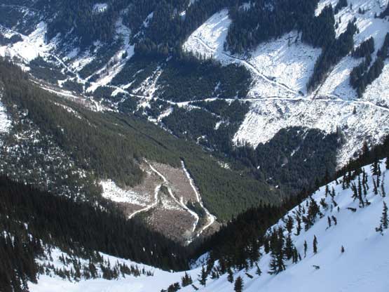
Zooming-in at the logging road system in Twin One Creek drainage
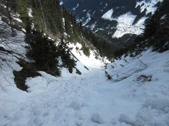
Booting down the gully. It’s awkward but at least fast going
The post-holing took over again once the avalanche debris ran out near the bottom of the gully and it’s here that the snow had gone entirely shit. I soon swapped crampons for snowshoes and even with the 30′ flotation I sank down to knee deep very often. The worst was after merging out of the gully proper into the woods. The snow was isothermal top to bottom that I literally thought I was back in the Rockies. I took at least a few big face plants either tripped by deep weak spots or by the invisible logs underneath. I swore literally a ton, but again there’s nothing to do other than sucking it up. I did use my brain power here and found an easier line through the bottom of the forest that avoided most of the worst bushwhacking. Once back to the road I knew for sure the snow wouldn’t be nearly as supportive as in the morning so did one last gear transition to strap the snowshoes on.

The snow had gone isothermal by 2 pm.
After a while of wallowing it’s time to bushwhack. Snowshoes off.

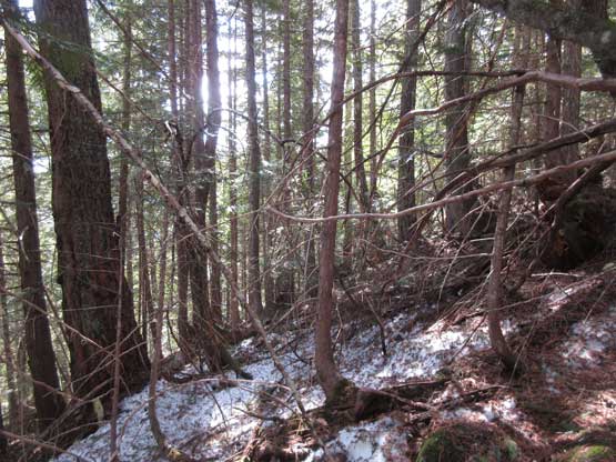
At least the bush was much nicer than the line I used on ascent

This is the start of the SE Gully’s creek. What a mess…

Here’s where I exited the forest onto Twin One FSR

Oh the road plod…

One huge avi path not far from where I parked…
The last 2 km of road walk was uneventful and my round trip time was exactly 7 hours. The adventure wasn’t over yet as I still needed to be careful negotiating the Twin One FSR. The large water bar right at the start of this road provided challenge again and I scrapped the bottom of my Tacoma pretty badly. Thankfully the result was only a minor dent and some large, but surface scratches on the exhaust line so I continued driving home. Other than taking a food break in Pemberton I managed to put down the entire drive back to White Rock in a single shot. The traffic through North Vancouver was horrible as fuck. It was literally crawling from Taylor Way turn-off all the way to Ironworker’s Bridge and to top it off, there was no accident whatsoever but rather just the volume of the traffic at 6 pm on a sunny Saturday… I think the next time I should take a nap in Squamish which would certainly help me being mentally (and physically) prepared for the gong show. It sucked ass a big time… On the bright side, I was really happy to utilize this unseasonably stable window to put Twin Goat Mtn. in the bag. Now with only Taylor, Caspar, Griefswald and Kosegarten left I am finally confident I could indeed bag all of Joffre Group’s peaks in winter, or close enough to winter…
