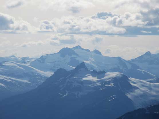
Mount Sampson
July 20, 2019
2811m
Pemberton / Upper Lillooet FSR, BC
Mt. Sampson is a trophy objective by any measure other than perhaps the technical aspect although the North Face does offer a steep snow-and-ice route for adventurous mountaineers. The standard route on the south face is a Class 2-3 scramble and is well written in Matt Gunn’s Scrambles in SW British Columbia, but the challenge comes from the access. The route documented in Matt Gunn’s book has deteriorated in recent years. It is still doable but alder thrashing on heavily overgrown roads along with a troublesome creek crossing due to bridge-out is unavoidable. A couple years ago I had discovered a new approach option that goes from ~1100 m elevation on a logging road system branching off from North Creek Road, followed by a 1000-m grunt up the south slopes of “Zorah Peak” before making a cross-country travel to the base of Mt. Sampson. Earlier in this year Alan Blair went there and reported good roads and fast travel and even managed to climb Mt. Sampson in one long day.
With Alan’s fresh beta I figured it’s finally the time to put Mt. Sampson on the agenda but I had no desire to do Mt. Sampson in one day. I wanted to also climb the nearby Mt. Delilah and Sessel Mountain which meant at least 3 days were required, and when it comes to overnight mission like this nobody beats Alex to be the perfect partner. Alex and I made a plan to spend 4 days in the zone and Paul S. from BCMC joined us at the last minute. We briefly thought about making a car-drop at Railroad Pass to link up with peaks in Railroad Group but abandoned the idea for simplicity. The three of us met in West Vancouver at around 5 am and a couple hours later we were up in Pemby Valley. The road wasn’t nearby as smooth-sailing as I was expecting but didn’t impose any issue to Paul’s 4Runner. There was one tree that we had to get out and pull aside, along with numerous steep and loose corners but that’s why we brought a 4Runner there. We drove to the highest we could drive, at close to 1200 m elevation.
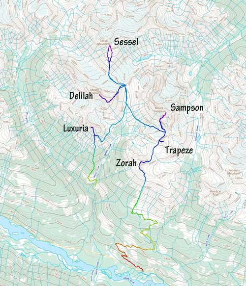
Sampson Group peak-bagging. GPX DL
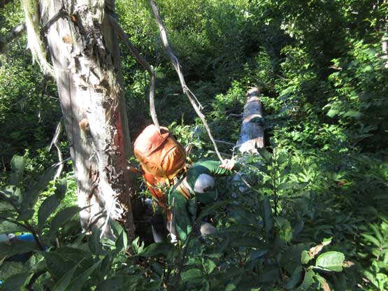
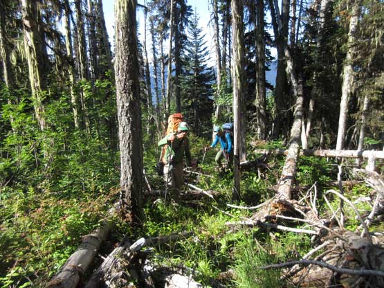
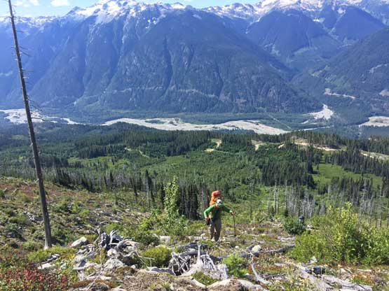
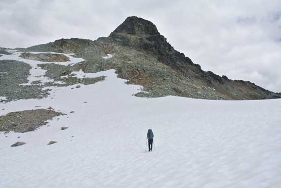
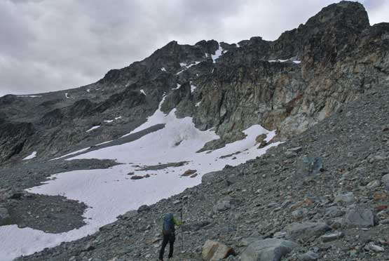
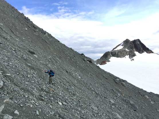
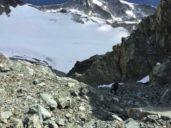
The shittest section of this approach came right at the start where we had to thrash through “BW4” bush for about 200 m elevation. The brush was so thick that we couldn’t see our feet and had to probe ahead to make sure we wouldn’t step into some deep holes. Thankfully there weren’t many brambles type of plants but combing 10-feet tall alders with tangled dead-falls and thick underbrush our pace was painfully slow. It took us over an hour to thrash through the misery. The second stage was a very foreshortened plod up the never-ending south slopes of “Zorah Peak” for over 700 vertical meters. This was no fun under what felt like 30-degree temperatures and overnight packs.
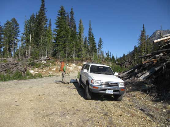
Paul’s 4Runner made to almost 1200 m on the logging road spurs
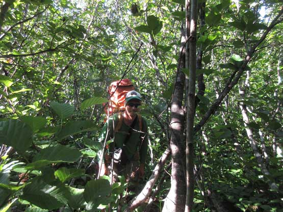
Right off the bat this was what we had to do
Me into the alders. Photo by Alex R.
Alex having fun time on BW4 bushwhack…
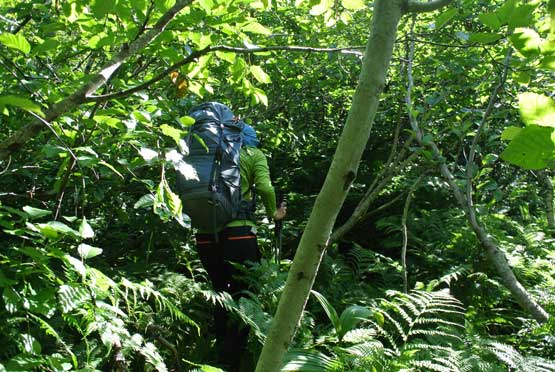
The terrain became a tiny bit better but not for long
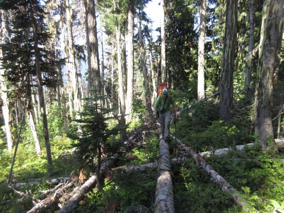
Balancing over mangled dead-falls seemed efficient, until the log broke…
Bashing out of the misery…
Now grunting up steep south-facing slope under 30-degree Sun…
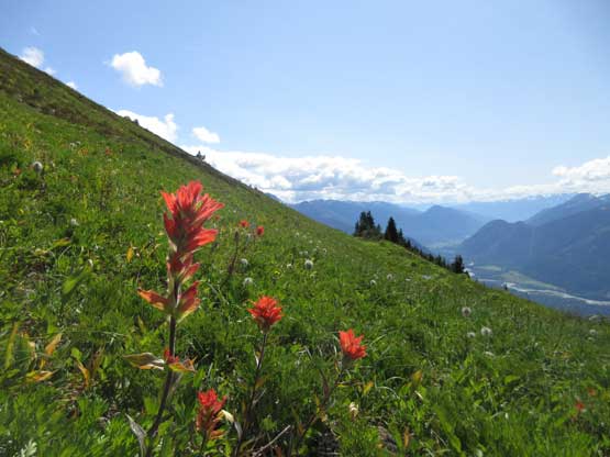
Beautiful paint brushes for some different views…
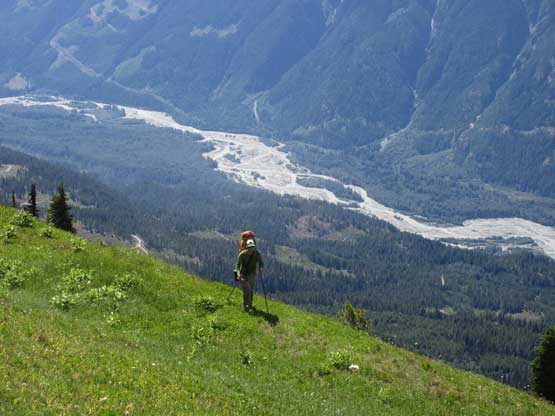
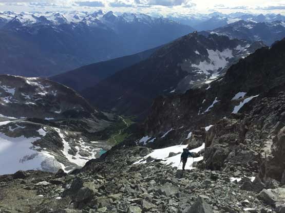
Alex with Lillooet River one vertical mile below
Another photo of zooming-in at Alex with Upper Lillooet Valley below
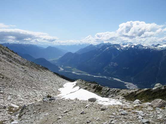
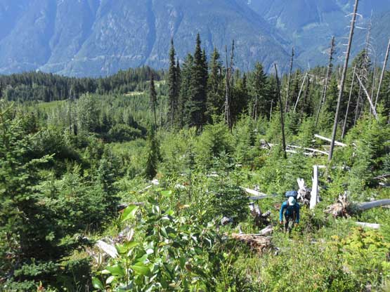
This is the Upper Lillooet River valley which also known as the Pemby Valley
On the south shoulder of Zorah Peak now, looking ahead
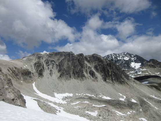
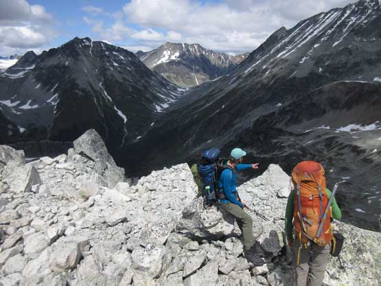
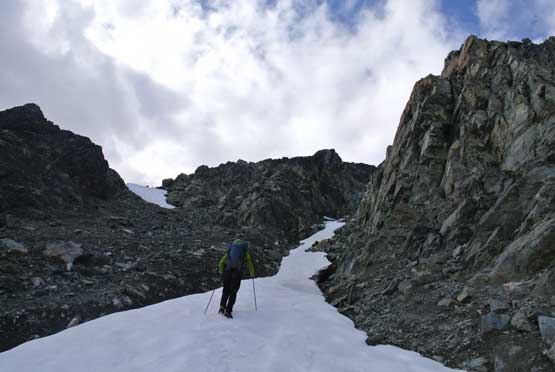
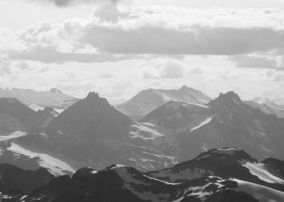
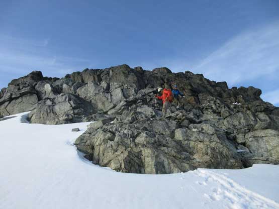
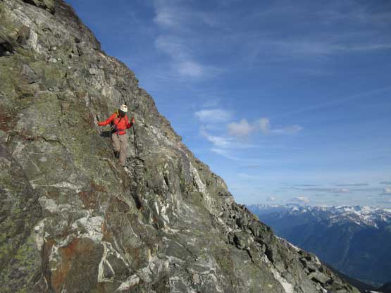
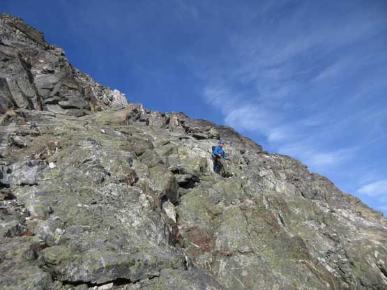
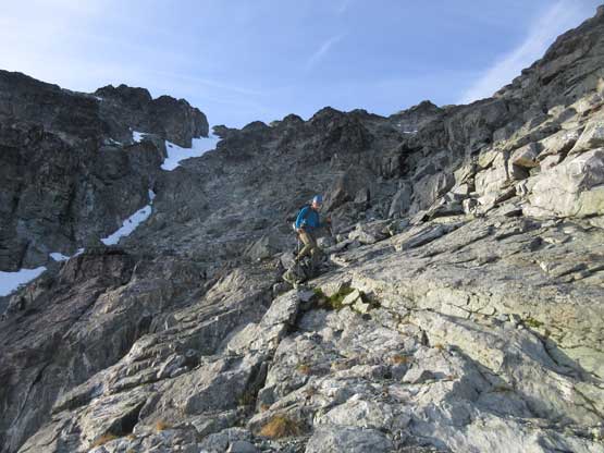
In less than three hours we made to the high shoulder of “Zorah Peak” and there came the first decision point. We wanted to bag “Zorah Peak” despite it’s just a bivouac.com name and after debating about the pros and cons we opted for carrying up-and-over “Zorah Peak” in favour of the shortest distance. The traverse over “Zorah Peak” is written in a separate trip report because it’s a separate peak. And then there came more easy cross-country travel on talus and snow and in short time we were at the base of “Trapeze Peak”. The ascent of “Trapeze Peak” from the west side looked tricky but we decided to try it nonetheless. It turned out to be mostly 3rd class scrambling on loose rocks and of course, this section is also written in a separate trip report.
Surveying the route from the summit of “Zorah Peak”
Traversing “Zorah Peak” was more difficult than expected with some Class 4
Me heading for Trapeze Peak. Photo by Alex R.
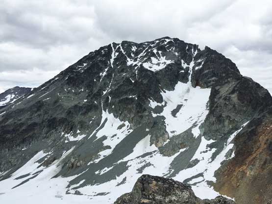
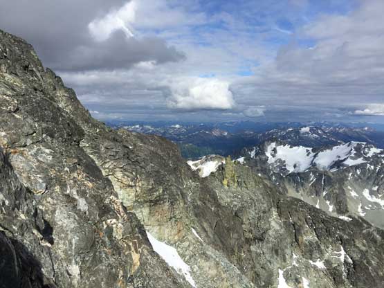
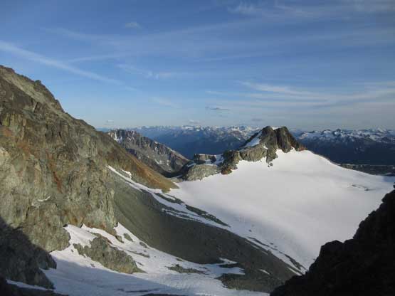
South Face of Mt. Samposon from the summit of “Trapeze Peak”
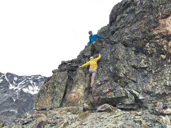
Tricky 3rd class scrambling on “Trapeze Peak”
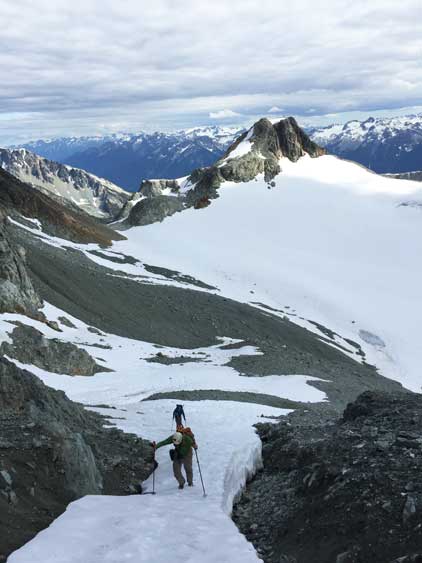
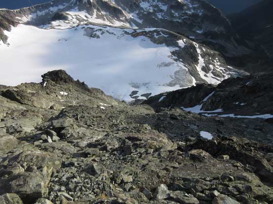
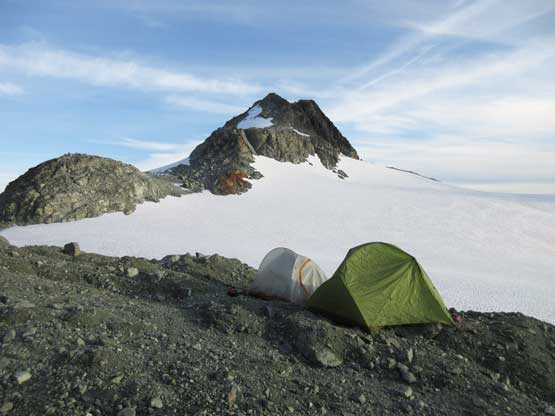
After summitting “Trapeze Peak” we descended easy glacier to the base of Mt. Sampson. The plan was to set up camp at the base of Mt. Sampson’s south face but we could find no great spot to pitch the tents, but none of us wanted to camp on snow so we spent at least half an hour digging out the tent platforms. By this point we still had about 5 hours of daylight and nobody wanted to just kill the hours at camp doing nothing, so up Mt. Sampson we went. The route appeared to be a mix of snow and rock so we carried ice axes and crampons which were of course, not needed.
Descending easy glacier to the base of Mt. Sampson to set up camp
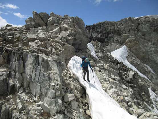
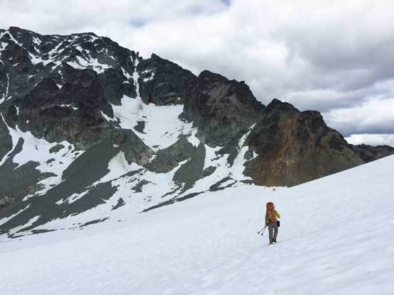
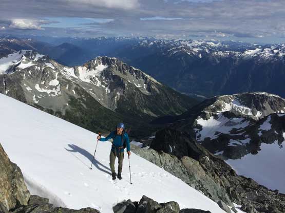
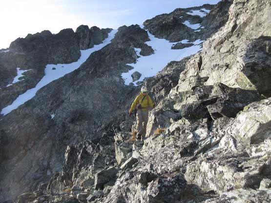
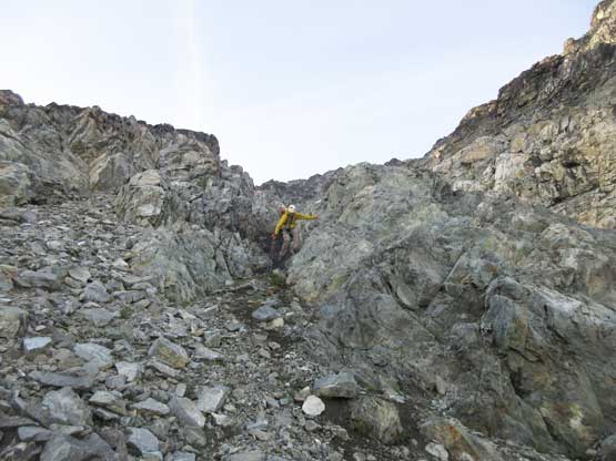
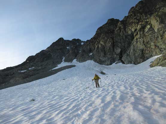
The traverse upwards into the “central gully” had some shitty moraine type of choss but they were short-lived. Most of the choss was still covered in snow so the travelling was easy and fast. Into the couloir we could still utilize snow for a long while before bailing onto rocks on climber’s right. The terrain appeared mostly just class 2 and I was getting tired from kicking steps. From this point onward we stayed entirely on climber’s right side of the main gully (fall line) and with good route-finding we managed to keep the scrambling within “easy class 3”. Near the summit we did have to traverse and ascend several patches of snow but nothing steep nor exposed enough to warrant the use of ice axe and crampons. The summit view did not disappoint especially with the evening lighting we had. This year had been shaping up greatly for no forest fire smoke into late July.
Me traversing scree and moraine towards the central gully. Photo by Alex R.
Paul traversing some really shitty moraine type of scree
Me leading into the snow couloir. Photo by Alex R.
Alex and Paul following up the snow couloir
Paul exiting the couloir on some of the typical terrain here
Paul higher up on the scramble. Nothing difficult just tedious
Gorgeous views once the lighting was good
Paul traversing a patch of snow near the summit of Mt. Sampson
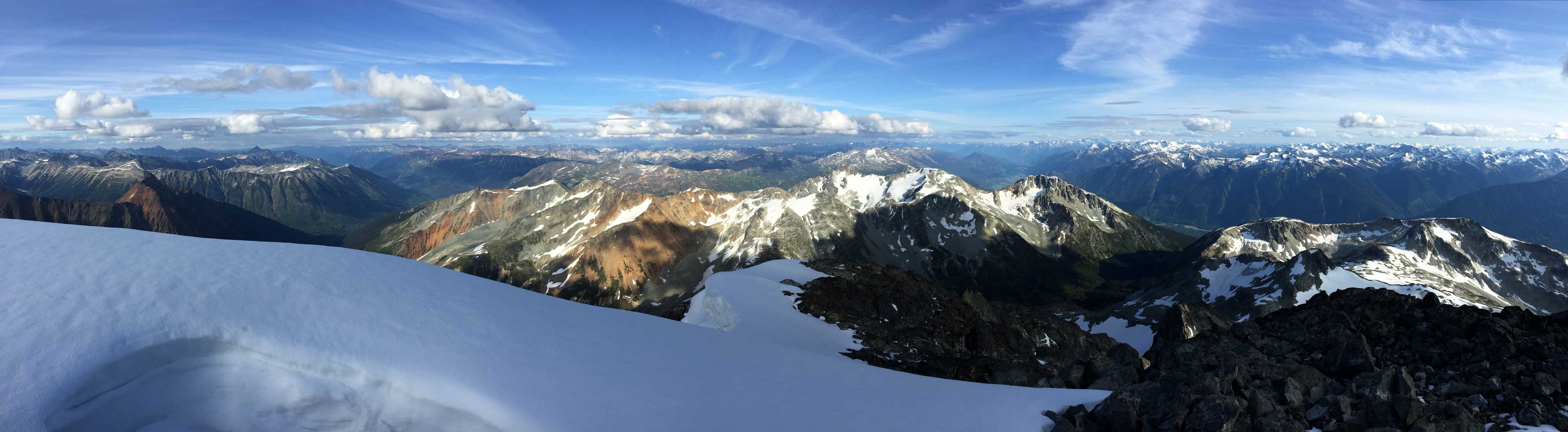
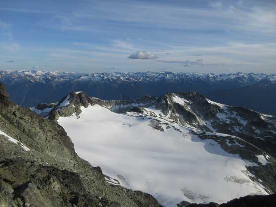
Summit Panorama from Mt. Sampson. Click to view large size.
Looking over the peaks in Railroad Group. They all looked tiny
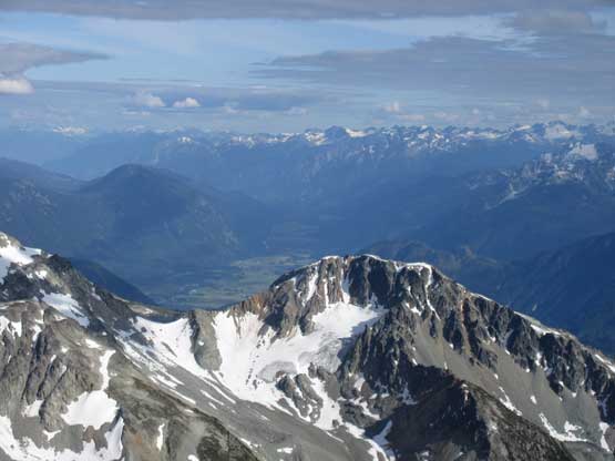
Handcar Peak with Pemberton Valley behind
A zoomed-in shot of Overseer Mountain and Spidery Peak
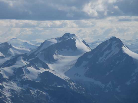
Manatee Peak with Pylon Peak in front
The rugged Mt. Meager and Plinth Peak with Obelia Peak behind on LIllooet Icefield
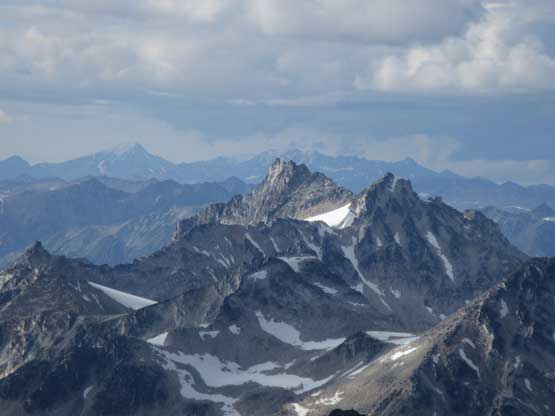
Mt. Thiassi is an impressive fang of rock
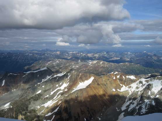
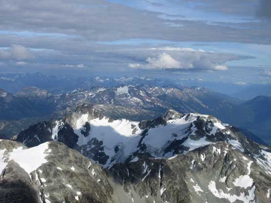
This is a wider view looking over a sea of peaks to the NE
In the foreground in sunlight is Frost Fiend
Mt. Morrison in the foreground with a ton of peaks on Pemby Icefield behind
In the background are Mt. Weart and Wedge Mountain
Goat Peak in foreground with Mt. Matier et al. in Joffre Peak behind in the shade
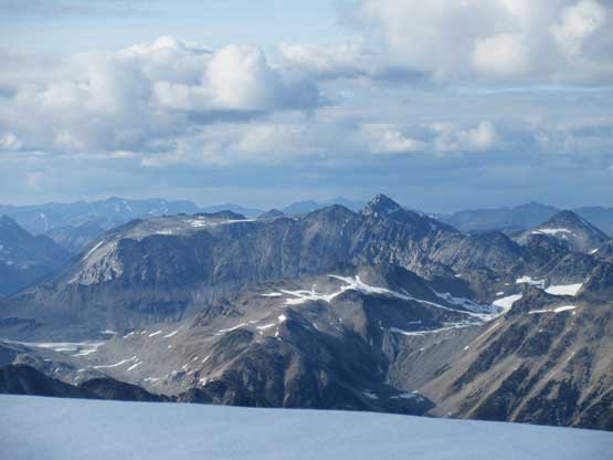
Mt. Vayu to the north is another worthy area to explore
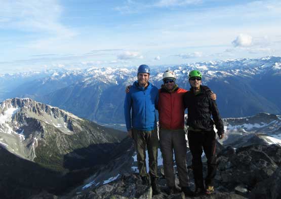
Our group shot on the summit of Mt. Sampson
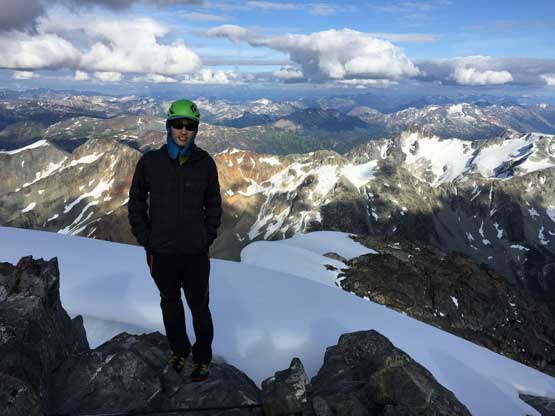
Me on the summit of Mt. Sampson
The summit was windy and chilly and we didn’t bring a ton of clothing on this trip so after less than half-an-hour we started the descent. I thought about boot-ski down the central gully so took the ice axe out, and regretted soon as the gully was too steep for me to comfortably boot-ski. I had to down-climb facing into the slope. It was still a fast and fun process but I thought scrambling down class 2-3 rock would be much easier so I bailed onto rock and joined Alex and Paul. We then worked carefully down the loose terrain and the hardest thing was to keep rocks on the mountain. It was nearly impossible to not knock shits down on each other. Lower in the couloir we also stayed on down-climber’s right to avoid as much snow as possible to trade off for choss, but once the terrain mellowed down we went back onto snow and had a blast boot-skiing down to camp.
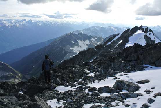
Time to head down. Photo by Alex R.
Descending off from the summit
Alex on some steep but easy 3rd class terrain
Paul down-scrambling
Alex on the typical terrain on the south face of Mt. Sampson
Looking down from partway down the face
Paul descending.
Looking down at the glacier we crossed from Trapeze Peak
Alex negotiate a tricky 3rd class step to avoid snow
Almost down. Looking at Trapeze Peak and the glacier we traversed
Time to boot-ski
Back to camp with Trapeze Peak behind
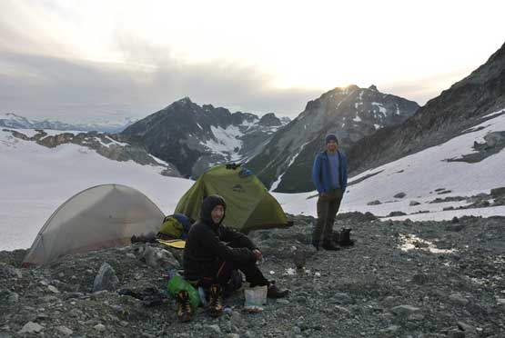
Camp at sunset. Photo by Alex R.
After a couple years of longing I finally managed to stand on the summit of Mt. Sampson but I didn’t find it to be as exciting as I was expecting. The scrambling was super easy and the approach had been tested out by friends. We were there doing everything right and managed to tag three summits which made an efficient Day 1. At this point we were thinking that the 4th day might not be needed at all, but we should focus on one peak at a time. The next day we would descend/traverse to the broad Sampson/Delilah pass and climb Sessel Mountain and Mt. Delilah, and the 3rd day we would traverse and climb Luxuria Peak to make a loop.
