Suicide Bluff
June 29, 2020
1167m
North Shore Mountains, BC
“Suicide Bluff” might seem like a strange name of a summit but it actually is, though unofficial. Pretty much all of the pimples on Mt. Seymour’s lower slopes have gained either official or unofficial name and this is one of them, but probably because of the unofficial status this hike hasn’t gained much popularity yet. The trails are unofficially maintained with multiple warning signs of “dangerous, stay out” so that’s another deterring factor. A couple weeks ago Wendy asked me for some easy, but less popular suggestions and I recommended this one. Wendy then tried it two times with her friend, LanLan but didn’t make it due to snow and route-finding so I agreed to go with them on their third attempt. For one reason or another I still hadn’t done this peak yet.
There was really not much to say about this hike and I did not do any homework at all other than checking the Gaia map. On the map it shows two trails heading towards the summit but I did not know what to expect and based on Wendy’s description I’d expect some confusing branches and/or off-trail navigation, but that’s OK. Wendy and I left White Rock in her Mercedes at 5 pm and made to North Vancouver an hour later. We ordered a sushi dinner (half an hour’s wait) to wait for LanLan showing up. We then raced up the Mt. Seymour’s access road. I was hoping to have this luxurious dinner at the parking lot with some views but unfortunately the bugs were really bad, so we piled into LanLan’s vehicle for the dinner. It wasn’t very elegant but we did manage to make it work.
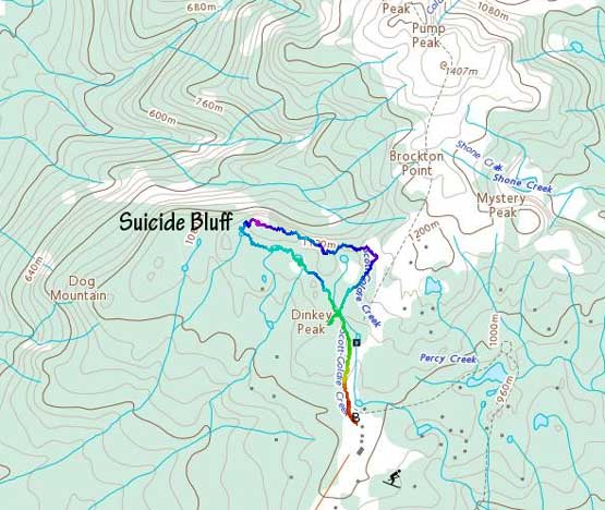
A loop on Suicide Bluff. GPX DL
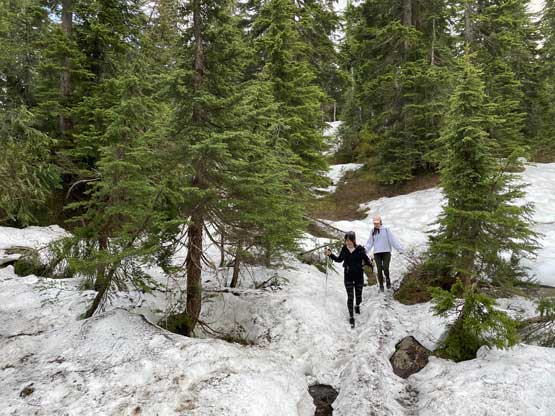
We did not start the hike until past 7:30 pm but there’s still enough time to get that sunset views. We followed the main Mt. Seymour’s trail to a junction and took a wrong turn towards Dinkey Peak but realized the mistake in no time. We then backtracked and found the correct, unsigned trail on the Gaia map. This trail was muddy, narrow and bushy at places and led us to two small lakes. We did some photography at the lakes and resumed the hike.
As you can see this trail isn’t very obvious

Wendy posing at the first lake
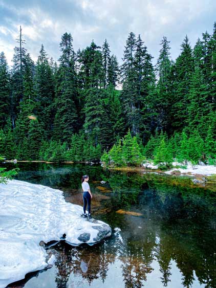
LanLan on the first lake

More about the photoshooting on the first lake.
The trail unfortunately came to an end so I led the way bushwhacking a short distance to the west ridge of Suicide Bluffs and found a much-better trail. To reach the summit required a few hands-on sections aided by several batman ropes, and was really fun. We timed ourselves really well as we arrived at the summit literally 5 minutes before the sunset so got some superb photos. Sometimes it’s all about the summit and sometimes it’s about that perfect shot.

A bit of navigation here. We got off-trail
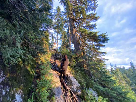
The second batman rope on the west ridge of Suicide Bluff

LanLan posing for a photo.

Wendy near the summit at sunset.

The summit had this cool tarn for some photography
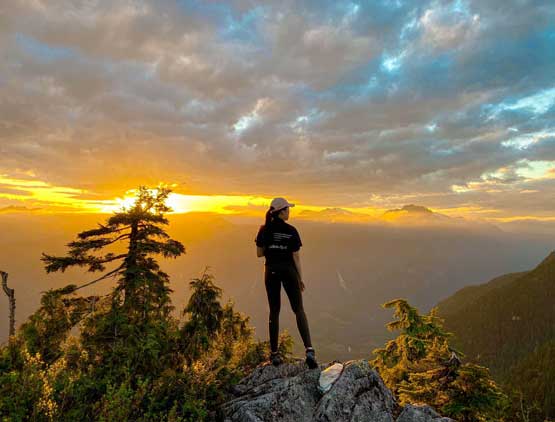
Wendy and the sunset
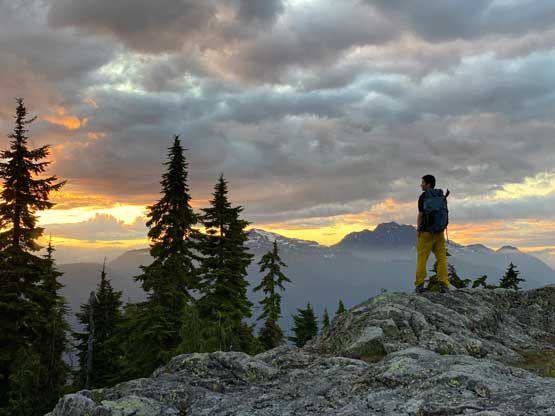
Me on the summit of Suicide Bluff

LanLan and Wendy on the summit

Cathedral Mountain looms impressively in the distance
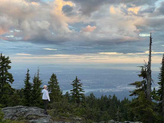
Wendy in front of Vancouver

Another photo of Wendy on the summit

Me and my reflection in that tarn…

Our group shot on the summit of Suicide Bluff
After the show’s over we leisurely descended the east ridge with some up-and-downs to join the main Mt. Seymour trail. For those wondering what would be the easiest trail to reach this summit then definitely the east ridge. The descent down the main Mt. Seymour trail back to the parking lot was uneventful and strangely we saw nobody on this entire hike. The parking lot was also empty and we got back home at past 11 pm.
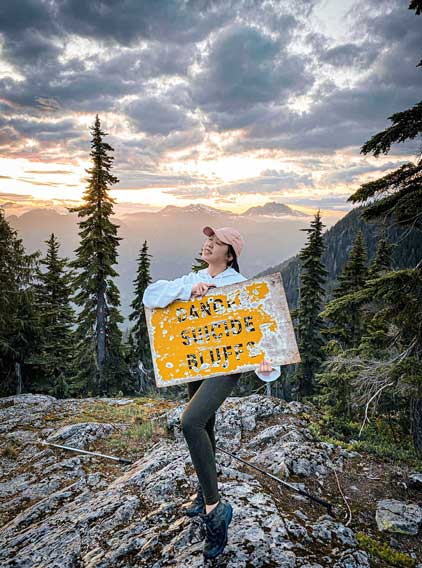
“Dangerous”? Not really…
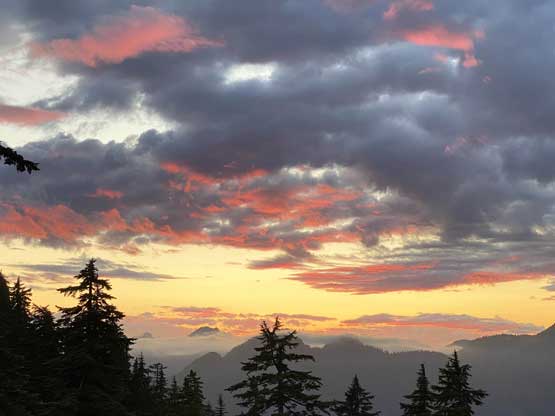
One last photo of the dusk sky.
