Little Alberta
September 5, 2014
2970m
Icefield Parkway (North), AB
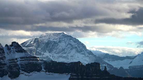
Little Alberta is the only “Little” I know being officially named. Probably because Mount Alberta is so grand its “little brother” becomes a legitimate peak. Speaking Mount Alberta, it’s the toughest 11,000er in the Canadian Rockies and one of the grand prizes for mountaineering in this country. I can see it’ll be in my future but definitely not in this year.. The idea of ascending Little Alberta had been tossed around for 2 years already but never came to realization. There’s very limited route beta on internet other than the one-sentence description from the first ascent party. We knew they ascended via chimneys on the west side but nothing more than that. Could they be as hard as the chimneys on Mount Alberta? We had no idea. However, we did have some confidence that the route would likely go as a scramble via the southwest slopes thank to Vern’s photos taken from Twins Tower.
With a short high pressure system arriving at this past weekend, Vern, Ben and I finalized our objectives on Mount Woolley and Diadem Peak. We knew alpine rock routes were likely out of shape given the recent significant snow fall and trips involving troublesome glacier and bergschrund were not the greatest idea at this time of the year neither, so we figured Woolley/Diadem could be our last chances on 11,000ers. However, the approach for those two is relatively short and the climbs can even be day-tripped. All three of us had 3 days so we had to bag some other peaks nearby to justify the extra time, namely Little Alberta and Mushroom Peak. Regarding which to ascend first we had no idea and we’d decide based on condition, weather, energy and so on. Given the recent snow and the guaranteed good weather this would be an incredibly scenic area to explore and we were all excited about it.

Ascent routes for Little Alberta, Mt. Woolley, Diadem Peak and Mushroom Peak. GPX DL
Vern had extra days off and he wisely chose to hike in on Thursday evening to save some energy. Ben and I were not nearly as lucky. I had classes till 9 pm on Thursday evening and I would not want to skip them unless it’s a “must”. We didn’t manage to leave Edmonton until 10 pm – what an exhausting way to start a tough trip like this… It’s about 5 hours drive to the trail-head and after catching up a few hours steep we woke up by 7 am and started shortly after. The first obstacle would be the Sunwapta River. Folks who did it earlier in the season described this ford as the crux but as for September the river crossing was reasonably straightforward for us. It’s a very cold crossing though, but not even knee deep in the major channels. On the opposite side of the river we ditched running shoes and the river gears.
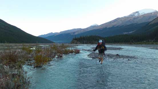
A cold but easy crossing of Sunwapta River
The trail up Woolley Creek was easy to spot and reasonably easy to follow. I say “reasonable” because it’s overall an unofficial trail that’s not marked on any map. There were a few washouts and intermittent sections and the boulder fields were disorienting but the overall quality was much better than some of the unofficial trails I’d done. Firstly we had to gain steeply up more than 100 vertical meters on the left bank of Woolley Creek to bypass a waterfall – a pretty impressive one actually. Then we lost elevation briefly to the creek and for the rest of this approach we’d be staying very close to the creek. Further up we got lost in the boulder fields picking a line too far climber’s left. There were a few cairns indicating bearing right to follow the creek but we either didn’t see them or ignored them. We realized the mistake soon and managed to cut over and found the trail again. There was more boulder hoping for the next while. Towards the end of this valley the trail, along with the Creek, took a sharp turn towards right (north) side and led us towards and then pass treeline, up a foreshortened moraine slope and eventually to a 5-star bivy side right at the base of Woolley/Diadem. There’s surprisingly a great amount of elevation gain (more than 600 meters) that didn’t look to be that significant on the topo map. It took us over 3 hours to get here and Vern was waiting for us patiently.
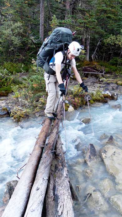
Crossing a slippery log on the approach trail
On the boulder field now, looking up.
The east face of Mt. Cromwell. The new snow made it look like a Himalayan giant
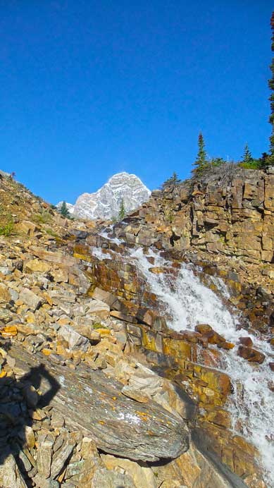
A neat waterfall on the approach, Mt. Woolley behind
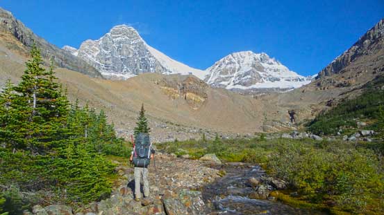
In the upper valley now, heading towards Woolley/Diadem
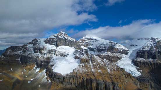
Mt. Woolley close-up shot
Woolley and Diadem will be our playground the following day.
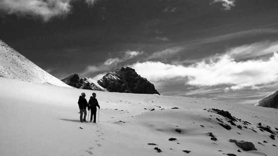
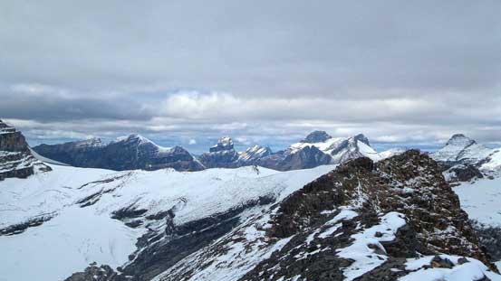
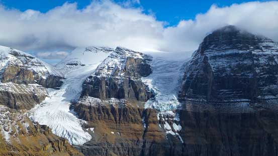
We spent quite a while discussing which of the peaks should we do on this day. Mushroom would be the most guaranteed but also the shortest. We’d be back to camp too early and neither of us wanted to sit around doing nothing for 6 hours. Doing Woolley/Diadem would be possible but it was already kinda late in the day, and given the superb weather forecast for Saturday it made perfect sense to climb them on the following day. So we set on Little Alberta – the most exploratory one and turned out to be much longer than expected. Had we knew how long it took we probably would just go for Mushroom instead… Approach would be almost the same as for the Japanese Route on Mt. Alberta – up and over Woolley Shoulder, down to Lloyd McKay Hut and then further down south and west around the mountain to the opposite end. The entire process involved gaining 500 m height and losing at least 400 m. Woolley Shoulder was a tedious and ugly place. Neither of us had done much research about it and we all underestimated this slog. The slope appeared to be ridiculously steep and rock was horribly loose – kinda had a taste of what would be like on Alberta! There’s intermittent path along the way but difficult to follow. The correct way was ascending climber’s right side of Woolley/Engelhard col. This had the least steep terrain but eventually brought us higher than the col on Woolley’s side. Our effort paid off as we were awarded with a big WOW moment with some of the biggest faces in Canadian Rockies suddenly showed up in front of us – East Face of Alberta and North Face of Twins Tower!
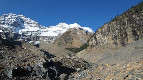
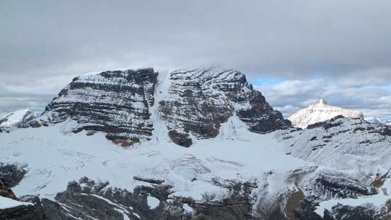
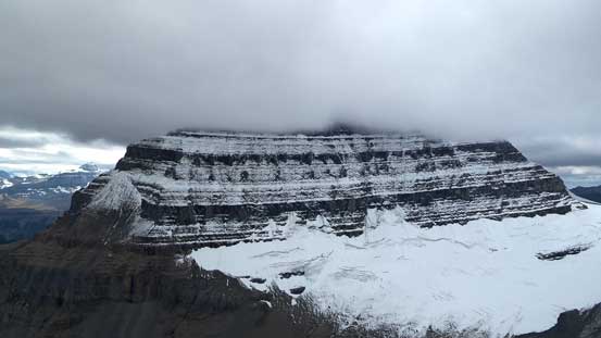
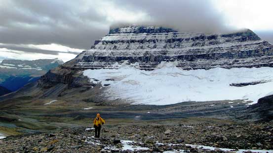
The southeast face of Diadem Peak. We could study the entire ascent route form this vantage point
Heading towards Woolley Shoulder – we didn’t know it’s that high…
Looking back towards Sunwapta Peak that I ascended earlier in this year

Vern and Ben slogging up, with Mushroom Peak behind – our last objective in this trip
We utilized snow for as much as we could. Steep grind towards the shoulder
Vern on the final push

Cresting Woolley Shoulder, looking towards Engelhard and Cromwell

The south face of Mt. Woolley came into view

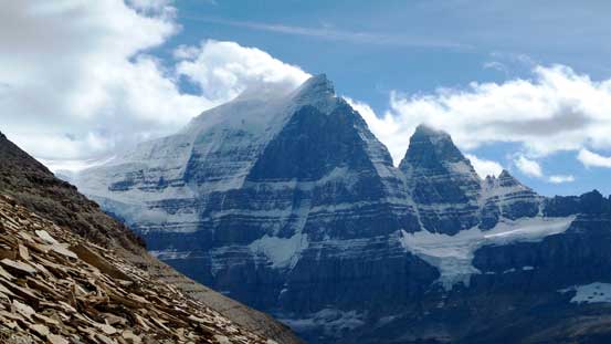
And, Mt. Alberta!
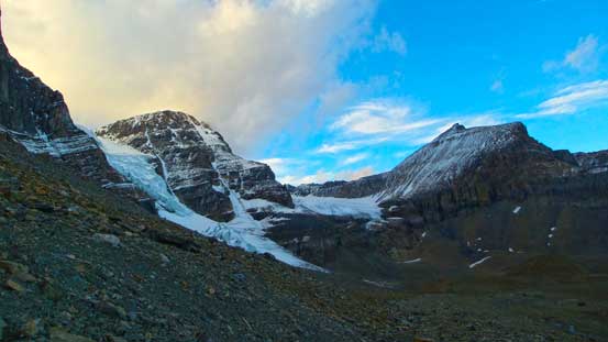
Our motivation got suddenly boosted up. We could see our objective straight in front and not much higher so we continued down towards Lloyd McKay (Alberta) Hut. What we didn’t see was the elevation loss involved in contouring around this mountain… The route to Alberta Hut was scenic as we traversed on the edge of Woolley’s south glacier. The glacier was covered with a few inches of fresh snow and we discovered one or two holes – should have probed more carefully… There were rocks poking through but we were still on glaciated terrain as those rocks were just debris on the ice. Anyway, after about an hour of down-hill walking we arrived at Alberta Hut. Straight ahead would be the north ridge of Little Alberta – very intimidating. We also saw the next stage and it looked very depressing.

Vern descending from Woolley Shoulder. Again, snow helped to speed up the progress
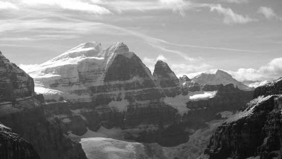
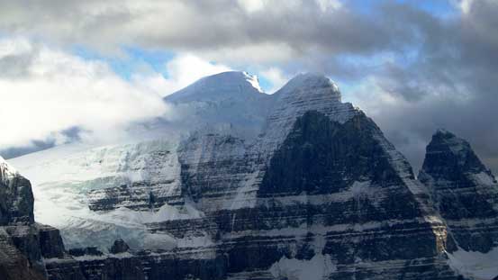
What a view of North Twin and Twins Tower. This face is arguably the hardest face in Canadian Rockies.
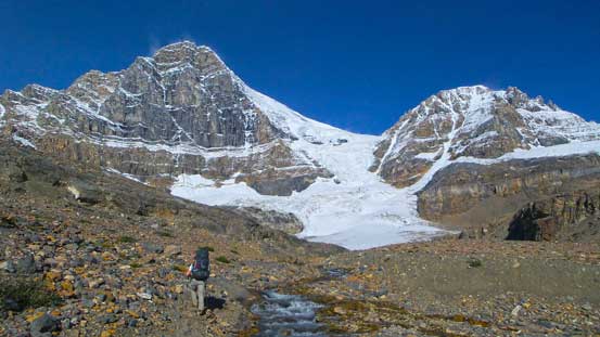
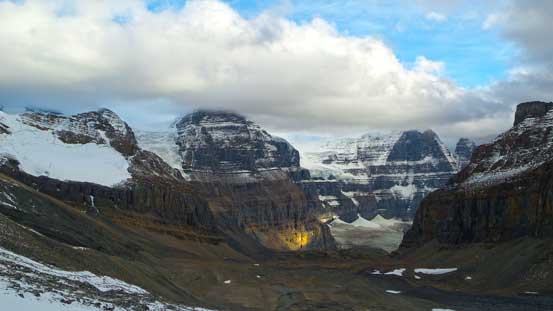
Our objective – Little Alberta. Need to contour and descend all the way to the opposite side to proceed the ascent
The south face of Mt. Woolley again

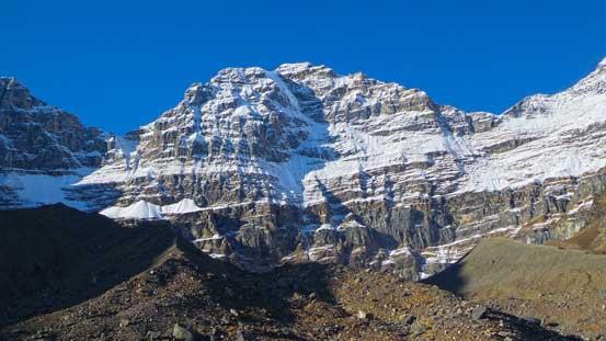
And, the East Face of Mt. Alberta
Vern and Ben on the small glacier south of Woolley.

Despite the rock poking through the new snow, we were on a glacier here

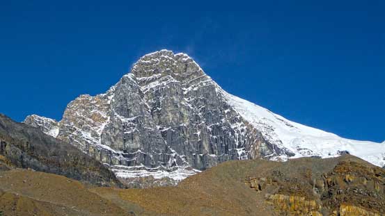
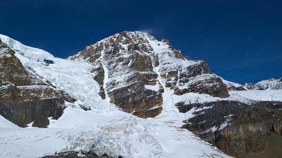
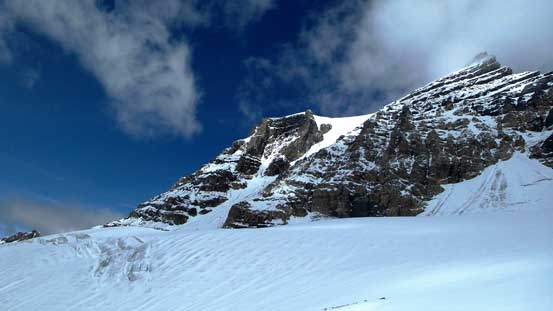
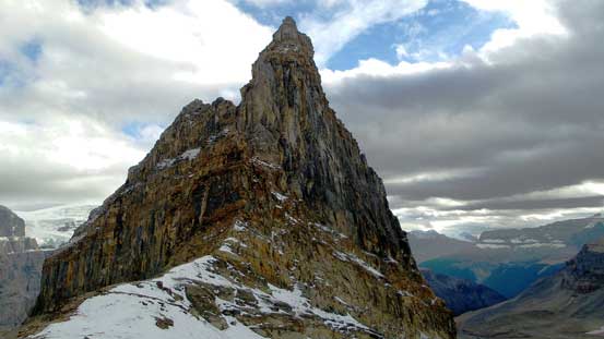
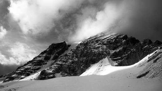
Little Alberta looks increasingly intimidating
In Lloyd McKay Hut, tired and depressed to see the massive amount of elevation on the west side of Little Alberta
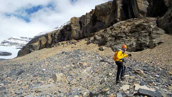
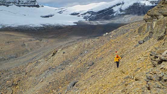
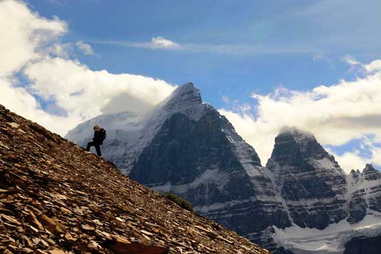
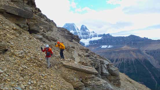
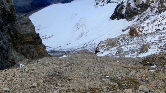
After taking a necessary break we started losing height around the west side of Little Alberta, hoping there indeed existed a break on the imposing cliff band. Needless to say my motivation was low at this point as I realized we probably had to drop all the way to the valley floor. However, at this stage I was pretty much committed to this ascent. I could not look back thinking about how much height we had to regain a few hours later, but rather focusing on the task ahead. I knew based on Vern’s photo from Twins Tower and Raff’s photos from Cromwell we had to see Twins Tower first before spotting the easy route, and if the scramble route did not appear until we started to see Cromwell then our attempt would be over. Keeping this in my mind I charged on overcoming endless side-hilling on loose rubble and boulders until the Twins started to appeared around a corner. At this point we still couldn’t see the scramble route but decided to keep traversing around the next corner – and yes, a trouble-free line appeared in front of us!

Well, we had to keep descending to the valley floor then…

Ben losing height form Lloyd McKay Hut

Mt. Alberta hidden in clouds now… We started to lose the views. Oh no….
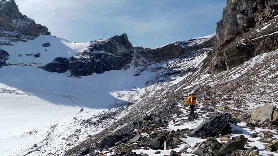
Vern kept traversing under the imposing cliff band.
More side-hilling
Finally able to see Twins Tower again!
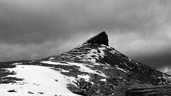
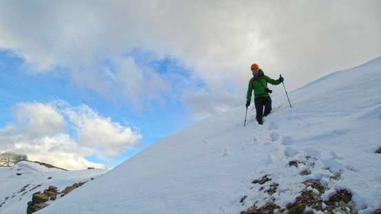
Our motivation was once again, boosted up instantaneously. For the next short while we had to contour or ascend loose class 3 terrain up a series of ledges before coming to the long foreshortened scree slope. Following this slope up we’d eventually hit the south ridge. The ridge was easier than expected and soon we were staring at the final summit block. Getting up the first summit was straightforward. I had no idea which of the two was the true summit but obviously I was hoping the first one was. The next summit looked to be equally high but there’s a register on the first summit – that’s good enough for me. Our celebrating was short-living due to obvious reason and after quickly signing the register we immediately started the long journey back. Apparently this register rarely got exposed to fresh air…
Ben and Vern slogging up the typical scree in this area…
Me with Twins Tower behind. Getting psyched. Next spring?! Photo by Ben N

Oh the scree slog…. Hundreds of meters of this
On the south ridge now, looking towards the summit

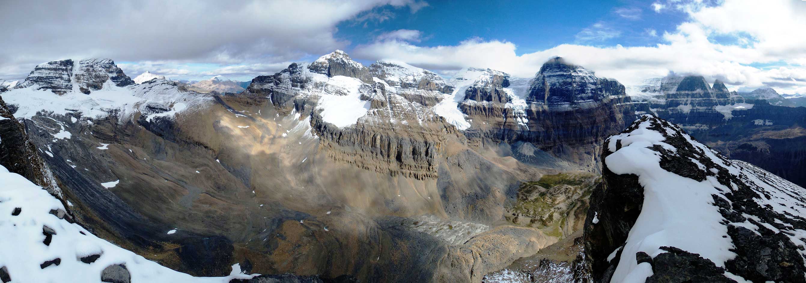
Summit Panorama. Click to view large size.
Peaks in Winston Churchill Range – Smythe et al.
The south face of Mt. Woolley
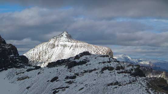
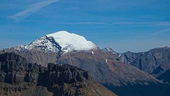
Mushroom Peak – pretty cool looking peak actually
Sunwapta Peak
Stutfield Peaks and the glaciers

North Twin and Twins Tower
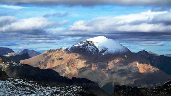
Mt. Alberta

Sundial Mountain in the Chaba Icefield area
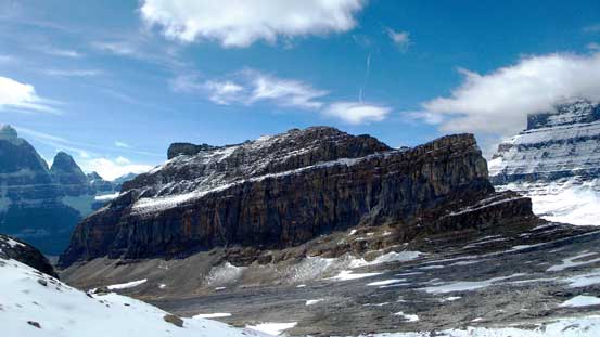
Mt. Engelhard and Mt. Cromwell

Me on the summit of Little Alberta
Another panorama from the summit. Click to view large size.
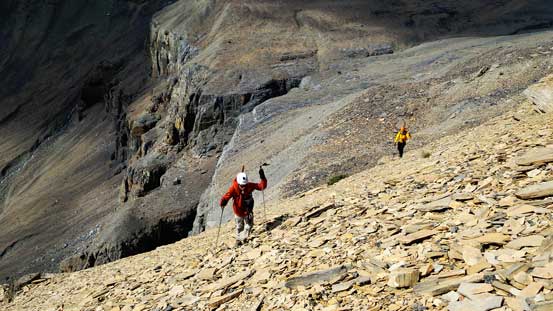
On the return we greatly appreciated the looseness of Little Alberta. Scree surfing down was as fast as we could expect and in no time we were back to the traversing section. This part also went by fast since we already knew where to go (and thank to the few cairns we built on the way up). Around the corner, we were ready for the long slog back to Alberta Hut. Tedious process but at least we were getting there… Another break in the hut we set for the final slog back to Woolley Shoulder. This part was just as tedious but at least scenic. The clouds started to lift at this point and we were treated with some gorgeous evening views on Rockies’ giants. Down from Woolley Shoulder was again, fast and furious thank to the scree and snow. About halfway down we were back on rubble and boulders and the rest of the way back to camp was slow and frustrating.
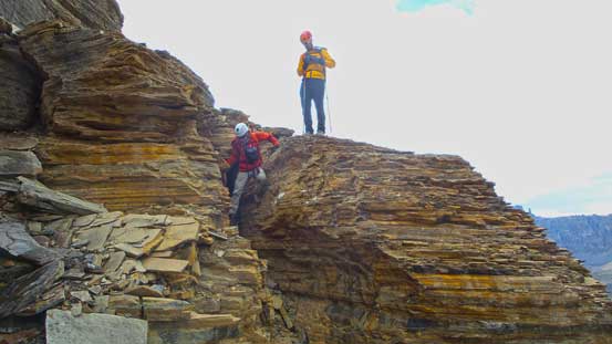
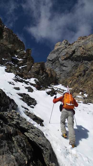
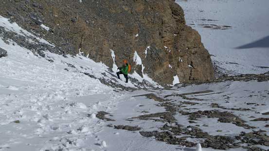
Descending a trickier step – stemming was the key

Traversing around a corner. We built quite a few cairns to help the descent
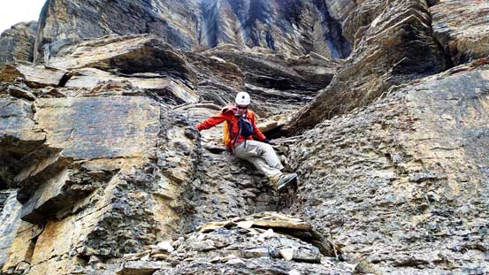
Typical terrain on this peak
We got off-route briefly and had to down-climb this
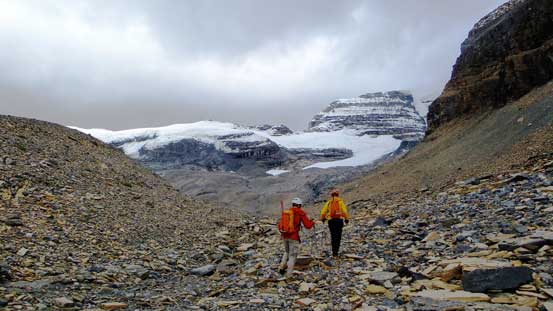
Down to the lowest point, now time to slog 400 m back to Woolley Shoulder…
The north ridge of Little Alberta – has it been climbed?
Vern coming up with Mt. Alberta behind – what a massive mountain
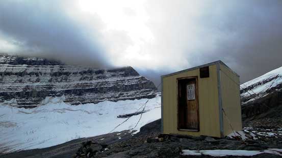
Lloyd McKay Hut (Alberta Hut)
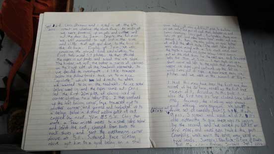
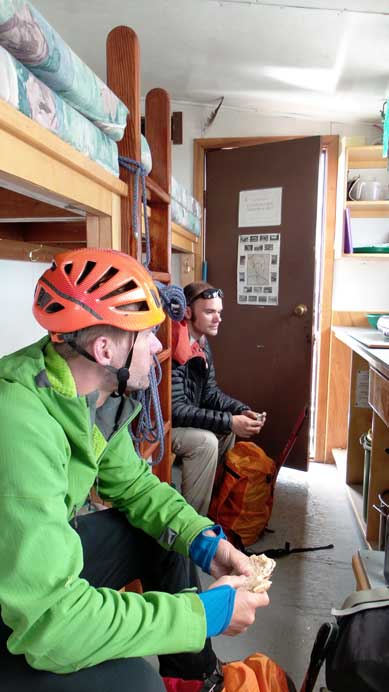
Grand names in the hut entries
“The Black Hole”
North Twin and Twins Tower
Mt. Woolley

Back to Woolley Shoulder, looking towards the front range
Another view of the Twins
Mt. King Edward finally free of clouds
Vern descending snow from Woolley Shoulder
Scree skiing!
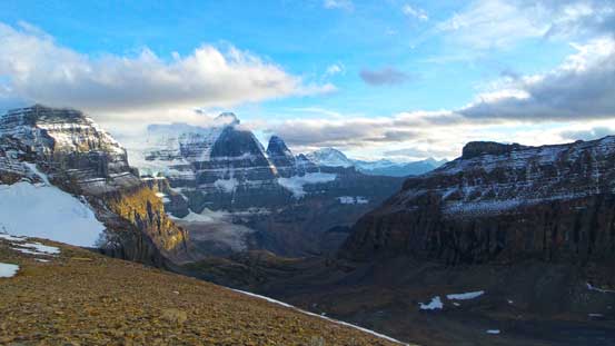
Evening view of Diadem and Mushroom

Hiking back. Woolley Shoulder high above on the right side

Me and Vern descending back to camp. Photo by Ben N
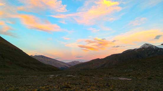
Gorgeous evening colours
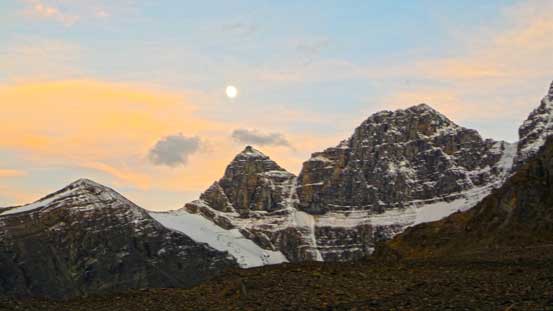
Moon rise over Stutfield Peak. Time to rest.
What an exhausting day before climbing Woolley and Diadem… Ben and I must have ascended more than 2000 vertical meters and spent about 13 hours moving at a fast pace. But on the other hand, we felt very satisfied to have Little Alberta successfully bagged and this actually set a very good mood for the rest of this trip. Ah the stubborn peak-baggers… Overnight we tried to catch as much sleep as possible and apparently there wasn’t much time to do that. At 5 am we woke up under starry skies and we’d be soon off to ascend Mount Woolley and Diadem Peak!
