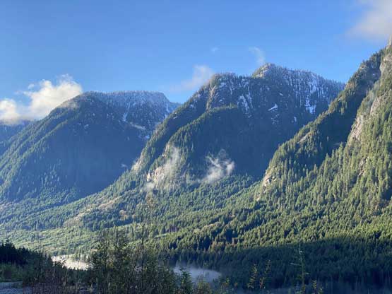
Mount Varley
November 23, 2021
1639m
Port Mellon / Sunshine Coast, BC
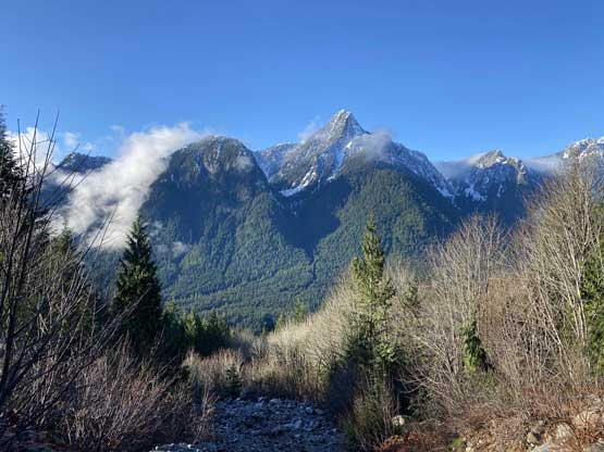
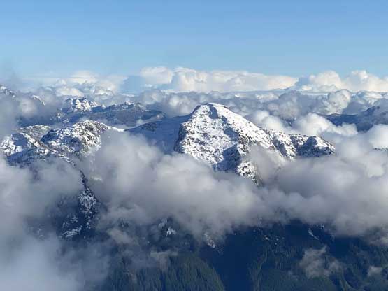
Mt. Varley is not the tallest in the lower Sunshine Coast, but boasts a handful sub-peaks and over 600 m prominence. The east face appears just like a smaller version of Mt. Sedgwick, attracting climbers who regularly drive up and down the Sea to Sky Corridor. The standard route ascends the forested south slopes from the end of “Canfor 5411” spur road off Rainy River FSR near Port Mellon. The area has restricted access to “daylight time only” thank to the gate at the pulp mill and recently the Rainy River FSR had been actively logged. Those loggers are not friendly towards the visitors but the standard route of this peak does not trespass into their work zone, at least for now.
Matt and I had been talking about Mt. Varley for a while and the general consensus was to tackle this objective in November or December. After reading several trip reports I determined “winter” would be the ideal time due to the bushwhacking on the upper route and the low-elevation FSR access. This past Tuesday saw the only sunny weather in the foreseeable future, but we had very little clue how the creek crossings on these logging roads were doing after the apocalyptic Atmospheric River event a week earlier. I went back to the maps and came up with a few route variations in case some key bridges were washed out, and I also suggested to bring bikes in case the Rainy River mainline itself was blocked by a mudslide. After locking in the objective Mark decided to join, taking his own vehicle and bike to meet up with us in Sunshine Coast. To make sure we definitely could get on the first ferry the three of us in two vehicles showed up at 6:15 am, one hour ahead of the scheduled sailing. About two hours later we were at the Port Mellon gate. Mark’s car was not suitable to the FSR driving so we all squeezed into Matt’s truck. I still remembered that gate keeper from Tetrahedron Peak’s trip in 2019 and he asked us the same questions and let us in. The Rainy River FSR was extremely muddy and saturated, but not washed out, and a few kilometers into the drive we got stopped by a logging truck. Apparently they were logging right at the start of the “standard route” but then I told the guy that we would go into the forest right here, taking my “Plan C” alternative. In retrospect we should have ignored him and just go for the standard route, as we learnt later that it’s not in their work zone after all.

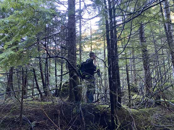
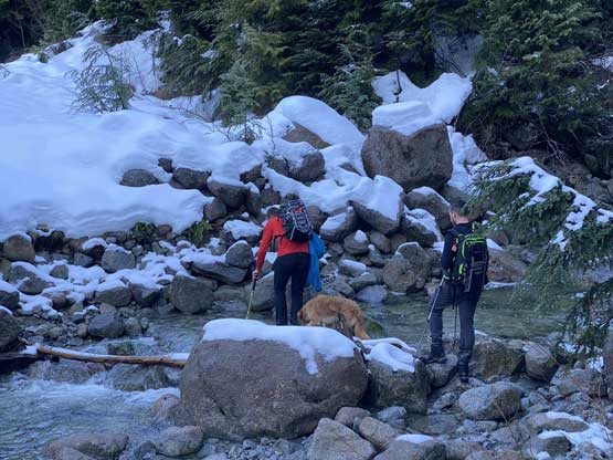
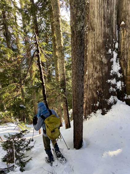
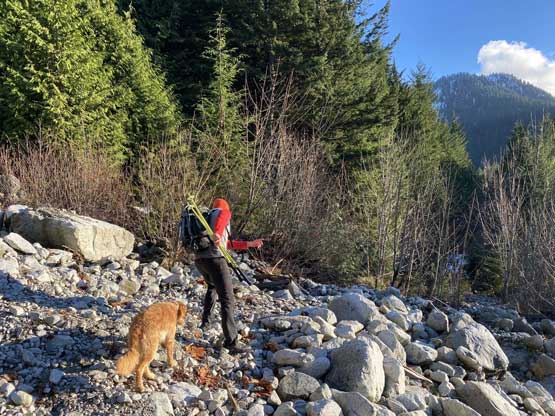
The “Plan C alternative” had about 1 km of deactivated spur at the start, so we did put the bikes in use. We were able to pedal a short ways but had to push the bikes on other sections. After one switchback the road became seriously deactivated so we ditched the bikes very soon. I also swapped my footwear from biking shoes to Trango Tech mountaineering boots. From the end of this spur road we bushwhacked through a wet and slippery cut-block that involved fair amount of thorny plants, but thankfully the mature forest was not too bad. We had to gain about 200 m elevation in this mature forest to (hopefully) hop across the creek that runs in the valley south of “Box Canyon Peak”. We could not cross the creek any earlier thank to a canyon feature and the bushwhacking beside the creek’s canyon was miserable to say the least. The bushes were not particularly dense, but wet, cold and pokey. The creek crossing was not a problem after all such that we even managed to rock-hop across while keeping the feet dry. After the creek we had another section of bushwhacking to content with before merging onto the standard route.


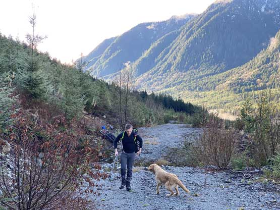


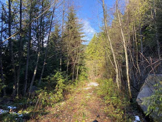
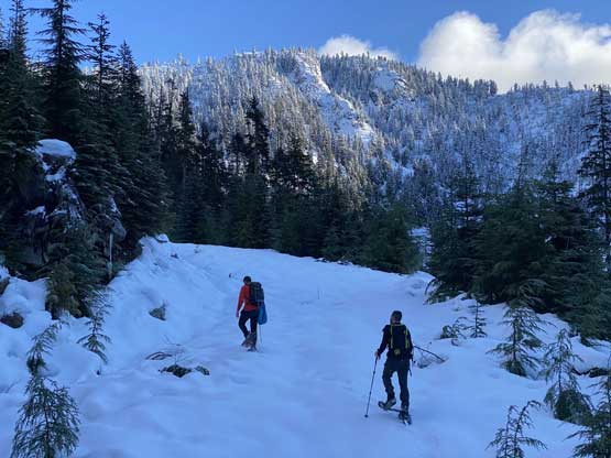
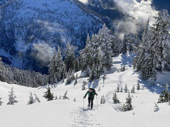
We popped onto the bigger of the spurs on “Canfor 5411 road” literally 20 meters passed the correct turn-off. The smaller spur was where we were supposed to take. Matt had worries about the bushwhacking on this road but I thought if nobody else mentioned alders on the road in their trip reports then it should be a “cruise sail”. I ignored the fact that those trip reports were at least 2015 or earlier. The road did become overgrown after a major washout but the bushwhacking was overall tolerable, though not pleasant. The wetness was the factor that made it worse. Thankfully the snowpack thickness significantly improved above 600 m elevation such that I even managed to strap the snowshoes on before the second creek crossing. This second crossing was a trivial fair as well so I brought the crocs all the way here for no use. A while after this crossing Mark and Matt also opted to strap the snowshoes on, and we had an easy plod to the road’s end, underneath a steep and massive cut-block.


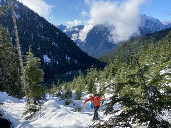
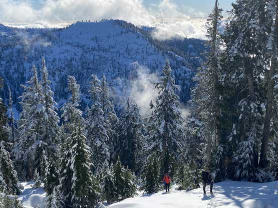
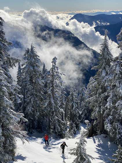
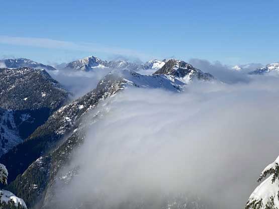
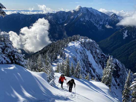
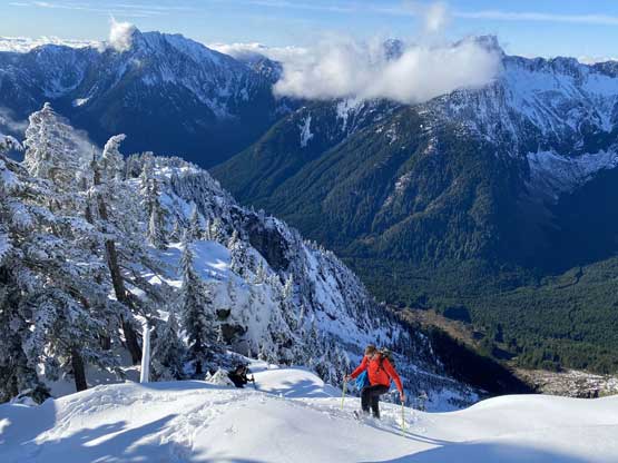
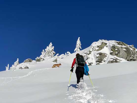
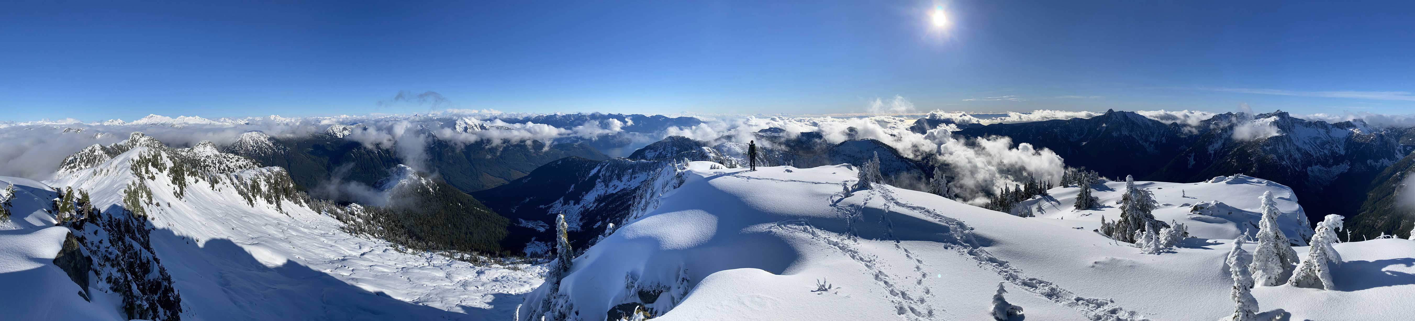
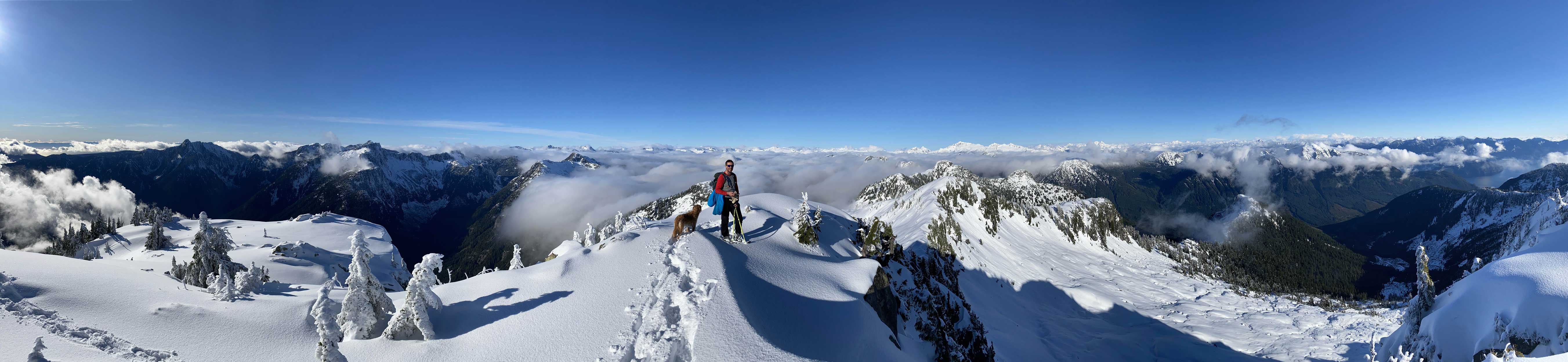
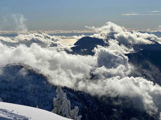
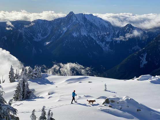
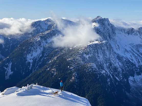
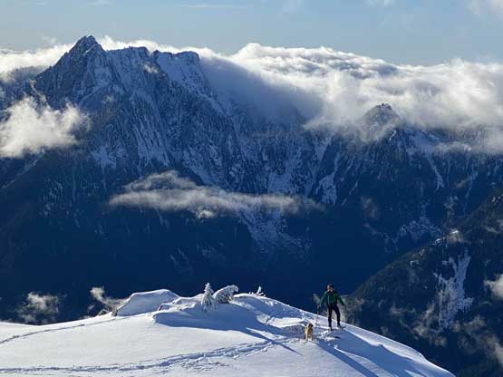
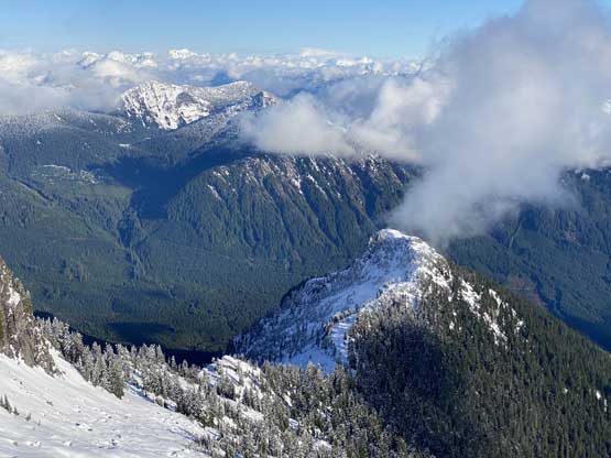
We ascended straight up through this cut-block with snowshoes on. The lower zone still seemed a bit thin but the snowpack thickness soon kicked in as we gained elevation rapidly. After taking a much-needed energy break we dived into the mature forest. From here we just had to put one foot in front of another for a few hundred meters’ elevation to reach the uppermost SW Ridge. The snow condition was a bit treacherous as we had about 15 cm ish powder sitting on a firm rain crust. The powder also became sticky and balled under our snowshoes. The balling issues decreased as we gained SW Ridge but the terrain became a bit more complicated with several short, but steep rolls to overcome. I was sure there existed a less-steep variation on climber’s right but we liked the ridge option for more views and we also liked the steepness for more fun. We tackled a few 40+ degrees rolls head-on with snowshoes and then merged into a gulch feature. The summit was free of vegetation and offered a neat 360-degree panorama.


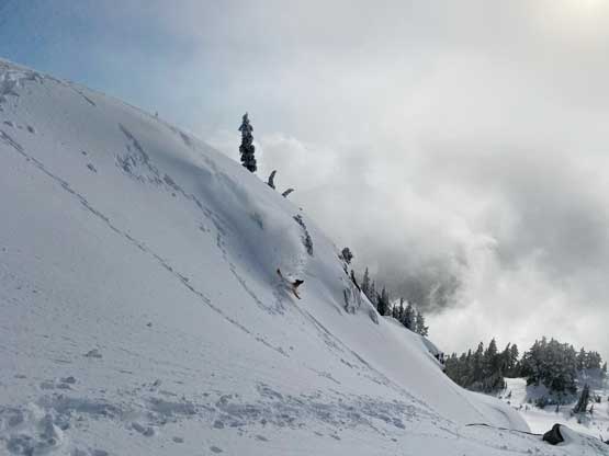
To descend the upper slopes we combined the techniques of glissading and “technical snowshoeing” and got down in no time. The lower forested slope was less fun to descend as it wasn’t steep enough to glide, but still, we made down to the logging road in a timely manner. We kept the snowshoes on until completely running out of snow and then thrashed down the overgrown sections on this spur road. We already made the decision to just descend the standard route and if the loggers were to fuck around with us we were already leaving anyway. It turned out that although the route went right next to their closed area we did not have to trespass into their work zone after all. Oddly for us, the trip was not done after descending to the truck as we must slog back up the other spur road to retrieve the bikes. Thankfully the downhill ride was fun enough to justify the extra effort.


The drive down and out of the logging road was still muddy and slippery and I would expect all FSRs to be saturated and waterlogged from the rain events. We drove right to the ferry terminal and an hour later we were able to board the 6:25 pm ride back to the mainland. I was disappointed that we didn’t go to Gibsons for dinner but then the dinner on the ferry was actually not bad.
