Mount Kent
December 19, 2013
2635m
Kananaskis – Smith Dorrien Valley, AB
After ascending King Creek Ridge on Tuesday, the nearby higher summit, Mount Kent, bumped up my “list”. It’s well documented in Nugara’s More Scrambles in the Canadian Rockies, but also briefly mentioned in his Snowshoeing in the Canadian Rockies book. The summer scramble route is very avalanche prone when loaded and folks who ascend this peak in winter usually takes one of the few routes up the southern section of Kent Ridge, and then extend the ridge-walk to the true summit. And that’s exactly what I would do.

Mt. Kent winter ascent route. GPX DL
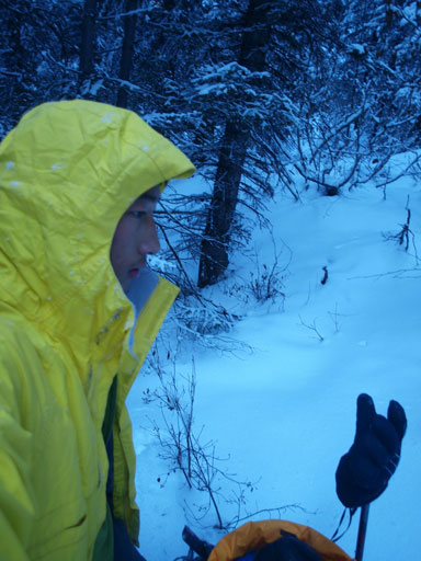
Wednesday was miserable in Canmore and about 20 cm of snow had fallen. I originally planed to ski in Sunshine but decided against it, to save some energy for the following trips. The forecast promised blue sky on Thursday so that’s the time to go. It’s a mid-week trip so not surprisingly I had to go solo again. I’d use the shortest among the three possible lines to crest Kent Ridge south, and my references were Bob Spirko’s and Golden Scramblers’ trip reports. Due to the -23 temperature I slept in Canmore’s ACC Hostel the previous night and had a good sleep. I woke up at 6:30, and after an exciting drive (Highway 40 was completely covered in snow) I arrived at the trail-head (Black Prince day-use area) at about 9am. Despite the clear sky, temperature was at the ridiculous -29 degrees.
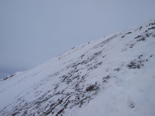
There’s really not much to say about the (first part) ascent since it’s pretty much going up a treed rib. I knew I shouldn’t go too far climber’s right otherwise I’d encounter avalanche slopes. For this reason I decided to arm with my GPS. The initial 200 vertical meters or so was easier than I thought. Despite the recent storm, there wasn’t enough snow at this elevation and the post-holing wasn’t bad. There was some light bushwhacking in alders at the lower elevation though, but nothing troublesome compared to what I’d done in the bush before. Higher up the snow got deeper and the slope got steeper and the post-holing started to get tedious. It was mostly knee to thigh deep crappy snow from about midway up to the top of “the knoll”. Just about to reach the knoll, I came across an old set of snowshoe tracks (man I wish I could find them earlier)..

Morning glow from Smith-Dorrien road
Me in the trees

There’re quite a few open slopes to ascend in the trees
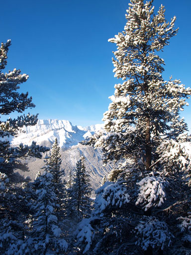
Already some nice views!
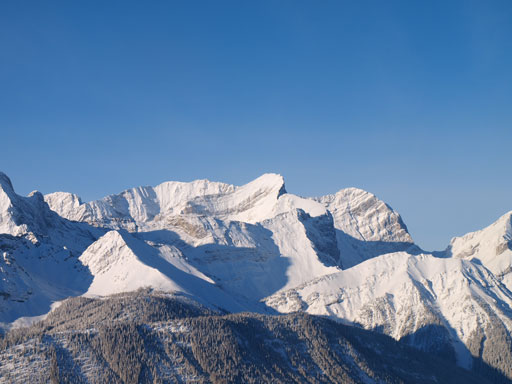
Mount Smith-Dorrien

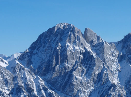
Murray and Cegnfs
This set of tracks led me up and over the knoll. The descent down the other side of this knoll was short but very steep. Up again, I kept following the snowshoe tracks for quite a while but eventually lost them. But at this point I was already pretty close to the ridge crest anyway. The view fully opened up at the ridge crest with the British Military Group and Opal Range peaks stealing the show. After seeing the rest of the ridge at the first highpoint I ditched my snowshoes. At this point I’d done the first part of this ascent.

The upper slope towards the ridge crest. The more climber’s right, the more trees.

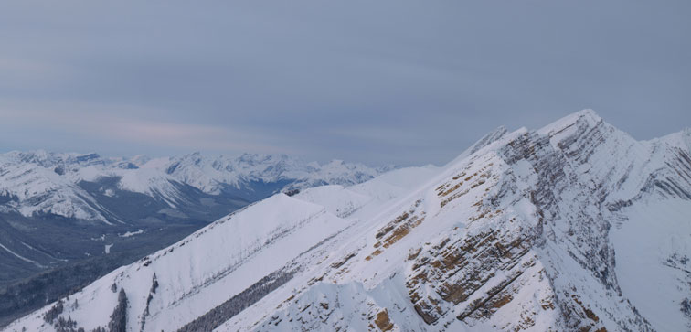
Zooming-in towards the true summit, which is on the far left

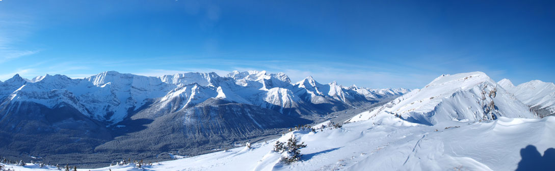
Panorama view of Smith-Dorrien valley

Near the ridge crest

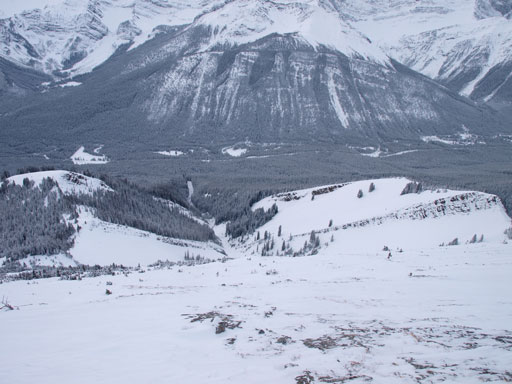
Panorama of the other side. This valley is between the long ridges of Lawson and Kent

Inflexible and Lawson

Packenham
Blane
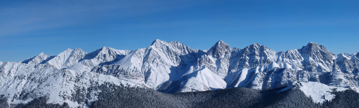
Panorama of Opal Range: Denny, Potts, Evan-Thomas, Packenham, Hood, Brock

More of Opal Range: Blane, Burney, Jerran, Elpoca, with Wintour in the foreground
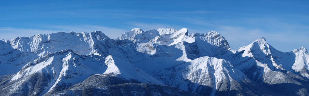
The British Military Group: Sir Douglas et al.
The second part was simply following the ridge to the summit, but it’s not as easy as it sounded. I can imagine at this part of K-Country, this ridge would be wind-blown for most of the winter, but not right after a big dump. The ridge looked to be very snowy than from Golden Scrambler’s photos. There were a couple sections that would be a simple walk on some slabs in dry condition, but I had to deal with snow covered slabs. Thankfully none of these slabs were steep and I could just gather enough traction to make through. There were also quite a few hands-on steps and occasionally I had to detour on the left side to bypass some rock pinnacles. The crux came at just before the summit. A vertical rock band blocked my way. To overcome it without climbing some near-vertical snow, I had to drop for quite a ways down to the left side to find a break. Up again, I immediatey encountered snow covered slabs again… I never thought this mountain would be this slabby, but oh well, it didn’t impose too much of an issue to me and soon I was standing on the summit. Now a layer of high clouds had rolled in and the blue sky disappered. Well, I already got the views at the lower ridge so that was okay.
Panorama from the first high-point, still a long way to go!
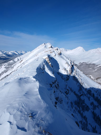
The ridge starts to get narrower
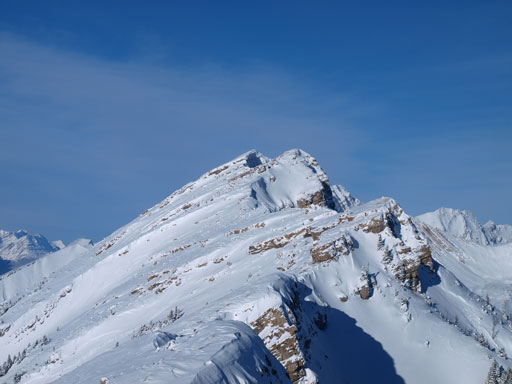
The true summit is on the far distance

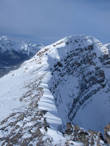
Sometimes I had to traverse left underneath some rock pinnacles
The last bit. Note that in the foreground it’s snow covered slabs, not scree..
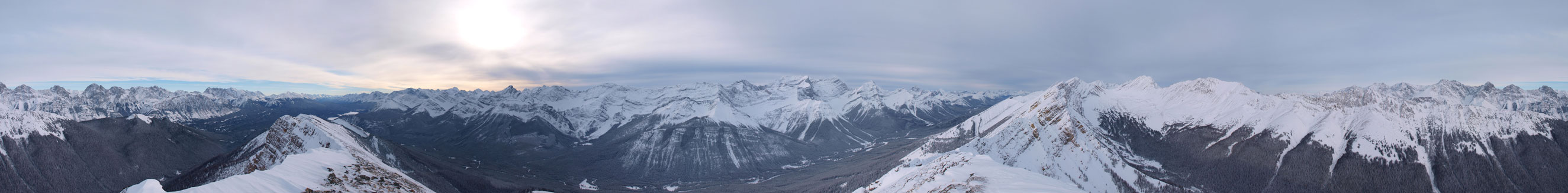
Summit Panorama. Click to view large size.
Zooming-in looking south. Kananaskis Lakes on the lower right

On the skyline you can see Joffre being the highest, also Warspite right of center
Kent Ridge North Peak is actually higher than the official summit of Mt. Kent.
With the cold temperature I didn’t linger long on the top. Going back along the ridge was much easier since I’d already made the footprints. The hardest section was descending the snow covered slabs near the summit which required lots of cautious moves. Once I picked up my snowshoes again, the rest of the way was pretty much putting one foot in front of another. Plunging-step down the unconsolidate snow was as fast as one can expect.
Descending snow covered slabs (not scree) near the summit was pretty difficult
Looking down the summer scramble route. This is not the way up in winter!

This is the crux band. The obvious snow break was near vertical and I had to descend for quite a ways to bypass this obstacle.

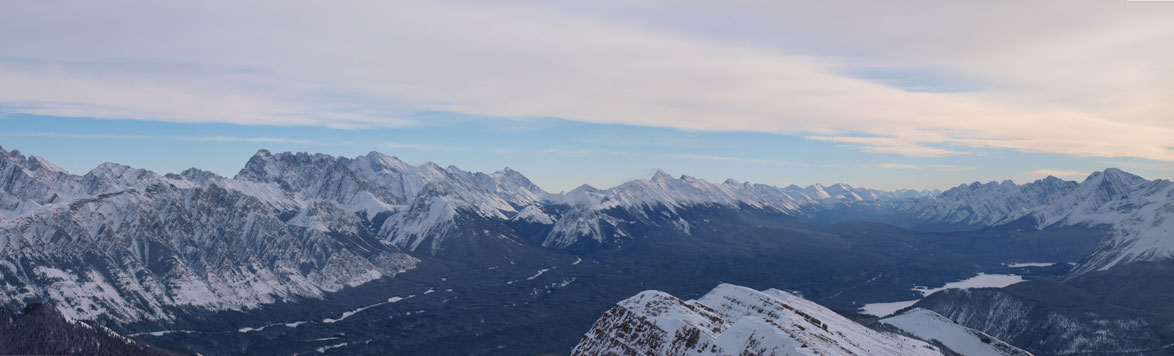
One last panorama view from this ridge

Going back was faster since I could just follow my footprints

Down the slopes now, looking at another outlier
It was shorter than expected and my round trip time was 6.75 hours. The ascent, though steep, travels in trees pretty much entire way to the ridge crest. There are still a couple spots presenting some avi potential in the trees though. The safest way would be the #1 route in Nugara’s snowshoe book, but that’ll add a couple more kilometers’ post-holing. This peak offers lots of stuffs – lots of work-out, awesome views, interesting ridge-walk and some scrambling spots. I’d recommend this trip to those of you confident on moderate scrambles in winter conditions.
