Mount Prevost
February 5, 2022
788m
Vancouver Island, BC
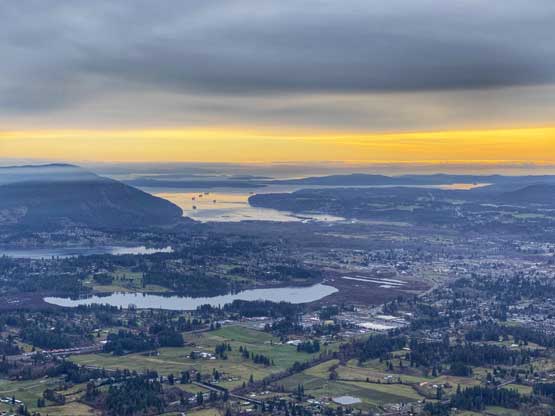
Mt. Prevost is one of those hills in the immediate vicinity of Duncan that’s slightly taller and more prominent than the others. This peak boasts exactly 600 m prominence. The elevation of the summit and the “prominence saddle” had both been surveyed and shown on the government’s topo map. There are numerous ways to tag this summit including a near-drive-up option via Mt. Prevost ML. (Mainline) to the north. The most common route for hikers is to take the trail from Drinkwater Road to the south, while the eastern flanks are better known to the mountain bikers. I eventually decided to take the road option, but by a combination of the “drive-up” and “mountain biking” methods in winter conditions.
I made the spontaneous decision to day-trip a bunch of smaller summits on Vancouver Island literally two hours before I left home. The areas without precipitation in the forecast were eastwards from Manning Park, and strangely the southern Vancouver Island. From the cost perspective to drive the Tacoma all the way to near Princeton was just as expensive as taking the Vancouver Island’s ferry rides so the decision was easily made to do the shorter drive. Instead of rushing in the morning I opted to reserve and take the 10:45 pm ferry from Tsawwassen to Duke Point. I finished work at 9 pm and spent over half an hour piling all the gears into the truck and eventually made to Tsawwassen ferry terminal with half an hour’s spare before departure. I managed to sleep intermittently on the ferry. I wasn’t sure how far I wanted to drive up the FSR but eventually it was the road condition that made my decision. I drove to 500 m elevation at Prevost/Big Sicker pass and the snow suddenly became continuous. There were icy tire tracks on the steep hill ahead but to tackle that wasn’t really an option for my Tacoma. There was a large area to park the truck and sleep a few hours.

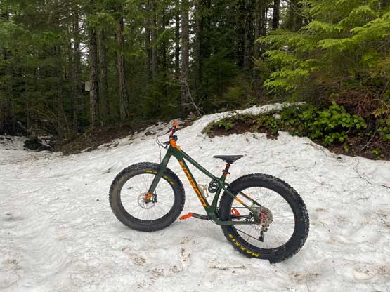
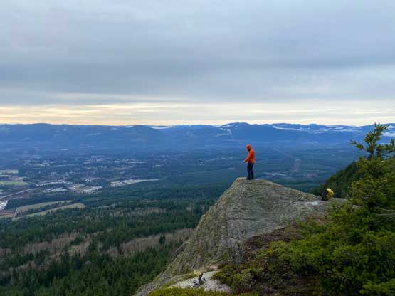
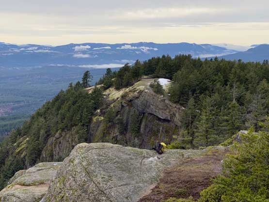
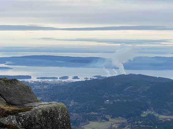
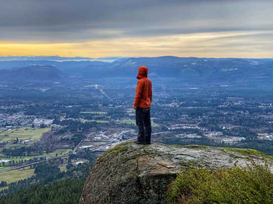
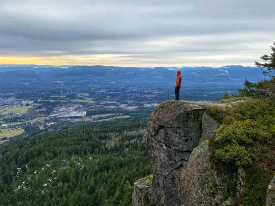
With only a few kilometers’ of biking to the summit left I didn’t have to wake up early. I decided to sleep in till whenever I wanted to get up, and that turned out to be 8 am. Half an hour later I started the pedalling and soon I had to start pushing the bike. The tire tracks were extremely icy and the grade was quite steep. I almost needed to don microspikes but I didn’t have the appeal of “using microspikes” so with some stubbornness I did manage this ascent without traction. Some parts of this road were doable by pedalling but I definitely pushed the bike for more than half of the way. Near the top the grade steepened again with more icy stretches. I could have just ditched the bike but stubbornly pushed the bike all the way to the end of the road between Mt. Prevost’s two summits. The trail to the summit (east peak) was short but very steep with a section aided by a fixed rope. The summit had lots of open bluffs with shear cliffs on the south side. I even traversed farther east to check out a few more potentially-better viewpoints and I did not regret that decision. Being alone on this entire mountain meant I really had to be patient to find spots to take those self-timed photos since the longest timer on my phone was only 10 seconds.
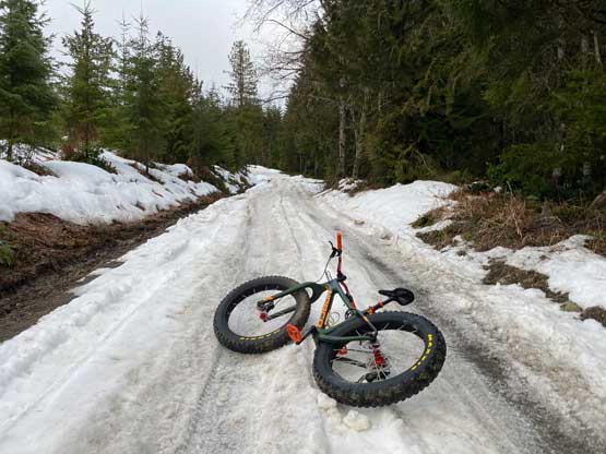


Eventually I was satisfied with the photos so it’s time to move on. I easily descended back to the bike. The downhill ride was not as difficult as I thought as I did manage to ride the entire way including some ridiculously icy and steep sections, but I did take one massive spill about halfway down. The fat bike’s traction amazed me once again, but I also learnt that on ice I absolutely had to point the wheel forward without even a slight attempt to change direction. Once back to the truck I immediately turned left to pedal uphill again, towards Big Sicker Mountain.