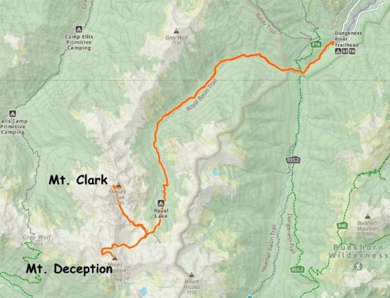
Mount Deception
June 30, 2023
2374m
Olympic National Park, WA
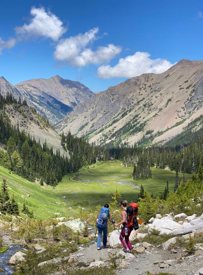
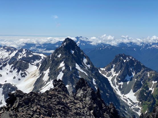
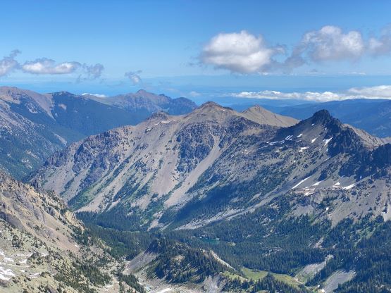
Mt. Deception is the second highest and the second most prominent peak in the entire Olympics, second only to Mt. Olympus. I had climbed Mt. Olympus back in 2017 and I wanted to come back for Mt. Deception. This one does not however have a reputation to be “fun” so I wasn’t very keen. Mel somehow discovered this peak and was extremely keen (probably because of the name), so Elise and I were eventually convinced. I did force us to camp at Royal Basin for one night so that we could bag a secondary objective namely Mt. Clark. That turned out to be an excellent decision as the scrambling on Mt. Clark was the actual highlight of this trip. Mt. Deception is just taller and more prominence and needs to be done due to the statistical significance.
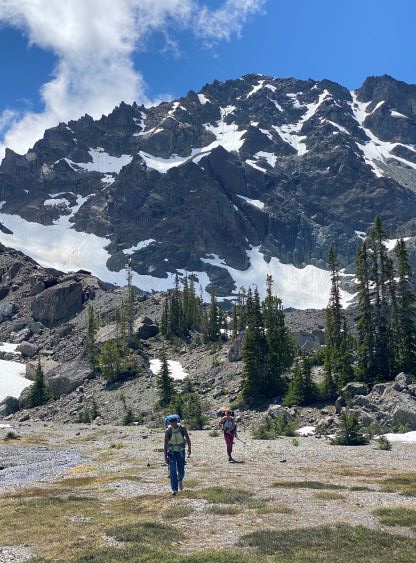
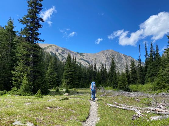
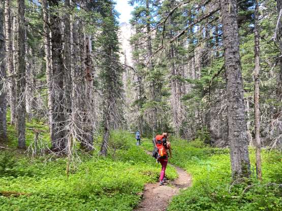
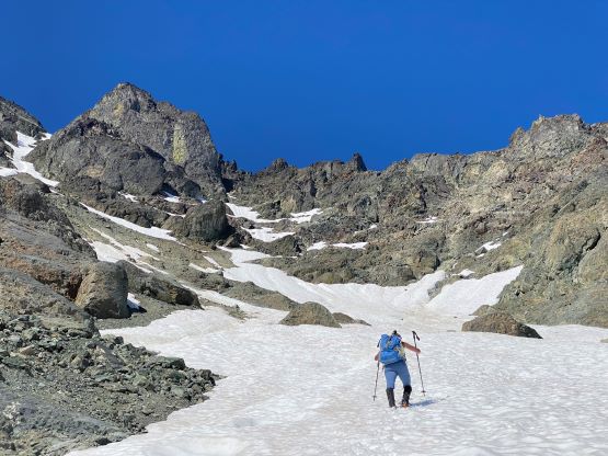
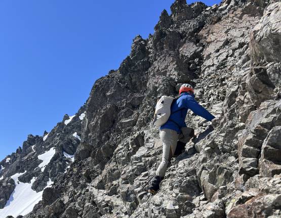
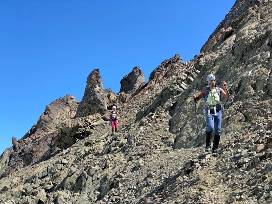
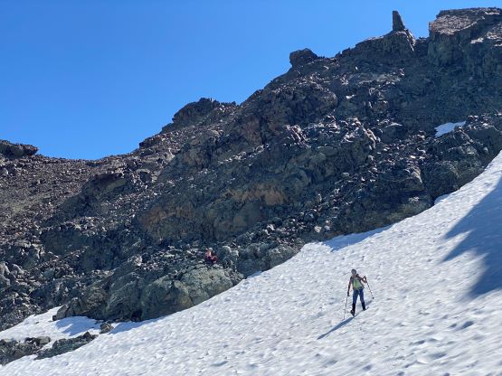
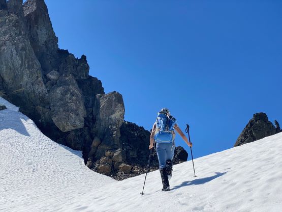
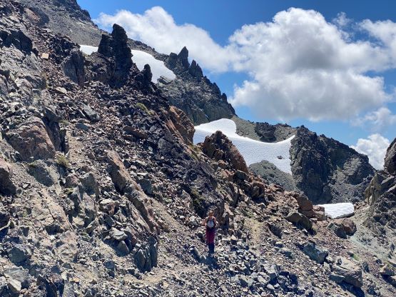
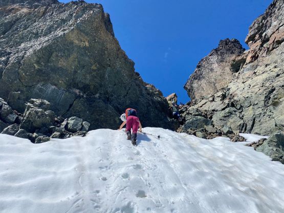
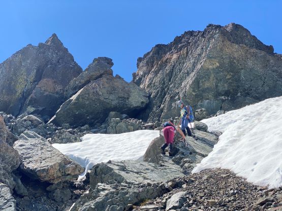
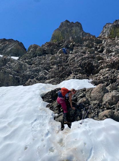
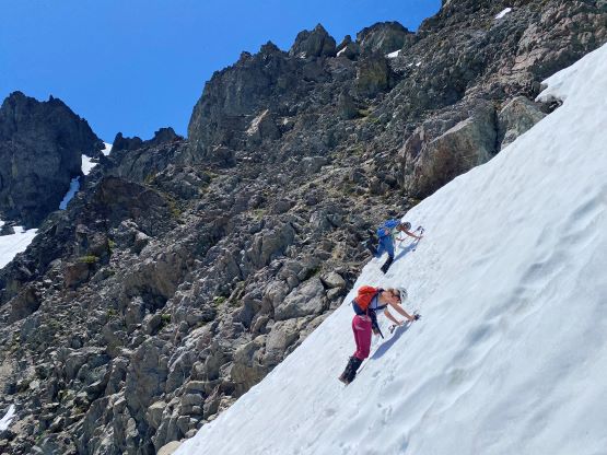
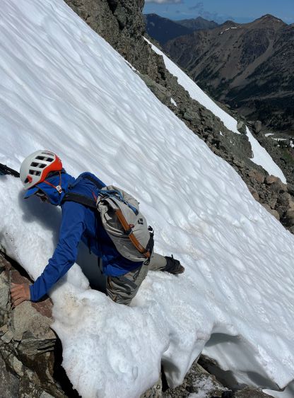
Due to the late return from Mt. Clark we didn’t sleep until 11 pm, so the decision was to sleep in till whenever we wanted. I also wanted the snow slopes on Mt. Deception to be baked in the sun for several hours so that we wouldn’t be front pointing the whole way up. I did not bring the footwear for proper front-pointing. We eventually woke up at 8:30 am and started an hour later. I was surprised that out of the 100 people camping at the lake, nobody went up Mt. Deception. The initial section was confusing thank to the random moraines and crests and we ended up not following the GPX tracks that we downloaded. Instead, we stayed on far climber’s left and found a path with minimal resistance. We also attacked the lower face on climber’s left by linking the snow fields. There’s one short transition on choss, but otherwise we managed to avoid the troublesome lower moraine slopes all together. I then made us to don crampons as the snow slope ahead would mostly like be steeper than appeared, and that was the correct call. Mel had some exceptional amount of energy, and led the step-kicking all the way to the rock transition. I then led us route-finding through the maze of choss. The micro-terrain was complicated but we managed to keep the scrambling to within class 3. We did have to cross one exposed snow slope, which could probably be avoided but we didn’t bother to search for.


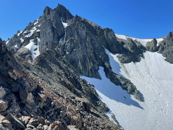
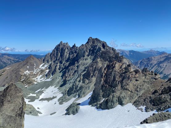
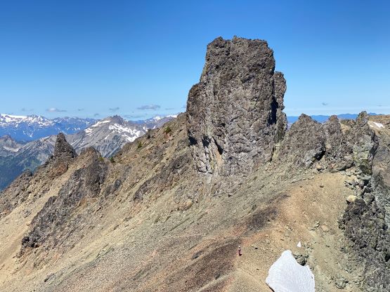
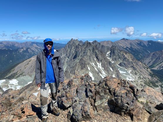
The upper section of this complicated wall terminated at a notch on Mt. Deception’s north ridge. The route to the summit from here is easy, but contrived. Instead of following the rugged north ridge we had to lose 30 m of the hard won elevation onto a small glacier. This short stretch of descending was on some horrible choss. We then traversed across the glacier to the far side of Gilhooley Tower and wrapped around to its back (south) side. I ditched my ice axe and crampons at the base of Gilhooley Tower anticipating no more snow travel, but we did have to briefly step onto snow near the summit. The slope angle was thankfully mellow enough that no traction device was needed. The final stretch to the summit via NW slopes felt like eternity as we were all very tired and demotivated by this point. I eventually dragged my tired self to the highest point and we sat there for almost an hour to regain strength.
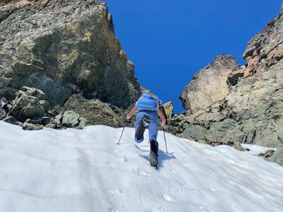


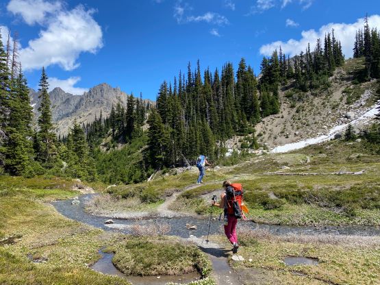
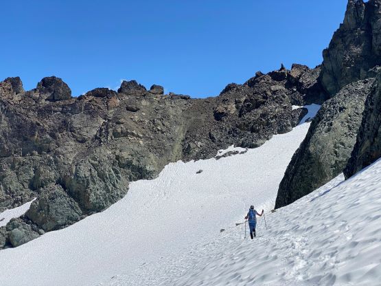
After eating three sandwiches I finally had enough energy to descend, and the decision was to make a single push dashing down to the camp without stopping for food/water and we did succeed on that. Descending that chossy section of the east-facing wall required a lot of caution due to rockfall hazards. There were a few interesting spots that we ascended and we opted to just down-climb the exact same route we took, as this way we didn’t have to use too much of our brains. A few of those short little down-climbs were stiff 3rd class but not a problem for us. To descend the steep snow we still needed crampons and I opted to take the ice axe out for added safety. About halfway down we stored the traction devices and went for some boot skiing and glissading. I didn’t glissade the whole way down as I didn’t want to rip my pants off. To get back to camp we also returned the exact same way as we came in.


We had packed most of the camping gears prior to leaving for Mt. Deception so we didn’t have a ton of work to do upon returning. Mel then led the blistering pace down the trail and I was impressed by how much energy she still had, given that this was the first backcountry camping trip for her. The trail pace was faster than I would ever wanted to do, but I managed to keep up for 10 km, jogging most of the way with maximum speed recorded by Gaia app over 15 km/h. I eventually gave up on jogging as I still had 4 sandwiches in the pack and I was feeling hungry. I stopped at a stream and took a 20 minutes break eating 3 of the 4 sandwiches, and then plodded the final few kilometers back at a more-comfortable “Vlad’s pace”. The girls had already finished changing but I’m also fast on the trail-head transitions so didn’t make them to wait for too long. I then drove us straight to Kingston-Edmonds ferry and we got on the 7 pm ride with only one sail delay. While waiting we went out for dinner, and eventually got back to White Rock at 10 pm.