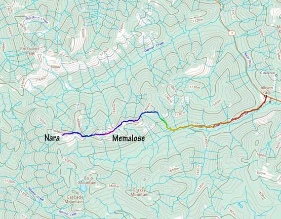
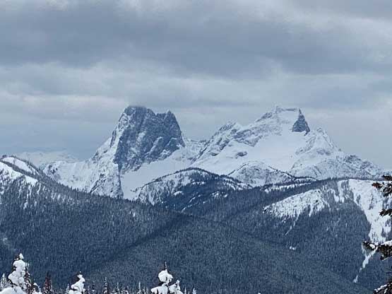
Memaloose Peak and “Nara Peak”
March 12, 2023
1945m
Manning Provincial Park, BC
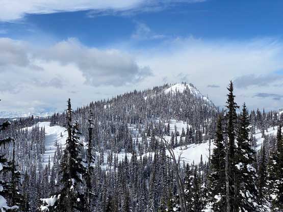
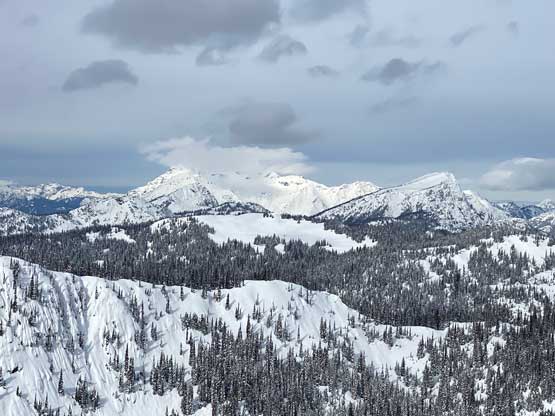
These two peaks in Manning Park are better done in winter. “Memaloose Peak” is the highest summit in the headwaters of Memaloose Creek. Despite the unofficial status this is a very legit summit with 300 m prominence that also offers a 360-degree panoramic view on a clear day, and because of that this peak has gained some popularity over the past few years. “Nara Peak” however, is an unofficially-named forested bump on the west ridge extension of “Memaloose Peak”. According to bivouac.com the name “Nara” was derived from a city of Japan. I absolutely have no idea how this area is related to Japan so I don’t like this name. “Nara Peak” does boast over 100 m prominence so I do consider it as an independent summit, although I’m fairly certain that only the stubborn peak-baggers would consider the out-and-back extension to “Nara Peak” after making the already-long slog to “Memaloose Peak”.
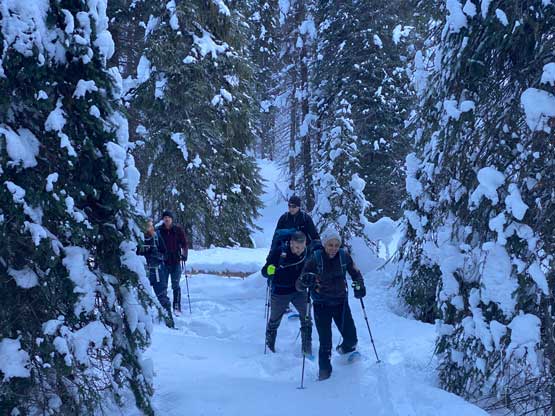
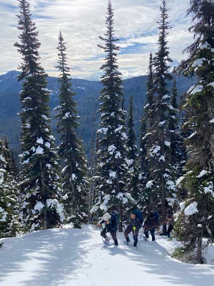
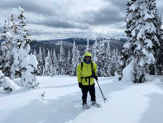
Despite the 20-km distance these two peaks are safe from avalanche concern, and does not boast any technical challenge whatsoever, so this outing is rather just a very strenuous winter “hike”. It’s easy to form a large group. At the last minute it was Nikita, myself, Raphael, Vlad, Mark D., Matt L. and Sean P. heading out in two trucks. We grouped in Abbotsford at 6:30 am and made to the trail-head at Allison Pass at 8 am. Thank to the time change we lost one hour of sleep so 8 am on this day was more like 7 am. I anticipated the horrendous trail-breaking that we had been experiencing recently would resume, so I brought my 30′ snowshoes.
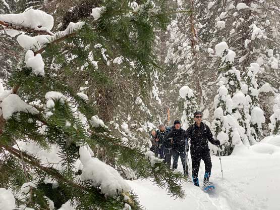
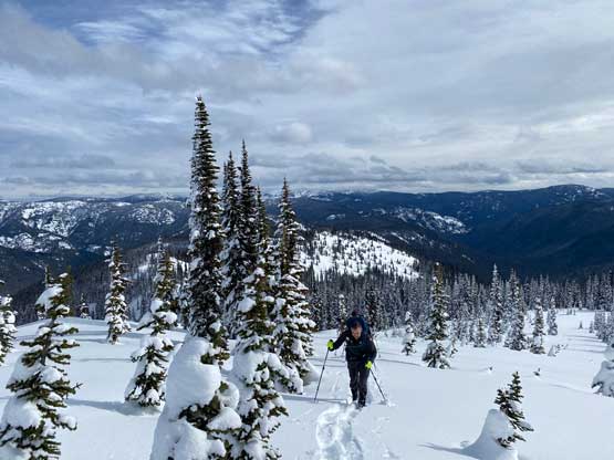
The forecast was calling for clear skies in the morning but increasing clouds with flurries later in the day. Raphael was setting a blistering pace right from the start but I wasn’t sure if he was racing against the weather or just wanted to be quick. A kilometer or two later about 1/3 of the way into this Memaloose Creek approach the trench made by previous parties disappeared so we were on our own trail-breaking from the early stage. This was not as expected. Matt L. and I took over the lead once the trail-breaking began. There was a faint track and some flagging tapes to follow but the trail wasn’t very obvious at places. We ended up losing the trail but regained it quickly after some cross-country travel. There was also a lot of micro-terrain in the valley with up-and-downs that would become annoying later.

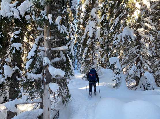
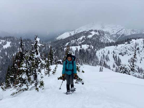
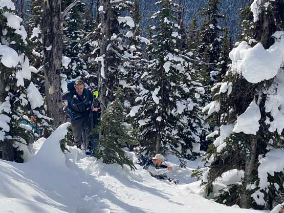
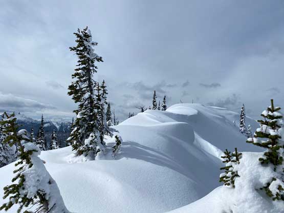
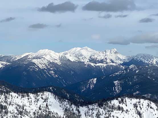
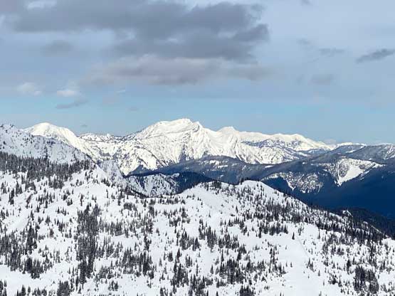
The next stage was a straight-up grunt onto the east ridge system of “Memaloose Peak” while gaining close to 400 m elevation. The slope angle wasn’t ridiculously steep but the snow condition was brutal. A combination of the bottomless sugar and a breakable crust meant the 30′ snowshoes were essentially “critical” for the job. Near the ridge top I opted to ignore the downloaded GPX tracks and led us traversing leftwards across some open slopes. The purpose was to bypass the first bump and the associated unnecessary elevation gain/loss/regain. We then mostly followed the broad and forested ridge crest plodding towards Memaloose Peak but we also did some side-hilling on the steeper south side slopes. On one occasion a few of us heard a large “whump” but the slope wasn’t steep enough to let loose. The avalanche forecast was “M/L/L” on this day and our zone should be considered as treeline, so that “whump” was quite surprising. We then regained the ridge and made the undulating plod to the summit of Memaloose Peak. A few minutes after arriving the sky had turned completely overcast so we timed it reasonably well.
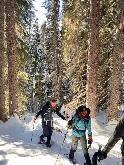


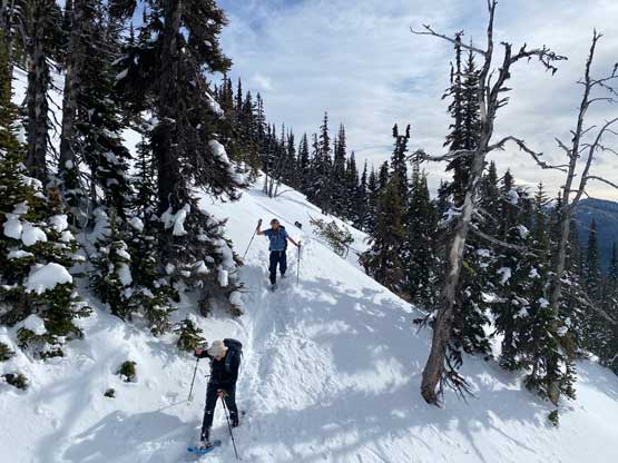


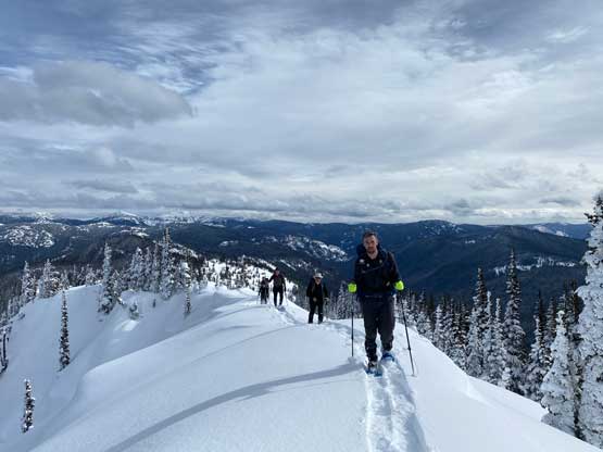

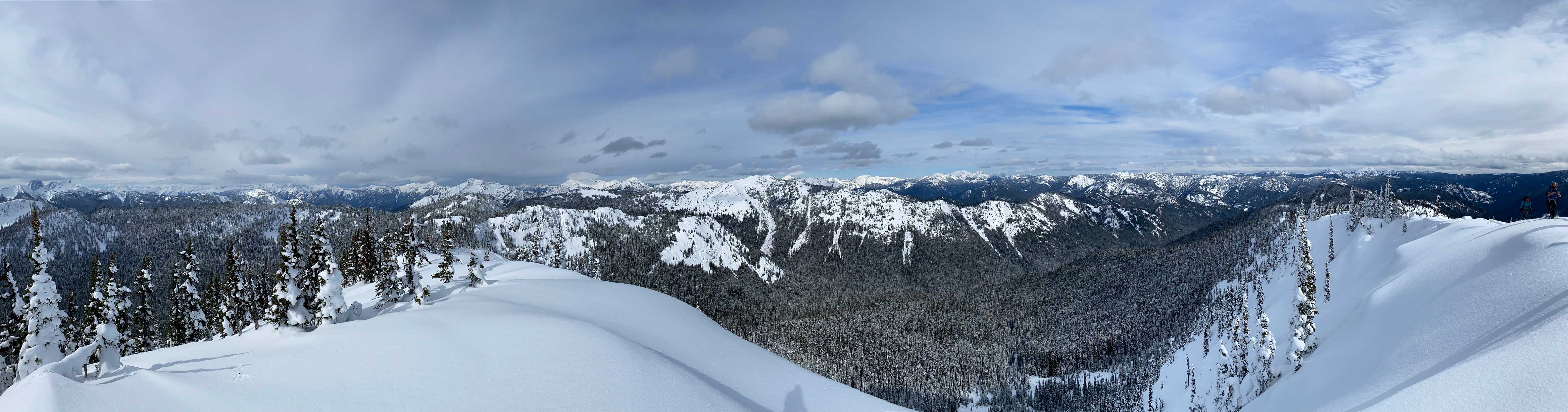

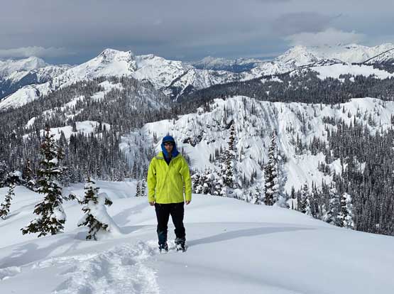

Since all 7 of us here are the stubborn peak-baggers we must carry on to “Nara Peak” despite the uninspiring forested nature of that bump. Matt and Mark led us plunging down the steep east ridge of Memaloose Peak and I carried on, leading us plunging down into the forested Memaloose/Nara saddle. By this point we had lost close to 150 m elevation and this must be regained an hour later. The plod to the summit of “Nara Peak” from the saddle involved more micro-terrain, route-finding and up-and-downs but I tried hard to minimize the undulating nature of this section, wherever applicable. We bypassed the two high points on the connecting ridge and then easily slogged to the forested summit of “Nara Peak”. There’s a micro viewpoint slightly farther to the west, but it wasn’t super worthwhile.


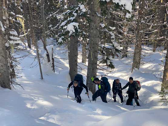
We did take another lengthy break on the summit of “Nara Peak” but we couldn’t see anything so we might as well started the plod back to “Memaloose Peak” to take the next break. The elevation regain was definitely annoying but it wasn’t too bad. The weather had completely collapsed by the time we got back to “Memaloose Peak”. The flurries had began so we might well descend to Memaloose Creek to take the next break there. The horrible snow condition made the down-hill snowshoeing fairly heavy and strenuous. The rest of us (without the 30′ snowshoes) would basically post-hole down to the ground as soon as stepping out of the tracks. I, on the other hand, was mostly able to plunge down the soft, untracked snow but I did also need to be extra careful. The flurries had turned into the snow blizzard by the time we all descended into the creek and the final 5+ km of slog back to the parking lot was boring and tedious. Our round trip time was just over 7 hours. Later at home I realized that we got hit by an “atmospheric river” there…