Daybreak Peak
May 17, 2013
2420m
Jasper – North Boundary Trail, AB
May long weekend usually marks the wrapping-up of ski/snowshoe season and the start of summer scrambling. It’s in the what’s so called shoulder season. It was very difficult to come up with a suitable objective. Long story short, after 100 emails back and forth, it was Eric, Ben, and myself planning an ambitious 4-day traverse, starting at Rock Lake and extending deeply into Willmore Wilderness, in the middle of nowhere. At the last minute, we changed our plan briefly. We decided to do a day trip up Daybreak Peak (the closest official summit, lies on the northern boundary of Jasper N. Park) to scout out the condition, and then a 3-day trip up Mt. Persimmon following. We had no clue how dry (or how snowy) was in Willmore. We didn’t want to bring extra snow gears if we didn’t need to, but we also didn’t want to fail due to not bringing some essential gears. Therefore a “short” day trip on Friday seemed to be the best plan.
Eric and Ben would prefer leaving Edmonton very early (3AM) Friday morning. I honestly prefer leaving at Thursday night since then I would have some sleep. But I’m fine either way. Ben had just been to Rock Lake a week ago, and he kept mentioning the roughness of the last few kilometers. We were lucky on this day though since the road was apparently just maintained, and it was no worse than Smith Dorrien all the way to trail-head.
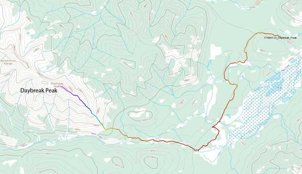
Daybreak Peak scramble route. GPX DL
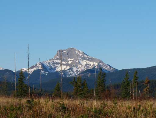
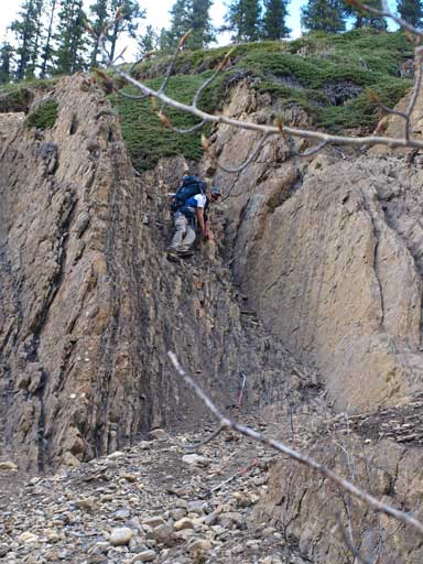
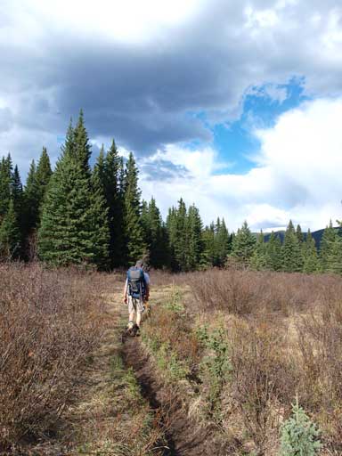
The approach was needless to say, long and boring. After ascending a short hill, we were constantly losing elevation on a wide trail all the way towards Jasper Park boundary. There were a couple nice viewpoints though, and we got some good morning shots of The Rajah. That would be an exciting scramble only if the Snake Indian River is fordable. After a long slog on the trail, we lost it in a meadow area. It was more like a marsh land that I had to take off my boots briefly in order not to wet them too early in the day. Eric and Ben were wearing mountaineering boots and they just walked through the wetland. I also lost them briefly since they were way ahead of me, but thankfully I catched them up not far up on the other side and we quickly regained the trail. The trail eventually led us to Rock Creek, where we finally could get a unobstructed view of Daybreak Peak, which was still, apparently far away.
An unnamed peak north of Kephala, seen from the drive in

A zoomed-in view of The Rajah, from partway through the approach trail

More about this viewpoint
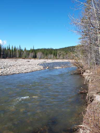
Now we’d made to Rock Creek. It’s more like a river though.

Eric hiking towards our objective in the distance

Daybreak Peak and Rock Creek

We would soon start bushwhacking.
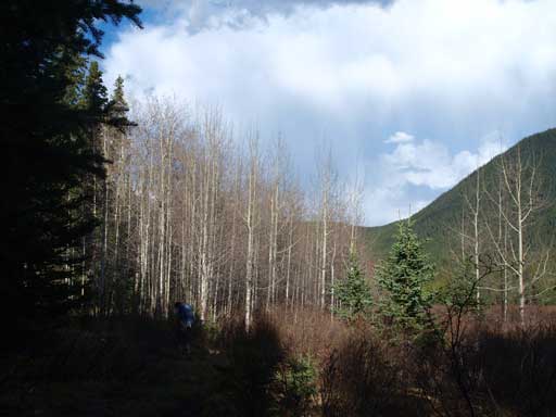
At this point, we were very optimistic about the bushwhacking in the next few kilometers, since the creek (more like a river though) has very wide banks that provide easy travelling. It was more like a Canmore styled bushwhacking, rather than the Jasper styled. However, the good part was short lived and we were soon forced to enter thick bushes. We decided to just leave the creek bank and headed into the forest. In retrospect we did make a good call. We got better bush in the forest, but we had to deal with constant up-and-downs. It was very frustrating, but what we could do when we couldn’t see where we were aiming at? We kept traversing climber’s left, resisting gaining elevation too quickly. But still, we came to a deep trench that we had no choice but dropping down to its bottom and climbing up the other side. The bush was also thick and the slope was steep. Thankfully there wasn’t that much bush to negotiate after this bit. We found game trails here and there and followed them upwards and eventually reached treeline, where we finally got a nice view of the nearby mountains that none of us had set our eyes on before. There are just so many good mountains in Jasper and Willmore, and they definitely deserve names.

Bushwhacking down a steep forested slope

Scrambling in the bush

Me doing the same step. Photo by Ben Nearingburg

Panorama view from treeline

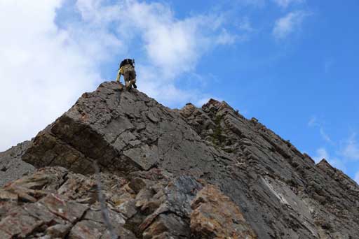
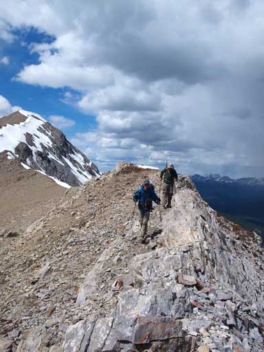
Eric and Ben scrambling up the rib
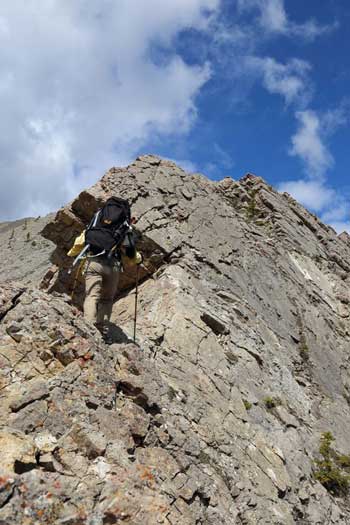
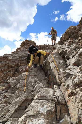
Oh by the way, the mosquitoes were out. We couldn’t take a break near treeline since the bugs were fierce. We kept slogging up the ridge and soon entered some scrambling terrain. From here on it was basically following the ridge crest up, with a couple detours on climber’s right side. At the first significantly exposed section, I went straight up and over it. It was manageable but very dicey. After that bit I decided to go for the easiest line for the rest of the ascent. The views were also constantly improving with more and more rarely seen peaks showing up. It took us a long time to the false summit. There was a big cairn on this false summit. We once thought it was the summit, but after a quick check on Ben’s GPS, we realized that the summit was still almost 1km away. The connecting ridge was straightforward and we soon stood on the summit. There was no cairn nor register, so we built one and placed the new register that Ben had brought up. The summit itself is on the Jasper Park/Willmore Wilderness boundary, the ascent ridge is in Jasper Park, but the approach is from Willmore. We immediately focused on the next objective, an unofficially named peak, Highbreak Peak. It would be two bumps further down the ridge, but to get there apparently requires a ton of elevation loss and regain, plus an interesting slabby section up towards the first bump. We couldn’t tell if that’s a scramble or not. None of us brought climb shoes up, plus we were pretty tired and it was just the first day of a planned 4-day trip, so we decided to give Highbreak a miss.

Ben taking a break

Me hiking up the typical terrain. Photo by Ben N
Me studying the direct line up the challenging bit. Photo by Ben N
Me challenging up the direct slab route. Photo by Ben N
After that bit we bypassed all the difficulties on climber’s right.

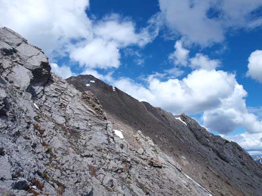
The false summit ahead
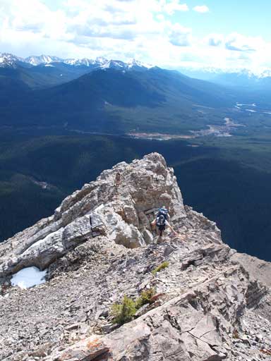
Still some scrambling

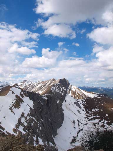
The true summit seen from false peak
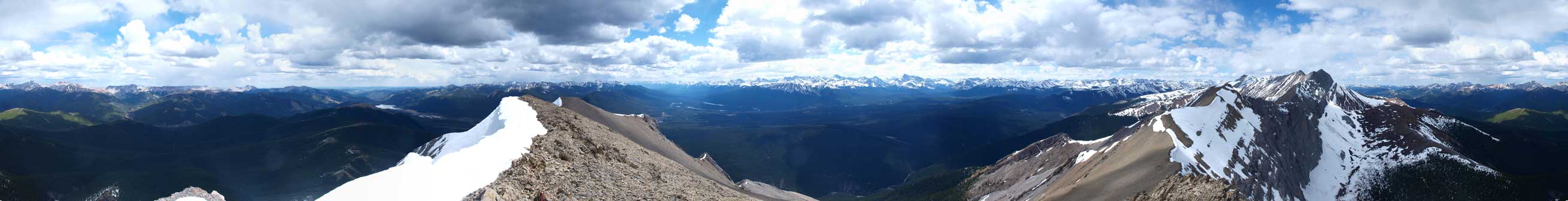
Summit Panorama. Click to view large size.
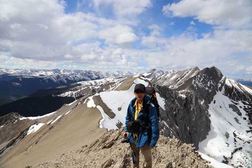
Me on the summit. Photo by Ben N

Me soaking in the views. Photo by Ben N

Mount Robson

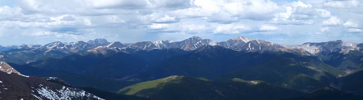
Panorama of peaks in the Northern Jasper

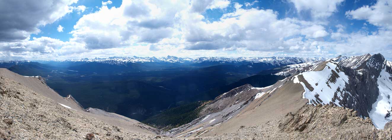
Snake Indian River Valley, and peaks in Boule Range on left
The group of front range peaks.
Another panorama towards the mountain side.
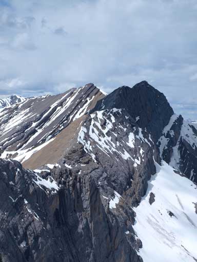
The route up Highbreak Peak (the higher peak in the back) looks long and difficult

The clouds did make some great views
We placed a new register here.
More great view towards Highbreak Peak

Panorama of Starlight Range and more remote peaks behind
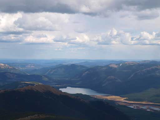
Rock Lake was where we started the day.
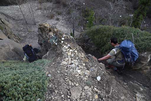
On the way down we bypassed all of the difficult bits including the slab that I went up, on skier’s left side. We took advantage of the scree/open slope further down and went almost all the way down to Rock Creek. A short bushwhacking brought us down to creek bank. Wow, that was fast. But oh well, guess we actually chose a slower way back. The creek, or I should say, the river, was raging and there was no way to jump across it. It wasn’t even fordable. We had to stay on the left side, but the bank got dangerously narrow at places and we were forced to sidehill on steep terrain, where a slip would wet us completely. At other places we had to bushwhack through some dense vegetation. At one point we got enough of these and bailed the bank and went up into the forest, but soon we found ourselves being too high and we had to drop down… However, we did get some interesting hands-on scrambling while down-climbing a tight and loose chimney. It felt like forever to get back to where we’d left the creek bed in the morning. And it was such a relief to see our footprints that we’d left in the morning.
Ben and Eric hiking down the ridge
A bit of scrambling. Photo by Ben N

The Rajah

Another look towards Rock Lake
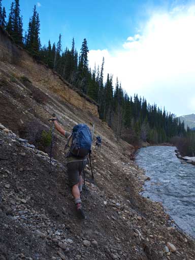
The riverside wasn’t easy at all

Exposed and loose terrain above the river

Me scrambling through a challenging part. Photo by Ben N
Eric and I took different lines down a tight and loose section. Photo by Ben N
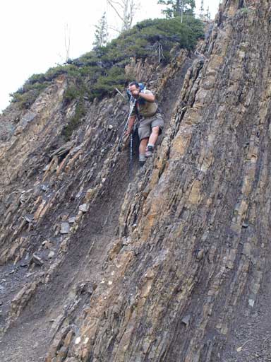
Eric down-climbing the chimney
Ben down-climbing another chimney. Both are steep and loose
Finally back to the trail.
Gorgeous views
More views
Eventually we made back to the parking lot (staging area).

Ben and his car.
We took numerous breaks in the next kilometer or so and refilled our water bottles. Our peak was getting farther and farther away, which was very good. Once we made back to the trail, it was merely a walk, but a long slog, back to our car. At the wetland, I, again, took off my boots to prevent them getting wet. I still planed to use them for the next couple days though. Now after that bit, we started to feel the elevation loss that we’d done in the morning, because we were constantly going uphill for a long time. The forecasted rain finally got to us. It was actually a hail storm, quite heavy though. We quickly got soaked. Thankfully it was relatively short lived. More and more slog, we eventually made back, and our round trip time was 12.5 hours on a fast pace. Based on what we’d just experienced and our energy level, we bailed the Mount Persimmon plan and drove to Hinton for some greasy burgers, and we would decide what we should do the next day.
