Windfall Peak
December 24-25, 2016
2472m
Van Horlick / Duffey Lake Road, BC
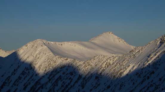
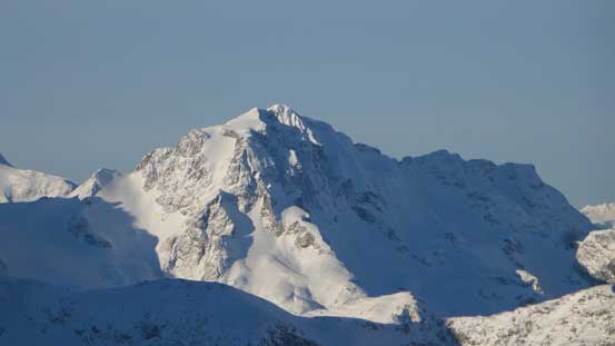
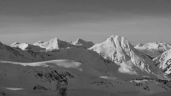
“Windfall Peak” is a name obtained from bivouac.com, referring to a fairly sizable peak sandwiched between the Van Horlick and Blowdown Creeks from Duffey Lake Road. Despite the unofficial status, this peak dwarfs the nearby classic Steep Creek area to the north and offers some outstanding views. I have friends who did it as a ridge-walking traverse from Steep Peak and the same route looks fairly reasonable even in winter conditions, but having just ascended Steep Peak in the previous week I wasn’t keen on that. I wanted to make Windfall Peak a completely separate ascent to justify visiting this area twice in a roll. By simply looking at the topographic maps the most obvious approach option is via the hanging valley south of Steep Peak from Van Horlick drainage, but thank to the very last-minute decision I didn’t do any research on it and I underestimated the bushwhacking effort required.
The weather was supposed to be gorgeous and I somehow managed to shift things around to get a 2-day time frame in this past Christmas long weekend. The downside was the conditions given the reported “above average” trail-breaking effort so with me myself doing all of the work I couldn’t plan anything too outrageous. Loading up some overnight gears I left home around 9 pm Friday evening and made to Pemberton past midnight, then up the snowy Duffey Lake Road and then parked my Jeep at the start of Van Horlick FSR. On hindsight I should have driven 6 km up this road but not having chains or anything like that I didn’t want to risk it. The next morning I didn’t wake up until 9 am, figured I should have plenty of time making to the basecamp given the relatively short approach.
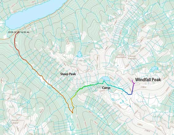
Windfall Peak ascent route. GPX DL
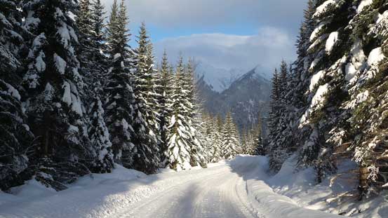
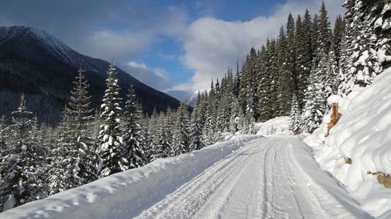
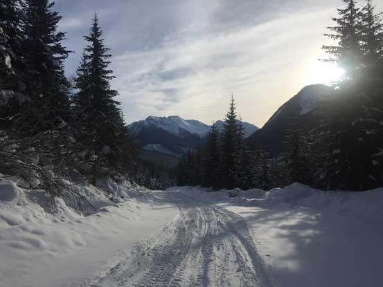
The initial business was walking 6 km up Van Horlick Creek FSR. At time I did not know what exactly to expect but apparently hordes and hordes of 4x4ers and snowmobilers drive up this road way into the valley. That had made my life much easier than anticipated and time flee by fast. In less than 1.5 hours I made to the junction where I was supposed to leave the main road and go up the side road, also known as Pushiki Trail. Snowshoes on and up I went and it turned out that even this side road was heavily travelled by snowmobilers. No complaint on that and at the first major switchback it’s time to leave the packed trail and start the bushwhacking game.
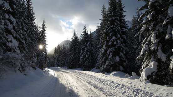
The typical plod up Van Horlick FSR
For a total of 6 km of this.
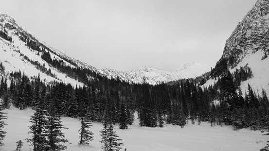
More about the typical view from this road
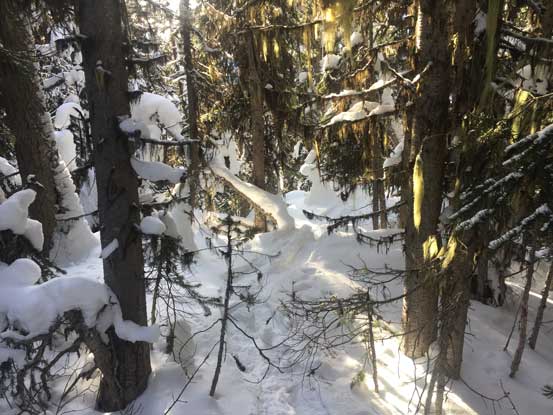
The next stage was the most experimental and apart from “it might get pretty bushy” I didn’t know what else to expect. Right off the bat I had to bash my way up a dense band of alders followed by some tight timbers on increasingly steep terrain. At the same time the trail-breaking was horrendous – knee deep on average and not to mention some weak spots that I sank to waist deep. There were lots of fresh snow on the trees too and every time I touched a branch there gotta be a ton of snow fallen, and in no time I got soaked through from inside to outside. Higher up I came across a few more deactivated logging roads all tangled with alders, and in between was the tight secondary growth forest. My progress was painfully slow and for more than one time I was questioning why the hack I would put myself into this… But I was in the game already so I had to keep going no matter how miserable this would get.
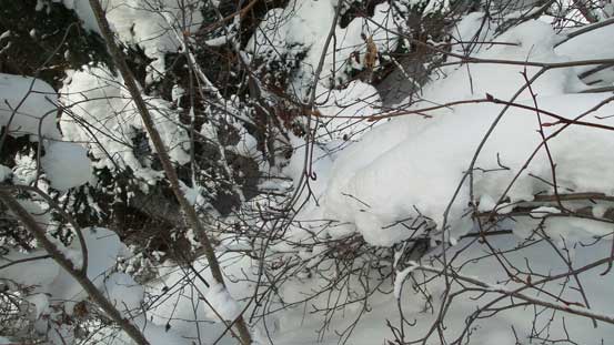
Let’s deal with this tangled mess…
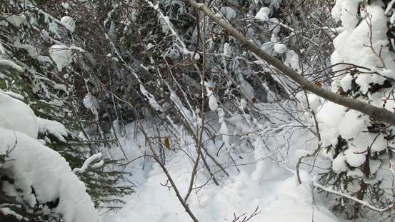
Powering it through…
Heavy duty trail-breaking at the same time…
At one point it seemed like the grade had eased off a bit and I followed the terrain traversing towards climber’s left side, overcoming more alders and aiming for the main creek, but once making there I was disappointed to see the creek was impossible to follow. It had steep walls on both sides and the creek bed wasn’t completely covered, so more bushwhacking up the climber’s right side and eventually at one reasonable spot I crossed the creek to the left side. The bush did get better as now I had made the transition from the logged secondary growth forest to the old growth, but still the path wasn’t easy. Lots of careful route-finding was still required. Eventually after a few hours of struggling I made to the first flat meadow area and could finally see the route ahead.
Finally managed to cross the creek and into the old growth forest
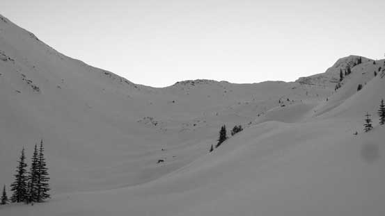
The first meadow area, looking ahead.
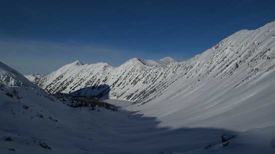
A mandatory food break was taken but it got cold in no time thank to the wet clothing. Two of the bolts on my right snowshoe’s binding also got ripped off but I did manage to fix them using the screws that I brought up. Quickly resuming the approach I initially took a straight beeline forward but the terrain somehow guided me towards climber’s right side. I crossed the main creek and then ascended gradually into the upper draw, followed by a long side-hill diagonal traverse cutting across a big slope on again, the climber’s right side. Ahead was a headfall feature and the route I took had dumped me way to the right of the lake’s outflow so once cresting the lip I was at least 50 vertical meters above the lake. Not wanting to lose the hard won elevation I kept that side-hill traversing mode and eventually at the last trees I dropped the pack. Gears out I had about 20 minutes to set up the camp before dark.
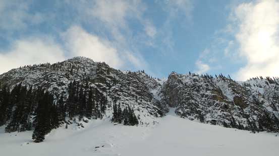
The route traverses underneath this impressive north face of an unnamed peak
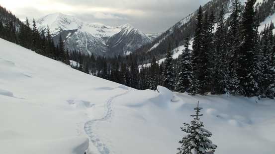
Looking back at my tracks into the upper draw
Ahead would be that headwall. I opted to cut a long side-hill traverse to save some elevation loss
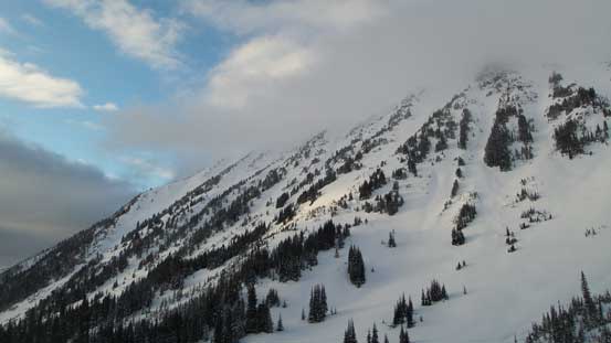
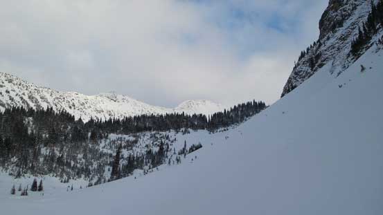
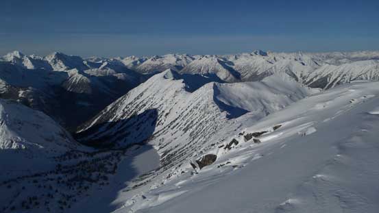
The south slopes of Steep Peak
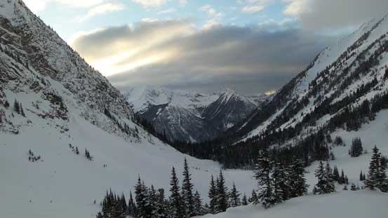
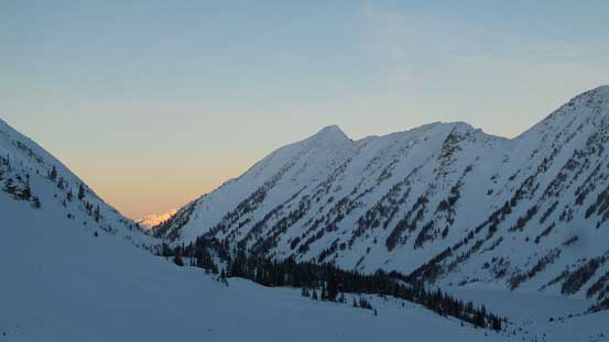
Looking back down the valley. Mt. Caspar behind
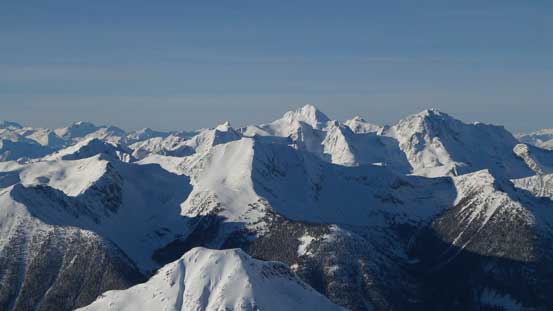
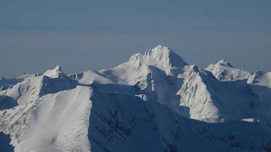
Finally had my objective in sight after struggling for many hours

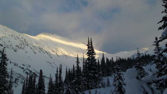
Started to see some evening colours now.
Setting up camp was fairly fluent but then killing time through that 16-hour night was quite a different game. I firstly took a nap, woke up about 2 hours later and spent some time cooking dinner and melting snow. It’s 8 pm now, 12 more hours to kill and the problem was, I could no longer fall asleep that easily after taking a nap. Thankfully I did come prepared loading my iPhone with lots of Hebe Tien’s clips and musics. I also brought a battery pack in case I needed to charge something. Towards dawn the sky had cleared up, temperature had dipped down significantly and condensation had gone crazy in the way that as long as I touched the tent’s wall it’d snow on me. I was shivering even wearing all layers (including the “storm degree parka”) inside my -20 bag. About 1 hour before sunrise I figured I’ve had enough of this so up I went. Fighting coldness was difficult and putting in the frozen boots was even more difficult but I had to do so no matter what. What a miserable way to start a Christmas day…
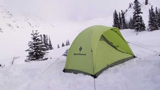
This is where I spent the Christmas Eve
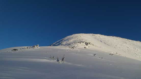
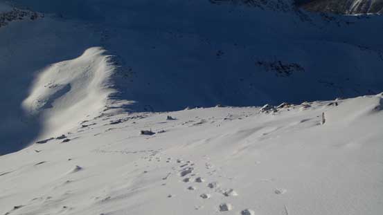
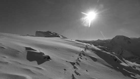
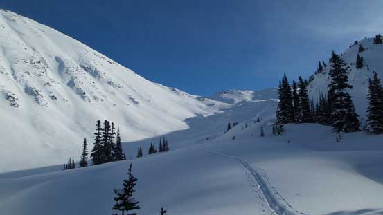
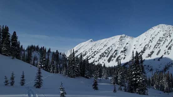
I managed to get going when it’s already bright enough to not require head-lamp. From the last trees my initial business was side-hilling and dropping into the valley which would eventually lead me up to Windfall/Silent Hub NW3 col. It looked like a fair amount of elevation loss was involved but actually not much at all. Plodding up the valley was straightforward and the trail-breaking condition finally improved probably because I’d now merged into the alpine zone. Ascending to the col was easy with nothing too overly steep, and then turning left up the south slopes of Windfall Peak the terrain had become primarily shallow and wind-blown. The snowshoes were ditched soon and a long and foreshortened boot-packing slog would soon begin.
Starting the summit push now, looking ahead to the valley
Looking back, it’s alpenglow time, but I was too low to see the fire going on…
Cresting the col between Windfall Peak and Silent Hub NW3, looking ahead
Cayoosh Mountain
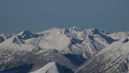
Peak 2318 in Steep Creek area
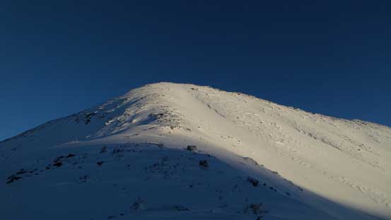
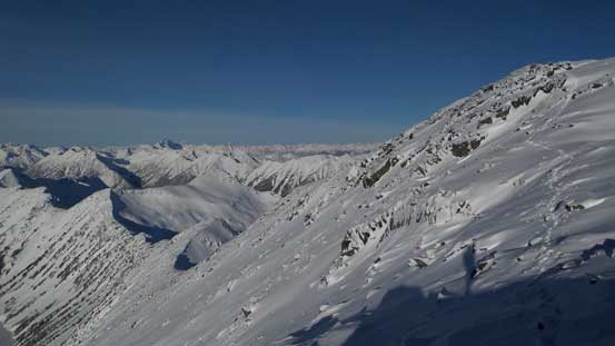
This is the typical terrain on the south ridge of Windfall Peak.
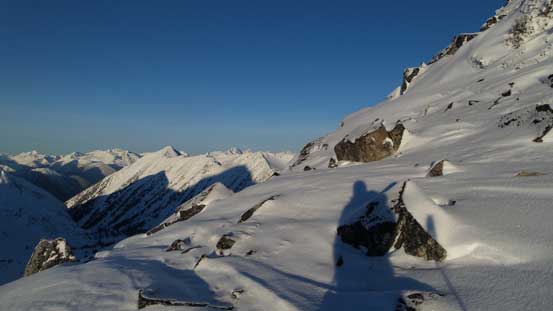
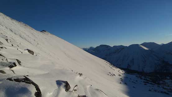
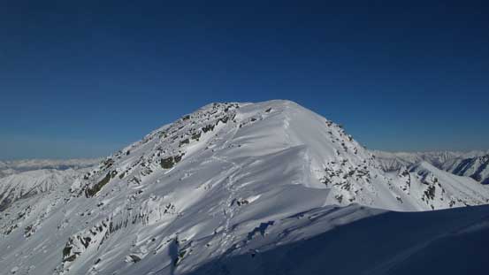
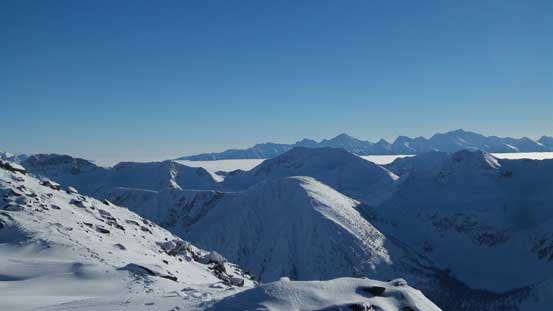
There’s not much to document about the plod up Windfall Peak’s broad south ridge other than perseverance and patience. It looked like very close but actually very far away. Once hitting the summit ridge I turned right first to check out a minor bump before turning my attention for the true summit. The final traverse involved a narrow spot with some massive cornices to be careful about, but nothing overly tricky. To my surprise the summit was actually not very windy so I spent about half an hour up there soaking in the views.
The terrain was more like the Rockies – windblown and shallow
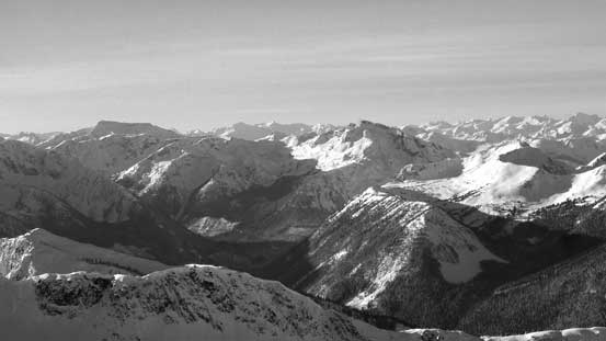
Looking across the south-east slopes
Joffre Peak looks magnificent

Snowspider Mountain
Looking down at the south ridge slopes. Nothing fancier than this.

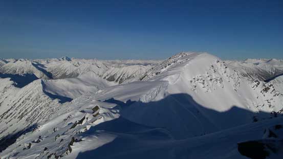
Almost on the summit ridge now
I firstly went to check a false summit bump
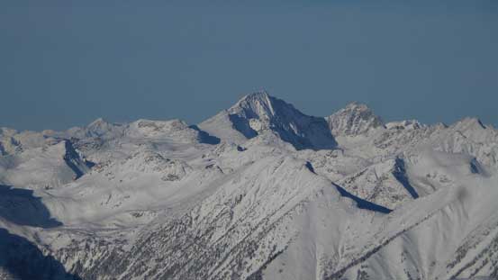
Siwhe Mountain looms impressively behind Stein Valley
The traverse to the true summit
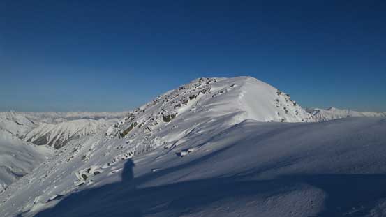
The final push
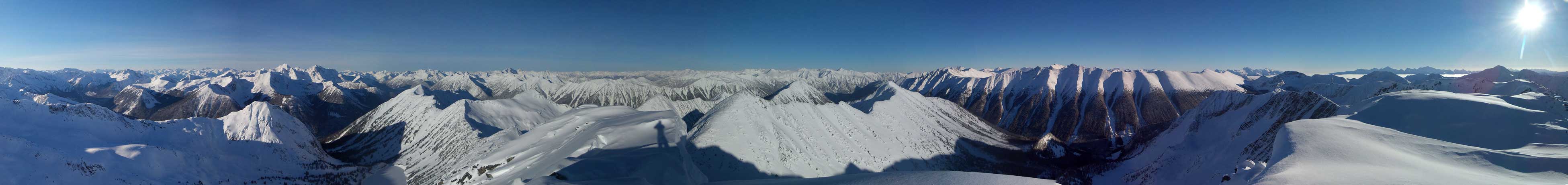
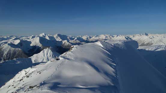
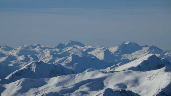
Summit Panorama from Windfall Peak. Click to view large size.
Looking up the Van Horlick Creek drainage towards Asherah Peak and Snowspider Mountain
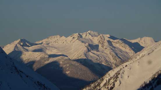
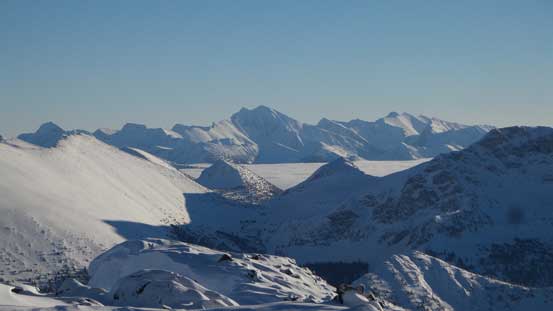
The Joffre Group rises behind Mt. Caspar
Mt. Matier
Cayoosh Mountain
Mt. Marriott and Nequatque Mountain
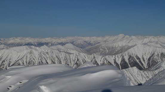
The sea of peaks looking north. Whitecap Mountain dominates the skyline
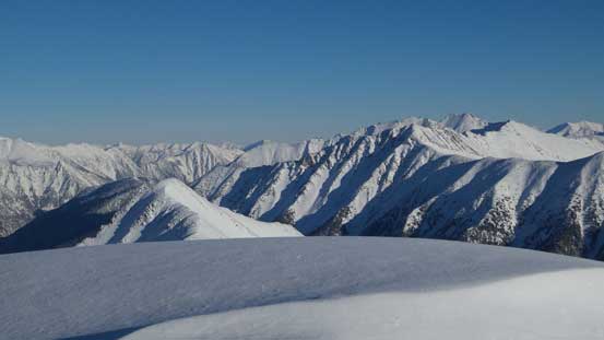
On the right are peaks by Channel Creek – Channel Peak and Tigger Peak
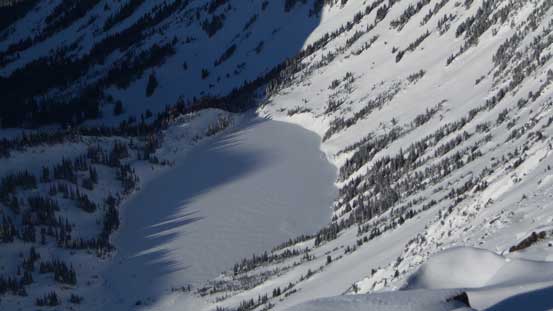
A zoomed-in view of the lake that I passed en route
A wider view looking down at the lake, Steep Peak and Peak 2318
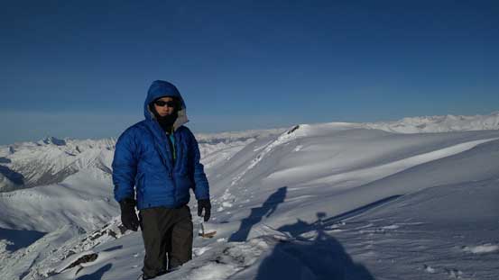
Me on the summit of Windfall Peak
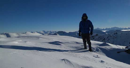
Another picture of me on the summit
After carefully reversing the summit ridge traverse I got to enjoy a fast plunge down the south slopes. Lower down I picked up my ditched snowshoes and carried them in hand (while boot-packing) until Windfall/Silent Hub NW3 col. I briefly thought about tagging Silent Hub NW3 too but I wasn’t impressed by the name of it, so down the valley I went. It’s a fast plunge down on snowshoes following my tracks and in no time I was back in camp.
Time to go down, looking back at the true summit
Looking sideways across the true summit’s face
Traversing back across the ridge
One last look at the Stein Valley area with Petlushkwohap and Skihist dominate behind
Wedge Mountain and Mt. Weart dominates the skyline looking south-west
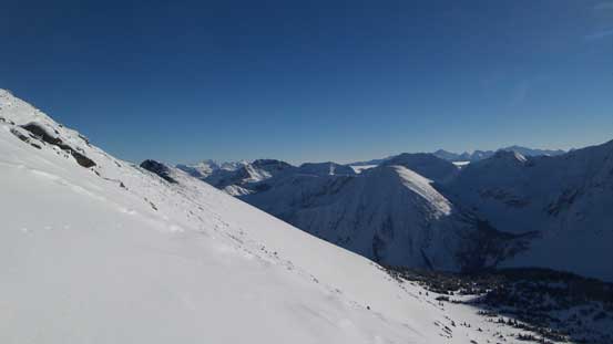
Descending the south slopes now
Endless terrain
Time to plunge down this valley
Wasting no time I soon started breaking camp. Given the number of overnight trips I’ve done in the past this was a fluent process. I was still amazed by the amount of condensation as pretty much all gears of mine got wet. My sleeping bag must have gained a ton of weight through absorbing all of those moisture, but oh well. It was still very cold so I had to keep moving. On the descent I resisted the urge of being fancy about the route and decided to just simply retrace my steps. I knew some places were gross but it’s better to stick with the known. My camera died soon thank to the coldness but to my great surprise my iPhone was still working so I did get some photos for the return. Once back to the roads the final 6-km along Van Horlick FSR was a cruise sailing, albeit mind-numbing plod.
Looking back at the valley I just plunged down
Had to keep moving..
Into the forest.
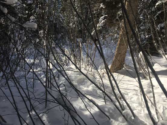
Pushing through the alders..
Back to the road now..
It was brutally cold at the parking lot (-18 degrees according to the thermometer) and I wondered how cold it actually got last night high up in the valley.. Not bothering to linger any longer than necessary I quickly made the transition and then drove up that winding and slippery Duffey Lake Road to Pemberton. A food break was taken somewhere in Pemberton and then I managed to put down the rest of the drive back home in a single shot. Tired but satisfied, and I have to say this was a pretty good objective given the conditions we had.
