Mount Arrowsmith
September 29, 2019
1819m
Port Alberni / Vancouver Island, BC
Mt. Arrowsmith is the highest summit on the southern half of Vancouver Island and might actually be the most popular objective on the entire island. The approach is next to non-existent and the access is via 2WD logging road systems in Cameron River drainage although complicated with logging company’s logistics. The access road (Cameron Connector and Cameron Main) is only open to recreational access on weekends and holidays, and on top of that there’s no guaranteed access even on a weekend because the company has the right to close the roads whenever they want, with very short notice. The peak itself boasts at least a dozen alpine climbing routes with a few of them being “intro level” alpine climbing that I’m very interested in. However, the shortest and also the easiest option is Judge’s Route on the SW flanks (class 2+) with next-to-nothing in terms of route-finding because of the shear volume of traffic. This standard route is also very doable even in the dead winter with a deep snow coverage.
About a year ago Vlad, Mel, Al and I had paid the ferry rides in hoping to day-trip Mt. Arrowsmith from Vancouver in early December, but we were shut down by unexpected logging activities on a Sunday, with zero notice on Island Timberline’s website. We then drove all the way to Klista Mtn. only to get shut down again due to heli logging, that we had to eventually settle on Mt. Wesley and Mt. Horne as consolation prizes. This year Vlad, Mel and I were back, with Adam and Connor coming from Washington state to join the team. Instead of doing it as a snow ascent in December we picked the last weekend of September. The weather was forecasted to be stellar but the previous storm had left a dusting of snow on the mountain. The original plan was the “Nose Route” but with the snow and ice we settled on just the standard route. We also wanted to do Mt. Benson in the afternoon because the standard route of Mt. Arrowsmith wouldn’t be a full day. It’s not a cheap trip to hop onto Vancouver Island, so we had to make the most use of the spent.
Adam and Connor drove to and crushed at my place in White Rock on Saturday night. We woke up at 4:15 am, drove to and picked up Vlad in Richmond and then Mel in North Vancouver and we were at the ferry terminal 45 minutes before the departure. The ride was first-come-first-serve so we had to be there early to secure a spot. The overall ride took about 2 hours that by 8:30 am we were off the boat driving north on Island Highway towards Port Alberni. This time there was no fucking around with logging activities nor gates that it was a cruise sailing all the way up Cameron Main to the junction of Pass Main. The secondary road (Pass Main) was steep but smooth. At the parking lot we decided to drive further up the spur road because it appeared “doable” in my Tacoma. The spur road definitely required 4×4 HC due to numerous ditches but with careful work we managed to shave another couple hundred horizontal meters off. We parked at the highest we could drive to, together with two other vehicles.
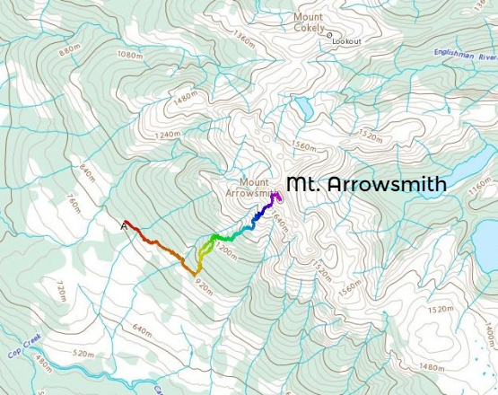
Mt. Arrowsmith via Judge’s Route. GPX DL
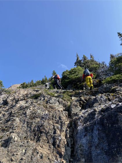
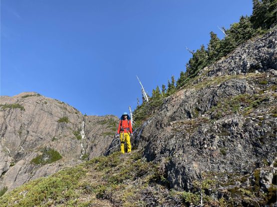
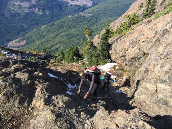
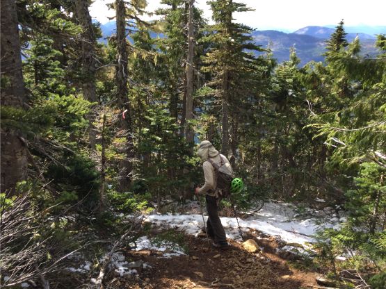
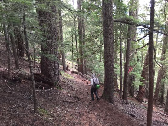
The first 1.5 km was walking up the decommissioned portion of this spur road and the official trail starts from the road’s end. The trail was very well defined at the start and wasn’t as steep as people made it sound, but after about 200 m gain the trail became a little rough and indistinct at places. We also had to hop over or duck under a few annoying dead falls and soon enough, we started encountering fresh snow. Meanwhile we passed at least five different group of hikers. I thought the island never gets crowded but maybe not on Mt. Arrowsmith on a sunny Sunday… We took a longish break before the route became “scrambly”. We came here prepared to scramble a lot of 3rd class ledges and chimneys but the reality was much simpler than what it appeared. We probably had to do a total of five 3rd class moves and none with notable exposure. The majority of the route would fall into the category of “hiking” although a very steep one. The path was obvious even on the scrambling steps.

Taco parked at the highest we could drive to on the spur road

The start of the trail
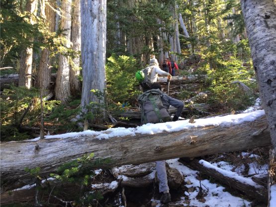
This stretch was annoying from lots of dead-falls and fresh snow

Mel getting higher on the route

Passing another group of hikers. We passed a lot of them…

Mel at treeline posing for a photo
Mel scrambling up. Photo by Mel O.

Mel on the first scrambling step, probably off-route
Getting back onto the trail here

Vlad seemed to have some fun here
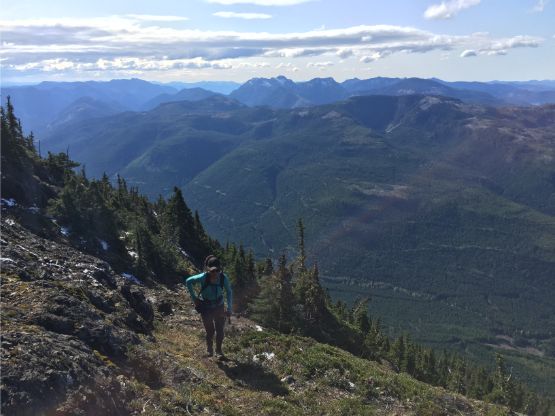
Me on the typical terrain on the upper Judge’s Route. Photo by Mel O.

Adam and Connor setting the pace
Vlad scrambling another step

Adam traversing a narrow ledge

Mel scrambling

Mel arriving at the summit ridge now.
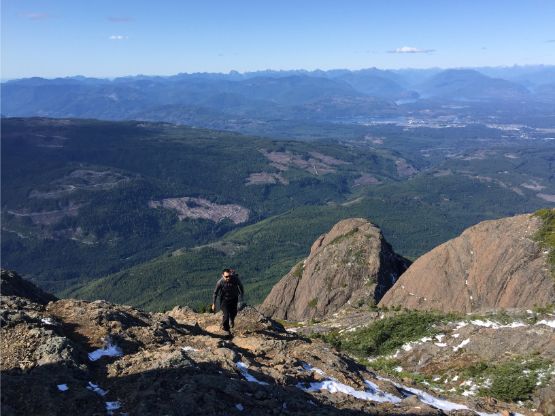
It didn’t take us long to reach the plateau/saddle NW of the true summit. From there the view fully opened up. While being busy taking photos we easily scrambled the final 50 meters to the true summit. The last bits involved a bit of 3rd class scrambling because we didn’t find the easiest line, which was hidden behind a gully filled in with new snow. The summit was gorgeous but windy and cold, so we only stayed there for about half an hour. The ascent took us about 1 hours 40 minutes only but with Mt. Benson also in the plan we actually didn’t have that much extra time to kill.

Mel posing on the summit ridge with Straight of Georgia as a backdrop
Vlad approaching the summit of Mt. Arrowsmith
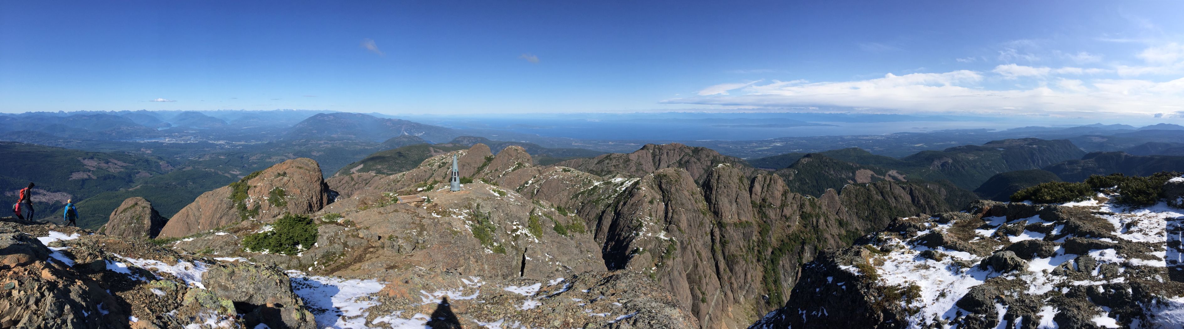
Partial Summit Panorama from Mt. Arrowsmith. Click to view large size.
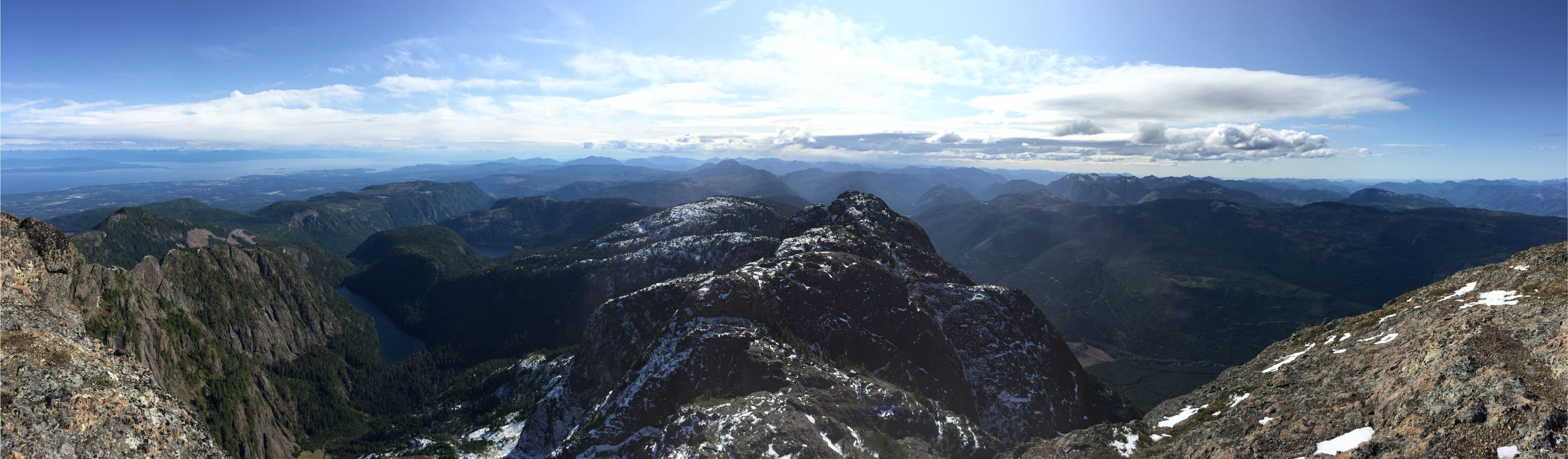
Partial Summit Panorama from Mt. Arrowsmith. Click to view large size.
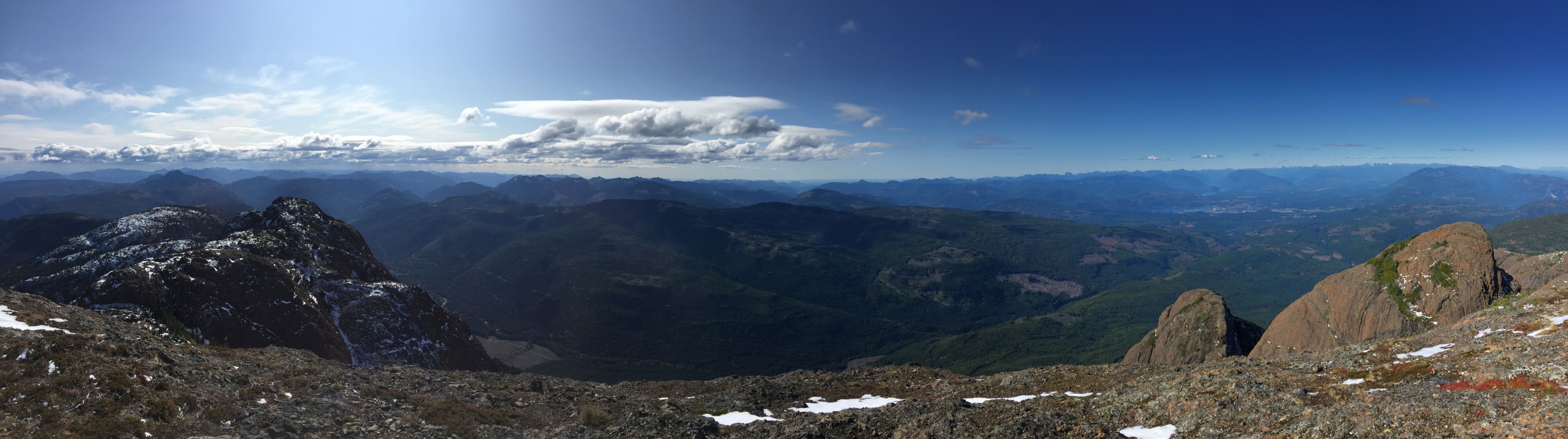
Partial Summit Panorama from Mt. Arrowsmith. Click to view large size.

Me on the summit soaking in the views. Photo by Mel O.
This is a east side view down into some typical rugged terrain on the island
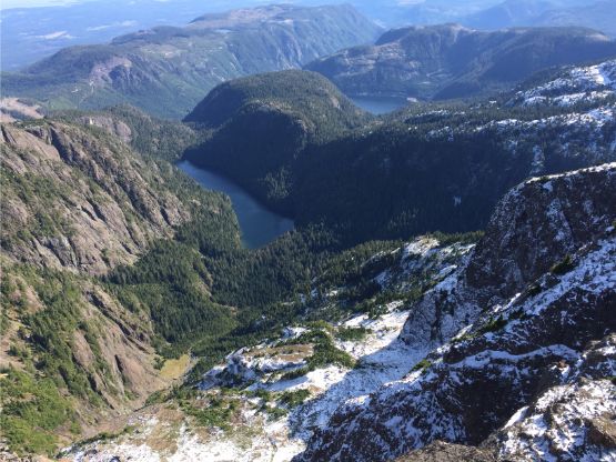
Fishtail Lake and the rugged country

This is looking down along the undulating SE Ridge and the Cameron River valley
Mt. McQuillan to the south

This is looking over the summit of Mt. Cokely towards the mainland
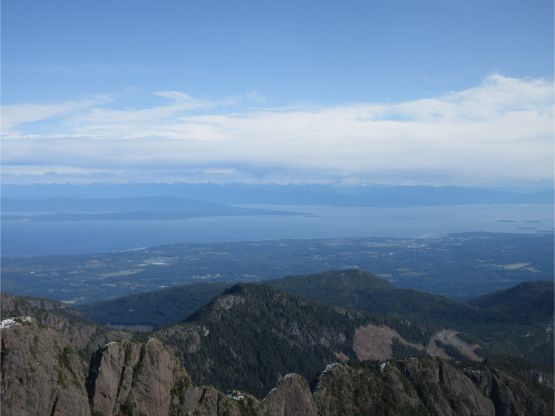
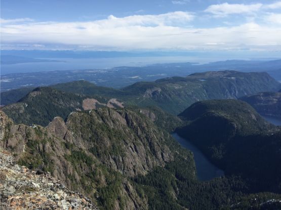
Nanaimo and Straight of Georgia

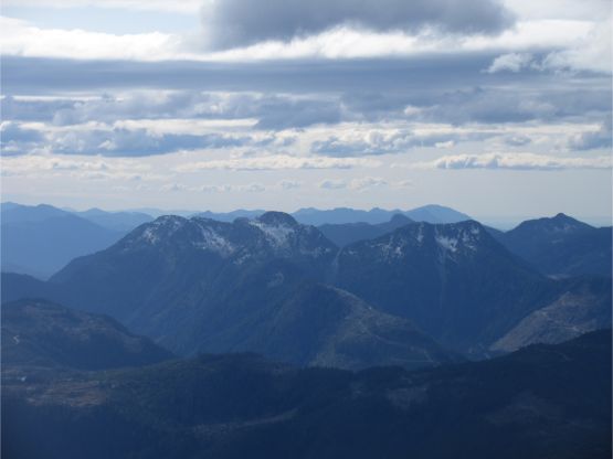
This is a zoomed-in view towards the central Vancouver Island
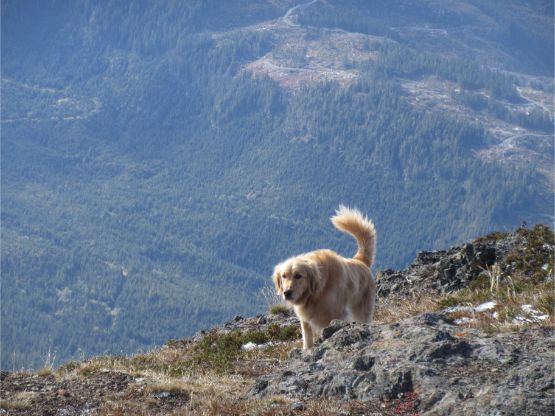
Beastie sighting on the summit

This is a western view towards the Pacific Ocean

Another photo of Beastie. He seemed to have a lot of fun here

Me on the summit of Mt. Arrowsmith

Mel and I on the summit of Mt. Arrowsmith

Our group shot on the summit of Mt. Arrowsmith plus Beastie
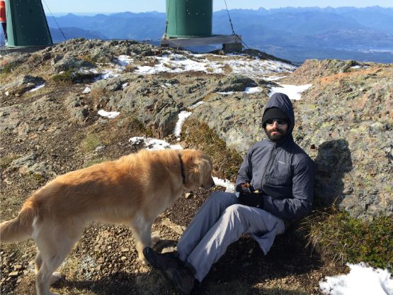
Connor and Beastie
The descent was uneventful in general. I opted to wear mountaineering boots for the whole way down until the logging road at the very end, before finally swapping for trail runners.

Vlad starting the descent now

Lots and lots of tourists coming up…

Connor and I descending. Photo by Mel O.

Mel descending the typical terrain

A bit of scrambling here and there but nothing difficult
Adam plodding into the woods now

Vlad on Judge’s Route
Adam on the lower portion of the trail now.
Our round trip time was 3.5 hours including a long stay on the summit. This is overall a very short objective that for us coming from Vancouver, the challenge is about to get there at the first place. Once making through the logistics bullshit (gates, fire closures, etc.) the ascent is that short-and-sweet Type I fun kind of outing, so highly recommended. For us the day wasn’t over yet as we had to hurry up to do Mt. Benson. The new objective was to bag Mt. Benson, and still to catch the 8 pm ferry back to Horseshoe Bay.
