Fire Mountain
January 22, 2021
2112m
In-SHUCK-ch FSR / Harrison Lake, BC
Fire Mountain sits roughly in the center of the loosely-defined region of “SW British Columbia”, about halfway down the In-SHUCK-ch and Harrison West logging roads system that connects Pemberton to Harrison Hotsprings. This is a very remote region and the round trip requires over 160 km of driving on logging roads no matter what direction one chooses to access from. Fire Mountain itself is not particularly tall by the South Coast standard, but stands out by over 1000 m prominence thank to the three deep valleys that surround the massif. The summit is mislabelled on the goverment’s topo map. The true summit is the eastern of the two peaks, which is unfortunately (or fortunately) more difficult than the officially-named west peak. To facilitate the steep forested approach one needs a thick snowpack to cover the underbrush but to ascend the true (east) peak safely one also needs a bomber snowpack stability, and combined with the ridiculously long backroads access this peak might not be as “simple” as one might expect.
Matt Juhasz had been putting some hard man’s work on the list of “SW BC Prominent Peaks” including several forays into the area to just check out the accesses and one failed attempt on Fire Mountain a month ago. When Matt invited me to join his “Midnight Crew” for Fire Mountain on this past Friday I instantly agreed. The weather looked stellar and the avalanche hazards had dropped to the lowest so far in this season. I did have to work on Friday, but given the golden window I just had to take the day off. The opportunity cost might be several hundred dollars but Fire Mountain was worth the bail. The only beta we had was Matt’s previous attempt so there wasn’t really a “proved route” on this mountain. Matt proposed another (longer) west side approach by crossing the frozen Fire Lake but I voted for repeating his previous attempt’s southern approach in favour for a more direct attack. The forest might be ridiculously steep but the thick rain crust we had been having recently would greatly ease any difficulty in the forest.
The 2AM wake-up call was pretty soft by the Midnight Crew’s standard. The drive from White Rock to North Vancouver added almost an extra hour for me. The five of us – Matt, Iliya, Sean, Ben and myself all piled into Matt’s full size truck at 3 am together with Matt’s dog and a couple hours later we had driven past Pemberton onto the In-SHUCK-ch FSR. Matt was able to cruise down the main line in almost 80 km/h for most of the stretch even in the dark. The drive on Fire Creek spur road was also more smooth than expected. Once past a junction to what seemed like a hydro project the road was no longer maintained. A downed tree could well deny our further access but Matt was smart enough to bring a chainsaw. Not far beyond the downed tree we encountered continuous snow with only faint sets of tire tracks, but Matt was able to push a few more kilometers up the road to around 520 m elevation, only a few more kilometers from where we “ideally” wanted to drive to. Thank to the smooth progress we had to start with head-lamps on.
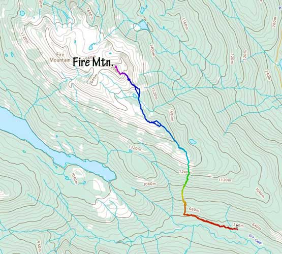
Fire Mountain south side approach. GPX DL
The snow was deep enough on the road to use snowshoes right from the truck but we were able to just boot-pack it thank to the thick rain crust. Matt set up a blistering pace and in no time we were done with the road plodding. Into the forest we were able to continue boot-packing for about a hundred vertical meters before strapping snowshoes on. This also marked the spot where the light was finally bright enough to not require head-lamps anymore. The next 800 meters of elevation gain was mostly a straight-up shot in this increasingly steep forest (with some route-finding here and there) but the going was never too outrageous. I expected some real shit show but other than a few awkward spots around some bluffs we did not encounter any major obstacle. The supportive snowpack definitely helped. We cruised up to where they turned around last time in about an hour and half whereas it took them over 5 hours to reach that spot previously. Right around that section we ventured climber’s right into the mature forest briefly but the terrain kind of forced us to traverse back climber’s left into the younger trees. We encountered another steep zone in the next few hundred meters of gain with 40-degree and numerous bluffs to weave around, but again, our MSR snowshoes worked perfectly on the supportive crust that we were able to cruise up with no delay whatsoever.

Matt sawing the only downed tree on Fire Creek FSR

Twig and me still in the pitch dark after the road slog. Photo by Matt J.

We had some annoying dead-falls lower down
Matt weaving around some steep bluffs on the lower zone

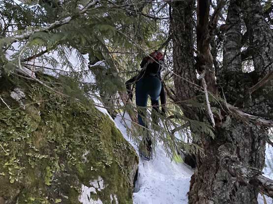
The forest requires careful route-finding
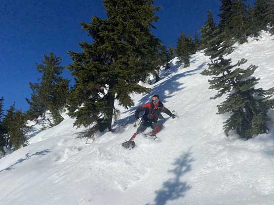
Sean traversing across a short but shitty stretch
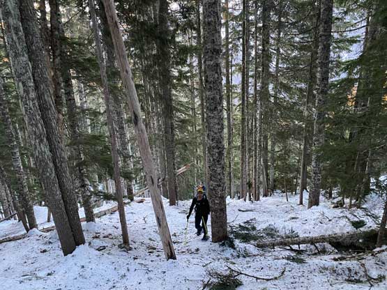
Matt cruising up the mature forest for a while

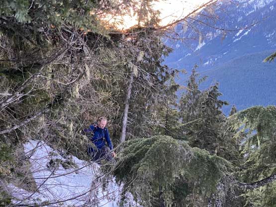
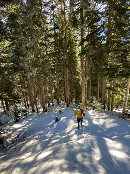
The morning sun shone through the trees

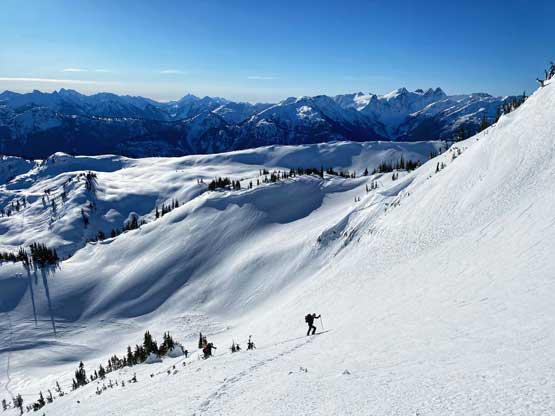
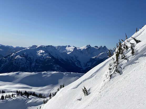
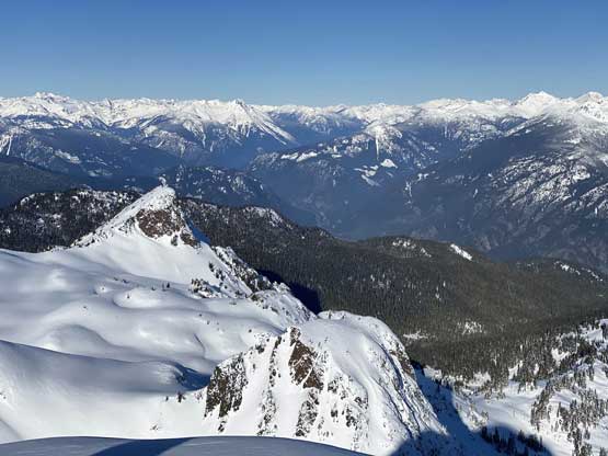
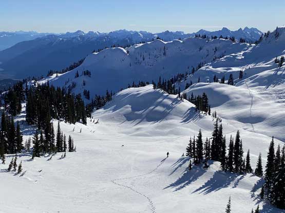
Finally had some views, looking past “Candle Peak” area

Ben ascending another steep step

Matt and Twig

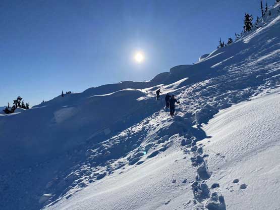
Ben plodding into the first sunshine we tasted
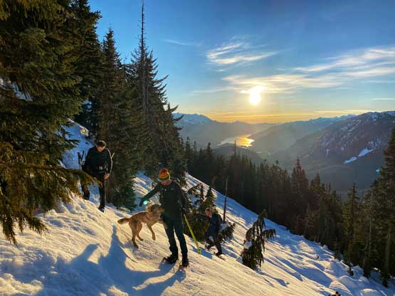
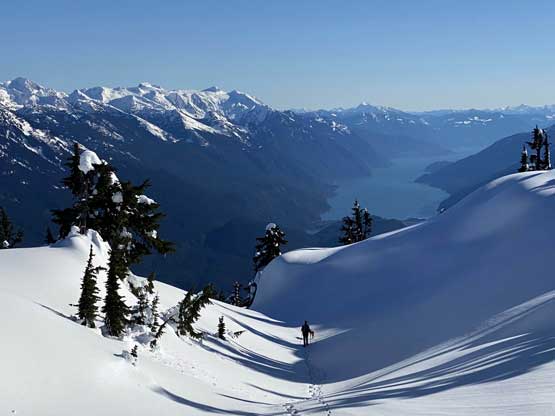
Our crew and Harrison Lake in front of the morning sun
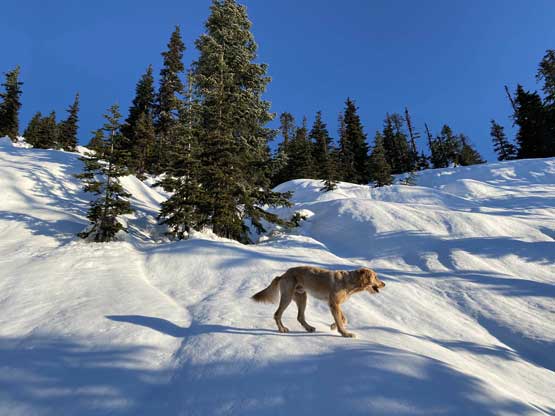
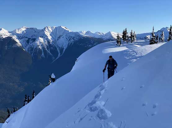
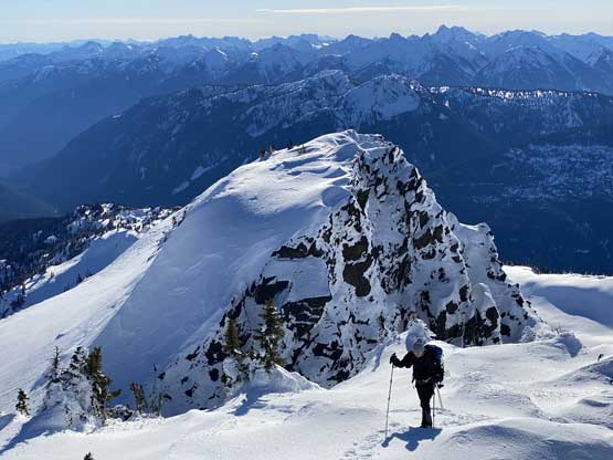
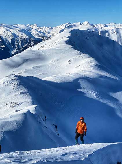
Twig led us up the upper bluffs towards the summit ridge
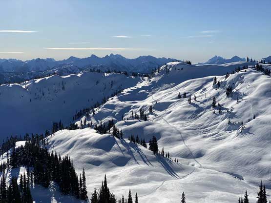
Once reaching the broad south-east ridge of the massif we took a longish break to regain some strength. For the next short stretch along the ridge we stayed generally to the right of the crest and encountered mostly open forest and easy terrain, until an abrupt drop forced use to ascend a steep roll to get onto the ridge crest. We were finally able to see the entire upper route at this point and made a final decision to use the “south side gully/ramp” to gain the east side of the summit block instead of the “SW chutes”. Once this decision was made we bailed off the ridge crest again with Matt leading across several steep traverses into the bowl south of the summit block. This stretch also involved at least 50 m of elevation loss and some undulating terrain.

The best view of Mt. Pitt was actually from this forested lower ridge

Finally onto the broad SE Ridge, plodding ahead

The typical forest on this stretch of the plod – easy but a bit sloggy

A dead-end forced us to ascend steeply up this roll
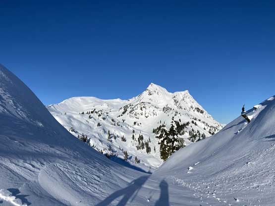
Our first unobstructed view of Fire Mountain
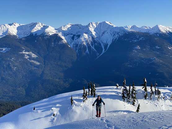
Iliya plodding up with “Speke Peak” on Nahatlatch/Lillooet Divide
Iliya starting the long traverse into the bowl

Matt and Twig leading the way towards our objective
Our crew crossing one of the old slide paths

Matt crossing another steeper slope
Looking back to show our tracks across this undulating zone

Twig and Matt plodding up

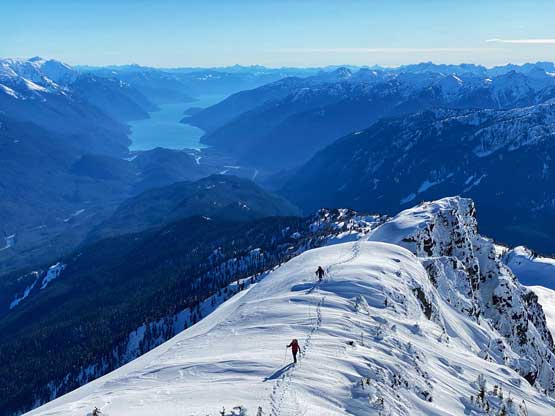
Sean in front of Harrison Lake
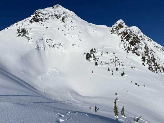
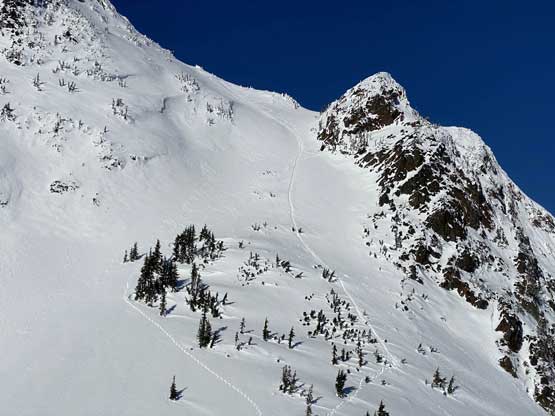
The attack of the summit block started with a section of steep “ridge crest feature” with some small cornices to be aware of and this zone ended at the base of the aforementioned “south side gully”. I took over the lead here putting some zig-zag tracks straight up the middle of this depression zone that maxed out near 40 degrees. At the top of this gully we veered left onto the east face and the next 100 m gain to reach the summit ridge involved more (unexpected) steep terrain. There was no obvious attack that looked tame and the line I chose started by a rightward traverse onto a massive hard-pressed windslab in search of the lowest angled terrain. Ascending this 40+ degree windslab forced me to take one snowshoe off and bootpack (others took their ice axes out). The grade petered out slightly after this rollover and I strapped the snowshoes back on and grunted onto the summit ridge. The traverse northwards to the true summit was pretty easy but very scenic.

An avalanche crown in foreground. The terrain around here is big
Matt looks tiny compared to the route we were going to climb
Matt partway up the “south side gully/ramp”
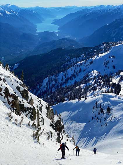
In the middle of the gully with Harrison Lake behind
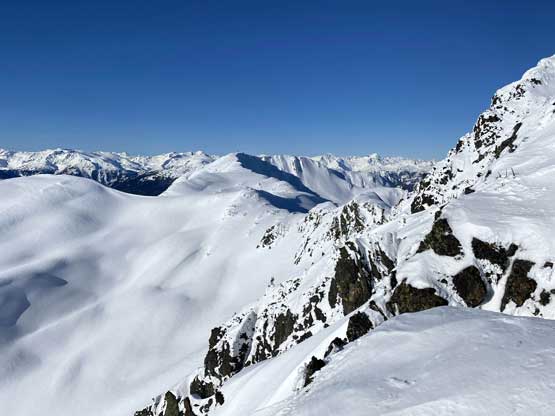
Looking sideways across towards Fire Spires and Terrarosa Glacier

The east face of Fire Mountain’s summit block.

Ben starting the hardpressed wind slab pitch
This shot shows how steep the west side of the summit is…
Ben gaining the summit ridge
Matt and Iliya traversing the summit ridge with Harrison Lake behind
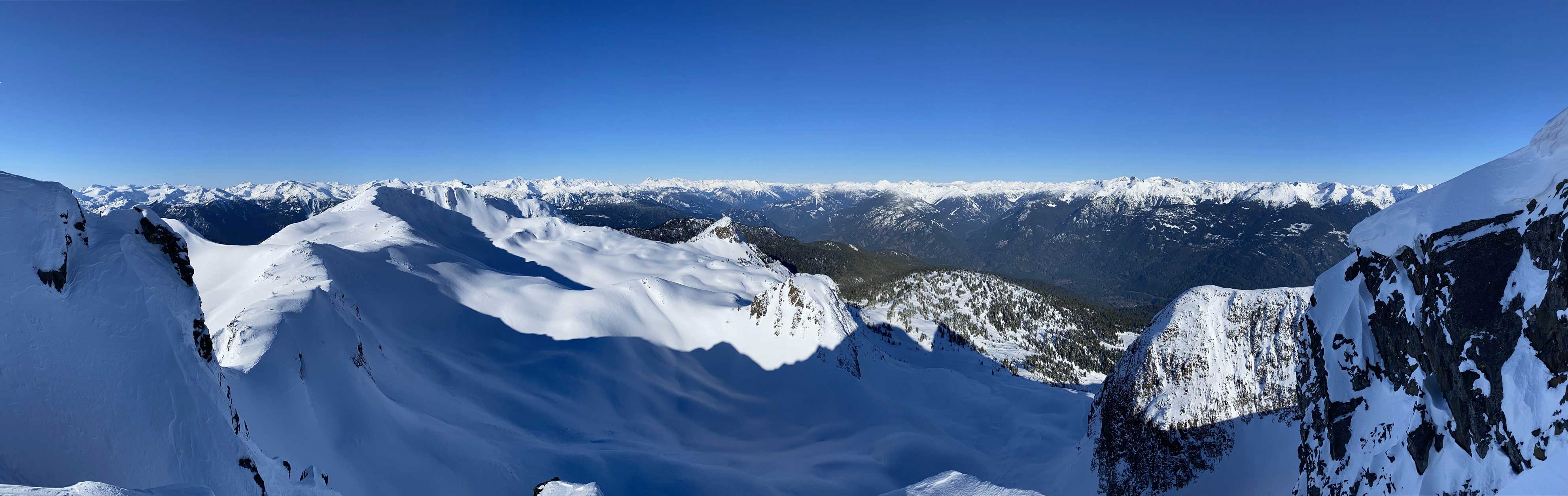
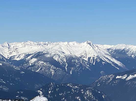
Partial Summit Panorama from Fire Mountain. Click to view large size.
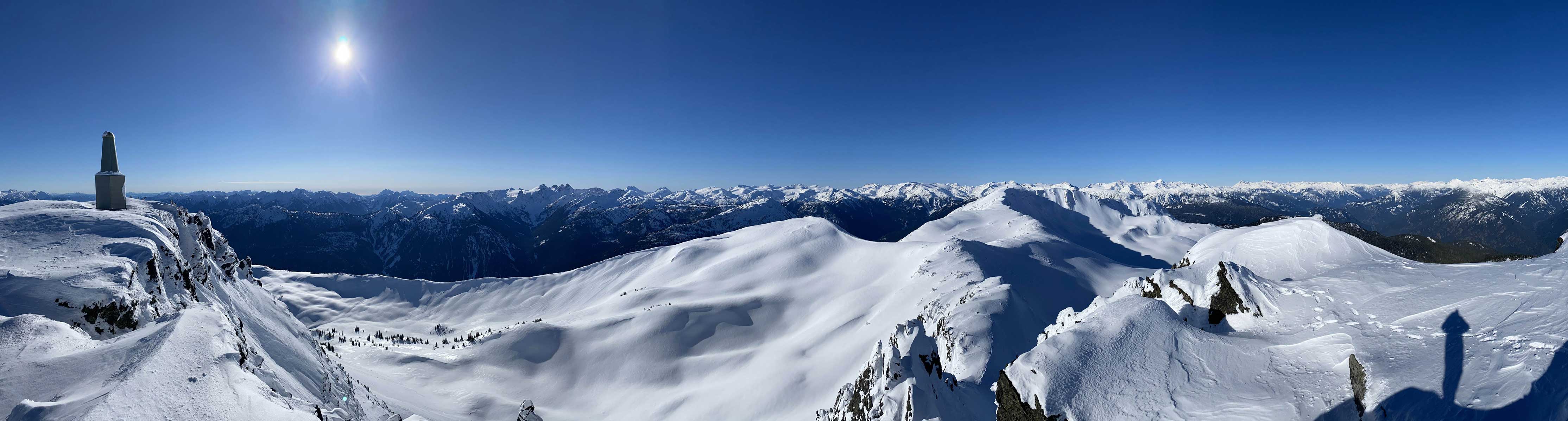
Partial Summit Panorama from Fire Mountain. Click to view large size.

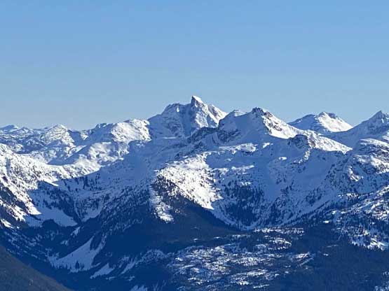
Robertson Peak dominates the skyline looking south

Old Pierre Mountain and Pukulkul Peak are two iconic peaks on Stave/Pitt Divide

The entire Snowcap Icefield with Mamquam Mtn. poking on the far left
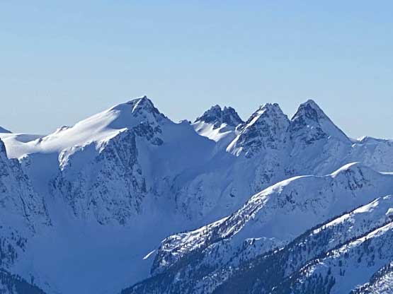
The Fire Spires – Ember, Flames, Flash, Flicker

Mt. Judge Howay and Mt. Robie Reid behind Mt. Lamont

Livingstone Peak and Govan Peak on Nahatlatch/Lillooet Divide
The uber remote Mt. Mason

A close-up shot of Traverse Peak
Gunsight Peak (In-SHUCK-ch Mountain) in foreground

Wedge Mtn., Lesser Wedge and Mt. James Turner

Nivalis Mountain with Mt. Sir Richard on the far left

The Stave/Katzie group of peaks on Misty Icefield
The very rugged and deep valleys 2000 vertical meters down to Lillooet River
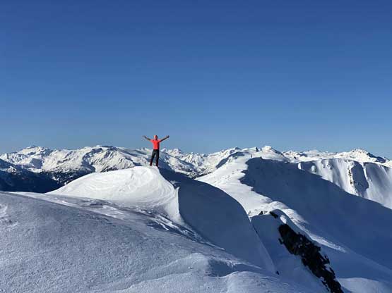
Me on the summit of Fire Mountain
Iliya posing for Instagram on the summit
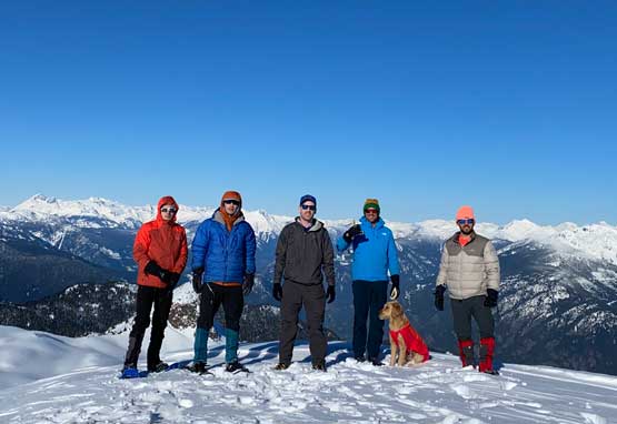
Our group shot on the summit of Fire Mountain
As usual for the Midnight Crew the summit stay could not be very long but we still managed to get most of the photos that each of us wanted. On the descent Matt and Iliya led a couple long glissades down the east face and then the south side gully. I’m not particularly competent on glissading but following was a lot easier as I already knew what to expect. I did not even bother to use an ice axe for the slides. The five of us got down to the bottom of the steep zone in no time where we took another longish break.

Sean finishing the steep glissade off the east face

Sean starting the (longer) glissade down the south side gully
Looking back at our glissade tracks

Matt heading down in front of Harrison Lake
Matt now far down into the bowl

Iliya taking another glissade to short-cut some distance
We pressed on to finish this hike in a single push. Plodding up and over those undulating terrain was a little tiring but we managed to find a slightly more efficient line on the return. The steep forested descent wasn’t as bad as I thought as the snowpack was softening slightly to give easier purchase on the snowshoes. A combination of various “technical snowshoeing” techniques were applied that a few of us managed to descend this entire thing without taking the snowshoes off nor to use an ice axe. The last few klicks on the road seemed numbing but at least went by fast.

Traversing back across one of the many steep slopes in this bowl

Another photo of the traverse back across the bowl

Matt almost back onto the ridge

One last look at the summit area of Fire Mountain
We found a sweet line on the return
Iliya demonstrating his technical snowshoeing

Ben negotiating one of the many bluffs
Me heading down the mature forest.

Matt showed us why he’s so fast…

A bit of bushwhacking here and there but nothing too bad

Down to the road now

It’s truck time… Fire Mountain in the bag..
Our round trip time was 7 hours 20 minutes covering over one vertical mile of elevation gain on various terrain. Twenty minutes later Matt started up the truck. We had no problem turning around on this snowy road and a short while later we were down to the main In-SHUCK-ch FSR where Matt took off cruising north at 80-100 km/h. A long bumpy ride later we were back to Pemberton and another couple hours later we were back to North Vancouver. We stopped in Whistler for a proper restaurant dinner. I, unfortunately had one extra hour of driving as I live on the very southern part of Metro Van. only a few minutes away from U.S. border…
