Silver Peak (I-90)
January 10, 2023
1708m
Snoqualmie Pass, WA
Silver Peak is the highest peak in the area immediately south of I-90 at Snoqualmie Pass and subsequently boasts over 600 m prominence. It’s actually one of the easiest P600m objectives in Washington. In summer months one can easily hike the PCT from Mt. Catherine trail-head to Silver Peak’s south ridge and the round trip can be done in mere 1-2 hours. The bigger challenge is to do this peak in winter as the forestry roads are closed (snowed in) and the peak itself boasts substantial avalanche terrain so a longer day and a stable snowpack is needed. The way to attack this peak in winter is from Annette Lake and the south ridge might still be the easiest option, but Matt J. had published some “beta” about the NW Ridge from Lake Annette trail. The NW Ridge looks rugged on the satellite images but since it’s already a “proven” option I might as well stick to the known. Shayan M. suggested to follow Matt’s route for a sunrise hike on Tuesday. I was initially not keen as I seriously needed some rest-days. To get Silver Peak done as a before-work exercise required another vampire styled all-nighter push but the weather was too nice to pass, so I pulled the trigger.
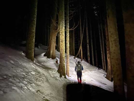
Shayan’s car needed some maintenance so I unfortunately had to be the driver again. At least the road’s paved so I could drive the Corolla to save some gas. I however, suggested us to leave White Rock at 10:30 pm immediately after work, as that would give us at least 2 hours of sleep at the trail-head. The usual midnight departure time would basically mean “no sleep” and I didn’t think I had enough gas to pull off another day like that with 3 hours of driving on each end. The final kilometer before the trail-head was surprisingly not paved with lots of pot-holes but didn’t impose too much of a problem to the Corolla, but I had to drive at a snail’s pace. It was still raining and snowing by the time we got there but the forecast promised to clear in the morning. We indeed got about 2.5 hours of sleep and by 4:15 am we finally dragged our tired selves out and started the plod. It was still drizzling but what else could we do at this point.
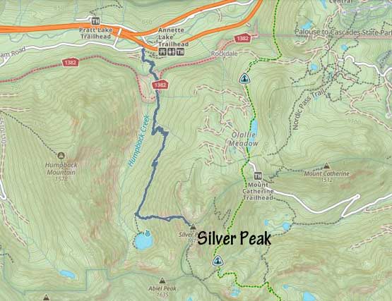
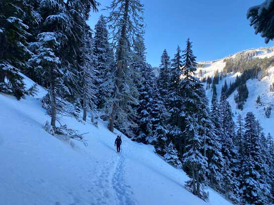
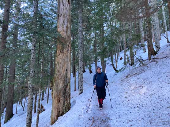
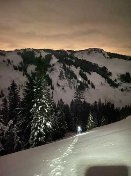
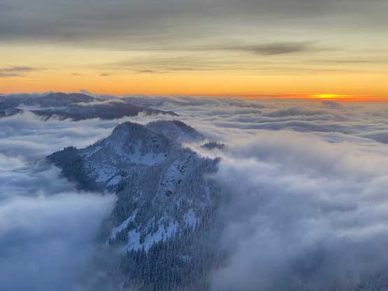
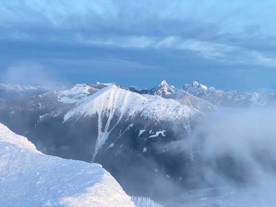
The trail was snow covered right from the start but the snow condition was hard-packed such that snowshoes weren’t needed as long as we stayed on the trail. This is typical in Washington state as each officially maintained trail sees zillions of hikers every week such that snowshoes are rarely needed. We gained more elevation on this trail than anticipated (over 500 m) and the last stretch before Lake Annette even had some annoying elevation loss that must be regained on the way back. To follow Matt’s route we did not need to plod all the way to the lake and instead, we strapped the snowshoes on and dived into the forest about 300 horizontal meters before reaching the lake. We picked a route in between Matt’s ascent and descent tracks which I thought would be the most direct option. Indeed, in about 5 minutes we picked up a set of skin tracks and used that to lead ourselves onto a broad open slope. I’ve noticed this gigantic slope on the satellite images and the plan was to ascend the climber’s right side of it. Unfortunately the recent snowfall and the winds had completely eliminated the skin tracks so we were on our own trail-breaking from this point onward.
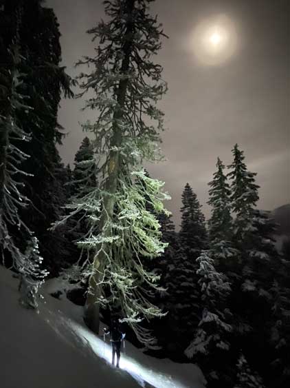
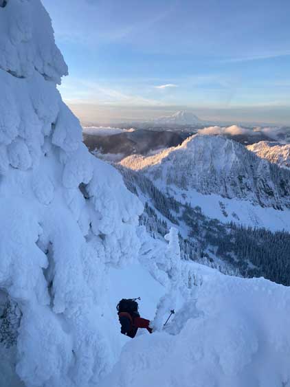
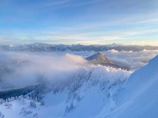
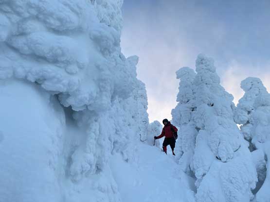
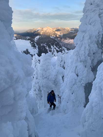
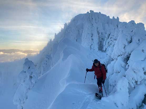
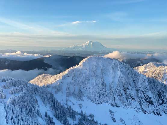
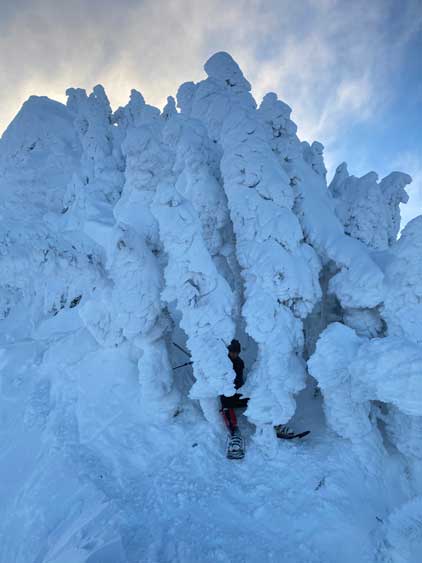
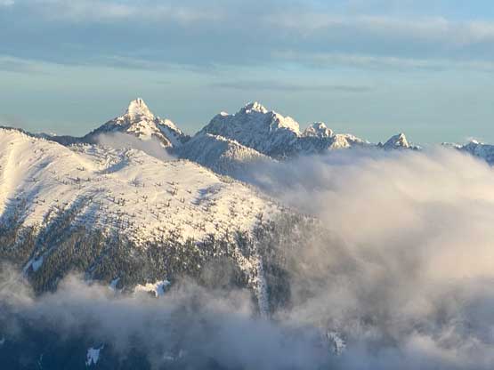
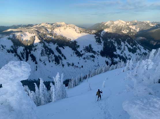
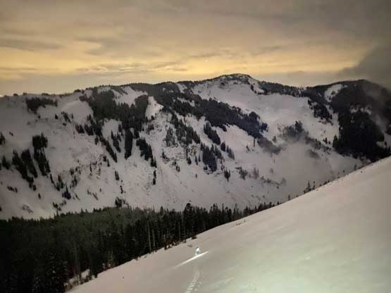
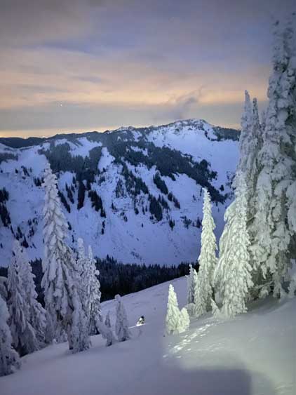
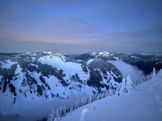
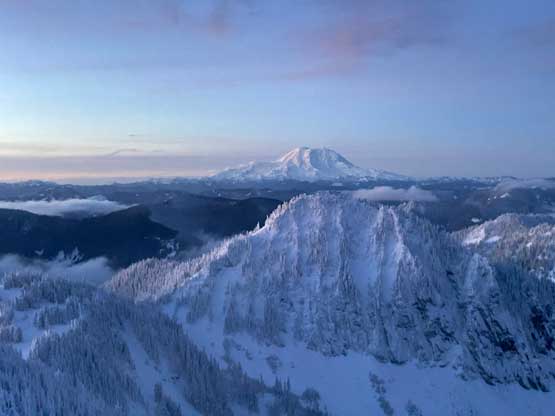
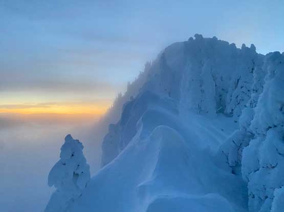
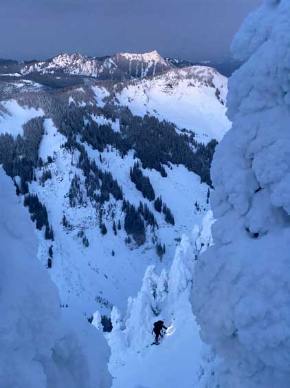
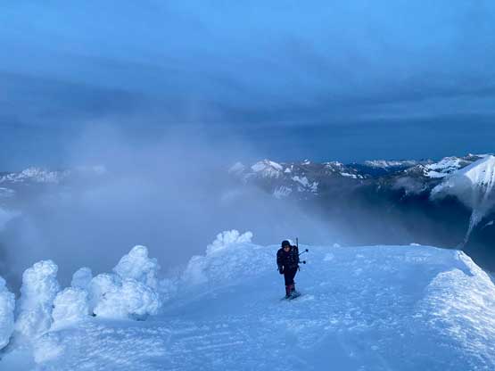
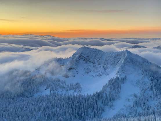
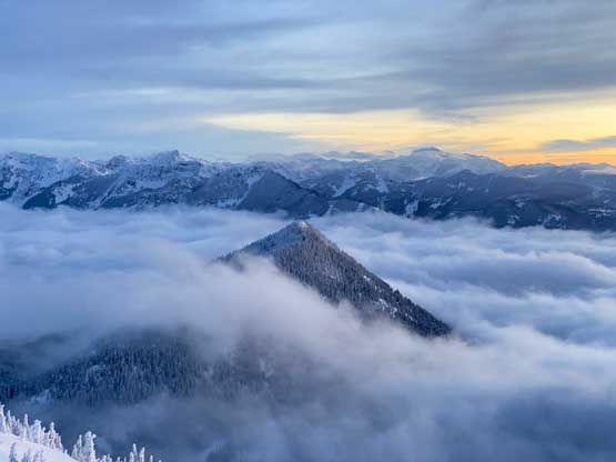
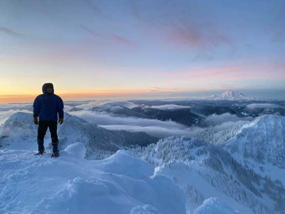
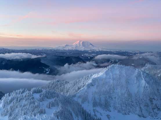
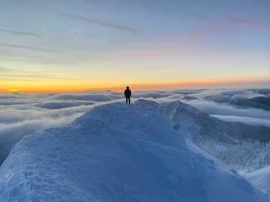
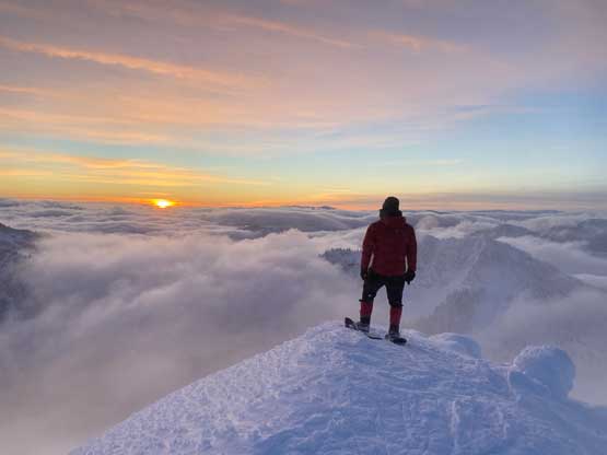
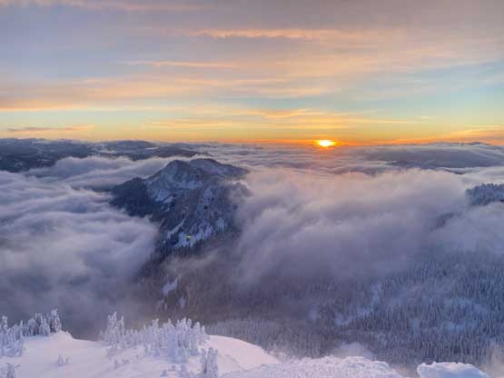
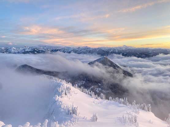
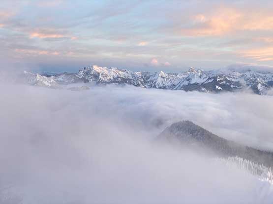
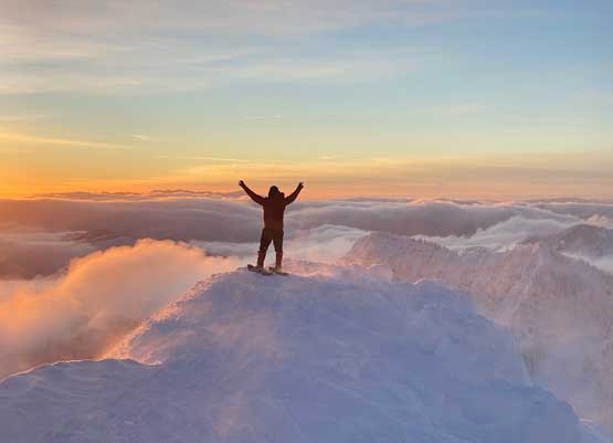
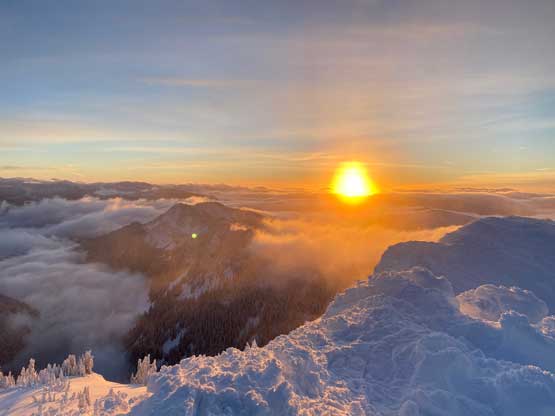
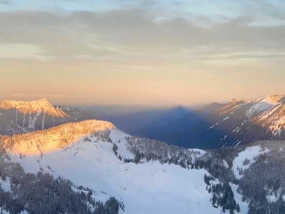
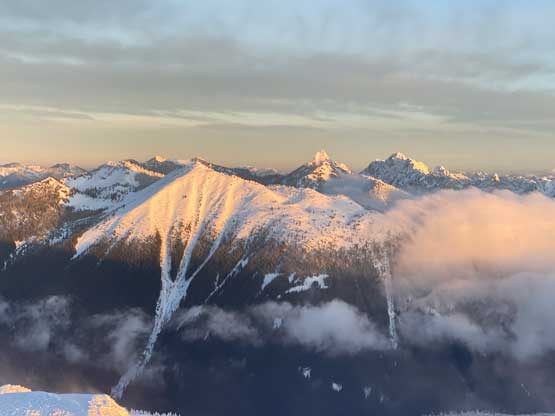
This slope was much bigger than I thought and the recent snow was also quite deep. At this point we had ascended through the mist layer such that we could see the full moon and the stars above, but we were about 2 hours before sunrise and we only had 400 m elevation to gain. I on purposely slowed down so that we wouldn’t summit in the pitch dark. After making a diagonal traverse due south (climber’s right) I led a line staying on the edge of the slope for the rest of the way up, and that brought us directly onto the NW Ridge. We picked up some old footprints on the ridge. The ridge traverse was harder than I thought with multiple obstacles requiring side-hilling onto the semi-exposed south side slopes, some minor bushwhacking and scrambling. There’s even a false summit that must be surmounted which meant more route-finding, side-hilling and scrambling. There were at least one or two spots that almost made me to switch footwear to crampons but I was being stubborn and either (barely) made it through with just snowshoes, or found an easier, but more contrived way around. The arrival on the true summit was about 30 minutes before the actual sunrise and we stayed for almost an hour to soak in the views. The views were phenomenal but the cold winds were brutal. I had to put on all layers and could only manage 5-10 pictures in one batch before having to warm up my hands.
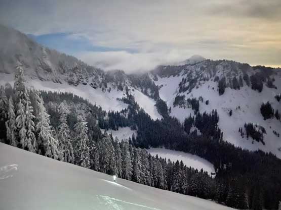


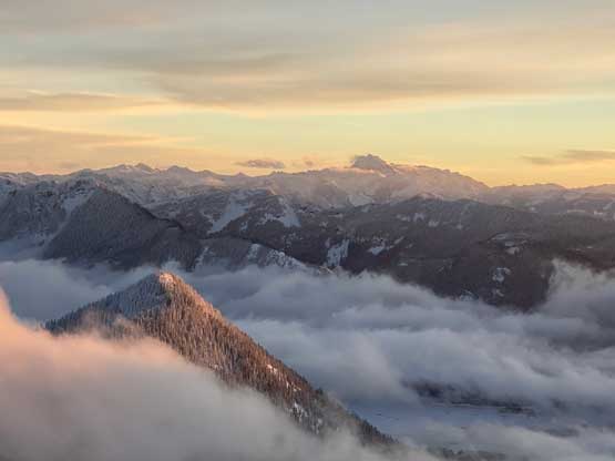
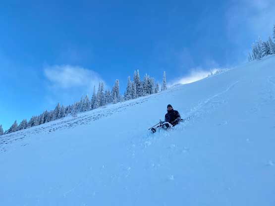
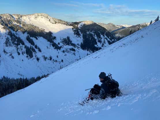
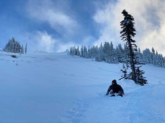
Eventually the cold winds forced us to retreat. Descending that NW Ridge still required lots of care and we even took some variations in the micro-terrain to avoid some exposed spots. I briefly thought about to descend the south ridge to make a loop, but I wanted the fastest way down to prioritize getting home in time for work, and the fastest option is always to stick to the known. To descend that massive open slopes we opted to glissade the middle of it. The glissading was slow thank to the not-that-steep angle combined with the heavy recent snowfall, but we did descend most of that slope on our butts. The rest of the return was long but uneventful and we met several hikers (oddly, all solo hikers) on their way up. None of them seemed to be doing the peak. Our round trip time was just under 6 hours. Shayan wanted to be dropped off in downtown Seattle to reunite with his brother so I did that, adding about 20 minutes of detouring but that’s okay. I pulled over only one time while driving the rest of the way home to take a break and I did eventually get home in time for work. I then worked all the way through to 9 pm and that’s quite an exhausting show.