Mount Norquay
July 6, 2012
2522m
Banff, AB
After a month of wet and questionable weather, a full sunny week came in early July. Okay, time to go bag peaks. On Friday, I found myself driving southwards towards the Rockies. Given a late start, I would only have about 5-6 hours of daylight time, so I didn’t have many options to go. I could have scrambled objectives like Door Jamb Mountain and Loder Peak, but I figured it’s the time to head further west and leave the very front peaks for off-season? I was told by more than one friend that Mt. Norquay is short but fun, so I decided to give it a try.

Mt. Norquay standard scramble route
The parking lot is the same as the ski resort’s and the ascent essentially follows the ski hills up. The mosquitoes were out on full force. I didn’t bring my bug spray and I suffered from that. On the lower slope, I had to ascent about 400 m up basically the black diamond run, which surprisingly had a faint trail/path helping the footing. However, as long as I decided to stop for a few seconds, for example, taking pictures, there’d be about more than 10 mosquitoes ready to bite…. The temperature was like 30 degrees but I had to dress in long pants and long shirt.
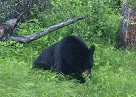
A black bear. Good thing I was in my car.

The route starts at Mt. Norquay Ski Resort
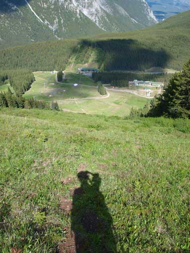
Looking down the steep grass slope (Black ski run)
Once getting to the upper terminal of the lift I had two choices according to Alan Kane’s Scrambles in the Canadian Rockies. If you go for the gully, you will be doing the first crux (harder than the actual crux). It’s not terribly steep, nor exposed, however, the problem is you don’t have good holds, especially when water is running. I had to trust finger holds for at least 1 move. Once clearing the first crux, I was facing a steep and loose, but broad gully. The ground is somewhat the worst type of terrain – loose dirt, clay, and little scree on firm ground.
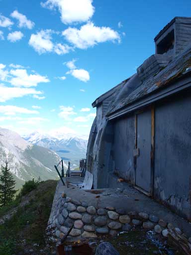
At the upper tram station.
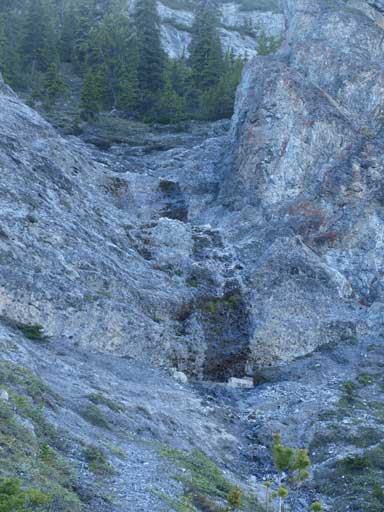
I scrambled up just to the left of water path. This is the 1st crux.

Looking down the board gully. You can see the upper tram station.
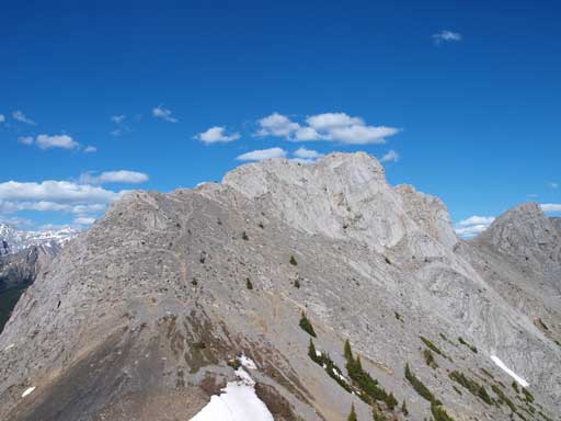
Topping out on the ridge, I was surprised by how much distance I still had to cover. According to Vern’s trip report, there’s a bypass trail to avoid the elevation gain/loss/regain over the lower east summit, but it wasn’t very obvious and I didn’t want to take a chance as it’s already late in the day, so I opted for ascending the east peak first following Kane’s direction. However, before the east peak, I had to go over a miner bump which involved the second crux. This one involves an exposed short traverse followed by climbing up a steep slabby crack. You don’t need to use finger holds here, but the holds are still minimal. Once up the crux, I was surprised that this high point wasn’t actually the east summit. A slight dip followed by steep moderate scrambles brought me to the east summit.

Mount Rundle, with Banff townsite below
Cascade Mountain

The step on route to East summit. I don’t think it deserves the “difficult” rating though…
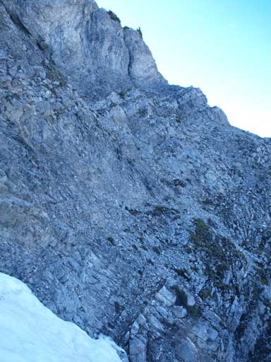
To get to the west (true) summit, I had to lose about 150 m elevation loss towards a saddle. From the saddle, it’s mainly moderate terrain to the summit. However, I had to overcome the third crux. Kane mentions a traverse horizontally towards climber’s right below the summit block, but on this day a snow filled gully blocked my way. Crossing this gully without an ice axe nor crampons was a bit sketchy. The snow wasn’t too hard though, but if I slipped, I would be all the way down. If you don’t like this, the direct line up the west summit is at least upper level of difficult scrambling (I’ve read other trip reports by people going straight up the west peak). I tried to find a register for about 5 minutes, but failed. I had no clue where that thing went.
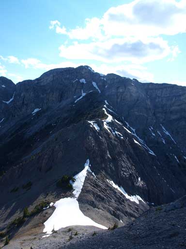
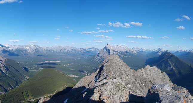
The West summit seen from the East peak.
Looking back at the East summit
Steep terrain to the true (west) summit
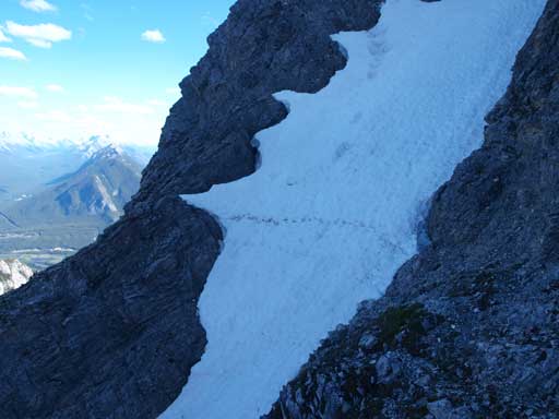
I just crossed this tricky gully without ice axe nor crampons
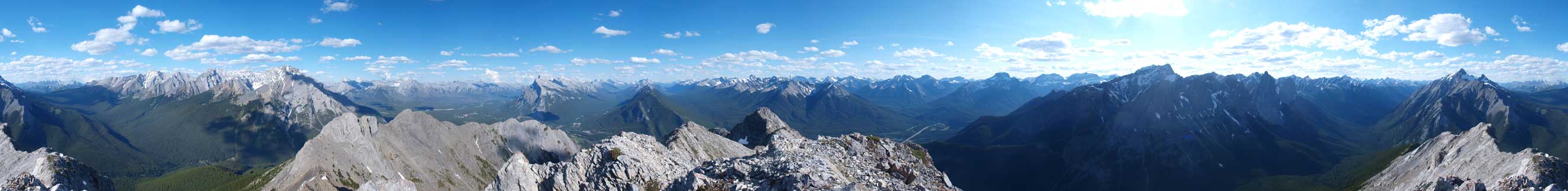
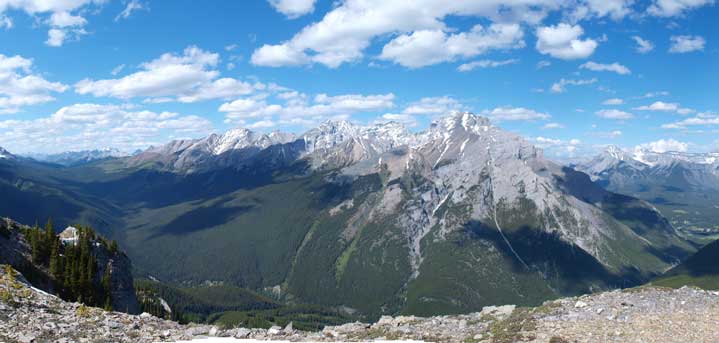
Summit Panorama. Click to view large size
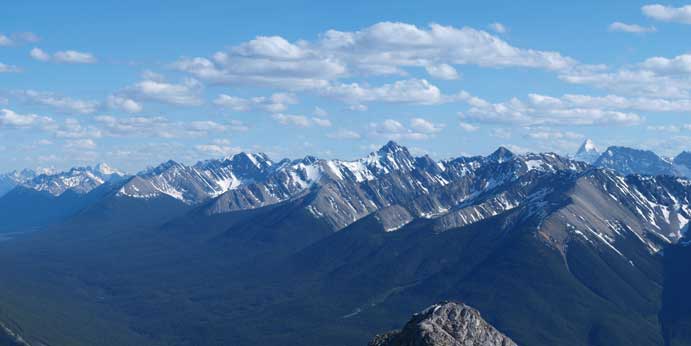
Sundance Range

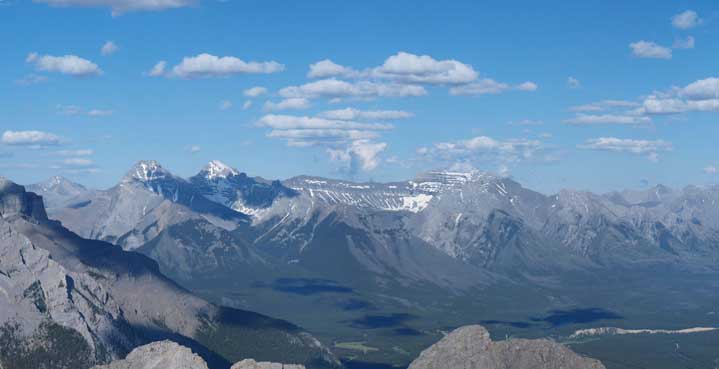
Mount Assiniboine
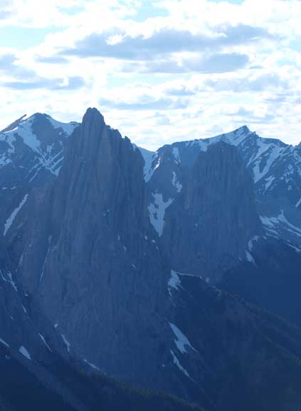
An obligatory shot of Mt. Louis. It wasn’t under the best light angle.
Zooming-in towards Fairholme range. From left to right are Mt. Inglismaldie, Giouard, and Peechee
I didn’t stay long because of time issue. One thing for a difficult scramble is, you’d better retrace your step on the way back, unless you’re 100% sure about the alternate route (which is the east peak bypass in this case). I couldn’t see an obvious trail/path contouring around so I re-ascended the east peak (tedious and tiring). Down-climbing the 2nd crux wasn’t a problem, but descending the loose gully required a lot of patience. It’s slippery and I was tired so it’s easy to fall. There wouldn’t be much of a consequence if I fall though, but I just didn’t like banana-pilling on a scree route. I bypassed the 1st crux on the way down (skier’s right), which was definitely easier but I still suggest you to as least take the waterfall way for ascending, for more enjoyable scrambling. Descending the ski run was a true test for my knees and it was pretty painful.
Bow Valley
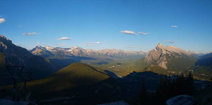
Another photo of Bow Valley. The sun was almost down.
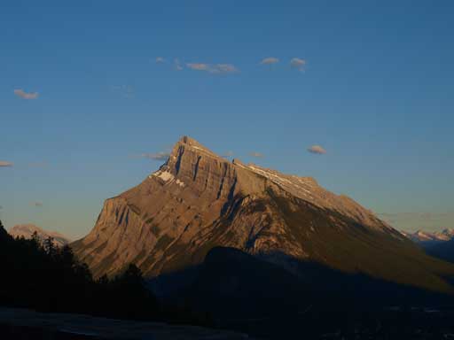
Evening view of Mount Rundle
Overall I didn’t find it being as “fun” as described by other scramblers. There’s quite some hands-on stuffs but also lots of awkward terrain and elevation loss/regain. However, it’s indeed a pretty short objective. I’d recommend this when you are short on time or energy, or on days when there’s afternoon thunderstorm in the forecast. The next day I decided to do a long trip, namely Mt. Aylmer.
