Fons Peak (Fountain Ridge)
October 26, 2021
1805m
Lillooet, BC
“Fons Peak” is the unofficial name given to the highest point of Fountain Ridge in the close proximity to the town of Lillooet. Fountain Peak is the only officially-named summit on this ridge and also the only one that has a somewhat iconic profile, but the ridge’s highpoint boasts over 800 m prominence. Unlike other forested ranges in this area Fountain Ridge is steep and rugged that logging roads had not been pushed any higher than the highway level. The SW side of “Fons Peak” from Fraser Canyon offers the least steep route to tag the summit but the east side from Fountain Valley offers the shortest and the most direct option. Both options would be somewhat theoretical because the “beta” for this peak is next-to-nothing on the internet. I do know two ascents of this peak, but their accounts are vague.
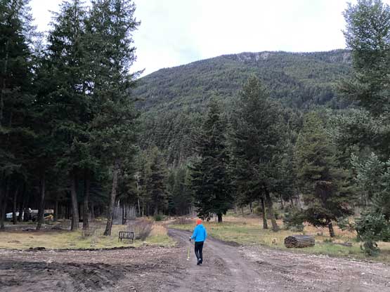
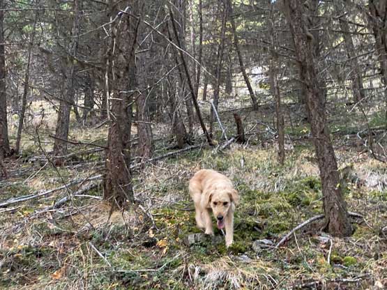
Matt J. and I had talked about to get out somewhere on this past Tuesday. The weather pattern had been extremely active recently such that we were facing another long drive out to the east to escape the dreary weather. Matt proposed a road trip past Lillooet to grab a group of P600m peaks. I was not keen on the long drive but reluctantly agreed because there really wasn’t any better option. The “plan B” would be to simply stay home, which was basically unacceptable to me on my day off-work. Matt did not have a vehicle in this week so I had to drive to North Vancouver to pick him (and Twig) up. To make this plan more feasible Matt offered me to sleep in his basement on Monday evening. I drove out of White Rock at 10 pm, made to North Vancouver within an hour. A few hours later Matt came out to wake me up at 3 am and we were soon on the road. The drive up north through Sea to Sky Corridor and then over the Duffey was all done in intermittent rain but as expected, the rain stopped as we descended into Lillooet. The horizon was still pitch dark. We loaded the gas tank and continued driving northwards to Fountain Valley. To my surprise the road to Kwotlenemo Lake aka. Fountain Lake was entirely paved. The recreation site at the southern end of this lake was closed but we found a nice pull-out to park on the road’s shoulder.
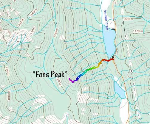
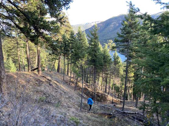
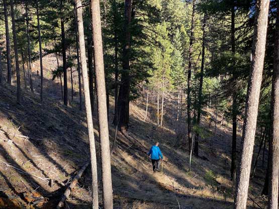
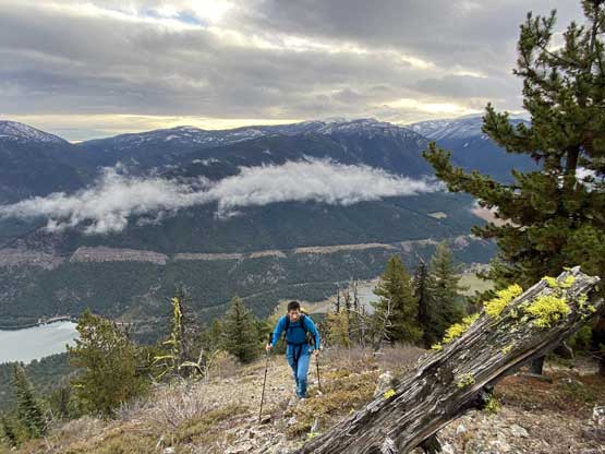
The ascent was really a no-brainer one as we just had to point our bearing straight up the hill for 800 m vertical meters. The route was not as daunting as the contour lines suggested but the grunt was definitely relentless. We encountered evidence of old logging roads but we had no idea where those were originated from. We also encountered game trails here and there but they were all traversing the hill side and useless to us. There were some fields of annoying pick-up-sticks but in general we managed to keep the bushwhacking grade within level 2 with only short stretches of level 3. The ground was just like the nearby Fountain Peak, not as soft as we had hoped for. The entire hill was basically a rubble slope covered in thin soil and moss. The footings were loose.


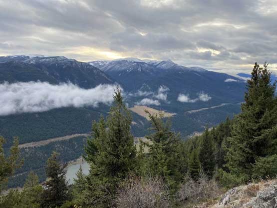
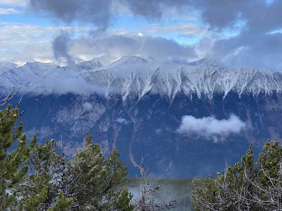
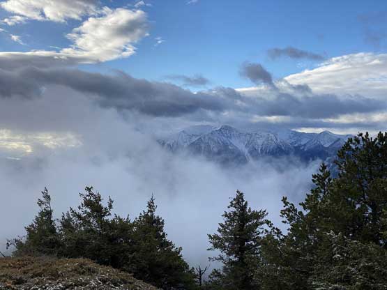
About 150 m under the summit we encountered a few bluffs but the scrambling was easy and the route-finding was straightforward. The views opened up dramatically as we topped out on the ridge and the summit was a short distance away. The summit was not as open as Fountain Peak but the views were nonetheless okay. The cold breeze and the fact that we had more peaks to ascend made our summit celebration a short one. We did managed to catch cell signals so I did my usual update on the peakbagger app.


On the descent we were confused as where exactly to bail off the summit ridge into the insanely steep forest. In the end we had to consult with the GPS device multiple times to correct our bearing. Matt then led the whole way down staying more or less on our track and the going was not any worse than the way up. The pick-up-sticks were much easier to step over on the descent. Our round trip time was 2 hours 40 minutes and we did not feel like rushed. I had some concerns of vehicle getting broken into because I simply do not trust people in this area, but thankfully that did not happen. I immediately turned on the engine and our next destination would be Pavilion Mountain.