Farbus Mountain
June 28-29, 2015
3165m
Lyell/Mons Icefields, AB/BC
Farbus Mountain is one of the three continental divide peaks between the famous 11,000ers Mt. Alexandra and the 5 peaks on Mt. Lyell. It’s not a significant summit by size comparing to its neighbours but given the location one would naturally expect terrific views on a clear day. It’s not an easy peak to access neither, with only two approaches that make sense. Parties who do the southern Great Divide Traverse need to ascend the entire length of Alexandra Glacier from Alexandra River all the way up to Lyell II/III col, and en route Farbus Mountain is only a 2-hour detour, while peak-baggers climbing the Lyells can also access the easy slopes of Farbus Mountain by descending 500 vertical meters from Lyell II/III col on crevassed terrain. By either route it’s at least a 3-day adventure to bag this peak.

Farbus Mountain ascent route from Lyell Hut over Lyell II/III col. GPX DL
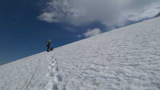
Vern and I climbed it on the 3rd day of our Lyell Icefield peak-bagging trip. Having already bagged Lyell III, Lyell II, Lyell I, Lyell V and then Arctomys Peak in the previous two days we were tired and low on motivation. But as peak-baggers we were even less motivated to just wonder around in the hut for a full day doing nothing… The extra night spent in Lyell Hut costed me more than 40 bucks and I had to make use of it. Ben wasn’t feeling like climbing Farbus and decided to sleep in, while Vern and I left Hut at roughly 7 am. The first 2-3 hours was repeating the snowshoe slog to the col between Lyell II and Lyell III. It’s boring like hell and I’m not going into details about this part.
A view towards Lyell 2 from the familiar slog up to Lyell 2/3 col
The impressive Lyell 3
Vern on the slog
Looking back at Lyell 4 and 5
Good picture showing our tracks on Lyell 3…
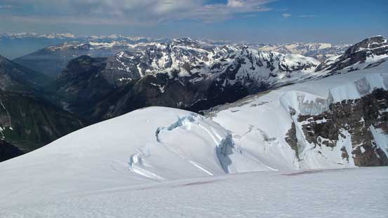
From the col we were facing against new terrain. Farbus Mountain wasn’t originally on our agenda when planning this trip so I didn’t study the upper Alexandra Glacier except for knowing it’s “crevassed” and the fact Rick Collier et al. ascended this route on skis. After descending for a while around the seracs on Lyell III we were slowly getting confused. The direct path towards Lyell III/Farbus col started to look steeper and steeper. I was suspecting it’d end with drop-offs (icefalls) so proposed a traversing line to hit the west ridge of Lyell III first, and hope that ridge connects to the col with no real difficulty. None of us knew if this route would work so it was a gamble. We had to cross numerous large crevasses on sagged bridges and at one steeper roll we had to take the snowshoes off. The snow was even worse than the previous two days with occasional post-holing down to the glacier ice. I even took out the avalanche probe making sure we didn’t step on a crevasse. It’s a tedious process but eventually we did manage to hit the solid rock on the west ridge of Lyell III. Looking back we realized our route was by no doubt the only possibility..

Snowshoeing down from Lyell 2/3 col onto unknown terrain
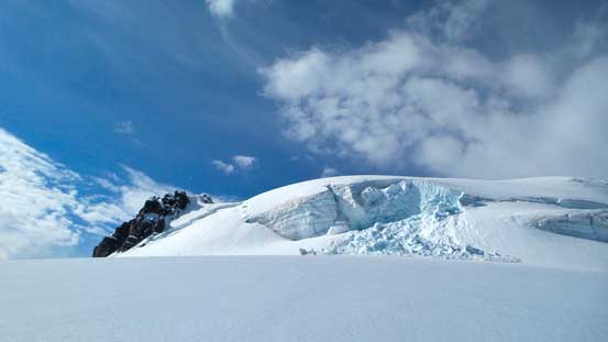
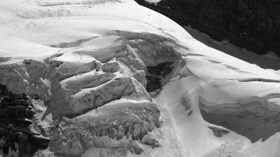
Seracs on Lyell 3
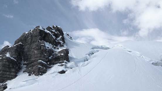
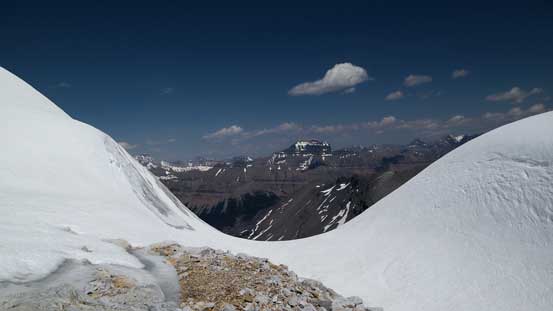
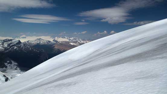
The low bump ahead is our objective, but much farther than it looks
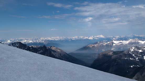
Cool valley smoke by Bush Arm
At a steeper roll we had to take the ‘shoes off, so ditched them
The route connected to the ridge, but a lot of post-holing involved.
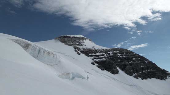
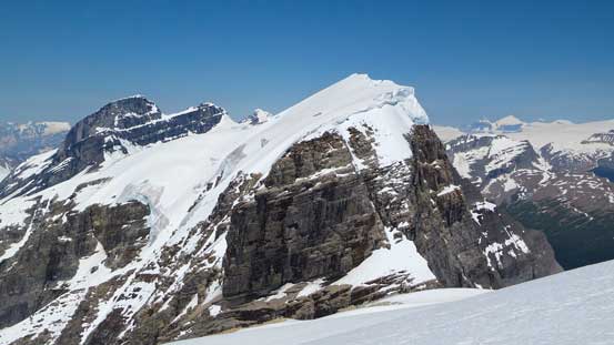
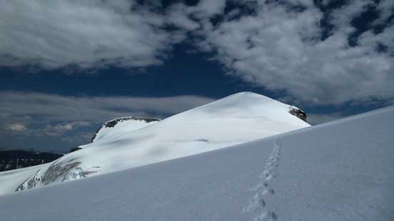
Farbus now looks bigger, but still had a lot of height loss
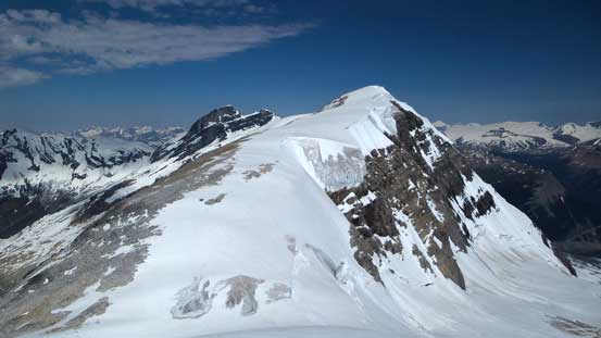
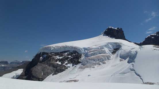
There was still hundreds of meters of elevation loss. The rock scrambling started to get trickier too as we had to deal with some large boulders on a steeper roll. We were tempted to bail onto snow but not knowing exactly what the terrain ahead we stuck with the rock. After what seemed like eternity we made down to Lyell III/Farbus col, realizing we must have lost at least 500 vertical meters of height… Oh well… At least the ascent of Farbus appeared easy and short. Mmm… We always forgot the views tended to be foreshortened when looking straight into it.
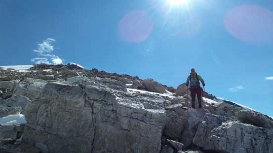
Scrambling down rock
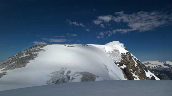
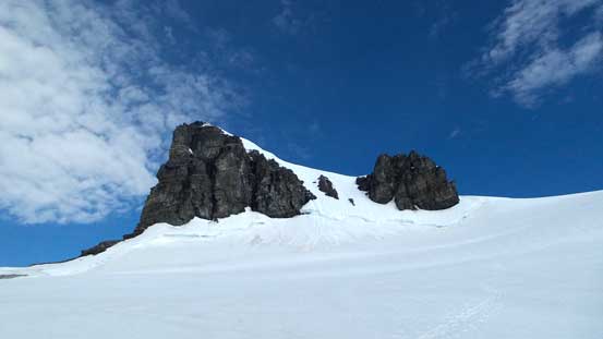
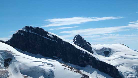
Farbus Mountain ahead
Finally made down to the col
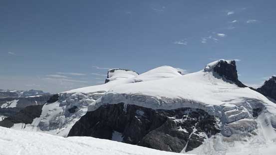
Cool views from the col though
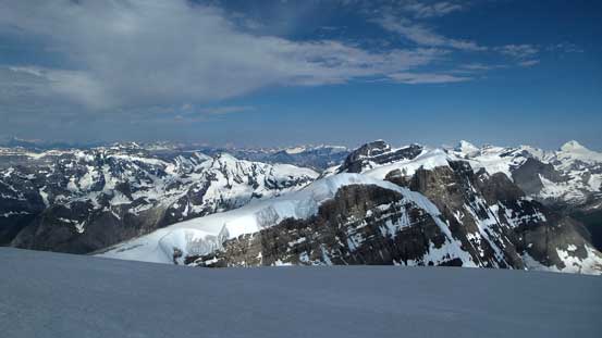
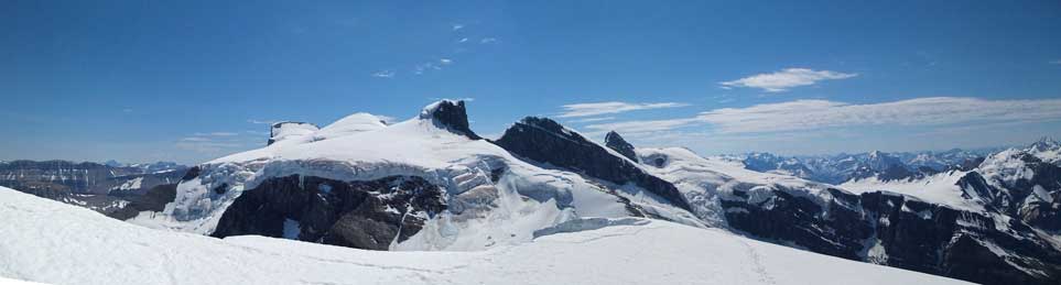
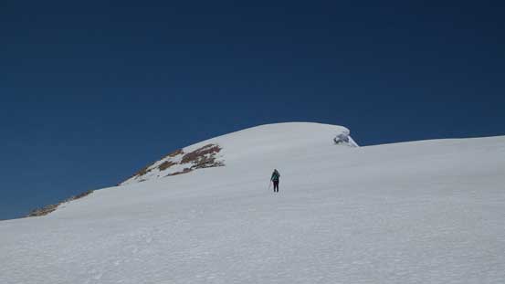
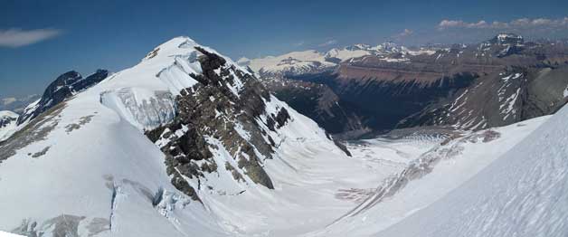
The ascent of Farbus was indeed technically easy, but far from ‘short’. We had to gain at least 200 meters of height and over a long distance. The summit just never seemed to get closer, and once it did get closer we had to ascend onto the summit glacial field, probing the cornice carefully. We still couldn’t ascend to the real apex due to the massive cornice but by wondering back and forth a bit we did manage to get most of the views. Looking back towards the 5 peaks on Mt. Lyell stole the show, while Mt. Alexandra was trying her best to compete towards north.
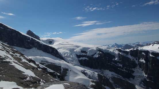
Looking back we could see the icefalls coming down from Lyell 4

Gorgeous view of the N. Face of the Lyells
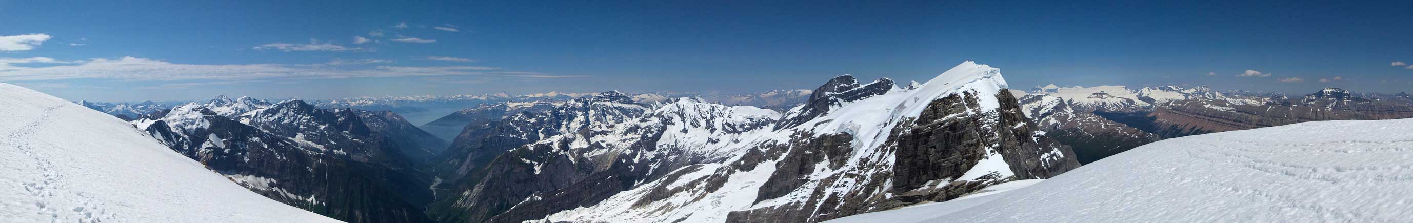
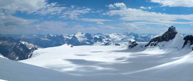
Partial summit panorama. Click to view large size.
Partial summit panorama. Click to view large size.
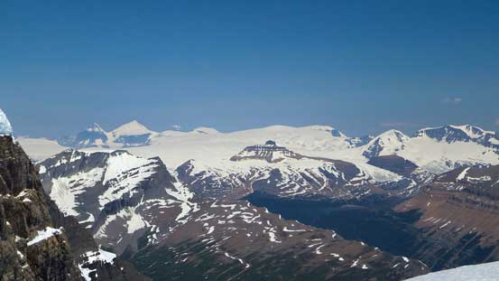
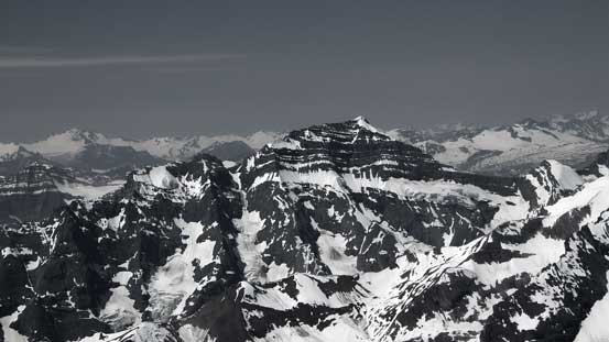
Oppy Mountain is a near-11,000er between Alexandra and Lyells
The Columbia Icefield
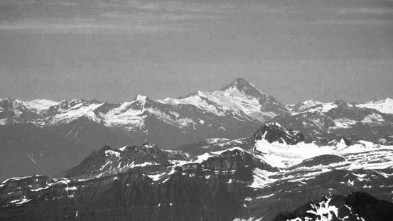
Mt. Saskatchewan is another near-11,000er
Lens Mountain with Rostrum Peak and Icefall Peak behind
The beautiful and rugged scenery in BC Rockies

The N. Face of Kemmel Mountain
Mt. Sir Sandford is a bulky one
Cockscomb Mountain is an interesting peak

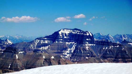
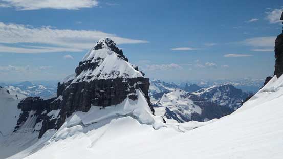
Mt. Alexandra
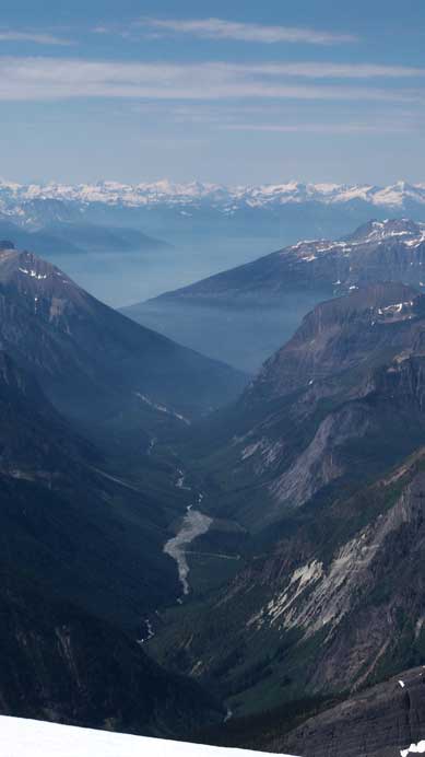
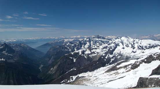
The deep Lyell Creek valley
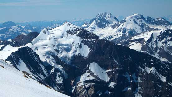
Lyell 1, 2 and 3
Lyell 4 and 5
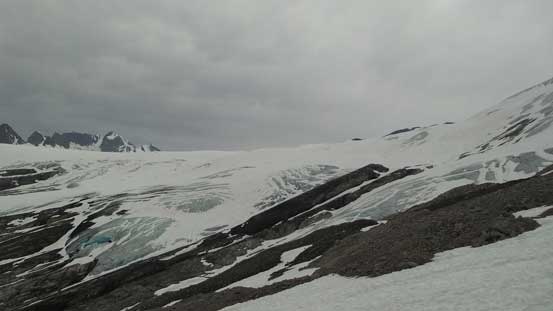
Icefalls on the upper Alexandra Glacier

Icefalls coming down from Lyell 1 & 2
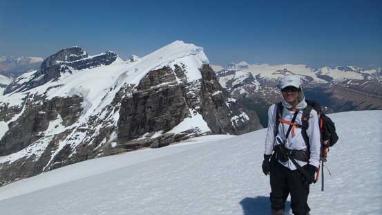
Me on the summit of Farbus Mountain
After a quick lunch break sitting just below the glacial field (with view straight down into Lyell Creek) we started the long slog back. It seemed like “slog” had been the theme for this trip. Descending back to Lyell III/Farbus col was fast and fun but re-ascending back to Lyell II/III col was slow and tedious. Now knowing what we were in for we opted to stay mostly on snow avoiding those tedious boulder hopping, but the price we paid was post-holing. At least for the most it was good step-kicking but near the rocks we did have to do knee-deep post-holing. Once back to the snowshoes we picked a slightly higher bench in between two gigantic crevasses (sags) rather than crossing them like on the way in, and slowly worked our way back up.
Vern descending snow
Almost back down to the col, looking ahead towards Lyell 3
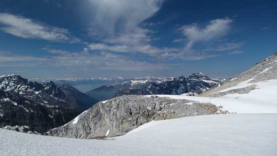
A view from the col
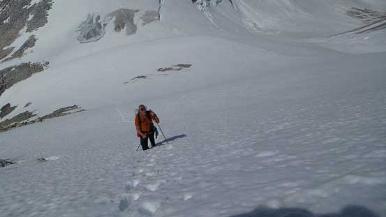
On the way back up we also stuck with snow
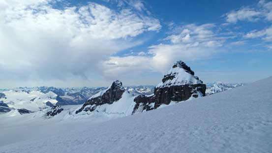
Looking back at Farbus Mountain
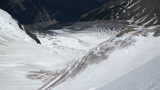
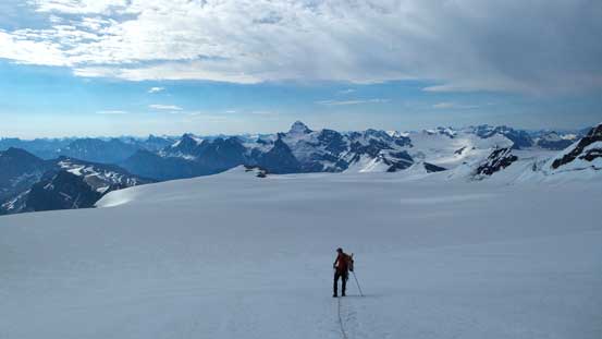
The heavily crevassed Alexandra Glacier
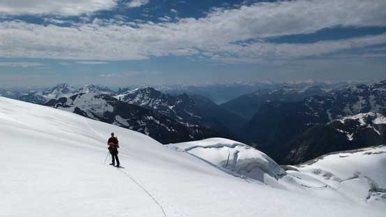
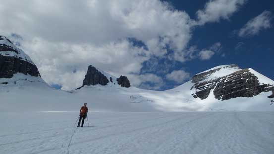
Traversing the upper Alexandra Glacier

Farbus Mountain looks small again
Vern high on the Alexandra Glacier
Almost back to Lyell 2/3 col
Eventually we made back to the high col. That’s the last bulk of elevation gain in this trip. Descending from Lyell II/III col down the Lyell Icefield was again, fast, but not so fun as it’s still a tedious process. My iPod came handy for this part as all the views were repetitive. After eternity we crossed back the broad shoulder of Lyell V, down the BC side of this icefield, marched across another kilometer and then up the final hill towards our home – Lyell Hut. It took us 9 hours which wasn’t too bad actually, but we were moving fairly fast.
The impressive Lyell 4 from the familiar side
I like the shadow of the clouds on Lyell Icefield
Back to the slog…
We got the newest weather forecast saying there’d be 10-15 mm of rain on our exit day… That’s quite a dramatic change in the forecast over the course of 2 days, but we had no choice but to deal with it. We figured there’d also be a good chance for thunderstorms so woke up early at 5:30 am, and left the hut shortly after 6:30. It was already raining outside so the race began. This descent had virtually no major elevation regain except for the very beginning where we had to ascend up and over that big glacial hill. Snowshoeing down the icefield was no fun thank to the uneven surface but still fairly quick. Within 1 hour we exited the glacier. The gear transition turned out to be the only break we had during the entire descent. Once packing the technical gears we were back to the race with weather. We quickly made our way down the slabby/snow/moraine section and onto the ledge traverse. Picking up the trail we stayed high on the slope and crossed that intermediate creek before descending straight down the skier’s left side. By doing so we avoided bushwhacking as well as that log bridge. Back on the trail the rest of the return was fast but we did get briefly lost again near the end of the ledge traverse. Overall we managed to knock down the entire descent from Lyell Hut to car in 4 hours… Considering many parties choose to chopper in and out we apparently didn’t do bad on time…

Weather turned in on our exit day…
Thankfully it wasn’t a total white out on the icefield
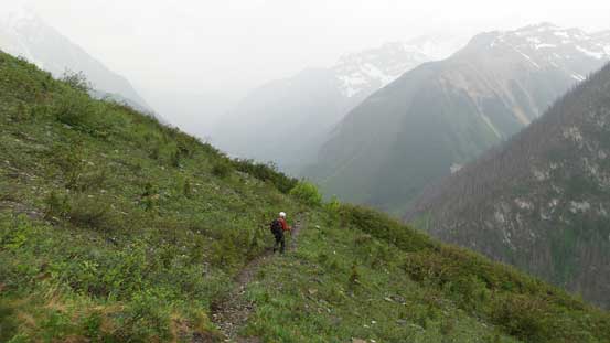
Descending the trail in rain
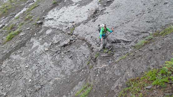
Slippery down-sloping terrain

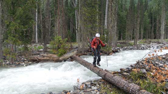
Vern au-cheval across the log bridge
Ben walking across the bridge
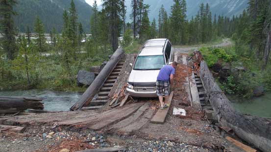
Now the exciting time began – the drive out. I think we all had huge concern that Ben’s SUV might not be able to make it out even though nobody spoke it out. Indeed we were facing some serious difficulties. The washed-out creek crossings weren’t too bad but the river/swamp crossing had become a death trap… The river was flowing very fast and it’s deep (more than door deep) and we couldn’t see the bottom. I had no idea how we made through. And now came the collapsed bridge. One of the planks got popped up and knocked off the bumper but other than that no major damage. Thankfully it didn’t hit other places otherwise we’d have huge problems.
Mm. Not very good…
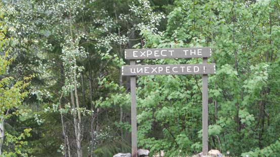
This sign explains this road well…
The rest of the drive back was long – 6 hours back to Calgary and another 3 hours back to Edmonton, and that concluded our 6-peak adventure on the Lyell Icefield. Despite we didn’t get Lyell IV it’s still a very successful trip. In terms of views it probably turned out better than the 5 Lyells as some of my favourite shots were actually taken from Arctomys and Farbus. On the other hand, I don’t think any of us would ever drive the Valenciennes River FSR again, but it’s only 11 km after the bridge so a bike might can solve the problem. Don’t know how to deal with that swamp crossing with the bike though, but if I ever come back for Lyell IV it’ll have to be in August so hopefully by that time of a year the water level can drop. Awesome area and highly recommended!!
