Lil’wat Mountain
October 23, 2022
2073m
Pemberton, BC
This is an unofficially named summit in the immediate vicinity of Pemberton. The peak’s elevation is not significant by the area’s standard, but it rises one vertical mile abruptly above Pemberton Valley and it also boasts over 400 m prominence above the nearest saddle. The access is from Spetch Creek FSR shared with the standard routes of Cassiope Peak and Saxifrage Peak but this peak requires some degrees of bushwhacking and receives a lot less attention than the neighbours. For some reasons I was more intrigued by this little summit than Cassiope/Saxifrage as those two are getting much more popular these days. The ascent of Lil’wat Mountain still boasts some exploring potential as other than Simon’s trip report on bivouac.com there wasn’t much information online.
I had been considering this summit even prior to Simon’s trip in 2018 but this was overall too “easy” to be considered a primary objective on a nice weather day. I also didn’t want to walk extra distance on that logging road so the ideal time for me was the so-called “shoulder season” when I couldn’t contemplate bigger objectives but the access road’s still free of snow. After a long, dry and hot autumn the first snowfall finally arrived. The snowfall amount seemed to be minimal but enough to make things slippery. Holly and I eventually settled on this less ambitious objective. I was considering to car-camp to get more hours of sleep but due to various reasons we couldn’t leave home in the previous evening. Instead, I woke up at 5 am, grabbed Holly from downtown at 6 am and drove us to Pemberton in the morning. I’m never a fan of the Sea to Sky Highway as my driving is very slow on curvy roads. Holly was surprised that we didn’t make to Pemberton until 9 am but then I reminded her that I’m more of an Albertan driver. The Spetch Creek FSR did not impose any problem to my trusty Tacoma and in fact I think we could have made the trail-head in Holly’s SUV. Comparing to speeding on winding highways I’m actually much more comfortable negotiating rough FSRs.
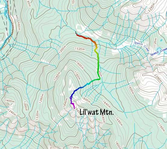
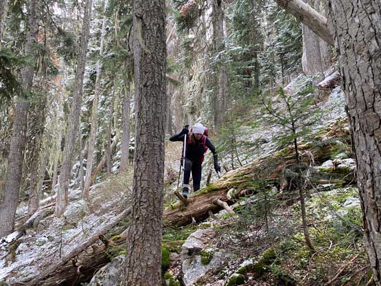
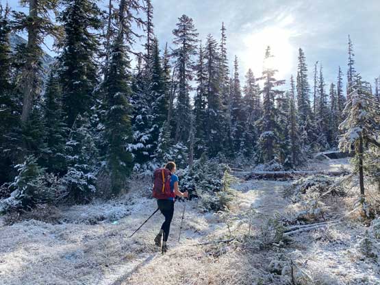
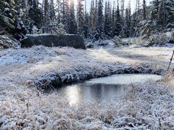
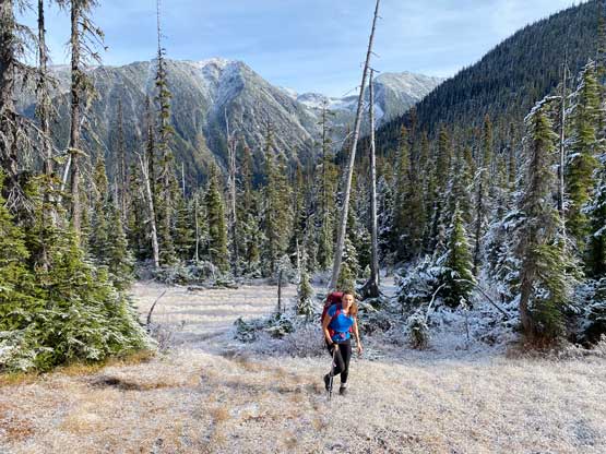
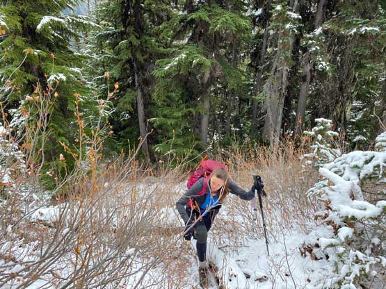
Simon had taken a direct route up the forested north ridge but I thought it’d be nicer to hike a couple kilometers up Valentine Lake trail to bushwhack up the NE slopes. This would shave off both elevation and distance of the off-trail portion. The trail condition was good with only a few dead-falls to hop over and as expected, there was fresh snow from 1300 m elevation onward. We left the trail just after crossing a meadow area at 1500 m but in retrospect it’s probably easier to leave the trail before entering this meadow. The bushwhacking was thicker than anticipated with some sustained underbrush, but nothing annoying by SW BC’s standard. The annoying part was the fresh snow on the vegetation that made my hands wet and cold.


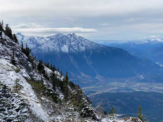
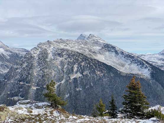
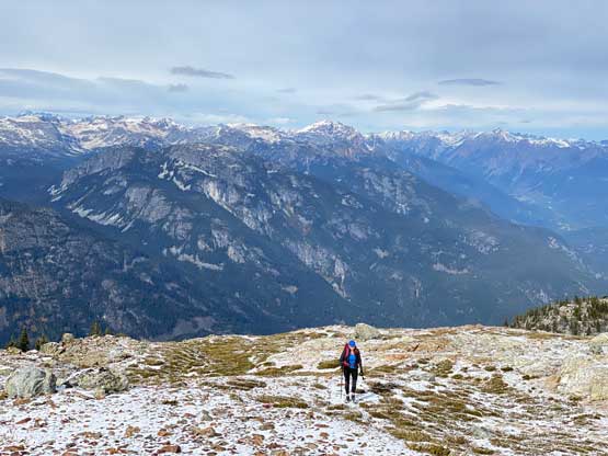
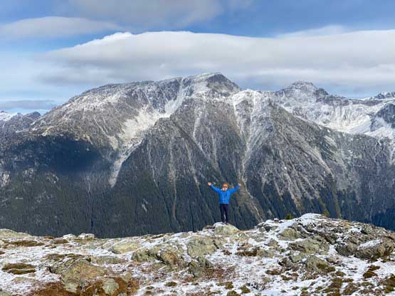
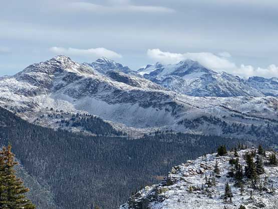
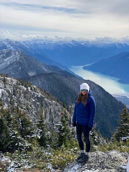
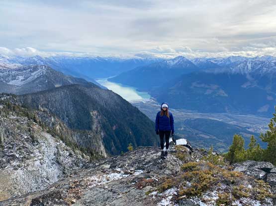
I think we took only one break in the forest and then pushed onto the broad north ridge where the views finally opened up. The direct attack of the summit seemed to involve some 3rd class scrambling but there’s a ramp extending outwards to climber’s right. I opted to check out that ramp and sure enough that offered a walk-up route to the summit. There wasn’t much in the way of boulder-hopping so the fresh snow wasn’t really that much of a pain. The summit was very cold and windy but we came prepared with the winter parkas so we were able to linger on the summit for over an hour without freezing ourselves to death. We even descended to a minor viewpoint on the south side of the summit to check out more views, as the communication structure on the true summit was rather annoying.


After updating my socials I figured that we might as well start the descent. Instead of taking a gamble of another route I decided to follow the exact route that we took on the ascent. For the most parts I could see the footprints but lower down we lost the footprints and had to rely on the GPS. The bushwhacking felt infinitely easier on the downhill. Once joining the trail we leisurely plodded the few kilometers back to the truck and then drove home. The traffic was actually quite tolerable on a Sunday afternoon. After dropping Holly off in downtown I continued down south to Richmond to have a dinner before driving back home to White Rock.