Mount Tilley
October 5, 2017
2649m
Revelstoke, BC
Despite a close proximity to the civilization Mt. Tilley seems largely unknown on the internet. The reason is very simple. The nearby Revelstoke classic Mt. Begbie draws everybody’s attention leaving this little neighbour next to unexplored. The two share the same approach but to get to the base of Mt. Tilley’s south slopes (easiest route) an additional 5 km or so has to be covered with much of this stage on unpleasant boulder fields or bushy slopes. The exploration from Begbie’s bivy down to Revelation Lake and then up the south face of Mt. Tilley is a unique experience in its own way, but I doubt anybody, other than the locals or the stubborn peak-baggers would actually bother to put in those efforts. A determined party can possibly do it in a day but most would require at least 2 days if not more.
The plan among Adam (Gimplator), Al (Spectrum) and myself was to ascend Mt. Begbie and Mt. Tilley together in two days. On the first day we completed the mission of bagging Mt. Begbie but after so we weren’t 100% certain about Mt. Tilley. This peak simply doesn’t look attractive enough and the approach looks like a bit of a pain in the ass. The morning we woke up at sunrise and discussed some possibilities. In the end we concluded it’s either Mt. Tilley or going home and in this case we picked the former. Would be stupid to waste a gorgeous day like this.

Ascent routes for Mt. Begbie and Mt. Tilley. GPX DL
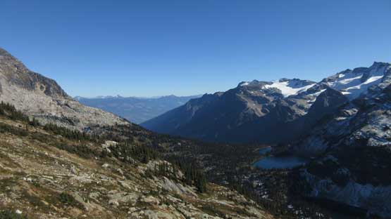
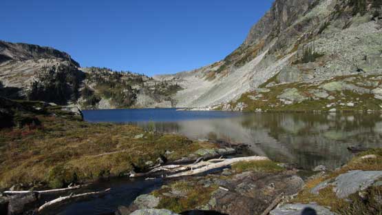
Right off the bat we faced the first section of unpleasant terrain. What looked like a walk on the map turned out to be a mile-long stretch of boulder fields with some on glacial ice (hence loose like hell). This wasn’t the worst I have done, but close enough such that it’s guaranteed this place will never see me for a second time. In short words, it’s NOT fun.. After the boulder fields we joined a creek and descended (easily, on grass) to the shore of Tilley Lake. The traverse across this lake on its east shore was again, on mostly unstable boulders which made 4-letter words flying around for another round. The good thing, we already got some neat views of this rarely travelled valley.

Mt. Begbie on the morning of Day 2

This is the perfect camp spot if you plan to ascend these peaks…
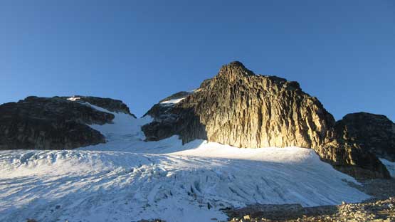
Another shot of Mt. Begbie before leaving for Mt. Tilley

Tilley Lake
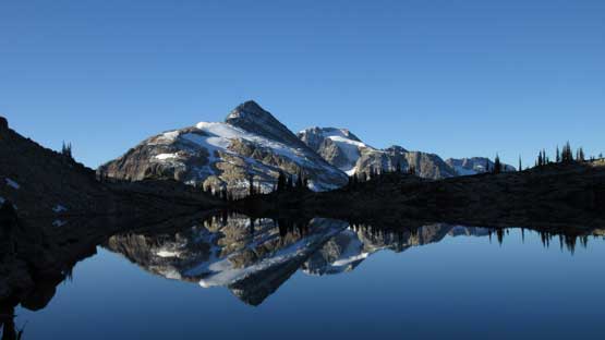
I don’t even think this peak has a name.
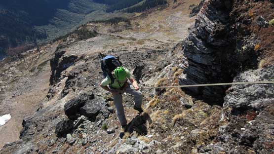
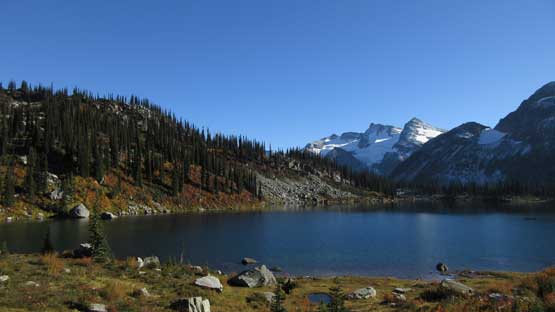
The descent from Tilley Lake to Revelation Lake was worse than the previous stretch. First of all we had no further information other than “we had to descend to the next lake before going up again” so we had to figure out the micro-terrain on our own, and trust me there’s lots of micro-terrain. There’s the main outflow drainage which we used as a directional guide. Staying on the north side worked out initially but dumped us in some very steep bushes. It’s too slippery to continue so we back-tracked and hopped across to the south side and then found more gentle terrain. At the shore of Revelation Lake with more than 300 m hard won elevation lost from camp, it wasn’t obvious where exactly to go up again so we kept traversing until a band of thick brushes blocked the way. Then we took a sharp turn ascending steeply with a general leftwards bearing. A couple minor obstacles required some degree of route-finding and scrambling but I think we did excellent in finding the path with the least resistance to get onto the south face.

Kept descending from the outflow of Tilley Lake.
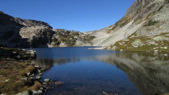
After a while we dropped down to Revelation Lake

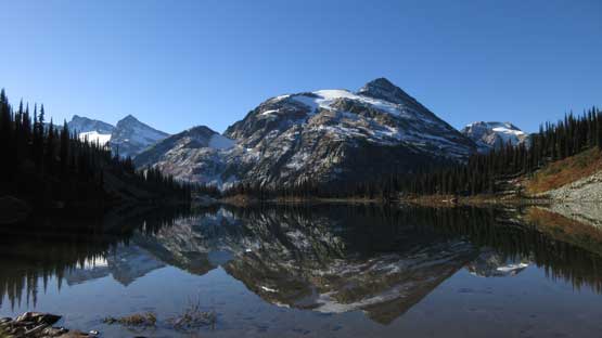
Mt. Tilley looms very impressively above
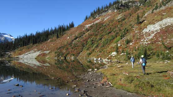
Traversing the shore of Revelation Lake

There’s a band of thick bush preventing a further traverse, so we went up
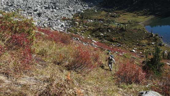
The typical steep bash to get out of this lake’s basin

And then we had to link the pieces together. Not very difficult but lots of guess work
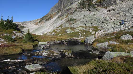
Finally we got onto this bench. We then traversed across to the south face proper
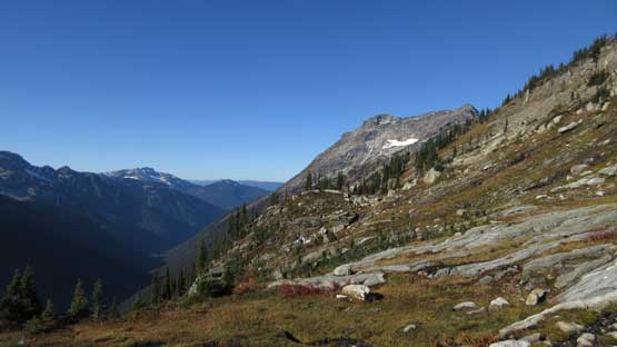
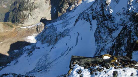
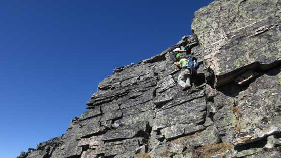
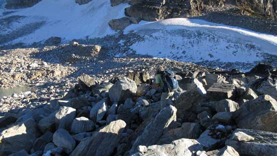
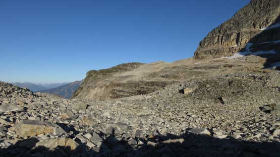
A mandatory break was then taken but soon enough we got going again. The task was simple now that we just had to shoot straight up the south face/ridge to the summit although the top section looked a bit interesting from below. This whole process would involve about 500 m of gain but the first 400 m was just a mind-numbing plod. The only thing worth noting is the terrain, gradually transitioning from “good rock” to “mediocre”. Near the top the easiest line looked to be on the climber’s left side with a bit of traversing but I wanted to go straight up over a band of cliff. This turned out to be harder than expected with one short 4th class step. The rope was taken out and thankfully I also brought a quadruple-length sling which fits perfectly to a bomber boulder.

Davis Peak looks very attractive to the south

This is much of the south face of Mt. Tilley

Mt. English to the side

Adam plodding up the talus field

Terrain’s getting more interesting the higher we went
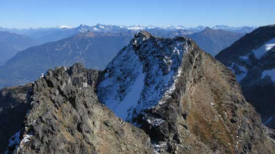
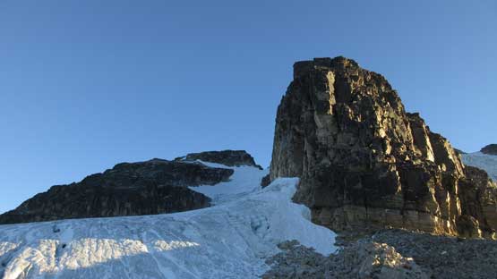
This sub-summit is very impressive in its own.

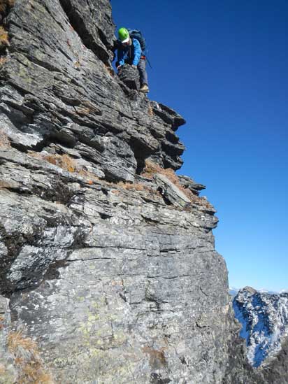
Adam climbing up the crux (with a belay now).
Once everyone’s cleared this crux step we resumed on. There’s still a fair amount of 3rd class scrambling with route-finding although the rope stayed in the pack now onwards. The summit was reached shortly after and I actually think this one offers better views than Mt. Begbie does.

Another shot of this “shark’s fin” sub-summit and Mt. Begbie behind

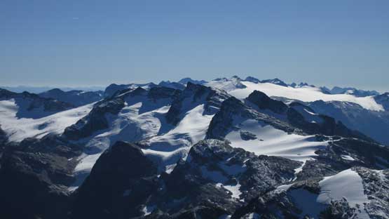
Summit Panorama from Mt. Tilley. Click to view large size.
Mt. English to the west
“Big Apple” with the famed Blanket Glacier behind
Looking far north into the Carnes Group of the northern Selkirks
A full stretch of icefields with Cat Peak et al. in the central Monashees
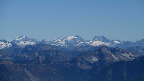
Giants in the southern Selkirks. Very few people venture that way.
The north face looks like a good mixed climbing route
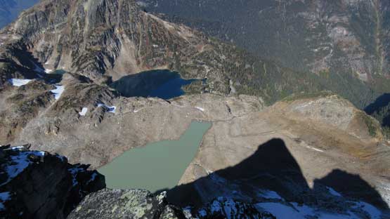
Some cool contraction in the lake’s colours

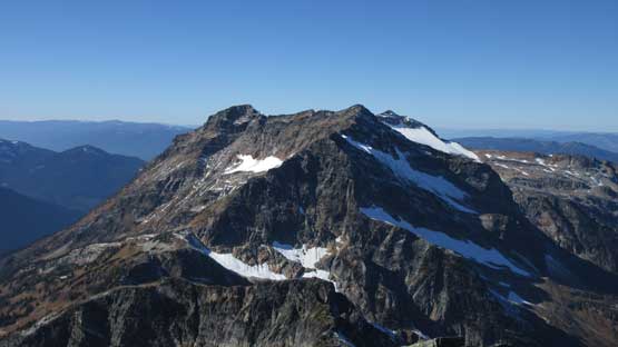
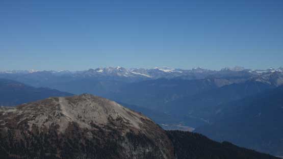
This is a full view looking north. Mt. MacPherson in the foreground

This is looking at Revelstoke and Columbia River Valley

A very interesting unnamed lake below Mt. MacPherson

Another look at this “shark’s fin” sub-summit

Me on the summit of Mt. Tilley with Mt. Begbie behind

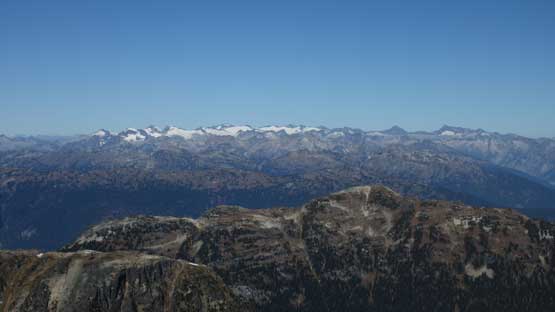
Another panorama from the summit of Mt. Tilley. Click to view large size.
About half an hour later we decided there’s enough October sun tanning, so down we went. There’s some strategies about this crux. Al went around on down-climber’s right, Adam rappelled off while I cleaned the station and gingerly down-climbed. The one cruxy move turned out to be a bit more awkward than expected but at that point I was already committed to the down-climb. Al’s route turned out to be the fastest so scrambler wins on this one.. The rest of the descent down to Revelation Lake wasn’t too bad although I had to pull the GPS out many times in order not to miss some key corners. We still ended up getting lost briefly but again, with the GPS handy any form of back-tracking would be a short one as I never allowed us to deviate too far from the up-track.
Descending from the summit. 3rd class and lots of hands-on
Adam rapping off the crux
Me about to down-climb the crux.
The broad pass between Begbie and Big Apple and Mulvehill Creek valley

Adam with Davis Peak behind

The SW side of Mt. Begbie is pretty eye-catching too
Down to Revelation Lake now
And then there came the 300 m grunt back to the campsite with again, much on unpleasant terrain. Slogging back, and then around Tilley Lake wasn’t too bad but then negotiating that long stretch of boulder field was mentally taxing to say the least. Adam led a line further north (left) which seemed to work a little bit better. At least we avoided that rock-covered-glacier section. After what seemed like eternity we eventually crested the ridge and then got back to camp right in time for sunset. There’s not a lot of extra time to kill as we had to immediately break camp and head down. Much of the final 1500 m elevation loss was down using head-lamps and it was not fun..

Grunting back up this little drainage towards Tilley Lake
At the outflow of Tilley Lake right in time for some perfect lighting

I wish we had another day to spend here.
Tilley Lake and its outflow
Who doesn’t want to camp here!

Just another shot of Tilley Lake. This shows the unpleasant traverse around

Really clear water
This is not very fun though. At least one km of boulders like this…
We had to gain that high shoulder and much of this is on boulders
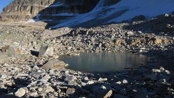
This tarn has almost frozen over

This shot is for you ice climbers!

Another tarn that had just frozen over
Finally made back to the shoulder now, looking at the north ridge of Mt. Begbie

Mt. Cartier across the Columbia River Valley
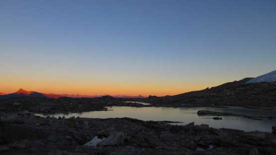
Dusk horizon from camp
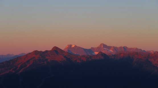
Albert Peak and North Albert Peak in the Selkirks. You see them from Highway 1
In the end, Mt. Tilley was a great adventure but not one I would do again. Period. Type II fun at the maximum although the views were awesome. Mt. Begbie deserves its classic status but the only downside, Revelstoke area is a bit far from anywhere, whether you are from Calgary, Edmonton, Vancouver or Seattle.
