Otuskwan Peak
October 25-26, 2013
2640m
Ya-Ha-Tinda / Ghost Area, AB
So the question is, where is Otuskwan Peak? I’m sure that most people, even some hardcore peak-baggers, haven’t even heard of this name. Though relatively easy to access, it’s located in an obscured part of Alberta’s front ranges. It’s south of Ya-Ha-Tinda and north of Ghost River Wilderness. The summit is at roughly halfway between Mount Aylmer and Wapiti Mountain. Inspired by Brandon Boulier’s successful ascent of the nearby Zombie Peak one week ago, Ben, Eric, and I decided to give this area a visit before the old man winter really comes. It’s a tough decision whether we should go for Zombie or Otuskwan. Given the limited time we opted for the shorter one.
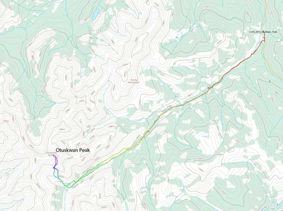
Otuskwan Peak scramble route. GPX DL
Panther River forestry road was in a good condition but locating the Sheep Creek trail-head in dark was a different game. My new GPS came handy but there’s a chemical plant near the trail-head making lots of confusions. The parking area is at an obscured corner. There’s a steep and narrow road leading down from the main road after passing the plant but we didn’t discover it so we had to walk extra distance. Eventually at about 10:30pm on Friday night we started our trek. Our plan for Friday was getting to the end of Sheep Creek “road” which is really just an intermittent ATV tracks. The road/trail would be easy to follow in daylight time, but in darkness it’s a different game even with GPS navigation. There’re a ton of washouts and creek crossings and many of those involve guess work. The creek was flowing high considering it’s already late October and the crossings weren’t straightforward. Many of those involved balancing on ice coated logs. (Later we know most of these bridges were built by Brandon’s group one week ago. They certainly made our lives easier. A big kudo to them).
We also made a big navigation mistake and to correct it we had to climb up a steep and icy slope. I didn’t feel secure with the gripping so started to traverse the sketchy bank and ended up trapping myself at a dead-end. I had no choice but to ford the creek… Ben and Eric climbed up that icy slope. We probably wasted an hour here.
Continuing up the “road” we made more and more mistakes, and eventually we completely lost the “road” and ended up bushwhacking. At about 800m short from our proposed destination we decided to set up camp. It’s already 1:30am and we were feeling very sleepy. We did find a prime bivy spot so that’s it. It’s not very far from the creek neither so I could manage to get some water. There wasn’t much we could do in dark so the next morning we decided to sleep in a bit and we were up by 8.
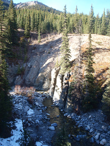
We were pretty close to the end of this road/trail so even though we managed to find it on the other side of Sheep Creek it couldn’t do us much favour. The theme of the rest of the approach was simply bushwhacking, side-hilling, and creek-crossing. We started with bushwhacking and side-hilling way above the creek floor and soon got tired of it so bailed down to the creek. There are a ton of canyons and they were impassible given the high water flow so we were forced to exit the creek floor again. And further up at one point a big canyon/gully from a sideway drainage forced us to drop down again… The progress went painfully slow but we were getting there.

Our campsite
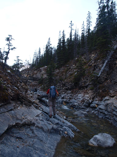
Typical creek. It’ll soon become impassible
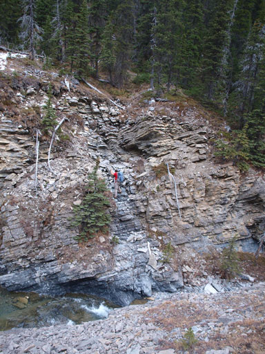
Eric exited out on the north side, while I went up the south side

Bush wasn’t pleasant
Eventually it’s the time to go up. We weren’t patient enough so bushwhacked up the forest. We could have gone further and follow a big drainage up, but oh well. Once exiting the woods the rest of the ascent was pure slogging on side-hill terrain. Some rock band prevented us from going straight up. The scree was loose, the progress was slow and I weren’t enjoying it at all. But once topping out on the summit ridge after bashing the scree for eternity, the views suddenly opened up. The sky was crystal clear and we could see miles and miles away and many rarely seen peaks in this area. There were some moderate/difficult scrambling steps on the summit ridge. They’re avoidable if you want more side-hill bashing. I didn’t want more side-hilling so scrambled up all of them. And as expected, this summit rarely sees visitors. The Rick Collier’s register placed in 1991 hasn’t seen a name since.
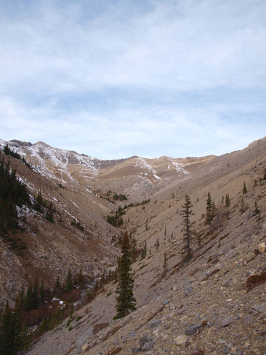
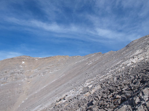
The ascending bowl. Summit is on the right, out of sight
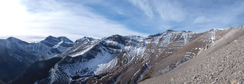
Panorama view from the boring ascent

Lots of side-hilling

One of the few parts that’s not side-hilling
The summit is finally in sight, somewhere up there…
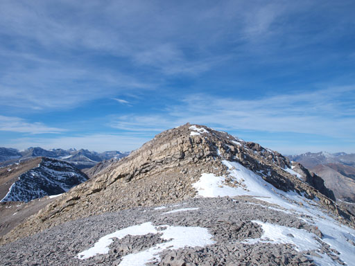
The summit block.

Summit Panorama. Click to view large size.
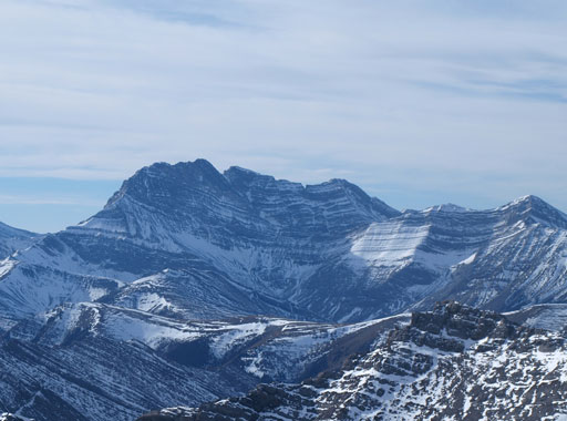
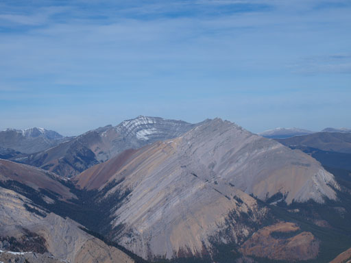
This impressive peak doesn’t even have an official name. “Puma Peak” according to bivouac.

Panther Mountain in the distance
Barrier Mountain (back) and Dormer Mountain (front) almost blend together
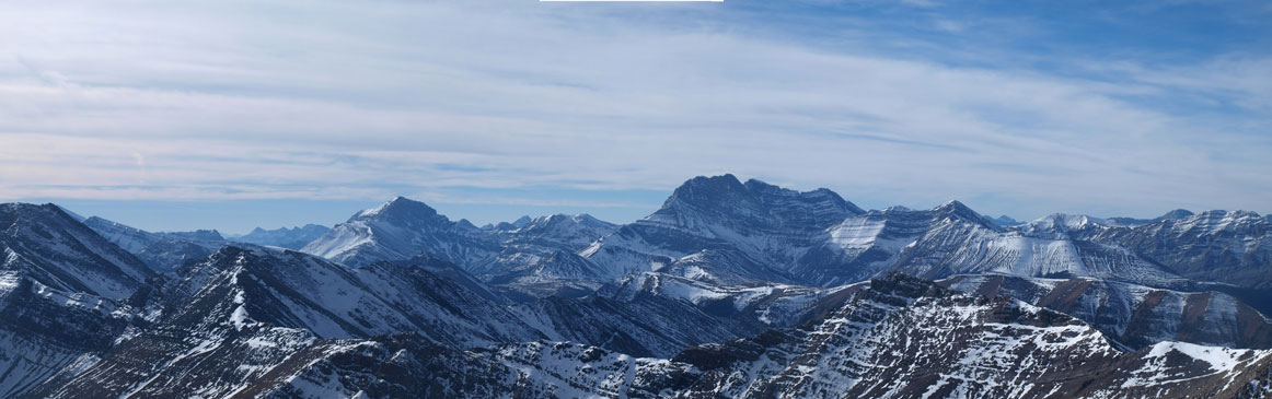
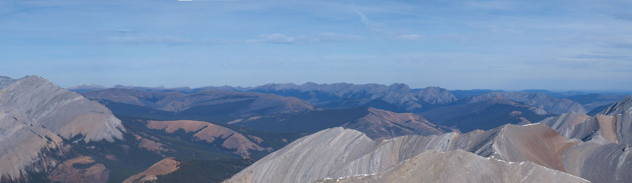
Panorama view of some impressive peaks in Palliser Range
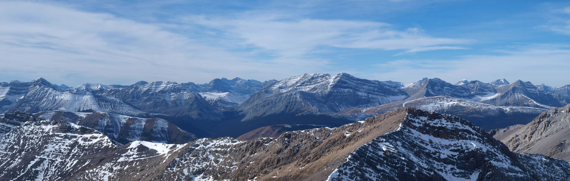
More Palliser Range. Panther Mountain right of center.
Looking northwest, more unnamed peaks
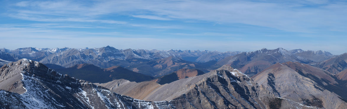
This is looking towards Ya-Ha-Tinda. In the distance you can see Maze Peak, Labyrinth Mountain, etc.
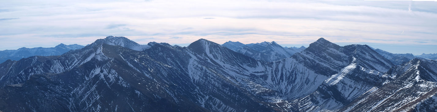
Peaks towards south are higher than Otuskwan. Zombie Peak is the highest one on left side

Me on the summit of Otuskwan Peak

The old Collier’s register
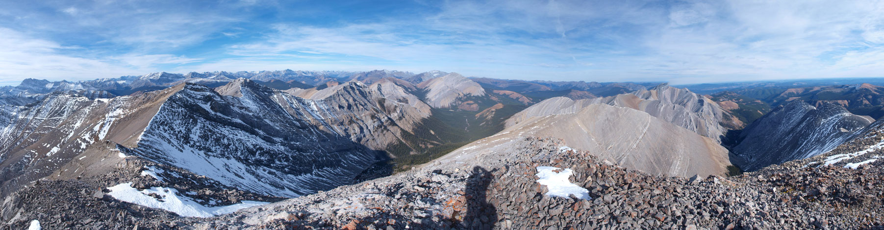
Another Panorama from the summit. Click to view large size.
The descent was much better. Well, for scree/rubble slopes, usually the worse the ascent, the better the descent, and vise versa. Down to Sheep Creek valley, we decided to stay on the opposite side hoping to find better bush. The bush was indeed better on this side but not by much. We also tried more creek-side scrambling. The creek hoping, though time consuming, was quite fun actually. Coming back to the “road” was surely a welcomed change. We made no mistake on the rest of the return and got back just before dark.
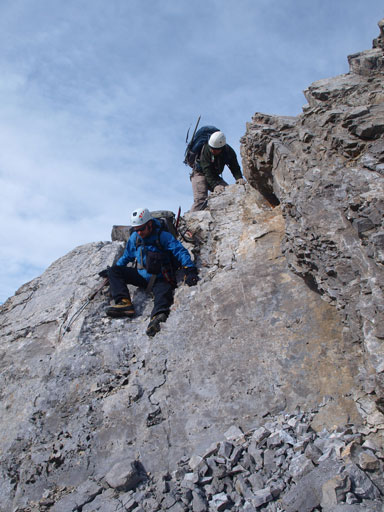
One of the few scrambling steps

Down to the creek. Note the canyon feature
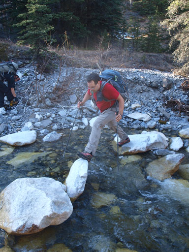
Interesting creek crossings.
Sheep Creek

Even on the trail/road, we had to cross creek due to washouts
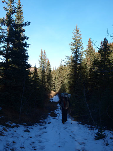
This is the typical view from this road/trail
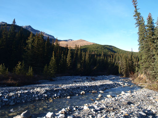
Sheep Creek
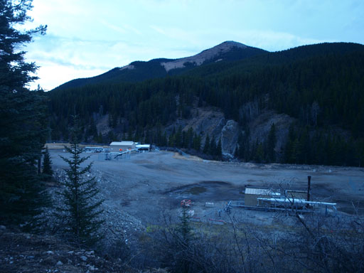
A chemical plant near the trail-head

Evening colours from trail-head.
For peak-baggers looking for something “new” to do in late season, this is a reasonable objective (though I don’t think I’ll recommend it). I’ll be back to do Zombie Peak someday in a different year.

Beauitful, remote area! Thanks for TR
[…] Peak is one of those peaks that I first heard about in 2013 when Steven, Ben and Eric made a late season ascent. Steven mentioned that they were the first to sign the register since Rick Collier in 1991 and of […]