Mount McQuillan
June 14, 2020
1575m
Port Alberni / Vancouver Island, BC
The area to the immediate south-east of Port Alberni on Vancouver Island is more known for the forested summits and heavy logging activities with logging roads running in pretty much every single valley and on every single peak. Mt. McQuillan is one of the taller and more prominent summit in that area. Traditionally the peak is approached from King Solomon Basin in the upper China Creek drainage but it can also be done by the bushy and 3rd class west ridge, which is approached from Father and Son Lake at the headwaters of Franklin River. Prior to this trip I had done zero research about this objective as I was joining a competent team of peak-baggers based in Nanaimo at the very last minute. I literally didn’t make my mind until 7 pm on Saturday evening and caught the 10:45 pm ferry ride from Tsawwassen to Nanaimo, with literally every single piece of car camping equipment sans sleeping bag…
I had been talking to Phil Jackson for a while on Instagram (@islandalpinequest) and I had also read a lot of trip reports written by Matthew Lettington as his beta is pretty much my go-to for the island trips, particularly Golden Hinde a few years ago. The weather forecast was questionable but the weather on the mainland was even worse. I was pretty excited to meet these guys and I seriously needed more friends and partners who are based on the island, as convincing my mainland partners to take the ferry had been a very difficult and sometimes, frustrating task in the past few years. I ended up only making to the island 4 times, with all but Golden Hinde being exhausting day-trips from the mainland (not even with car camping)… I was informed to meet them at 7 am at the start of Museum Mainline so I drove there straight from the ferry terminal. I made there at almost 3 pm and tried to sleep a bit while wrapping myself up with all clothing I brought. It wasn’t cold but sleeping without a sleeping bag was a difficult task. At 7 am Phil and Matt showed up along with a third friend, Dustin and I followed them up a series of logging roads to the trail-head of Father and Son Lake. The last switchback required 4×4 and high clearance but otherwise the road was in a surprisingly good shape, especially considering the worrisome gate at the bottom. The gate had some clear languages of “private property” and “needing permission” but the others assured that they had never seen it being locked.
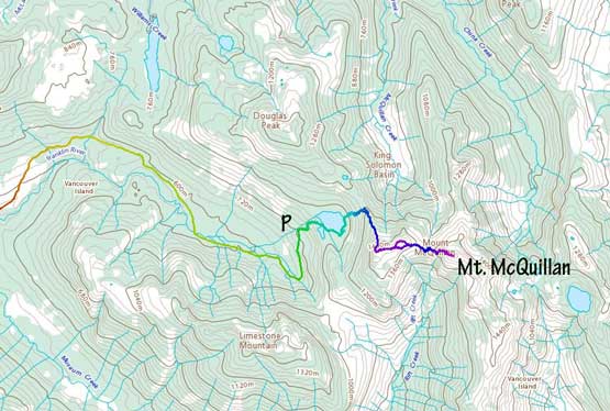
Mt. McQuillan via West Ridge. GPX DL
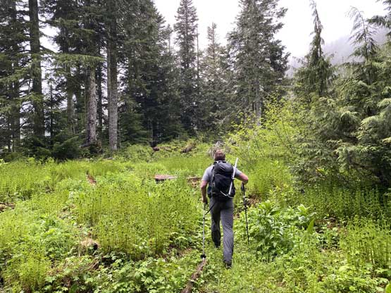
The weather was dreary so I opted to wear the waterproof winter pants instead of the summer pants as the others assured me there’s going to have some bushwhacking. The brushes looked awfully wet even at the parking lot. We made some quick work to the lake and contoured around its south and west side to directly beneath McQuillan/Douglas saddle. Phil had been up this route many years ago with a different group so he led the way entering the bush. We had some dead-falls and some brushes but nothing bad from the west coast standard. There’s one bluff that we opted to scramble straight up, which was fun. Higher up the grade steepened and we encountered more brushes but we weren’t far from the ridge at that point. Once gaining the ridge the travel became much easier that we even picked up a flagged path. Another hundred meter or so higher we started encountering snow and the snow soon became continuous. The visibility was poor but it wasn’t difficult to pick a line trending diagonally west (climber’s right) straight up the north slopes of the western sub-summit. The last bits were steep but the snow was very soft that an ice axe wasn’t needed.
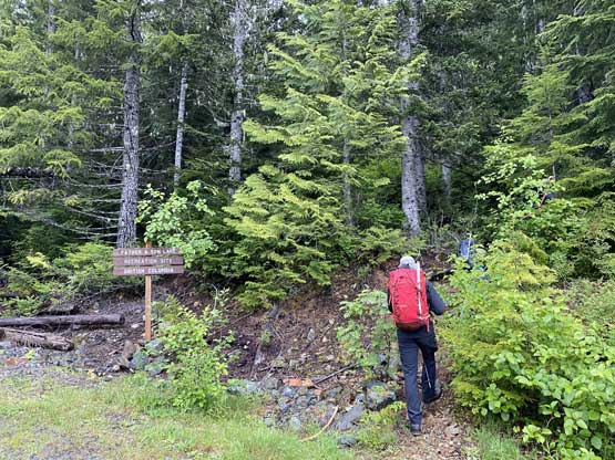
The start of the hike on Father and Son Lake Trail

The very soggy Father and Son Lake
Phil leading the way contouring around Father and Son Lake
Matthew contouring the lake.

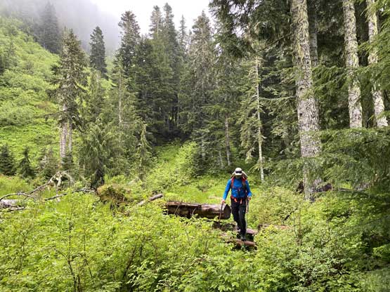
The bushwhack began..
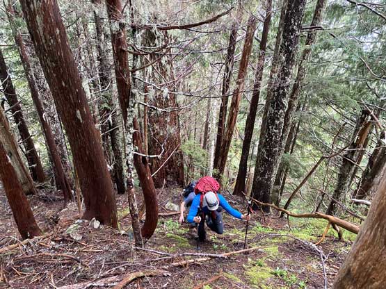
Honestly the bushwhack wasn’t bad. It’s steep but in old growth
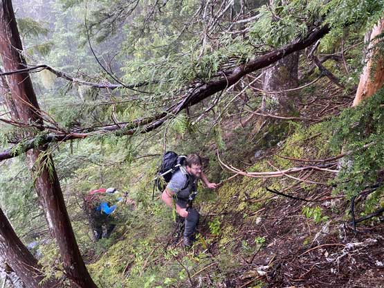
We had to find a way up a couple minor bluffs
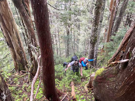
The brushes became denser the higher we went
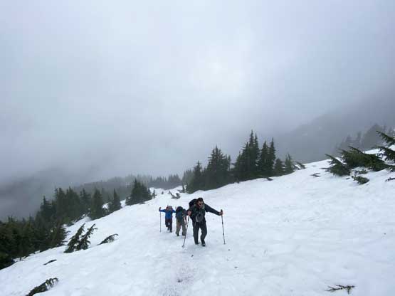
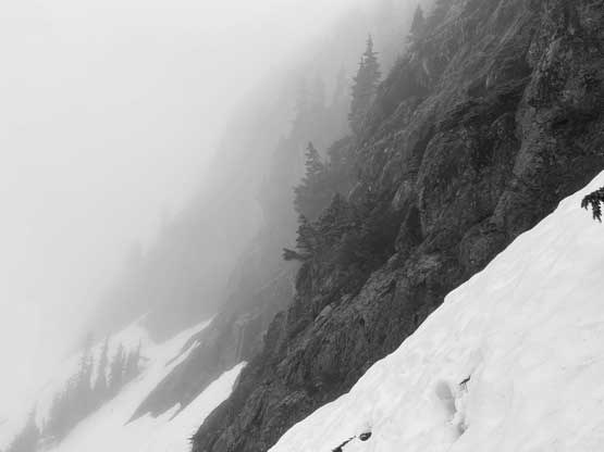
Onto continuous snow now heading up the north slopes of the sub-peak
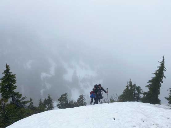
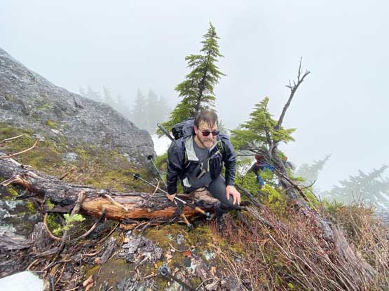
Given the density of peaks’ names on the Vancouver Island I was surprised that this sub-summit doesn’t have a name. We dropped down the gentle east ridge of this sub-peak and upon seeing another minor bump along the way we opted to traverse across the south slopes of it to save some extra elevation gain. The short-cut worked in the end, but I probably wouldn’t say it’s a better route as it involved a lot of side-hilling on wet grasses and bushes. The total elevation drop to the low point under the west ridge of Mt. McQuillan involved more than 150 vertical meters so it was downhill for quite a while. The weather had turned into light rain. The forecast was garbage. It’s shaping up to be a miserable day while looking ahead to the steep and bushy west ridge of our objective. The thrashing and scrambling started right off the bat that we had no choice but pulling up a series of class 3 steps using green belays. We got soaked to the bone in literally zero time. Then more bush and snow (sometimes steep) we encountered a mid-level rock band. Matt, Dustin and I scrambled the rock which involved one tricky move, while Phil found an easy, but wet and bushy bypass. The upper ridge involved more route-finding and a bit of class 3 scrambling but soon enough we were at the summit cairn, with no view of course but at least the rain stopped, briefly.
Moody view from the start of west ridge looking up…
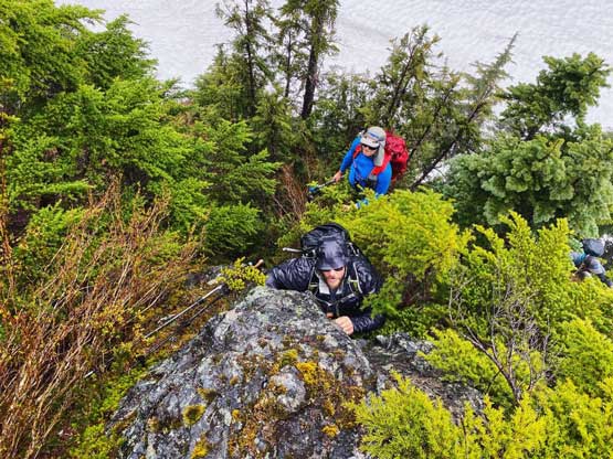
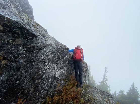
Pulling up a very bushy and slippery 3rd class step at the start
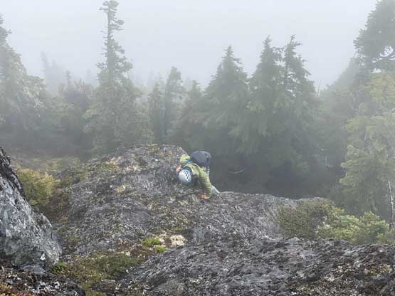
The terrain varied a lot on this ridge.
Phil trying to have some fun, after another bushy and wet step
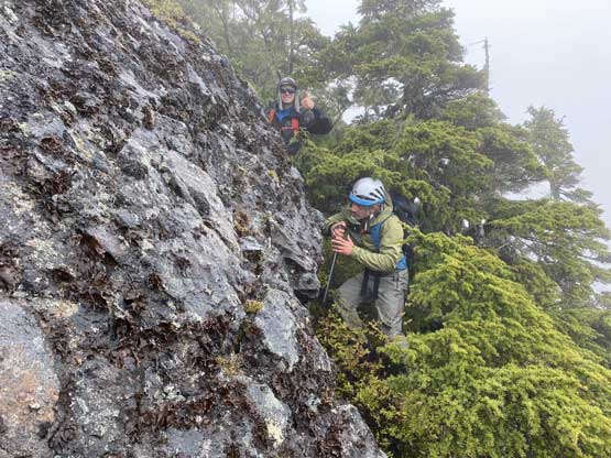
Matthew leading up the crux step-up move. It’s avoidable on climber’s right
Dustin tackling that tricky step.

Summit register confirmed our success…
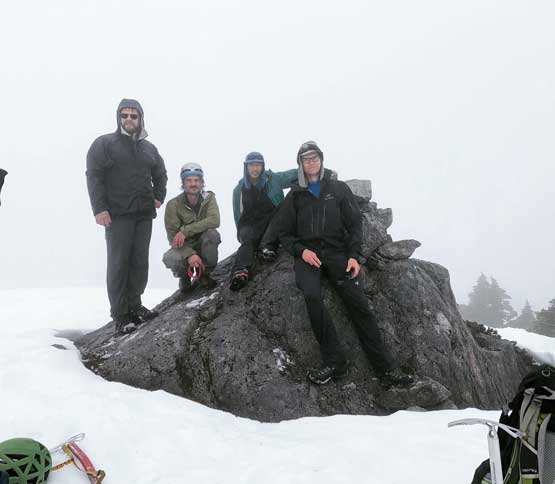
Our group shot on the summit of Mt. McQuillan
It soon became too cold to linger. For the upper rock step we found a different variation with similar difficulty. For the middle band Phil led us down using his bypass which certainly was a better choice especially for descending. And then we stuck close to our route thrashing and lowering ourselves down a few tricky and slippery steps. We then opted to stick closer to the ridge rather than dealing with all of those side-hilling, which turned out to be a better choice. We did feel the elevation regain to get back to the top of that sub-peak though. We then had some fast and furious boot-skiing and glissading down the north slopes of the sub-summit. The bushy descent back to Father and Son Lake wasn’t particularly fun, but wasn’t too bad neither with careful GPS work to make sure we stayed on route. It was still raining when we got back to the lake so didn’t bother to linger. The rest of the descent was uneventful.
Dustin descending onto the snow underneath the uppermost rock band

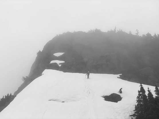
A very brief clearing revealed the only view we had from this peak
Dustin and Matthew thrashing down the bushy bypass

Trying to have some fun glissading…

Almost finished the bushwhack descent back to Father and Son Lake
Our round trip was about 6 hours moving efficiently the whole time. At the parking lot I wasn’t particularly sure what to do next but given the hefty ferry cost (150 dollars round trip) and the fact it’s only 2 pm I couldn’t quite resist the temptation to bag another peak, even with the miserable weather. After following the others down Museum Main I made my mind and turned southwards with the next objective being Mt. Spencer.
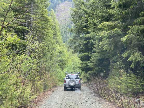
Driving down now.. Really need a GPS to navigate the logging roads here.
