Ngong Hills
December 23, 2023
2461m
Nairobi, Kenya
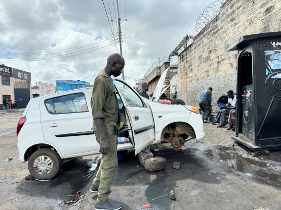
I happened to have most of a day to kill in Nairobi and I naturally went onto the peakbagger app and instantly noticed this objective, with almost 500 m prominence. I then checked the Gaia map and noticed a bunch of trails. The next thing that I did was a simple Google search and the result was positive. This is actually one of the most popular hiking objectives in the vicinity. The day was supposed to be a buffer day but my 3 connecting flights went fluently without any delay. Despite the jetlag and the general exhaustion from travelling across half of the globe I did not want to do nothing in the hotel. I sent a message to Charlotte, the receptionist of the guiding company that I would be using in this trip, but there was no response. I did not want to solely count on Charlotte so I talked to the hotel’s front desk and secured my private driver. I needed a driver who could drive me both ways and wait a few hours for me to do the hike. They wanted to charge 150 USD but I bargained it down to 100 USD. I thought this was still ridiculous but I remembered asking Charlotte about the cost of doing Suswa by myself, which was the other option that I considered. That price quote was over 500 USD, so I reluctantly accepted this front desk’s offer. I had slowly come to realization that Africa is actually one of the most expensive continents unless you do it in Petter Bjorstad and Eric Gilbertson’s self-propelled style. I had never even driven manual transmission and I’m never the greatest when it comes to the unexpected and the unknowns, so I prefer to work harder at home and simply use money to solve the problems.
This trip was organized by Rob Woodall and the plan was to bag 10 “Ultras” along with a bunch of “P600s” in Kenya, Uganda and Rwanda. The trip would be fully guided (through African Ascents) and costs well over 6000 USD per person. Adding the expensive flight tickets the cost for me was quite a bit higher than 10,000 CAD. I did do some evaluations but it didn’t take me long to pull the trigger. I would not otherwise get another invite to do these obscured peaks so this was my only chance, until maybe 10 or 20 years later when the next generation of peak-baggers come to this level. Rob would take a direct flight from London to Nairobi so there’s no need for him to have this buffer day. I ended up arriving on time together with the checked bag, so I got to do this bonus peak on my own. The driver showed up half an hour later than said, but I was not surprised as this is in Africa. I had already learnt in Indonesia that “this is not in U.S. or Canada”. People in developing countries do not take time seriously, period. I also learnt in Indonesia that the drivers would eventually come, and the service would actually be not that bad, so I patiently waited in the hotel’s lobby. The driver showed up with a shitty vehicle that within 10 minutes the engine was overheating. We did one detour into one of, if not the poorest place I’ve ever been to and to my great surprise, the problem was actually fixed. We then had a cruise-sail to the village of Ngong (pronounced as “gong”). My original thought was to take the south ridge route but the driver positioned me better for the north ridge. The north ridge would involve more up-and-downs but not much added distance. I was not aware that one could actually drive all the way onto the north ridge and the driver obviously had no knowledge about this hike whatsoever. I simply directed him to what I thought was the nearest/shortest way and sure enough, the steep and muddy road prevented us from driving higher than the end of the pavement. Fine, I got off the car and started walking, anticipating at least 3 hours of round trip on a fast pace.


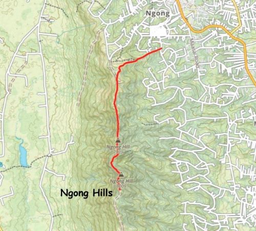
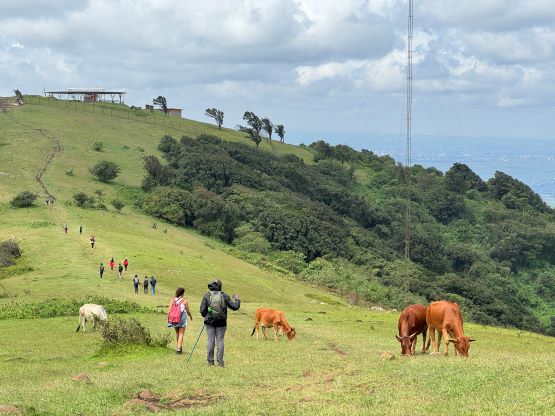
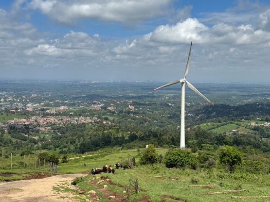
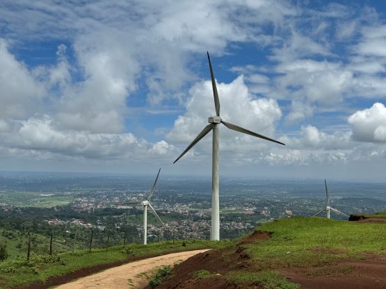
There was hardly any “traffic” on the lower route as I basically started in the middle of some farmlands, but higher up I merged onto a wider road used for some power plants. I was surprised that I did not encounter any “no trespassing” sign. Maybe this route is never popular enough for them to bother with putting up the signs. A while later I ascended onto the north ridge and merged onto an even-wider road, now with some vehicular traffics. A group of tourists had just got off their van and I even encountered some 2WD cars driving up and down the road. Had I looked more closely on the maps I probably could have directed the driver onto this better road, but oh well. I wouldn’t mind some extra exercise. It turned out that one could all the way to near the first “hill” and there’s a large parking lot.
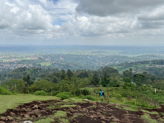


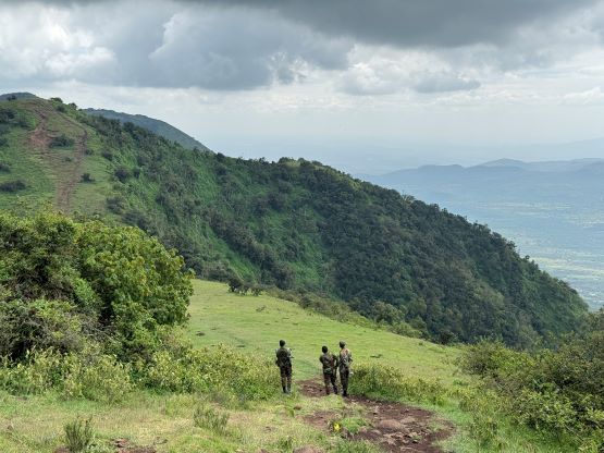
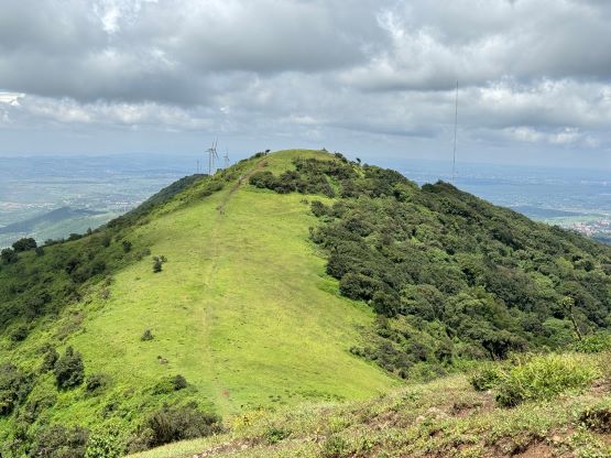
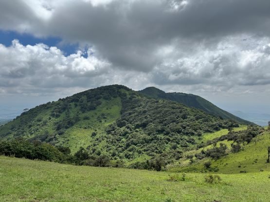
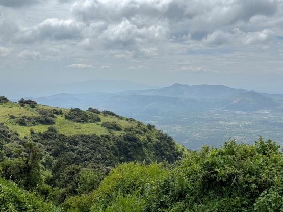
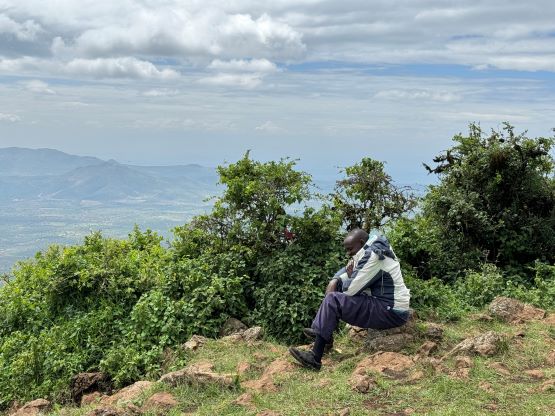
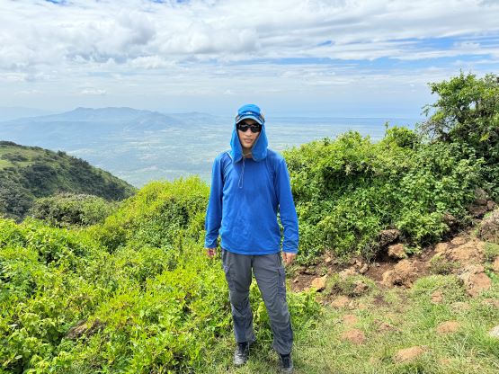
There’s one security guard at the trail-head, asking me to buy some drinks but mostly to collect money. I ended up giving him about 1.5 dollars worth of Kenyan cash since I didn’t want to risk drinking their juices. I encountered several hordes of hikers including quite a few foreigners. All of those foreigners were guided and some of the guides were actually carrying a riffle. I was the only unguided foreigner but nobody came to fuss with me. The people were actually very friendly. There are a few major bumps to traverse over and each of them requires about 50 m elevation loss. The true summit is on the far south, and very few of those hikers venture all the way to the highest point. The “road” only continued to the second-to-last bump and the final kilometer was actually done on some narrow jungle trails. There was only one group of locals on the true summit and they assured me that I indeed made the highest of the Ngong Hills. It’s now clear to me that driving all the way to the southern trail-head would definitely shave some time, distance and elevation gain, but the north ridge route is more scenic and fulfilled.


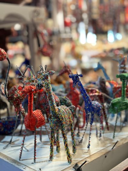
Without doing much lingering I quickly made my way back down that jungle trail, and then plodded over each of those bumps on the north ridge. I had to descend the same way as my driver was waiting for me at the starting point. I would be nicer to do a point-to-point traverse, but such would require more thorough organization and planning. I jogged most of the downhills and eventually finished the round trip in about 2 hours 50 minutes. While driving back to Nairobi the driver took me to a famous market for the visitors. I’m not someone who likes to buy souvenirs but it was nevertheless cool to learn some Kenyan culture. I eventually got back to the hotel at 3:30 pm.