American Mountain
April 21, 2021
1483m
Hope, BC
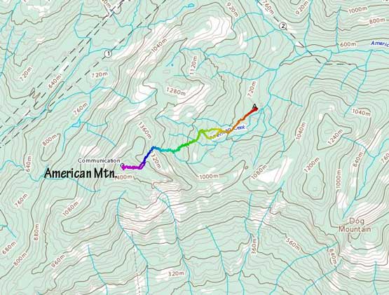
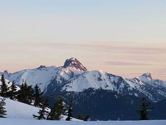
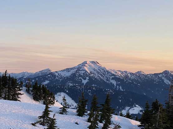
“American Mountain” is the unofficial name assigned to a rather locally prominent summit at the headwaters of American Creek to the north-west of Hope. This peak is a few bumps to the west of the officially-named Dog Mountain but this is the one that boasts more than 600 m of prominence. The steep south face drops straight down to the Fraser River and boasts a somewhat iconic profile. Other unofficial names of this peak include “Arcade Peak”, “Pk. 25-34” and “Ruby Microwave”. I personally probably would just call it “Dog West” but I picked “American Mountain” as the preferred name because it’s more often used in the local peak-bagging community.
The easiest route to reach the summit of “American Mtn.” is from the logging roads in American Creek drainage. One can easily drive ~8 km up the road to a “big bend” at under 700 m elevation. From there the summit can be easily attained via some typical SW BC forested travel (though more rugged than I thought). The best time to hit this summit is spring when the road is clear but the route still holds enough snow to cover the bush. A few days ago the “Cariboo Crew” – Al, Katie and Jenn had laid a track up the eastern flanks of this peak and I instantly decided to follow it up in the morning of Wednesday. I had to be back home in the afternoon for work, but my plan was to watch sunrise from the summit, so time shouldn’t be an issue.
In order to catch as much sleep as possible I decided to drive out and car-camp. Contrary to most of us, I never fall asleep in the first half of the night so this is the only way for me to get some sleep. I made to the desired parking spot at midnight and set the alarm at 3:30 am. I had brought some T&T sushi for breakfast and I started the ascent at 4 am. In the pitch dark I really appreciated having a set of GPS track to follow.
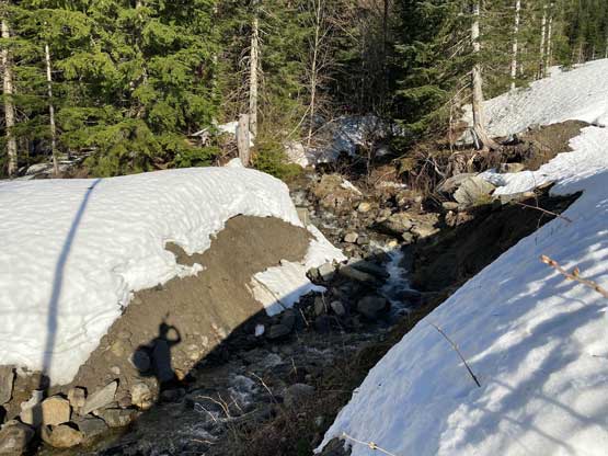
The first stretch of this route was following a deactivated logging roads for about 1 km due SW. The footprints laid by Al’s group (on Saturday) was still visible but not very obvious thank to the crazy melting we had been having recently. I was still able to just follow their foot steps but for once in a while I had to consult with the GPS track to correct the bearing. There were quite a few creek crossings and dry patches but I was able to plod through all of them with snowshoes on. I decided to take their ascent track upon hitting a split and this turned out to be a mistake. The reason that I picked the ascent track was because the footprints being more visible, but this route led me side-hilling into an open creek with steep banks. Some degree of bushwhacking was required to get out of this zone. The next section involved some gradual leftward-trending travel in mostly open forest to a brief section of logging road at 1070 m. I followed their tracks crossing this road ascending another stretch of forest before merging into a gully constraint. Ascending this constraint on snowshoes (40 degrees) was tricky due to the icy conditions.

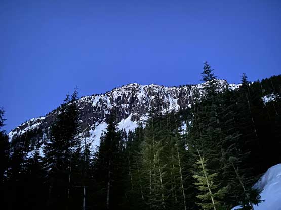

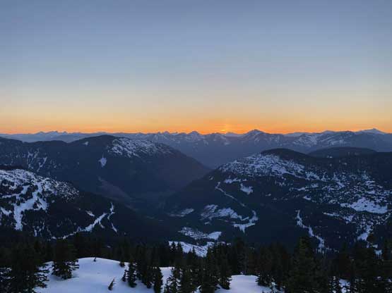
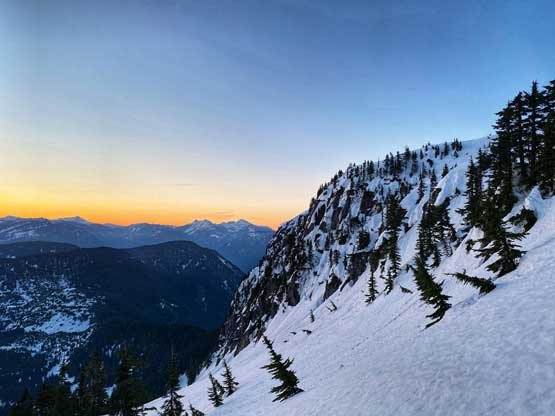
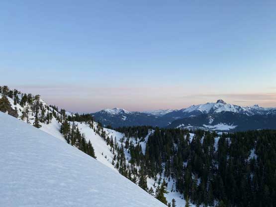
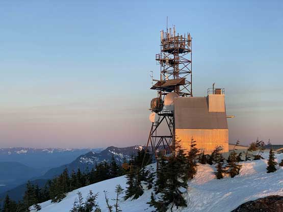
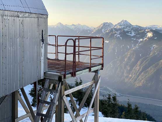
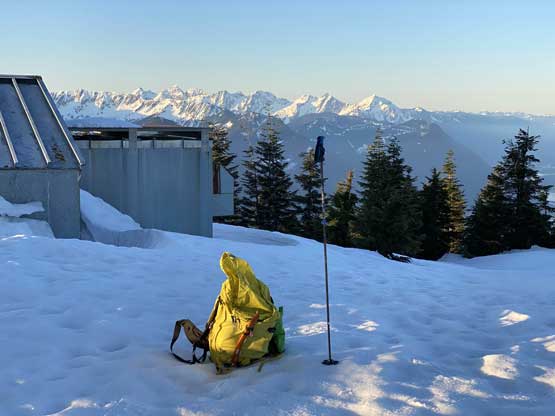
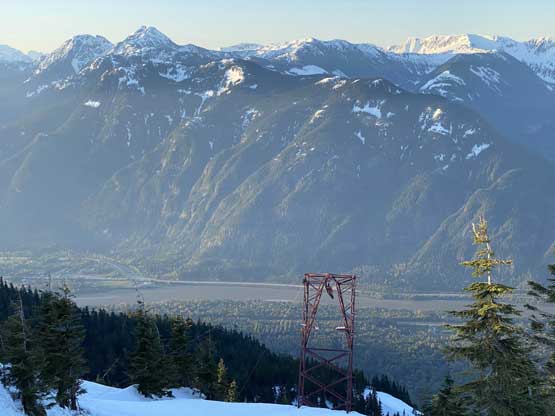
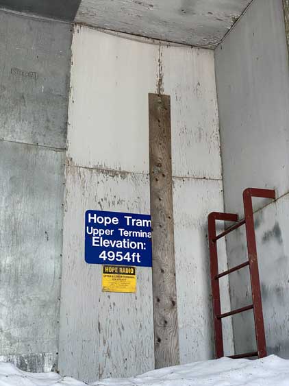
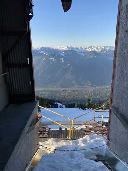
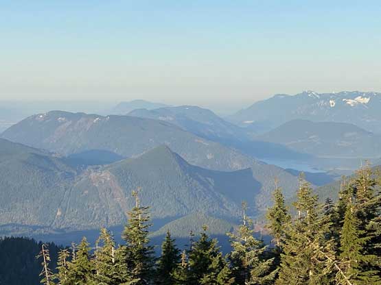
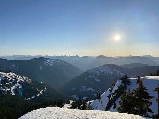
At this point the sky was bright enough to not require head-lamps anymore. The route then ascended the middle of this gully feature for another few hundred meters of gain to the base of the upper east face. I followed the ascent tracks steering climber’s left onto another steep roll (35+ degrees) to top out on the uppermost east ridge. The rest of the plod on the east ridge was easy and scenic and I timed it perfectly to reach the summit at sunrise. I spent almost an hour on the summit exploring the old Hope tramway and the various aspects of the views.


After having enough of the views I decided to head down. Snowshoeing down the upper route was painful on my ankles as the snow was still firm and icy but occasionally I would break the crust, sinking down into the slush. For that steep step in the gully I had to make a quick gear transition to swap snowshoes for crampons. The glissade tracks created by Al, Katie and Jenn had completely frozen over making crampons necessary to safely descend. I would assume the conditions would be much easier a couple hours later, but not at 7 am in the morning. Lower down I mostly just retraced the steps but I took a variation near the end to avoid that steep creek stretches. This variation was mostly on open cut-blocks covered by at least 1-2 meters of snow, so highly recommended.


I finished the trip at 8 am and not wasting any time, I quickly started the engine and drove down the Amercian Creek FSR. I met at least half a dozen trucks on their way up. They didn’t look like logging trucks so I would assume there’s some hydro projects currently going on. The lower half of the road was freshly graded as well. I eventually got back home at 10 am and I did earn myself plenty of time to take a nap before work.
