Lincoln Peak
May 25-26, 2018
2768m
Mt. Baker / Middle Fork Nooksack River, WA
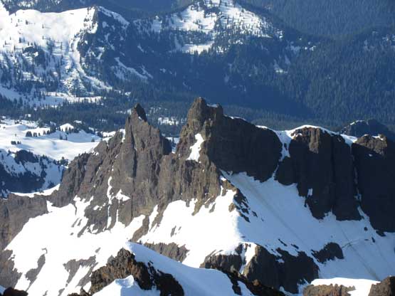
In the middle of the “Black Buttes” of Mt. Baker sits a formidable spire guarded by near-vertical walls on all sides. The infamous Lincoln Peak is the 16th highest in Washington and has reputation to be one of the most difficult summit to reach by even the easiest route, and by no doubt is the grand daddy of beast in the true WA Top 100 x 400P list. The original “Bulger Top 100” sets some interesting criteria that (barely) excludes Lincoln Peak but that’s because the original list makers were too scared of it. The first time I had my sight on this one was from Hadley Peak a couple years ago and I wondered who would dare to climb that… I researched immediately after. It indeed has been climbed, but not to my surprise it ranks #2 on the “Top 10 Most Difficult Peaks in WA” list…
Lincoln Peak has just over a dozen known ascents as of today and other than one party (March 2015) that boldly put a new route on the NW Face, all other ascents were done in spring via the 60+ degree uber-exposed “X Couloir – Emancipation Proclamation” on the SW Face. This “standard route” is the only one that’s remotely feasible. The rocks on this mountain is volcanic conglomerate so that’s why nobody has done it in summer time. In many ways it’s similar to Atwell Peak near Squamish, but I can tell you right here that the undertake of Lincoln makes Atwell like just a warm-up climb. Over the past couple months I’d been talking to a local WA alpinist Matt Lemke and the plan was exactly to knock off Lincoln Peak this year. I had never climbed with Matt prior to this year but I did come across his trip reports many times. Matt Lemke is much more technically oriented capable leading unknown 5.10+ rock pitches or vertical snow/ice and his enthusiasm, strength and experience is exactly what I needed. To know each other better we climbed the Nohokomeen Headwall of Jack Mountain a couple weeks ago and that trip was an absolute blast. And then there came the last weekend of May where a slight dip in freezing level lined up with decent weather.
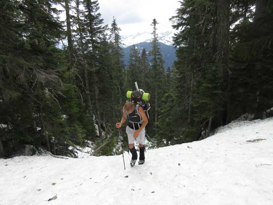
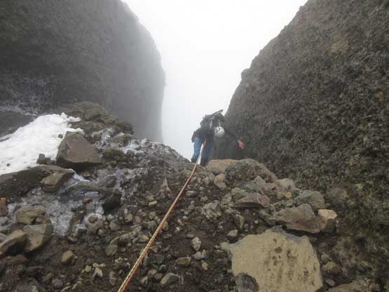
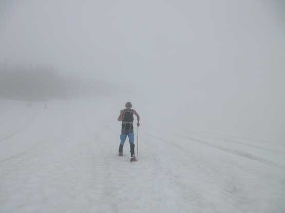
Lincoln Peak is one that I’ll ditch any work plan as soon as the window opens so after convincing myself the Friday-Saturday of last week would be the best timing of this year I did the exact, ditching every other “city-ish” plan and starting to load gears. I paid a visit to MEC Vancouver (horrible traffic) for some last minute stuffs and then it’s time to pack up. To make sure we wouldn’t fail because of not having the right gears we hauled two 60m ropes, six pickets, two screws, a set of nuts and cams with a ton of cords, two ice tools (each), steel crampons, snowshoes, trail-runners and the whole set of camping equipment. You have to pay your blood. I picked up Matt from a “free parking lot” in Bellingham at around 8:30 am and then off we went down the Middle Fork Nooksack FSR. This long gravel road was in an excellent shape and we even managed to get two switchbacks up the spur road. I parked not because of the worsening conditions but rather the fear of having to turn around on this narrow ATV track…

Lincoln Peak via X Couloir. GPX DL
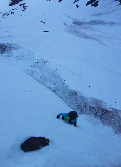
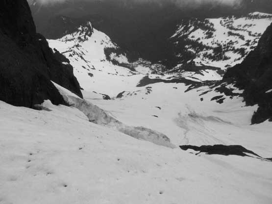
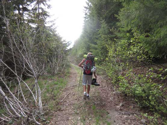
The remaining 4 switchbacks up the spur roads was a fast sailing on trail-runners but the adventure was just about to begin as we pushed ourselves into the alders around the last bend. After a while the alders got horrendous that our progress was limited to about 5 meters per minute. Not so good… Matt went uphill a bit to check things out and sure enough there’s a “path”. It wasn’t too good neither but at least we were actually able to make some progress. About a couple hundred meters after the road turning onto the NW side of “Pt. 4480” we started to hit patchy snow and the snow soon became continuous. There went the donning of mountaineering boots hence the first bulk drop of weight… It felt good. Then upwards we went into the forest from the end of this spur road, angling diagonally out to the right and then back left aiming at the outflow drainage of a small tarn near 1500 m elevation. This process took a lot longer than expected with lots of trail-breaking and some occasional discovery of deep post-holes..
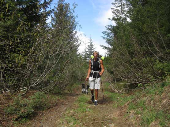
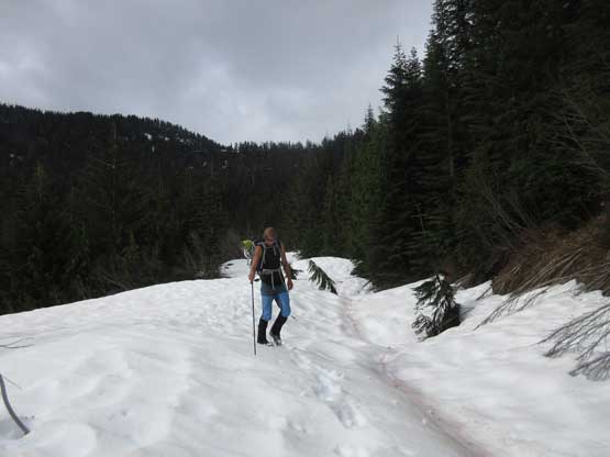
Matt carrying his 7.5 lb boots and hiking up the road
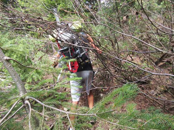
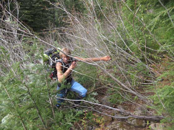
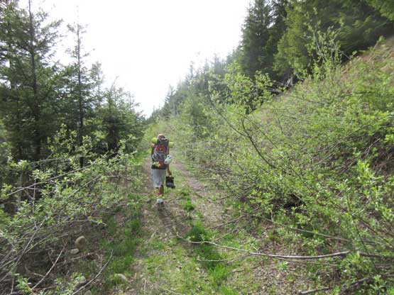
Time to bushwhack… It was pretty bad.
After a long while of struggling we hit snow
Me kicking-step up in the forested section. Photo by Matt L.
Matt coming up to the outflow drainage of that tarn
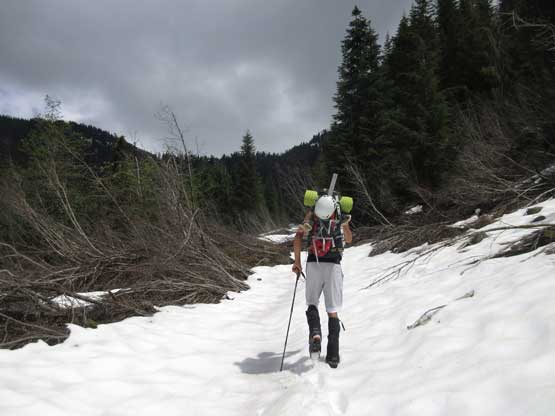
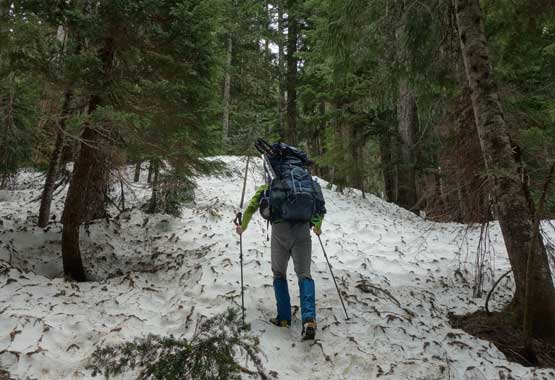
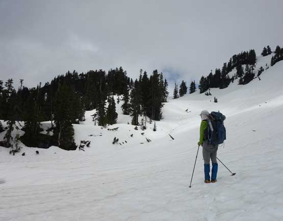
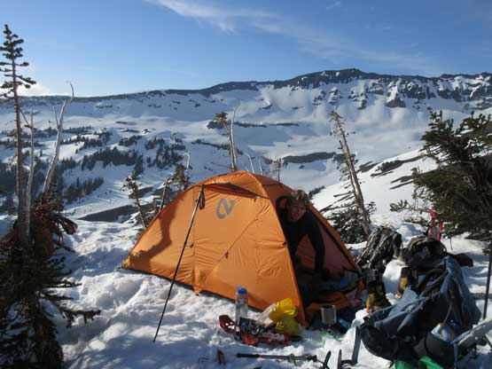
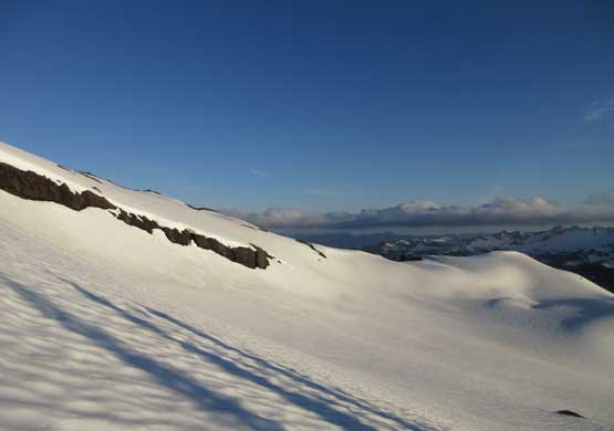
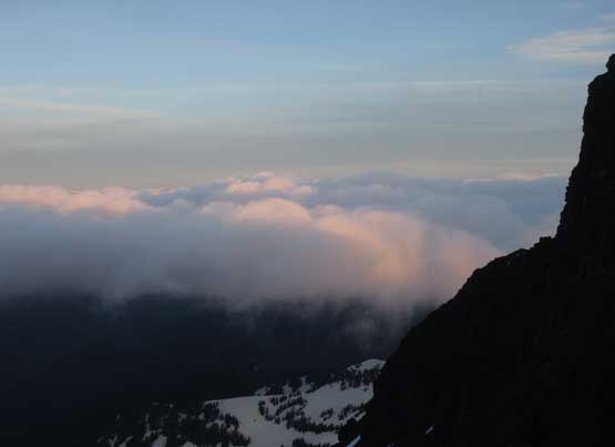
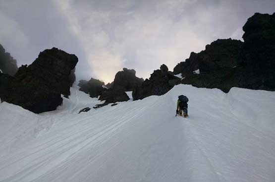
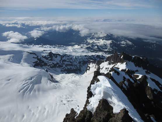
At this point the terrain flattened out so to reduce more weight we donned snowshoes. It wasn’t necessary but better than carrying them. There’s one steep roll just before the route tops out on the broad ridge leading up towards the bivy site. With the Lightning Ascents I had no problem punching a diagonal traversing line on snowshoes but Matt had to take his MSR Evos off and boot-pack. This is also where we were supposed to get the first glimpse of Lincoln Peak but too bad, the day was mostly overcast. Much of the plod across the upper plateau was done in a white-out and it surely was a pure slog. We found a perfect spot to pitch the tent. There are trees nearby to anchor the tent (even though we didn’t use them) and about 15 meters above the site we could sit on dry rocks glimpsing at our objective. After taking a nap the sky cleared up and there went another perfect sunset in the North Cascades.
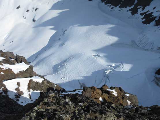
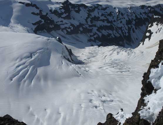
This is that tarn. We tried to get some water there but it looked too dirty
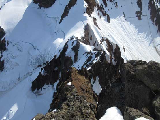
Me studying the route. Photo by Matt L.
Matt boot-packing up a traversing roll while carrying the shoes
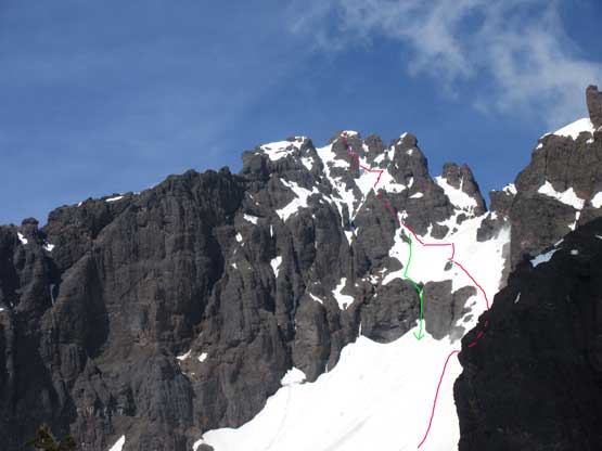
Lincoln Peak with our route drawn. Red – ascent and Green – rappel
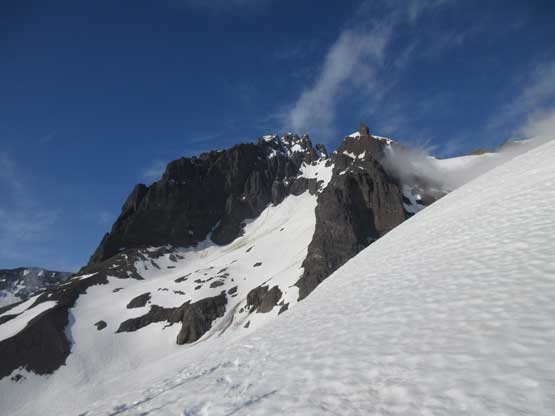
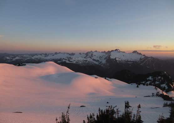
A wider view of Lincoln Peak from our camp
After a couple hours’ nap the weather cleared up at camp
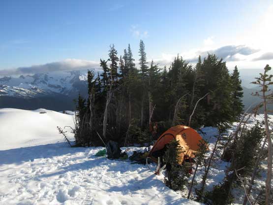
Just another shot to show this awesome spot for camping
The light’s getting better and better. Time to walk around to explore
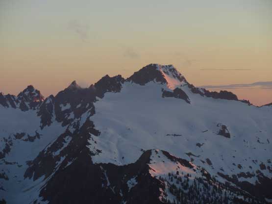
South Twin at evening glow
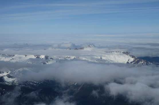
A full range of Twin Sisters.
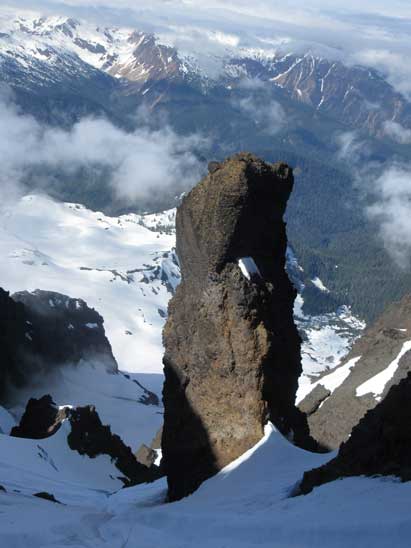
Seward Peak is another major peak in the “Black Buttes”
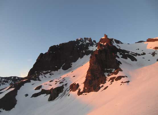
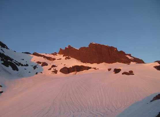
Evening glow on our objective – Lincoln Peak
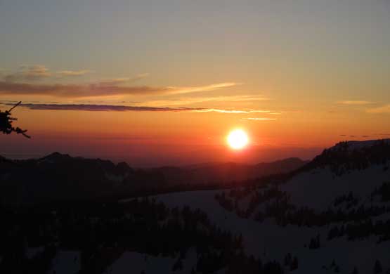
Just another perfect North Cascadian sunset.
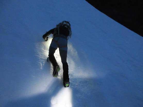
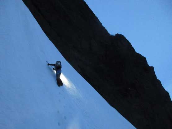
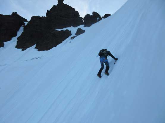
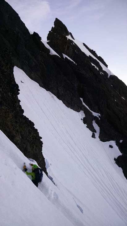
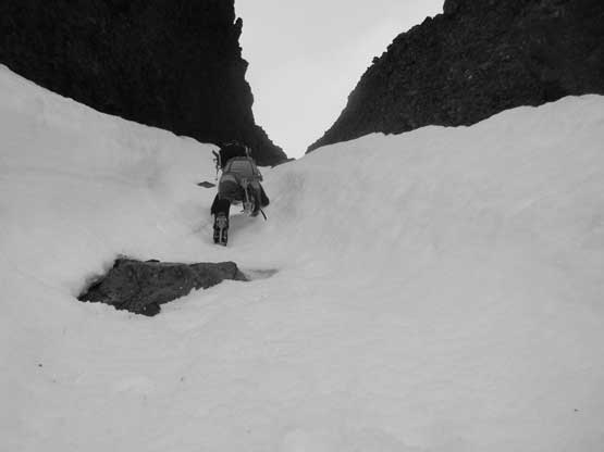
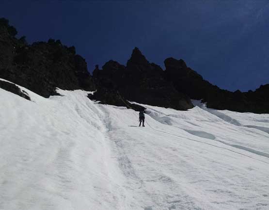
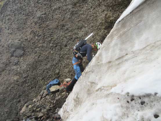
I slept reasonably well without thinking/worrying too much about what’s coming next. The alarm went off at 2 am but we were too tired to get up. The alarm was then reset at 2:30 am and we eventually managed to get going after 3 am. Right off the bat we had to don crampons thank to a full depth freeze and then the long long side-hilling traverse down and around the obvious rock buttress was hell of a tedious process. My ankles hurt from traversing hard snow on crampons. Based on the earlier observation I led us up through a dirty-snow gully and then zig-zagging for roughly 400 vertical meters on 35-degree snow. The sky just about to clear up when we hit the enormous bergschrund. It looked no good with the only possible break being a wall of 70-80 degree rotten snow. Just as I was thinking about all kinds of strategies Matt came up and gingerly soloed the whole pitch while kicking in giant steps – certainly one of the most impressive soloing I’ve observed. I thought about getting a top-rope belay but figured I had to be quick, if possible. I started soloing the wall of snow while using Matt’s steps as “handholds” and did it fine. After this pitch of excitement we soloed a short, but even steeper pitch of alpine ice before the terrain mellowed back to 45-degree ish.
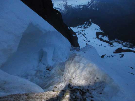
Realizing the schrund is much better than we thought…
Matt taking the lead up the only possible break
Matt soloing up the 70-80 degree pitch. This pitch absolutely blew my mind.
Me soloing up the schrund pitch. Photo by Matt L.
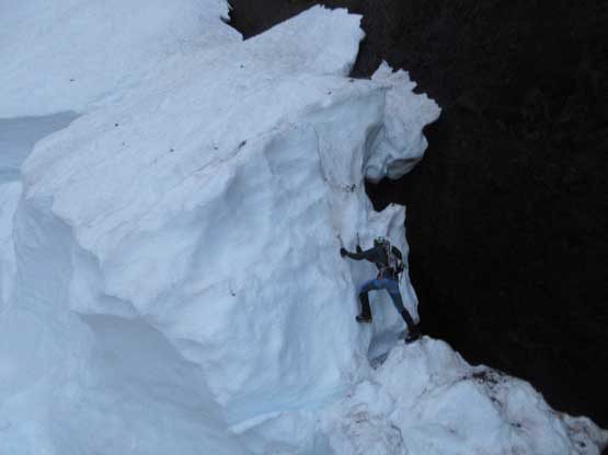
Matt taking the lead soloing the next short serac/ice pitch

Matt part way up this serac ice pitch.
Me soloing the serac pitch. It really felt like ice climbing. Photo by Matt L.
Above the schrund mess now. Looking down. You-fall-you-die the whole way up.
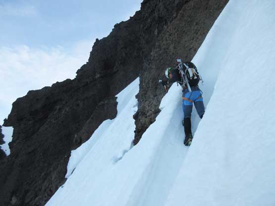
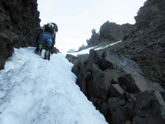
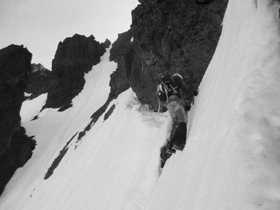
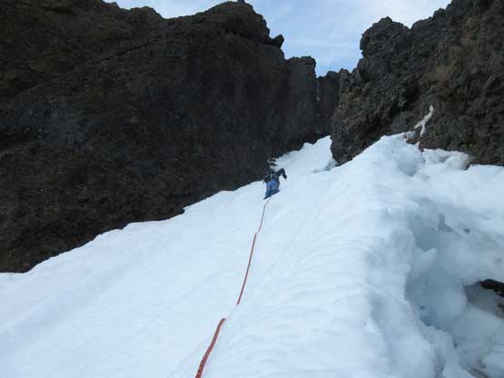
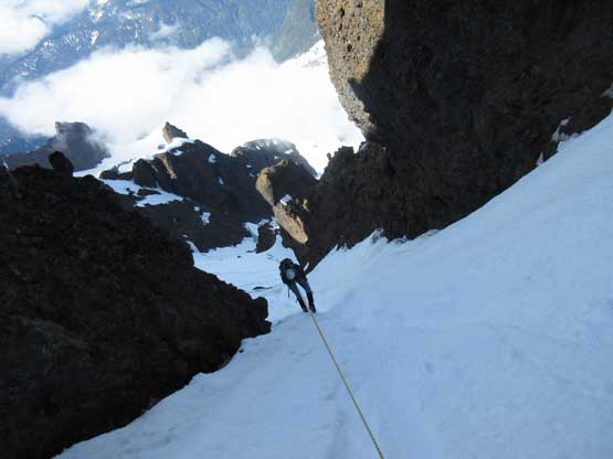
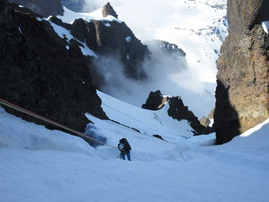
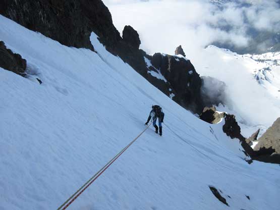
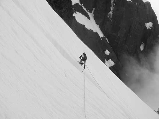
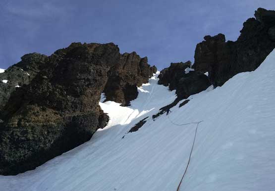
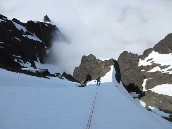
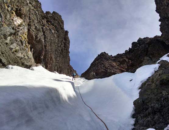
Pretty much the entire climb would be you-fall-you-die but after starting the first diagonal traverse that feeling only got stronger and stronger. Looking down that gigantic schrund’s waiting to eat any careless climber. The first 45-degree traverse to the large rock island of “pillbox” was just a warm up and the island itself offered a platform for a rest. Then up again we climbed directly up a shallow arete for a while before dropping left to traverse another (steeper) stretch towards the entrance of the lower couloir. Matt was on lead the whole time and kicked in some giant steps wherever possible. Much of the stage was front-pointing with a few enormous runnels to cross. Without Matt’s super height and steps it would be very difficult for me to cross those vertical wall of snow. The upper schrund below the lower-couloir was a piece of cake that we easily crossed on the far climber’s right side. We then traverse right underneath the moat and into the huge runnel of the lower couloir – finally able to go straight uphill despite the sudden increase in slope angle (55 degrees). Climbing straight up the huge runnel involved mostly front-pointing except for the climber’s left of 1-meter constraint (kicking-steps) but soon enough we were back to front-pointing. I finally took the lead here and kicked all the way to the upper snow arete separating the two large drainage basins on this face.

Matt leading across the first 45-degree traverse towards the “pillbox”
Meanwhile a layer of low clouds had created some cool lighting
Traversing above the “pillbox” towards the entrance of lower couloir
Already crossed the second schrund. Now using the moat to assist
Matt gingerly crossing one of the many, many runnels en route.
Me crossing this large runnel. Photo by Matt L.
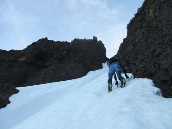
Merging into the lower couloir now. Matt leading up.
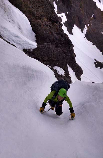
Me climbing up the ultra runnel in perfect conditions.
It’s all about front-pointing on 55-degree hard snow.
This is the narrowest spot – the “1-meter constraint”.
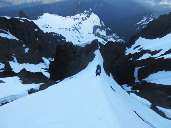
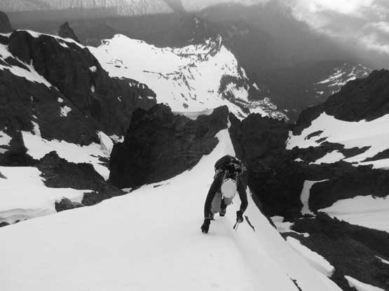
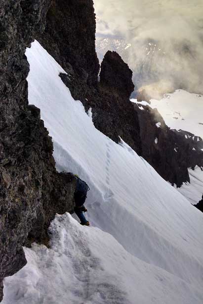
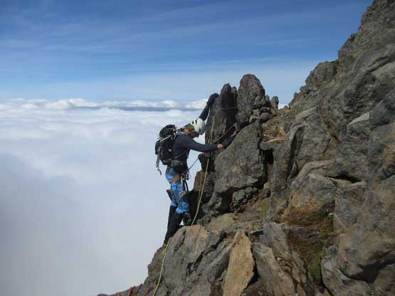
I continued the lead front-pointing up the uber-exposed snow arete with increasingly steep angles on both sides, step by step, all the way to the top where we could finally find a rest spot adjacent to the rock face. Matt took over the lead for the uber-airy upper traverse immediately below the rock face and was able to use some of the moat feature to reduce the calf burning. The downside was that we had to cross two short rock steps and of course a couple huge runnels as well. Watching Matt making progress on one of the runnel-followed-by-rock-step didn’t help building my confidence but I did manage to solo across that stretch, but for the next patch of crampons-on-downsloping-choss I was mentally done and asked for a belay. At this point we’d merged into the upper couloir with less technical difficulty ahead, but since the rope’s out we just used them. I continued up past Matt and ran a full 60-meter pitch to a rock anchor and then Matt took over the lead for the last pitch to the small col right below the summit.
Matt soloing the aesthetic snow arete just before the uber-airy upper traverse
Same as above. Matt soloing the arete
Me charging up the arete. Photo by Matt L.
Matt leading across the uber-airy upper traverse…..
Me crossing the largest runnel followed by a rock step.

The only place we got a brief break.
Looking down as I led the 60-meter pitch into the upper couloir.
Matt leading the next pitch up the middle of upper couloir.
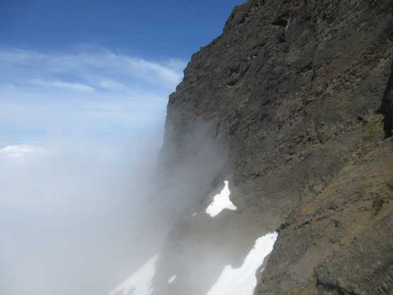
For the last 10 meters of the upper couloir pitch we had to simul-climb, but at this point there’s no further technical challenge other than just front-pointing. The final 10 m to get onto the summit had some steep snow and 3rd class rock scrambling and we simply soloed while dragging the ropes up. The summit itself is a very awesome place to hang around. We lingered up there for at least half an hour mostly to re-build the mental strength but also for the views. Watching climbers making progress on Mt. Baker was a fun thing and I wonder if any of them had seen us…

Mt. Baker with Colfax Peak in front, from summit of Lincoln Peak
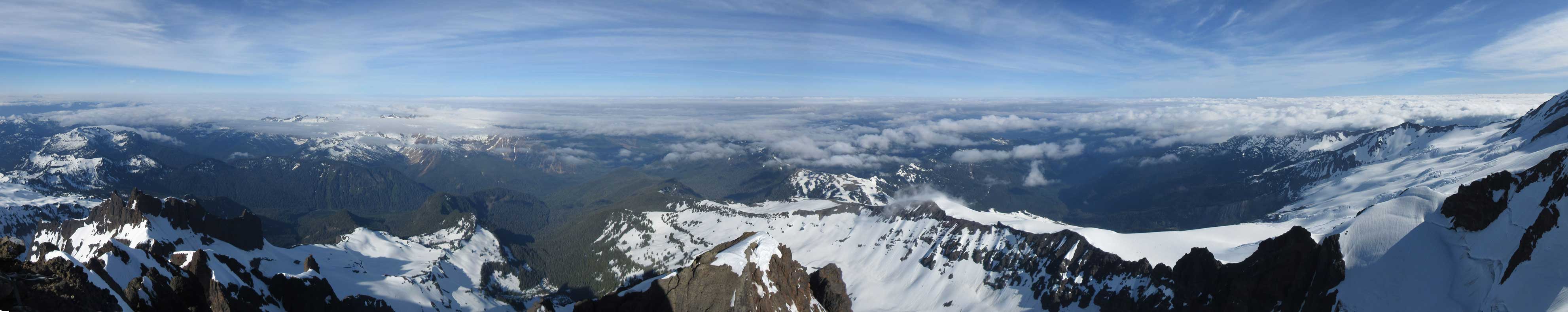
Summit Panorama from Lincoln Peak sans Baker. Click to view large size.

Bastile Ridge with Roosevelt Glacier in front
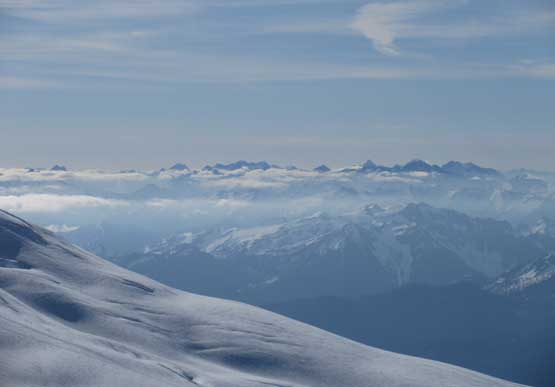
A sea of Bulgers looking south
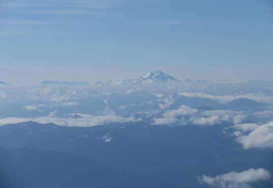
Glacier Peak looms on the horizon
This is Seward Peak… It still looks impressive
This is the shear drop down towards Colfax/Lincoln col
Looking straight down the North Face onto Thunder Glacier
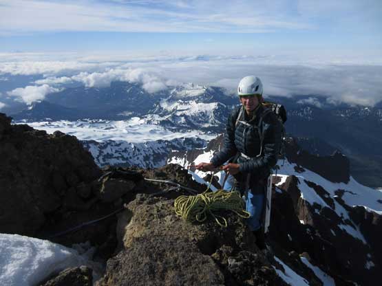
Matt on the summit of Lincoln Peak
A full shot of the southern view – one of my favourate views
The lower Deming Glacier is very crevassed
Twin Sisters are a bit shy to show up on this day…

Me on the summit of Lincoln Peak – 2nd hardest summit in Washington
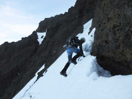
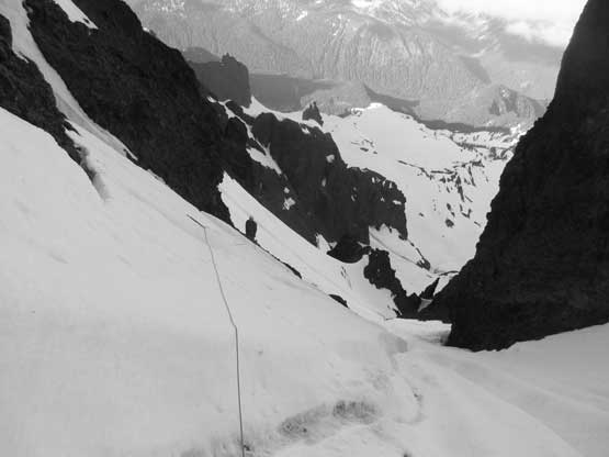
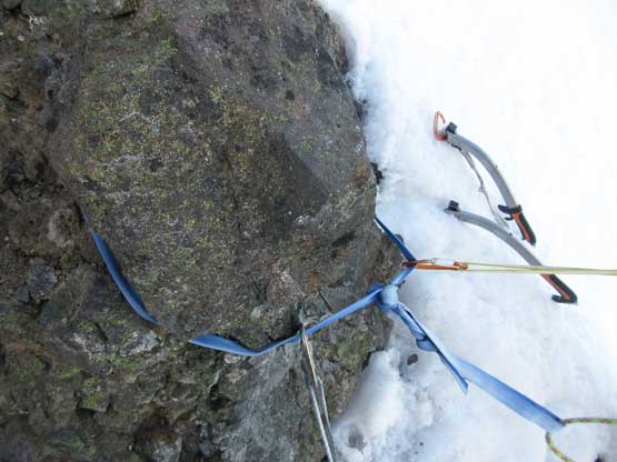
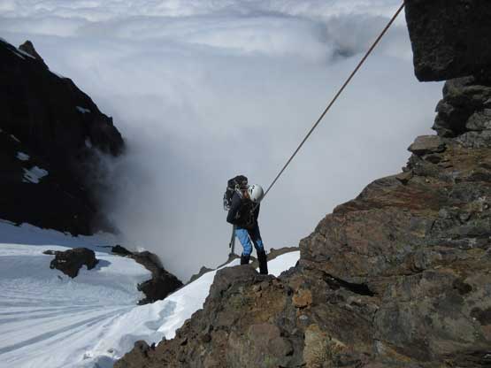
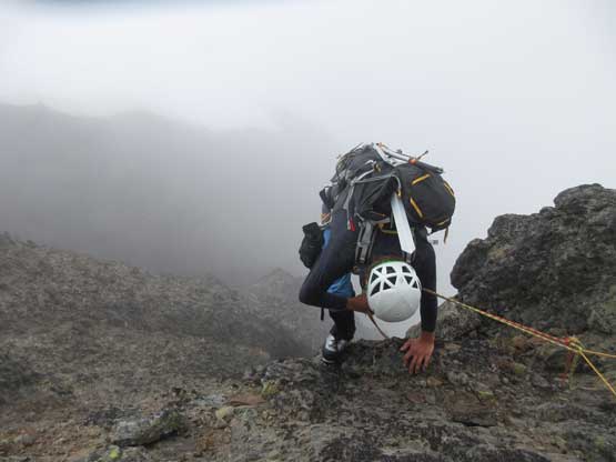
Earlier in the day we had agreed to rappel most, if not all of the way down because we had two 60-m ropes with a ton of gears and for another reason we were mentally drained from the exposure and physically taxed out from the sustained front-pointing. The sling around the summit horn had a “2006” marker written (12 years old) but after some brief inspection we just used it, rapping a full length into the upper couloir. Matt placed a picket and we did the second rappel off that picket to a rock horn. We had to build a sling anchor around the rock and rapped the 3rd full length with a bit of diagonal angle to the rock anchor before that uber-airy traverse. The last part of this 3rd rappel was awkward enough that we both had to rap with a single (left) hand while placing ice tool on the right hand, but the real piece is the 4th rappel. Matt bravely led across and had to place a picket halfway across, take both ice tools out to climb across deep runnels and then traverse some 60-degree snow to get onto the arete – all done while “rappelling”. Seconding this rap wasn’t much better and I pretty much had to do the same, but mentally easier as I already knew that process would go. The 5th rappel was off a single picket and got us into that lower constraint gully.
Rap #1 – the summit pitch
Rap #2 – the upper couloir
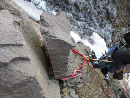
The “leaning tower of Pisa”
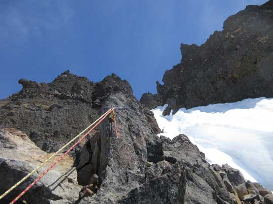
Rap #3 – Leaning Tower of Pisa
The horn anchor for Rap #4
Rap #4 – the uber-airy traverse
Matt halfway across the traverse. Two tools and a picket and still rapping
Me starting the most awkward rappel I’ve ever done. Photo by Matt L.
Rap #5 – the snow arete
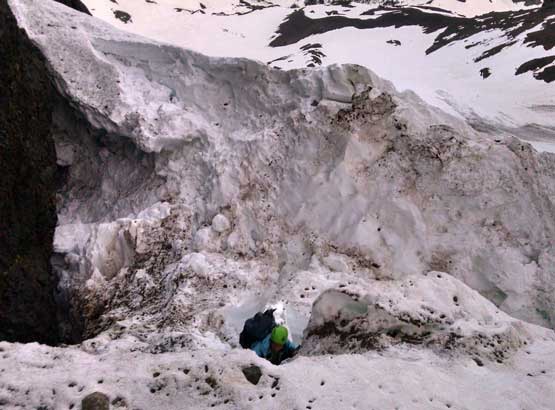
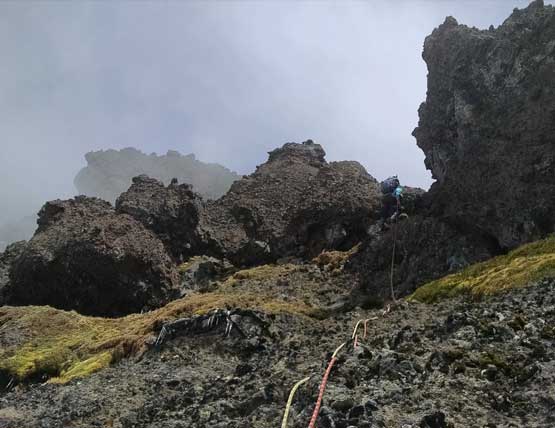
The next two rappels got us down the lower constraint gully with Rap #6 off a choss bollard and Rap #7 off a single picket (the 3rd picket we left on the mountain). The 8th rappel was off another rock horn and involved a short jump across the upper bergschrund. Fun and easy peasy but at this point we were a little bit disoriented. The angle eased off so we just down-climbed some 35-degree snow to the choss platform lower down but unable to find any more existing anchor. There’s a really good chicken-head so we wrapped it around and down another full-length before barely reaching a lesser horn. The ropes got completely stuck and we certainly fucked up the route. Climbing back up the rope with a few low 5th class moves on choss with crampons certainly felt like an adventure but we did manage to keep our heads cool. Matt topped back out and found another (even lesser) horn and led down the (supposed 9th) rappel into the waterfall gully. We placed the 4th picket in the snow and even backed it up with an old picket we found there, and the last rappel was hell of an experience. Firstly we had to knock a shit ton of choss off and then there’s a very dirty and awkward wedge steepening down into a 80-feet vertical/overhang with waterfall cascading down while kicking into the rotten ice. To make it more memorable there’s a 3-meter schrund to jump across to cap it off.
It’s that choss bollard in the center of the lower gully
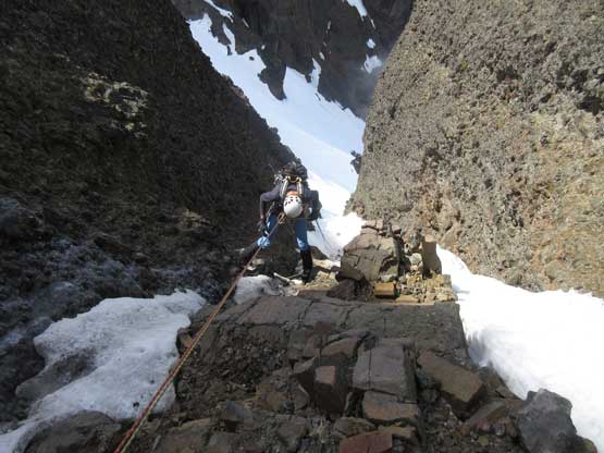
Rap #6 – lower couloir constraint pitch
Rap #7 – lower couloir giant runnel
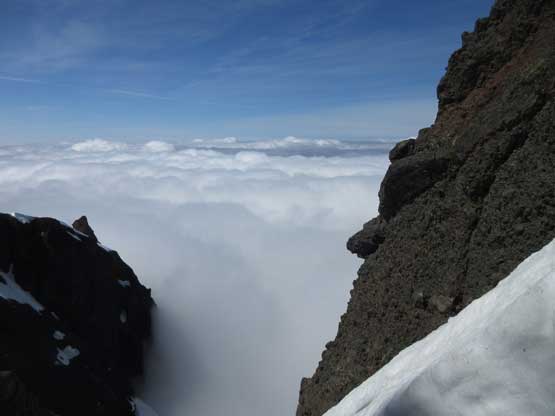
I really like this shot with the sea of clouds

Back to the rappelling photos. Still on Rap #7
Me rapping the giant runnel pitch. Photo by Matt L.
Matt examining the next anchor.
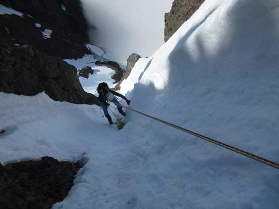
Rap #8 – snowfield
Looking back up from partway down Rap #8

Matt rapping onto the snowfield
Me rapping onto the snowfield. Photo by Matt L.
Clouds started to roll in. We soon lost visibility
Rap #9 the wrong pitch into misery…
I also went down this misery pitch and we got our rope stuck…
After the correct Rap #9 we finally got into this waterfall gully
And then found an old picket…
Matt leading down Rap #10 the overhanging waterfall…

It’s that 80-feet free hang and vertical with water dripping onto us.
Jumping this schrund was actually fun.
Just before the last waterfall rappel we had descended into the clouds layer hence a full-on white-out now so the rest of the descent was aided by GPS navigation. Thankfully I carried my GPS all the way up and down Lincoln Peak but first of all I had to traverse back to the initial schrund because I left a pole down there. I debated about just leaving it there because I didn’t want to see that bergschrund (and our tracks) again but that carbon fibre pole is quite pricy (and new) so better not ditching the dollars. The pole also offered more balance as we plunging and slipping down the 35-degree lower slope which seemed to drag on forever. That long long traverse to get back to camp was also a complete GPS navigation in a white-out and then there came Josh Henderson greeting us from camp. His plan was to solo the peak on the following day and we exchanged some fresh beta and wished him good luck.

Descending into that dirty gully was the only part we had some visibility
Matt running down the snowfield on snowshoes.
At this point we had literally no water so instead of packing up immediately I spent some minutes melting about 1L of water for us, and then we loaded our packs with all of the wet gears. Snowshoeing down wasn’t very fun because the snow was a little bit hard on the ‘shoes but then boot-packing down the forest was quite fast. We simply retraced our steps but did discover more deep holes. Hiking back across that bushy road we played smart this time and managed to stay on that path of “trail” which certainly saved some blood. And the last couple miles hiking down that road was a welcomed change of pace. Our time of the Day 2 was 15 hours exact and believe it or not it took us 10 hours to descend from the summit of Lincoln Peak back to the truck.
Back to the roads now. Still cruise sailing
Oh man. You gotta love alders…
Finally home free.
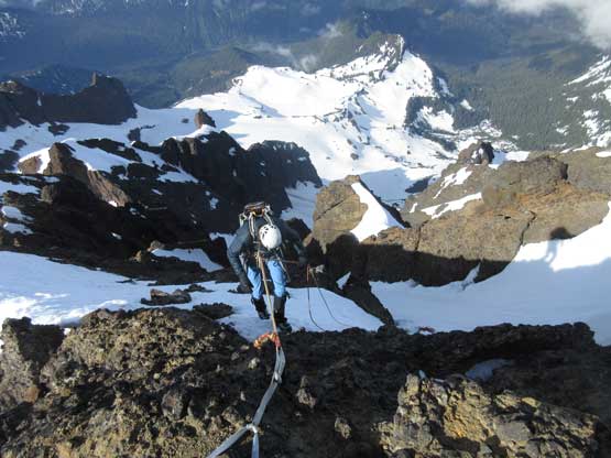
The last 4 long switchbacks on trail-runners. Lincoln Peak in the bag..
How difficult is Lincoln Peak? According to that famed list it ranks #2 in all peaks of Washington state but for me I think it might rank #4-5 ish in WA because I’m not experienced at climbing hard rocks on granite. Among the 736 peaks I’ve bagged I’d say Lincoln Peak ranks #4 with only Alberta, Robson, Deltaform leading in front and with Atwell and Bryce coming close from behind. Other than the overall technical difficulties I’d say timing is also very tricky. A good window only lasts for maybe less than 2 weeks each year and some year it simply doesn’t form. A cold, clear night is an absolute must which might not even happen at this time of a year. Besides that you have to be willing to risk soloing stuffs that you shouldn’t be soloing, rapping off single pickets or otherwise you risk to time it out with increasing chance of getting caught in rock/ice falls or snow slides. To get this summit you take chances no matter what.
In the end I had to thank my partner Matt Lemke for leading pretty much every single hard pitch as well as the whole descent. Without his expertise and experience in climbing Patagonia’s giant routes this trip would certainly not happen. To cap it off I’d say once again that “timing is everything” and I’m confident to say that last Saturday was indeed the best window to climb Lincoln Peak in 2018. Definitely looking forward to more hard shit in WA.
Check out Matt’s Trip Report and the page of WA Top 10.
