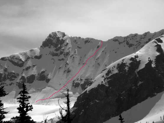
Jack Mountain (Nohokomeen Headwall)
May 11-12, 2018
2763m
North Cascades Highway, WA
Ranking the 14th on the Bulger List with over 4000 feet of prominence the monarch of Jack Mountain is by any measure a major summit in Washington state. There is no match to the majesty of this bulk mass of snow, ice and rock in the close vicinity. I’ve observed Jack Mountain from almost all directions but I also knew an summit bid via any route would be a serious fair. The standard route (south face) includes a contrived multi-day approach as well as some long sections of unprotectable 3rd to 4th class choss. However, with my extensive experience in the Rockies 11,000ers I knew this route would make a perfect recipe for my kind of appetite, but Jack Mountain can be done as a continuous snow climb. About a year ago I came across Jason Hummel’s ski report of an approach via May Creek and then a climb via Nohokomeen Headwall and ever since that I’ve marked this option as my primary target.
The north approach (May Creek) and the climb via Nohokomeen Headwall (200 m, 45-55 degrees) does not have much detailed beta sources on the internet but with my experience in mapping it’s not hard to pin down the details. There are two ways to get to May Creek with the lazy option of taking a water taxi across Ross Lake. This usually isn’t an option until the first week of June. The other option is by hiking the East Bank Trail which goes just under 8 miles with at least 300 meters of up-and-downs. To make it more exciting the North Cascades Highway is closed at Ross Dam trail-head and that adds about 5 miles of biking each way into the fun. Towards the second weekend of May a perfect weather window formed up over the Pacific NW and at the same time I managed to put together a strong team with myself coming down from Vancouver joining Jake, Matt, Josh and Elaine from Seattle and vicinity. With a solid 2-day plan formed all 5 of us gathered together at the Ross Dam trail-head at 11:30 pm Thursday night and slept in our vehicles.
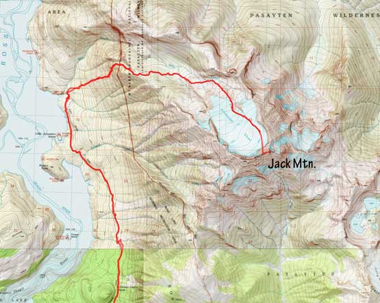
Jack Mountain via Nohokomeen Headwall. GPX DL
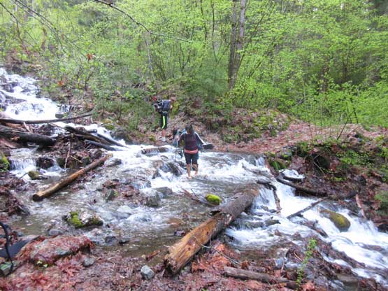
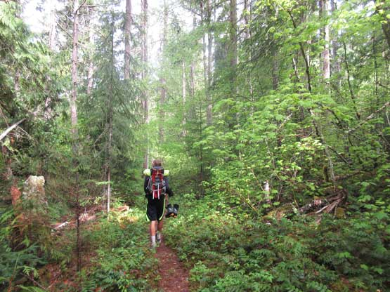
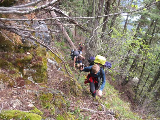
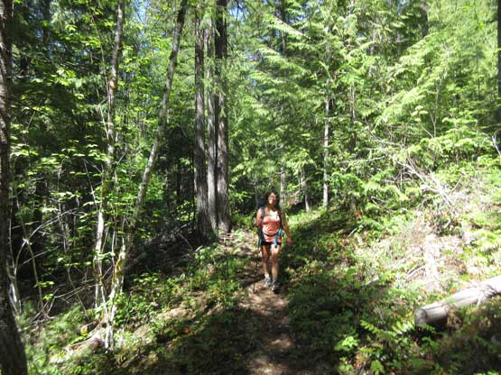
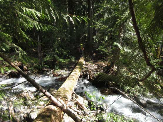
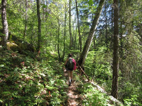
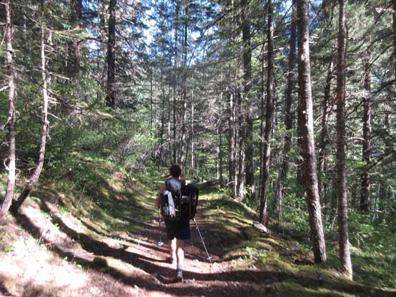
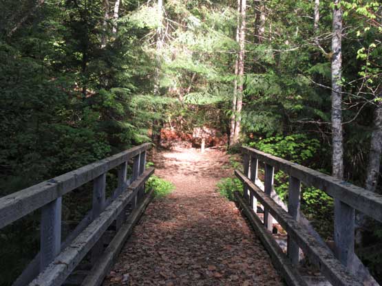
The next morning we all woke up at around 5:15 am ish and did some last minute gear check. The packs were huge with mine over 17 kg. The first 7 km of biking on Highway 20 had me worried because I hadn’t biked for ages but it turned out to be actually quite fun thank to the pavement with a flat-or-downhill grade, although to be fair I never got to figure out how to use the gear switch of this bike (borrowed from Jake). After ditching the bikes we hiked a couple switchbacks down and crossed the raging Ruby Creek. The trail then traverses back westwards for about 4 km contouring at roughly 600 m elevation with a couple interesting creek crossings. The next stage is a gradual climb up and over Hidden Hand Pass and then a (very gradual) descent down towards Roland Creek. The raging Roland Creek was then crossed on a log bridge and another 3 km later we arrived at the southern tributary of May Creek (13 km of hiking). It’s here that we ditched the trail-runners and donned mountaineering boots, and then into the bush we went.
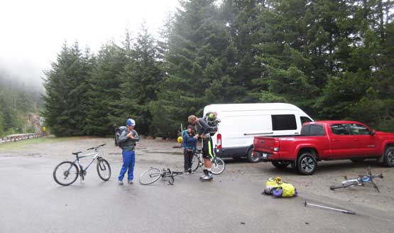
Loading up gears at Ross Dam trail-head. 7 km road biking right off the bat.

It’s definitely team work. Lots and lots of creek crossings…
Elaine fording one of the higher creeks.
Matt plodding on the boring trail.

Jake crossing a huge log bridge. It was kinda interesting…
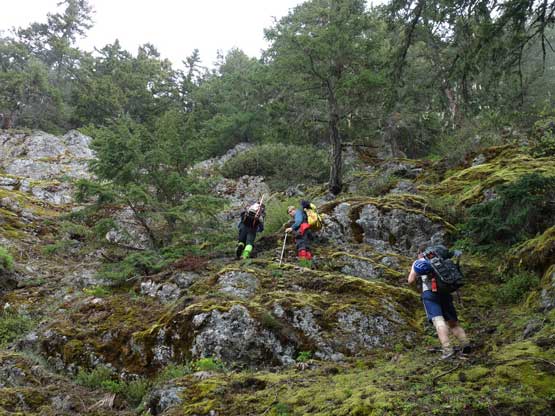
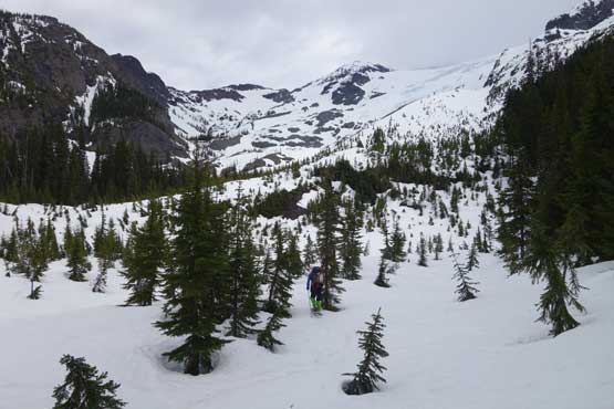
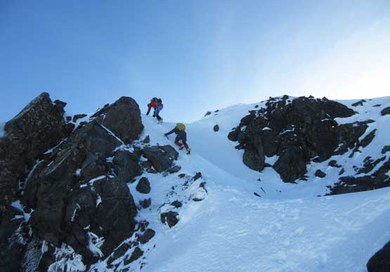
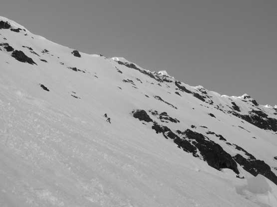
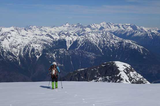
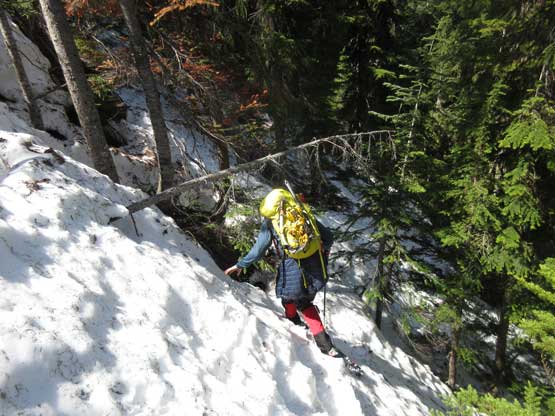
The general bearing is to head straight uphill until hitting some steeper sections and cliffs at around 1000-1050 m elevation. This worked out pretty nicely. There’s some minor bushwhacking here and there but nothing sustained. The terrain did steepen up towards 1000 m elevation and knowing we had to trend climber’s left eventually I led the group diagonally across a band of alders, and then we were at those cliffs. Breaking through the cliffs wasn’t a difficult task but the key is to be patient. Anytime in doubt we would either traverse climber’s left using goat trails, or shoot straight uphill. There’s about three short sections that required brief scrambling but nothing exceeds “class 2” and soon enough we were back into the open forest. Trending south-eastwards we started to hit patchy snow and in another half an hour the snowshoes were strapped on and the next stop — the broad NW Ridge shoulder with good views.

Into the jungle we went. It was damp and wet thank to a few days’ rain…

Cross-country travel in the lower forest. It was a little bit disorienting.
This is the start of scrambling section. Photo by Matt Lemke
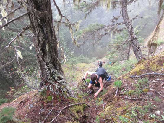
Josh scrambling up one of the few cliffy sections..
Following the goat’s paths is the key to nail this section.

Josh happy to finally hit continuous snow.
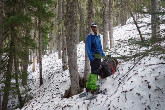
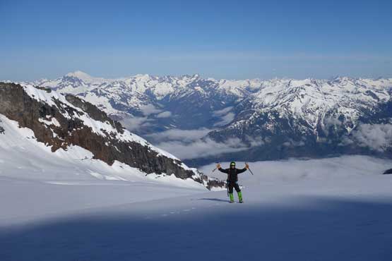
Me donning snowshoes. Note my 105L backpack… Photo by Jake.

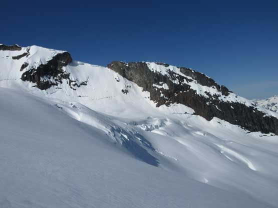
Our first view of Nohokomeen Glacier, from the NW Ridge shoulder
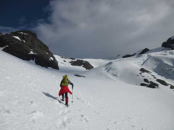
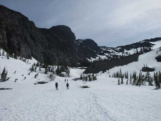
The next stage was traversing into May Creek drainage towards the toe of Nohokomeen Glacier and the question was how much elevation we had to lose. None of us came with much beta about this section but I thought it should be possible to just trace the contour line. This led us into some steep forested terrain that’s difficult to manage with snowshoes but not impossible, and on top of that we still had to lose about 50-70 m elevation. Once into the May Creek drainage we did find running water and load up all of the water bottles. At this point we were doing perfectly fine on time, but Jake and I still wanted to camp high up on the glacier to catch some sunset views. The rest of the group opted for a lower camp but would start two hours earlier in the next morning. With the new target set Jake and I had to keep plodding. We didn’t realize at that time but from where the group split to the high camp underneath Nohokomeen Headwall there’s close to 1000 m elevation gain, and all on snowshoes with heavy packs.

Traversing steep terrain (on snowshoes) into May Creek drainage
After some elevation loss we finally hit this low point and time to go uphill again.
The route we took trends climber’ left into a side drainage and then cuts back climber’s right traversing beneath a steep rock outcrop feature. This entire stage involved some treacherous slipping and post-holing but the upside, the weather did slowly improve with the light getting better and better on the horizon. We were 3 hours from sunset and despite the tough work our motivation was high. Ascending the climber’s right side of that rock outcrop was very foreshortened and needless to say, it seemed to drag on forever. That “flat spot” we were hoping for didn’t come at 2100 m elevation and not wanting to spend two hours digging a snow cave we kept plodding all the way to the base of headwall at roughly 2400 m elevation. There came a (nearly) flat plateau and there we go the perfect campsite.

We ascended a line far to climber’s left through this gulch feature
Jake’s high on energy and broke trail for most of this stage.
The view’s getting better and better, at last.
Into the high country.. The clouds’ lifting up.
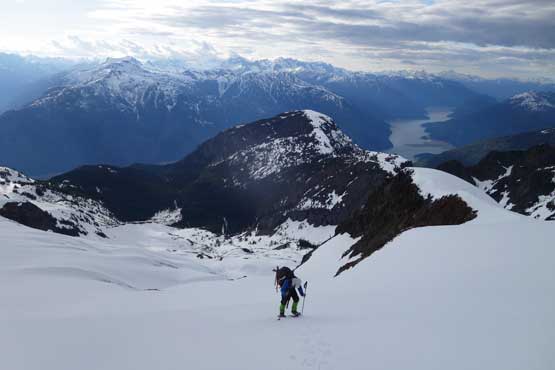
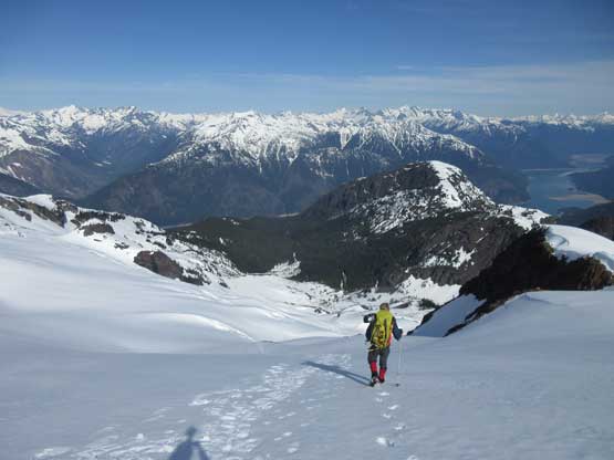
Me snowshoeing up the Nohokomeen Glacier. Photo by Jake.

The trail-breaking was a brutal exercise in this sloppy snow.
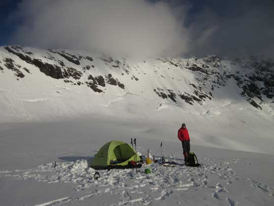
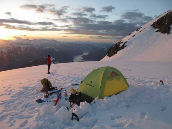
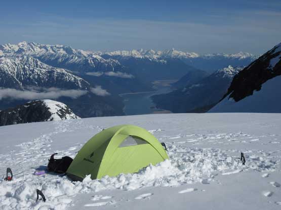
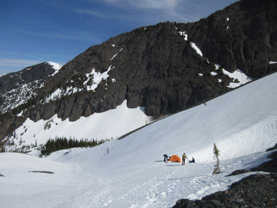
Finally got the camp set up, right underneath Nohokomeen Headwall.
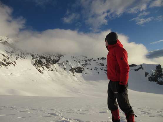
Jake surveying our route. It’s looking good…
Can’t beat this front door view. That’s why we hauled heavy loads this high.
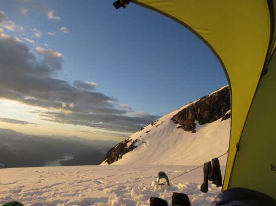
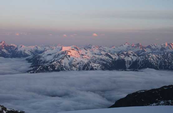
The views were surely awesome but it’s fairly windy that we had to be extra careful setting up my tent, but that’s not a huge deal. Half an hour later the tent was erected and the dinners were ready. Jake did some extra work melting a couple liters of snow while I played my photographer’s job taking in the scenery. The sunset view from this camp was one of the best I’ve ever seen in the mountains, with the partly cloudy sky enhancing the colours.
One of my favourate pictures from this trip.
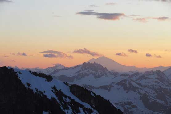
Mt. Baker clearing up over the north-eastern horizon.

Jake, our camp and the headwall.
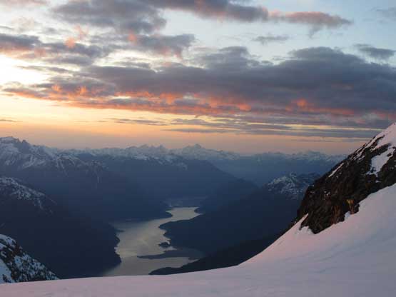
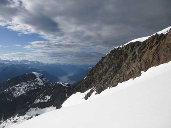
Ross Lake and the evening skyline
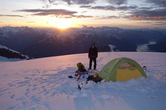
Me with a gorgeous sunset behind. Photo by Jake.

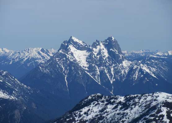
Mt. Redoubt and the Mox Peaks

Slesse Mountain on the horizon. Note the redness of this evening.
The next morning we woke up later than anticipated for simple reason a true alpine start wasn’t required with the deep freeze. Matt and Josh showed up just when Jake and I were about to leave camp, and another 20 minutes later we were all at the base of Nohokomeen Headwall taking the tools out. Josh opted to call it a day due to his footwear issue but he’s already summited Jack Mountain via the standard south face route. Matt, Jake and I had the right gears so carried on. The condition was a little bit on the firm side but still fine for kicking steps. I led the first half trending diagonally climber’s right of the fall line with some increasing exposure. Matt took over the lead once we started going straight up and towards the finish I took over the lead again for the final 50+ degree section. The final lip to get above the headwall was quite an exciting 60+ degree finish that I used a vertical placement for a leverage.

Morning alpenglow on Mt. Baker with the southern Pickets in front.
Mt. Prophet at center on alpenglow.

Matt and Josh showed up with a sea of clouds above Ross Lake behind

Jake climbing up the lower headwall. The lower wall was icier than expected

After a while Matt caught us up and took over the lead for the upper wall

Matt and Jake topping out above Nohokomeen Headwall
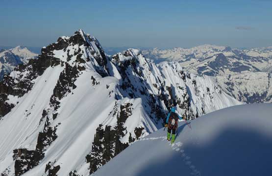
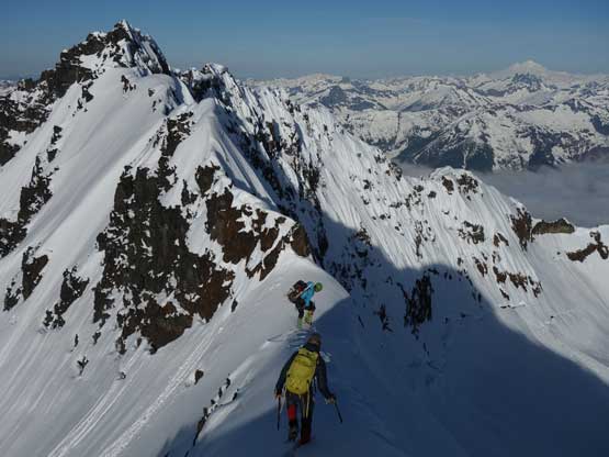
With the headwall behind we still had work to do. The summit ridge traverse wasn’t easy with numerous narrow spots as well as huge cornices dangling off on the sides. But it was overall a short section the didn’t eat too much time. And before realizing we were already standing on the summit of Jack Mountain aka. my 10th Washington Bulger. The summit stay was short thank to that cold wind but the views were incredible towards all directions nonetheless.
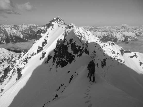
The summit ridge is exhilarating at places
The views were as awesome as it can get.
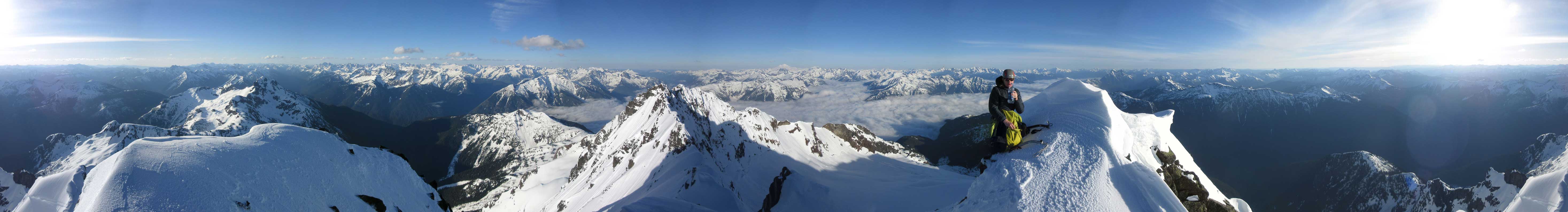
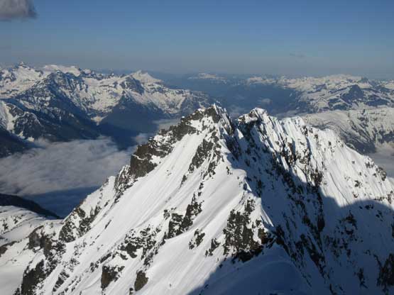
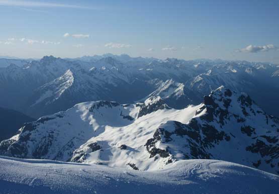
Summit Panorama from Jack Mountain. Click to view large size.
Looking over the western sub-summit

This is looking south across North Cascades Highway over Ruby Mtn.
Looking SE over Crater Mtn. towards the Cascades’ crest

Glacier Peak rises behind Buckner Mountain and Boston Peak

Goode Mountain and its classic NE Buttress highly visible

This is Black Peak one of the Bulgers immediately off the highway
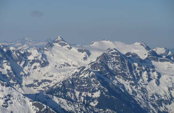
Snowfield Peak and its attached satellite peaks

That broad peak behind is Bacon Peak. Mt. Triumph is visible in front
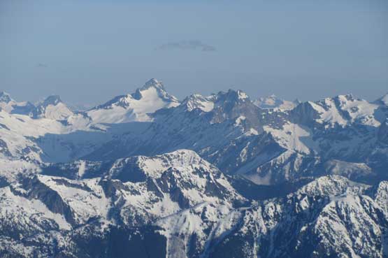
Mt. Redoubt and Mox Peaks the heart of Chilliwack Group
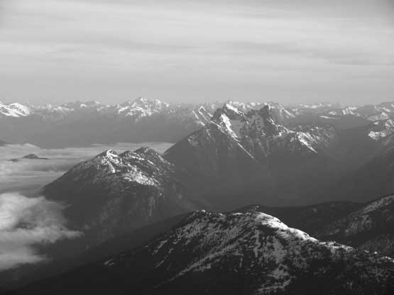
Hozomeen Mountain on the northern horizon. Behind is Manning Park

Me on the summit of Jack Mountain. Bulgers #10/100
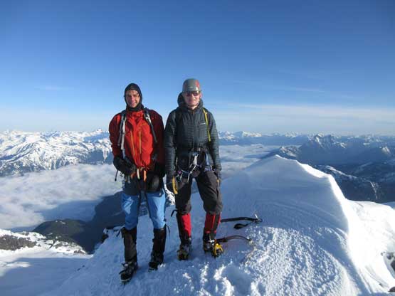
Matt and Jake on the summit of Jack Mountain
Reversing the summit ridge traverse was quick and easy and down-climbing the headwall wasn’t too bad neither. The extra time we took kicking in the firm steps on ascent now paid off nicely as we just had to reverse our own tracks step-by-step. It didn’t take too long before everyone’s off the face. The ‘schrund was easily crossed. Matt carried on to his lower camp while Jake and I spent some time soaking in the experience while breaking camp. Plunging down Nohokomeen Glacier had some increasingly deep post-holes thank to the softened snow that eventually we opted to strap the snowshoes on. Once the rest of the group finished breaking camp we easily snowshoed down into the May Creek headwaters and then reversed that uphill traverse to get back onto the “NW Ridge shoulder”.
Down-climbing the summit ridge.
Just another view from the ridge traverse.
Me descending the summit ridge. Photo by Matt L.
Jake descending with me staring down the headwall… Ready for down-climb?

Matt carefully down-climbing the upper headwall.

Matt and Jake down-climbing. The upper wall is 50 degrees steep ish.
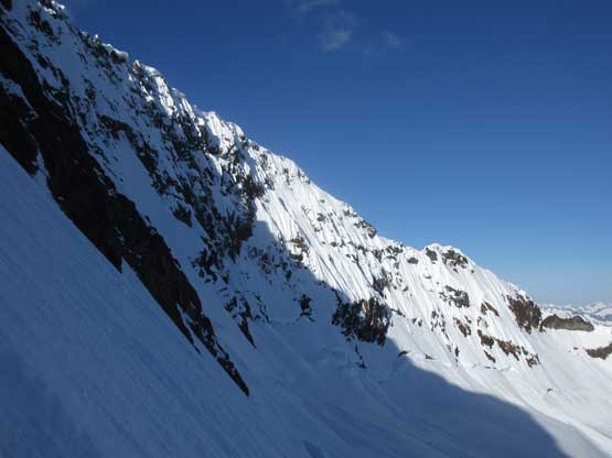
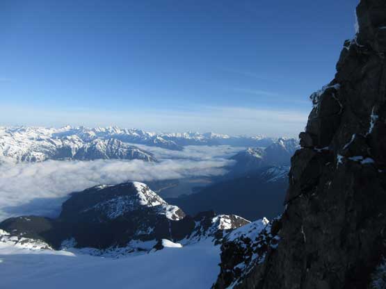
Looking sideways across the headwall.
This is the lower headwall. Matt and Jake still down-climbing.
Me showing the victory pose on the descent to our camp. Photo by Jake

Our camp with the Nohokomeen Headwall behind..
Just another shot to show my tent, with Ross Lake behind

This part of the headwall gives some Alaskan feel.
Me heading down the glacier. Photo by Jake
Jake plodding back across the upper N. Glacier

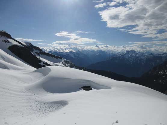
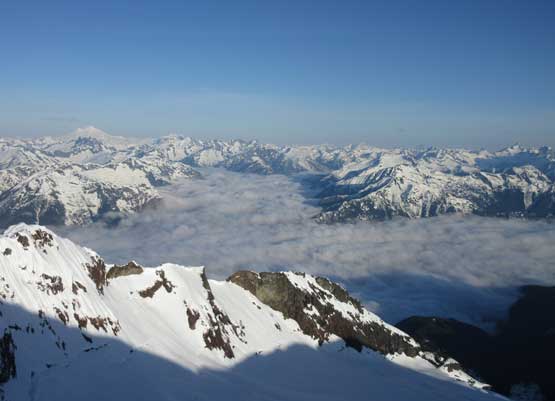
Expansive vistas all around. Can’t get enough of it…
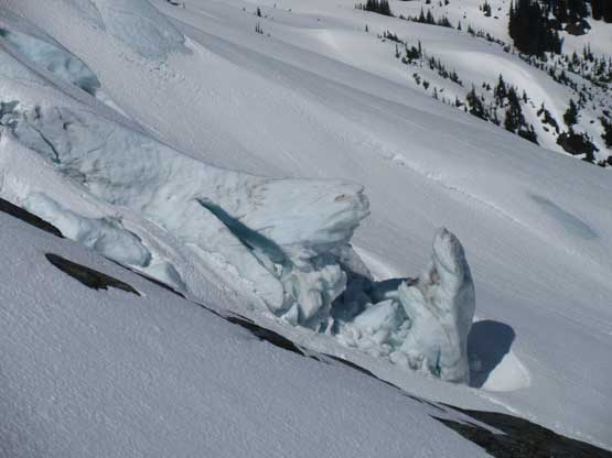
The upper N. Glacier icefalls
The iconic double-summit of Hozomeen Mountain
Jake descending Nohokomeen Glacier

More about the glacier. I like the clouds in this shot
Ice climbers?

The snowshoes were strapped on again.

This is the lower Nohokomeen Glacier icefalls.
Back to Matt, Josh and Elaine’s lower camp
Heading down. You can see four of us in this one shot

That bump has an unofficial name of “Angels Wing”…
That sketchy sidehill traverse on snowshoes to get back onto the ridge
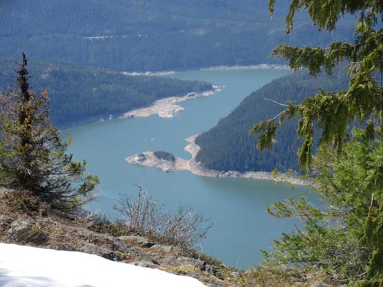
That ridge shoulder offers some neat views. This is Ross Lake
A review shot of the route up Nohokomeen Headwall…
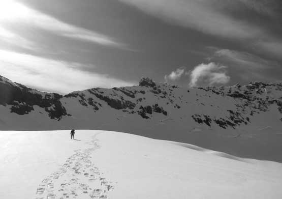
Down from the ridge shoulder the snowshoes were taken off in no time. We took another long break filling up the water bottles at snowline thank to a running stream. Descending back through those tricky cliffs required careful navigation but easy enough to just reverse the GPX tracks. I managed to lead us down through the exact line we took on ascent including every single “scrambly” part as well as the goats’ paths. That band of alders was crossed at the same place we did on ascent as well and then we just went straight downhill. We did deviate from the up track towards the bottom but I think we found a less bushy line on descent which was actually a bonus.

Snowshoeing down steep snow in forest

This is one of the key sections on that cliff part

This is another key step that we had to make sure to exit precisely

Jungle descent..

Lots of dead-falls and underbrush
Of course we took another very long break at the southern tributary of May Creek swapping footwear from the Nepal Evos to trail-runners. The runners were still wet, unfortunately… There’s not much to document about the final 13 km back along East Bank Trail other than the numerous annoying up-and-downs. Other than that big climb up and over Hidden Hand Pass we still had quite a few smaller upclimbs… The stream crossings were actually easier this time that I didn’t have to take the shoes off and neither did I wet my shoes in the creeks… There’s a bonus at the end that the North Cascades Highway was now open. Jake took off on lead biking to the Ross Dam trail-head and drove Matt’s huge van back to the East Bank trail-head. This saved the rest of us from the final 7 km biking.
Elaine happy to be back on the trail.

Ross Lake through the forest

The trail is in in good conditions except for the blowdowns and creeks
It’s that log bridge again.
Another day-hiker passed us.

Matt trying to hop across this creek without taking the shoes off
Josh marching down the lower portion of East Bank Trail.
Bridge crossing Ruby Creek. Almost done…
Two long days of hard work (13 + 13 hours) and Jack Mountain via Nohokomeen Headwall is down. We weren’t even feeling rushed at all and I wasn’t very tired neither. I have to say that with our kind of fitness this route is perfectly doable in two days even adding the road biking section. Timing wise I’d say a colder window in May is the best for snow safety. The bergschrund is slowly opening up so I wouldn’t wait till June to take the water taxi. Of course in early May one would have to haul snowshoes but that’s fine if you are fit enough. Overall this was an awesome trip on a big mountain with friends. Can’t wait to get back onto more remote Washington peaks.
