Phantom Crag
January 17, 2015
2329m
Ghost River Wilderness, AB
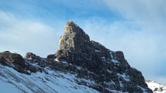
For rock and ice climbers with some experience in the Ghost area, Phantom Crag must be a somewhat familiar name. In fact, due to the short approach its lower cliffs offer numerous rock and ice climbing routes. However, this is not a popular objective in the scrambling and mountaineering community. Despite the fact it’s the smallest peak in the Ghost, it’s one of the most striking peaks out there (together with Devil’s Head). It has a short approach and relatively low elevation gain, but getting to its summit is by no means easy. The published route beta is sparse but after researching thoroughly I realized this should not be treated lightly. The summit pinnacle involves a 8-10 meter vertical wall rated at 5.4 followed by some class 3-4 scrambling up numerous rock bands. Traditionally I wouldn’t attempt something like this in the dead winter, but there’s always some exceptions.
Originally Ben, Vern and I were considering Center Peak down by Crowsnest, but with an increased wind warning issued for southern Alberta we had to switch our plan at the last minute. Instead of down-grading our objective or cancelling the trip we decided to try something different. We figured given the orientation and local topography the ascent route on Phantom Crag could potentially be relatively sheltered from the SW gusts. On the other hand the recent strong wind could also do us favour by stripping off the alpine especially since Phantom Crag is located on the easternmost part of the Rockies. And combined with the fact that crux 5.4 wall is short we figured if bringing a ton load of rock and mixed climbing gears we should have a fairly high chance of success. Of course none of us was 100% confident, but it’s not a bad idea to try neither. Else what could we do at this time of a year…
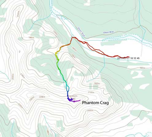
Phantom Crag ascent route. GPX DL
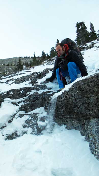
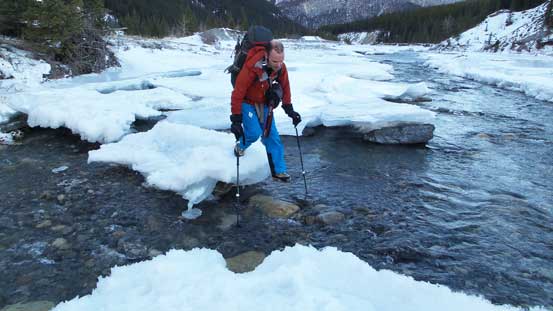
With Vern volunteering to drive his truck we could count on at least making to the top of “big hill”. The road condition turned out better than expected and Vern did a fantastic job negotiating down the “big hill”, crossing the first channel of Ghost River and then following the previous trucks’ tracks for another 2 km or so. We parked just before a large patch of ice and at this point our approach distance was already shaved off to within 1 km. Great.. Wind was not as bad as we expected and not far from the start we were treated with gorgeous sunrise views. Continuing towards our ascending drainage we were surprised to see the main channel of Ghost River still had liquid water flowing… We almost had to wet our feet (that would be awful in January) but thankfully we found a reasonable place to cross.

Gorgeous sunrise view. This was a bonus for us!
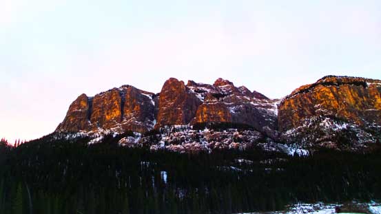
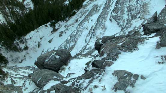
Looking up towards our impressive objective.
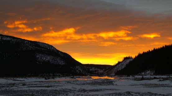
Sky slowly changing colour from red to yellow

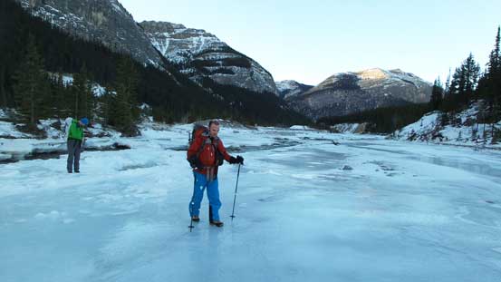
Vern walking on the ice river. Note the reflection on ice.
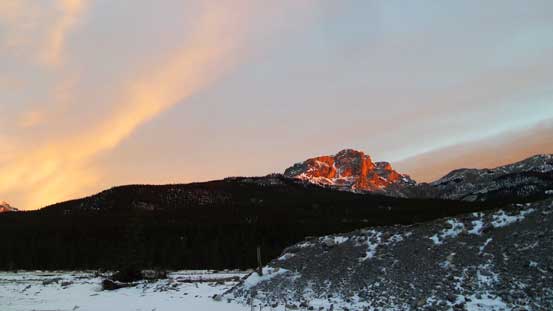
Black Rock Mountain which I did in the past July

More ice walk towards our ascending drainage

We found a reasonable place to cross the main channel of Ghost River. Photo by Ben
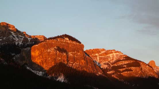
Alpenglow on the rock faces on Phantom Crag
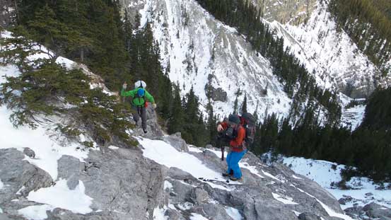
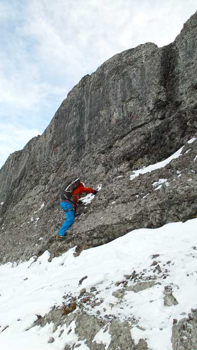
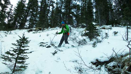
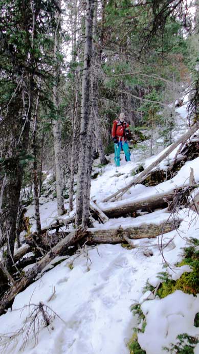
The ascent drainage was more difficult than I thought. Firstly we should have realized that if this area is indeed sheltered from wind, it’ll be a wind deposited area. So as a result we had to deal with considerable amount of post-holing. Nothing major challenge though but the snowpack was a wee bit deeper than normal for this area and sometimes we sank passing our knees. Secondly there was a few cliff bands at lower elevation that we didn’t prepare for. At the first fork we took the supposed left branch, but that dumped us right at the base of a 50-meter wall. Thankfully after zig-zagging up climber’s right side we found some game trails on the steep forest. It led us diagonally up bypassing this wall. Shortly after we were facing at the second wall. This one was a lot less imposing but still required some moderate scrambling, on climber’s left side this time.

Above the first rock wall, looking ahead
Ben and Vern exiting the first wall. We bypassed it on climber’s right side through steep trees

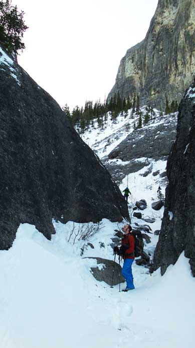
This is the second wall

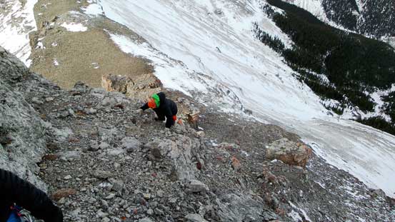
Ben scrambling up

Vern’s turn on the second wall
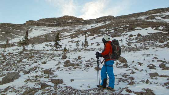
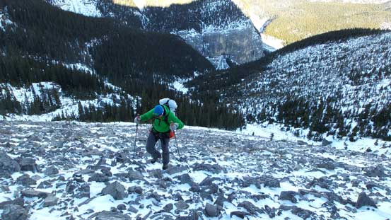
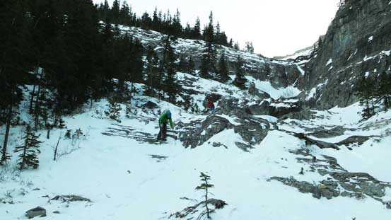
From above the second rock band to treeline was a tedious slog in deep snow. The treeline appeared to be “right there” but the process seemed to drag on forever. Once exiting the trees we had to slog up a pile of frozen scree to the base of the crux rock band. This is a vertical wall guarding the summit block from all directions. Though it doesn’t appear to be major there’s no easy way up. Based on our research we knew the easiest line up was a double-crack system rated at 5.4. It was advertised to be only 5 m but in fact it’s almost 10 m high. Ben and I tried to free climb it firstly but it turned out even trickier than appeared. After some discussion we decided to backtrack and try another gully further climber’s left that Vern noticed. The climbing section in that gully was shorter but more technical. Ben tried it but gave up shortly after, so we were back to the first route.

Still quite a ways to go to treeline. LOTS of post-holing.
Finally at the wind-blown alpine slope
Vern slogging up frozen scree
This peak immediately to the west of Phantom Crag is quite impressive

Looking back towards Black Rock Mountain. Could I see Brandon Boulier’s CSMC group?
This pictures shows the alpine slope is actually quite steep
Vern arriving at the base of the crux
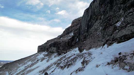
This wall guards the summit nipple. There’s no easy way up.
Ben challenging up.

This picture clearly shows the angle of terrain at the crux. Snow only made things harder.
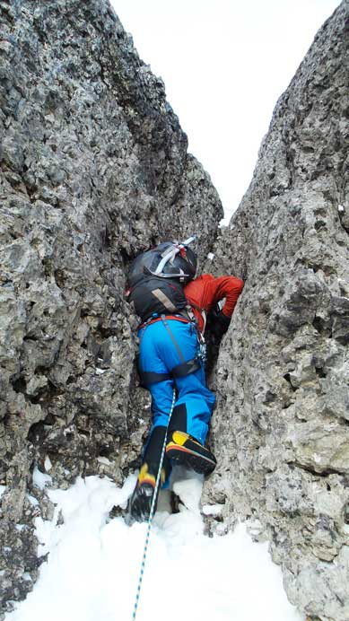
We decided to try another gully. Just like I suspected, it’s even more difficult.
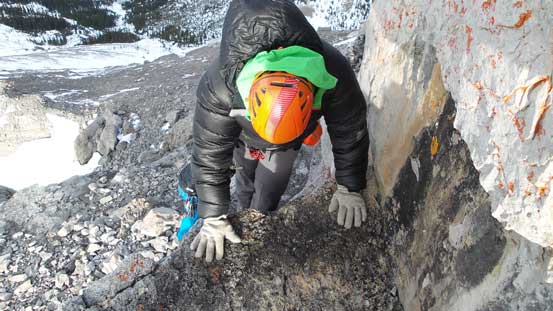
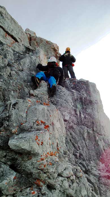
This time I volunteered to lead, but using rock shoes (I was the cheater to bring them up). But at the same time Ben felt it’s not going to be that hard so he decided to try it again, but with ice tool. Halfway up he announced he could climb it so I threw up the rope to him, and then switched back to mountaineering boots. Ben did an absolutely fantastic job free soloing that wall, and then anchoring the rope to a boulder. To save time Vern and I just basically climbed up the rope with prussik as a self belay. The rocks were greasy and slippery and there weren’t many holds neither. The exit was very challenging too due to lose snow, so Ben was the hero on this day.
Ben free-soloing up the crux wall. Photo by Vern
Vern clearing the crux wall.
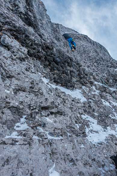
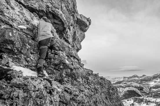
There was more difficult terrain coming up. Immediately we had to scramble up a steep class 3 section and then we were at the base of summit nipple. The final wall appeared to be vertical or overhanging on all directions but we knew there must be a scramble route up. After carefully examining I climbed up a tricky 4th class step to a hidden ledge, then traversed this ledge (ducking underneath overhangs sometimes) back to the climber’s right. Then I found easier terrain (class 3-4 again) leading back to the summit plateau. The views were great but the wind gusts were strong.
Moderate scrambling immediately above the crux.

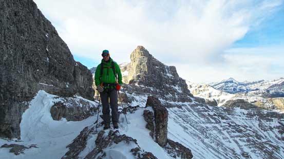
On the ridge now, looking ahead to the summit nipple
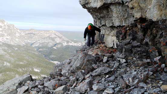
This is the key traversing ledge. Vern ducking underneath some overhangs
This ledge terminates at another scrambling section
Me challenging up the last few steps. Photo by Vern
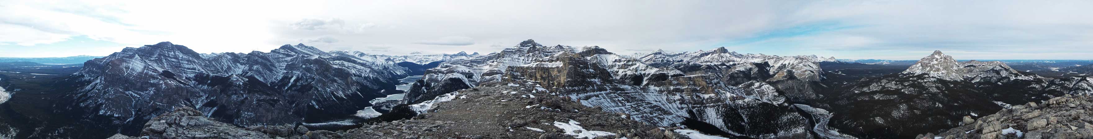
Summit Panorama looking towards the mountains. Click to view large size.

Summit Panorama looking towards the prairie. Click to view large size.
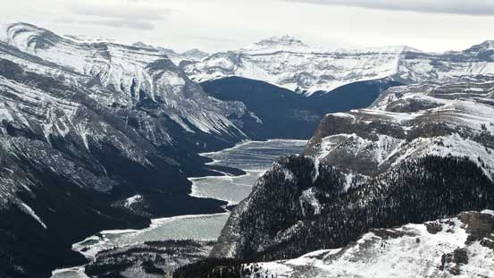
The frozen Lake Minnewanka
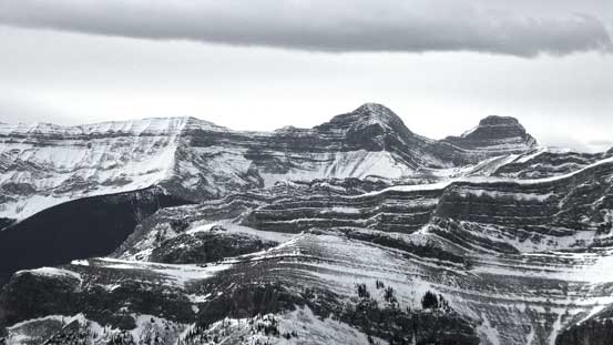
The unusual view of the back-side of Girouard and Inglismaldie
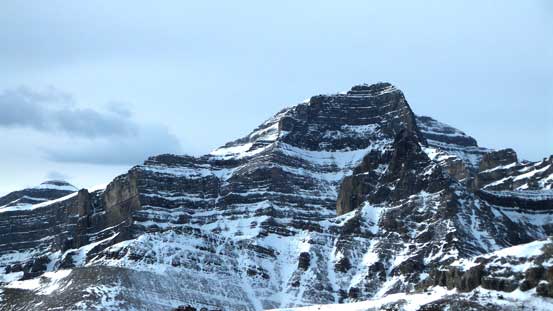
The huge bulk of Mt. Costigan

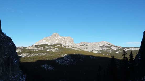
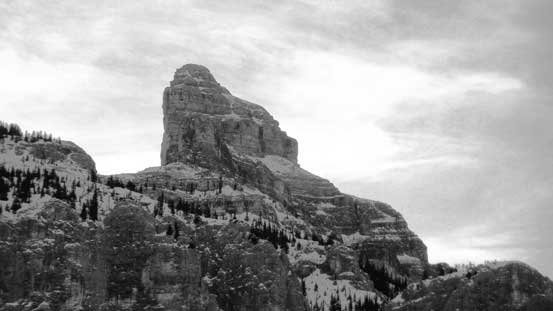
Devil’s Head – landmark of Ghost area
Looking down the steep east face. Devil’s Gap on bottom right
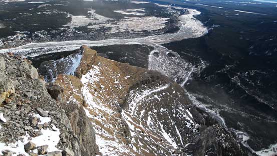
The frozen braided Ghost River
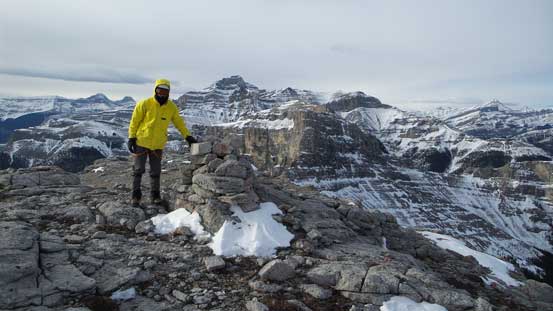
Me on the summit.
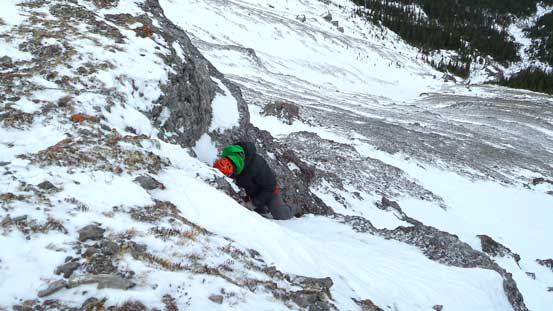
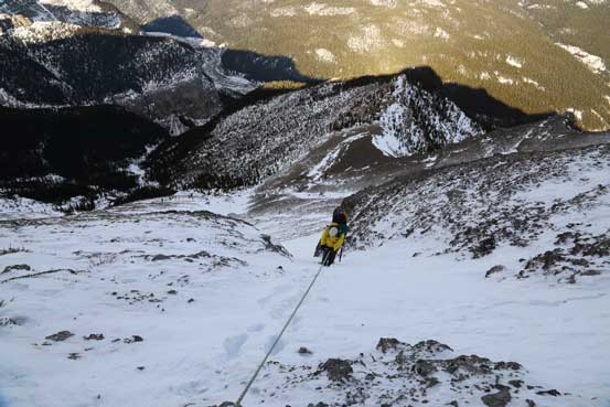
On the descent we considered rappelling off the boulder off the crux band, but that boulder didn’t appear to be bomber and there’s no easy place to put back-up anchors nearby. After some discussion we decided to investigate a few potential rappel station further east. Eventually at just above the “short but more difficult” chimney we found a bomber rock tunnel on the wall. We were also glad to have brought up a 60-meter rope as a 30-meter rope wouldn’t be sufficient. Rappelling was straightforward and soon we were back to easy terrain.
Ben and Vern scrambling down from the summit nipple

Down-climbing the 4th class section

More down-climbing

Great view of the connecting ridge to the higher unnamed peak. But very strong wind.
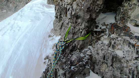
Solid natural anchor for rappelling. To use this you must have a 60-meter rope..
Me starting the rappel. Photo by Ben
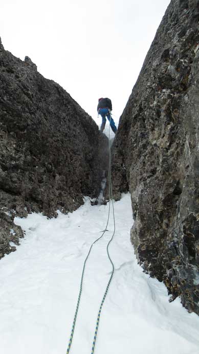
Ben rappelling the steepest part.
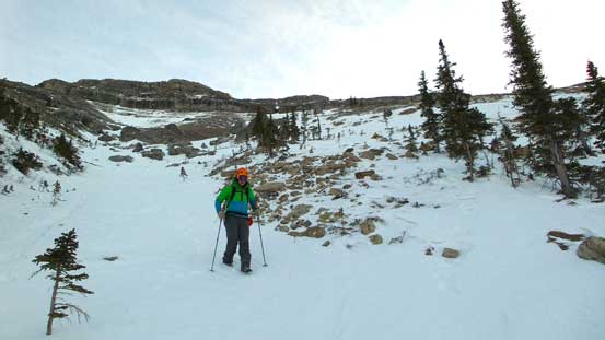
Retracing our tracks down the soft snow was fast and in short time we were back to the initial canyon. We accidently noticed bolts on both sides of this canyon so apparently this is also a sport climbing area. The rock quality appeared to be bomber so maybe in the future I’ll return here for some rock climbing. Our round trip time was 8 hours, a lot longer than expected.
Vern plunging down the snow gully to save our knees
Descending through the trees
Ben just about to jump down the second rock band
Black Rock Mountain again
Descending towards the first rock wall
Looking down the first wall. It’s a long way down…
We bypassed the first wall through steep bush
Then back to the canyon. Ben carefully examining the bolted rock routes.
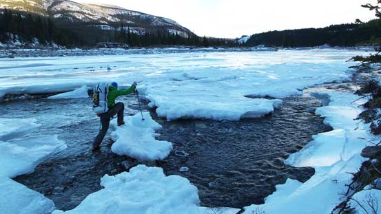
Vern crossing back Ghost River
Ben’s turn

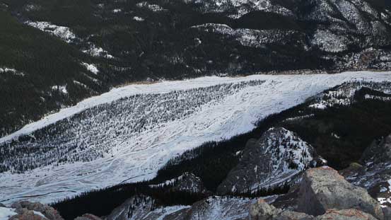
The Ghost River is more of an ice river now.
Ice walk!
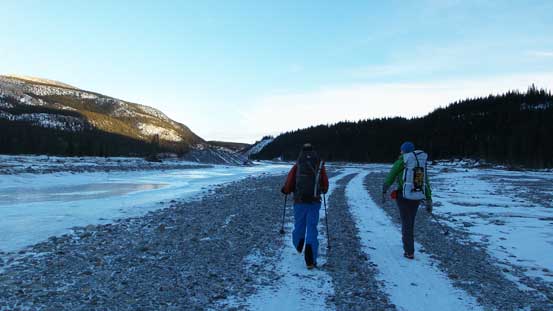
Walking back

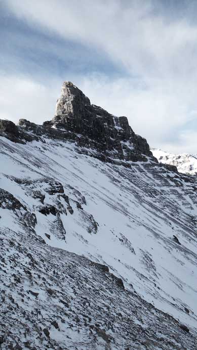
Looking back at our objective
Zooming-in of the summit nipple

Zooming-in of Devil’s Head
Phantom Crag is a technical summit even in summer so I’m happy we managed to bag it in winter. It’s also good to do “something different” and this opens up some other trip potential. Vern again, did a good job driving back up the “big hill” and overall it was a very satisfactory day in the mountains again.
