Mount Forgotten
November 15, 2023
1830m
Mountain Loop Highway, WA
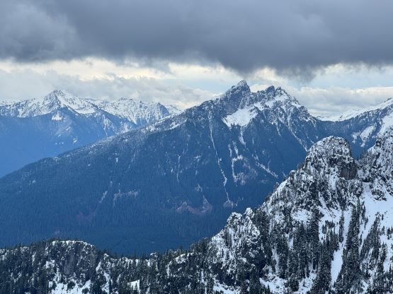
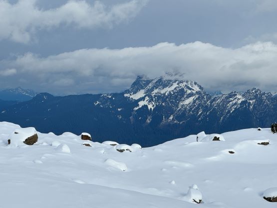
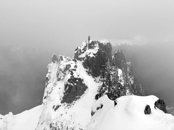
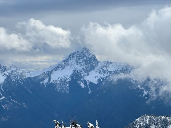
Mt. Forgotten is one of those rather-significant peaks accessed from Mountain Loop Highway as it boasts over 800 m prominence. This peak shares the same trail-head with the popular Dickerman Mtn., which I did in 2017 on snowshoes. Mt. Forgotten is not normally done in winter but so is the case for most of the “better” peaks in the Cascades. I cannot do every single damn mountain in that 2-3 months of summer, so some of those will have to be done in less-than-ideal conditions. In this particular case I came across a few November trip reports confirming Mt. Forgotten had been summitted on snowshoes, so I quickly put together a group. I had a rare Wednesday in which I did not have to be back home for work until 8 pm. The weather was not the best, but good enough to get the job done. What I did not realize at first was that those parties only went to the first (east) summit. There are three summits – east, middle and west. It’s not 100% clear to me which of the three is the highest so we must ascend them all to be sure. The traverse was sketchy enough in summer to scare away some seasoned scramblers, so this discovery jacked up the trip to a proper winter mountaineering outing. I decided at the last minute to bring a 30 m rope, a small rock rack and lots of slings in addition to mountaineering boots and steel crampons, which proved to be actually necessary.
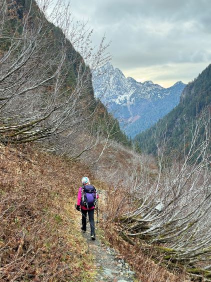
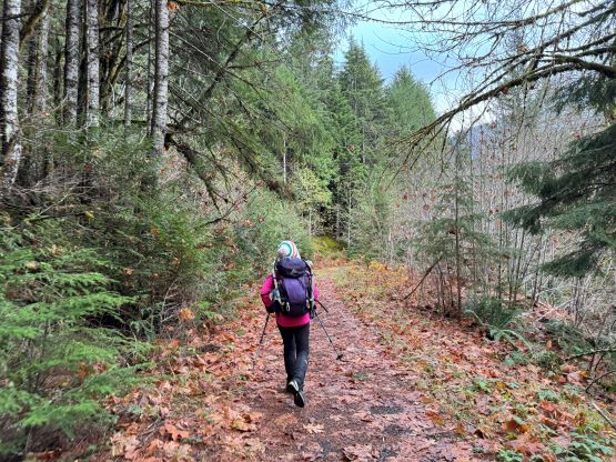
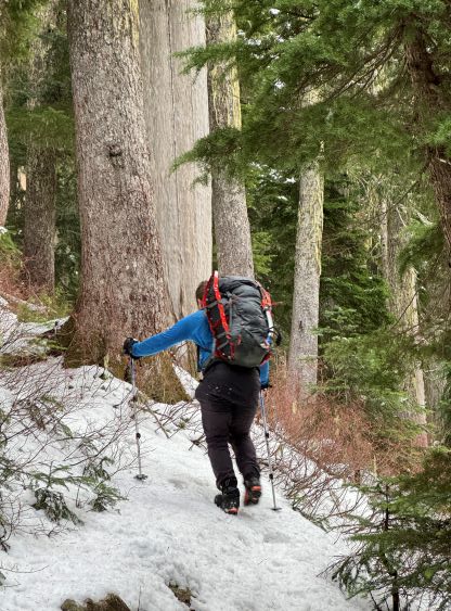
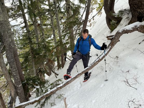
Due to the evening commitment we still had to get up at an ungodly hour so I made Chris, Sean and Kate to show up at White Rock at 3 am. The first challenge was to squeeze all of the gears in the trunk of the Corolla. I then drove us down south in this fuel-efficient vehicle and within 3 hours we had parked at the Perry Creek trail-head. I thought about taking the short-cut by using the decommissioned road but there’s a massive block and we couldn’t see the status of that road beyond the block. The trail would only add an additional kilometer of hiking anyway. I opted to wear trail-runners while carrying the mountaineering boots, making the already-hefty pack even heavier. I still think this was the correct decision as we did not encounter continuous snow in the first 2 hours of the plodding.

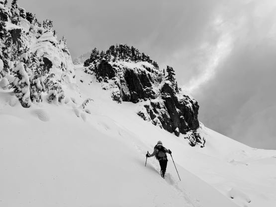
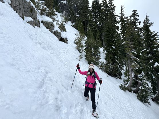
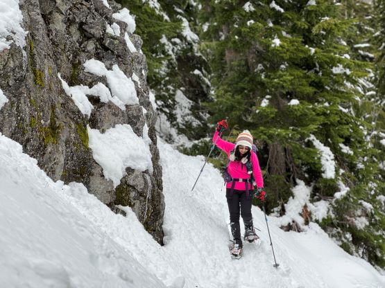
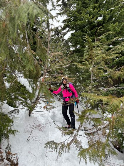
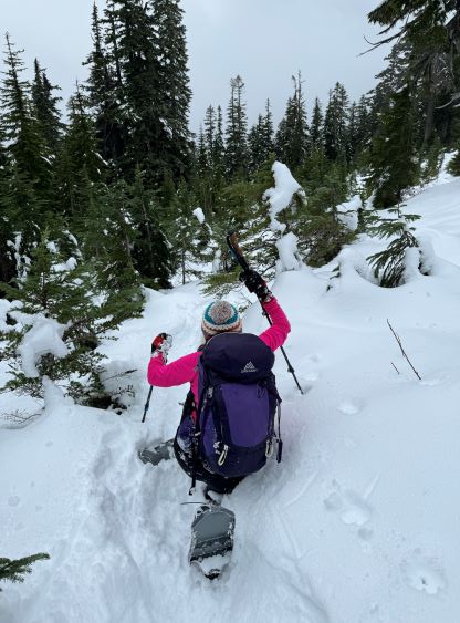
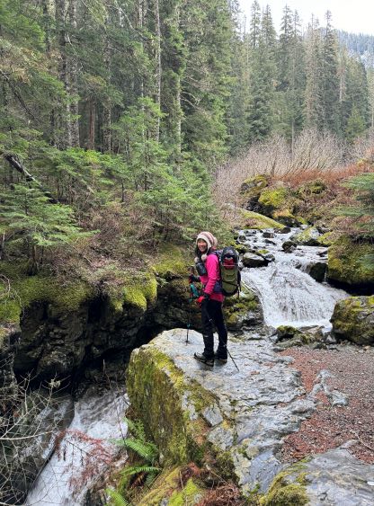
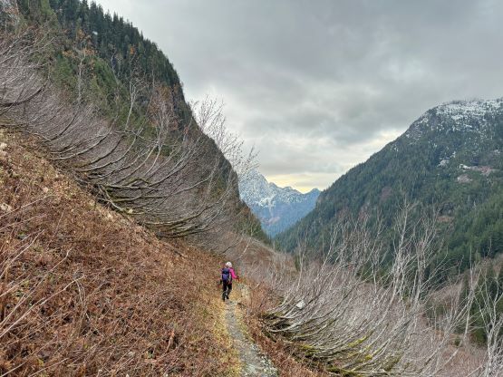
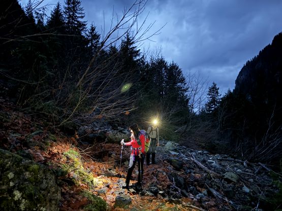
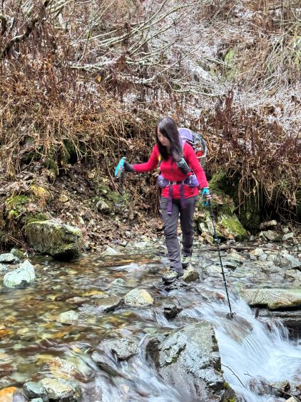
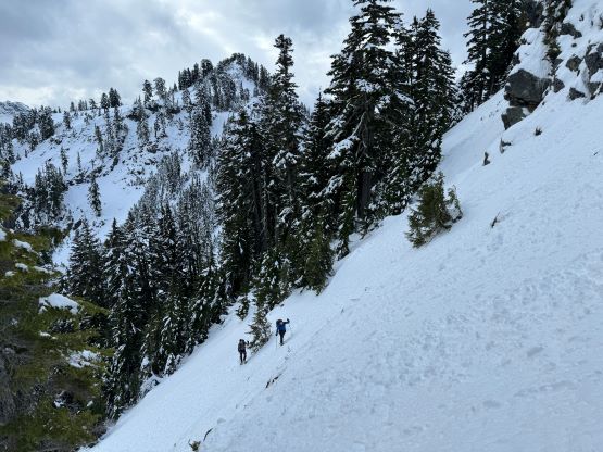
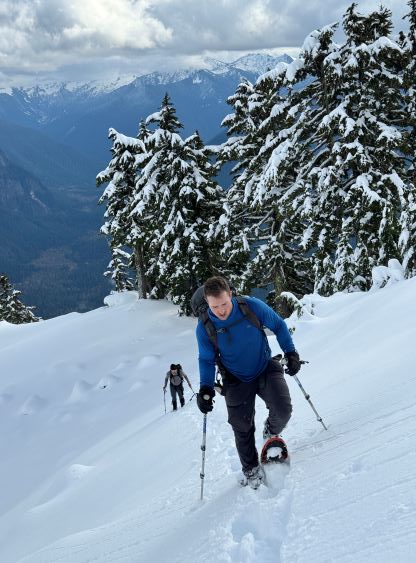
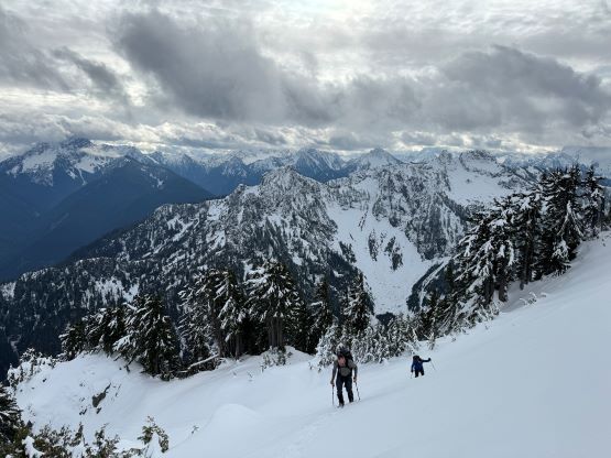
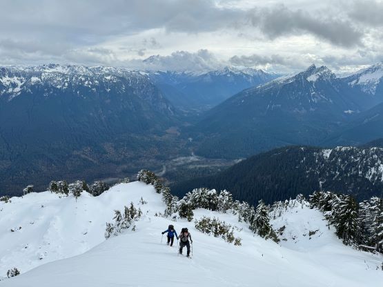
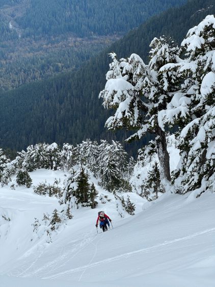
The first hour was done using head-lamps and we quickly came to the the crossing of Perry Creek, which was rather trivial by rock-hopping. I knew this was a reliable water source so I carried some empty bottles and loaded up the water here. We took our first break at around 1250 m elevation and I finally decided to swap the trail-runners for mountaineering boots. I did not actually have to do the transition here but I did not want to make an additional stop because of that. The depth of the snow increased drastically below the ridgetop viewpoint at 1500 m elevation. Sean and Chris was leading in front and opted to post-hole to the viewpoint. We then immediately decided to don snowshoes. The trail was no longer visible. I then led us traversing across the north side of the ridge crest (better views), and mostly followed this ridge all the way to the unnamed bump above Forgotten Meadows. Chris and I discussed about bypassing the bump, but opted for the up-and-over option. The weather was better than forecasted so we’d rather get more views now than later. Meanwhile Kate caught up and decided to wait for us to tag the actual peak. I thought it’d take at least 4-5 hours to climb Mt. Forgotten and back so I gave the car key to Kate and expected her to slowly hike back to the trail-head. Little did I know that she actually followed our tracks all the way to the (fore) summit after spending an hour here by herself. This was downright impressive considering the amount of “technical snowshoeing” involved.

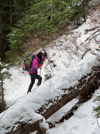
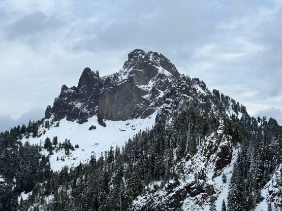

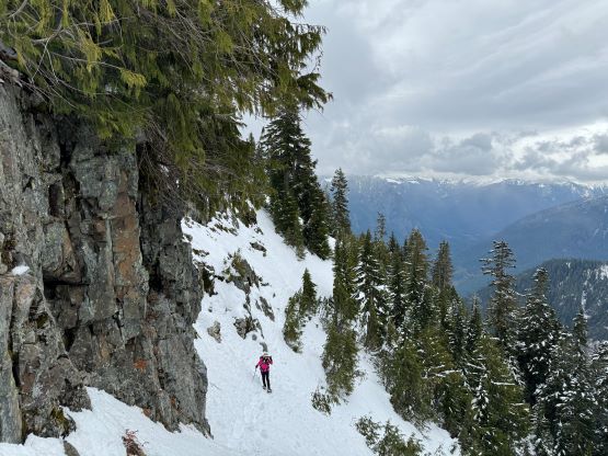
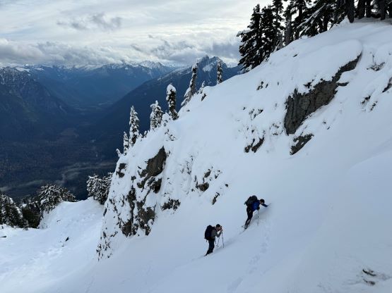
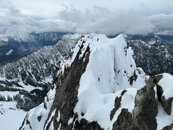
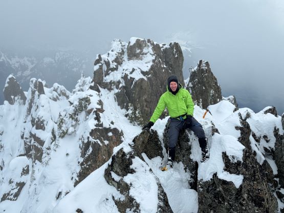
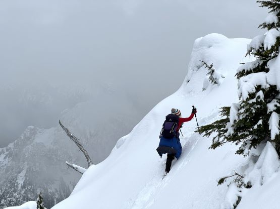
The descent off this unnamed bump was not trivial and involved fair amount of steep terrain and route-finding. We did not have to do any bushwhacking but we had to link up several 35-40 degree slopes. To descend these slopes on snowshoes required years of experience so it was very impressive that Kate did all of these essentially solo. The next stage was the mile-long side-hilling traverse across the south-east side of Mt. Forgotten. Again, the trail was entirely buried and not visible and the slope angle was sustainedly 30+ degrees for the entire way. I consulted with the GPS multiple times to make sure our bearing was still correct, and there were several stretches of up-and-downs to bypass or skirt around vertical cliffs. Most parties would start to doubt the feasibility, but with perseverance, experience and confidence we eventually wrapped around the SE Ridge and located that key gully on the east face. The gully was only around 35-40 degrees and the snow condition made it an easy ascent on snowshoes. I made about a dozen switchbacks within the gully’s constraint. After exiting the gully I led us ascending a large open slope to a ridge feature on climber’s right. This ridge separates the main east face gully from another (steeper/narrower) gully further to the right. We snowshoed up this ridge and ascended another open slope to the first (east) summit.


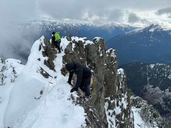
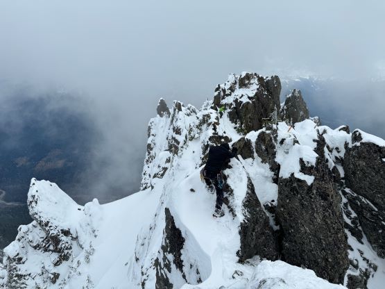
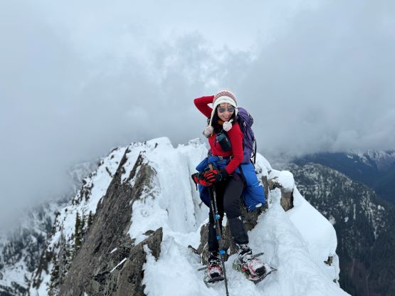
The sight of the middle summit was daunting so I immediately decided to don all of the gears that we had hauled up. The transition took a while, but in about 15 minutes we were ready for the technical climb ahead. The belay anchor was easily built using an existing rock horn, and I also put in a cam (.75), and slung around another horn while down-climbing into the notch. The infamous au-cheval was completely covered in snow on the right (north) side, while the other side had lethal exposure. I had read Matt Juhasz’s trip report in which he mentioned “a million footholds”. The footholds must be on the north side because the exposed (south) side had hardly any, so I spent a few minutes cleaning the snow and sure enough, I discovered a ledge that’s large enough to be a somewhat reliable foothold. I made a few ginger moves, switching between the sides tip-toeing on crampons and was able to avoid that awkward au-cheval all together. I used a mediocre boulder on the middle summit to set up a fixed line for Chris, and then belayed Sean across.


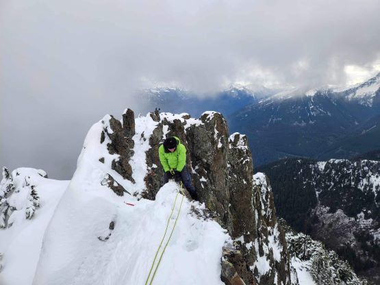
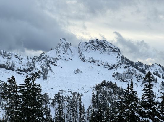
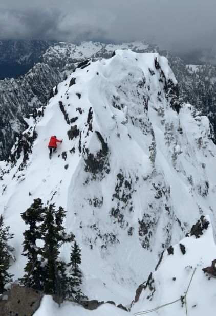
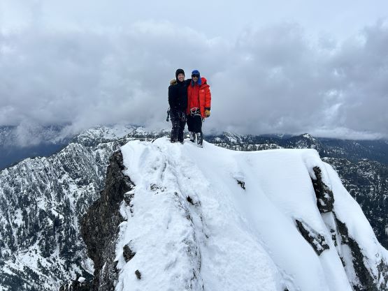
The west summit appeared to be lower but we still wanted to ascend it for completion. The crux of the entire climb was the descent into the middle/west col. I tried to down-climb but the final few moves were too technical so I opted for a rappel. Chris and Sean then followed. The rope must be left there in place because we weren’t sure how difficult to climb up that step, so we proceeded to the west summit without the rope. There’s another gap to cross near the very top and that involved a few exposed class 3/4 moves. It took me a while to figure out a sequence and it turned out to be easier than appeared. After celebrating the full traverse we easily descended back to the middle/west col, and then free-climbed that short pitch back onto the middle peak. Sean and Chris went up first and used different beta. I initially tried Sean’s way but opted for Chris’ beta in the end. To get back to the east summit we again, belayed each other across that airy gap. The descent was more awkward but we already knew the sequence of these moves so it wasn’t too bad. Kate had given me a two-way radio earlier in the day and I finally remembered that. I turned it on to inform her that we had finished the climb and were about to descend. To my great surprise she replied that she was already in that east face gully going up. About 20 minutes later she showed up and tagged the east summit.


I then gave the car key to Chris and the decision was to descend in two teams of two. Chris and Sean went ahead and followed the exact same path that we took on the ascent, making the snowshoe tracks even better for us to follow. Kate wasn’t very comfortable about descending the 35+ degree slopes on snowshoes, so she took the ‘shoes off and wallowed/glissaded the whole way back down to the mile-long traverse. Kate was planning to do the entire traverse sans snowshoes, but after falling into a tree well I finally convinced her to put the snowshoes back on. The snowshoeing was much easier than she thought, that we were able to maintain a reasonable pace throughout. Not to my surprise Chris and Sean had laid a track bypassing that unnamed bump so we followed their tracks. The rest of the hike-out was tedious and never-ending. I was very happy to come across my ditched trail-runners as walking in those mountaineering boots sucked. Kate had incredible stamina and started running, so we jogged most of the way back and only made Sean and Chris to wait for around 20 minutes. Our round trip time was just over 10 hours and that wasn’t too bad considering my pack weighed about 30 lb at the start. Chris and I took turn driving us back to the border and we even earned ourselves enough time for a proper dinner before my 8 pm work.