Mount Burns, East Peak
August 30, 2015
2622m
Kananaskis – Sheep River, AB
This was my last trip in the Canadian Rockies before moving to Vancouver and Vern, Ben and I were struggling to find the perfect objective. A system was pushing over the Rockies from the Pacific and the weather was miserable by the divide but reasonable in the front ranges. But every time this weather patten happens the front ranges will get hammered by strong wind. This trip was not an exception. Our original plan was to make an ascent of Gibraltar Mountain from Sheep River but the wind was already howling at the parking lot. Gibraltar would involve at least 10 km one-way just to get to its base and the Sheep River trail was in an unknown shape thank to the flood damage in the spring of 2013. None of us was in the mood for that so I suggested why not just do the peak immediately to our right. It’s well documented in Andrew Nugara’s More Scrambles in the Canadian Rockies book.
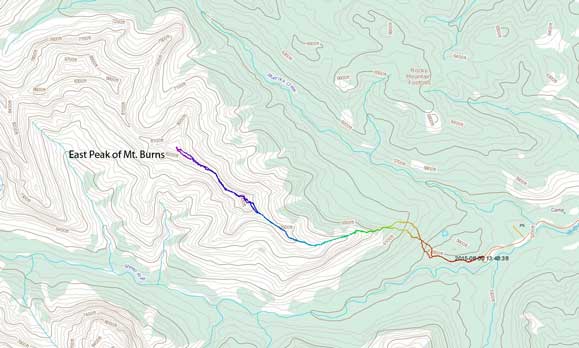
Scramble route for the East Peak of Mt. Burns. GPX DL
Although the East Peak of Mt. Burns doesn’t have an official name, it provides an enjoyable and reasonably short scramble with fair a bit of hands-on stuffs. After following the main Sheep River Trail for roughly 10 minutes we ventured into the bush. It’s Alberta front range’s bushwhacking so basically hiking through open forest. We gained the broad E. Ridge and followed it upwards to treeline. The first bump was bypassed on climber’s right on a sheep trail, but once cresting the col between the first bump and the false summit we were welcomed by the strong gusts that nearly knocked me off balance several times. We forced ourselves to the base of that false summit and thankfully the wind died down (the NE slope was sheltered from the SW wind).
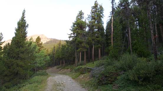
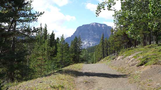
Hiking up the Sheep River Trail in the morning

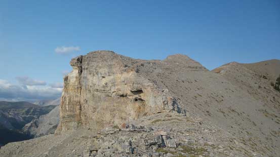
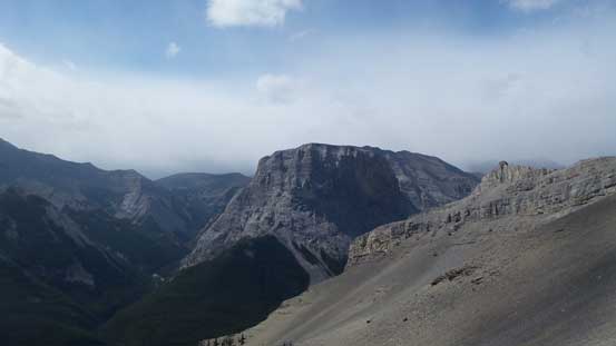
A view of Gibraltar Mountain. Oh nope, it’s just the false summit of it…
Arrived at treeline, looking up

Shunga-la-she is another Nugara’s scramble

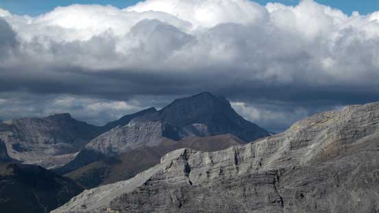
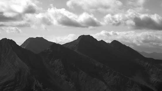
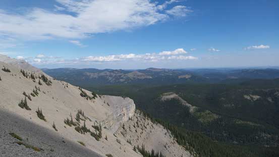
A view of Bluerock Mountain
Ben marking up the scree

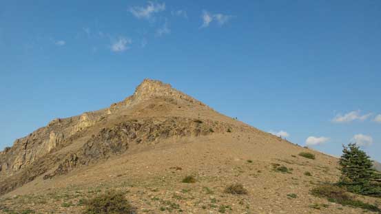
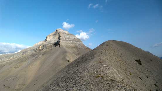
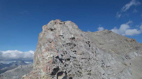
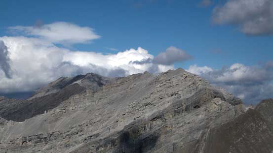
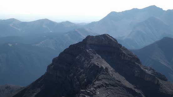
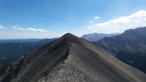
This undulating ridge leads to the false summit. True summit is behind on the far right
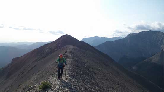
Following the ridge up
Ahead is another bump, then the false summit

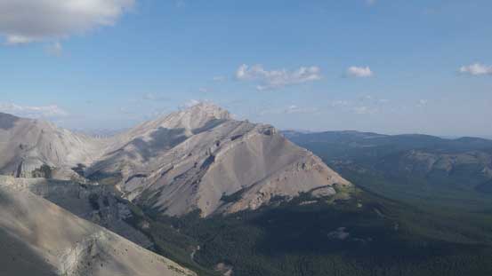
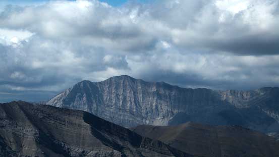
Gibraltar Mountain

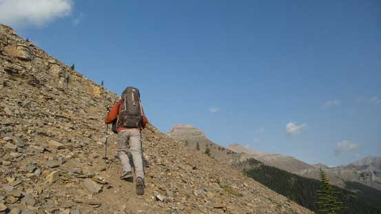
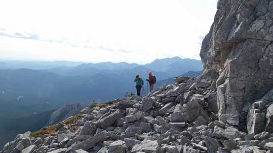
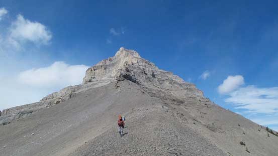
Hiking towards the base of this false peak
Vern on the ridge crest, battling against the wind
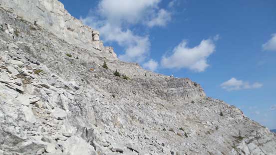
The false summit would be quite challenging to ascend, and thankfully to get to the true summit we didn’t have to traverse up and over it. There wasn’t a clear path but many routes would go. We basically did a long rising traverse line to contour around the E. and NE sides. At one point we found a large cairn indicating we were on route. Once around the false summit the wind picked up again, unfortunately.
Picking a rising traverse line across this face
Vern and Ben around a corner
Another view of Bluerock Mountain
The connecting ridge to the true summit was interesting. It’s fairly challenge to stay directly on the ridge crest so we had to often bail to either side looking for ledges to bypass the difficulties. Up the other side of the false/true col Ben and I opted to attack the few rock bands head-on for some fun scrambling but Vern went around on climber’s right side which was basically a scree plod. Shortly after we made to the summit. We did a bit of statistics before this trip. It’s my 422nd summit (~400 in the Rockies) and the 157th peak that Ben and I ascended together.

Traversing towards the true summit

Ben and Vern ascending a step

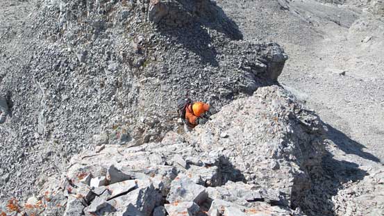
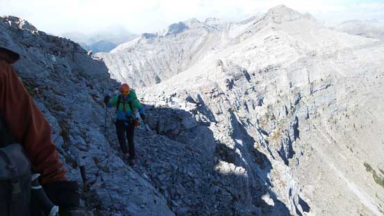
Traversing on some ledges to bypass harder stuffs

Looking up the connecting ridge
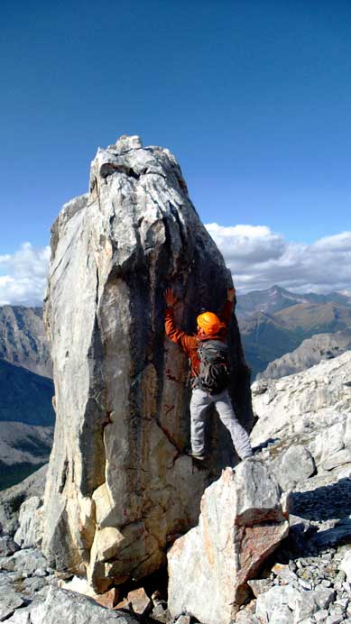
Ben trying to climb this boulder… Or not…
Ben and I picked the direct line charging up some difficult terrain

Gaining a short chimney
Another section of exposed terrain ahead.

Having fun on the ridge
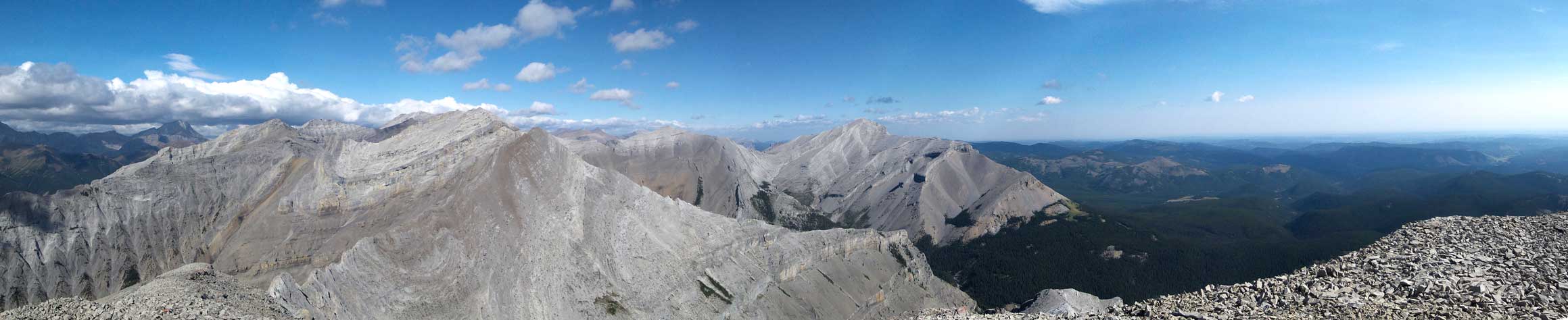
Partial summit panorama. Click to view large size.
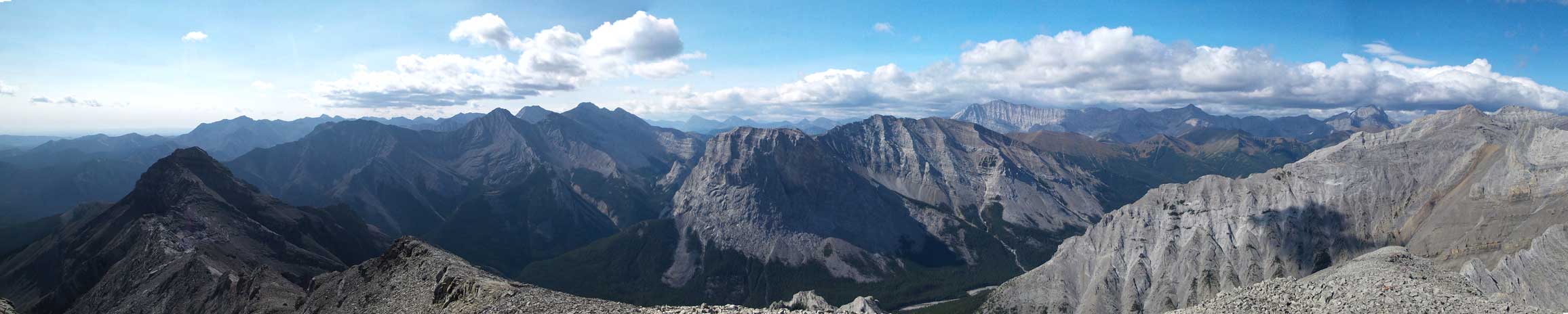
Partial summit panorama. Click to view large size.
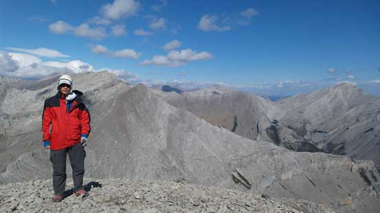
Me on the summit
Mist Mountain
Mt. Rae
Looking further along the ridge towards the true summit of Mt. Burns
The low bump on bottom left is Mt. Ware
This is the false summit that we bypassed
Highwood Peak

Gibraltar Mountain
On the descent we all went down Vern’s bypass route and then retraced our steps down the ridge, around the false summit. But now the wind had gone crazy and some weather was moving in from west. Thankfully all the hard stuffs were over and we quickly went down into the woods, and then it’s a simple plod back to the parking lot.
Traversing a ledge to gain the face of that false summit

Typical terrain on the false summit traverse

Some weather was moving in
Leaving the false summit behind
Another view of Gibraltar Mountain
Up and over the next bump. The wind was the worst around here
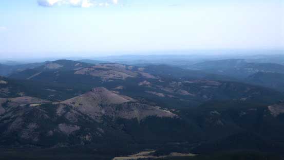
Oh the exciting prairie. I guess I won’t see you again anytime soon…
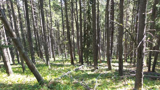
I’ll surely miss the nice and soft Alberta’s bushwhacking
Down to the trail.
And now it’s time to think about the lengthy drive from Calgary to Vancouver, but before that I was invited to Ferenc’s home to say goodbye to him. A big congratulation to Ben and Ferenc for a successful ascent of the Japanese Route on Mt. Alberta in marginal conditions. Then I went to pick up my loads from Maury’s house (and said goodbye to him as well), and then I was off to the Coast. I drove partway in the evening of Aug. 30th, slept in my bivy sack for a night and finished the rest the next day. The weather was terrible from Rogers Pass to Sicamus, and then from Merritt all the way to Vancouver… The traffic was not inspiring neither once entering the lower mainland, but oh well… I’m excited to explore the Coast, but yes, I’m sure I’ll be back to the Rockies for some selected objectives at some point.
