Dos Cabezas Peaks
March 22, 2023
2548m
Willcox, AZ
Dos Cabezas means “Two Heads” in English and this mountain is an iconic double-summit massif visible from I-10 in south-eastern Arizona. This peak also boasts close to 1000 m prominence making it one of the more “important” objectives in the area. The scramble to the higher south summit is 3rd class using a ramp/gully system, whereas the traverse to the north summit is much more complicated, but still does not involve roped climbing. It’s unfortunate that much of the lower slopes of this mountain are inside private lands making the access the actual “crux”, even though the summit itself is in BLM/public lands. The trip reports on peakbagger.com illustrate how climbers had chosen different strategies to deal with the access pain in the past decade so I’m not going into details here. About a year ago Adam W. and Rob W. pioneered a new access route utilizing a dry wash west of the village of Dos Cabezas to bypass the first few kilometers and hence most, if not all of the prohibitive signs on Mascot Mine Road and I was mostly intrigued by their trip reports. When planning this Arizona trip with Nikita and Raphael I told them that we’d be following the Walker/Woodall route under the cover of darkness on the 5th (final) day of the trip. The weather forecast was calling for strong winds (over 100 km/h gusts) but it wouldn’t be worse than my old days in Rockies’ chinooks so I was determined. Raphael and Nikita were eventually convinced to trust my experience and judgement.
While walking on the upper Mascot Mine Road Adam and Rob encountered private houses with barking dogs and at least one hidden camera. I downloaded their GPX tracks, went onto the maps and proposed a new route to completely bypass Mascot Mine Road and the associated properties except for the middle section where nobody lives on. My years of experience climbing peaks without any online information in BC’s Coast Range had trained me to always take “beta” with a grain of salt. I of course trusted Adam and Rob’s planning, but I wouldn’t take their route as the only possible way. My plan was to ascend the entire course of that long and undulating SE Ridge system from the road all the way to the “Iron Tower”. The cost of minimizing the trespassing exposure was the unknown degree of bushwhacking.
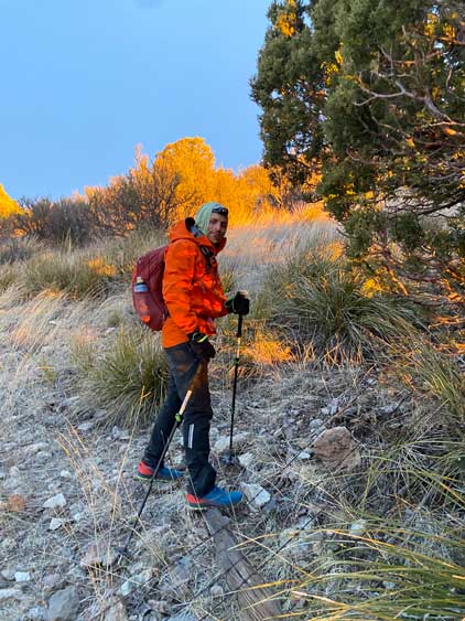
The evening before saw some gusty winds in the town of Willcox such that Raphael couldn’t even get his tent erected even with the help from two other people. I, on the other hand, had brought my trusty BD Hilight which is designed to withstand high winds. Nikita then volunteered to sleep inside the vehicle while Raphael and I would share my tent. The alarm went off at 2 am and we were about to start the approach at 3 am as planned. We chose to park the vehicle on a nearby cemetery and we did not encounter a problem after returning.


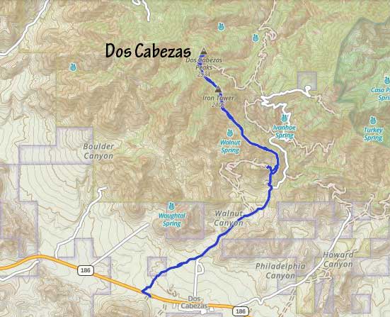
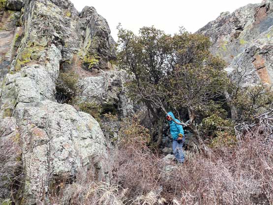
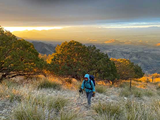
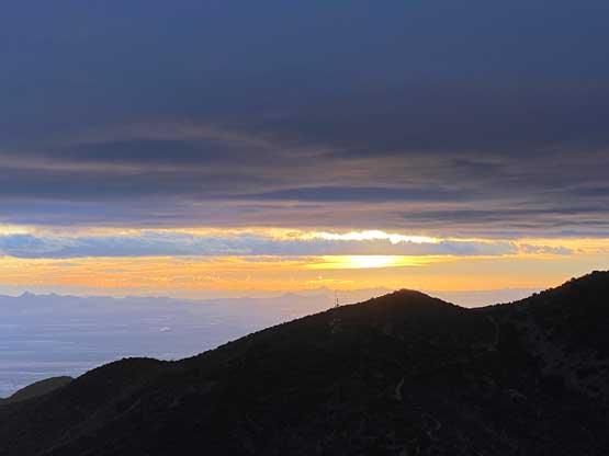
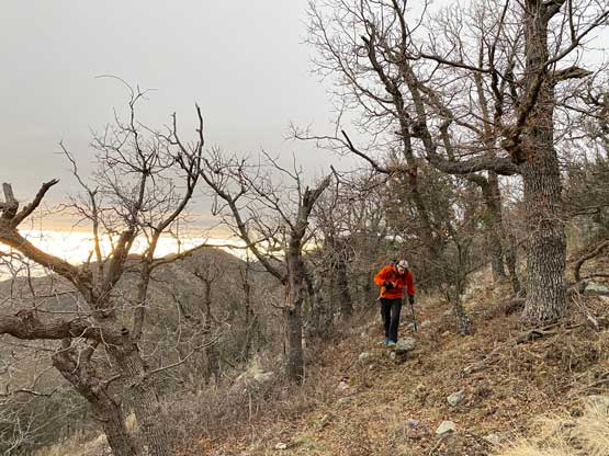
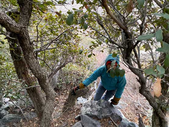
From the cemetery we walked westwards down the highway for about 200 m and then dived into the Walker/Woodall wash. There’s one barbed wire fence to hop across just to get down into the wash, but there wasn’t any prohibitive language or sign so we could make the assumption that this wasn’t in anyone’s private lands. We then dashed up this dry wash for a couple kilometers and intersected Mascot Mine Road from one spot where the wash goes really close to the road. Adam and Rob had actually plodded much further up this dry wash but at 4 am we decided to just use the road to speed things up. A few more kilometers later we left the main road onto a narrower spur road into the unknowns. The experimental route started off nicely, but the road quickly became abandoned and overgrown with impenetrable amount of thorny plants. After foolishly pushing through the cacti for about 10 minutes I made the decision to turn us around. I had come here with Plans A, B and C so even though Plan A didn’t go, we still had options. The next strategy was to leave this spur road and scramble eastwards onto the aforementioned ridge system, with some added distance but hopefully less thorny bushes. There was still thorny plants but the density was penetrable so we kept going. I have to point out that the route-finding wasn’t very obvious in the darkness so we didn’t pick the path with the least resistance, but a few hours later on the descent I could confirm that the unavoidable bushwhacking in thorny plants is very minimal on this route. Once the ridge turns left (westwards) the going had become increasingly easier the higher we went. After taking the first energy break we sped things up again to aim for sunrise from the top of that “Iron Tower”.


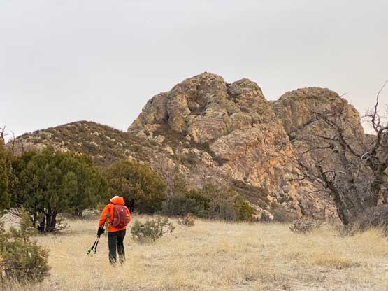
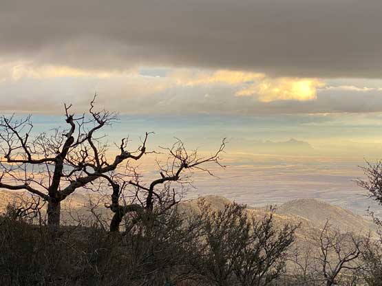
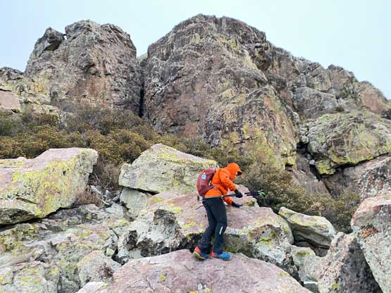
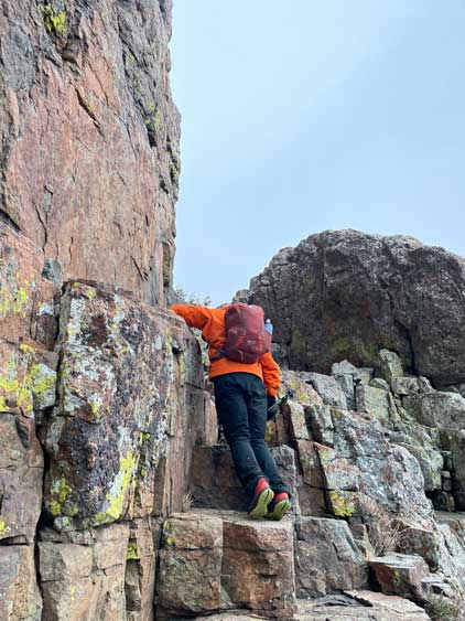
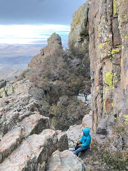
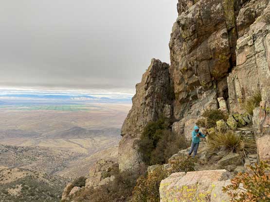
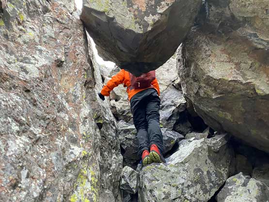
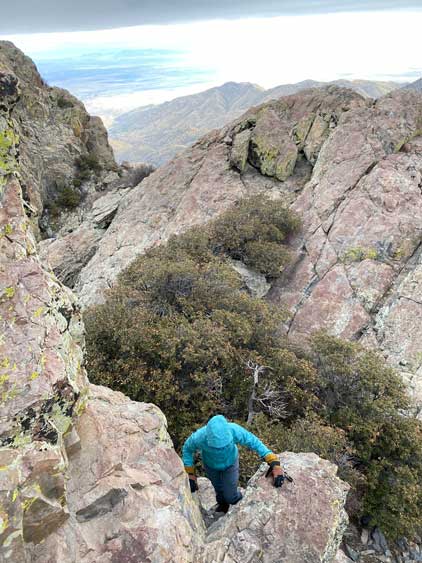
At this point we had joined the standard route back into the known and I was overall satisfied about our exploration of this new route. We followed a mix of open terrain and animal trails descending a short ways to Iron Tower/Dos Cabezas saddle with jaw-dropping view of our objective ahead. We then scrambled and thrashed to the base of the south peak. Almost all other trip reports emphasized bushwhacking here but we didn’t find it to be that bad. The plants were not thorny and that’s all what mattered. The density of the vegetation would never be a problem for us coming from BC’s Coast Range. The winds were howling as forecasted but the route was mostly sheltered except for a few corners on the ledge system. The traverse across the ledge was rather obvious and then we turned into a vegetated gully heading into the infamous chockstone. The scrambling through the keyhole (class 3) was the most enjoyable part of the south peak’s ascent and for this part I agreed with everyone else. Above the chockstone gully we still had some 3rd class scrambling to content with before topping out onto the south (true) summit.


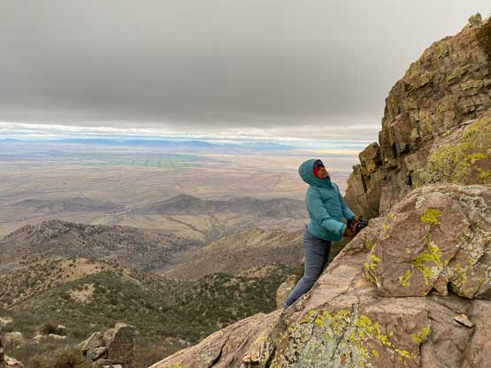
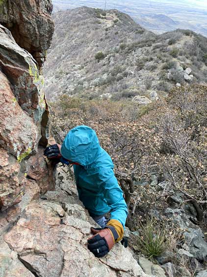


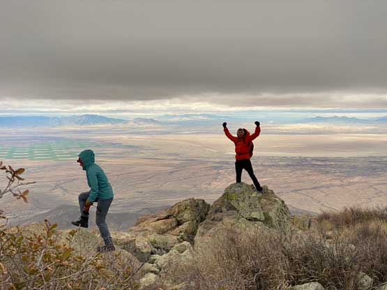
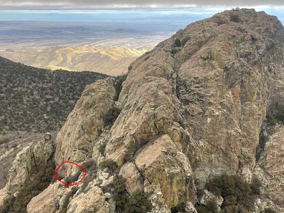
While looking for a register (we still couldn’t find one) I went northwards to inspect a possible descent route into the south/north saddle since I also wanted to scramble the less-visited north peak. There’s one trip report saying “technical climbing” and “two rappels needed” or something like that, but again I always take beta with a grain of salt. I’d rather trust my own judgement. I spotted a ledge system on the NW Face that could potentially lead me a fair ways down, so even though the entire descent wasn’t visible I figured it’d be worth to try. Descending onto that NW Face ledge was straightforward and midway down the ledge I encountered some exposed, wet and 3rd class down-sloping terrain, which gave me a pause but didn’t impose any problem. The bottom of that stretch still held snow, so I faced into the slope and kicked some steps (using trail runners). Thankfully the snow was rather soft. The bottom of the route was not visible from above, but turned out to be fairly easy with only one 4th class move required and I didn’t even look hard enough for alternatives. I then quickly post-holed across the vegetated north/south col and picked up the route on the north peak that I previously spotted. The ascent of the north peak from SW was mostly 3rd class with one harder step that I managed to bypass on the descent, and I attained in the summit in short time.


I again, tried hard to find a register but to no avail. Instead of wasting time there I quickly made my way back down the north peak and then back up the south peak, roughly following the exact route I took, with minor improvements here and there. The others wanted to get off the south peak as the weather was overall not looking great with threats of rain, so I agreed. I called for a break once the scrambling was finished since I hadn’t consumed any food and water yet since our only food break pre-dawn. The rest of the descent down from the Iron Tower following the undulating SE Ridge system felt considerably easier than on the ascent, as we were now able to pick better lines in day time. After descending to the road we decided to reverse the exact things we did on the ascent rather than taking Adam/Rob’s “higher wash” variation. The only excitement we encountered was a huge ass bull snake. Raphael spotted it after I pretty much stepped across it without noticing. I then made sure to pay more attention to the ground for the rest of the return and our round trip time was about 8 hours taking in account of everything. The day was still young so we made the spontaneous decision to hike Sugarloaf Mountain inside Chiricahua National Monument for simple reason of why-not.