Mount Victoria, North Peak
July 8-9, 2014
3388m
Lake Louise, AB/BC
With a full week’s sunshine in the forecast, Ben and I had to make some aggressive plans to take full advantage of it. We both could manage a 3-day trip and we had a couple options. After weighing the advantage and disadvantage of each we decided to go slightly more conservatively mainly because of the hot weather. We were seriously considering another 3-day trip further north, but neither of us had 100% confidence on the current snow condition and we certainly didn’t want to bash 1.5 days through miserable bush, cross a major river and ascend a fractured glacier only to realize our objective being out of shape. However, we still wanted to do big snow climbs, so how about North Victoria AND Mount Lefroy… This seemed to be the most reasonable plan as the approach to North Victoria only takes 2-3 hours so we wouldn’t lose much in case the snow being too soft. That being said, for both North Victoria and Lefroy together we could manage in 2 days so for the last day, we decided to team up with Ken for an easy rock route, namely Goat Mountain Traverse. Alright, that was THE PLAN…
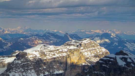
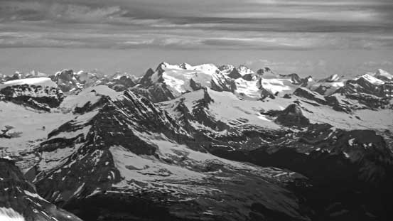
Mount Victoria is one of the icons in Canadian Rockies that everyone should be familiar with so I don’t need to do much introduction. It has two summits (South and North), with the south summit being the true one. However, unlike other double-summit peaks like Wiwaxy or Kaufmann, the two summits of Mount Victoria are not equally impressive/high. The north summit is merely a subsidiary bump on the north ridge, but it’s listed as a separate peak on the 11,000er book. For this reason I’ll have to do it at some point. The climbing route goes up a very fractured Victoria Glacier, crosses a bergschrund, ascends steep snow/rock to Victoria/Collier col, and then traverses some 50 degree snow before eventually topping out on the summit. It’s a beautiful line, but also a serious undertaking.
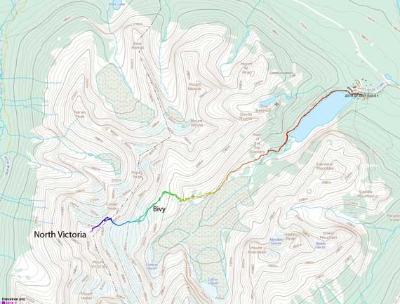
North Victoria ascent route via Victoria Glacier. GPX DL
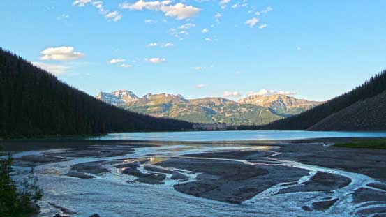
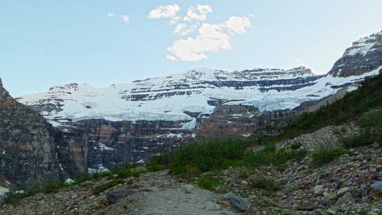
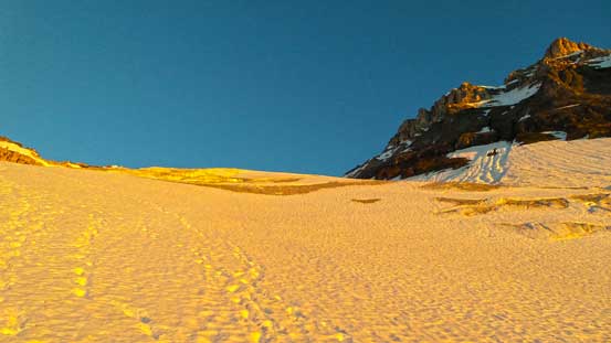
To make our trip easier we decided to knock off the approach in the previous evening, so on Tuesday we left Edmonton as early as we could we made to Lake Louise by around 8 pm. We made one stop in Canmore to book the Abbot Hut for Wednesday night, also to buy some essential food for our trips. At the trail-head we loaded up gears as quickly as possible and soon we passed millions of tourists on the lakeshore trail. The Plain of Six Glacier trail seemed to be a lot flatter than the first time I did it back in 2009, and in short time we made to the tea house. Not doing any unnecessary stop we continued on the trail, passing a major avalanche path and located the much narrower climber’s trail on the right side. This climber’s trail was in a surprisingly good shape and assisted us greatly on making to the bivy site before dark. There were quite a few prime bivy spots but we decided to continue all the way to the toe of Victoria Glacier before setting up camp.
At the back of Lake Louise

Reflection of Mt. Aberdeen on a seasonal pond
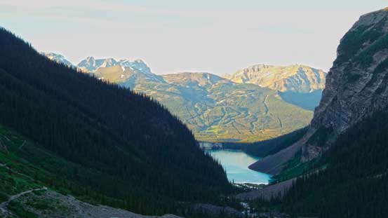
Looking back at Lake Louise and Skoki
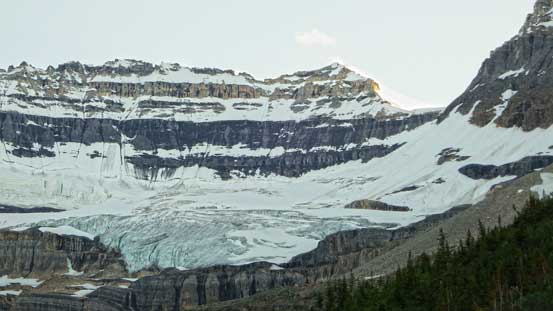
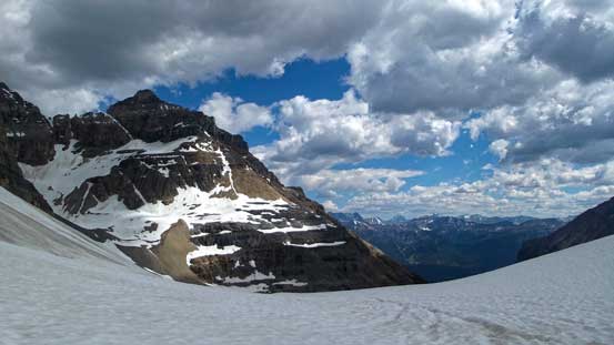
Looking ahead to our objective and the fractured Victoria Glacier
Mt. Victoria seen from near the tea house

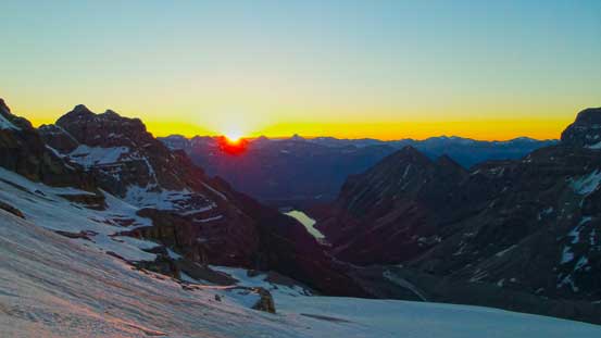
Gorgeous evening glow on the distant peaks in Skoki
Evening glow on Haddo Peak and Mt. Aberdeen
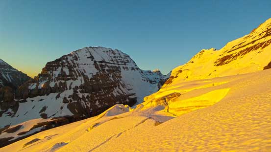
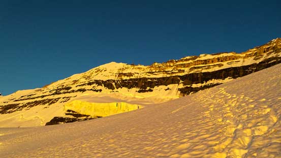
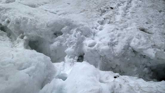
As expected it was very warm overnight and I felt very hot in my -7 degree sleeping bag. The next morning we woke up at 4:30 am and again as expected, there was no freeze. But we were overall not post-holing on the snow and the judging by the previous party’s tracks the condition we got was actually better, so we decided to give it a go and roped up (this’s a glacier that you really want to travel roped up). The condition on this glacier was fairly “early season” and we were able to follow previous party’s tracks up the middle line without wondering around nor jumping across any gap. We could tell there were many holes around but they were all well bridged. At one section the terrain reminded me greatly the ramp on Athabasca Glacier, with gigantic man-eating crevasses on each side.

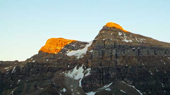
Alpenglow on Mt. Temple
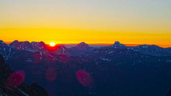
Sunrise over the horizon. The two big peaks on the skyline are Mt. Douglas and Mt. St. Bride

Alpenglow on Mt. Victoria
Another sunrise view

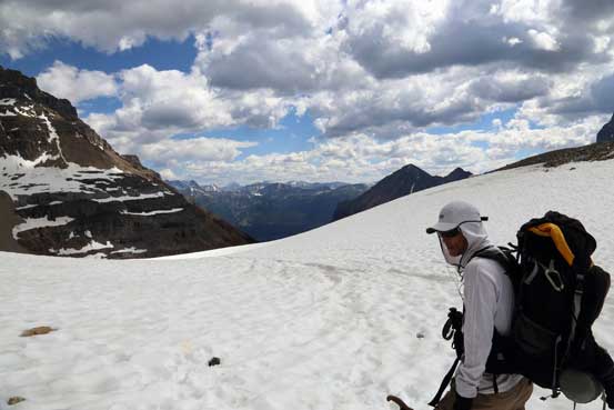
Ben ascending Victoria Glacier
Easy travel on Victoria Glacier
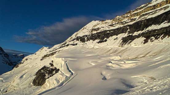
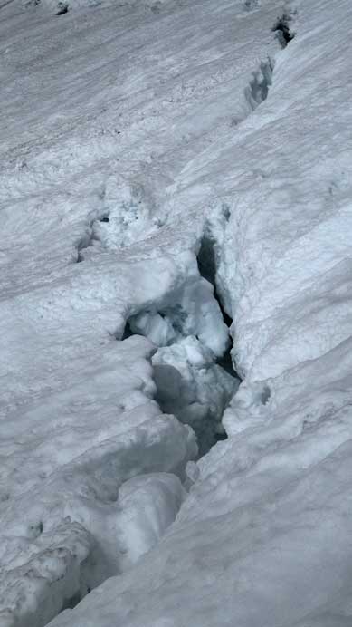
To each side of our route there were lots of man eating crevasses like this
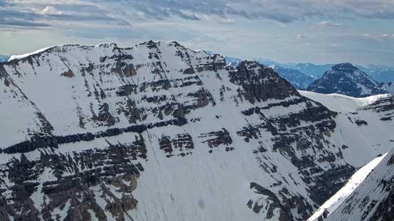
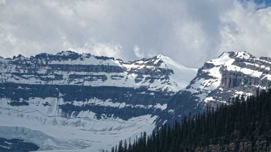
The east face of Mt. Victoria again
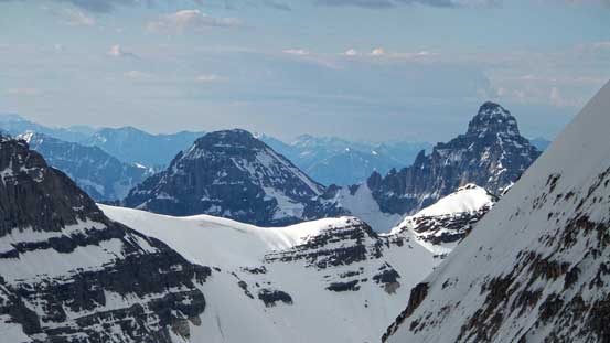
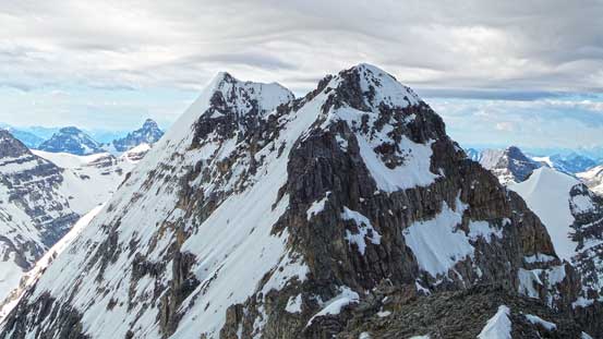
Collier Peak
One of the many beautiful but also fearsome crevasses

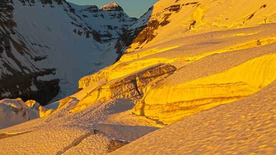
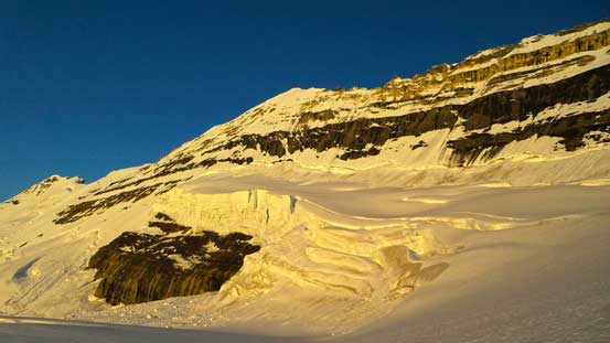
Impressive seracs on Victoria
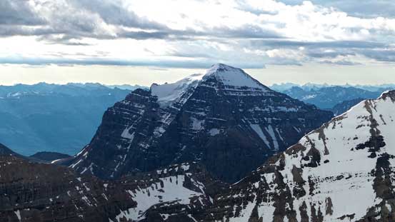
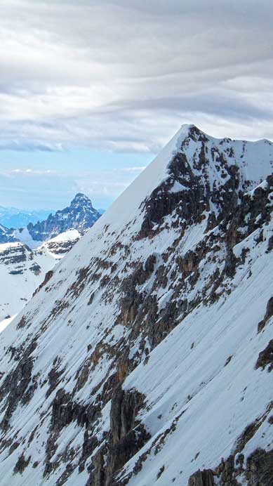
Mt. Victoria
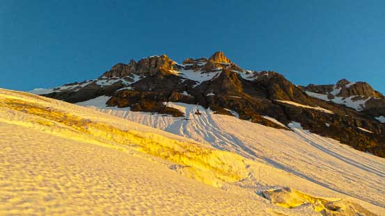
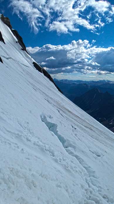
Travel on the upper glacier was straightforward but soon Ben started to have crampon problem. His crampons kept falling off and after spending 20 minutes or so trying to fix, he decided to give up. The problem came from his boots being nearly worn out on the toe part so in order to fully resolve the issue he had to buy (or rent) a new pair of crampons (that’d be later in this afternoon after finishing the trip). This also meant I’d be on my own for the rest of the climb, so I untied from the rope and ditched my harness before proceeding solo (pretty confident to solo this route given the condition – soft enough snow to kick in but not slushy to cause avalanche concern). I followed the tracks and stepped across the bergschrund easily and then the slope steepened considerably towards Victoria/Collier col. This part was the technical crux for me. More snow or a lot less snow would both make it easier but I somehow got the harder condition. The tracks led me more or less straight up the slope. The snow was pretty thin and icy around the upper black rock band and it was very difficult to get on the rock, and even if I did so, the rock was covered by either verglass or running water. I took out my ice tool and climbed up a short section of very hard snow/ice, cramponed up the wet rock, and then climbed another short section of ice to exit the rock before eventually topping out on the col. I saw 2 very obvious rapping anchors on top of this sketchy section and at this point I was regretting not bringing the ropes up… But oh well, I could always use the curving snow line on the descent so that was still okay.
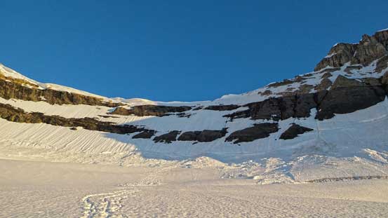
Looking ahead to Victoria/Collier col
Another shot of Mt. Victoria’s east face and glacier

Mt. Lefroy and the fractured Victoria Glacier
Now I was on my own. Climbing steep snow towards the col
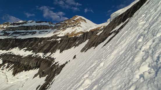
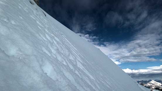
This is the typical terrain. You certainly can’t afford a mistake on this entire section

Me searching a way up. Photo by Ben

Cresting the ridge, looking ahead
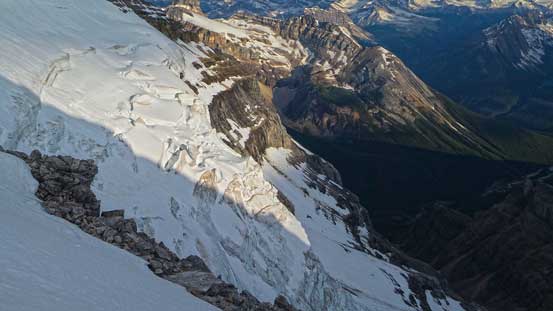
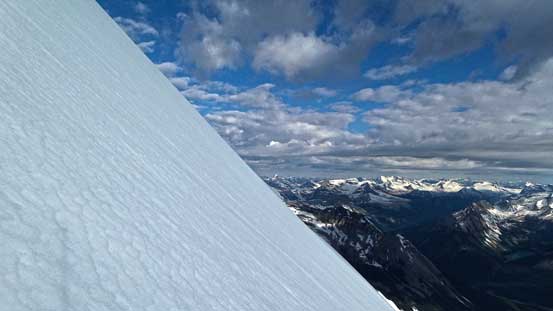
Impressive seracs on the north side
There was more post-holing on the ridge than expected – sometimes knee deep. Again, following previous party’s tracks eliminated a lot of hard work for me as I slowly gaining elevation towards the 5.3 rock step. Despite the fact it looked “easy” to me, having no rope with me meant I’d use the snow bypass route. Except for more post-holing there wasn’t any major difficulty, but at one section the slope did get ridiculously steep. My estimate would be more than 50 degrees and this part kinda reminded me Trapper, Ayesha and Collie earlier in the year. Around the rock step I, again, followed the tracks steeply up the snow face. Instead of regaining the ridge line I aimed more-or-less straight towards the summit. This part was foreshortening though and took me quite a while. The view from the summit was great, but not superb due to some high clouds rolling in. I also had no mood to soak in the view and I had to immediately focus on the descent after taking some obligatory photos.
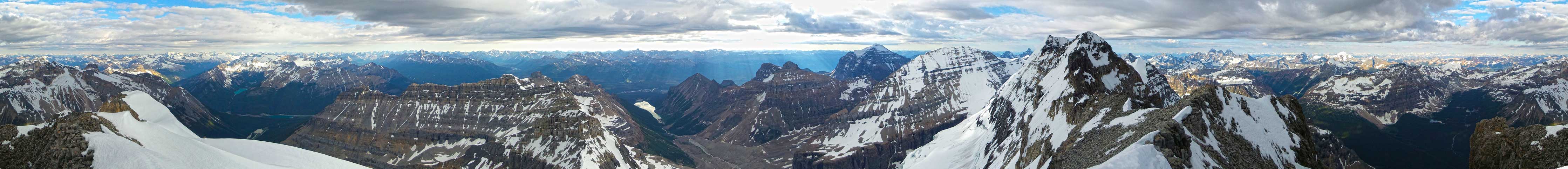
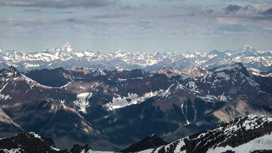
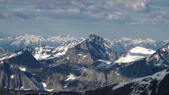
Summit Panorama. Click to view large size.
Mt. Temple, the majesty

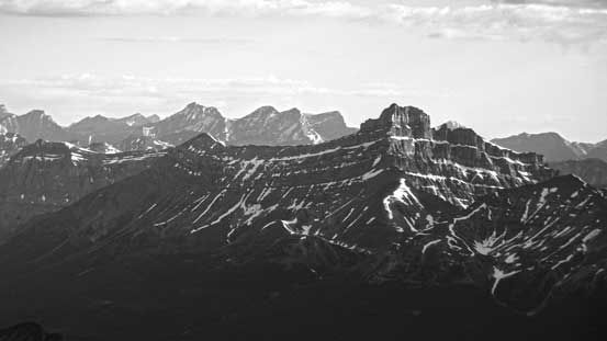
The fearsome Goodsirs
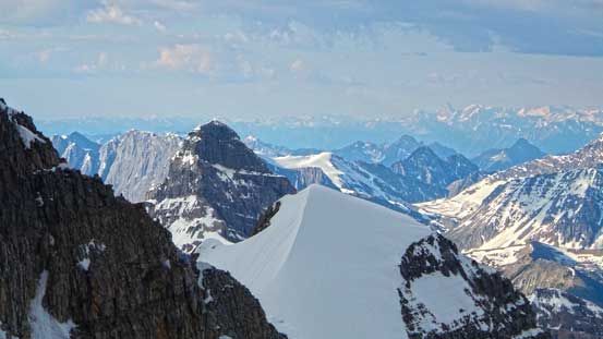
Mt. Lefroy, our objective for the next day. The route goes up the rightmost couloir
Deltaform Mountain is on my to-do list once I have some smaller rock routes done
Hector with Willingdon rising behind. I’ve climbed both of them
Sunshine shone on Mt. Stephen, one of the bigger Kane scrambles that I haven’t done yet
Mt. Sir Donald (left) and Mt. Rogers (right) dominates the skyline
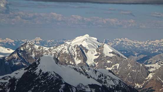
Beautiful glaciated Mt. Vaux. I was told it’ll be covered in the new edition of Kane’s book
Chancellor Peak will also be in the new Kane’s book.
Way in the distance we could see the Bugaboos in the Purcells
Mt. Biddle and Mt. Huber (snow bump in foreground)
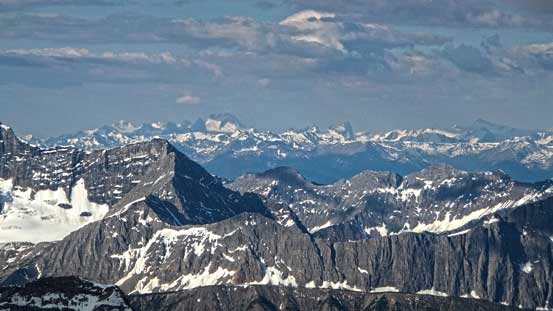
Giants in the southern Selkirks. Those are peaks south of Mt. Dawson and I’m not familiar with their names
The intimidating connecting ridge to the main summit of Mt. Victoria
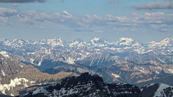
Mt. Mummery and the Freshfields

Mt. Forbes poking way behind in the distance. The glaciated peak in foreground is Mt. Collie
The east face of Mt. Victoria. Can’t believe some people have ski’d it
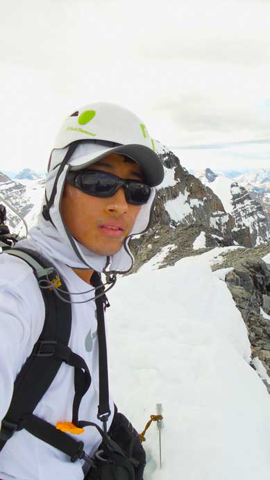
Me on the summit of North Victoria, my 12th 11,000er. Being the only person on the top I had to take a selfie
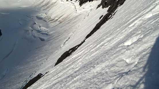
Retracing my steps down and around the rock step went by quickly and soon I was on my way down the lower ridge towards Victoria/Collier col. Using my previously spotted snow line I’d take a different route down from the col to avoid stepping on ice or wet rock. To take this alternate descent route I had to make a sharp traverse to skier’s right cutting underneath a gigantic cornice first, then down-climb very steep snow (45 degrees ish) to bypass the upper black rock band. Then instead of continuing down I’d turn sharply skier’s left overcoming a somehow thin area and then make a diagonal line down aiming for my up-tracks. This entire section was much longer than it appeared. I had to face inwards and kick in step by step, and at the meantime having both axes in my hands. It was certainly not a fast process but I was getting there. After rejoining my tracks I carefully down-climbed to the bergschrund, crossed it easily and rejoined Ben on the glacier.
Down climbing the upper north face. It’s hard to tell the slope angle without a climber in the photo…

Ahead’s the most steep section. Here I was traversing to bypass the rock step
Traversing

More of this traverse
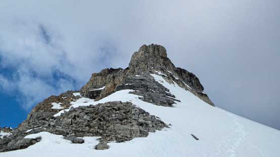
Looking back towards the 5.3 rock step that I bypassed. It doesn’t look that bad from up close
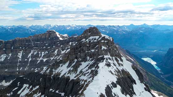
Ahead is Collier Peak. I don’t know its route but from the col it looks pretty tough
It’s a long traverse on this snow band.. Photo by Ben
Ready to step across the bergschrund
At other places it’s very wide
More of the bergschrund
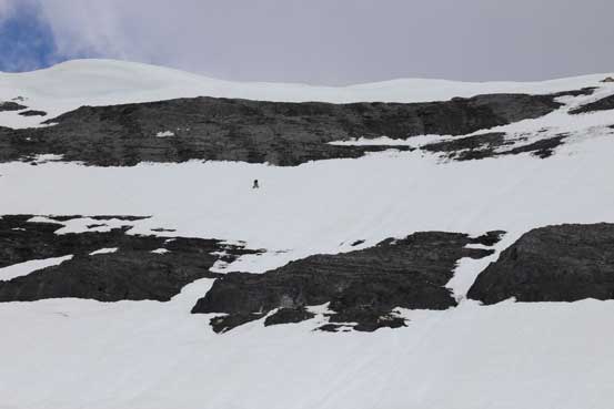
Ben was very disappointed by his gear malfunction and we were discussing if he wanted to use my crampons to climb the route. I was climbing efficiently for most of the time so we were way ahead of schedule at this point. I know many parties ended up needing 12 hours or even longer for this trip and on our current pace we’d be able to finish in 10 hours (including the approach time) so we certainly had the time. On the other hand I did have some concern with the soft snow on the upper mountain so in another 2 hours or so we weren’t sure if that’s still safe or not. So we decided against it and slowly retraced our steps back down the glacier and to our camp.
After packing up our gears we hiked easily out on the Plain of Six Glacier trail. There were again, millions of tourists that we passed by. It was a hot noon so we didn’t go particularly fast and by the time we made back, we were already focusing on our next trip. Looking back from Lake Louise, I felt a great sense of accomplishment to have “that beautiful peak” climbed.
Mount Victoria seen from our bivy site
Another view from our bivy site
Ready to leave. Photo by Ben

Hiking down the climber’s trail – very well maintained

An obligatory shot of Lake Louise
Looking back towards the summit from Lake Louise
Overall, North Victoria is a great climb, but quite a challenge. Like other snow ascents, timing is everything. For this trip you have to time the good travel condition on fractured glacier, the bergschrund, the choice between snow and rock up the black back to Victoria/Collier col, and then the choice of ascending 5.3 rock step or bypassing on 45-50 degree snow/ice. At the meantime weather is always an issue for big 11,000ers on the continental divide and snow condition is not always perfect neither. I know many parties, even the guided ones have been turned around for this or that reasons so make sure you’re well prepared. An ice tool is almost mandatory at any time of the year, and two 30 m ropes or one 60 m rope is recommended for safely descending the black band (in the case there’s no continuous snow line).
Having successfully bagged my 12th 11,000er was just the start of this ambitious 3-day trip, and soon after we’d focus on our next objective. Mount Lefroy turned out to be the toughest 11,000er I’ve climbed to date!

[…] it. Both of them would have summitted if not for Ben’s crampon issues. As it was, only Steven managed to summit and Ben wasn’t going to try again until he knew for almost 100% that it would go. After […]