Sutil Mountain
December 22, 2020
299m
Galiano Island / Southern Gulf Islands, BC
Sutil Mountain is the second highest summit on Galiano Island. There’s no published trail to the summit of this peak and all routes involve some degree of off-trail travel and bushwhacking. A simple research on Google returned no useful information. Earlier in the day Angela and I had made the summit of Mt. Galiano. We descended the easy west slopes of Mt. Galiano to what seemed like a chasm with a running creek that separates Mt. Galiano with Sutil Mountain.
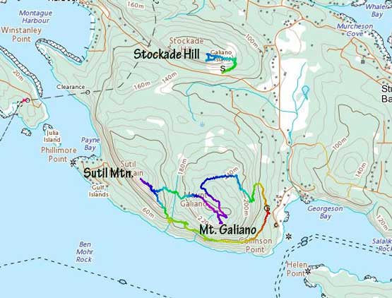
Dumpster diving on Galiano Island – Galiano, Sutil, Stockade. GPX DL
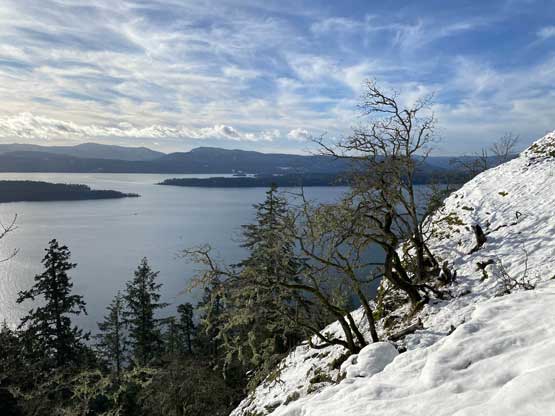
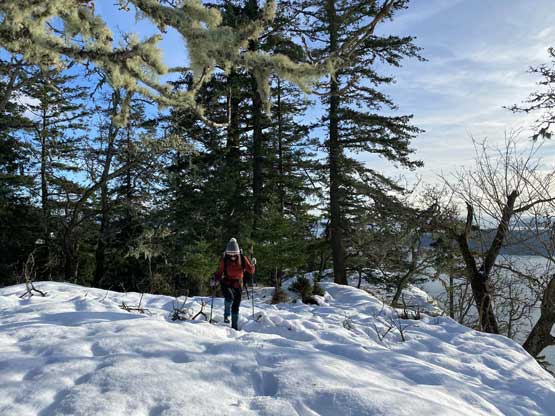
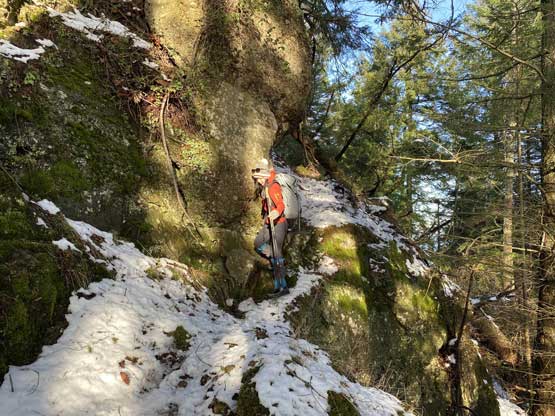
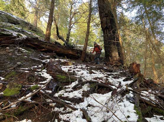
From the lowest point we ascended the east slopes of Sutil Mountain dealing with mostly open forest with occasional bushwhacking over dead-falls. A while later we came across a private road that was not shown on any map. The end of this road seemed to lead into someone’s house so we crossed the road bypassing the property. At this point we were not far from the summit. Following the SE Ridge up involved a couple scrambly steps with minor route-finding and all open areas had some post-holing thank to the recent dump of snow. There were more views from this ridge than expected so we took our time soaking in the views.

The forest was steep and slippery

There were a bit of bushwhacking at places too
After a while we reached the upper SE Ridge
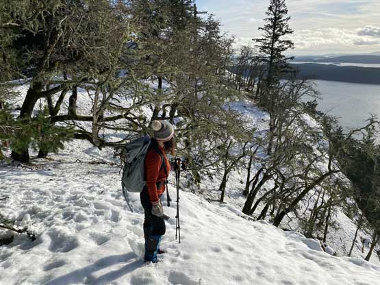
Angela soaking in the views on the SE Ridge

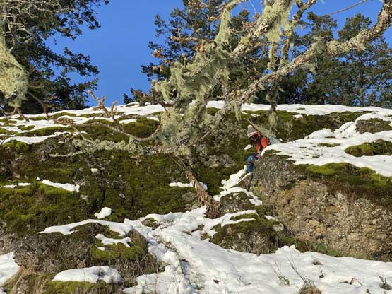
Angela on one of the scrambling steps
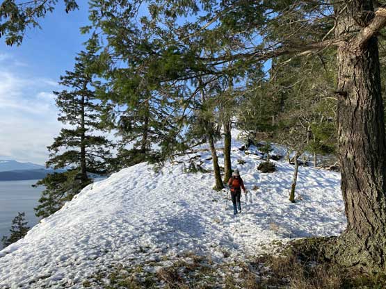
Open travel on the ridge with some post-holing

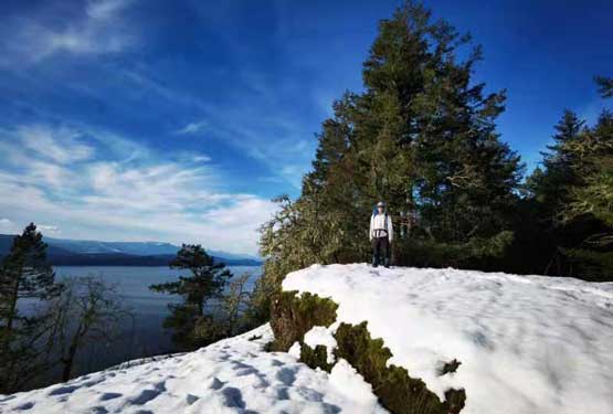
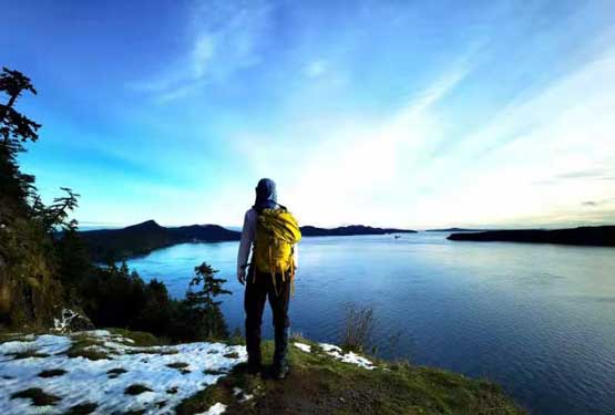
Bigger hills on Vancouver Island showed up
Me reaching the summit of Sutil Mountain

Summit Panorama from Sutil Mountain. Click to view large size.

Me on the summit of Sutil Mountain taking in the views

Another photo of me playing on the summit of Sutil Mountain
On the descent we decided to go down the SE Ridge to join a trail that traverses under the south side cliffs of Sutil Mountain and Mt. Galiano. This trail would eventually lead us back into Collinson Provincial Park and then the parking lot. The SE Ridge was steeper and more slippery than expected but with careful work we made down without a problem. The trail that showed up on Gaia map turned out to be actually a road but upon reaching a junction we took a wrong turn. Thankfully I soon realized the mistake but instead of backtracking I opted to short-cut through bush to correct the mistake. Further down this trail/road we came to a viewpoint named “top of the world” so we had to check it out. The views were really nice so worth the short detour. The rest of the hike back to the parking lot was uneventful.

As you can see, the ridge was very open for views

The descent was a bit tricky with the fresh snow

We just retraced our steps on the upper ridge
Angela scrambling back down that tricky spot

Mt. Galiano was our previous objective

We descended past someone’s house

We even got a view of Mt. Judge Howay and Golden Ears on the mainland

Angela descending past that house

Me taking a short break

Very open views from just below that house
Angela continuing down the SE Ridge
Exploratory terrain here was somewhat steep at places

At other places it was just an open and scenic walk
The ridge eventually became really steep for a while

Some route-finding and experience in off-trail travel required

Almost down to the trail
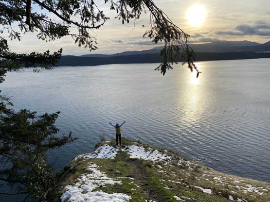
Me posing at “Top of the World viewpoint”
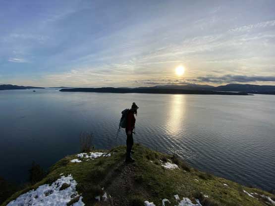
Angela at “Top of the World” viewpoint

Mt. Parke on Mayne Island

Ferry traffic was busy around here
Another photo of me on “Top of the World” viewpoint
At this point we still had about an hour’s daylight time. I was getting a bit tired and low on motivation but our ferry schedule was fixed. We only had two options. Option 1 was to waste two hours in the car waiting for the ferry ride and option 2 was to bag Stockade Hill and possibly watch sunset from the summit. Of course we picked the latter.
