Mount Wintour
September 6, 2022
2700m
Kananaskis Country, AB
Mt. Wintour is one of the smallest objectives in Opal Range but there’s still no “easy” route to the summit. This range is notoriously difficult and most peaks require technical climbing even by the easiest possible routes. There isn’t a ton of “beta” about Mt. Wintour but Andrew Nugara’s trip report along with Kevin Barton’s SummitPost page was sufficient enough to get the job done. The official grade of the south ridge is 5.4 but it’s more like a “borderline scramble” thing with only a few climbing moves required. This was the second day of my Canadian Rockies scrambling trip and I was supposed to meet up with Devan Peterson for something. I said I was only interested in a small objective as I needed to be fresh for Mt. Robertson the day after. Devan gave me a few options and I picked the shortest of those. I was actually quite excited about Mt. Wintour as this peak had been on my “list” for many years.
I decided to carry a 30 m rope, harness and rock shoes but the plan was to not use them unless I felt uncomfortable. I was fairly certain that I could scramble this route after talking to Kevin Barton about his honest thoughts but I wanted to have some extra contingencies. Devan and I decided to meet up at the entrance of Kananaskis Highway at 7 am. I simply drove out to the Casino the night before and slept in the car. The temperature had dropped to near freezing such that I had to put on extra layers even with the -7 C sleeping bag. Devan showed up on time but we had to drive out to the “trail-head” separately as Devan also planned to ascend something else in the afternoon. The trail-head had a quotation mark as there wasn’t really a trail, but the parking area is well defined and easy to find.

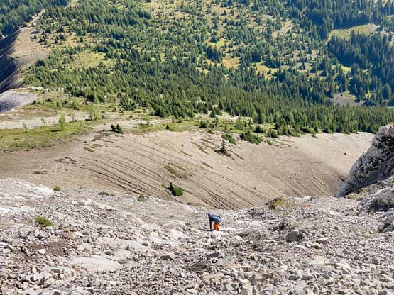
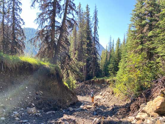
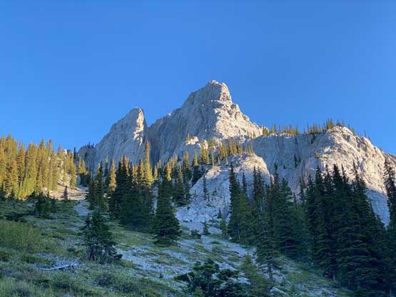
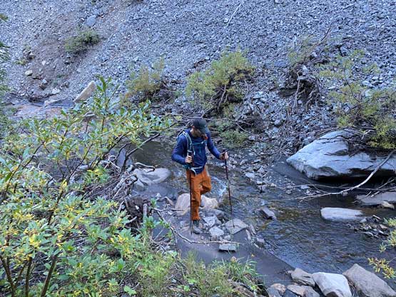
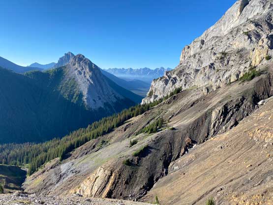
There was no GPX about this peak so we had to read Kevin’s beta in words and match that to what we saw on-field. That was surely very inconvenient in this modern era but let’s face it. We firstly followed the drainage of Opal Creek but after a short while we ascended steeply out of it on climber’s left (north). The terrain was insanely steep to gain the ridge ahead but once there we picked up some animal trails that led us to the base of an obvious scree gully. This gully matched what Kevin described in his trip report so we found a ledge and traversed into it. Devan and I picked different lines up through this gully with mine being worse than his. The scrambling was very loose and unpleasant but the difficulty never exceeded class 3. Near the top of the gully we picked up the game trail again and dived back into the forest. A traversing descent followed as we slowly worked our way back into Opal Creek drainage.


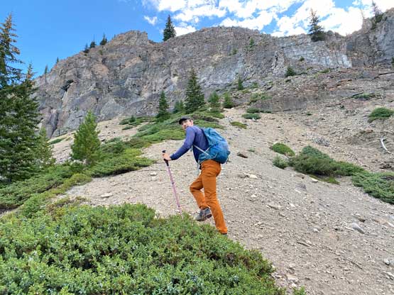
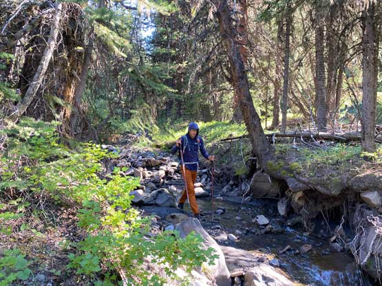
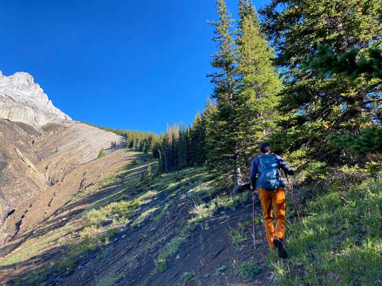
We decided to ascend close to the creek and that was probably not very efficient. At times we had to hop back and forth across the creek and the going was definitely not very smooth. Thankfully this stretch wasn’t long and we soon emerged into a meadow area. Plodding across this meadow we came to a dry creek bed. We then ascended this creek for a short distance and then onto the climber’s right side bank of this creek higher up. The next stage was a very foreshortened plod straight up all the way to Mt. Wintour’s “east shoulder”. I called for a break about 100 m under the shoulder to don sunglasses and we took another short break on the shoulder to ditch some unnecessary stuffs. This trip was shaping up to be much shorter than anticipated so I ditched some extra food, water and cloths. I still carried the technical gears so my pack was still much heavier than absolutely needed.


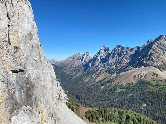
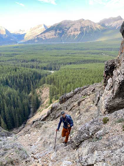
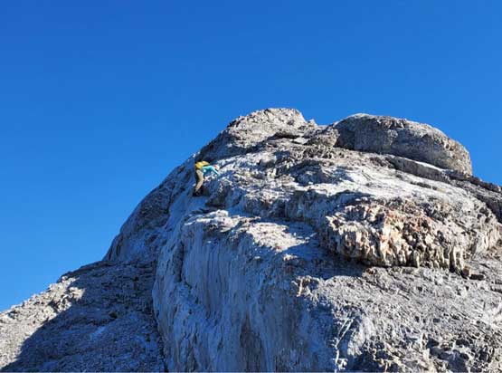
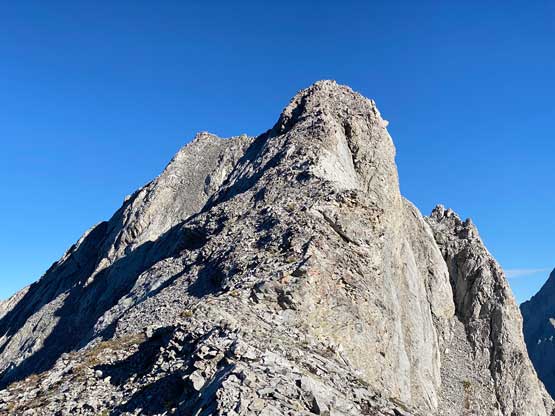
I was quite unsure about the section to gain the south ridge of Mt. Wintour but the worrisome turned out to be very unnecessary. We simply picked whatever that seemed doable on climber’s left side and the scrambling was class 3 at the hardest. The terrain was quite loose though and route-finding was definitely required. The start of the ridge had a stretch of 4th class with exposure which both of us felt to be more challenging than the actual crux higher up. This section led us onto a substantial bump on the ridge. To descend this bump we had to bypass a chuck of the ridge crest by detouring onto the east face. The terrain was loose, but the technical difficulty was minimal.
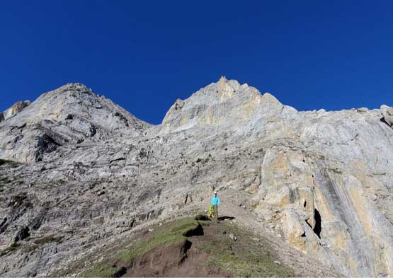


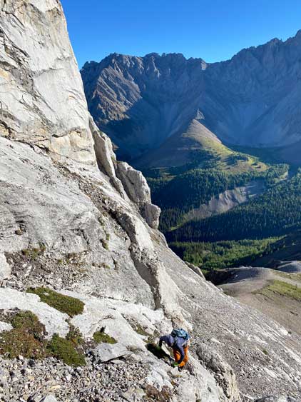

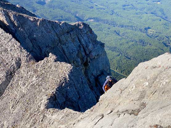
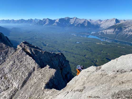

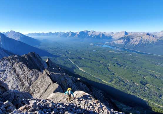
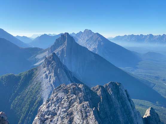
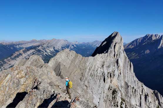

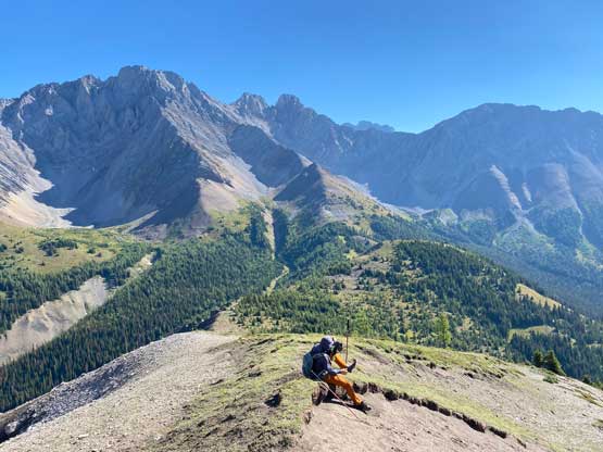
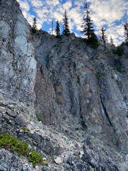
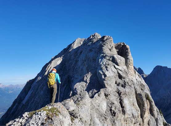
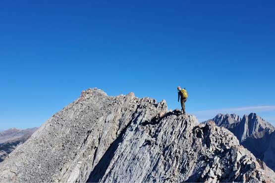
We regained the ridge crest briefly until I found a neat-looking ledge system that could potentially bypass a major stretch of the south ridge. I knew the other parties all stayed on the ridge crest but I wanted to do some experiment here. The ledge was mostly wide enough to simply walk across but a few spots did require some careful foot work, thank to the loose and down-sloping nature. The route-finding was also not a no-brainer but it wasn’t difficult to figure it out on-field. This ledge traverse basically brought us to near the actual crux, which appeared to be much easier than anticipated. I didn’t even bother to don rock shoes. I firstly ascended some scree on climber’s left side of the wall and then did a few low 5th class moves to get back onto the slabs and that’s it. Immediately above this slab pitch we had to scramble up another stretch of 4th class down-sloping ledges with exposure. From there all we needed was to balance across some simple knife-edges and then we were on the summit, 2 hours 10 minutes after leaving the cars.


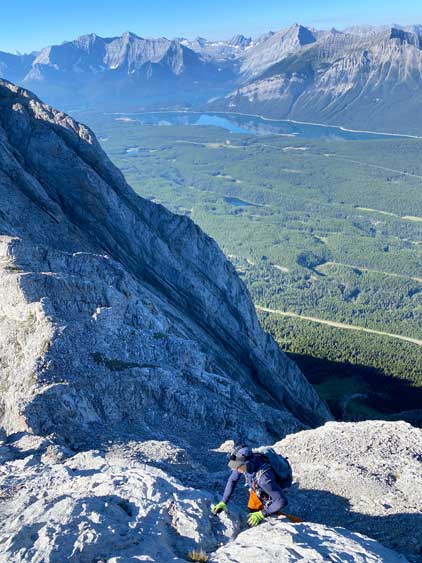


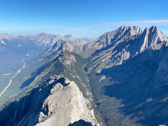
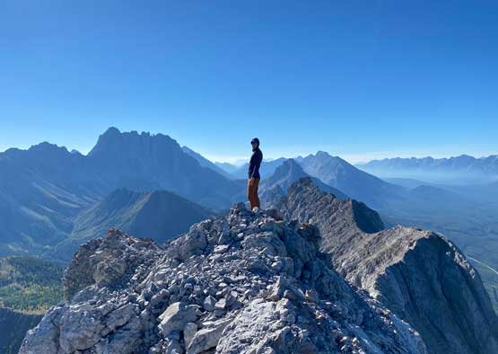


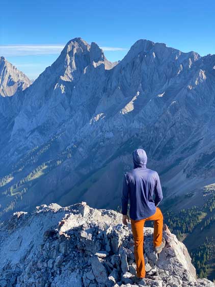


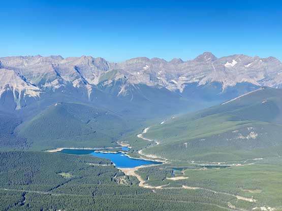
We stayed on the summit for about half an hour as the views were awesome. I then followed Devan’s lead to scramble back across the south ridge following the exact same route that took on the ascent. Devan set a blistering pace so we covered distance on this semi-technical terrain in no time. Once back to the ditched gears we literally ran down into Opal Creek drainage. The “trail” was intermittent to say the least so fair amount of route-finding was still required. I opted to lead us staying entirely on the north side of the creek to avoid the complication of micro-terrain, but the punishment was some insanely steep side-hilling on grass slopes. Lower down we descended the chossy gully and stayed above Opal Creek all the way back to the deactivated road. This variation was overall better than our ascent route in my opinion. Our round trip time was just over 4 hours and I even managed to drive back to Canmore for lunch.