Mission Peak
July 4, 2020
2403m
Lillooet / Seton Portage, BC
“Mission Peak” is also known as “The Teat” by the First Nations and this is the second highest summit on Mission Ridge that runs from Lillooet all the way to Seton Portage, towered only marginally by Mt. McLean to the south. Mission Peak locates about midway on Mission Ridge and unlike Mt. McLean, this peak is approached more often from Seton Portage side via an unofficial trail that starts from the highest point (1970m) on Mission Ridge Powerline Road. The access road might look sketchy on the maps, but is regularly travelled for all kinds of uses so the condition is often better than one might expect. The grade is still very steep and there are a few rough stretches near the very top but there was no major obstacle that a stock 4×4 vehicle should have no issue making to the very end.
Alex and I had been tossing around this idea for a while after seeing some recent posts on Instagram. We knew the access was good and we must take advantage of that. The trigger was not pulled until the very last minute because in the height of the summer mountaineering season we would have preferred to climb something bigger in the Coast Ranges. We picked Mission Peak only because the “plan A” was cancelled at the last minute. We were going to fly in for something elusive but we determined the forecast wasn’t good enough for that. To access the trail-head we had two options. The shorter option was to go through D’arcy on some long stretches of gravel roads to Seton Portage but I preferred to take Fraser Canyon past Lillooet and access Mission Pass (that connects to Seton Portage) from the partially-paved road towards Gold Bridge on Carpenter Lake side. The sole reason was that I preferred driving on less curvy roads but the results were huge. We were damn glad we took this direction. Later posts reported that D’arcy was still blocked by the First Nations due to COVID and there were two fatalities on the Duffey closing that road for pretty much this entire weekend making a detour to Lillooet from Pemberton impossible.
I estimated a 6+ hour drive to the trail-head so we agreed to leave White Rock at 4:30 am. The long and exhausting drive to Lillooet went by uneventfully and from there onward it was all new ground for me. We took the Bridge River Road towards Gold Bridge but unlike advertised elsewhere, this road isn’t entirely paved. We encountered two very long stretches of gravel and even without the gravel sections this road could not be driven too fast due to infinitely many tight turns and blind corners. At the east end of Carpenter Lake we took the left turn crossing the dam and then a cool tunnel and the drive up onto Mission Pass was quite easy. We then took the narrow spur road following the powerline on Mission Ridge. This road was easy for my Tacoma (now with all terrain tires) but I can see why those without 4×4 ended up turning around, as the grade was damn steep and the surface was loose and sandy at places. We drove all the way to the trail-head linking up several critical turns using the Gaia GPS app on my phone.

Mission Peak via Mission Ridge. GPX DL
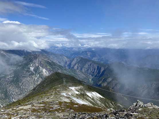
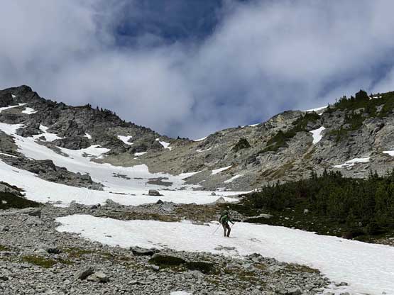
The parking aren’t wasn’t very spacious and could fit two or three trucks at most. We were the first ones arriving so had no problem taking the most obvious spot. The trail was very obvious and brought us to the treeline in under 15 minutes and within half an hour we had arrived at the first highpoint on Mission Ridge, unofficially known as “Geodedic Peak” on bivouac.com. The weather had been cloudy so we continued the ridge rambling towards the next bump, where we were treated by some intermittent views down towards Seton Lake.

Looking down at Seton Portage and Anderson Lake from the drive-in

My Taco partway up the access road
Weird stuffs found on the trail
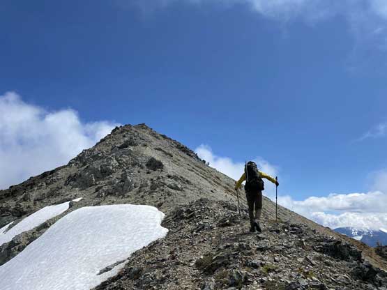
Partway up “Geodedic Peak”, looking back

On the summit of the first bump – “Geodedic Peak”
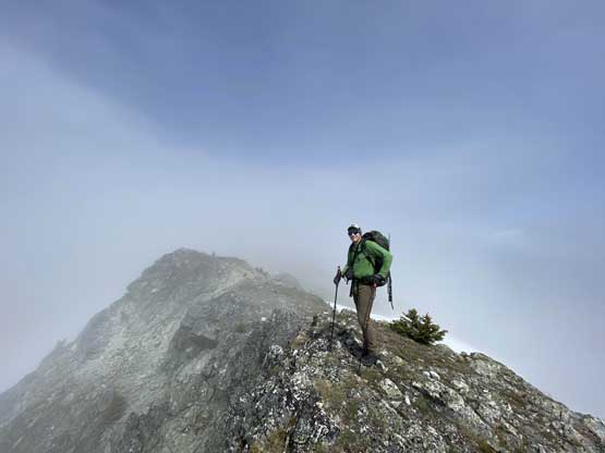
Alex traversing the summit ridge with clouds coming in and out
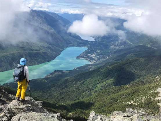
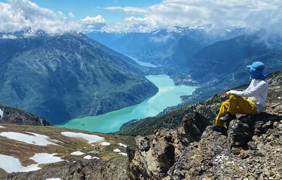
Me taking in the view of Seton Lake. Photo by Alex R.

Alex on the same vantage point with Seton Lake below
I had read Fred Touche’s trip report on bivouac.com about a technical notch on the NW Ridge of “Puck Peak” and the recent Instagram beta confirmed that. We had no interest in doing unnecessary work so to bypass that notch we traversed around the north-west side of “Puck Peak” and descended more than 150 m down into a bowl, and regained the elevation on either snow or scree. This route brought us to the summit of “Puck Peak” via the broader NE Ridge and the views were again, intermittent.

Traversing lingering snow patches to avoid unnecessary elevation gain
We descended more than 150 m down into this bowl following online beta

Alex now regaining elevation on snow. This section was a grunt

Looking back at the bypass bowl to avoid some technical issues on the ridge
Alex wondering what the ridge’s gaps would be like…
Alex on the ridge of “Puck Peak” now looking back

Plodding up “Puck Peak”

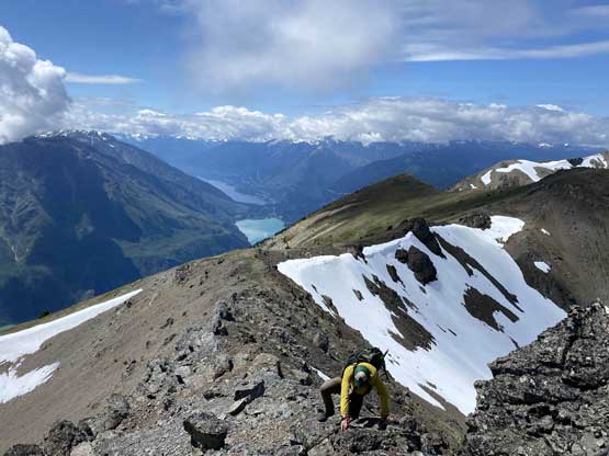
Me on the summit of “Puck Peak” with Seton Lake below
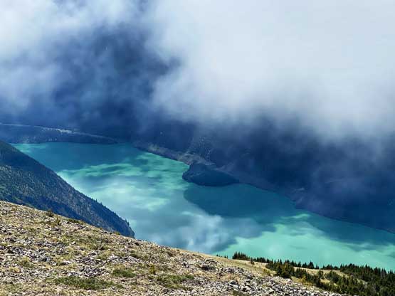
The clouds actually made Seton Lake look cooler
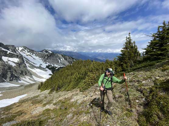
We took a long break and resumed the ridge rambling. The next stretch had a few mild scrambling and narrow steps but we also started to see some forms of a trail. The trail was too good to believe as just an animal path but it probably just is. Once rambling over the next bump we found finally see our objective and the terrain had transitioned into alpine meadows. We easily bypassed the next bump and ascended the following bump with some scrambling.

Alex descending from “Puck Peak”

Another photo of me with Seton Lake below

Alex descending on scree with Seton Lake as a backdrop
Regaining elevation towards the next bump…

A smaller lake on the NE side of the ridge…
There were some scrambling involved

And, a lot of walking on flat ridges

Looking back towards the southern stretches of Shulaps Range

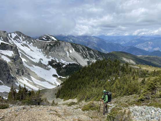
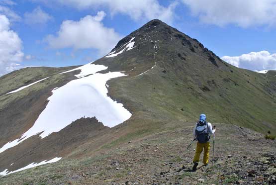
Our objective, Mission Peak ahead
There’s one huge chuck of limestone that we wondered about its origin. I liked limestone way more than granite so couldn’t help but to play with it. The rock texture offered so much greater grip. After the fun we descended into the final saddle and easily scrambled to the summit followed the path of the least resistance. We lingered on the summit for over an hour for simple reason of why-not.

Heading towards the base of this huge chuck of limestone…

Me playing on the limestone. Photo by Alex R.
Me heading for the summit now. Photo by Alex R.

Alex partway up towards the summit
Alex approaching the summit of Mission Peak
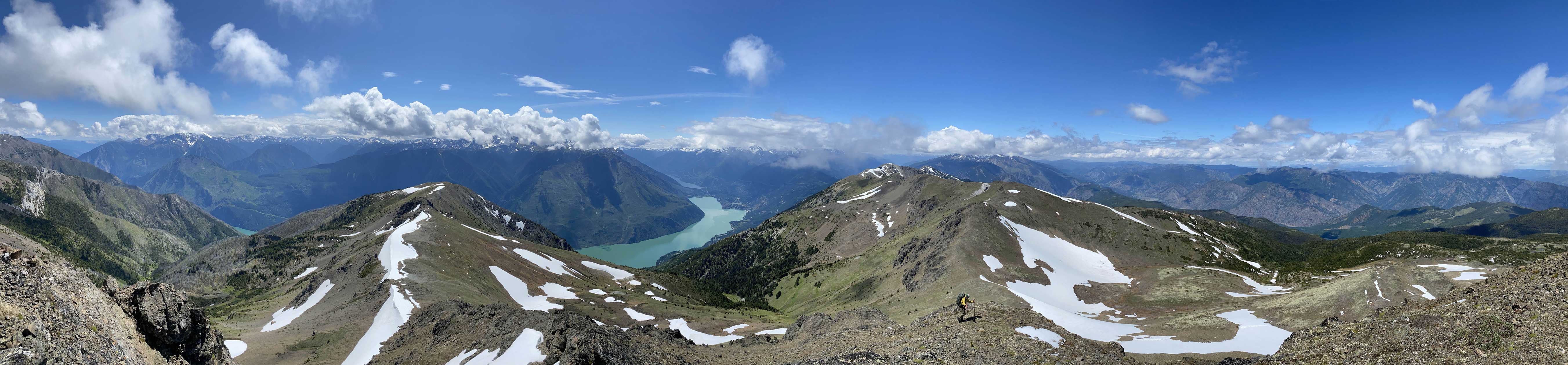
Partial Summit Panorama from Mission Peak. Click to view large size.
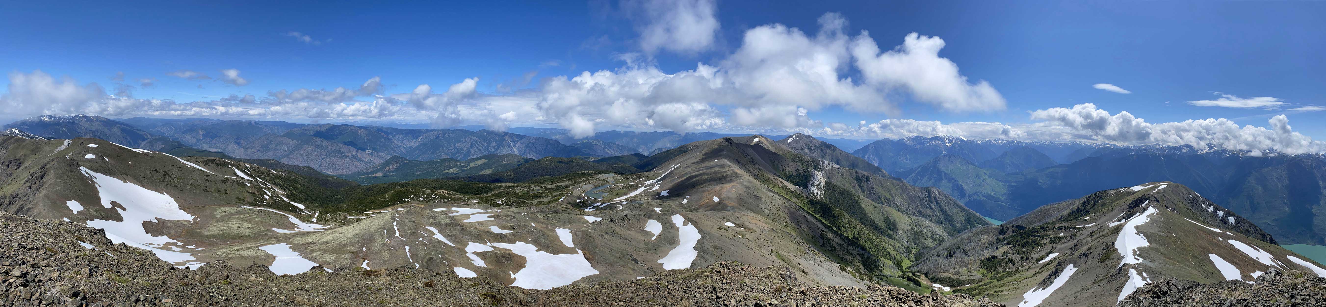
Partial Summit Panorama from Mission Peak. Click to view large size.
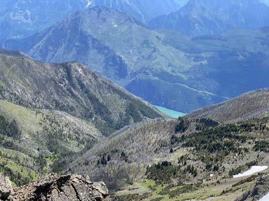
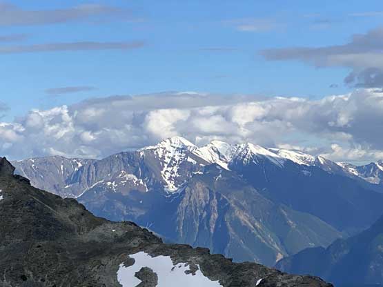
This is a southern view with Cayoosh Point (Ample Mtn.) in background

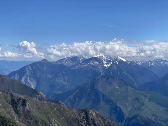
A zoomed-in view of Mt. McLean
Looking towards Mt. Brew in the distance with “Cayoosh Point” in front

Me on the summit of Mission Peak
Me on the summit of Mission Peak with Seton Lake as a backdrop
For the descent we decided to just reverse our route without doing any unnecessary work. We bypassed some of the bumps and plodded over the others. Once back onto “Puck Peak” we resisted the temptation to explore the ridge and just plunged down into the bowl, and slogged back up to the NE Shoulder and then slogged up the south ridge of “Geodetic Peak”. We now could see the views from this minor bump. We saw a huge group of ATVers summitting “Geodedic Peak” about half an hour ago and opted to rush back to the truck to make sure they didn’t smash our windows. The worrisome turned out to be unnecessary. We then drove to the radio tower on “Tsee Peak” the lowest bump on the NW end of Mission Ridge and easily bushwhacked to its highpoint.

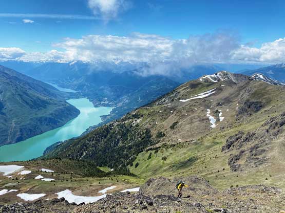
Descending from the summit now
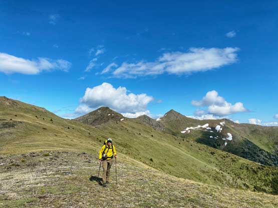
Alex traversing on alpine meadows with Mission Peak behind

As much as the scrambling goes on this ridge

The view cleared up a bit towards Mt. Brew

A full show of Seton Lake
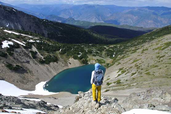
Me posing in front of a smaller lake. Photo by Alex R.

Panorama view including Seton Lake and that smaller lake. Click to view large size.

Descending snow into the bowl to bypass some notches
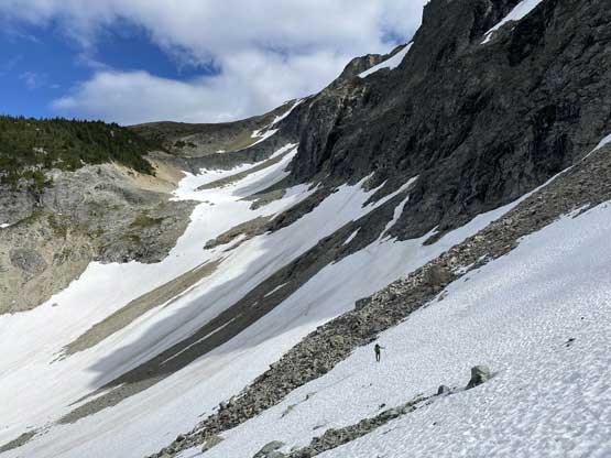
Traversing snow trying to stay high
A zoomed-in view of Mt. Brew

Me taking in the views from “Tsee Peak”
We then drove down the powerline road hoping for an ideal car-camping spot with some views into Seton Lake. We found one nice spot but it’s directly under the high voltage powerlines that constantly made some electric noises. None of us liked the sound of it, so after cooking dinner and waiting for the sunset we resumed the drive down. Our objective for the following day would be Nosebag Mountain.
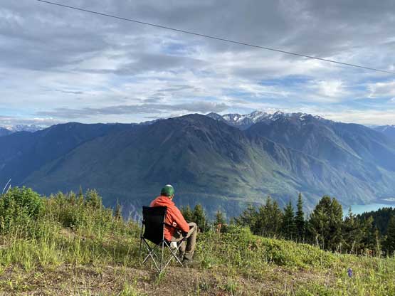
Alex soaking in the car camping experience
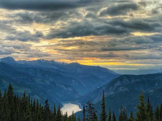
The sunset wasn’t as nice as we hoped for, but still gorgeous
