Train Glacier: Face to Locomotive
October 1, 2023
2485m
Pemberton, BC
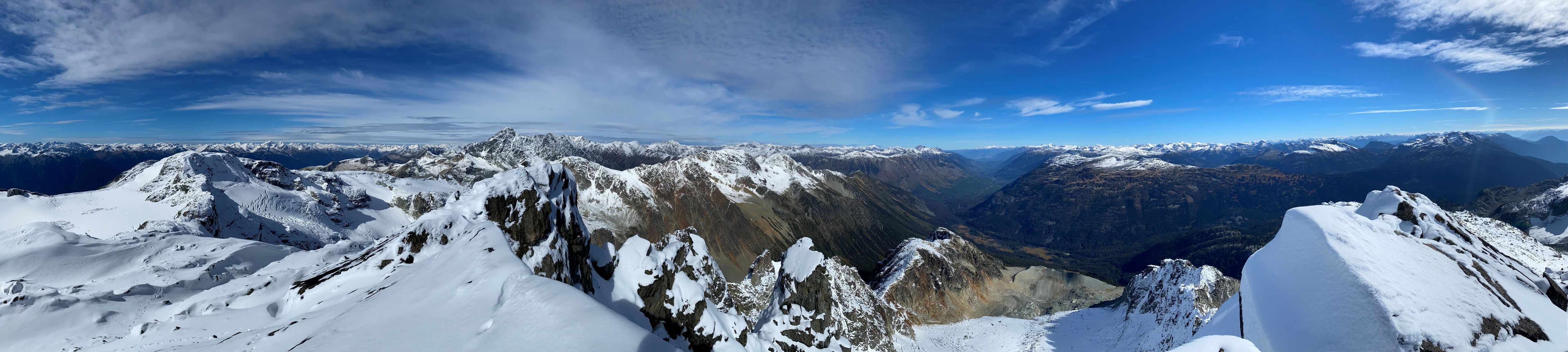
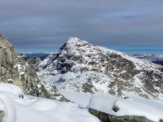
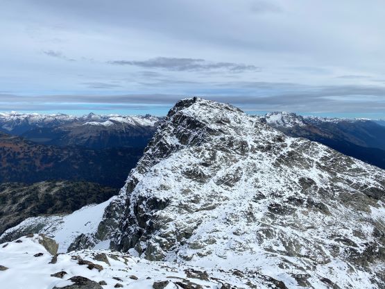
The group of peaks above Train Glacier has caught fair amount of attention in the recent years that the “Train Traverse” has already become a classic in the Pemberton area. The area is very busy thank to the easy access to Semaphore Lake. The adventurous folks probably want to scramble Locomotive Mountain, but to make a full day one should aim for the full traverse. The general consensus of the traverse includes 5 peaks – Face, Faceless, Caboose, Tender and Locomotive, but it’s possible to also include Handcar Peak adding a couple extra hours. The main reason why I hadn’t done this loop was that I wanted to do all 6 of the main peaks plus Railroad Mountain which is more of a “dumpster dive”, but in the end I opted to just do the classic loop-of-five. The presence of snow made the classic combo already challenging enough. I would have to come back for Handcar Peak but at least I do not need to repeat the other ones such as Face Mountain. Face Mountain is the highest and the hardest in this group, and boasts over 700 m prominence.
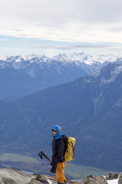
A few weeks ago Lulu W. gave me her schedule and I instantly picked the Train Glacier loop, simply because that was the only one that I hadn’t done. I do not usually plan trips ahead of time but Lulu had already planned at least 3 weeks in advance so I didn’t really have another choice. The weather turned out to be on our side, but the presence of a foot of fresh snow would make the scrambling more challenging. We did not mind that as the snow could also make the scenery better. Lulu and Pan decided to do both days of the weekend (first day being Mt. Rohr with another few friends). I could not manage Saturday but I told Lulu that I’d come to pick them up from Whistler at 4:30 am on Sunday morning. I anticipated several hours of head-lamp time so it’s better to start as early as possible. The 4:30 am departure time from Whistler meant I would not get much sleep at all. I drove out of Vancouver immediately after finishing work, and slept a few hours in the truck at Brandywine’s parking lot. The night was cold that I was glad to have brought the -18C sleeping bag in the vehicle. The drive to the trail-head was very much as anticipated and took about 2 hours. The condition on Hurley FSR was not bad, but one stretch in the middle was still riddled with countless washboards.

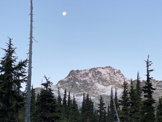
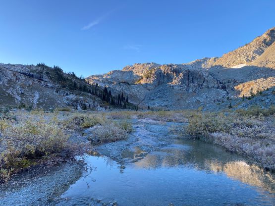
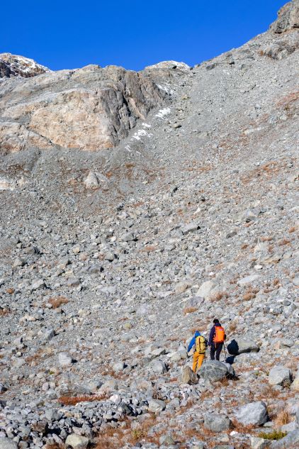
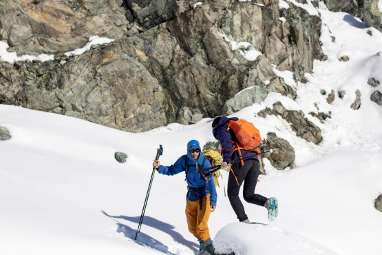
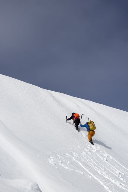
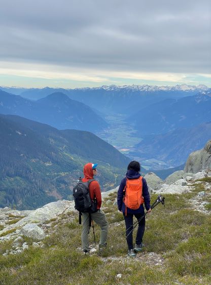
The initial 15 minutes were done with head-lamps and that turned out to be the only head-lamp time of the entire day. Despite the challenging conditions we were able to move much faster than I thought. The approach to Semaphore Lake took about 40 minutes and we took the first break there, playing with photography. Lulu had warned me that I should be prepared to spend hours and hours taking photos and she surely was not kidding. I ended up being both the photographer and the model. The trail connects a few lakes and campgrounds and most of the campers had just waken up. We plodded past the camps across some undulating terrain. After hopping across a creek on slippery rocks we took the first long break donning sun protection.
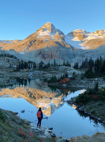


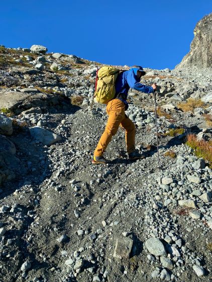
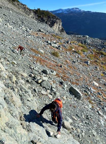
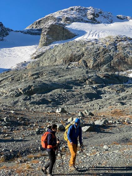
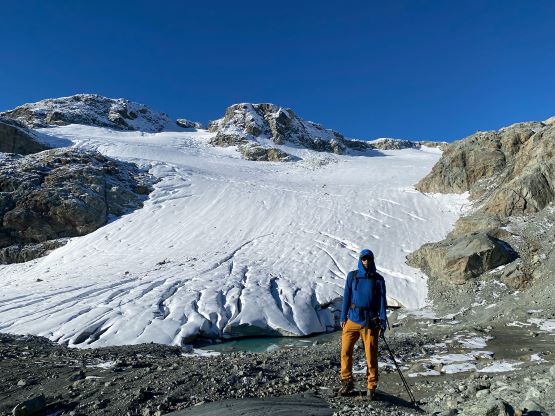
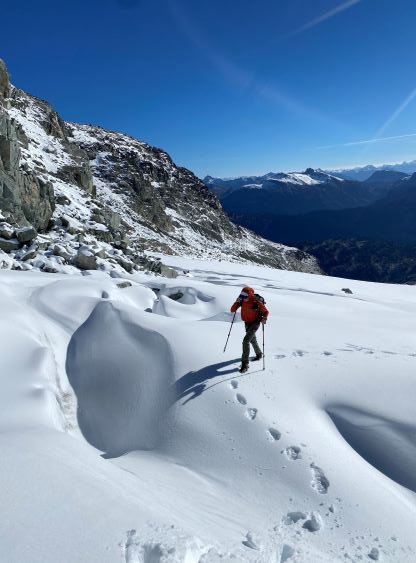
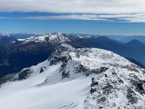
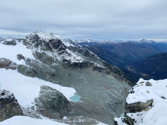
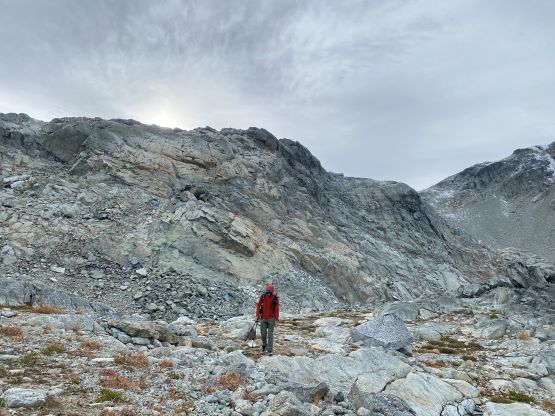
The next section involved a long rightwards diagonal traverse to avoid tackling the headwall head-on. The far climber’s right side provides a reasonable passage. We then did some side-hilling on choss. I did not do much homework beforehand as I liked to rely on my own route-finding on easy terrain like this. I noticed that our reference GPX track (from Andrew K.) veered far climber’s right that did not seem to make sense asides trying to avoid the glacier. The fresh snow would significantly slow down the progress on rock that I thought it’d be much simpler to plod up the glacier and stay on snow for as much as we could, so we stayed lower and then scrambled up a loose gully to access the upper reach of the glacier. We took another long break there. There was no need to don crampons as the fresh snow offered enough grip. There were some crevasses, but with probing the navigation was fairly straightforward. That being said I had led across hundreds of glaciers without falling into a crevasse. Higher up I decided to traverse farther left and aim for the ridge between Face and Faceless. This way we would be able to ditch our backpacks and ascend Face Mountain without carrying the heavy loads. To get there we ascended a steep and loose chute.

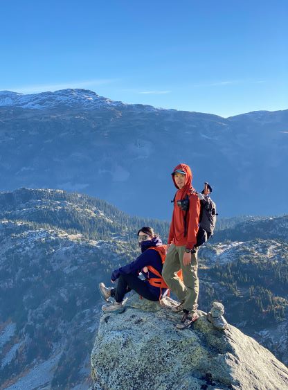


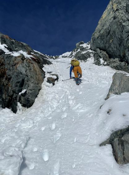
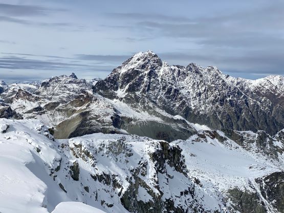
Little did I know that the crux of the traverse was actually on the Face Mountain side, so by staying on the glacier we actually bypassed that 3rd class crux. That spot appeared dauntingly difficult even for me, but I opted to give it a try nonetheless. It took me a while to clean off the snow from the slabs to figure out a sequence. It also helped that I wore mountaineering boots. Lulu and Pan only had hiking shoes so it wasn’t very feasible for them, whereas I promised to come back as quickly as I could. The ascend of Face Mountain via the SW Ridge appeared fairly complicated with the snow, but was actually quite straightforward. The hardest spot was definitely to get into that notch and the rest was “class 2” at most. I made the summit in about 20 minutes, took a few photos, then dashed down in 10 minutes making a round trip of exactly half an hour. Lulu and Pan could not believe that I came back in such a timely manner, but I explained that I did try to go as fast I could.
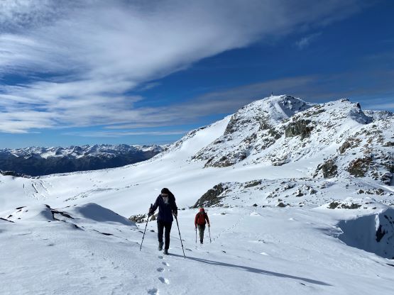


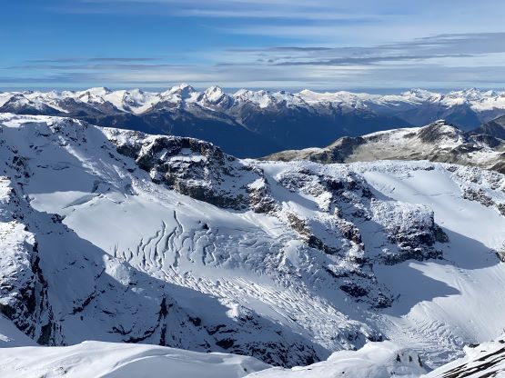

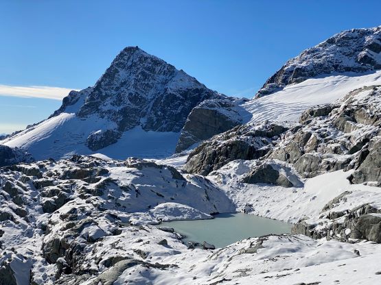
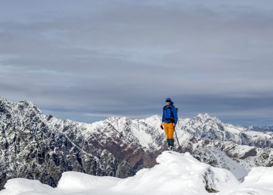
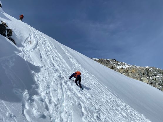
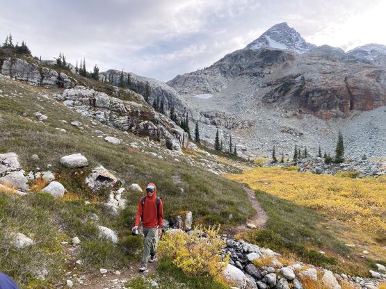
We then made a spontaneous decision to keep traversing on the glacier to the south side of Faceless Mountain and ascend the next objective from that side. This was very contrary to the classic route but I liked to stay on snow instead of dealing with snow-covered rocks. At the base of Faceless’s south slopes we made another spontaneous decision to climb the steep snow slope instead of joining the scramble route. This way we were able to stay entirely on snow to very much near the summit. Lulu had mentioned to me before that she wanted to touch a glacier and needed some snow climbing experience, so in addition to being efficient I also designed our own route based on that. I think the in situ decisions worked out really well. There’s a heli pad on the summit of Faceless Mountain and we spent another 20 minutes playing with photography. Eventually the cold wind forced us to resume.


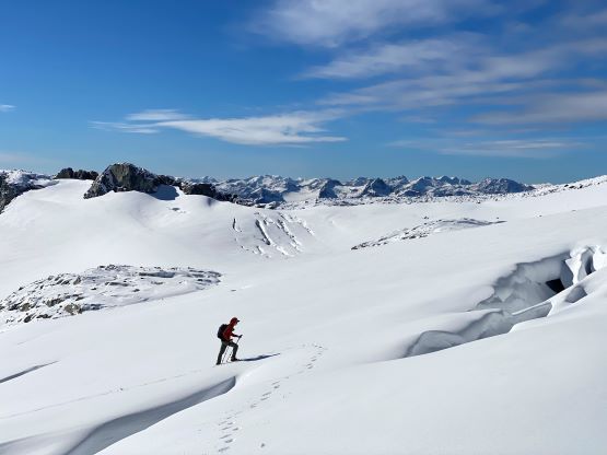
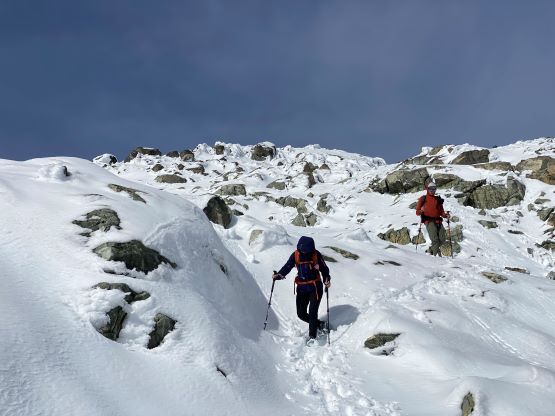
We down-climbed and plunged down the snow slopes towards the ridge connecting towards Caboose Mountain. This section was long and undulating. In the dry condition this would go very quickly as the terrain was mostly easy, but it was a tedious process for us. I led the entire way and had to use my brain for every single step forward. The route-finding was not obvious at times, but we were able to pick the most efficient way. Caboose Mtn. isn’t really a “peak” as it boasts only 28 m prominence, but it’s officially named so we could not leave it behind. We then wasted no time and traversed to Tender Mountain which was another officially-named bump that does not boast over 100 m prominence.


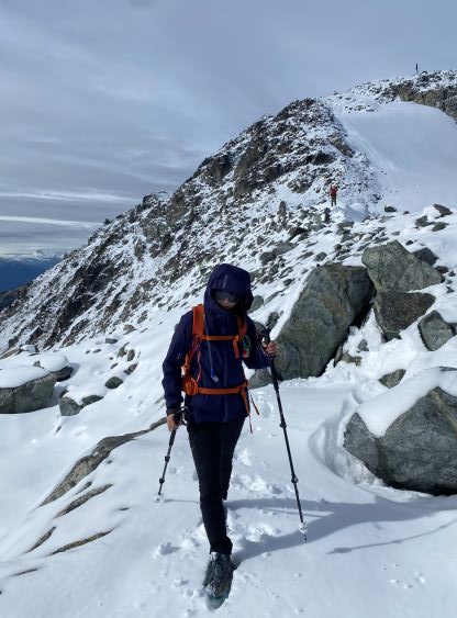

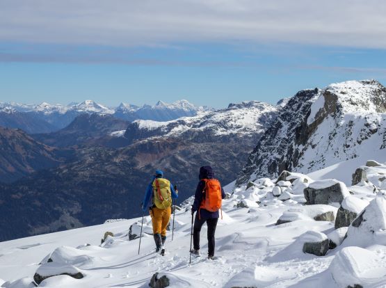


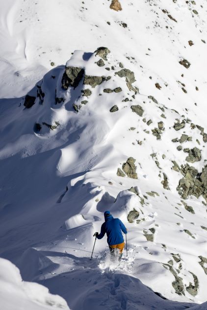
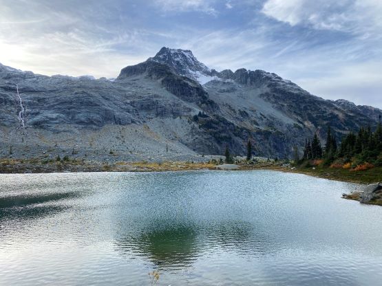
The drop between Tender Mtn. and Locomotive Mtn. was fairly significant and seemed complicated, but turned out to be straightforward. We could see and hear people on the summit of Locomotive Mountain and I wondered why they summitted at such a late hour if Locomotive Mtn. was their sole objective. Nonetheless we scrambled up the SW slopes of Locomotive Mtn. but the hordes had already started their descent. I was very happy to see foot prints because I no longer needed to use my brain on the descent off Locomotive Mtn. until running out of snow. I did not find the summit of this peak to be spectacular so didn’t bother to stay longer than necessary.
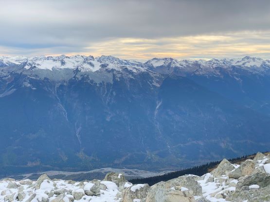
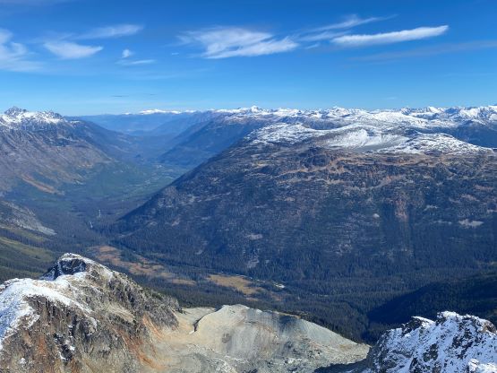
Andrew K. had mentioned the tedious terrain to get off Locomotive Mtn. and he was definitely correct. I initially ignored what he said as how “tedious” could a popular objectie like this be, but it was darn tedious especially if we stayed on Andrew’s and the Gaia’s built in GPS track. There were probably 100 bluffs and never-ending micro-terrain that required consistent finding of the path of the least resistance. Thankfully we had each other here so we could keep chatting to not think too much about the terrain. The many uphill sections still took a toll on us. Pan proposed that we should simply descend the open valley and in retrospect I think that should be a brilliant idea. I had no clue why the “standard route” traverses over so many hills and rolls. In any case we eventually descended to the lakes and plodded our way out without needing to use head-lamps. Our round trip time was exactly 12 hours.


I somehow was able to stay awake and drove us back to Whistler and not to our surprise Pan got a parking ticket. Thankfully it wasn’t too expensive. We then drove to Richmond in two vehicles and had a late hot pot dinner. There weren’t many restaurants willing to stay open till midnight on Sunday, but Richmond is rich of Chinese culture so it wasn’t too difficult to find one. I’ve heard that this hot pot (Hai Di Lao) is expensive and it sure was. I eventually got back home at around 12:30 am.
