Numa Mountain
July 5, 2013
2720m
Kootenay National Park, BC
Weather was marginal after I came back from Crowsnest area and there was no big plan throwing around, but I’d be very interested in joining a big group up a rarely ascended peak in Kootenay Park, namely Mt. Wardle. I remembered reading trip reports from both Sonny Bou and Bob Spirko’s websites and it’s the typical “Type II” fun trip. I didn’t check the forecast at the last minute but apparently some possible thunderstorms was added to the story. I met Wietse and Vern at the Petro Can along Highway 1 by 5:40 am in the morning. We picked up Dave Salahab at the Casino, and then met Kelly Smith at the Floe Lake parking lot. During the driving we changed the objective to a less aggressive Numa Mountain because of the obvious reason, the late start. Eventually Wietse and Vern drove down the Kootenay Highway for another 15 minutes or so and successfully convinced Kevin Papke and Scott Berry to change the plan. It’s hard to believe that none of us had done this peak and that showed the unpopularity of this objective.

Numa Mountain scramble loop
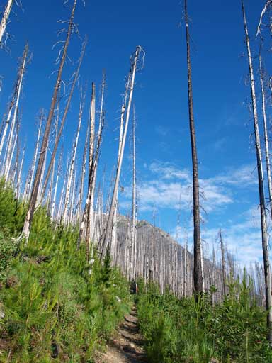
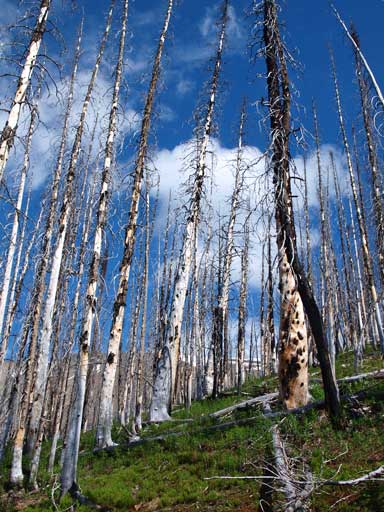
The approach is a pleasant hike for 6 km up the Floe Lake trail. This is one of the popular trails in Kootenay Park, and the trail gets regularly maintained. It got a little bushy at places but most of the deadfalls were cleared, at least for this 6 km anyway. We decided to go up the short-cut route via a giant avalanche valley, and if weather could hold, we would return via the scenic route and therefore give Floe Lake a visit. The initial travel in the burnt forest was very scenic, and time went by very fast with a ton of chatting between us. I had heard a lot of stories about Scott Berry, but this was my first time meeting him. I accompanied Kevin Papke up Storm, Wapta, and Vulture on his journey of Summits for Seniors, climbing 50 peaks in a year, and we had lots of stories to share with. My last trip with Kelly Smith was the mix of ski and snowshoe ascent up Fossil Mountain in Skoki area, and I briefly met Dave Salahab on the summit of Mt. Erickson last month, where Wietse and I hit our 200th summit together. And of course, I’ve bagged quite a few peaks with Vern already, including big ones like Mt. Wilson.

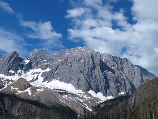
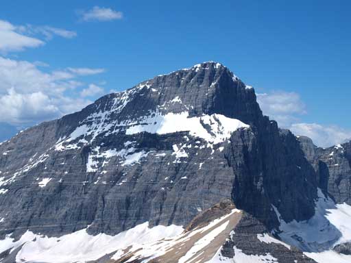
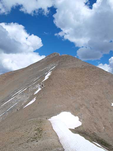
The true summit is behind the highest you can see in this photo. It’s a long way up there.

Vern hiking down to the bridge that crosses Vermilion River. I’m glad it didn’t get washed out by the flood…
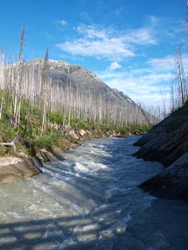
Vermilion River
Travelling can’t get better than this.

There’ll be another bridge crossing this stream
Travelling in the valley
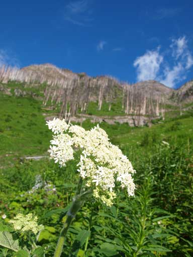
Lots of flowers
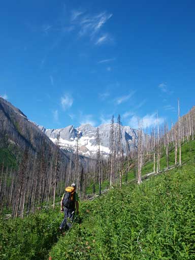
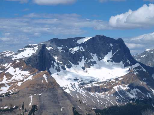
We were aiming at this impressive peak. Floe Peak.
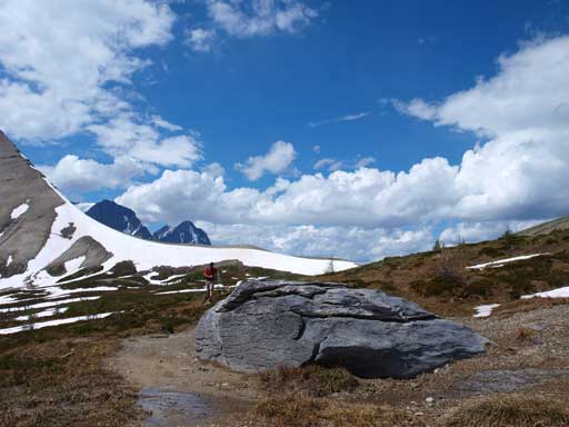
There were a couple smaller avalanche paths that we passed by. We resisted the urge of gaining elevation and continued to the big avalanche gully. The gully was very foreshortened and it was a grind. Oh by the way, despite the fact Numa Mountain is only a “small bump” in front of the eye-catching Rockwall group, the elevation gain is 1500 meters. Oh well, I forgot it’s in BC… After what seemed like eternity we eventually cleared this avalanche gully and entered a burnt forest. We resisted to gain the crest of this smaller bump on our climber’s right side, instead we contoured around it on its left side. The bush was light here. The summit appeared to be a scree slog in front of us. It didn’t look to be that far away, but I can tell you, at this point we were still more than 1 hour away from the top. Once hitting the ridge crest the views opened up.
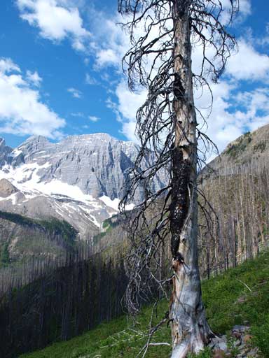
A lone burnt tree on this giant avalanche slope.
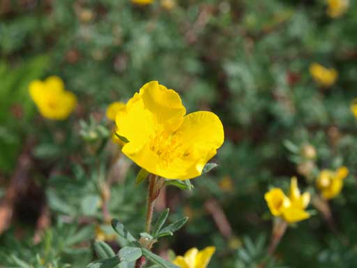
Flowers
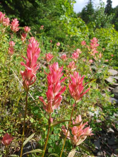
Paint brushes

Scott in the upper part of this gully

Vern slogging up the never-ending avalanche gully
Once exiting the gully, the terrain becomes burnt forest again.
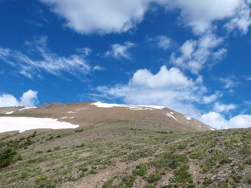
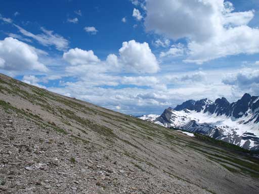
The very foreshortened slope on the alpine.
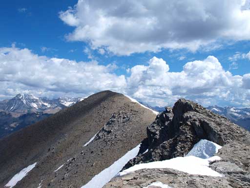
Weather was so far so good, and we immediately started the long slog up this very foreshortened slope. I aimed slightly towards climber’s left side while Vern led a group going straight up. The reason why I went this way was to avoid the snow near the summit ridge. I was wearing the flexible hiking shoes and I certainly didn’t want to kick step into hard snow on this day. The snow turned out to be softer than expected, but oh well, I didn’t waste much time anyway. Again, after what seemed like eternity, I hit the summit ridge. The true summit was apparently on my right side, but I decided to go left to a sub-summit that potentially offers some nice view of the Rockwall. To get there there were a couple scrambling moves.
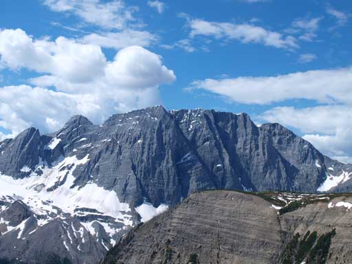
Floe Peak is always the eye-catching throughout the trip.

Looking back at the lower bump. If you blindly go up the gully you’ll hit this one. We stayed left so avoided unnecessary elevation loss

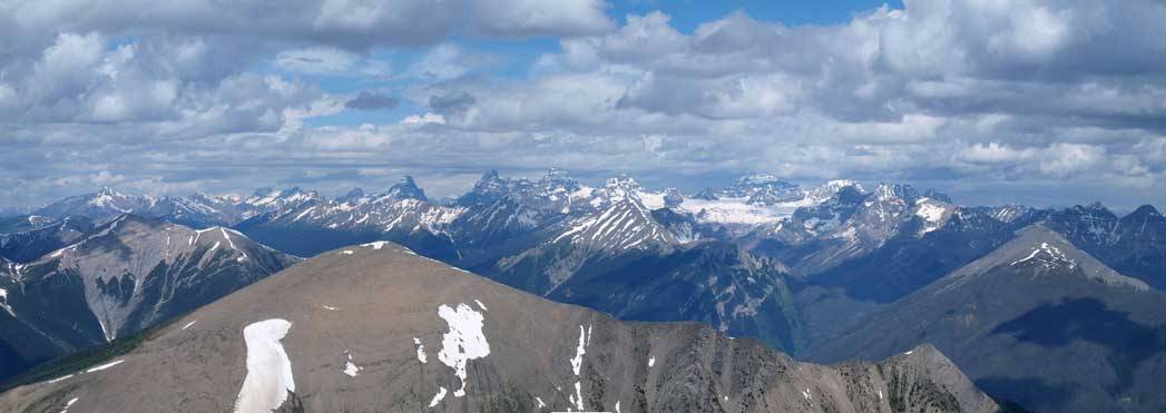
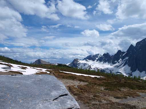
Panorama of the Rockwall range from the sub-summit. Click to view large size.
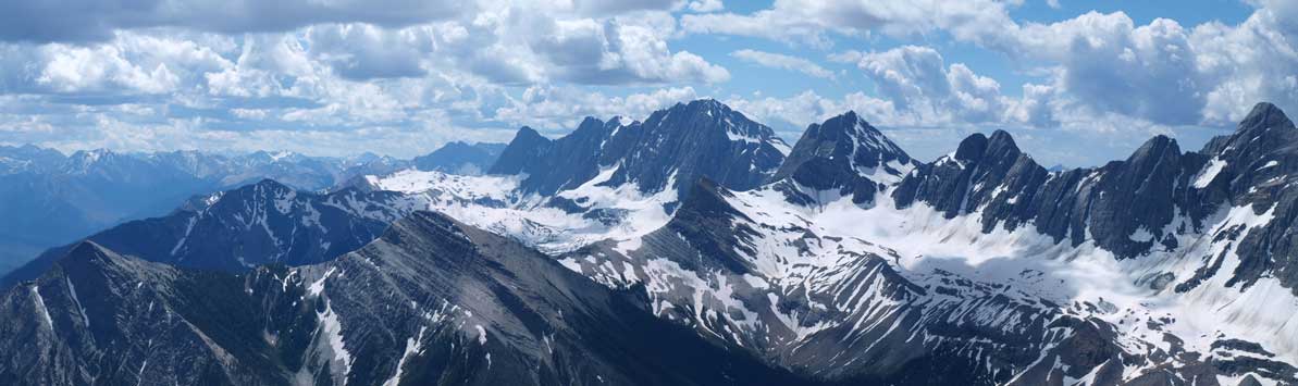
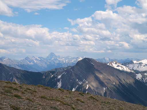
Looking south. Mount Wardle is at the end of this range.
Foster Peak
The unofficially named Hewitt Peak

Floe Lake and Floe Peak
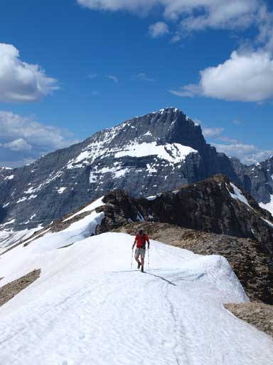
And then I was on my way traversing over to the true summit. At the last bit I merged onto snow line. The not-so-hard snow offered some easy travelling and I soon stood on this summit. The view was amazingly good towards all direction. It’s 100 meters higher than Kane scramble Vermilion Peak and offers probably the best view of the Rockwall area. It’s a long way up, but the scrambling is easy at most, and I couldn’t believe so few people had gone up here. We stayed a long time on the summit soaking in the views. The continental divide did a good job blocking all the thunderstorms in Alberta side, and it was a mix of sun and clouds above us for all day. On hindsight we could have bagged Mt. Wardle but I think this trip is much more enjoyable than the 1000 vertical meters of BC bushwhacking.
Now I’m on my way traversing to the true summit

Vern kicking-step up the snow route
Vern on the summit ridge, with Foster Peak behind

Summit Panorama. Click to view large size.
Looking north into the infamous Ten Peaks
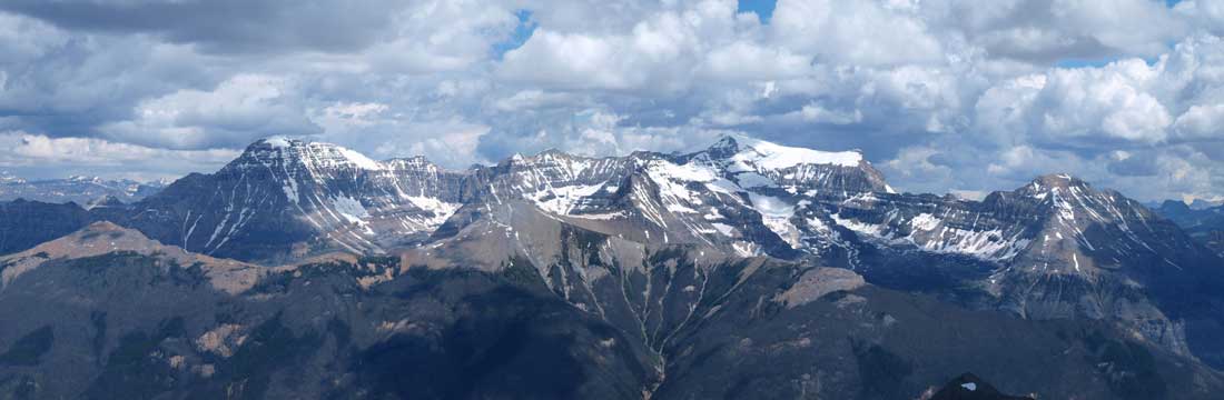
Stanley, Ball, and Isabelle
Looking at the Egypt Lake group from west side. Haiduk Peak is a scramble from this side.

Looking down the Vermilion River Valley towards the mighty Assiniboine

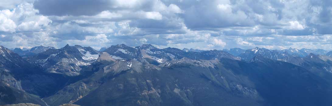
Panorama view again. Click to view large size.
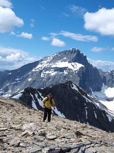
Kevin Papke approaching the summit

Me on the summit.
Eventually we decided to descend the long but scenic route via Floe Lake. Kevin and Scott had to get back to Calgary early so they would descend the same way we came up. Initially it looked that the scrambling could get tricky around the lower sub-summit, but after searching around we found the easiest way was to stay on top of the ridge crest and going over the false summit. The scrambling was easy to moderate and we soon dropped to the previously seen big scree slope. It turned out to be only partially scree, and partially rubble. Generally speaking it was easy to descend, and yes, it was such a long way down this slope. Looking back we all got impressed by the theme of this day, foreshortening… The elevation regain up a bump was not inspiring, but at least, didn’t take us long. We took another long break on top of this bump, and once everybody showed up we started the scenic descent down to Numa Pass.

Wietse coming up a scrambly step to the sub-summit

Wietse and Vern
Looking back at the slope we just went down

Beautiful afternoon. Where’s the thunderstorm?
Assiniboine in the distance

Another shot of Floe Peak
We picked different lines down this gentle slope
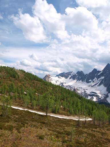
This area is apparently gonna be gorgeous in fall since we would travel through larch forest in the next short while. We soon picked the Numa Pass trail which still had some snowy sections. But there wasn’t much of post-holing, thankfully. After a long and scenic descent we made to Floe Lake where we took another long break. This would be a perfect morning photographing place. I couldn’t wait to see alpenglow photos from this lake. Oh wow, it’s right in front of a giant rockwall. To my surprise this peak in front of doesn’t have an official name. It’s unofficially named as Floe Peak for obvious reason.
Hiking back down the Numa Pass Trail
Looking back towards Numa Pass
Visiting here in fall?
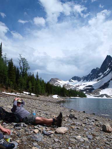
Dave Salahab resting beside the lake

Panorama of Floe Lake
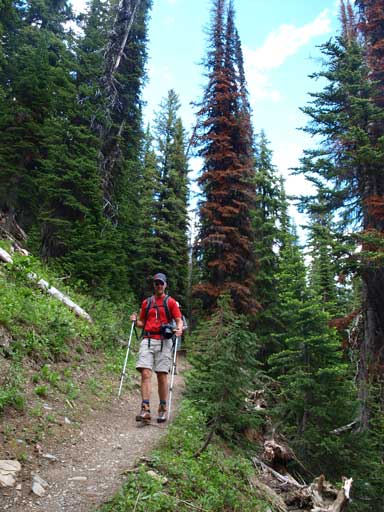
But, since we didn’t bring camping gears, we had to leave this lovely spot soon. The trail went on easy until reaching a area full of fresh avalanche debris. Terrain around there was steep and the trail goes switchbacking down the head-wall. It had to cross this mess several times, and hoping over and under the deadfalls was a bit of pain. Some of the deadfalls were gigantic.. Well, good thing was, after going down this headwall the debris were gone and we got this lovely trail back. The rest of this day was a numbing long walk. The distance from the lake to car is 10.5km.. This is a long way especially after gaining more than 1500m elevation already. At least the views were pretty good with a ton of wild flowers and nice views towards Isabelle Peak across Vermilion River Valley.
Vern hiking down the typical terrain on this trail.
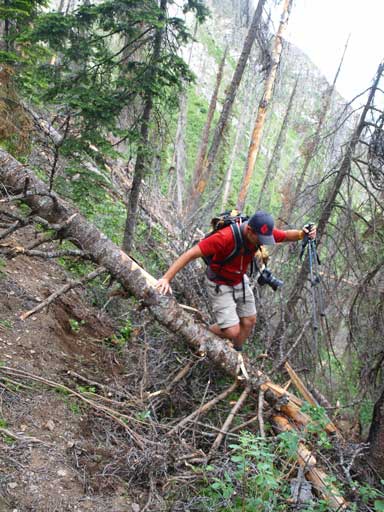
But there were some deadfalls

It got bushy at one section. Can you spot Dave whacking through the bush?

Looks stormy towards the Divide. In deed, it was miserable in the Alberta side, and we found it out on our drive back.
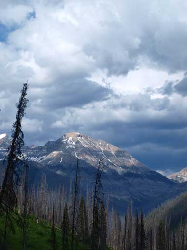
Isabelle Peak
Our round trip time was 10.5 hours which was certainly longer than expected. Good thing was, I enjoyed this trip very much. Bad thing was, Vern and I got pretty tired already and that would affect our plan for the weekend. Cirrus, Athabasca, or something else?
