Smith Peak
August 31 – September 1, 2014
3104m
Bull River (East Kootenay), BC
Smith Peak is one of the few named peaks overshadowed by the nearby 11,000-feet Mt. Harrison. I can see Smith Peak itself rarely draws attention to mountaineers apart from the ones based in SE BC communities such as Cranbrook. Before the trip I did not even know the existence of this peak. As I researched the other opportunities near Mt. Harrison I immediately noticed this one on the topo map. I asked Vern to check out Rick Collier’s trip report on bivouac.com and it seemed like a very reasonable objective.
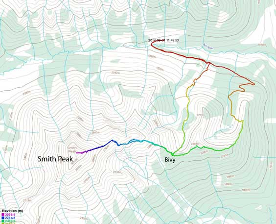
Smith Peak scramble route. GPX DL
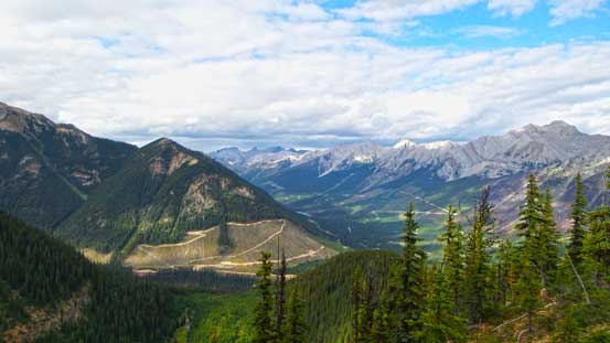
After successfully bagging Mt. Harrison and Mt. Folk, Vern, Ben, Eric and I decided to give Smith Peak a shot since we were in that area anyway. To use the most of the second day’s daylight time we would haul overnight gears up Smith Peak’s shoulder since we had the entire afternoon to kill after getting back to the truck. Rick’s description, though reasonably correct, was a bit vague for us. We figured the general area to park but struggled to find the logging road leading down to the Creek. It’s a bit overgrown and had a very sharp angle so to spot it you really have to look backwards. We found it eventually and started the day shortly after. The creek crossing was not much of an issue at all at this time of the year. We managed to use a log to cross without even wetting our feet.

We hiked down this road to the creek below. Photo by Ben

Eric filling up water at the creek. I filled up 3 L here as the entire ascent was dry.
The next stage was hiking up the maze of logging roads for as much as we could while aiming for the ascending ridge. The ridge we used was the least impressive and the easternmost one. A system of logging roads brought us high on the hanging valley just to the west of this ridge. We eventually bailed into the bush and went straight up. It was ridiculously steep for a while but the bushwhack was very tolerable and in a while we crested this treed ridge. Now the task had become obvious – following this ridge line all the way up. We picked up an excellent elk trail on the crest and this trail eventually led us up and over a partially treed false summit before dropping down to a col. The elevation loss here was frustrating – definitely more than 100 m. We wanted to set up camp at the col but there wasn’t enough room for 2 tents and 2 bivy sacks so we kept going further. Not far up we found a reasonable spot and that’s it. At the meantime it started to rain but about an hour after the rain stopped and we were treated with some gorgeous sunset views.
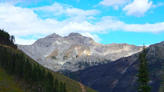
A view of Mt. Peck across Bull River Valley
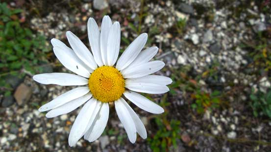
There were many flowers like this

Vern and I checking the GPS. Photo by Ben
High up on the treed ridge now, looking towards the summit
Looking back from the ridge
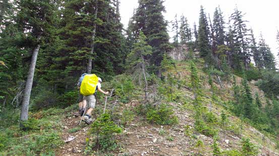
Typical ascending on the ridge
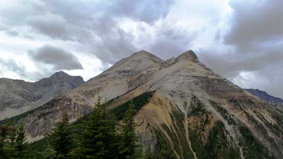
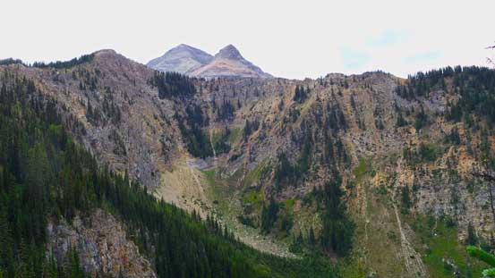
On the forested first summit looking towards the false and true summits

We arrived at the bivy site in rain
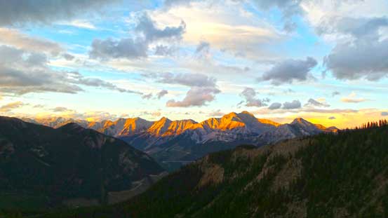
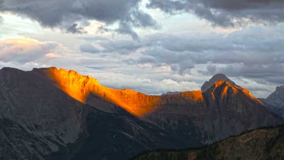
The rain passed by so we were treated with gorgeous evening glow
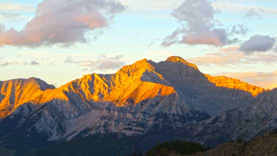
Mt. Peck at evening glow

This storm hit us earlier in the day
Evening glow and Mt. Washburn
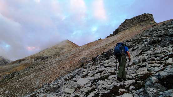
I got a nice sleep since I was pretty tired. Our objective for the 3rd day was to ascend Smith Peak, descend and drive all the way back so we had to be quick. We woke up around the first light and started the day at about 6:30 am. It had become obvious we had to circumvent the false summit on climber’s left (south) side but based on our earlier observation there was one section being unknown. To give us a second chance for other route choices in case this one wouldn’t work we just had to start that early.. Hiking up towards the false summit was easy and during which we got some excellent sunrise colours.

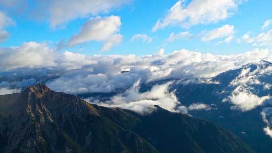
The next morning clouds came in and out. Typical weather

Sunrise was hidden behind the clouds but we could still see the colours
Eric grinding towards the false summit

Morning colours
More morning colours on the clouds
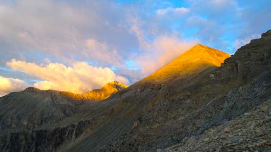
Now, morning glow on our objective!
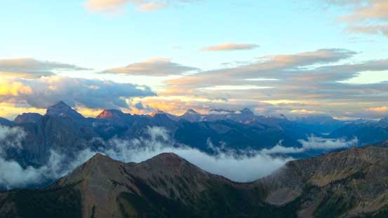
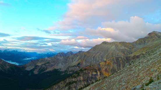
Morning view looking towards Mt. Washburn and Mt. Bisaro
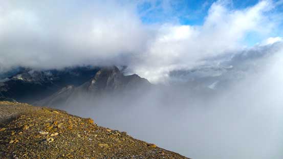
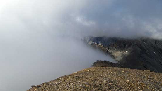
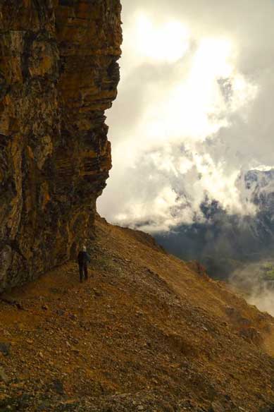
Towards the base of false summit we started contouring. There were a few scree bowls to traverse just like on Harrison, on ‘smaller’ terrain though. There really wasn’t much of hands-on scrambling but side-hill traverse was pretty tedious. Around the false summit we ascended to the ridge crest. The final push towards the true summit was long and foreshortened. There was one section we detoured to the left side looking for easier terrain but otherwise we stuck to the ridge crest. Near the top we entered clouds so the views from summit was very limited. It was very cold too.

Traversing around a corner, the true summit ahead
Gorgeous golden glow on the mountains!

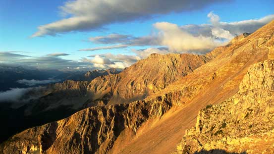
Golden glow and some low valley clouds

Ben and Vern traversing around the false summit

The last section of traversing before slogging back to the ridge
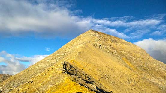
On the ridge now, looking ahead to the summit pyramid

Mt. Splendid
Clouds and blue sky

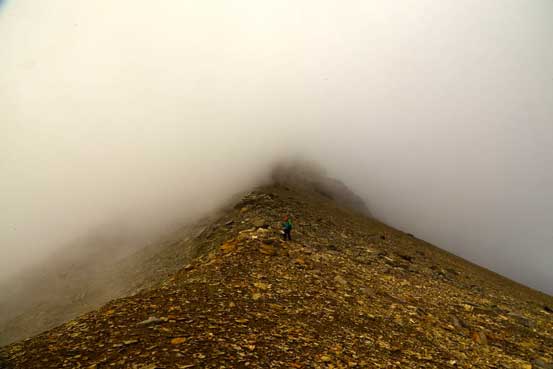
Hiking up the summit pyramid, we entered the clouds

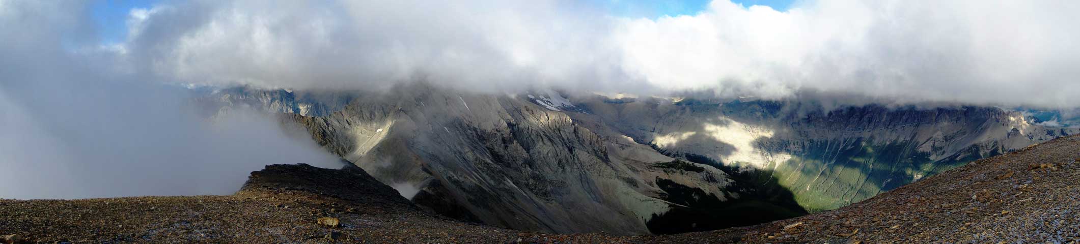
The clouds gave us a break and I quickly snapped a few shots
On the summit now, Mt. Splendid barely visible between the clouds
Cool looking clouds formation

Me on the summit with Mt. Harrison in the background hidden in clouds
As far as the summit view we got. Click to view large size.
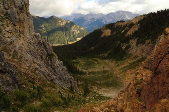
After quickly signing the register we started the descent. Going back was pretty straightforward and on the traversing section we could already use the tracks we made earlier in the day. Back to camp, we decided to try an alternate descent down the valley just to our north. This valley, though with unknown bush, would bring us directly to the truck. It was a gamble but we had the entire day ahead now so we were all in the mood to give it a try. We initially picked a scree/rubble gully steeply down to the bowl below. This part was surprisingly straightforward and into the forest we managed to use elk trails just beside a stream for a long time before bushwhacking really started. The bush was very tolerable but did have a short but dense alder band. We bashed down this band on skier’s right side and soon came out of the woods into a clear cut. We then picked up a rough logging road and followed it down to the main logging road. Another 1.5 km or so’s walk brought us back to the truck.
Vern descending. Weather got considerably worse now. Photo by Ben
Me traversing around the false summit on the way back. Photo by Ben

Packing up. Photo by Ben
Looking down our descent bowl – an alternate route that we hoped for the best. Photo by Ben

Looking back from the bowl. Photo by Ben

Near the end, me hiking down a logging road. Photo by Ben
Smith Peak turned out to be better than expected. I was expecting lots of bush, lots of scree and not much of view but neither of the factors was that bad. If not because the difficulty to access I’m sure this one would see more traffic. We were the first group signing the register after Rick Collier’s entry more than 10 years ago. Overall this was a very successful trip again with good friends. This August was a bit disappointing speaking the weather as we got 3 weekends in a roll of questionable weather forecast…
