Mount Fromme
February 17, 2021
1185m
North Shore Mountains, BC
For some reasons I’ve never found the North Shore Mountains too exciting (with a few exceptions), perhaps because they are too close to home and the access never changes from time to time, so that I know I can do them anytime I want. The last time I did a worth-noting summit in the North Shore has to be dated back to 3 years ago. However, despite that I still have done fair amount of peaks in the North Shore in 2015-17 period, including some very obscured ones like “Spindle Peak”. I did, however, left Mt. Fromme behind and I never felt excited to go there and bag it even though it had been calling me for years. The decision to finally pull the trigger was a very spontaneous one. A brief weather window formed in the middle of a dreary weak but I almost decided to just stay home playing the game of laziness. Angela wanted to get out for something but all the “hikes” we’d done were dumpster-diving. I wanted to find a decent “first real hike” for her and Mt. Fromme seemed like the right choice.
Because of the short drive we no longer needed to start with head-lamps on, unlike my other before-work trips. We left White Rock at around 6:30 am in the morning and made to the trail-head an hour later. There seems to have quite a few trails and trail-heads for this peak and I just randomly picked what seemed like the shortest option on Gaia map. This trail option starts at the south-west flanks of the lower mountain on Prospect Road. The parking situation was not very promising but I did manage to squeeze my truck into a spot.

Mt. Fromme from Prospect Road. GPX DL
The lower portions of this trail was literally a maze. I’m sure any trail would go but having the Gaia GPS map surely made things easy. I might not have picked the widest trail at the start but definitely picked the most direct path. After a few hundred meters of elevation we joined what seemed like a popular mountain bike trail. We took a ton of short-cut on this portion as the biking trail was clearly too “flat” for hikers. At about 700 m we came across the first logging road and its here that the snow finally became continuous. At 820 m elevation we came across the second stretch of logging road. The footpath had become very well-trodden as the lower trails had converged to a single path at this point.
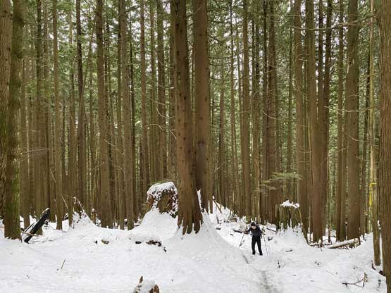
A typical view in the lower forest. It’s a boring slog
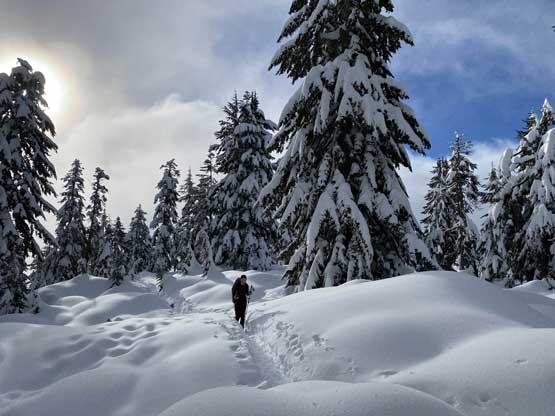
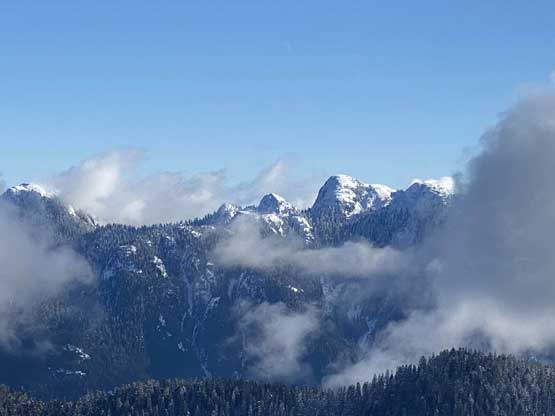
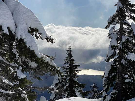
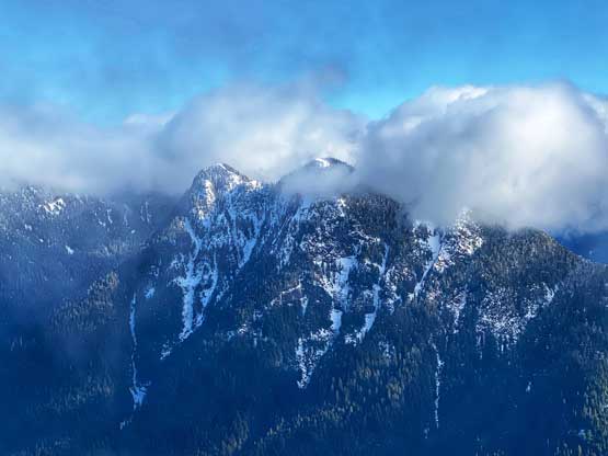
The grade of the terrain was actually mellower than the start of this hike, until the last 200 m rise to the summit. The steepest portion of this trail was definitely the last part. I was impressed by the popularity of this hike as well as the depth of the trench packed down by hikers. We had come with two pairs of snowshoes but we certainly had taken them for a walk. The weather had been cloudier than forecasted but we did manage to get some views from the summit with The Needles and Cathedral Mountain stealing the show.

A typical shot on the upper trail.
The first opening area is literally 10 m under the summit…
A view of Mt. Seymour, Runner Peak and Mt. Elsay (far left)
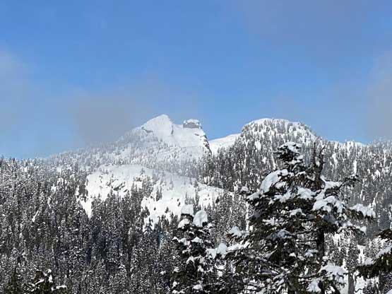
Crown Mountain, “The Camel” and Goat Mountain
A glimpse of Burrard Inlet and Vancouver Harbour
The three peaks of The Needles
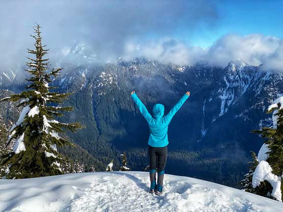
Angela posing on the summit of Mt. Fromme in front of Lynn Valley
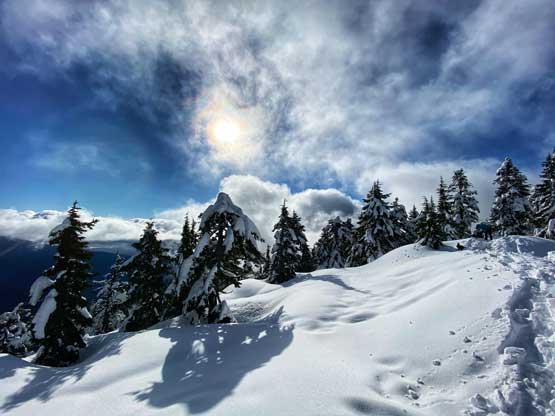
The low-angled winter sun
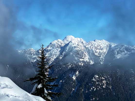
Cathedral Mountain showed up in the clouds
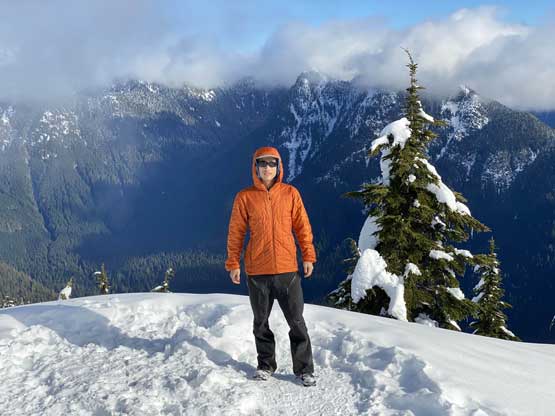
Me on the summit of Mt. Fromme
On the descent Angela decided to use microspikes while I opted to not use them. I preferred to just slip and slide on my boots as the trail’s grade was generally pretty mellow. The last few hundred meters of the descent was a little trickier as the trail was rocky and rooty with patches of snow and ice. Our round trip time was about 4.5 hours and we did manage to get back to White Rock in time for my afternoon/evening work.

Angela on the descent. This picture sums up the upper portions

One of the logging road stretches

This picture sums up the lower portions of this trail.
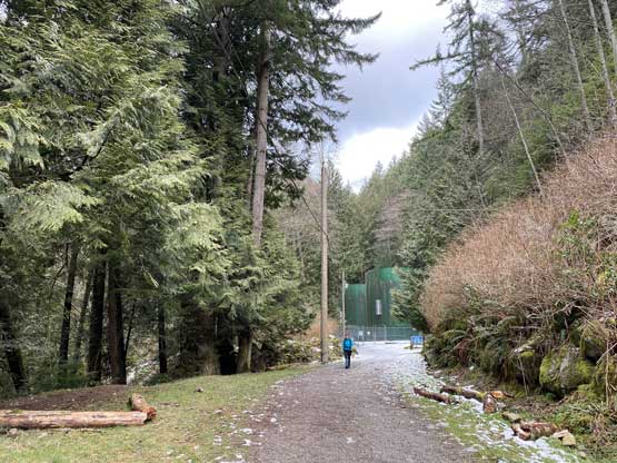
Almost done. The last 200 m was on a gated private road
