Sky Pilot Mountain
September 10, 2015
2031m
Squamish, BC
There is a small group of rugged peaks just to the south-east of Squamish behind the famous Stawamus Chief, and Sky Pilot Mountain is the highest one. It’s one of those peaks along Sea-to-Sky Highway that draws significant attention from scramblers and climbers for the simple reason that it “stands out” from the surroundings. The standard route (W. Ridge) from Shannon Creek up the Stadium Glacier followed by the infamous “Pink Slabs” goes at a difficult scramble (Class 3-4) with some exposure. The completion and opening of the Sea to Sky Gondola in the summer of 2014 made this once relatively remote area very accessible, and as a result hordes of people attempt it everyday in the prime season with some inexperienced and/or unequipped tourists. Two tragic deaths occurred on the standard route last year. Adding all of the facts it’s become a mountain that I’d like to experience it myself, sooner than later.
This past Thursday seemed like a good day with a high pressure ridge building up over the BC coast. From my limited research I knew there’re three ways to get this trip started: the “old” way driving up the rough 4×4 access road (Shannon Creek FSR); hiking up the Sea to Summit trail starting at the sea level; or taking the gondola ride which requires 35+ bucks and doesn’t open till 10 am in the morning. Either of the three has is obvious disadvantages and after some debating I opted for the hiking approach with the option of taking the gondola down… As a peak-bagger I was naturally interested in tagging the nearby smaller, but more difficult The Copilot in the same trip as they share pretty much 90% of the route. But that added extra time and considerably more gears (two ropes, harness, rappelling device, etc) so an early start was a must in order to catch the last ride back down (6 pm). The recommended starting point for Sea to Summit trail was at Shannon Falls parking lot but to my surprise it was gated at night time, so I parked at the nearby overflow area for the Gondola, and by 5 am I already started the trek.

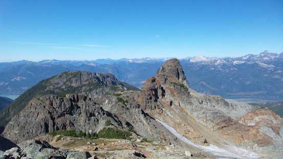
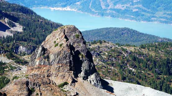
Sky Pilot and Copilot from Shannon Basin. GPX DL
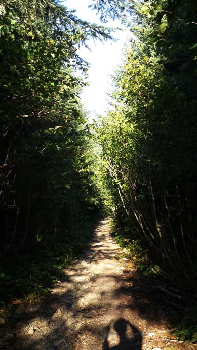
The initial section of this trail follows the Lower Shannon Falls hiking route passing the turn-off to the Gondola station. Soon enough the trail merged to the popular hiking route for Stawamus Chief. A couple hundred vertical meters up this steep grind I came to the signed junction, took the right turn (Upper Shannon Falls trail), and from here on I essentially followed the green stickers on the trees (400 of those in total) up the Sea to Summit trail. Speaking this trail itself I did not enjoy it. Partly because I ascended in dark so couldn’t see anything but trees, and the two major downhill sections were super annoying. And in general the grade was either too steep (sections assisted by fixed rope or handrail) or too flat… But nonetheless in under 2.5 hours I joined the Sky Pilot Valley trail which was also the old Shannon Creek FSR that’d eventually lead me to the base of my objectives.
After another hour of logging road slog the trail became rougher and rougher. I then passed the turn-off to Mt. Habrich and shortly after I arrived at the official end of Sky Pilot Valley trail. As a hike itself there’s nothing to recommend for this one and I’d say it’s pretty much exclusively used for climbers accessing Sky Pilot, Copilot and Habrich… I should have taken a well-deserved break here but the lack or sunshine combined with the humidity made it a very cold place to linger, so after quickly changing my footwear to mountaineering boots (and ditching my sneakers) I immediately pressed on. The trail passing the official end through the forest was still very easy to follow with plenty of flaggings, and I was making good progress. Soon enough I broke out of the trees and arrived at the large rocky basin.
Hiking up Sky Pilot Valley trail
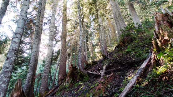
Ascending through forest passing the official trail-end
The views were starting to open up
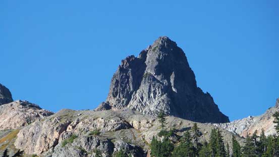
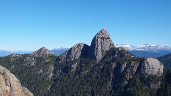
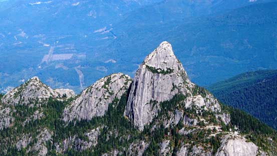
A zoomed-in shot of The Copilot – my route goes up the obvious gully
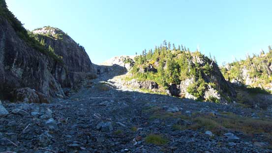
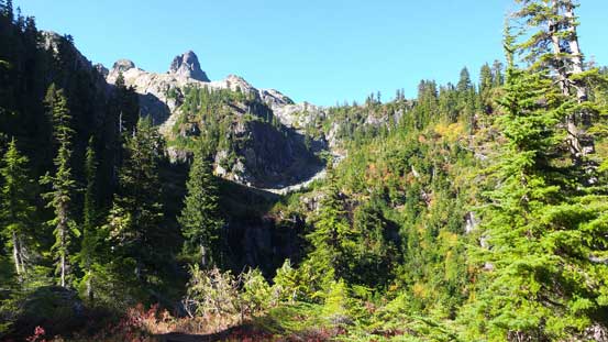
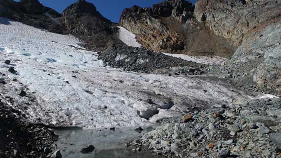
Arriving at the rocky basin. Time to straight up
From here on the trail became indistinct but really there’s no further need of a trail anyway. I basically worked my way straight up the rocky bowl following some sparsely placed cairns and paths here and there. I remember this section was fairly foreshortened but the greeting by the warm sunshine kept me maintaining a fast pace. Now I finally could take a well-deserved break and from this point I was not far from the Stadium Glacier – a small one with only a few crevasses. A rock slide had occurred somewhere on the climber’s right side dumping a TON of debris. I could have chosen to bypass the glacier by staying on the debris but since I brought the crampons up I decided to use them. Walking up the ice would be much faster than slogging up the loose debris anyway. But no matter what I still had to deal with loose rock for the section getting off the glacier up to the low col on Sky Pilot’s W. Ridge.
The classic shot of Mt. Habrich
Another (wider) view of Mt. Habrich
From the base of Stadium Glacier, looking towards Copilot
Stadium Glacier was bone dry…
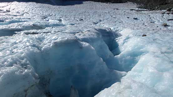
There’re a few crevasses and melt holes on this glacier

Looking down from just above the glacier

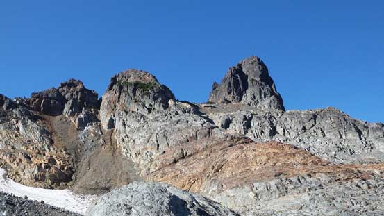
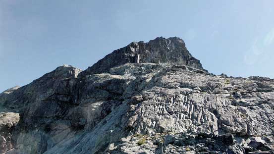
At the base of Sky Pilot’s W. Ridge, looking up
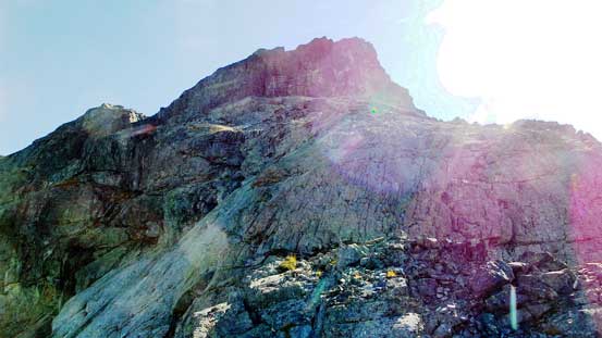
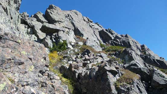
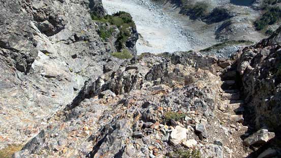
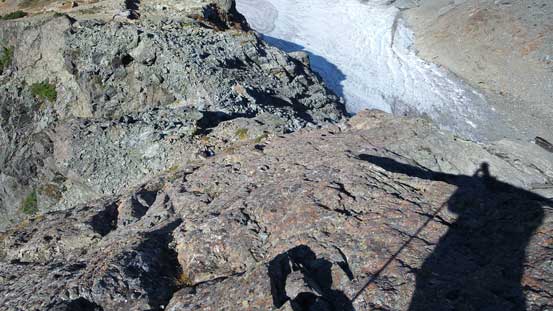
Another 10 minutes of slogging brought me to the base of the pink slabs. Because of the Class 3 rating and the fact I only had roughly 200 vertical meters to go I decided to ditch my backpack below the slabs to save some time and energy. The slab itself was not very difficult nor exposed but felt a little bit awkward wearing mountaineering boots thank to the down-sloping nature combined with the small holds. But I made through with no problem. At the obvious cliff wall ahead I followed cairns and paths skirting around to climber’s right side and then scrambled up a few gullies with some route-finding. Then I found myself back on the ridge crest.
Ahead is the “Pink Slabs”
Mt. Habrich with the Al’s Habrich Ridge to its left
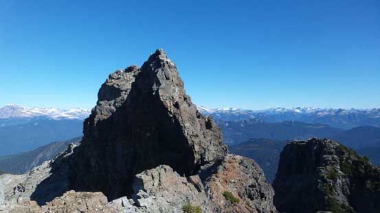
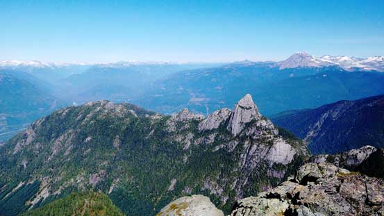
The Copilot, my second objective in this day
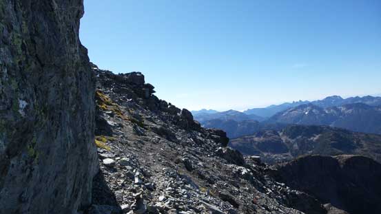
Skirting around the first cliff face
Then up some gullies and steps
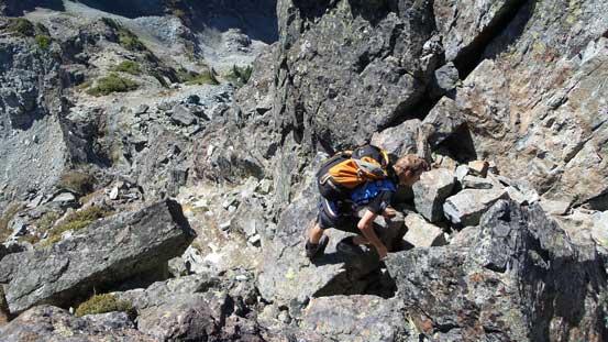
A bit exposed…
And a bit of route-finding
Back on the ridge crest, looking at the summit block
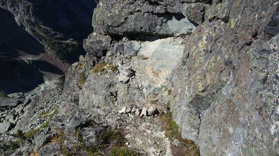
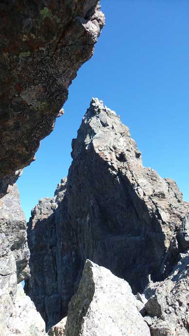
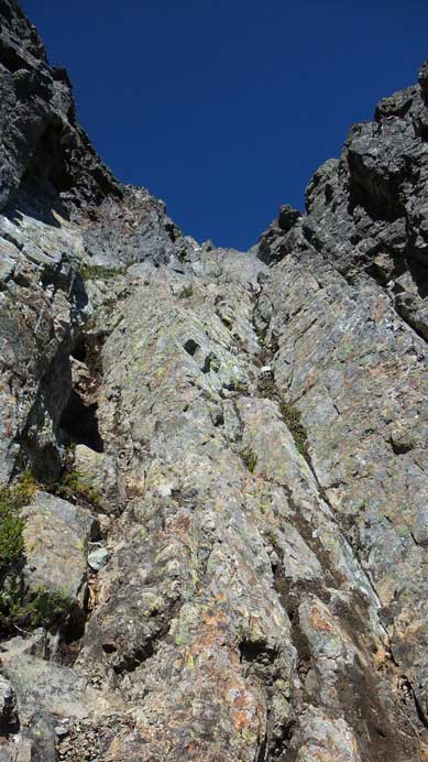
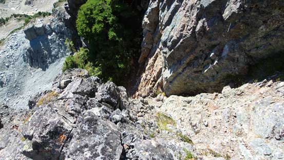
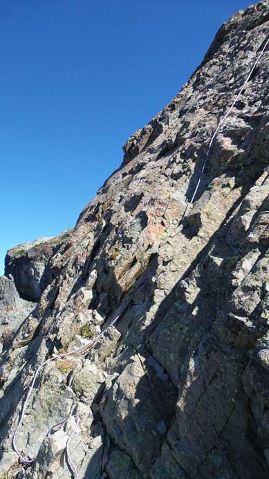
Up and over a minor bump I soon had to detour to the right again. Ahead was the summit block and attacking directly was not possible. The route went down a gully to the right first (with some tree root scrambling at the start), and then took a sharp turn climber’s left up another gully. But getting into this gully involved another trickier, but short step (the upper crux). I initially thought I was off route until I made through and saw the two bolts above.. Then the gully brought me back to the ridge crest bypassing the imposing gendarme/pinnacle on the left, and then another minute or two’s moderate scrambling later I was standing on the summit.
Ahead is the gendarme that I bypassed on climber’s right

Traversing underneath some overhangs

Descending the “treed gully”
Then up the upper gully to bypass that gendarme
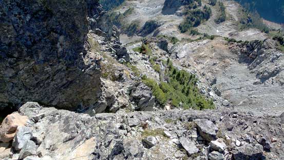
The upper gully is exposed to this…
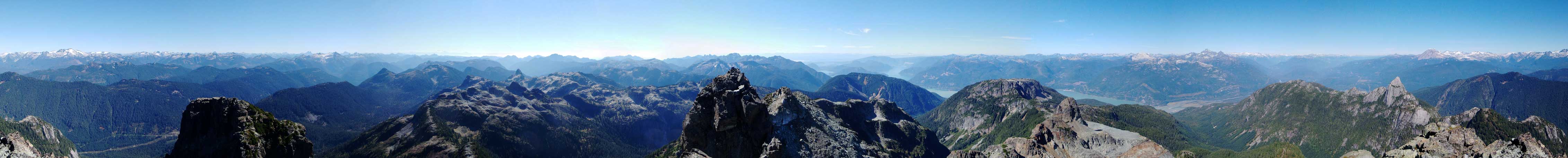
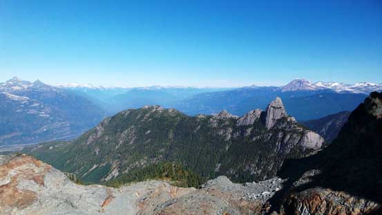
Summit Panorama from Sky Pilot Mountain. Click to view large size.

Looking down at Ledge Mountain, or commonly known as “The Ledge”
Mt. Habrich and Al’s Habrich ridge
Now I really want to get up Mt. Habrich, such a sexy peak…
The Copilot
Peaks by Mountain Lake area including Ben Lomond, the most striking one
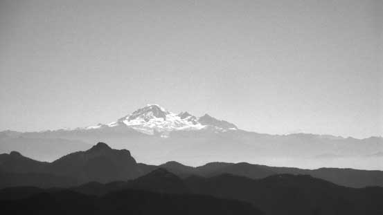
The massive Mt. Baker
The Lions that I ascended last weekend
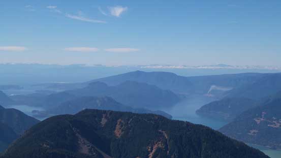
Islands by Howe Sound
Mt. Sedgwick

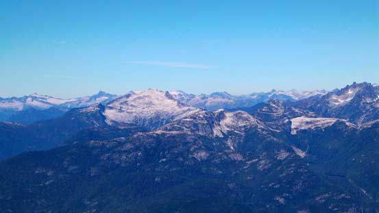
Mt. Tantalus is one of the hardest mountaineering objectives nearby
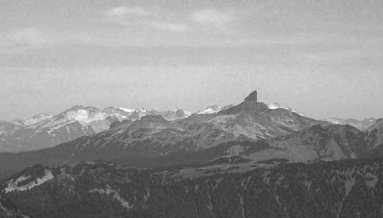
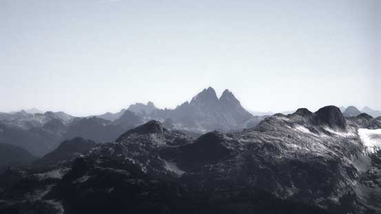
The very-unique Black Tusk
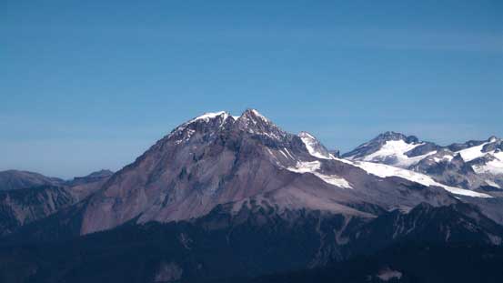
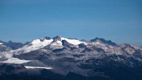
Mt. Garibaldi massive. To its right is Castle Towers Mountain
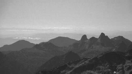
Parapet Peak and Isosceles Peak

Mamquam Mountain
Mt. Judge Holway
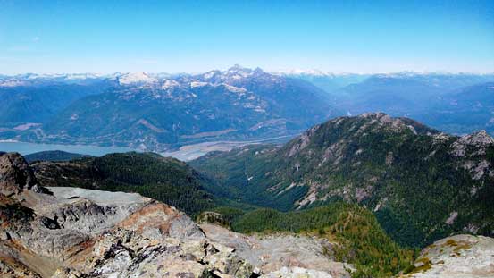
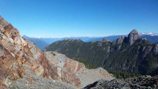
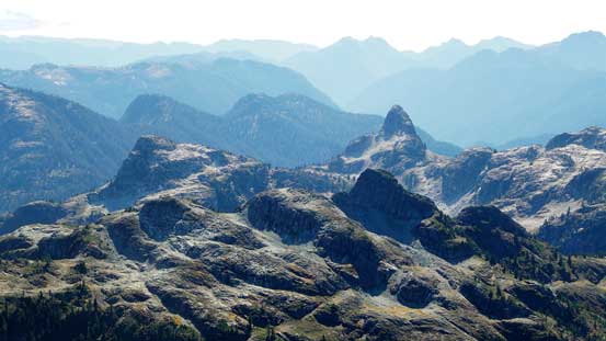
Another look at Shannon Basin
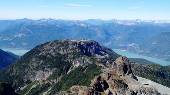
Goat Ridge is the broad plateau in foreground
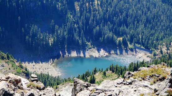
Utopia Lake at the head of Britannia Creek

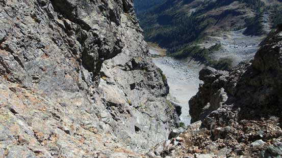
Looking far down towards Stadium Glacier
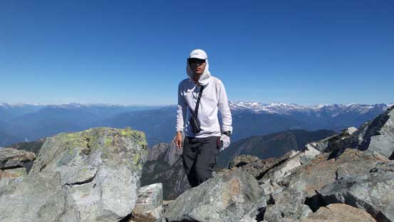
Me on the summit of Sky Pilot Mountain
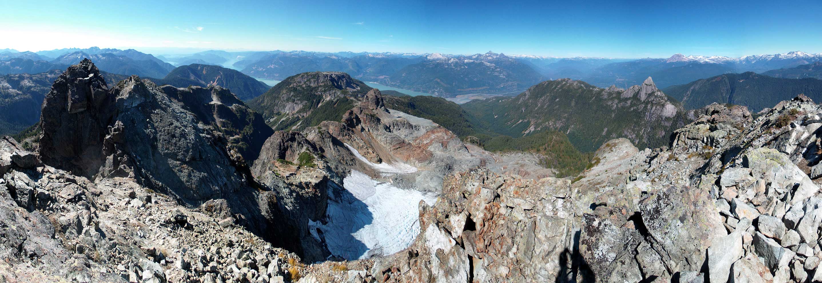
Panorama looking west. Click to view large size.
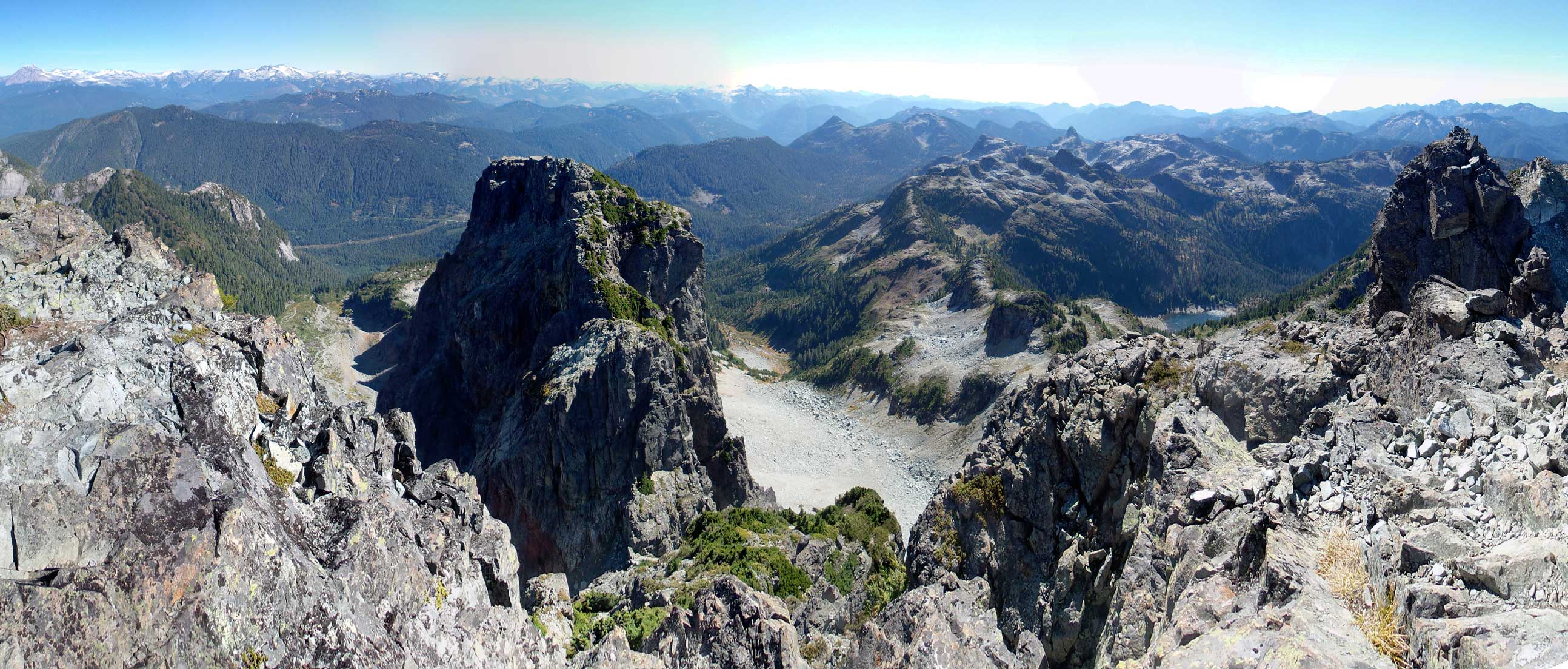
Panorama looking east. Click to view large size.
Thank to the bluebird September day I could see hundreds of kilometers away. I tried to soak in the views for as much as possible but I had no water nor food with me at this point. I still had another peak to ascend, and I also had a deadline to catch the last gondola ride down before 6 pm, so I couldn’t stay long. Retracing my steps down was pretty straightforward then it’s the pink slabs. I “crab-walked” down the upper slabs and down-climbed facing inwards for the lower section. Another group that I met higher up had fixed a rope to assist the slab pitch. I tried not using the aid and finding holds was a little tricky at a few spots, but by taking my time it was manageable.
Typical terrain on Sky Pilot
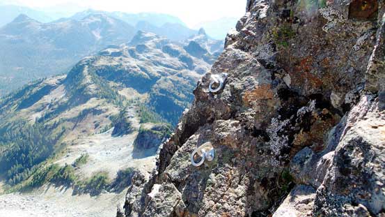
Two bolts above the upper crux
Down the upper gully
The first among the few groups that went up

Section above the pink slabs, another group was going up
Looking down the pink slabs
One of the groups fixed their rope at the pink slabs
Looking back the pink slabs

Descending to Stadium Glacier
During the descent I met at least 4 groups of scramblers on their way up (busy busy given it’s Thursday)… Now with The Copilot in sight I quickly made my way down to Stadium Glacier, and then it’s time for my next objective..
