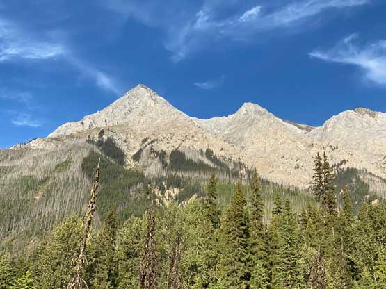
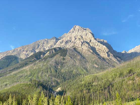
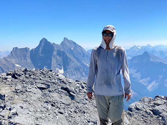
Chancellor Peak
August 18, 2022
3266m
Yoho National Park, BC
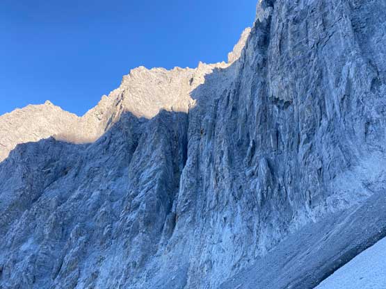
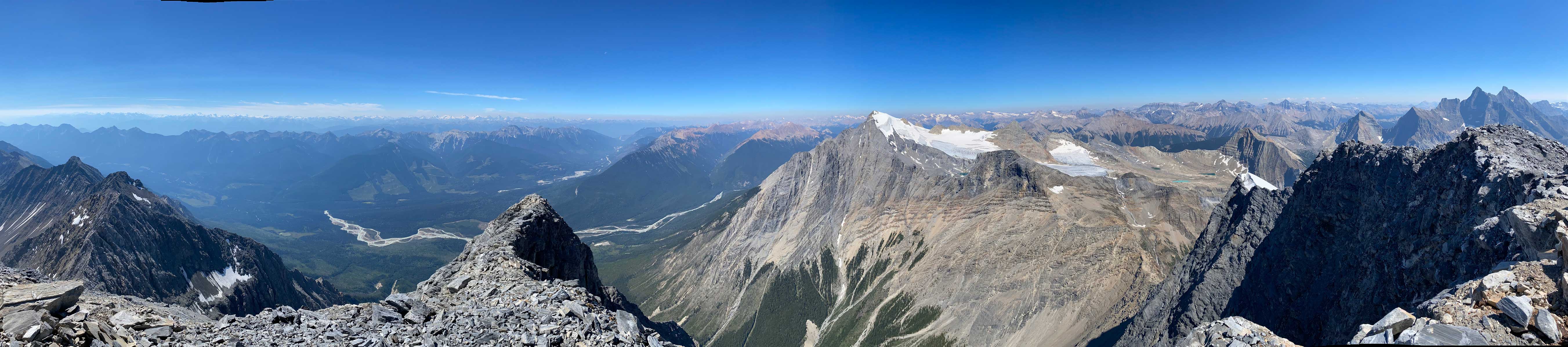
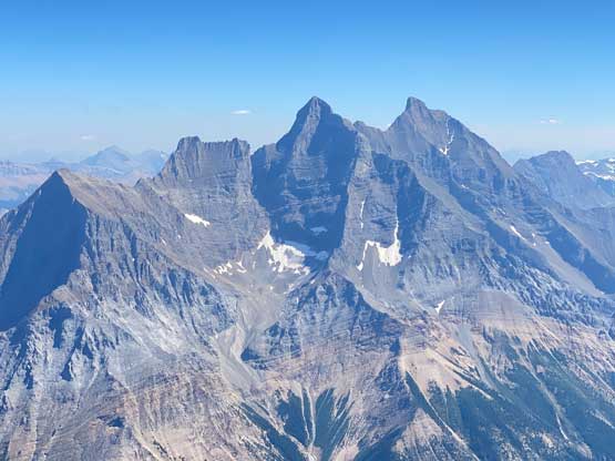
Chancellor Peak is considered as the grand daddy of beast of Alan Kane’s scrambles book (3rd edition) as well as one of the two most technical in that book, together with Mt. Robertson in Kananaskis. The general consensus is Mt. Robertson has the hardest climbing but Chancellor Peak is the most complicated overall, but either way this is either the hardest, or the second hardest in the Kane List and there’s no doubt on that. This peak does boast an extremely iconic profile while driving from Golden into Yoho National Park but the ascent of Chancellor Peak had not been brought into the scrambling community until Alan Kane published his 3rd edition in 2016. Prior to that the mystery of Chancellor Peak was only circulated in a small group of Rockies die-hard peak-baggers (myself included), but the lack of beta, the overall demandingness and the strict timing window meant we were never able to put together a trip. Fast forward to 2022 the “scramble” of this peak is no longer a secret anymore with 5 or 6 extremely useful trip reports on (mostly) Facebook, including but not limited to Doug Lutz (solo), Natalia F. (solo), Mike R./Liz I., Sonny Bou/Grant Myers, Devan Peterson (solo) and Anton Sarapulov (solo). This list of names shows the who-is-who of the Canadian Rockies scrambling community from 2016 onward aka. the “modern era of social media”. I sadly had missed out this era as I moved to Vancouver in 2015, but Chancellor Peak had always been on my mind even while I was climbing the 11,000ers a couple years ago in circa 2017-2020. With those guys’ brave work the mystery of the route had been mostly resolved and the approach suffering had gradually improved with more and more beta coming out.
Fast forward to 2022 the trip started out with Mt. Stephen with Oakley on Wednesday but the weather forecast showed bomber conditions on both Wednesday and Thursday. I started to wonder maybe I would have enough energy to pull off Chancellor Peak as well, even though I knew doing two big days (2000m + 2300m elevation gain) back to back might not sound smart, but the weather window was here and I must take advantage of that. I recalled that during my Lunette Peak’s climb in 2020 Noah MacDonald talked to me a few times about doing Chancellor Peak so I sent him a message. Meanwhile I asked my friend Doug Lutz who is literally the central of Rockies scrambling community to recommend one or two top-notch Rockies scramblers and his first response was Carl Glaser. I had never hiked anything with Carl but I trusted Doug’s judgement, so I sent Carl an invite as well. To a bit of my surprise both of them were instantly “in” even though I sent the invites only a mere day ahead at the very last minute. The plan was then quickly formed to start at Hoodoo Creek campground at 6 am. Carl and Noah would carpool out of Calgary early in the morning while I would simply sleep in the car at the trail-head. I was quite excited about this trip as part of me wanted to compare Chancellor Peak with South Goodsir, the sketchiest 11,000er considered by most list finishers. I had a hypothesis that South Goodsir is just plainly dangerous but actually not too far beyond these scramblers’ scope of experience but to prove this hypothesis I must climb Chancellor and/or Robertson. Among these two I felt more excited about Chancellor Peak as this is overall a much-bigger mountain with a more iconic profile.
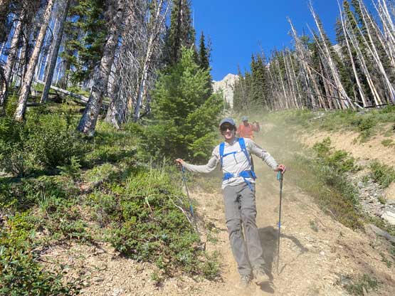
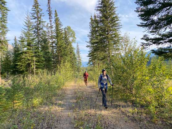
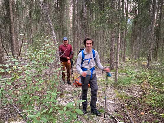
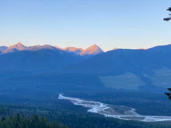
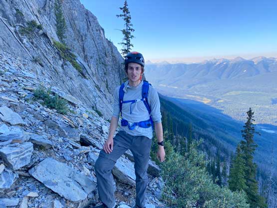
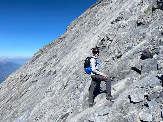
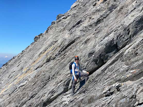
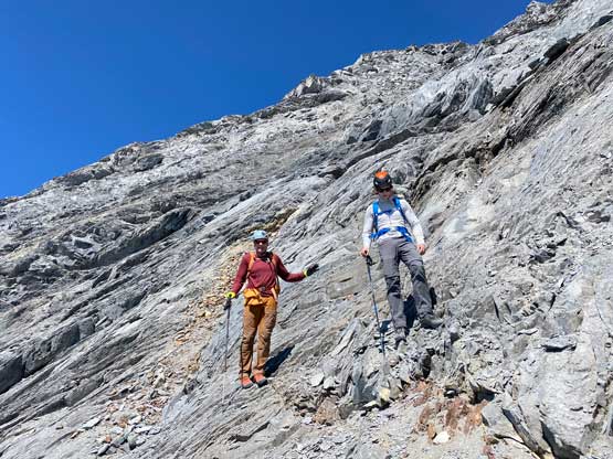
The previous evening I drove to Canmore after Mt. Stephen to properly prepare for Chancellor Peak’s climb. I could have driven back to Golden which was much closer, but I didn’t want to risk getting stuck at the highway closure again, and Canmore is the nearest town on the other direction that I felt comfortable with. I bought about 40 dollars worth of food and drink from Safeway (three bottles of Gatorade, three sandwiches, a bag of cheese with sausages and bunch of others), quickly repacked and drove back into Yoho. I made to Hoodoo campground at almost 11 pm and parked right in front of a locked gate. I had Anton’s GPS track and this parking spot was right on the track. There’s no cell reception and a few confusing side roads but I sent both of them the track so they should have no problem finding here. I opted to wear mountaineering boots while carrying rock shoes for the slabs near the summit and the rock shoes turned out to be essential for the mission. Noah was comfortable wearing approach shoes for the whole trip while Carl would do similar with me, but carrying approach shoes instead of rock shoes. The others showed up at 5:45 am and we managed to start at 6 am exactly as planned. This was right around the time when head-lamps were no longer needed.
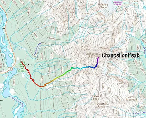
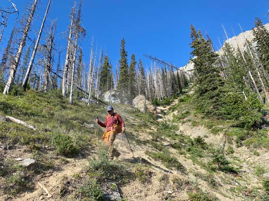
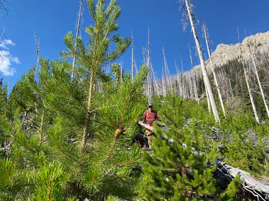
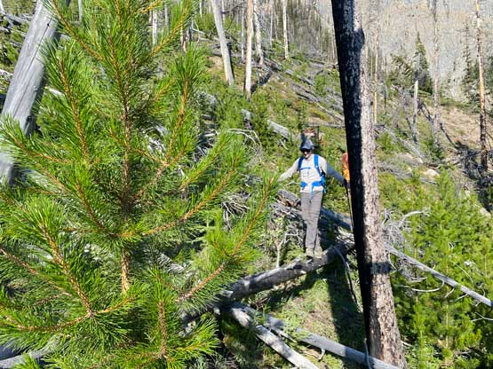
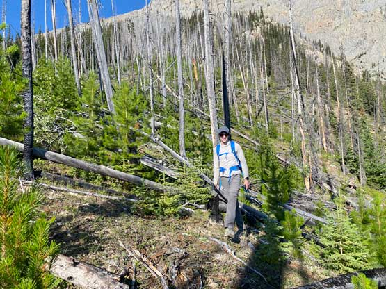
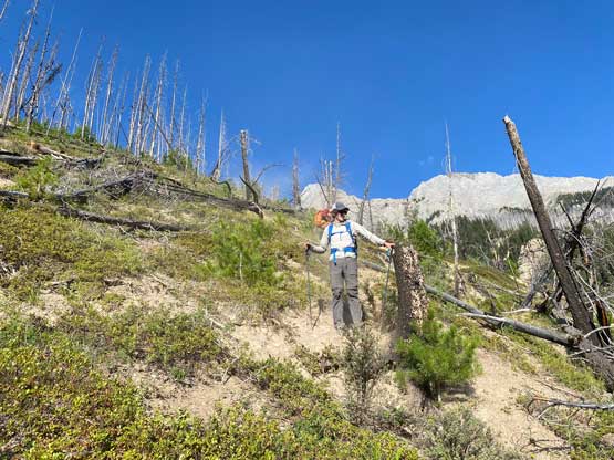
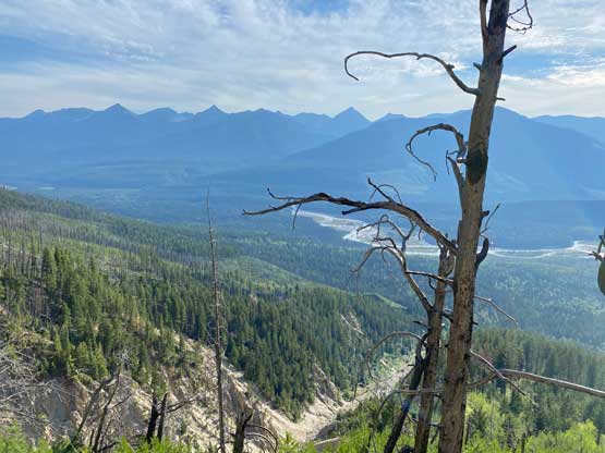
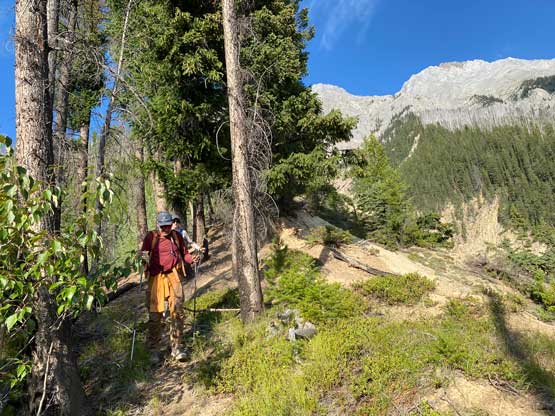
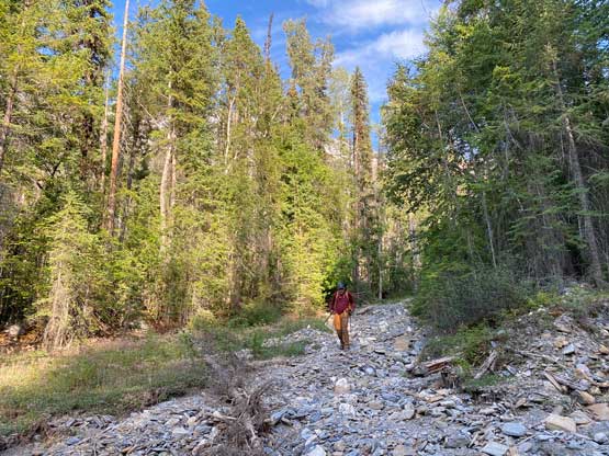
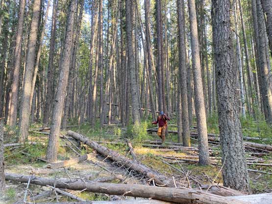
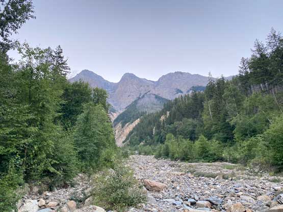
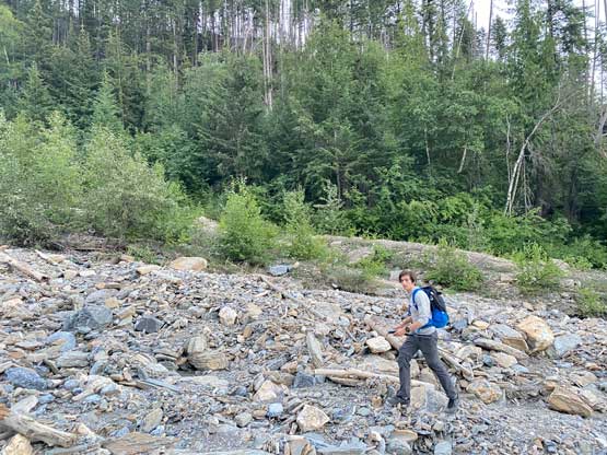
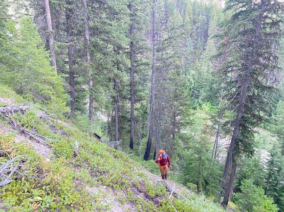
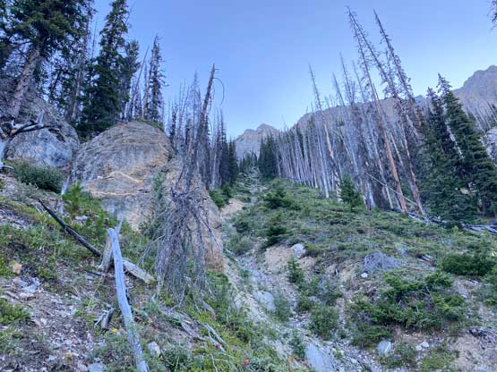
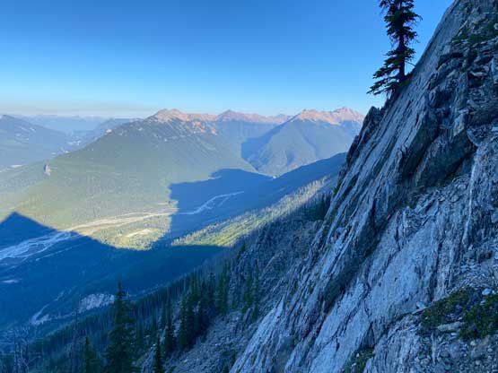
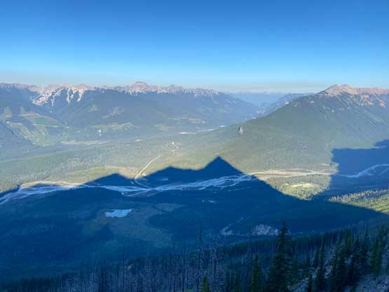
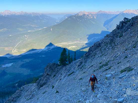
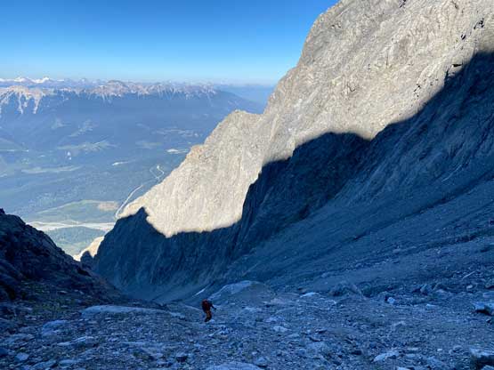
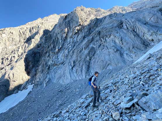
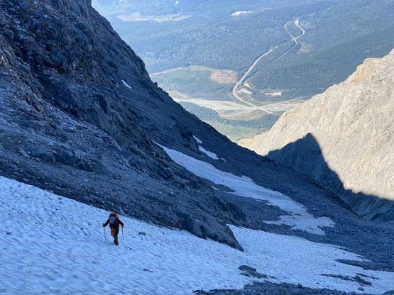
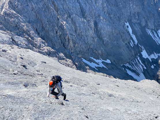
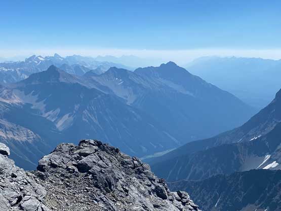
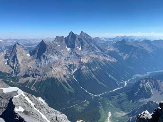
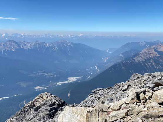
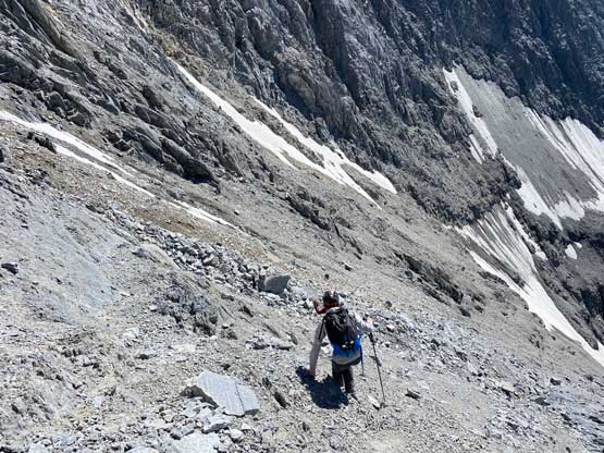
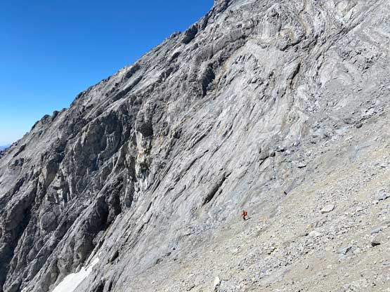
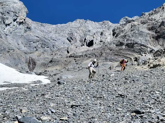
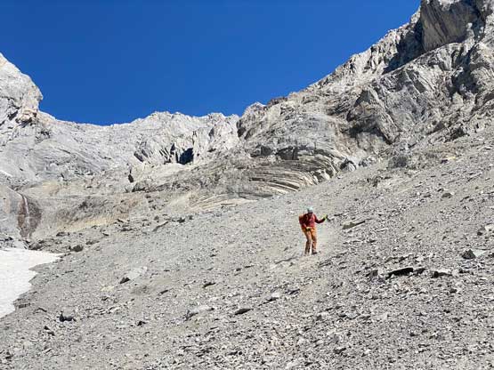
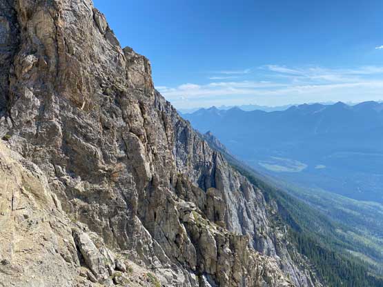
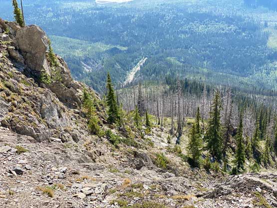
Anton had done a great job putting together a track that’s relatively free of bush but the track diverged on at least two occasions. I had asked him which branch of the track to recommend and he showed me the better way. With his beta we were able to nail this approach with under 10 minutes of bushwhacking overall. The plod across the clear-cut and then the swamp was definitely not aesthetic but I wouldn’t call that as “bushwhacking”. We just had to hop over some dead-falls that were no more than thigh high, and the swamp was not nearly as wet as we expected. There’s even a pretty well-defined path through the swamp. My pants were soaked from the dew but all of our boots were still dry after that section. On the far side of the swamp we briefly thrashed through a dense band of bush and then entered the open forest. Again, there were some dead-falls but nothing really annoying. We followed Anton’s descent track to the very bottom of a large drainage and easily rock-hopped up this drainage for a while. Once making sense we ascended a very steep and loose forested slope on climber’s left to escape the drainage onto a timbered ridge as we knew the earlier we could do this transition the better. We then instantly found the “animal trail that avoids 98% of the sticks” on this timbered ridge as mentioned in some other trip reports and indeed, we didn’t really have to deal with pick-up-sticks until the very end of this stretch, at least 600m higher up. The upper end of this ridge had some unavoidable dead-falls but like I said, the unpleasantness was no more than 10 minutes and that’s it. We then located a bush-free gully and grunted all the way to the base of the rock face ahead which marks the end of the approach and the start of the scramble. About 1000 m elevation had been dispatched by this point and we were under 2.5 hours into the trip.


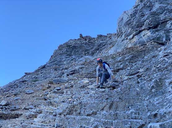
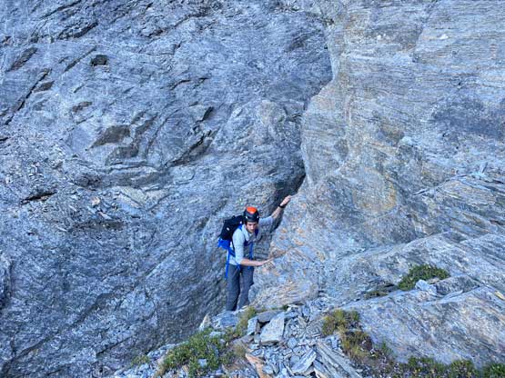
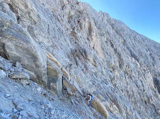
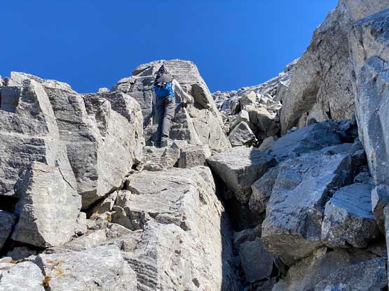
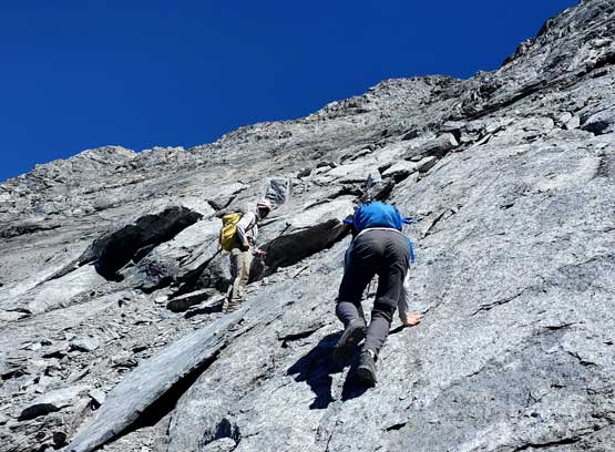
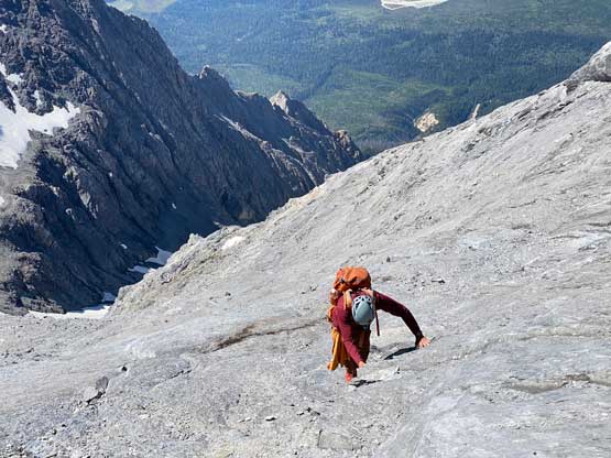
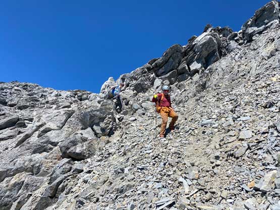
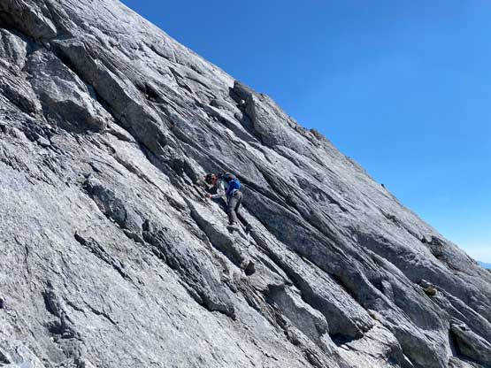
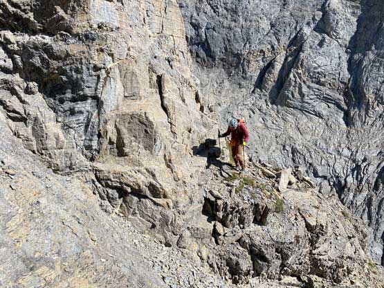
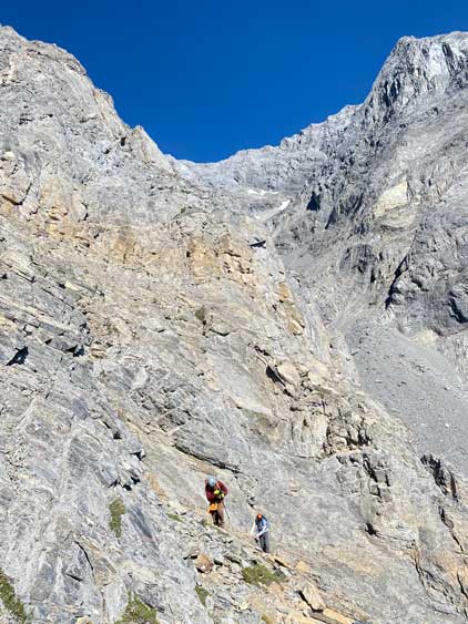
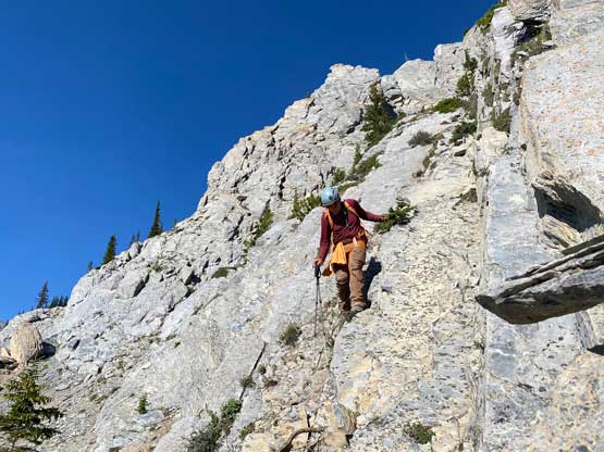
All three of us stored one of the trekking poles and carried the other to facilitate the scrambling terrain ahead. While traversing leftwards under the base of the cliffs I immediately located the “harder start” which did not look hard enough. I opted to check out the “easier variation” farther to the left but didn’t want to deal with more side-hilling, so we all climbed the 4th class “harder variation” which was quite fun. We then followed paths and cairns traversing a few ledges back towards climber’s right and crossed/ascended a few gullies. The scrambling was mostly 3rd class or less, but there were options to make it harder which at least Noah did. I am not a big fan of plodding upwards on treadmill scree neither so eventually all three of us opted for some stiffer terrain on either side of these gullies. The route-finding was rather easy with the GPS track overlay on both topo map and satellite images, and the cairns/path as well as our experience. For the uppermost gully in this zone we followed Noah’s lead ascending to an exposed ridge on climber’s right. The plan was to descend the gully later on the return, but we somehow ended up down-climbing this exposed ridge as well, but more on that later. After this ridge variation we were at the infamous downwards traverse into the main gully (more like a valley), the supposed crux #1. Again, with cairns the route-finding was straightforward. We down-scrambled a loose section and then walked across the most exposed parts of the ledge, which was easier than looked. The annoying part of this section was about 50 m elevation loss which must be regained later in the day.
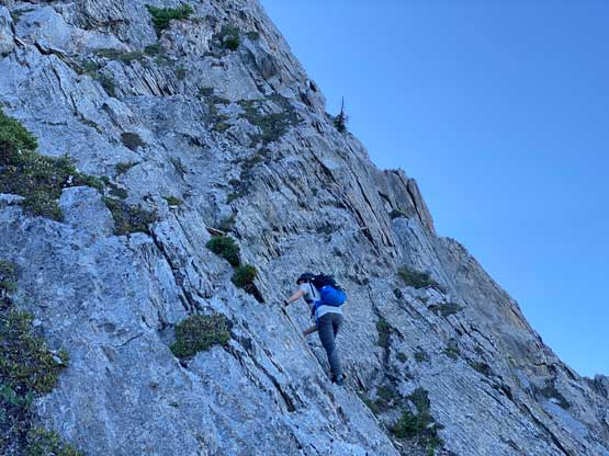
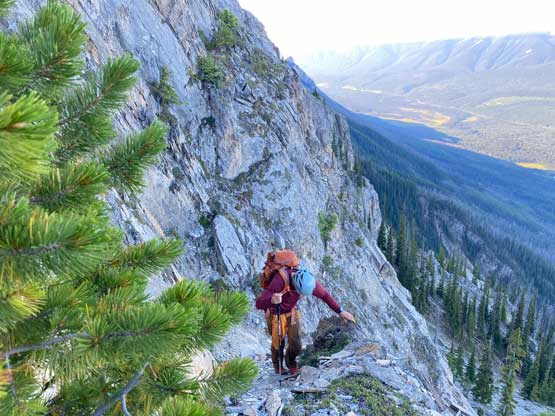
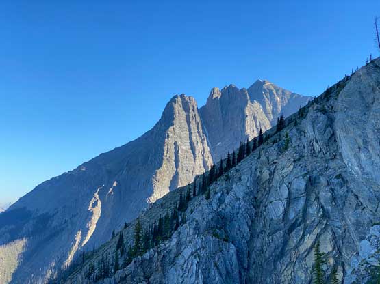
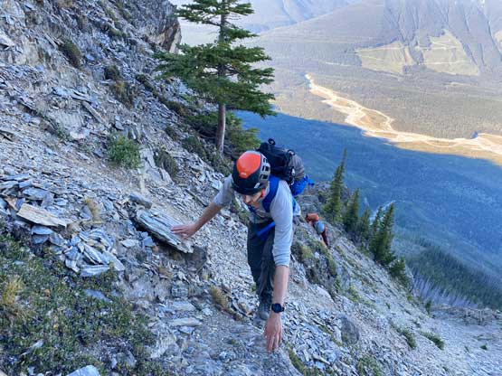
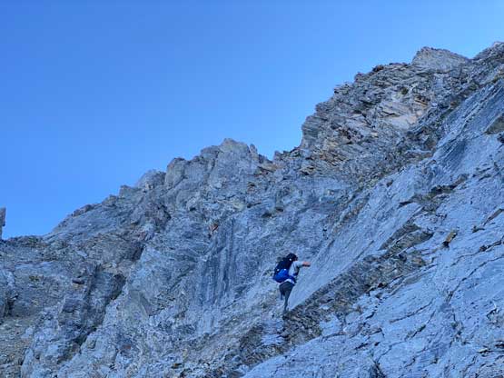
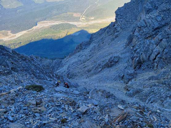

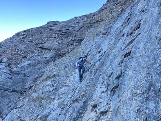
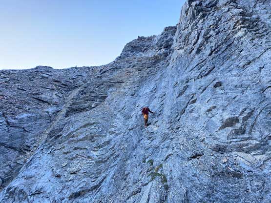
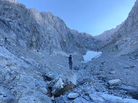
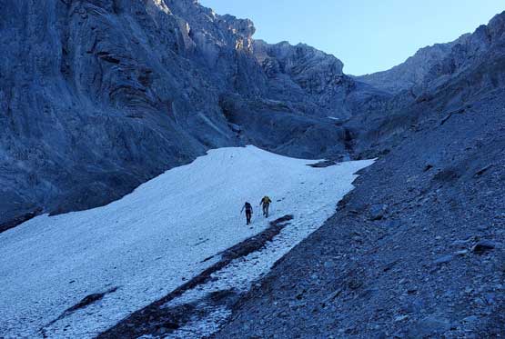
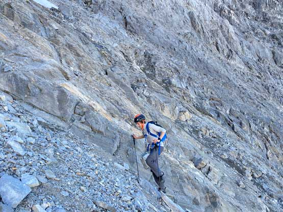
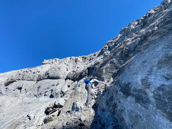
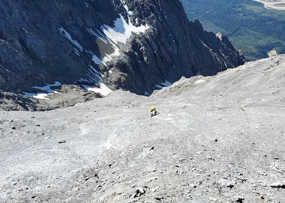
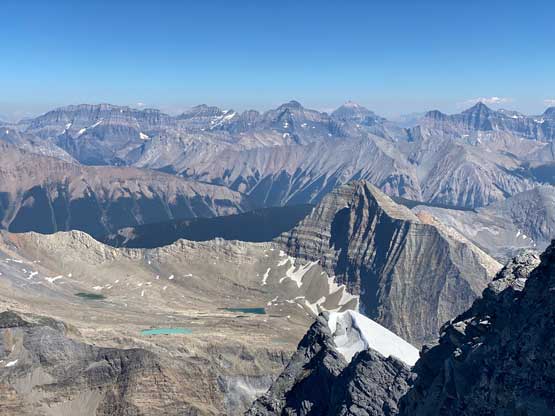
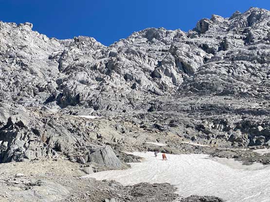
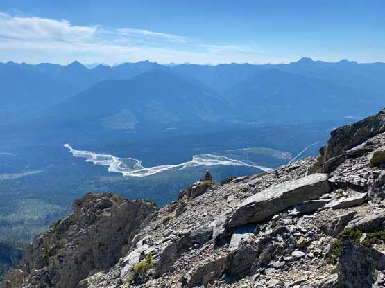
There’s a trickle of streams not far up from where we dropped into this main gully/valley so we loaded up the water bottles. I was not 100% about water sources higher up but in retrospect there were a much better source of water higher up, but we didn’t want to take a chance. We then took out the second poles and plodded up some scree and rubble to the first path of snow. Carl continued ascending the scree while Noah followed my lead ascending snow. I was the only one wearing mountaineering boots so snow was definitely my preference over scree. And then there came the “waterfall step” which would be the crux #2. Noah climbed a line closer to the water while Carl and I scrambled the most obvious break which turned out harder than expected. I was thinking maybe I would want the rock shoes for the down-climb later in the day but either way we all made our respective lines and both Noah and I would call this step “low class 5”. Mine could be 4th class if one really trusts the friction on this water-worn slabs. I couldn’t trust the friction that much, so did some harder moves. And for some of you wanting to bring a rope, there was no rappelling station above this step.


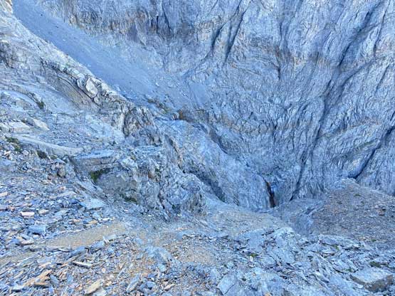
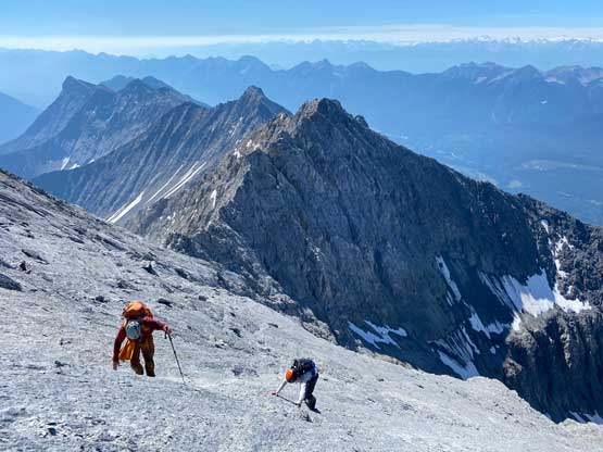
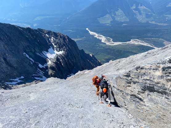
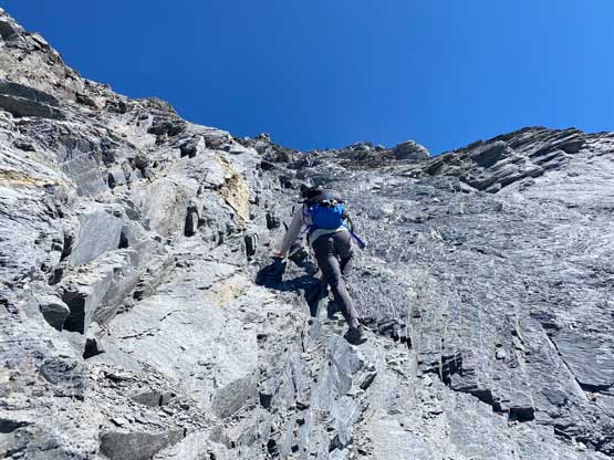
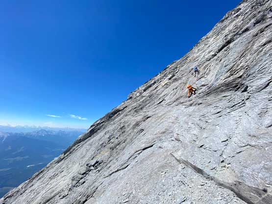
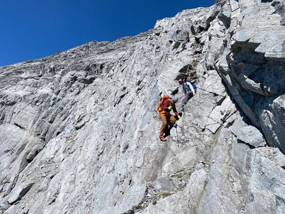
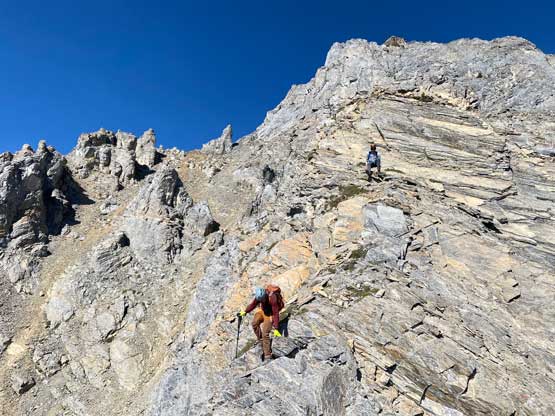
We then scrambled up more “moderate” terrain climber’s right of the main valley encountering more sources of water at higher flow rates. We then all merged onto the upper snow field. I led the way kicking some steps and the upper field of snow started to become quite steep. Carl merged climber’s left out of the snow and scrambled up some loose terrain and we re-grouped at the base of the “upper route” where we took another long break. We finally got our first taste of sun beams here but I could not say we were stoked about that, as this meant a long and hot ass day ahead. I think we did the route-finding on the lower half of the “upper route” pretty well by firstly traversing climber’s left and then ascending up through gullies and ledges. There’s one key ledge (not very obvious) marked with a cairn that we used to traverse leftwards where the more logical way would be to keep ascending to the right. This correct decision saved us some time as this key ledge above a cliff successfully brought us to the second half of the “upper route” where we slowly merged ourselves into a maze of slabs. This was where things became tricky.

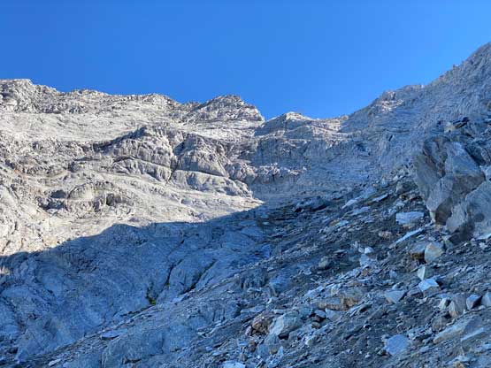

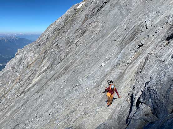
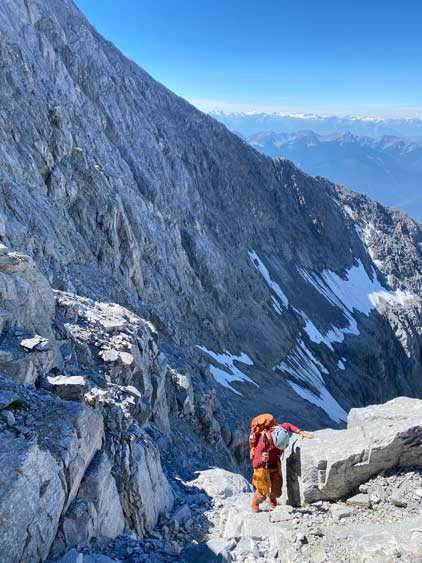

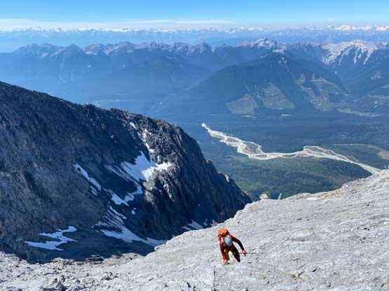
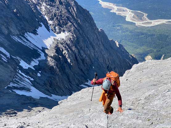
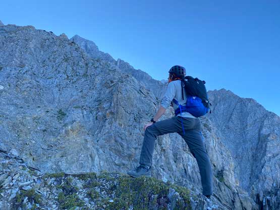
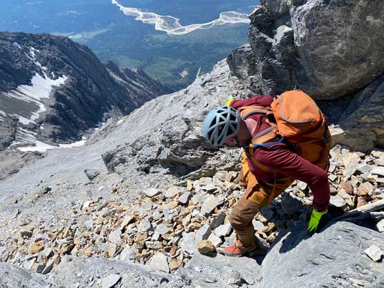
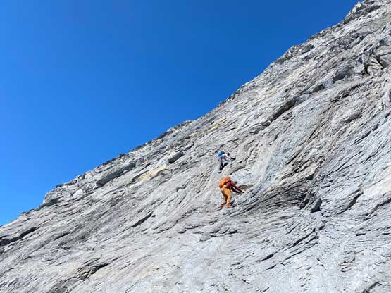
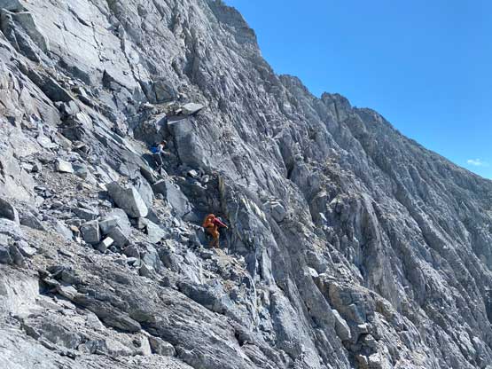
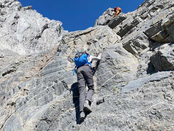
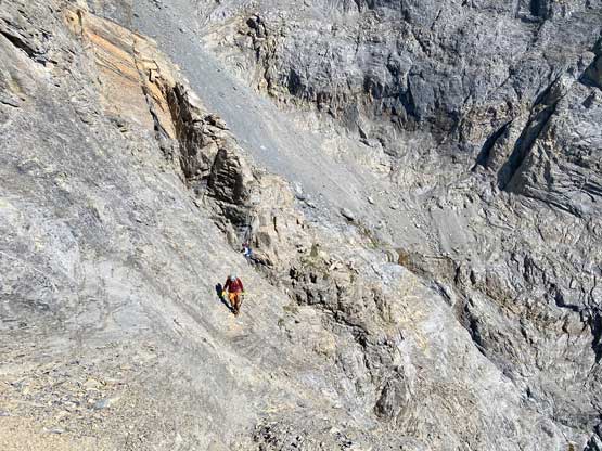
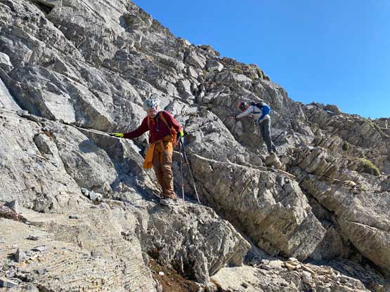
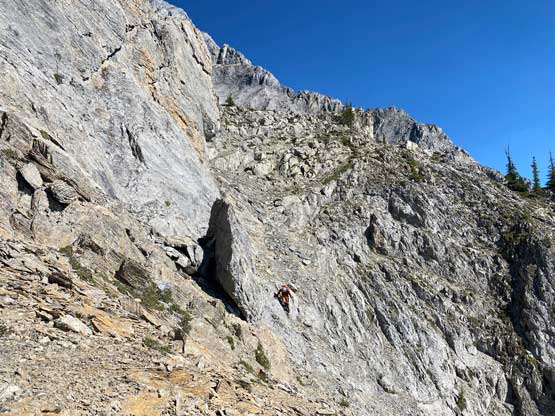
I had some beta that “climber’s right is harder” so we traversed across a few smooth slabs towards left instead, but later at home I also realized that some gorups actually went up and right to hit the ridge and that route didn’t seem to go too terribly. The line we took by staying low on climber’s left was the next level. At one point a cliff band forced us to ascending straight up and that quickly dumped us into 5th class terrain. We should have turned around to find an easier path, but we were being stubborn. I made the call to do a sketchy transition from boots to rock shoes and then led up a 5th class move and then we were committed to this line. But nearing the end it started to become really sketchy with nothing to hold onto. Noah and Carl climbed a pitch of slab corner that Noah rated “mid class 5” with a few irreversible moves to start with. I saw the lethal exposure of this whole section and couldn’t commit. Instead, after wasting at least 20 minutes trying to figure out another sequence I gave up, gingerly down-climbed the class 5 slabs that we just did, and climbed around farther to the left side on more low 5th terrain. The three of us then had to descend a bit to work around another band of rock before joining the two strips of orange rocks mentioned in the other trip reports. At least an hour was wasted here and we also must find a different, down-climbable route an hour or two later and that started to become a bit stressful. The rest of the ascent was not hard anymore, but still loose and exposed.


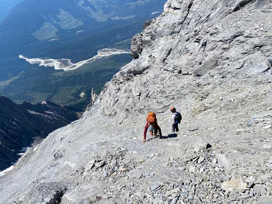

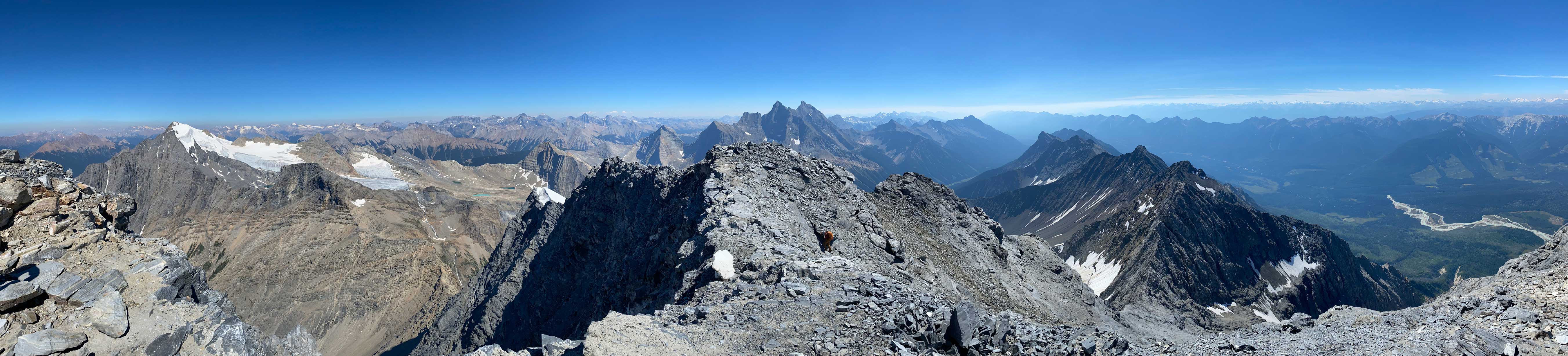

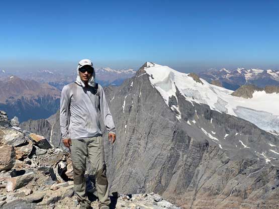

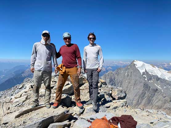
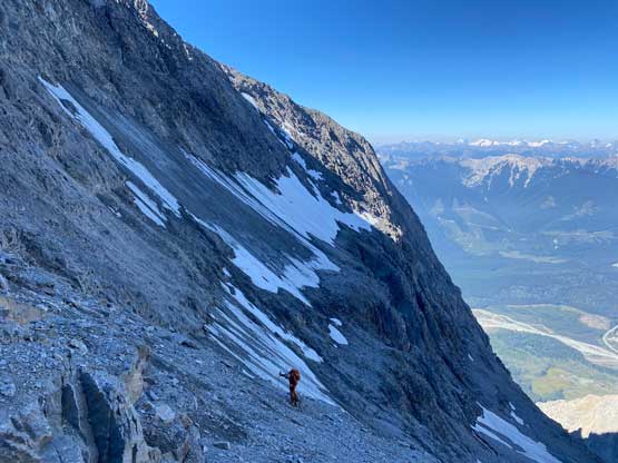
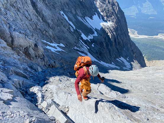
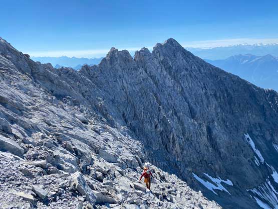
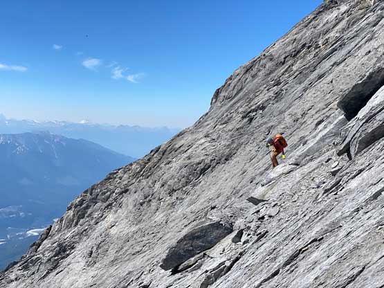
Despite the route-finding errors we opted to take our time on the summit as we were still doing great on time (as we nailed the route-finding on the entire lower mountain). I also enjoy reading registers that illustrate the who-is-who of a local community and this peak’s is certainly one. Eventually after 40 minutes on the summit we decided to face the descent. I was not too concerned as I was sure that one way or another we could make it down. I ended up being too optimistic again.. Pretty soon we came to that slab section and my first theory was to stay higher (more skier’s left) but quickly abandoned the idea after seeing a blank section of slabs. In retrospect that might have been the best way but I could not tell while looking at the slabs. Instead, we down-climbed the line we took to below the sketchy spot in hope to traverse underneath that section. After a committing stretch of down-climbing what we saw was nothing, but smooth slabs. Carl ended up balancing across without any issue but Noah soon turned back to follow me, ascending at least a full pitch of 4th class slabs back up to the level of that aforementioned blank section and then down towards skier’s right we finally noticed one stretch of slabs that were more broken. We immediately committed to that and sure enough it was only 4th class. We should have down-climbed to exactly where Carl was waiting but instead, we traversed skier’s left a bit too soon and that became the second error we made on the descent. To correct this error Noah and I both down-climbed some sketchy 5.4 terrain but after that we thankfully had no more problems. At the bottom of the slabs Carl and I had to take another break to switch footwear back to boots and then I led us down-climbing the snow slopes back into the main valley. I did some boot-skiing lower down as I had stiffer mountaineering boots.
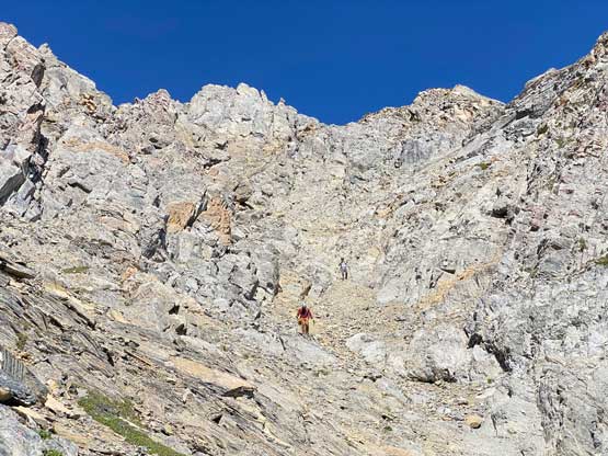
We all loaded up the water bottles while drinking as much as we could at this upper (better) source of water and then there came the “waterfall step”. This would become trivial after what we just did on the upper mountain, but I still opted to switch footwear back to rock shoes. Carl tried to down-climb in boots but immediately called to switch footwear as well. The climb again, turned out harder than expected but Noah used more “crab walking” techniques and made it look rather easy. We then switched the footwear back to the boots. I tried to boot-ski the lower field of snow but this one was icier. After a few turns I gave us, merged back to the scree and descended together with Noah and Carl. The scree here was not as fun as expected as the texture was more moraine than treadmill. The next challenge was to 50 m re-ascent back across the ledge, which was not difficult but tiring. Nearing the end of this traverse I started to side-hill a bit too soon (as I didn’t want to do that extra final 10 m of regain) but this dumped us back onto the exposed ridge variation that we just climbed earlier in the day. We then gingerly down-climbed this long stretch of 4th class and exposed terrain as none of us wanted to backtrack anymore. After the down-climb we linked up several gullies and nearing the bottom I led us veering more on skier’s right in order to stay on the “easier variation” and I think we succeeded on this micro-mission. The terrain was definitely not pleasant, but not as hard as the variation we took on the ascent.

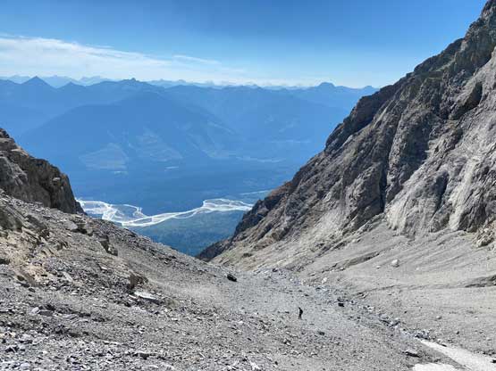


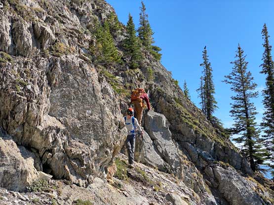
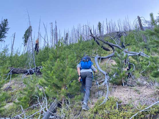
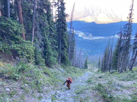
With all the down-climbing behind us we could finally take another break to take off the helmet etc. but the challenge was not over yet. The day was smoking hot and the entire forested ridge was baked under the merciless sun for hours and we must face the heat. I led in front and the other two had to also suffer from breathing in the dust. At least we did great on route-finding in the woods by mostly retracing the route took on the way in. We exited the timbered ridge back into the rocky drainage a little bit sooner than the morning, and this line was a little bit bushier at the bottom. The rest of the return was rather uneventful but the mosquitoes were horrendous. They somehow didn’t get bothered by the sprays so I got quite a few bites. They were even at the parking lot but thankfully I had a bug jacket in the car that surely became handy. Our round trip time was 13.5 hours including all stops and detours. We definitely didn’t repeat Sonny and Grant’s 24-hour epic but we were also not as fast as Devan Peterson’s 8.5 hour run. In the end I think our pace was reasonably fast especially considering all the errors we made on the slabs. I won’t go into the debate as whether this peak is a “scramble” or not as I’m into that. The conclusion of my hypothesis? I think South Goodsir has complicated terrain at least two times longer with more exposure and much worse rock quality, but the lines we took on Chancellor on both ascent and descent were more technically difficult. Had we stayed on the easiest path, this peak would’ve been much easier but can you find the easiest path that’s the main question. After being up there myself I still can’t say if I go back (which I’ll never) I can definitely find the correct path… I was also mentally drained and physically exhausted after these two days of hard work so spent the next day driving leisurely back home.