Fu Shan 浮山
April 3, 2018
368m
Qingdao / Shandong Province, China
Fu Shan is the tallest peak within the city limit of Qingdao on the east coastline of China. The whole mountain locates within a national forest so despite the close proximity to a large urban area, much of the hill is still relatively “wild”. The highest peak (among 8 or 9) is the second peak from east end. I spent at least a couple hours researching the routes but couldn’t find a lot of detailed, useful information but I did get a rough idea. From my hotel near the railway station I had to take a bus ride (501) to Hai’an Rd. and this whole process took about an hour.
After getting off the bus I walked for about 1 km along Hai’an Road and then Meiling W. Road. The “trail-head” is behind Hailin Hotel and I did manage to find it except I had to hop over a fence to access it, but that’s OK. The first part of this trail follows a secondary road and soon enough it became gravel and then the road disappeared. It’s nearly impossible to tell where exactly that trail went so I just bailed into the forest. At least the forest travel was open enough that I didn’t need to bushwhack. The trail re-appeared higher up on a flank but soon disappeared again. I found a shallow gulch/gully feature and used to break a minor rock band higher up and then I was directly underneath the eastern sub-summit. There’s some scrambling and then I picked up a trail traversing to the col between first and second peak.
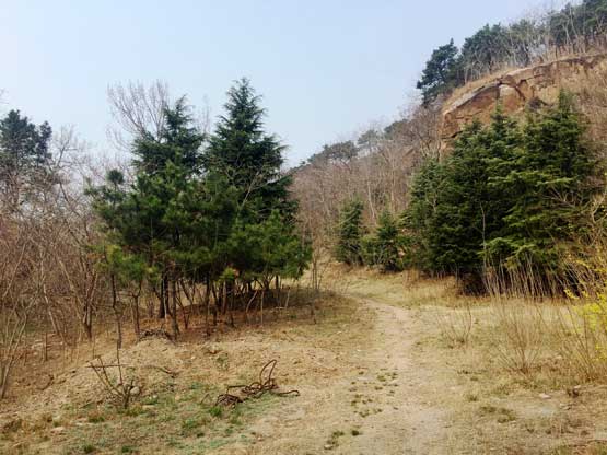
This is the start of this hike. I’m still not sure whether or not I was on route.
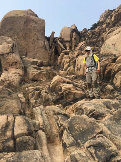
Partway up, looking ahead. I did some cross country travel here.

Looking back reveals part of the Qingdao city

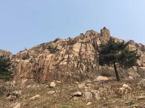
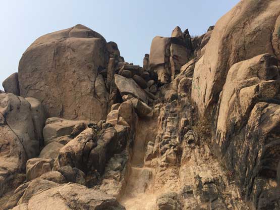
I found this gully and went straight up here

Above the gully, looking down. It worked out perfectly

Lots and lots of granite here

Traversing towards the col. True summit in view.
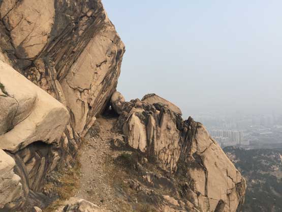
The ascent of the east ridge of true (second) peak involves lots of Class 2 and sometimes Class 3 scrambling on granite. I really liked the wilderness feeling of this little peak. Unlike the previous two peaks I did in China this one has no concrete staircase nor hordes of tourists. I only met two other hikers on the mountain and that tells something.. The summit offers some view of Qingdao city but the dense industrial smog obscured any distant view.
Zig-zagging my way up the east ridge of main summit

Lots of Class 2 scrambling on good granite. Super fun.

Almost there.

Summit Panorama from Fu Shan. Click to view large size.
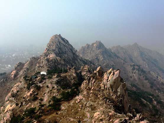
Other summits of the massif. The one in foreground is only a couple meters lower
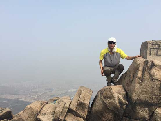
Me on the summit of Fu Shan

“Summit Selfie”…
Descending from the main summit was quite fun and then I had a quick chat with the two other hikers. They turned out to be the locals living right underneath the peak. They gave me some directions but being totally unfamiliar with the area I decided to just retrace the way I came up from. There’s some scrambling and a bit of bushwhacking but at least I knew exactly what to expect. The descent was quite fast overall.
Time to head down.

The other group grabbed a shot of me scrambling.
Another shot of me on the route.

One last view of the peak. Time to head down quickly to catch a bus ride.
In the end the hike took longer than expected but I did manage to get onto a 501 bus ride back to the hotel. I arrived at around 11:30 am, had a quick shower and then checked out. I had about half an hour to have lunch and then got onto the 12:30 bus ride to the airport. The trip continued for another 5 days but there’s no more hiking.
