Mount Caubvick (Mont D’Iberville)
June 14 – July 5, 2019
1652m
Nunavik / Torngat Mountains, NL/QC
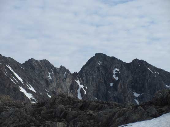
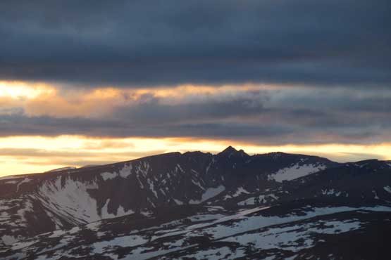
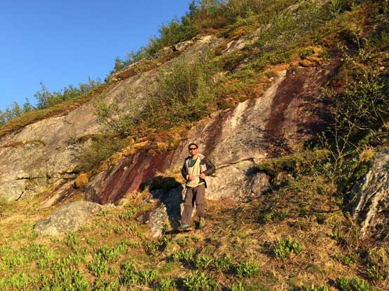
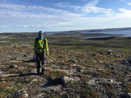
The highest summit in the Torngat Mountains east of Ungava Bay on the border between the provinces of Quebec and Newfoundland and Labrador is the highest peak east of Canadian Rockies on the mainland of Canada and despite the “low elevation” this peak also ranks #1 on the isolation list of Canada. The closest higher summit is over 700 km away and there’s no such comparison anywhere in this country. This peak is known as “Mt. Caubvick” in Newfoundland and Labrador and “Mt. D’Iberville” in Quebec. There’s some history regarding the names but I’m not going in depth here. For those of you interested in knowing a bit more about why this peak shares two separate names Greg Slayden has an in-depth write-up on his site. In any case, this is the highest summit of both QC and NL, extremely remote, difficult and very expensive to access. Most of the peaks in Torngat Mountains are walk-ups but such is not the case for the highest. The easiest route, Koroc Ridge involves exposed 3rd-4th class ridge scrambling with a crux step of 5.6, and adding to that, there is no zone of prolonged good weather at 60 degree N latitude making this one of the six major peaks in the extremely difficult but fabled “Canadian Provinces and Territory High Points” list. Months of preparation with logistics, 2-week expedition, a lot of money and a variety of skills are required no matter what.
A few months ago in April I received an email from Eric Gilbertson looking for partner(s) to join on potentially his last expedition to finish the “Canadian Provinces and Territory High Points” list. Only 4 people had managed to achieve such feat in history and if he could get Mt. Columbia in May (he did) then Eric would be the 5th completer. Eric’s plan was to take a chattered flight to the upper Koroc landing strip, have 5 days of window to climb Mt. Caubvick and then spend 8 days paddling 165 km down Koroc River on packrafts to be picked up by a boat. As ambitious as this seemed I was hesitating about the paddling section as well as the overall cost of this expedition. The only padding experience I had before this trip was an hour of canoeing on Lake Louise. I had never done anything worth noting on water but Eric convinced me there’s little “skills or experience” needed for packrafting. Eric pointed me an option to rent a packraft at about 50 dollars a day but I decided on purchasing in the end. I’m one person that hates the idea of renting for literally anything and in this case, having a packraft would greatly simplify a ton of ambitious ideas of mine so the decision was easy. A total of over 2500 dollars was then spent ordering an Alpacka Classic with removable whitewater deck and cargo fly, a dry suit, the dry bags, paddle (Manta Ray Hybrid), life jacket, river shoe and neoprene gloves and socks. I had very little idea about the comparison among brands and models so I played the laziness game here. The information online was too overwhelming to research and I basically ordered what exactly Eric owned and that’s it.
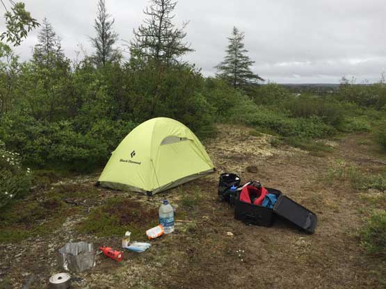
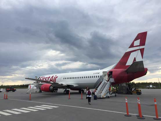
If you think spending 2500 dollars on the full set of packrafting equipment is expensive then you’re wrong. The most expensive leg of this expedition is the First Air flight from Montreal to the inuit village of Kuujjuaq and back at a round trip cost of 2800 dollars plus over 200 dollars of taxes. This was my major hesitation… To help me making the final decision to join the expedition Eric sacrificed his Aeroplan Miles and bought me a free round trip ticket but that’s not without hassle. First Air only reserves two seats per flight for Aeroplan Miles and that pretty much meant only two people per day can take advantage of that. The sacrifice I made was to arrive three days earlier than the scheduled chattered flight and depart four days later than the boat pick-up making a total of 7 days to kill in the villages of Kuujjuaq and/or Kangiqsualujjuaq. There’s literally nothing to do in those villages – no tourism, no cell phone signal, wifi only in the airport and ridiculously expensive food/grocery. The cost for one room in the local hotels is about 250 dollars and I’m not joking. It’s an easy decision for me to bring backcountry food for the entire period and sleep in nowhere but my own tent even when killing time in the villages, making this a full-on 20-day expedition. The longest trip I’ve done prior to Mt. Caubvick was around 8 to 9 days – Lizzie Creek Cabin ski trip in December 2015 and Tsar Mountain heli camp in August 2018, so the length of this trip was also a new challenge for me. As time came closer we had 5 of us in the team, Eric from Seattle, me from Vancouver and three more that Eric found from MIT Outing Club – Patrick Lam from Ontario, Yeuhi Abe from Boston and Christina Chen also from Boston but is moving to California. Everyone else except for me would have to purchase at least the return flight from Kuujjuaq to Montreal (1400 dollars + taxes).
The cost section is not over yet. The entire hike/climb/paddle would be done in a national park so there’s a ton of unavoidable money grabs. I normally do not give a shit about those when dirt-bagging in the Rockies but on this trip we could not avoid paying for camping and backcountry permits because we would use the park’s chattered flight as well as the boat pick-up. The chattered flight is 500 dollars per person and the boat pick-up is 400 dollars splitting among the group. The total cash donate to the Nunavik park was about 850 dollars per person. I had no complaint about this because this was already considered “minor” comparing to the gears and/or the First Air flights. There’s also an option to arrange our own flight from Kuujjuaq to the upper Koroc River but such a private plane ride would cost over 7000 dollars so we didn’t even bother to consider. It’s worth noting that years ago there’s no oppourtunity to take park’s chattered flights so the groups would have to pay for their own bush planes as well. There’s a risk of policy change in the future jacking up the cost of Mt. Caubvick but I’m hoping such will not happen. The cost discussion is still not over yet. We all had to purchase the ticket from Kangiqsualujjuaq to Kuujjuaq with Air Inuit (~250 dollars), as well as the travelling to/from Montreal. The flights from Vancouver to Montreal was about 550 dollars but another 100 dollars was donated because I needed two checked bags… On top of that I spent at least 1500 dollars purchasing a brand new 105 L backpack, a brand new MSR XGK white gas stove with fuel canister, a brand new pair of trekking poles that can be broken down into three pieces (to fit inside my checked bags), two Ursacks XL for bear protection, a brand new 150 L North Face duffle bag and of course, the 20 days of food. And finally, don’t forget about the oppourtunity cost because 20 days is not a short period of time. Expeditions like this are no dirt-bagging. Your choice.
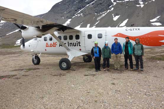
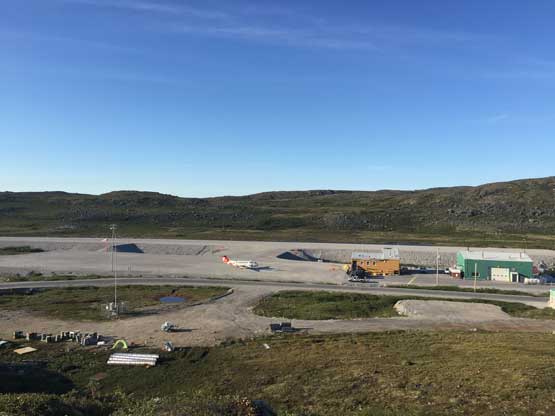
My expedition started on June 14 after finishing this semester’s work. I parked my Tacoma in my parents’ house then they drove me to the airport in the afternoon. Right away there came the first unexpected mishap. Patrick had warned me that sometimes it’s hard to get the stoves and fuel bottles through the security check points and sure it was. My fuel bottle was taken out even after explaining (and showing) there’s nothing but air inside the bottle. My parents had left and they don’t use cell phones for communication so I had to throw the brand new fuel bottle into a garbage bin, another 30 dollars donated… The flight from Vancouver to Montreal was uneventful and I arrived at just after midnight. My Montreal-Kuujjuaq flight would be 10 am in the morning and I had about 9 hours to kill. Most people would find a (somewhat) quiet corner to catch a few hours of sleep but such was not my decision. I spontaneously opened the peakbagger’s app and immediately noticed a few red dots on the map and sure there was Mt. Royal right next to the downtown. I spent at least an hour researching on how to get there by bus and then waited until 4 am to make my final decision. I donated 20 dollars to the airport’s locker and went for Mt. Royal in mostly cloudy skies with some light drizzle. The hike and exploring of downtown is written in a separate trip report because Mt. Royal is a distinct summit. I got some good views of the downtown Montreal and then got back to the airport at around 7 am. The check-in with First Air went without event but the flight was delayed by about an hour. And then another 2 hours later I arrived in Kuujjuaq airport. There’s no cell services, but I did discover there’s at least (very slow) wifi and drinking water in the airport.
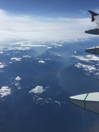
Familiar BC Cascades from plane ride Vancouver-Montreal
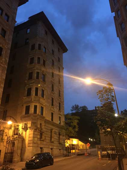
Exploring the downtown Montreal at dawn

Downtown Montreal from Mt. Royal
I went to Air Inuit and talked to Michel for storing my duffle bags as well as the others’ after their arrivals as planned. Michel was a nice guy and offered us to store the bags in his office and then gave me a truck ride to a local beach on Koksoak River. My original plan was to camp right next to the river but the water looked dirty and there were all kinds of activities including ATVs right on the beach. I quickly abandoned the idea and a local camper nicely offered me a free ride back past the airport into the town. She dropped me right next to the water treatment plant and I decided to camp right next to it. By this point I’d already talked to quite a few locals and it seemed like random camping in Kuujjuaq is no problem. Camping right next to the water pump meant I would have the easiest access to drinking water so why not. I did underestimate the traffic around the water pump and the sleep was not very good, so the next day I packed up everything and walked ~2 km back to the airport. Eric and Patrick arrived at noon and we opted to find another spot to camp and the decision was to not go far from the airport. We found a pretty sheltered spot and settled for the next few days. At this point I was deprived from sleep in the past several days so all I wanted was to go into my tent and sleep. Eric and Patrick went to hike 10+ km to a local maximum point and went back at dinner time. That evening I got to learn to operate my brand new white gas stove for the first time. It sure wasn’t as easy as playing with a MSR Reactor but on remote places like we couldn’t count on there’s fuel canisters to buy.

Michel dropped me at the beach by Koksoak River
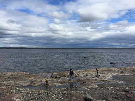
The beach at Koksoak River wasn’t as clean as I thought
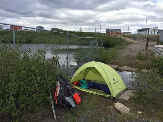
I moved camp to right beside the water pump. Not the greatest spot neither
There’s a small lake beside my tent that Kuujjuaq pumps water from
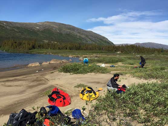
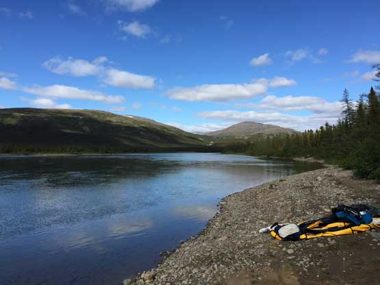
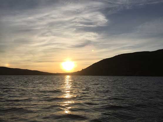
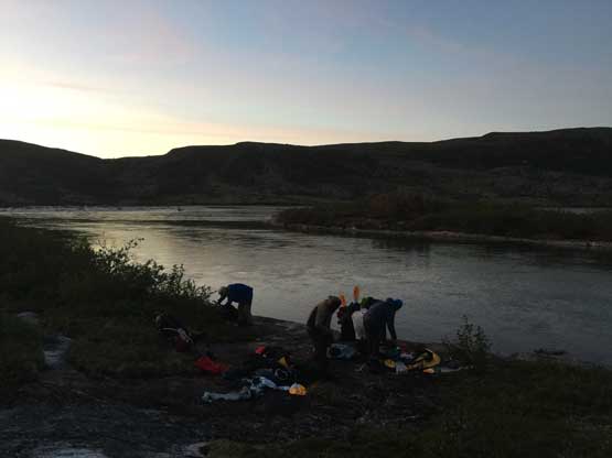
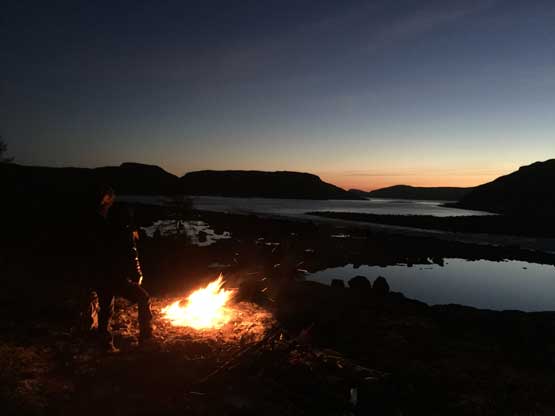
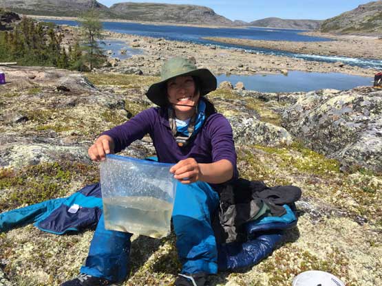
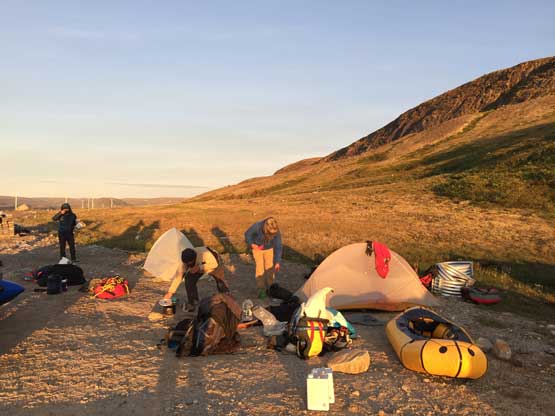
In the morning of June 17th we went back into the airport to welcome Yeuhi (10:30 am) and then Christina (12:30 pm). We spent the next three hours or so sorting the gears and food out and stored whatever that we didn’t need in Michel’s office. The rain finally arrived and dumped pretty hard for a while. The five of us then walked into the town to talk to the park’s rangers and to pay the fees. Nothing as surprising except for a polar bear warning near Ungava Bay that on the last camp before the boat pick-up we would have to stay up all night and make a big bonfire. The weather forecast for this north in the country is shit as expected. They couldn’t even tell the current weather so there’s little we could do other than letting the story unfold itself one day at a time. None of the models on spotwx.com nor windy.com was hopeful that we could indeed get a window for our summit attempt. That evening we opted to have a proper dinner in a local restaurant. The cost in Kuujjuaq is not nearly as bad as Kangiqsualujjuaq. It’s about 1.2-1.5 times the living expenses in Vancouver so totally affordable. None of us wanted to pay that 250 dollars hotel room though (even splitting among the five of us) so we all went back to camp. Eric, Yeuhi and I then went down to the shore of Koksoak River to test my packraft out. All river gears of mine were brand new so at least we wanted to make sure they worked.. Right away I learnt that paddling wasn’t as easy as I thought. That night rain came again and the morning of the 18th was soggy. Eric had doubt that we might not be able to fly to the upper Koroc at all on this day but to our great surprise, the flight was only delayed for an hour. They managed to fly us in even in the marginal weather.
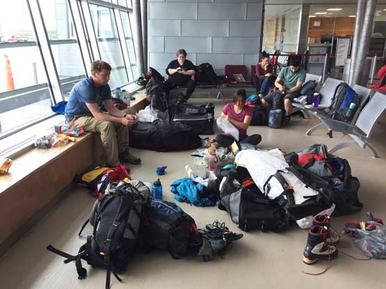
You know it’s an expedition when you have to spend hours sorting gears at airport
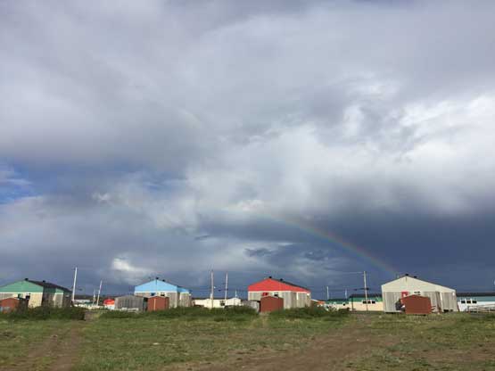
A major dump passed by and we got to see a neat rainbow over Kuujjuaq
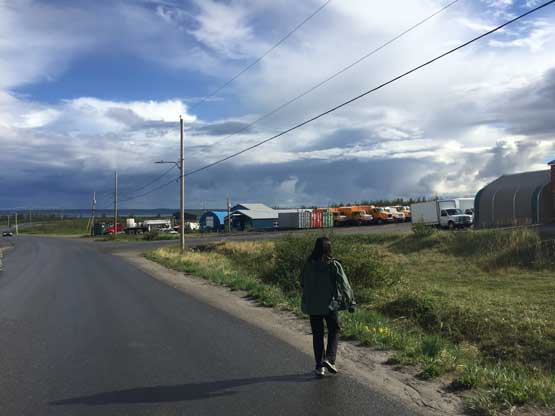
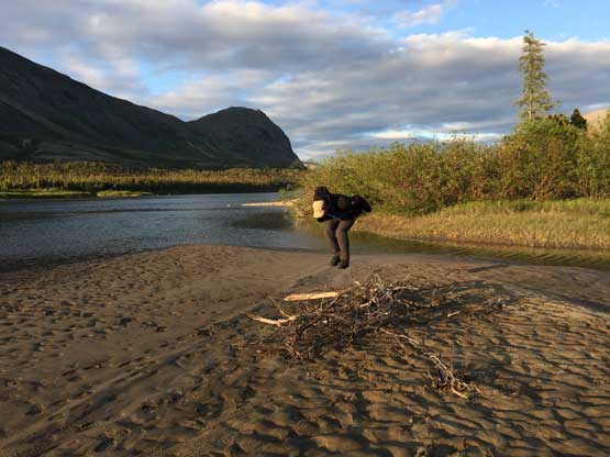
Christina exploring the village of Kuujjuaq

Back to the camp. Photo by Yuehi A.

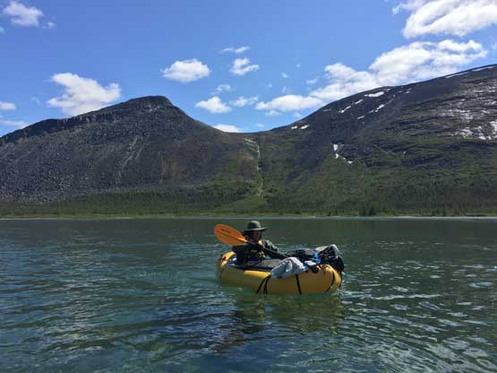
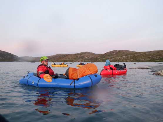
Yeuhi and I paddling on Koksoak River. Photo by Eric G.

Back to the airport on the morning of June 18th
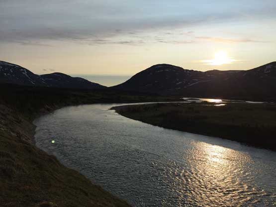
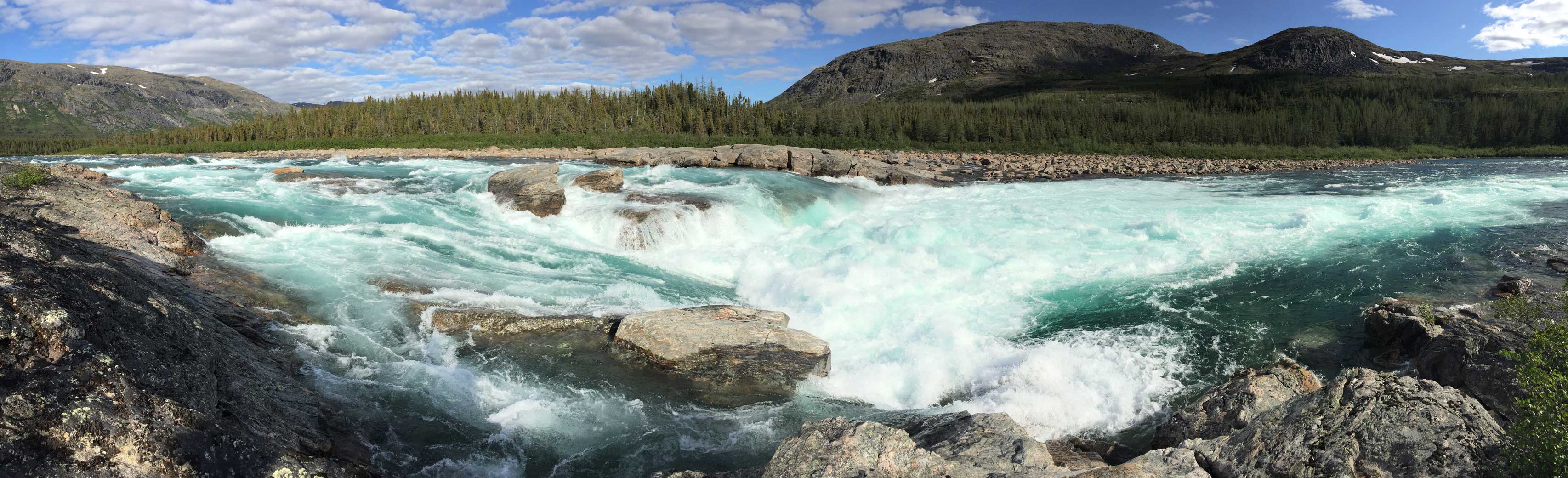
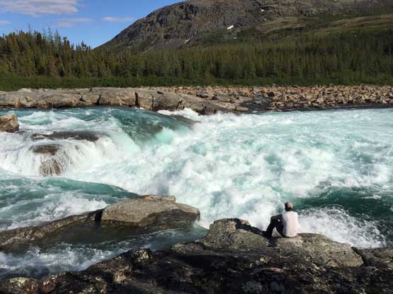
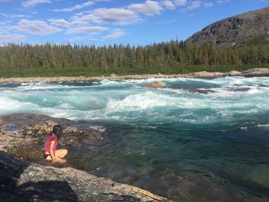
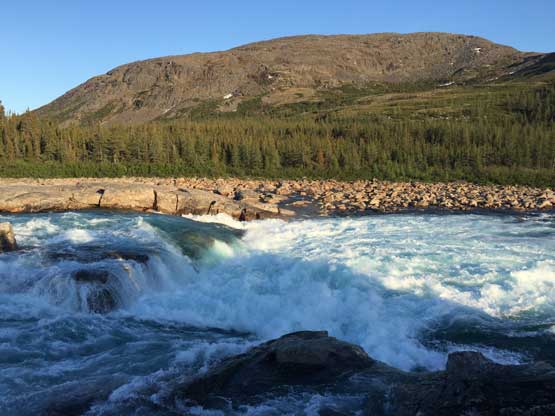
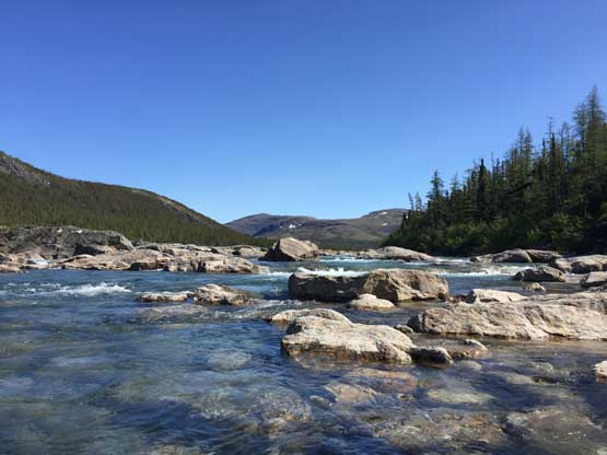
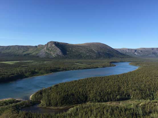
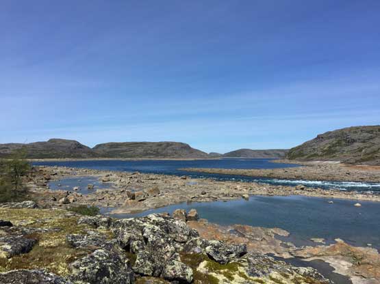
A few hours later we landed on the upper Koroc .

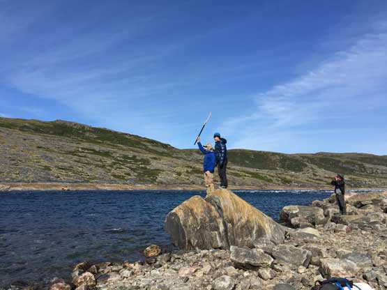
Ascent routes for Mt. Caubvick and Mt. Barnes-Pauze. GPX DL
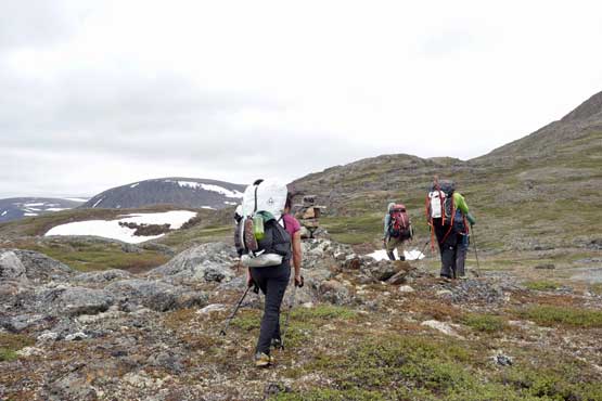
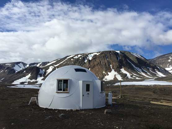
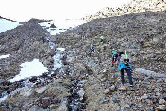
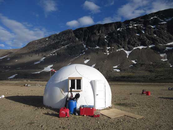
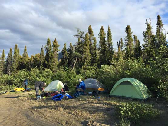
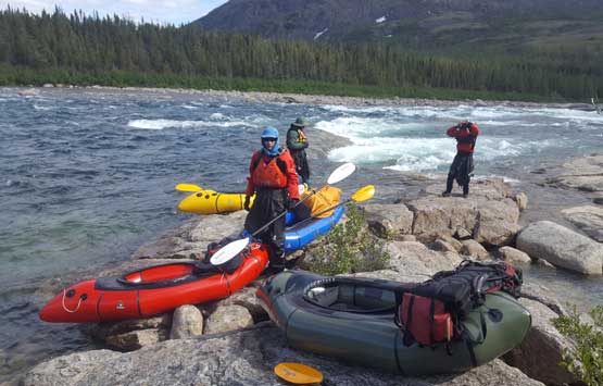
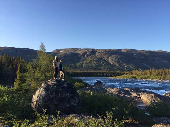
There were two big “igloos” at the landing strip that we used to store our gears. It appeared that the bears had tried hard to get into the igloos (broken windows etc.) but at least the structure was still in one piece. We spent about an hour sorting the gears and then loaded 5 days of food and supplies. From the landing strip to Mt. Caubvick’s basecamp was 13 km of trudge with about 500 m elevation gain but the reality was harder than the stats. We didn’t have very detailed beta so first of all we picked a bad spot to wade across Koroc River and then had to wallow through 2 km of brushes before picking up the trail. It’s hard to get lost given the abundance of cairns but the trail was more like a marked path and the travel was more difficult than hiking on an actual trail. The upside was the clearing weather. By the time we made to the basecamp at mid afternoon Eric and I was talking about to make the ascent right now (through the night) instead of waiting for the second day and to my surprise we did not have to persuade others by much. It seemed like we were going to have a window and we couldn’t afford missing it especially given how shitty the weather forecast was.
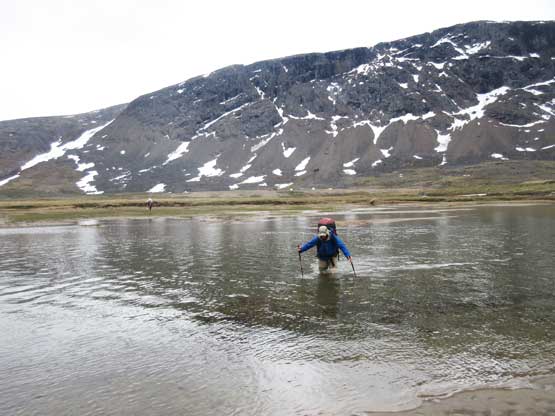
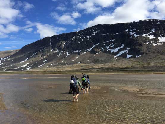
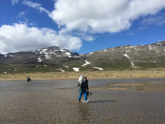
Eric fording the upper Koroc River near the landing strip
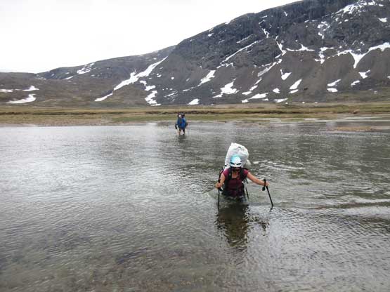
Christina fording the waist-deep river

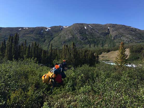
Off-route bushwhacking. We missed the trail
After a long while we rejoined the trail
Upwards and onward into the approach valley. Photo by Yeuhi A.

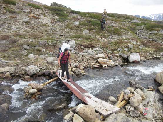
Patrick boulder-hopping across one of the many streams
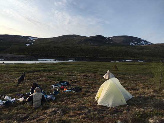
More igloos at Mt. Caubvick’s basecamp
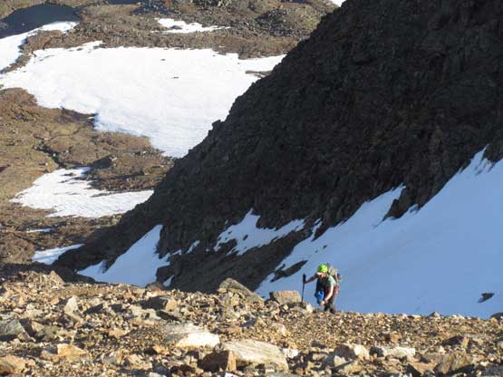
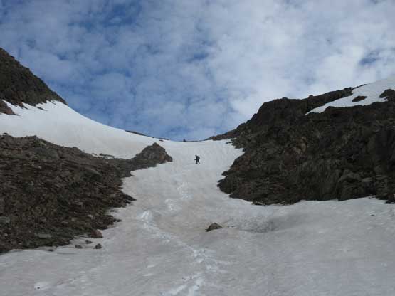
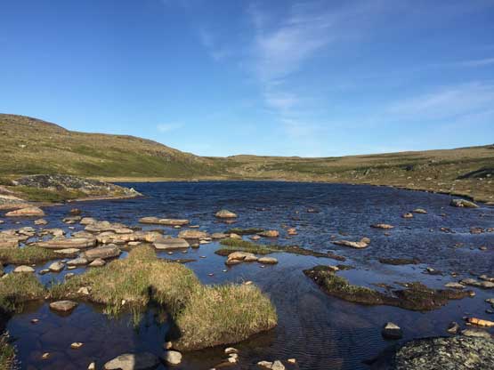
Our strategy was to go light-and-fast so that even though we were expecting a bivouac at some point we would not haul overnight gears. The dark time was only 2 hours long at this latitude. From the basecamp there was still fair amount of cross-country travel on open terrain and our aim was an obvious snow gully which would then be used to gain Koroc Ridge. There was a neat water source before, and in the gully to load up our water supplies. Once in the gully we decided to scramble on rock instead of using the snow to avoid unnecessary gear transitions. The shittest section was from the top of the gully to the proper Koroc Ridge – steep and loose talus. Once gaining the proper Koroc Ridge the travel became easy again but the sun came down not far from the “hiker’s summit”.

Time to go. Stoked.
A zoomed-in shot of “TG7” that Eric and I hiked later in this trip
Christina, Patrick and Yeuhi crossing the first patch of snow
Scrambling a gully to gain Koroc Ridge. Photo by Yeuhi A.
Yeuhi topping out above the gully
Yeuhi scrambling the shitty terrain to gain Koroc Ridge
Almost onto the Koroc Ridge proper. The terrain here was very foreshortened

Eric plodding on Koroc Ridge
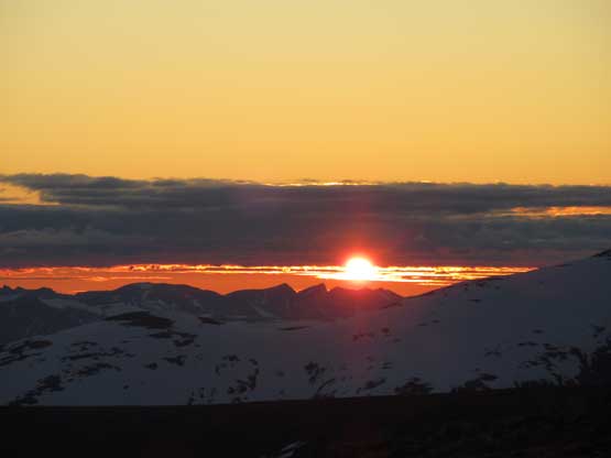
It’s sunset time…

Eric and Yeuhi on the upper Koroc Ridge with the evening horizon behind
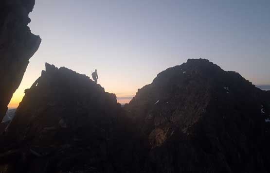
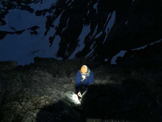
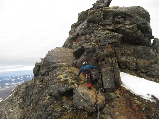
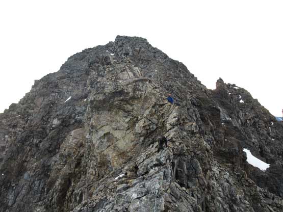
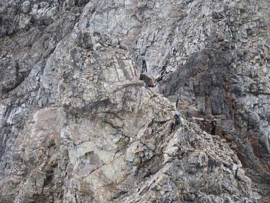
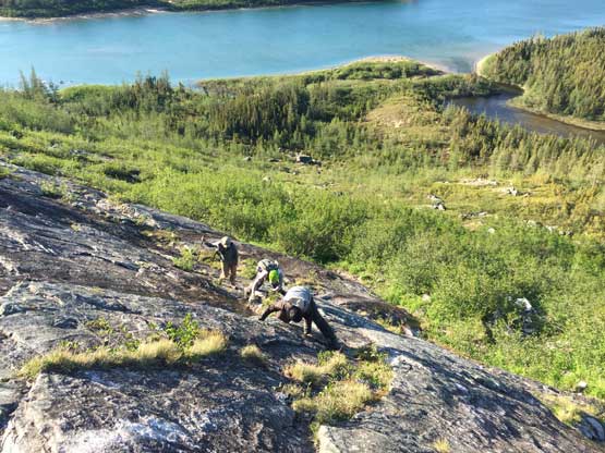
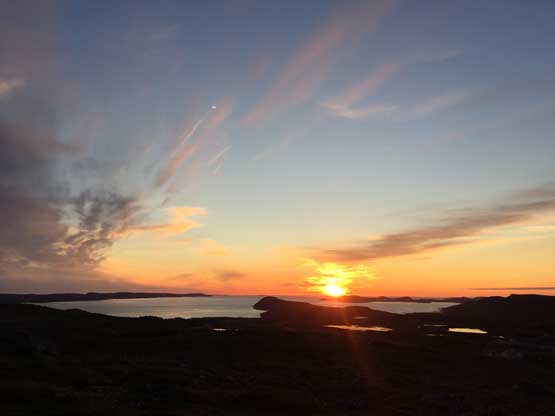
There’s an emergency shelter on the hiker’s summit that we didn’t bother to use. The inside of the shelter looked very dirty. We pressed on with me leading in front on the increasingly exposed 3rd class terrain. After traversing over a few towers the terrain became more mountaineering than scrambling. The terrain was still no harder than “3rd class” by BC standard but the exposure was deadly on both sides and the rock quality was not the greatest neither. At this point Eric decided to short rope Patrick, Christina and Yeuhi while I kept soloing in front to scout out the route. It turned out that the entire climb was bolted by the guides so we hauled our trad gears for no use. There were a few 4th class spots before the infamous Koroc Step rappel, and not to our surprise the rappelling station was also bolted. One 30 m rope was enough to get us down the vertical 5.6 wall and then there came the final summit push. It was dark enough that we all had to take the headlamps out and I again, soloed in front on the 3rd – 4th class terrain without a problem. There were still bolts here and there and my objective was to locate all of the bolts and I think I did the job fine. Not too long after starting the summit we all arrived on the summit, at 11:45 pm. It was chilly but not windy so with only 2 hours till sunrise we decided to shiver through the night on the summit for better views at sunrise. I was the only one bringing an onesie (which came with the drysuit) and as a result I was the only one not shivering. The wait was worthwhile and the sunrise from the highest summit in eastern Canada was one spectacular moment that we’ll all remember forever.

The emergency shelter on the “hiker’s summit”
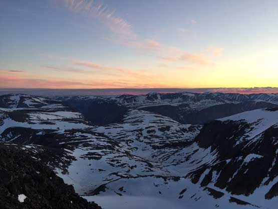
Looking west from the “hiker’s summit”

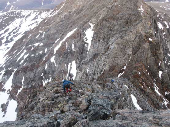
The scrambling began as soon as we passed the hiker’s summit
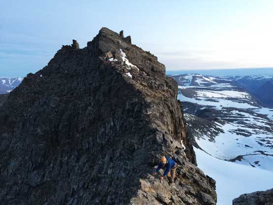
It soon become exposed so we roped up. Eric leading Christina here
Me on Koroc Ridge. Photo by Eric G.

Passed the Koroc Step rappel now. Looking back.
Eric continuing climbing the final summit block in dark.
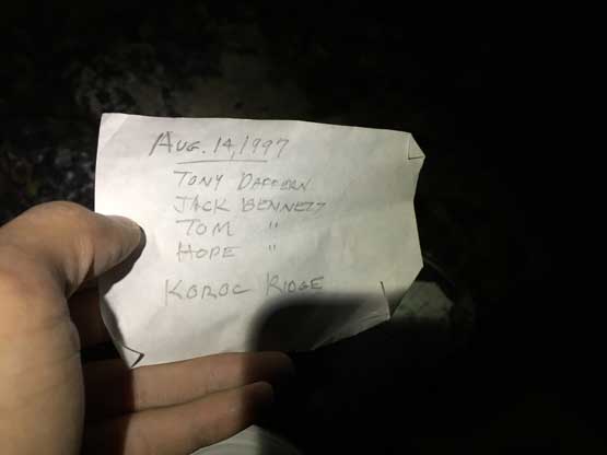
Familiar names from the summit register.
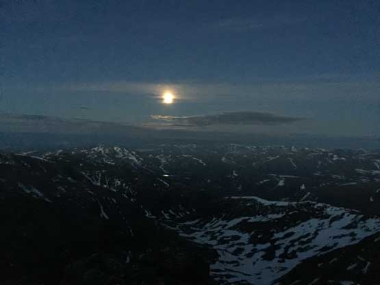
A full moon on the horizon over Labrador Sea
A frozen lake to the north of the peak. You won’t see this unless you make the summit
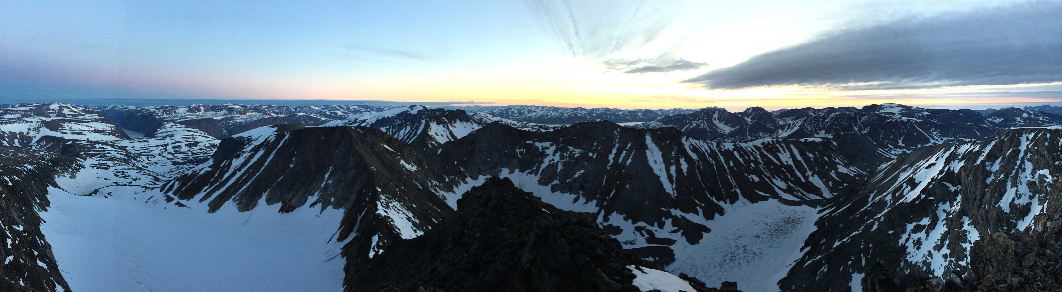
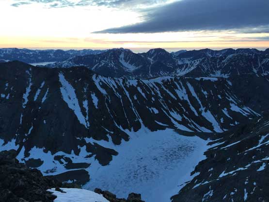
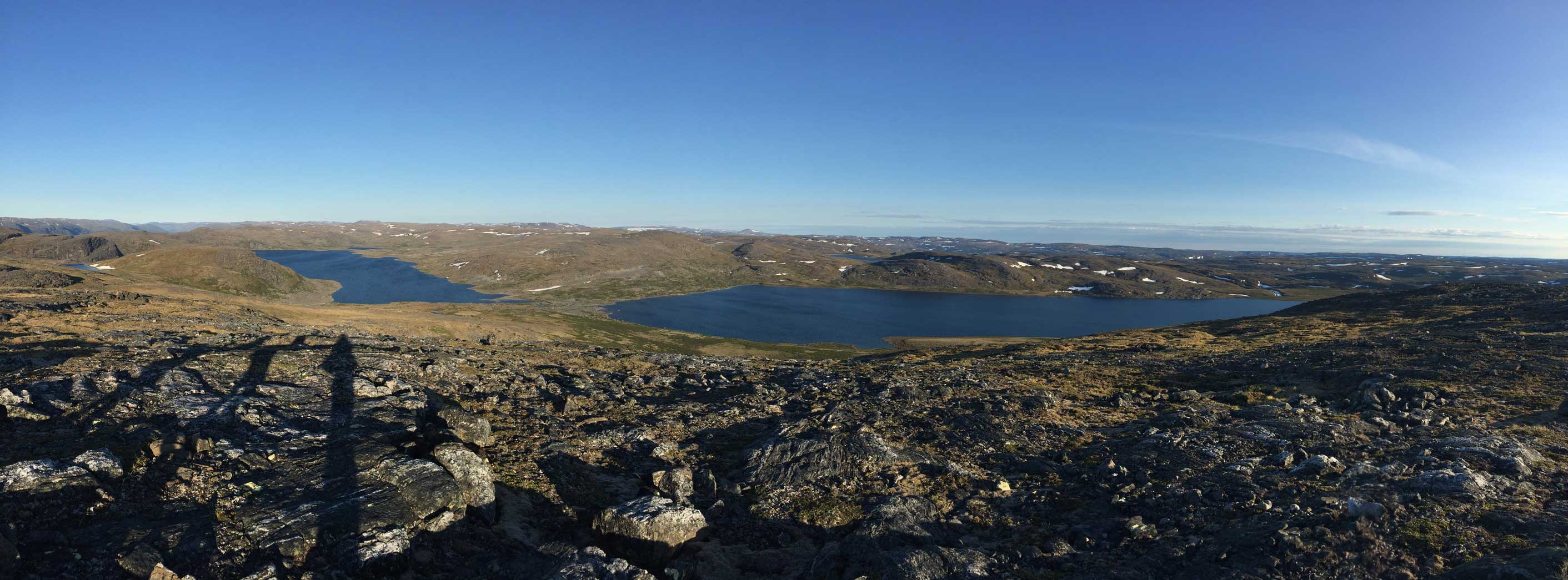
Partial Summit Panorama from Mt. Caubvick. Click to view large size.
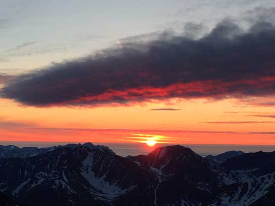
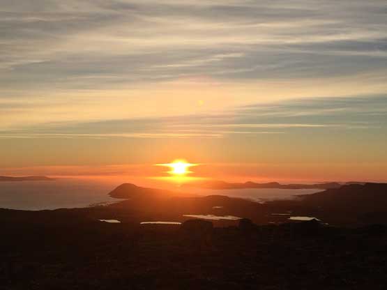
Gorgeous sunrise from the summit
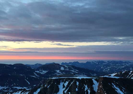
Morning horizon over the Labrador Sea which was covered in low clouds
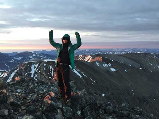
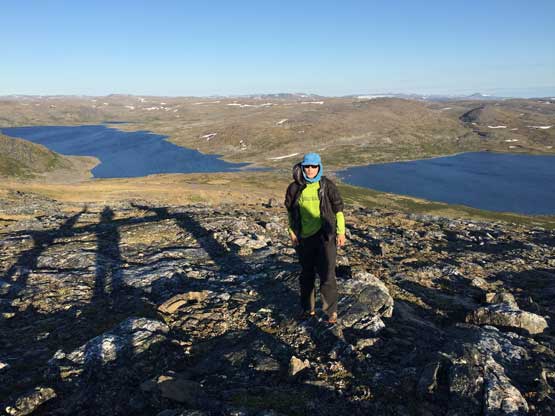
Me on the summit of Mt. Caubvick (Mt. D’Iberville)
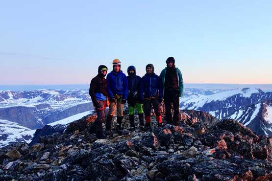
Our group shot on the summit of Mt. Caubvick. Photo by Yeuhi A.

Just another shot of the sunrise
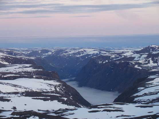
Deep fjords covered in low clouds
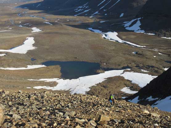
After admiring the sunrise views (at 3 am) it’s time to get off this mountain. I was thinking about just solo down-climbing the route but since everyone else decided to short rope I decided to play safe here. I needed to gain some experience on short-roping anyway as this is not a technique that I often use. The top-rope climb of Koroc Step was fun but I think the 5.6 grade was overrated. There were positive holds everywhere and the rock was very solid. The rest of the traverse back towards the hiker’s summit was enjoyable but then the descent off the lower Koroc Ridge was no fun. Thankfully I managed to spot a snow route that bypassed that shittiest pile of talus and that surely saved some time. The all-nighter push certainly got us at this point and I felt completely lack of energy. It had taken us almost 20 hours for the summit push that once back to camp all I did was cooking/eating a delayed dinner and sleeping. Eric was still very motivated and went for Mt. Cartwright and “Cartwright South” solo. I think this was the first time in history that I opted to bail a summit and wait at camp but Eric is the strongest climber that I’ve ever hiked with so I don’t feel bad.

Time to head down
Yeuhi descending the exposed 3rd class terrain off the summit

Ahead is the Koroc Step

Patrick climbing up a short step before the technical crux
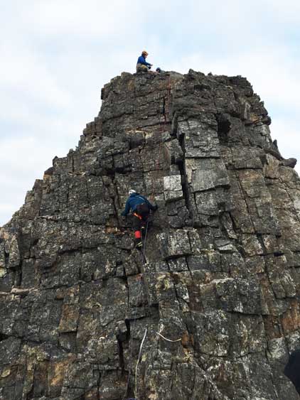
Patrick climbing the 5.6 Koroc Step
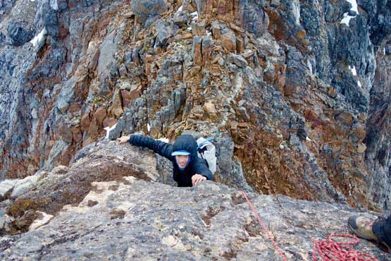
Me topping out on the 5.6 Koroc Step. Photo by Yeuhi A.
Patrick leading back across an awkward 4th class corner
Looking back at Christina and Eric negotiating the exposed ridge
Christina on another awkward spot
A review shot of the summit of Mt. Caubvick (Mt. D’Iberville)

Me picking a snow line to descend. Photo by Eric G.
Patrick and Yeuhi followed me descending on snow.

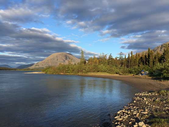
One of the few black bears we saw on the trip. This one was close to basecamp
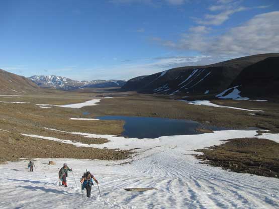
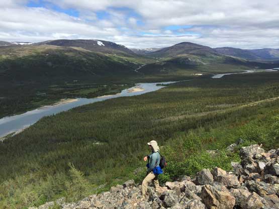
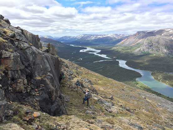
On the 20th we decided to explore the summits west of the basecamp and the plan was to bag the unofficially named Mt. Barnes-Pauze the second highest summit in Quebec. This was an ambitious day with about 28 km distance and 2000 m cumulative elevation gain all on talus, snow or moss. The trip report is written on a separate page.

Me on one of the unnamed summits with Mt. Caubvick behind
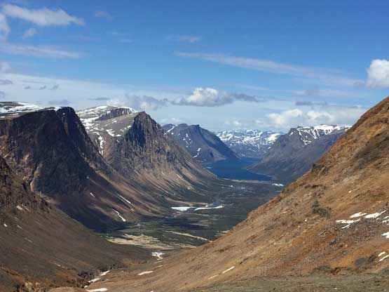
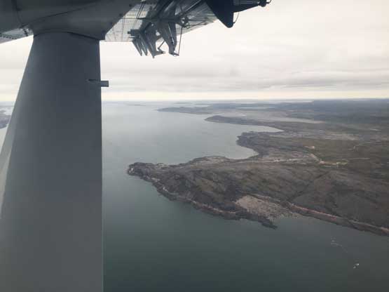
Palmer River and Tallek Arm into Nackvak Fjord in Labrador

Me on the summit of Mt. Barnes-Pauze
Eric, Patrick, Yeuhi and I made back to camp at 11 pm after dark and found Christina was no longer at camp. Christina had turned around early in the day and there’s no sign indicating that she had ever been back at camp. The inuit park rangers had flown off the peak (we saw a helicopter came in the AM) so no one knew what exactly happened. The four of us then spent the rest of the night searching the valley but with no luck. Eventually after a sleepless night, at around 9 am or so on July 21st Eric got an inReach message from his brother that Christina was at the landing strip ready to hike back up the valley towards us. The four of us was very confused but we soon packed up and started the hike-out. The hike was very boring and tedious that I did not enjoy it. Eventually at about 4 km from the landing strip we came across with Christina and Rendal (the park’s ranger) hiking up. It turned out that she had ascended one of the unnamed peaks nearby but got lost on the descent. Now with Rendal leading the way we followed the trail/path to a much shallower crossing spot to ford the Koroc River and then hiked the remaining 1.5 km or so back to the landing strip.
We paid close attention to not miss the trail on the return.

Randal and Nunavik Parks ranger led the way
Yeuhi and Patrick starting the ford
Christina fording Koroc River. This spot was much better
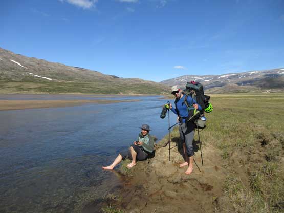
Finishing the ford
Back to the landing strip now.
The rest of the evening was supposed to be recovering from the all-nighter search but Eric and I decided against that. The summit south of the landing strip is the 7th highest in Torngat Mountains with over 700 m prominence so the fever kicked in and we opted for more punishment. The scramble was longer than I thought and the mosquitoes were brutal but the views were spectacular. The ascent of “TG7” is also written in a separate trip report.
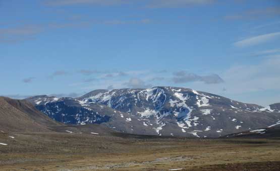
The massif of Mt. Caubvick from the summit of “TG7”.
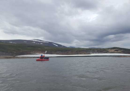
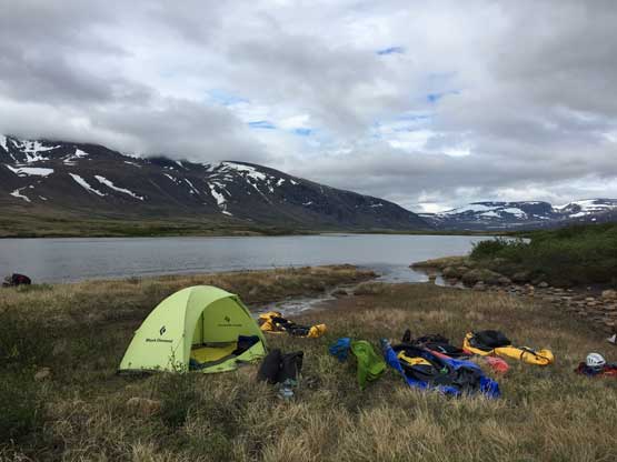
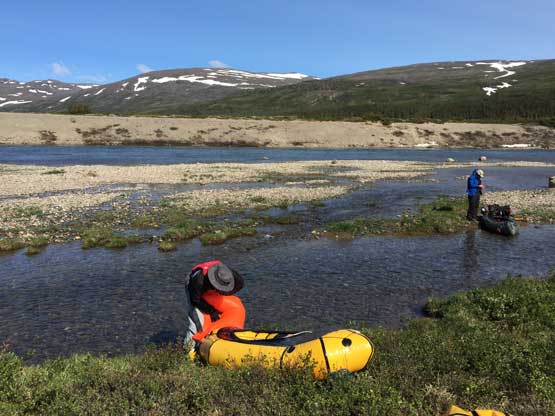
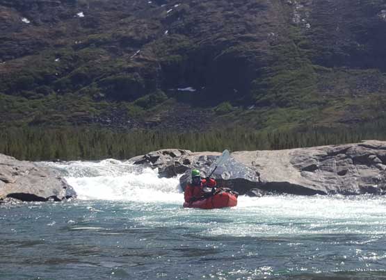
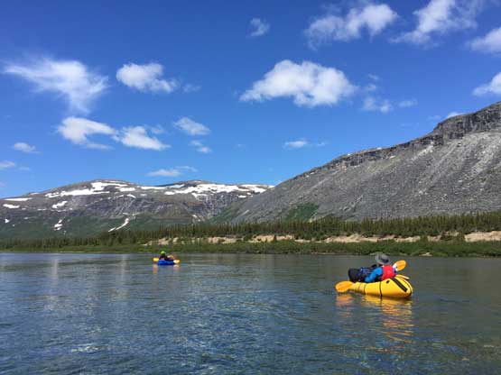
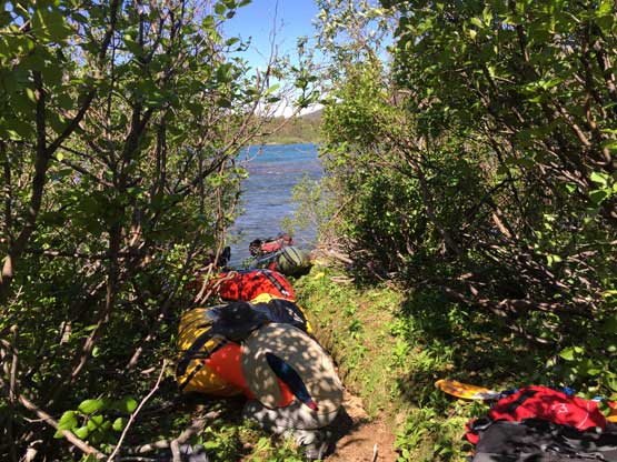
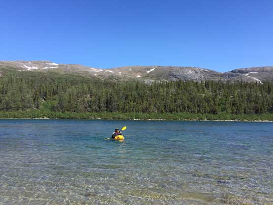
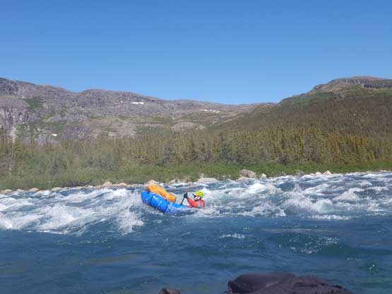
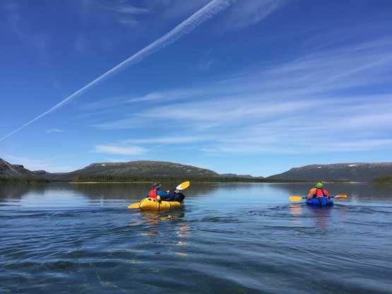
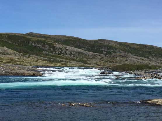
Thank to the better-than-forecasted weather we had completed the hiking and climbing with two bonus summits one day earlier than planned and considering the lack of experience in paddling I voted to start the descent one day earlier. Everyone agreed. Right off the bat in the morning we had to face the “portage zero” to move everything from the landing strip to the shore of Koroc River. A total of 9 days of food, a full packraft set and a shit ton of load other equipment was sure heavy to haul. I’m sure this was the heaviest backpack I’ve ever carried but it wasn’t as bad as I thought. I was not fast on the “river shore transition” to put shits in dry bags, inflate the boat, strap the backpack to the bow and put on dry suit and etc. but considering this was my first time ever doing this I’m just glad I didn’t need too much of extra help. About an hour into the paddle the rain came and that soon became the theme of this day – rain, windy and cold. I regretted for not wearing the onesie inside the drysuit but it’s too late to change and I just needed to suck it up. The first 25 km of Koroc River was great for me to “learn while doing it”. It started from easy floating to EV (easy waves), some Class I and II and finally, two sets of Class II-III rapids. The real challenge was picking a channel deep enough to float as well as negotiating the numerous rock gardens. We had to get out of the boats and haul, for many times. Eventually at KM140 we pulled over and settled for camping, still in rain and cold. Yeuhi and Eric managed to set up a tarp (thanks guys). The rest of the evening was still miserable but at least with the tarp we could cook and eat dinner not in rain. Another upside was the cold and rain had kept the mosquitoes at bay. They were merciless otherwise.

Padding beside some snow/ice banks. Photo by Christina C.
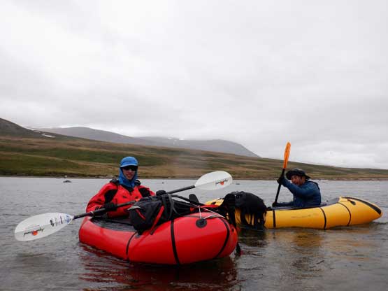
Me and Patrick padding in the rain and coldness. Photo by Christina C.
Me padding the upper Koroc River. Photo by Eric G.
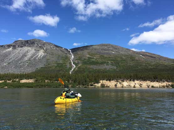
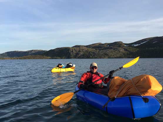
On the 2nd day of the paddling we woke up in cloudy skies but the rain had stopped so we opted to resume the descent. This was the first time that we experienced some head winds but for the most of the time we weren’t affected by the wind. The greatest challenge was still the rock gardens and this time, we had to negotiate rock gardens in some Class II-III rapids and a few spots were quite intimidating but also fun. I was very happy about my performance on the river but it started to look like my boat was leaking somehow. I thought it was the valve or zipper so we put some Tizip and hopefully it would improve on the next day. I had to park and inflate the boat for every hour or so and that was tedious. Especially before big rapids or rock gardens I really had to make sure the boat was fully inflated. On this day we covered about 30 km distance and at this point we were two days ahead of schedule and the trip was about to pass the halfway mark. In the evening Eric hiked a nearby local maximum. I debated about joining but couldn’t find enough motivation so opted to sit out at camp again. I certainly appreciated the extra hours of sleep as my upper body was very sore from the long days of paddling. Meanwhile the new weather forecast was calling for “sunny” in the next week.
Packing up the camp at KM140

More padding in cloudy weather. Photo by Christina C.
Fast forward. Now we were camping at KM109
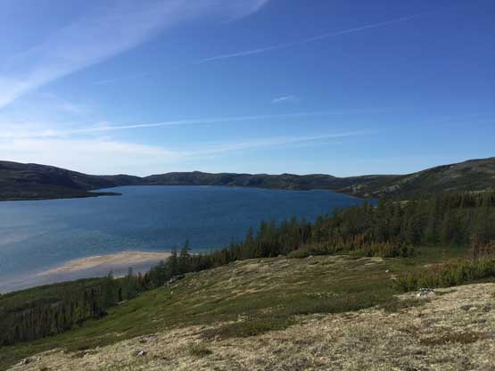
I hiked to a nearby highpoint for some views of the Koroc River. Click to view large size.
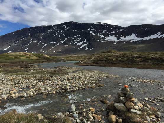
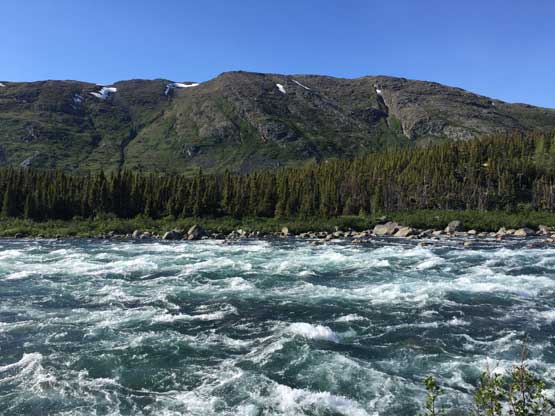
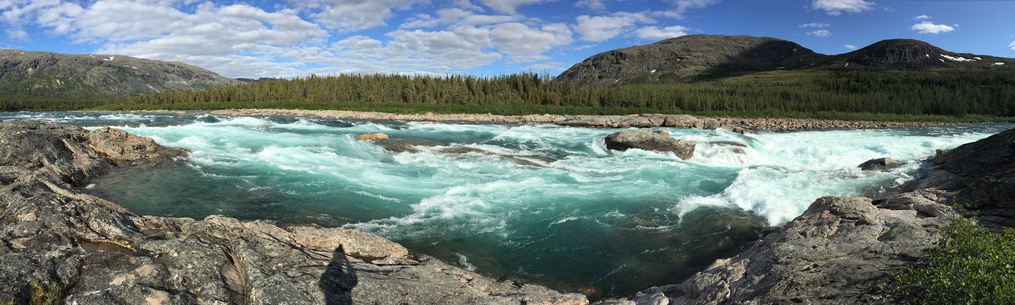
More about Koroc River.
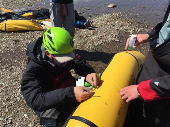
The 3rd day of the paddle we started in some strong head winds down from KM 109 but the wind wasn’t too bad once we actually got onto the river. My boat was still leaking but at least I didn’t have to blow it up too often. There were a few Class II and II-III rapids and the waves were getting bigger and bigger. The waves were intimidating but I thought it’s much easier than negotiating the rock gardens on the upper river. Upon hitting the first of the five portages I discovered a hole on the boat by seeing air bubbling out in the water. The fix was easy and I didn’t have issue with the boat for the rest of this trip. The first portage (bypassing a Class IV section) was the easiest one as we didn’t even need to deflate the boat. With 5 people all we needed was some man hauling.
Inflating the boat on the morning of the 3rd day of paddling
There was another stretch of Class II-III rapid before the second (biggest) portage to bypass Korluktuk Falls at KM 92. At about 2 km before Korluktuk Falls there’s a ranger’s cabin that we spent almost an hour to check out. The cabin was very luxurious but we resisted the temptation to play laziness. What caught my interest was a couple detailed labelled topographic maps showing names that we wouldn’t find online. It seemed like we had missed out Mont Haywood (damn it). The summit at ~KM 83 is named “Ilisapi Mountain”. I took a note on this and wanted to make sure we wouldn’t miss it out. The portage was about 1 km long and the trail was difficult to follow. We had to do a full transition and because of the length of this portage a double-carry wasn’t practical. By this point I had already caught the rhythm of these transitions but putting everything into the 105 L pack still proved to be difficult. A few items had to be dangled outside but my pack was nowhere as Christmas as Patrick’s or Christina’s. They both had 70 L pack so more than half of the equipment had to be leashed outside. Patrick lost his paddle somewhere in the bush but we managed to find it upon searing around. There’s one decent spot to camp right at the end of this portage and because we were ahead of schedule we decided to call it a day there. To kill the night we started a fire and let it burn until past 10 pm.
Me playing below the Class 4 waterfall. Photo by Christina C.
Time to do the 2nd, also the biggest portage

The continuous rapids and waterfalls (IV-V) that we had to bypass
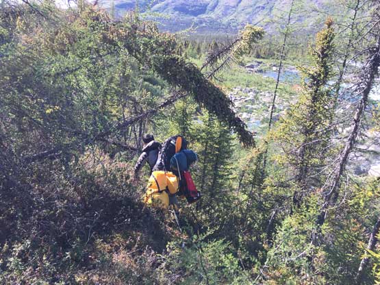
Patrick tried hard to do this ins a single portage
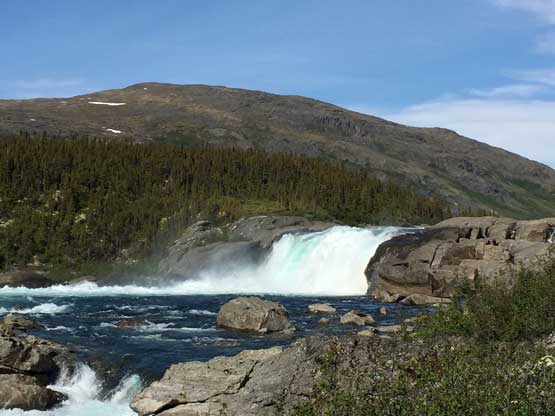
Korluktuk Falls
The trail was very indistinct and hard to follow
Lots of class 3 rapids that we also bypassed
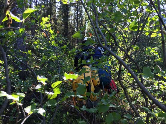
Bushwhacking with the heaviest pack I’ve ever carried
After setting up the camp Eric and I went to start a fire
The fire soon grew big..
The objective of the 4th day of paddling was to ascend Ilisapi Mountain and paddle to as far as we wanted. The stretch of RII-III followed by RIII at KM 90 had some big waves, big holes and rocks that we must paddle around. This was our first taste of the legitimate Class III rapids and given the high water level it was no joke. I somehow managed to avoid all of the obstacles but Yeuhi wasn’t as lucky and there went the first swim of the trip. The next 7 km or so was easy paddling and we found a neat spot to park underneath Ilisapi Mountain. Christina opted to wait while Eric, Patrick, Yeuhi and I went to hike Ilisapi Mountain. The ascent was again, written in a separate trip report.
Eric on the lower slops of Ilisapi Mountain
Scrambling up Ilisapi Mountain with Koroc River behind

Me on the summit of Ilisapi Mountain
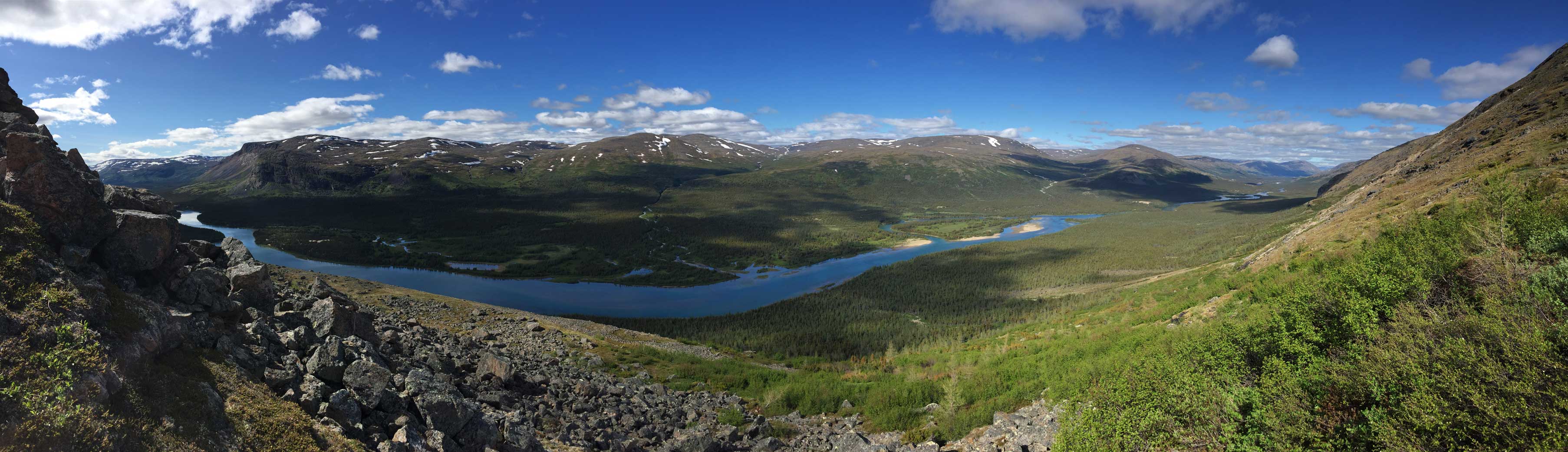
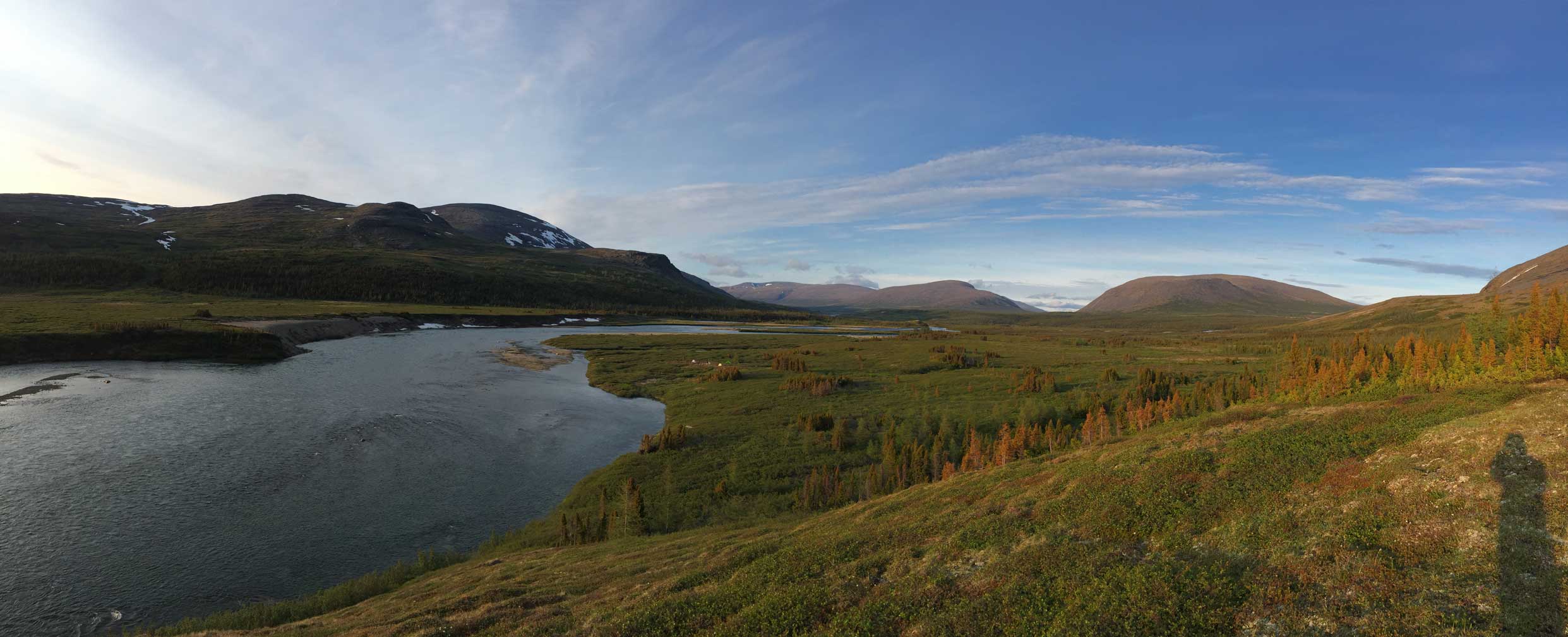
Panorama of Koroc River. Click to view large size.

Not the most pleasant bushwhack here…
Having paddled for only 10 km on this we decided to carry on so there went another transition. We carried on to just before the RII-III rapids on KM 79 before calling a day. This was again, a short and lazy day.
Time to inflate the boat again.

Christina with Ilisapi Mountain behind. Photo by Eric G.
Our camp at KM 79 ish

The water was crystal clear
Another shot of the beach that we camped at
Yeuhi trying hard to break a stick
After a while another big fire was started
Despite the two short days we just had we were still far ahead of schedule but it’s about the time to put some kilometers down. On the 5th day of the Koroc River descent we agreed to paddle at least to the long stretch of RIII at KM 55. The stretch of RII and RIII at KM 77 ish was very fun but after that we had to deal with a full 20 km of flat water. This was the first day in this trip that the temperature skyrocketed. Welcome to summer. At just before what’s supposed to be the crux – a 2-km long stretch of RII, RII-III and RIII rapids at KM 55 we had a discussion and because of the lack of good camping spot we decided to knock it off. The rapids weren’t nearly as bad as I thought by staying more or less on river’s right. We resumed all the way to the start of the 3rd portage (to bypass a RIV and SIV-V section) and camped in the middle of this portage. The waterfall was super impressive that we killed the rest of this evening by watching the water tumbling, despite the craziness of the mosquitoes.
Patrick’s boat had a major leak on this day.
Patrick padding on calm water

Me paddling. Photo by Christina C.
Christina padding with a neat waterfall behind

More about the padding on this calm stretch. It was the first real sunny day
Another photo of Christina on the river
Time to start Portage #3. Photo by Eric G.
Christina starting the 3rd portage
Panorama of the RIV section that we bypassed. Click to view large size.
Panorama of the SIV-V waterfall. Click to view large size.
Yeuhi admiring the power of nature
Christina decided to take a short swim

Me with the rapids behind
This was where we cooked. Great views but horrible mosquitoes
One last shot of the waterfall
Patrick and Yeuhi on top of a difficult boulder.
The transition to get back onto the river at the end of portage #3 was difficult because of bush. We had to get onto the river one by one but there were good eddies nearby for waiting around. The RII-III at KM 51 was a bit more difficult than expected and Christina had an unexpected flip and there went the second swim of the trip. We then did a ferry across and started the portage #4 to bypass a long stretch of RIV. This was a bushwhacky, 600 m long portage that Eric and I decided to single carry but the other three opted for double-carrying. Eric and I earned at least half an hour’s time and we did our first (voluntary) swim in the frigid Koroc River without drysuit. The sneak RII-III at KM 46 was very fun and required some tight manuever around rock obstacles. Nobody flipped here and we carried on to KM 37 to set up camp. Later in the day Eric, Yeuhi, Patrick and I opted to scramble a nearby unnamed summit. The rock had transitioned from choss to quartzite and now to granite and the scramble was 4th and low 5th class. The view from the top was worthwhile but given the no-name status I decided to not claim this “peak” as a separate summit. On the descent we found a Class 3 but very bushy bypass the get back to camp. The bushwhacking was pretty brutal at times.
Dropping onto the river one by one
Patrick ferrying across the river to start Portage #4

Eric ready to portage. This was a long and bushwhacky one

Portage #4 down.

A cool and interesting sneak (RII-III) to bypass the main volume (RIII-IV). Photo by Eric G.
My view of the sneak channels
Yeuhi padding on RIII rapids. Photo by Eric G.
Back onto calm water. The rocks here had transitioned to granite
Another photo of the padding on calm water
After setting up the camp we went to scramble
Looking back down at Koroc River
Panorama from the unnamed summit we tagged. Click to view large size.
Me on the summit of the unnamed peak
We found a easier, but longer route to get back down
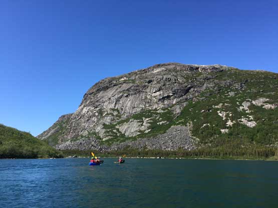
On the 6th day of paddling the original plan was to knock ~20 km off and camp somewhere near KM 15 but it didn’t go as planned. The paddling was tiring and tedious because by this point the river was more like a lake and the water was hardly moving at all. It took us several hours to paddle 10 km and sure, the next 10 km was just as tiring. It didn’t help that the head wind picked up so we pulled over and settled earlier than expected. Eric, Patrick, Yeuhi and I again, hiked to a nearby unnamed bump but on the summit Eric got a troublesome message on his inReach. The supposed boat pick-up wouldn’t come until July 2nd, two days later than planned and this definitely wouldn’t work. Thankfully this wasn’t the end of the game as prior to leaving for this trip Eric and proposed for a portage route from the lower Koroc River to Kangiqsualujjuaq overland and I still remembered most of it. The reason to find a portage option was that sea ice was still a possibility in late June that the park rangers couldn’t guarantee us a boat pick-up. This year the Nunavik region had gone through a warm May so sea ice was definitely not a problem, but our schedule had apparently messed up with the Canada Day long weekend. The portage would be brutal but not impossible and just as we were seriously thinking about it Eric got a message that says Randel would come pick us up on June 29th, which would be tomorrow.
Down from KM37 was all flat water.

What a sunny, hot and calm day. Not the greatest weather for paddling

Eric on the lower Koroc River
Having time to kill we hiked up a bump again. This is the lake we had to paddle across

A panoramic view from that unnamed bump. Click to view large size
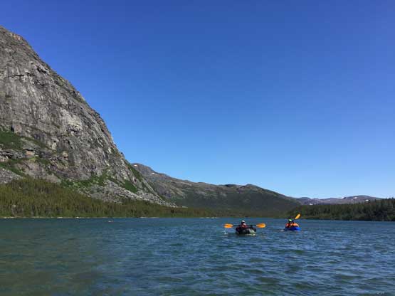
This meant we would have to complete the remaining 15 km of paddling in the evening of this day, which was no big deal. After another annoying but quick transition the boats were all ready to go. The next 6 km was paddling across a flat lake and thankfully the head wind had died down. The outflow of this lake involved a stretch of shallow RII-III which was pretty easy. Then there came a stretch of RIII but felt more like RII-III to me. And then in the fading daylight we had to march across another 5 km of lake water and by the time we got to the last portage I was already on a zombie mode. The last transition took forever but we all managed to single-carry it and found a not-too-bad ledge to camp on the shore of Ungava Bay, below the last set of waterfalls. The next several hours were spent building a huge bonfire to keep the polar bears at bay. Thankfully we didn’t see a polar bear. The tide chart showed high tide at 5:30 am and 6 pm on June 29th so we had to be prepared for the boat to arrive at 5:30 am. It did not arrive, not to our surprise. Some of us went back to sleep and some stayed up to watch for bears. I managed to burn all the woods that we could find nearby. Then I went back to sleep and Yeuhi and Eric went down for some unsuccessful fishing. Patrick and Eric also went for a swim in Ungava Bay and they counted that as a swim in the Arctic Ocean. I stayed in my tent for most of the day because I was still tired from the 37 km flat water paddling on the previous day.
Yeuhi padding across the first lake. Long, boring plod…
After two sets of RII-III rapids we were down to the second lake. Another boring plod
By the time we finished the second lake we had paddled 37 km of flat water on this day
Time to do the Portage #5 also the last portage
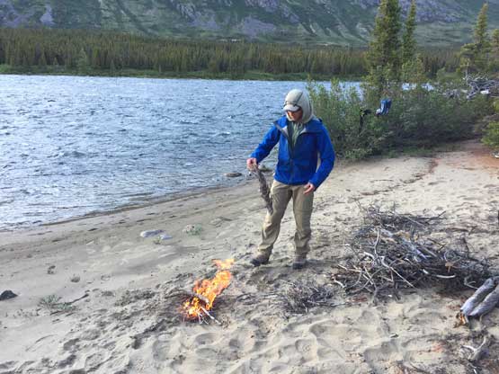
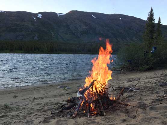
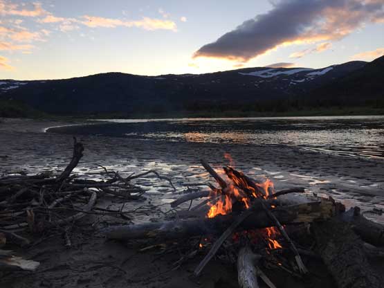
Big bonfire set to watch for polar bear
In the afternoon Eric got a message that the boat would come at around 4 pm. It did not arrive until almost 5 pm but such delay was minor. Watching the tide change from hour to hour was super impressive as the difference between low tide and high tide was over 6 m. The boat ride to Kangiqsualujjuaq was very fun. Jason and Rendal from Nunavik Parks drove really fast and we all got soaked thoroughly by the sea water spray.

High tide at 5:30 am. The fire was still on..
Low tide at 11:30 am. Note how drastic the change was
Christina was the only one managing to get some fish.
Eric, Patrick and I hiked back to the RV rapids for more photos
The boat came at 4:45 pm
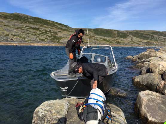
Getting onto the boat

Christina on the boat

Yeuhi on the boat. The ride was exhilarating
Randal and Jason fed us some meat. Thanks 🙂
The guys from Nunavik Parks were so nice that they gave us a free ride to the Kangiqsualujjuaq airport but we could no good spot to camp beside a zone near a bunch of waste gas barrels. We pitched the tents there anyway. It’s not sheltered from view nor wind and far from clean, but that’s just part of the expedition. That night we still had to eat our own backcountry food and then we hiked to a nearby ridge for a view of sunset.
They drove us through the village of Kangiqsualujjuaq (George River)
Patrick and I went to the park’s office to retrieve our stashed gears
Setting up camp beside the airport near a ton of waste dumps
Hiking to a nearby ridge for a glorious sunset over Ungava Bay
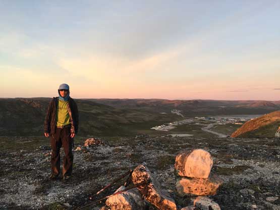
Me on the unnamed ridge at sunset time.
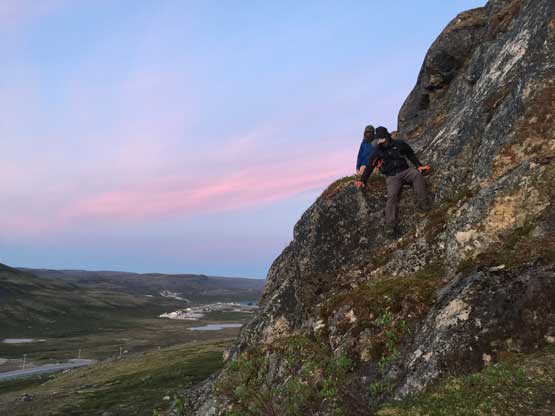
I led the way scrambling down a steep 3rd class route.
We now had to kill a full day on June 30th. The airport wouldn’t open until 1:30 pm. Eric went to tag two highpoints in the morning while I decided to catch up hours of sleep. The other guys also went into the grocery store to buy some food. Knowing the food here were more than 2x the price in Vancouver I opted to sit out again. I had brought enough food for the entire trip that I need not buy anything in Kangiqsualujjuaq. The airport had free wifi as well as drinking water so there’s where I decided to kill time. It felt a bit strange to be back on the internet after 2 weeks of absence. In the evening we hiked a local highpoint and returned to camp. The others decided to move camp to the top of the nearby ridge that we watched sunset on the previous day but I was too lazy to do that.
Hiking to another unnamed bump near George River
Yet another glorious sunset.
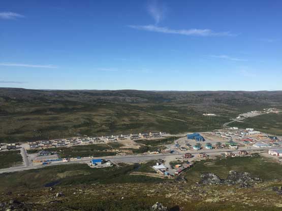
On the morning of July 1st I woke up at 8 am by the other guys descending from the ridge. I then went into the airport with them. The others all left for Kuujjuaq on the 9:30 am flight leaving me alone for the next 3 days. I killed most of this day in the airport browsing web pages and then hiked the two highpoints that Eric did two days ago in the evening. According to the forecast some weather was supposed to move in on the following day and sure it did. The night was very windy and the morning was cloudy, but rain held off until I arrived in Kuujjuaq in the afternoon of July 2nd. There’s a brief break in the weather that I utilized to set up my tent and cook dinner. I had to cook in bug jacket as the mosquitoes and black flies were the worst I’d experienced in this trip. It rained continuously and hard overnight but the rain stopped in the morning of July 3rd. Most of the 3rd was killed in Kuujjuaq airport but I did pay a visit to the local grocery store. I bought enough food that would last me all the way to Vancouver because I didn’t want to spend much money in Montreal airport.
I hiked to another unnamed bump for a view of Kangiqsualujjuaq
Just a typical view of this area…
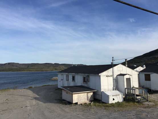
Kangiqsualujjuaq (George River) airport
Air Inuit flight to Kuujjuaq
Soggy and buggy camp in Kuujjuaq. That night was miserable
The night of July 3rd was dry so when I packed everything in the morning of July 4th most of the gears weren’t soaked. I then killed the rest of this day in the airport browsing web pages and ready stories. The First Air flight to Montreal was at 6 pm so there’s still the meat of this day to kill. Thankfully with internet my time could never get too boring. The night of July 4th was actually the worst because I wasn’t allowed to pitch my tent inside Montreal airport. There’s no way would I donate more money to the hotels so I just found a quiet corner, inflated my air pad and tried to catch as much sleep as I could. It turned out to be pretty much a sleepless night so I again, killed most of the time by listening to music and ready online stories. And finally there came the Montreal-Vancouver flight on the morning of the 5th. I dumped one luggage case because such an old case would be less than 50 dollars and that’s the amount of money I needed to bring it back to Vancouver. Because I had minimal food at this point I managed to squeeze everything inside my 150 L duffle, a 60 L duffle (carry on) and my 20 L backpack. No issue with bringing a stove and fuel bottle this time as I’d learnt from the other guys how to avoid the hassle. I also learnt from my flight on June 14th that everything on this Air Canada flight required purchasing so I brought enough food onto the plane that I didn’t have to give them anymore money. And that concluded this awesome, 3-week expedition to the Nunavik region of the far NE Canada.
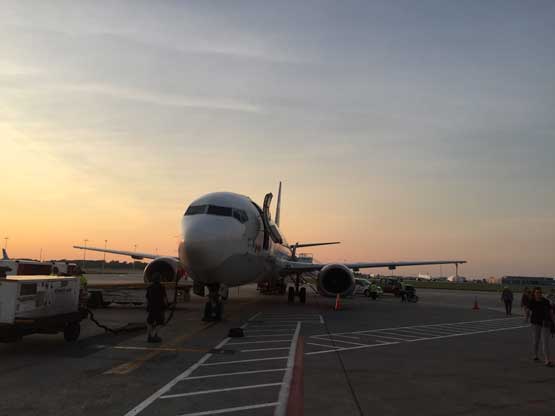
First Air flight Kuujjuaq to Montreal
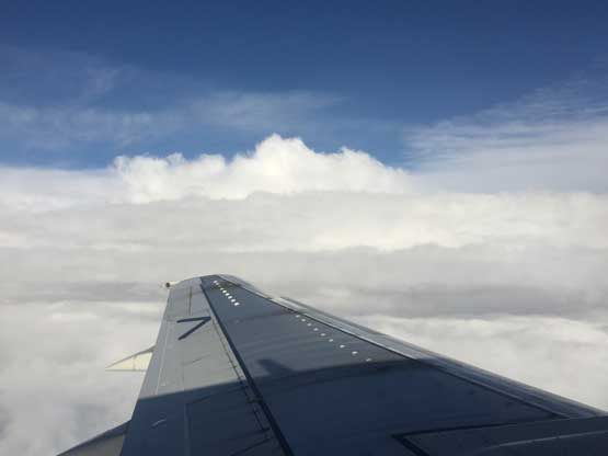
Above the clouds

Arriving at Montreal
At Montreal airport and one last night to kill…
Anyone reading my trip report and interested in Barbeau Peak the highest in Nunavut way up north on Ellesmere Island please contact me. That’s the northernmost significant summit on earth and only 500 miles from the north pole, so a worthwhile destination whether or not you’re going after the list. The most partners I can find, the cheaper this trip will be. You want to have a month off in June-early July, able to drag/carry 2-weeks of food for a traverse, and be willing to pay at least 15,000$ and possibly more. I have money, time and energy, just need partners.
