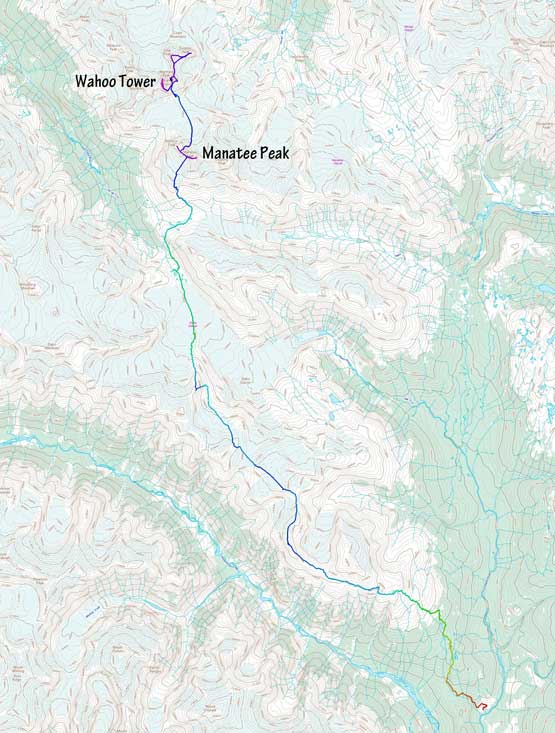
Wahoo Tower
July 10-14, 2021
2846m
Manatee Range, BC
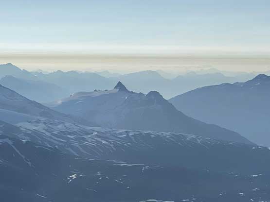
Wahoo Tower is one of the taller summits, but not the tallest one in Manatee Range in a remote area about 50 km to the NW of Pemberton and just to the south of Lillooet Icefield. This area boasts the headwaters of Meager Creek, Toba River and Manatee Creek that drains into the upper Lillooet River and the topography is generally more rugged than the typical South Coast Ranges. Wahoo Tower is the most fabled summit in this group simply because of its name. The north face does offer a 15-pitch route that goes at 5.10a that’s included in Alpine Select, whereas the south side offers a reasonably easy class 3 / steep snow route for the peak-baggers. The real challenge is the access. Traditionally this area is accessed by 2 days of trekking from the end of Upper Lillooet FSR but that road is gated now due to concern of fire and landslide. The other option is from the end of Elaho River FSR which we eventually decided to use as the exit option. Taking a helicopter is by far the most realistic way to get in, but doing so required paying 2400+ dollars of bill (one way) which is definitely not cheap for the typical weekend warriors.
I knew this peak but never planned it seriously mostly because of the lack of partners. It’s a difficult task to find keen individuals for expeditions like this, flying in or on foot, let along to find people who has the time flexibility that matches the fickle weather in our home province called British Columbia. About 10 days ago while on Vancouver Island I received a message from Elizabeth “Ellie” Hand on Instagram asking if I were interested in splitting a helicopter bill into Wahoo Tower. I took this invite seriously because she’s Ellie Hand, a climber whom I had been following for a couple years on social media even though I had never talked to her directly. They already had a team-of-three and the plan was to climb that 15-pitch route called the Articling Buttress on Wahoo Tower’s north face and exit the area on foot. Obviously their climb is not in my league (nor am I really interested in that to be honest) but I could just solo the south side descent route and still bag that peak. There are a handful other bag-able summits in the immediate vicinity and along the exit route towards Elaho River. My initial thought was that I needed to grab a peak-bagger with me as I knew the objective difference between me and their group would be significant and I did not prefer to end up soloing all the peaks there especially the ones that required significant glacier travel, but then after a few messages back and forth we agreed to do most of the trekking and scrambling together and only split up on Wahoo Tower’s summit day.
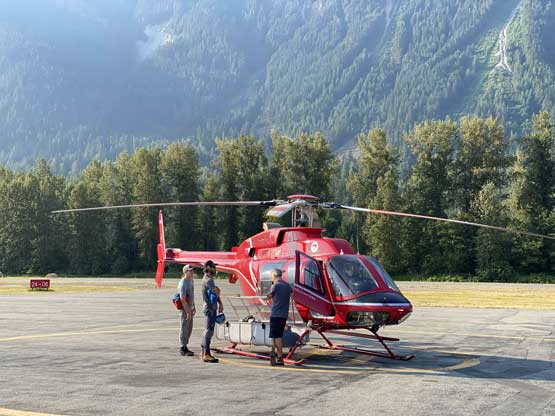
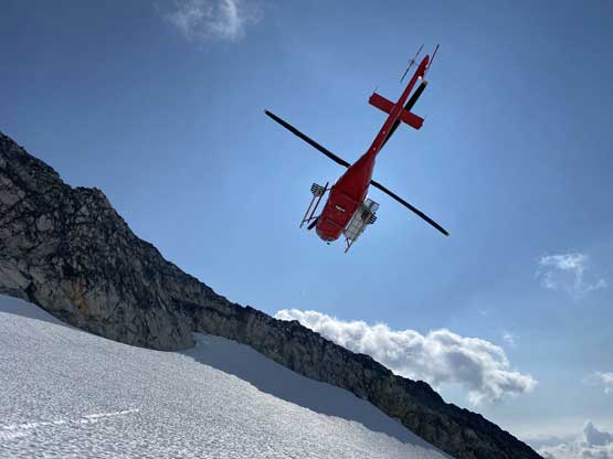
The next step was to commit to the logistics. The exit option out of Elaho River was experimental but with the second half assured by a single trip report. The first half from Wahoo Tower to Elaho Glacier would be completely theoretical but we had a few options to cover that part. I had concerns about the road to that far up the Elaho River valley (basically the driveable end) as well as the status of that bridge crossing the river, but Ellie was confident about it. I trusted her confidence as all three of them live in Squamish and this is literally their backyards. We booked a ride with No Limit Helicopters which oddly enough, was also my go-to in 2020’s various heli-assisted trips, but two days before the departure they cancelled on us saying they must go to deal with the wildfires. This was frustrating to say the least. Ellie then made a few more last-minute phone calls and a few hours later, we settled with Blackcomb Helicopters. The price would be 10% higher (2400$ plus tax) and the date had to be pushed back by one day. I had no problem with the increased cost but the shortened trip time (from 5 days to 4 days) was not preferable. But then I figured we could still make it work by skipping a couple summits and pushing for a couple longer days.
The flight with Blackcomb Helicopters would be in Pemberton and the time was 8 am. This meant I had to wake up at 3 am as I live in White Rock. I made to Squamish at 5 am, grabbed some breakfast in Tim Hortons and picked up the rest of the team in Ellie’s place at 5:30 am. We made to Pemberton Airport an hour before the scheduled flight because we did need time contingency in case of the traffic delays. But then the officer showed up confused why we would even be there as “their helicopters were all booked for the wildfires”. This was concerning but honestly I was not surprised given all the shit show associated with helicopters, planes and boats that I had experienced over the years. A while later the pilot came out and assured that they would make the flight for us, thankfully.
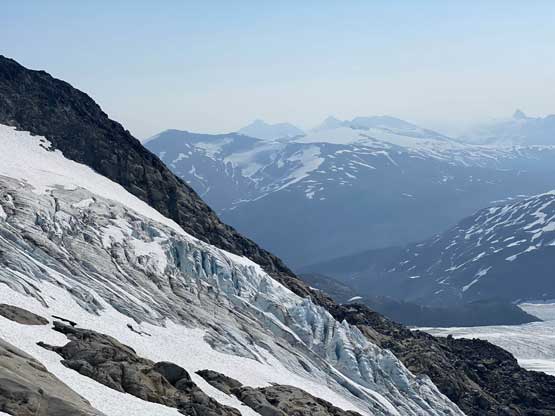
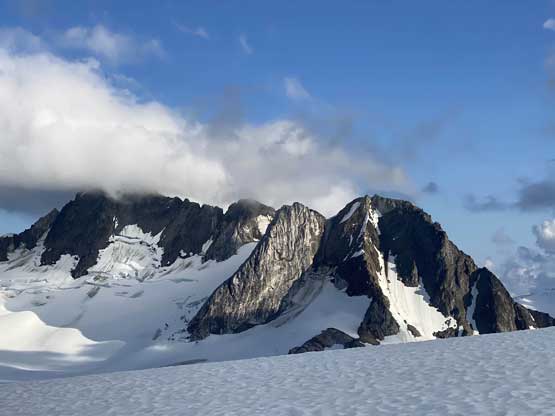
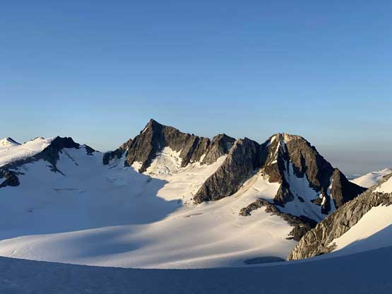
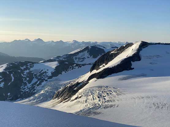
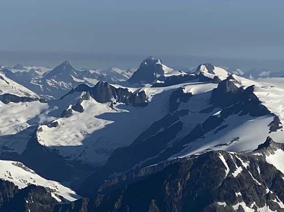
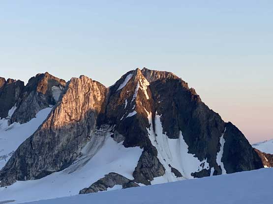
As always the helicopter ride into the area was the first highlight of the trip. Neither Jason and Rob had even been into a helicopter before so that’s a cool experience. The weather was a little bit cloudy for our likes but thankfully our destination was not obscured. After circling a few rounds around Wahoo/Mermaid col we were able to land right at the spot of “Plan A”, which was the hanging glacier/cirque directly under Wahoo/Mermaid col. This spot would serve the best as a basecamp for Wahoo Tower and the few smaller summits. After setting up camp we decided to scramble Mermaid Peak, Oluk Peak and Dolphin Peak and to have a good view of Wahoo Tower’s north face to scout things out. In the evening we went to Wahoo/Mermaid col to check out the rappels that they eventually had to do first thing in the morning. The conclusion was that the descent from that col into the north side was harder than expected, but they had a few ideas planned and agreed to sort it out in the morning.

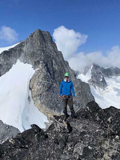


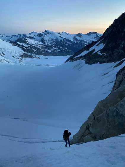
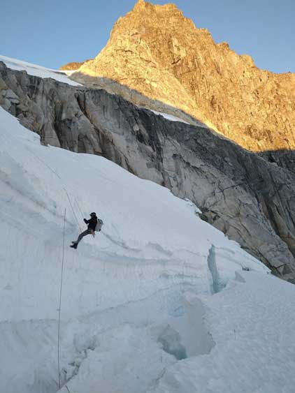
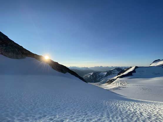
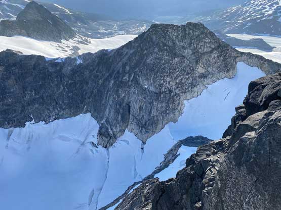
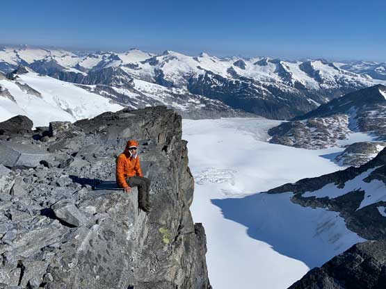
On the second day we woke up at 3:30 am and got going within an hour. I had to come with them to help cleaning the rappel stations even though I was not planning to do that climb. I had no problem with that and it ended up being a gorgeous morning with alpenglow views. I did the first rappel with them, cleaned off the second anchor once they were all down below the bergschrund that span across the entire slope, and soloed the steep snow back up onto Mermain/Wahoo col, and subsequently descended back to camp. The camp was still in the shade and I did not feel like going back into my sleeping bag, so I grabbed some food and immediately started my ascent via the south side “descent route”. This was shaping up to become a “rest day” for me.


From the camp to the summit all I needed was to grunt 400 m on easy terrain so there’s no need to hurry. The snow was also a little bit icy in the morning. I picked a line on the far climber’s left side to access the middle stretch of the route and that line involved some 40-degree snow climbing. The other option was to take the glaciated face to the right of my line but I wanted to minimize solo glacier travel for as much as possible. The route I took was pretty easy anyway. The middle section of this route was a simple slog on snow and then I faced the next decision-making point.
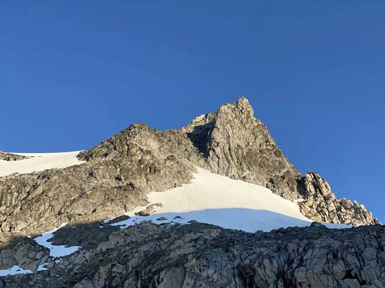


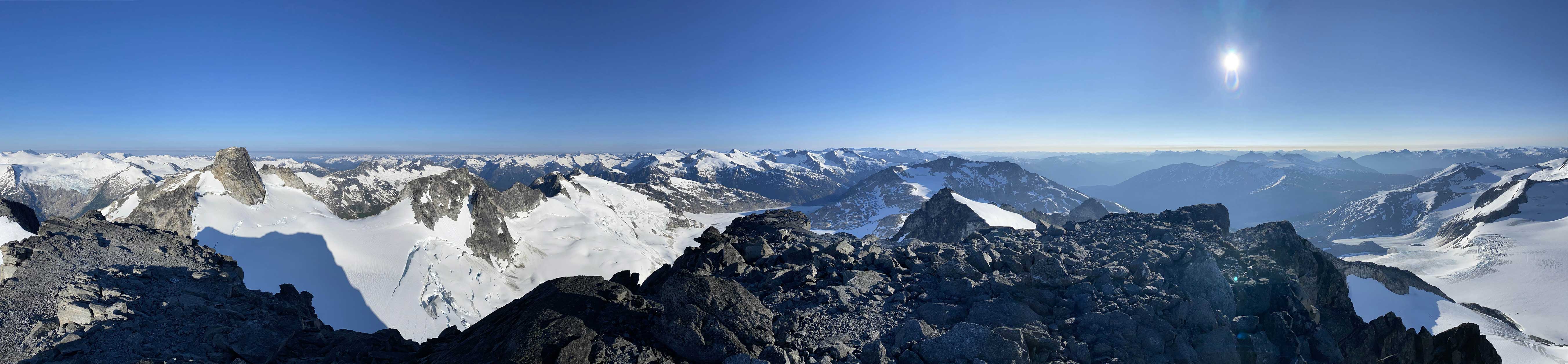
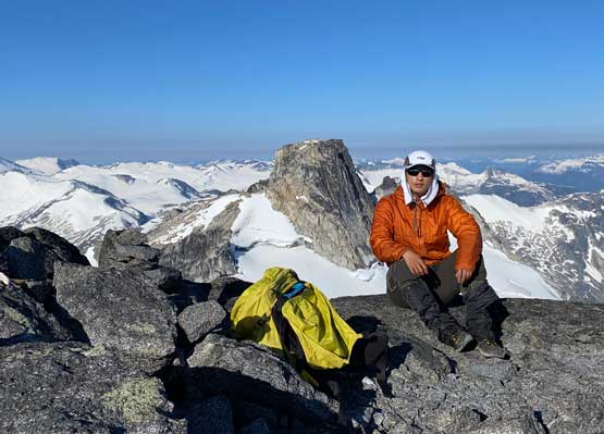
The upper route could be accessed via a few options. The most obvious one was by traversing/ascending a steep snow slope but as mentioned earlier, the condition was a bit icy. The other option was to take the rock route which looked to be class 3-4 but without any beta (at least I did not do much research). I decided on the snow option as I already had crampons on my feet. The traverse sure felt exposed but not difficult and after a while of concentration I was on the opposite side of that snow field. From there to the summit was just a simple scramble on class 2 terrain. The first thing I did after reaching the summit was to lay the soaked register out to squeeze out the water and let it dry, and then I laid down for over an hour as I was tired from the lack of sleep. The view was exceptionally clear and free of smoke, which was to my surprise but I would not complain about it.


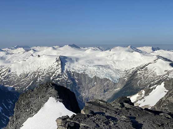


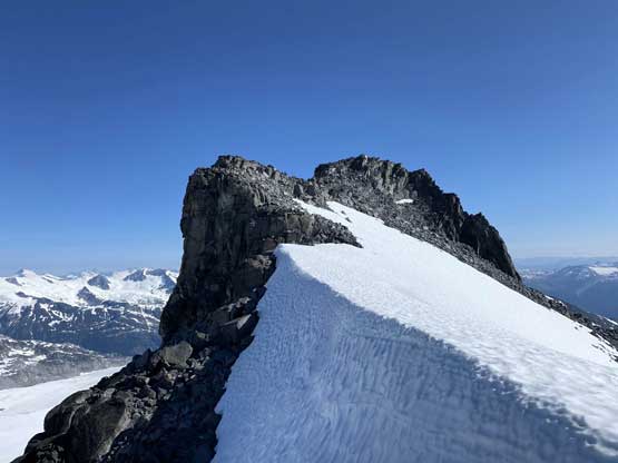
On the descent I decided to explore the rock route since I had so much time. This turned out to be an enjoyable scramble that did not exceed the realm of class 3. There were a few tricky moves but all could be bypassed had I wanted to. I only strapped crampons on for that steep roll near the end where I did not want to take a slip. I got back to camp at 10:30 am and took a massive nap. I woke up at 1:30 am, cooked a delayed breakfast and went back into sleeping mode. I slept through most of the afternoon until I heard something. The other guys eventually came into sight at 6:30 pm and were back to camp an hour later. The climb of the north face had taken them 12 hours from bottom to top and considering their experience and skills in rock climbing this surely was a demanding climb.

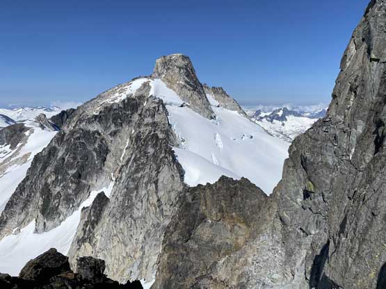


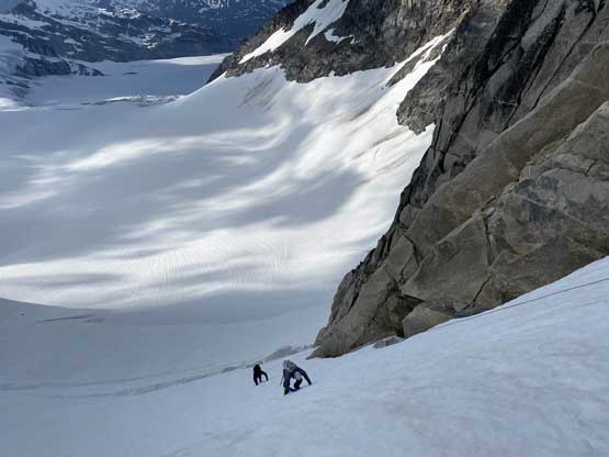
On Day 3 it took us a while to agree with a plan but the general consensus was to set up camp eventually at the toe of Elaho Glacier at the divide between the headwaters of Elaho River and Toba River. To get there we had two options but the final decision would be made after descending that steep snow from camp to the flat of Manatee Glacier. This descent was trickier than expected and involved a bit of steep down-climbing on snow. Jason and I went ahead to scout out the route. I thought we could avoid the steep snow near the bottom by sticking onto rocks but nope, we backtracked and down-climbed that steep section. A while later we all regrouped at the bottom. The decision was then made for Ellie and I to go for the “high route” over Remora/Manatee col to facilitate ascents of Remora Peak and Manatee Peak, whereas Jason and Rob would take the “low route” down the around Remora Peak to conserve energy for the massive exit day. The trip report of the exit is written under Manatee Peak as that’s actually the highest point reached in this trip.